ARTICLE OVERVIEW: Clingmans Dome at Great Smoky Mountains National Park
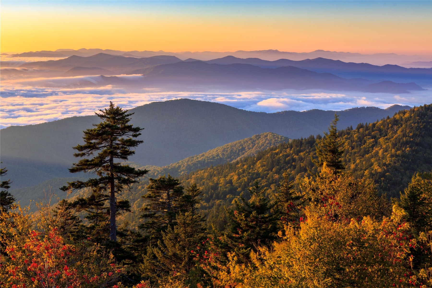
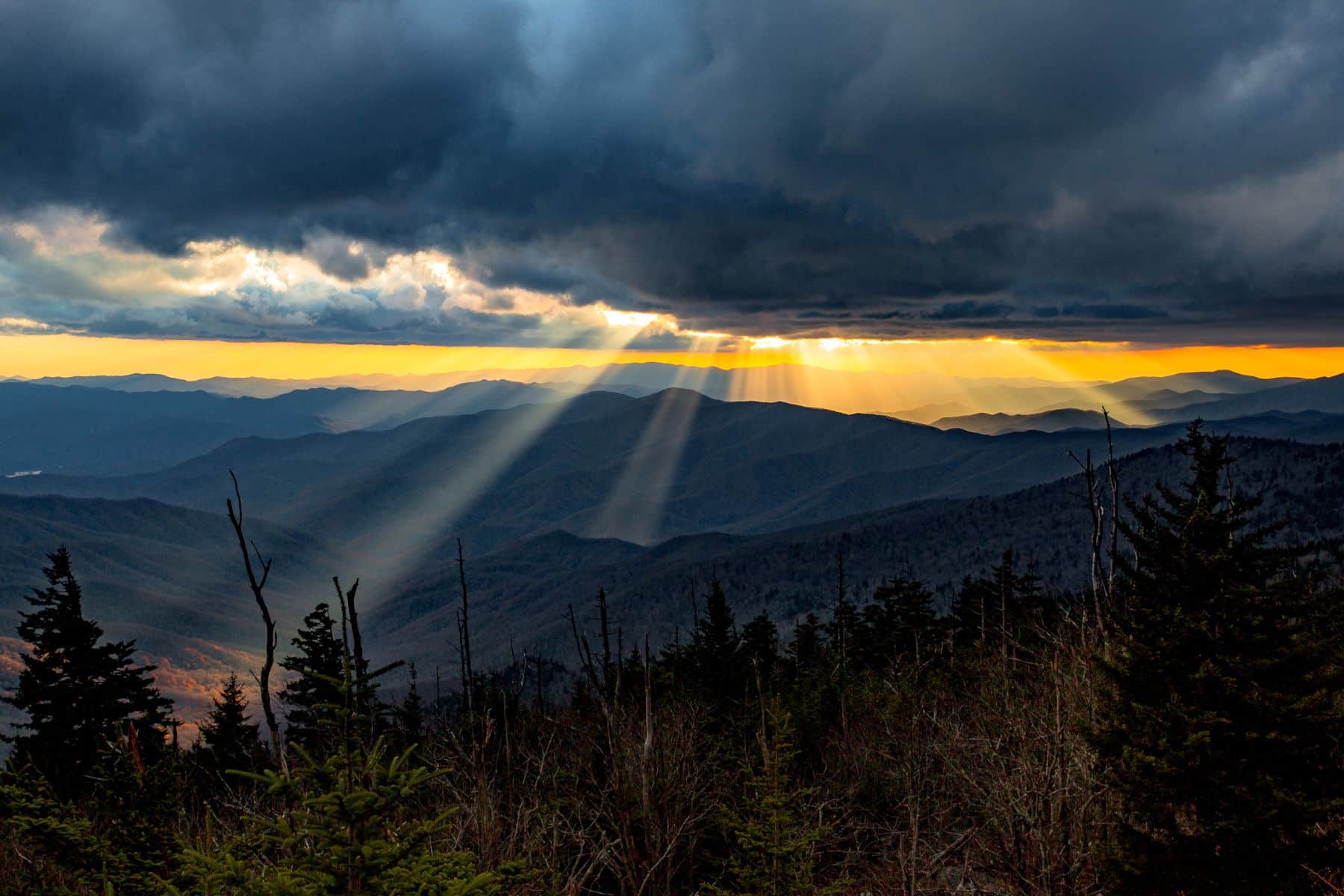
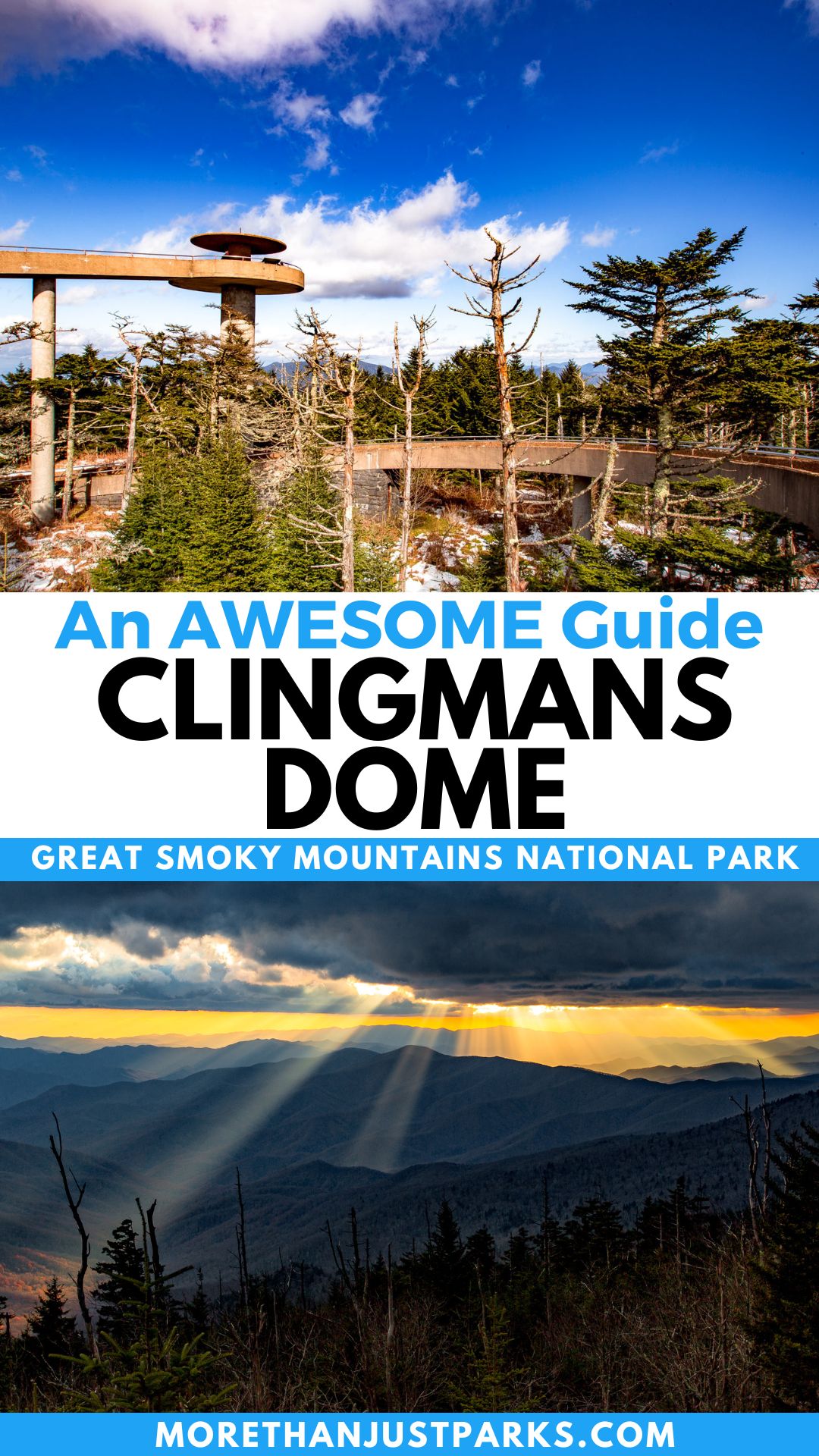
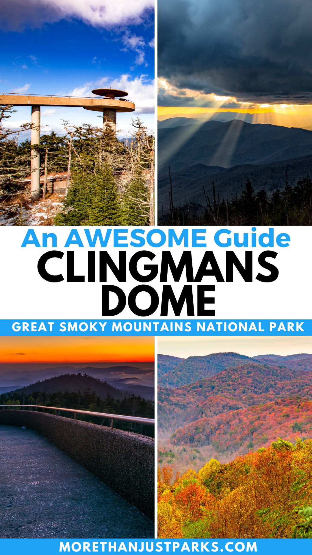
At the heart and height of Great Smoky Mountains National Park is Clingmans Dome. The domed mountain stands 6,643 feet above the Smokies, with a viewing platform allowing sweeping panoramic views. I’m going to help you explore Clingmans Dome trail from the short route to the long way.
No other spot in the Great Smoky Mountains or the Appalachian Trail stands taller. The dome is 5,768 feet taller than the lowest spot in the park at Abrams Creek.
Access points to Clingmans Dome are by road and trail, and even with that, the 13.3 million people or so who visit the park every year struggle to find their own space on this crowded piece of American park legend.
In this article, we’re going to help you plan the most adventurous and educational trip to the high point of the Smokies with folklore, facts, and foresight. Plus, I’ve got some secrets about getting there in winter when the road is closed.
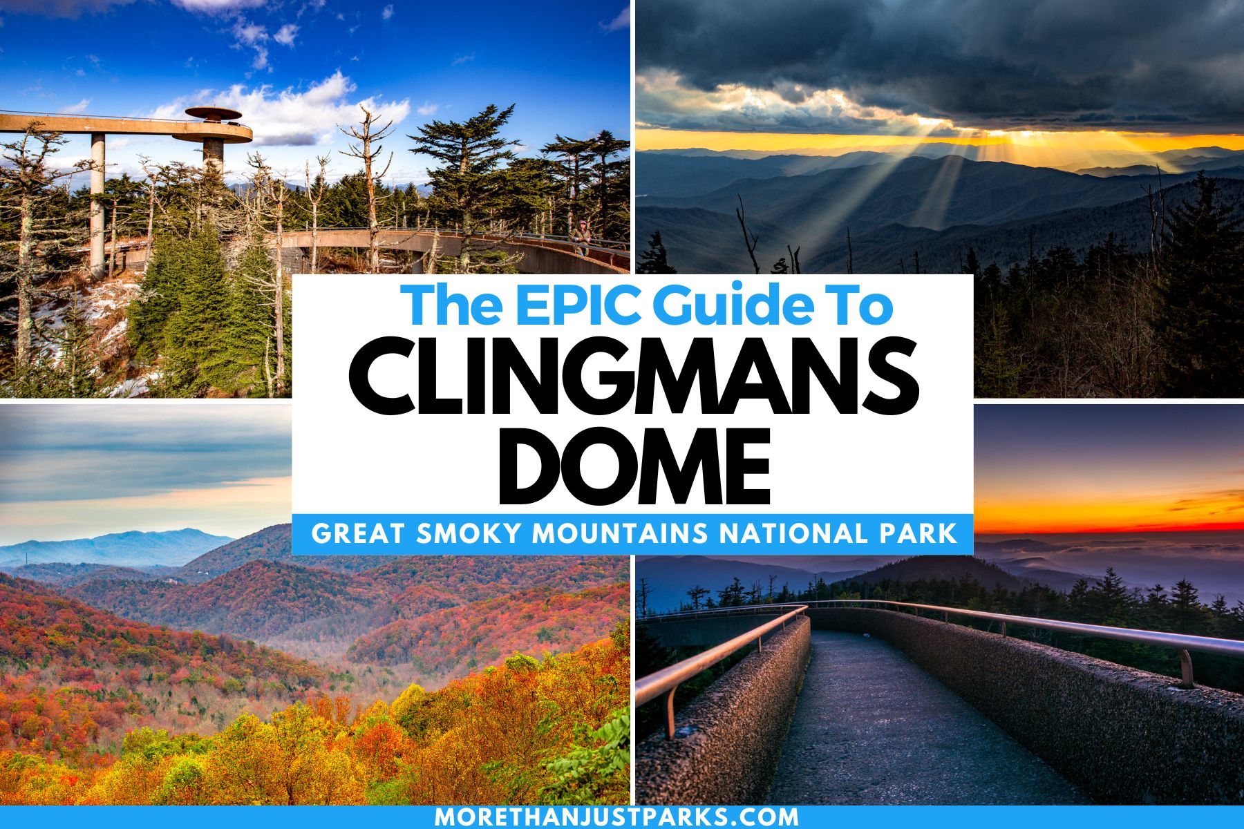
TABLE OF CONTENTS: Clinsmans Dome at Great Smoky Mountains National Park
Table of contents: Clingmans Dome
- Where is Clingmans Dome?
- Clingmans Dome Map
- Getting to Clingmans Dome Observation Tower
- Hiking to Clingmans Dome
- Clingmans Dome Weather
- The Tunnel Under Clingmans Dome
- History of the Smokies’ Highest Point
- Is Visiting Clingmans Dome Worth It?
- VIDEO: Great Smoky Mountains National Park Film
- How Do You Spell Clingmans Dome?
Where is Clingmans Dome?
Clingmans Dome sits at the center of Great Smoky Mountains National Park, with the Tennessee and North Carolina state line splitting through the middle.
It is easily accessible from Gatlinburg (20 miles) or Cherokee (23 miles) from Newfound Gap Road to Clingmans Dome Road. You will need to take the Clingmans Dome trail to get to the top.
Seasonal Closures on Clingmans Dome Road
“Is Clingmans Dome Open?” You’ll hear that question a lot when you visit, especially in shoulder seasons or winter. It’s important to note that the road closes from late November through April annually. Even with a mild winter, the road stays closed to vehicles.
At the same time, Clingmans Dome Trail and Observation Tower never close (barring a major winter storm). We’re going to tell you how to get there in all seasons in this article.
Clingmans Dome Map
Getting to Clingmans Dome Observation Tower
Access to the observation tower can be found on the road or by the Clingmans Dome trail. As noted above, the road closes four months of the year between December and April.
Driving to Clingmans Dome
Most importantly, you’ll need a parking reservation if you plan to stop for more than 15 minutes (which you will). Soaking in the views for a few minutes from the parking lot is an option, but you didn’t come this far to only come this far, right? Also, having a parking reservation does NOT guarantee a parking spot.
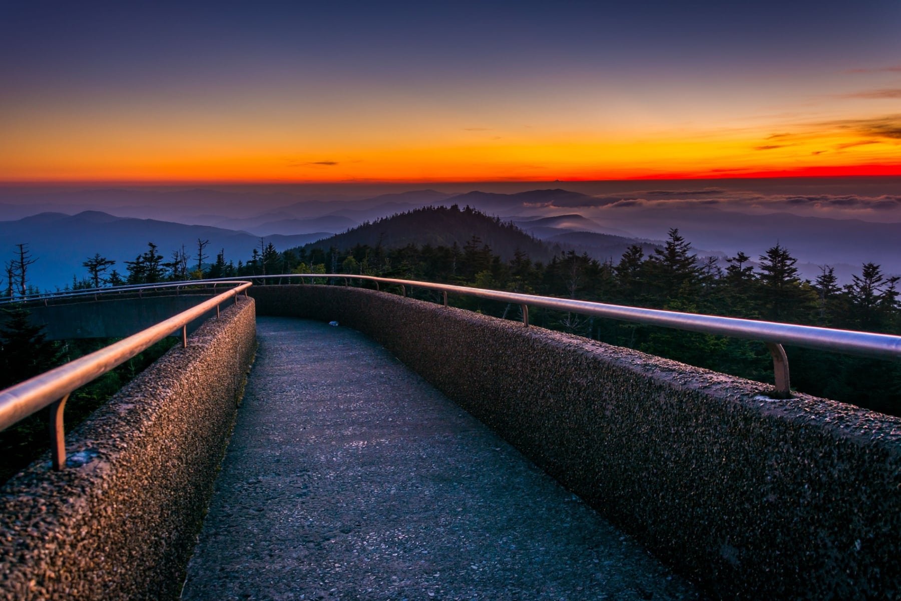
Even if you take the seven-mile drive to the parking area, you’ll still need to climb Clingmans Dome trail about one mile each way of the paved walkway with a steep incline (and then decline). Clingmans Dome trail ranks as a moderate hike.
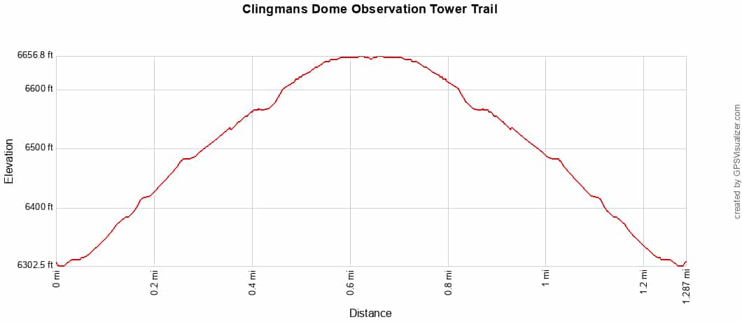
Wheelchairs are not recommended past the parking area, as there’s a 16% grade and 330-foot elevation gain.
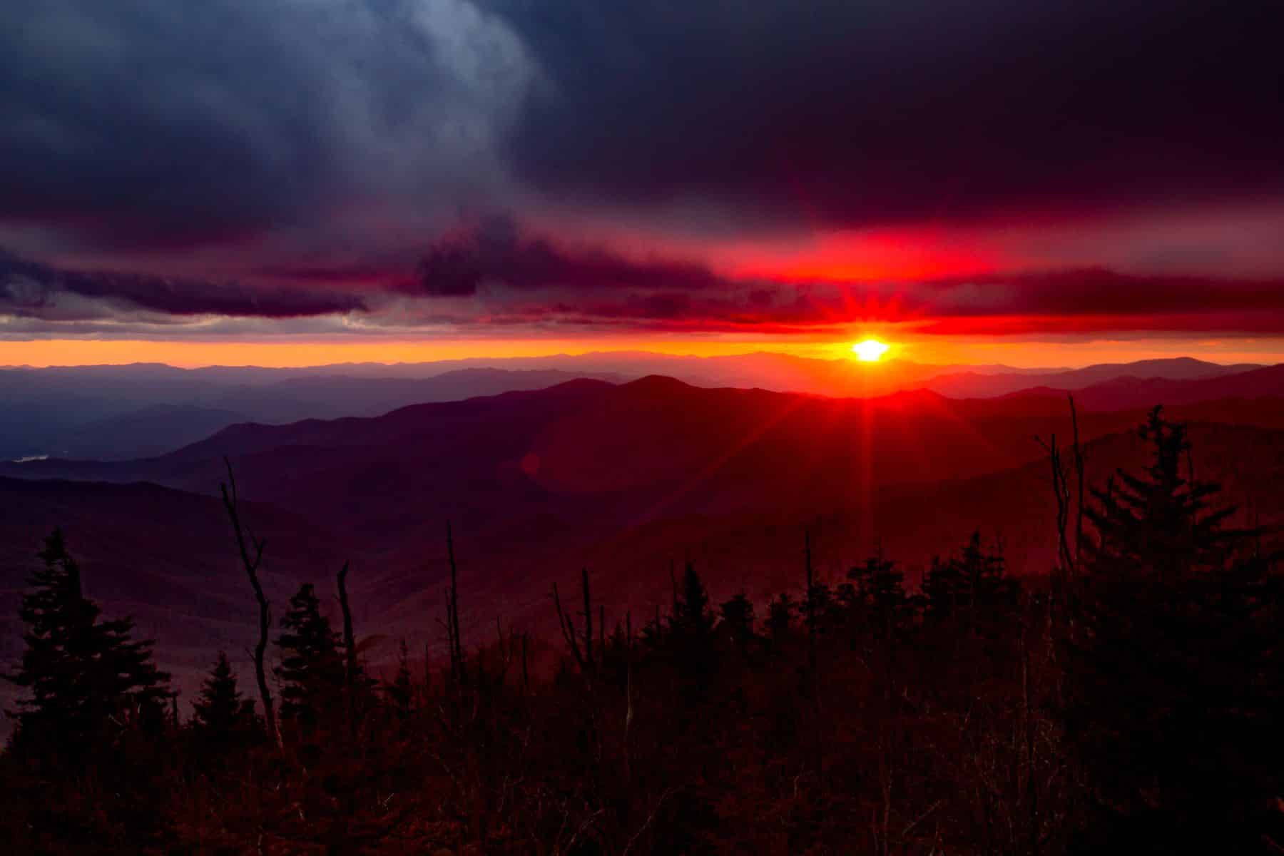
Get to the park before 10am to get the best chances of scoring a spot. It’s also a great place to see the sunrise. Clingmans Dome Road offers many pull-out locations to watch the sunrise, too, if the lot is full. The dome sits about 50 feet higher than the mountaintop.
CLINGMANS DOME WEBCAM: Soak in the view from the top of the observation tower, which also provides weather and air quality information. The camera is only active from April through November, tied to the road closure.
Hiking to Clingmans Dome
Another downside of parking is that several trails start near the lot, meaning spots can be taken for the entire day, and traffic doesn’t go in and out as fast as you might like. If you want to walk your way to Clingmans Dome, here are the best hikes.
Appalachian Trail
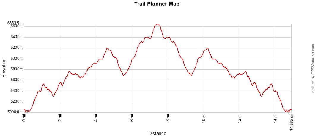
Starting at Newfound Gap Road and Clingmans Dome Road, parking at the lot. Cross over the road and follow the A.T. for 7-8 miles each way. The dome is the highest part of the famed East Coast trail, and the trek there is strenuous. Plan for 8-10 hours to complete this hike.
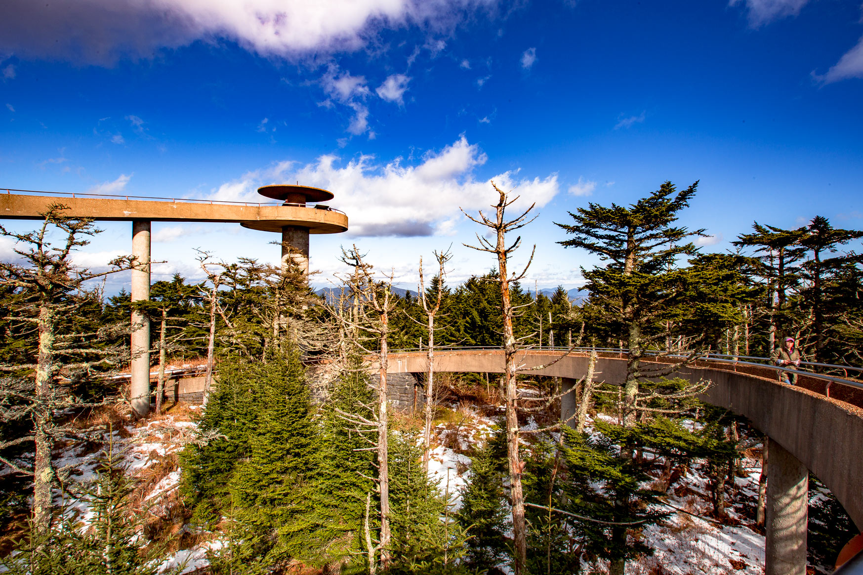
Winter Access to the Observation Tower
I’ve mentioned several times that Clingmans Dome Road is closed in the winter, but keep in mind that it is only off-limits to vehicles. One of the most exhilarating moments of my winter adventures was cross-country skiing on that legendary road to the observation tower and back.
The road isn’t paved, salted, brined, or maintained for the eight feet of snow that falls annually. The uphill part can be brutal on your calves, but with seven miles, the incline isn’t too terrible – especially with those views. On the way back, you’re going downhill and make up a lot of time.
Plus, you’ll likely have the road all to yourself AND money in your pocket that you didn’t have to pay to a ski resort. The only caveat here is that Newfound Gap Road must be open to experience this. However, that road is cleared regularly as it’s a critical lifeline between Gatlinburg and Cherokee.
Clingmans Dome Weather
The weather at 6,643 feet changes often, but expect it to be 10-20 degrees colder than the lower elevations.
Spring
Spring at Clingmans Dome can still be quite chilly, with temperatures often lagging behind those at lower elevations. Snow is still possible into April. Highs will be around 40-50° F, with March getting more than two feet of snow on average.
Summer
Summers at Clingmans Dome are cooler than at lower elevations, with temperatures rarely exceeding 70°F (21°C) even at the height of summer. Plan for average highs in the mid-60s, with lows dipping into the lower 50s. Fog can ruin the 100-mile view, and this is the rainiest season of the year with severe weather possible. High-elevation wildflowers peak during this season.
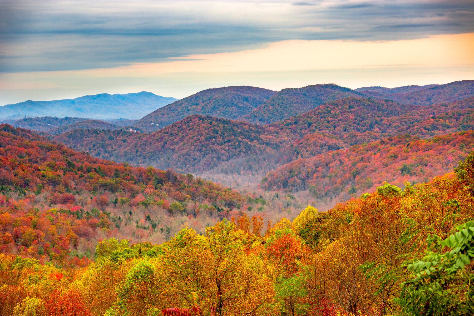
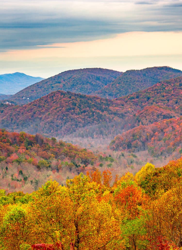
Fall
Fall is the best season to visit Clingmans Dome due to the abundance of beautiful fall foliage and those sweeping views. September can get highs in the 60s but that number is in the 40s by November. Lows linger in the 40s to 20s. Early to mid-October hits the sweet spot for high elevation (>4,000′) fall colors.
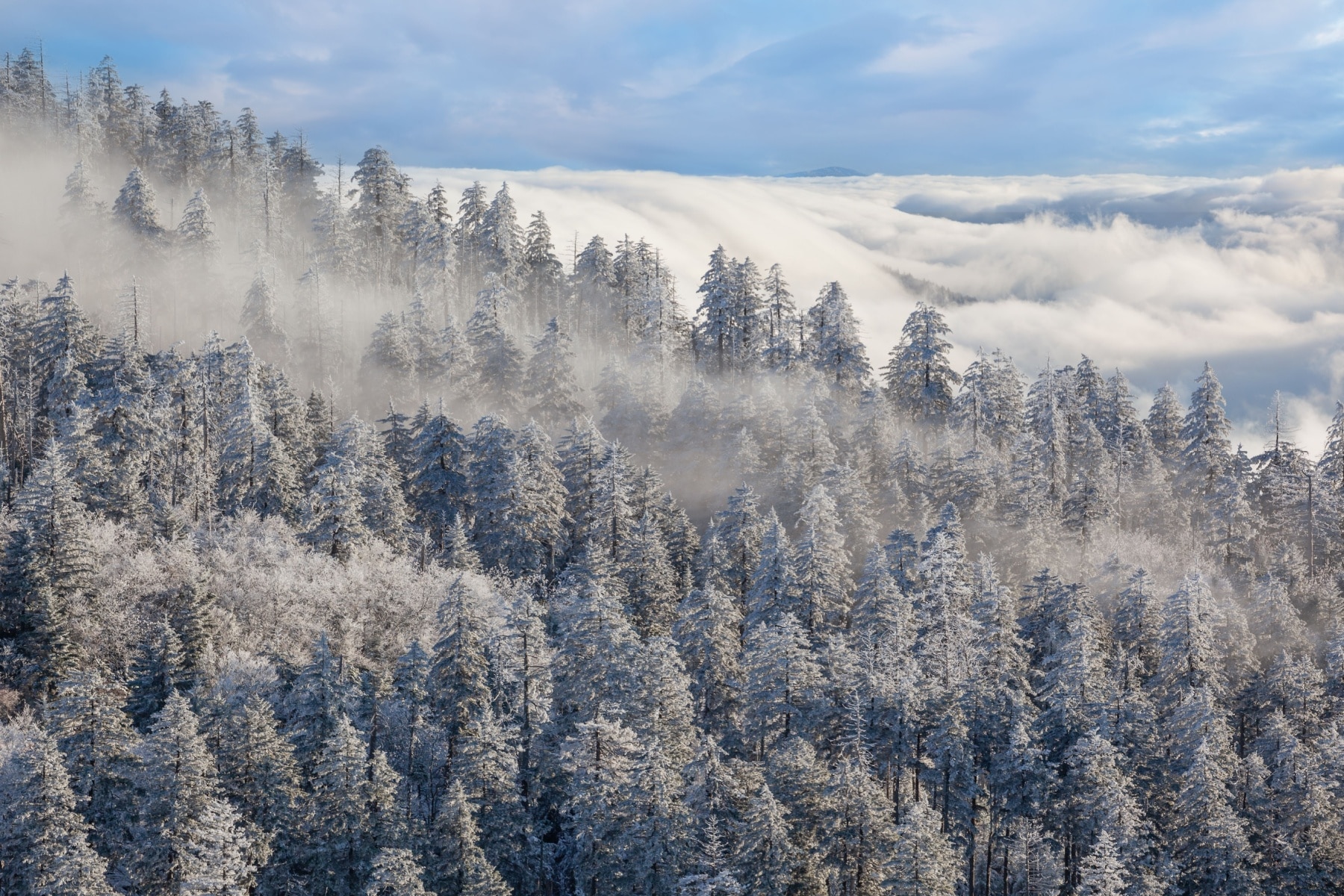
Winter
Winter at Clingmans Dome is cold and snowy. Snow odds start in October but ramp up by January, with the first three months of the year being the snowiest. Highs hover around freezing, with lows in the teens. The wind chill on the mountain can create conditions that feel 10-30 degrees coldest.
The Tunnel Under Clingmans Dome
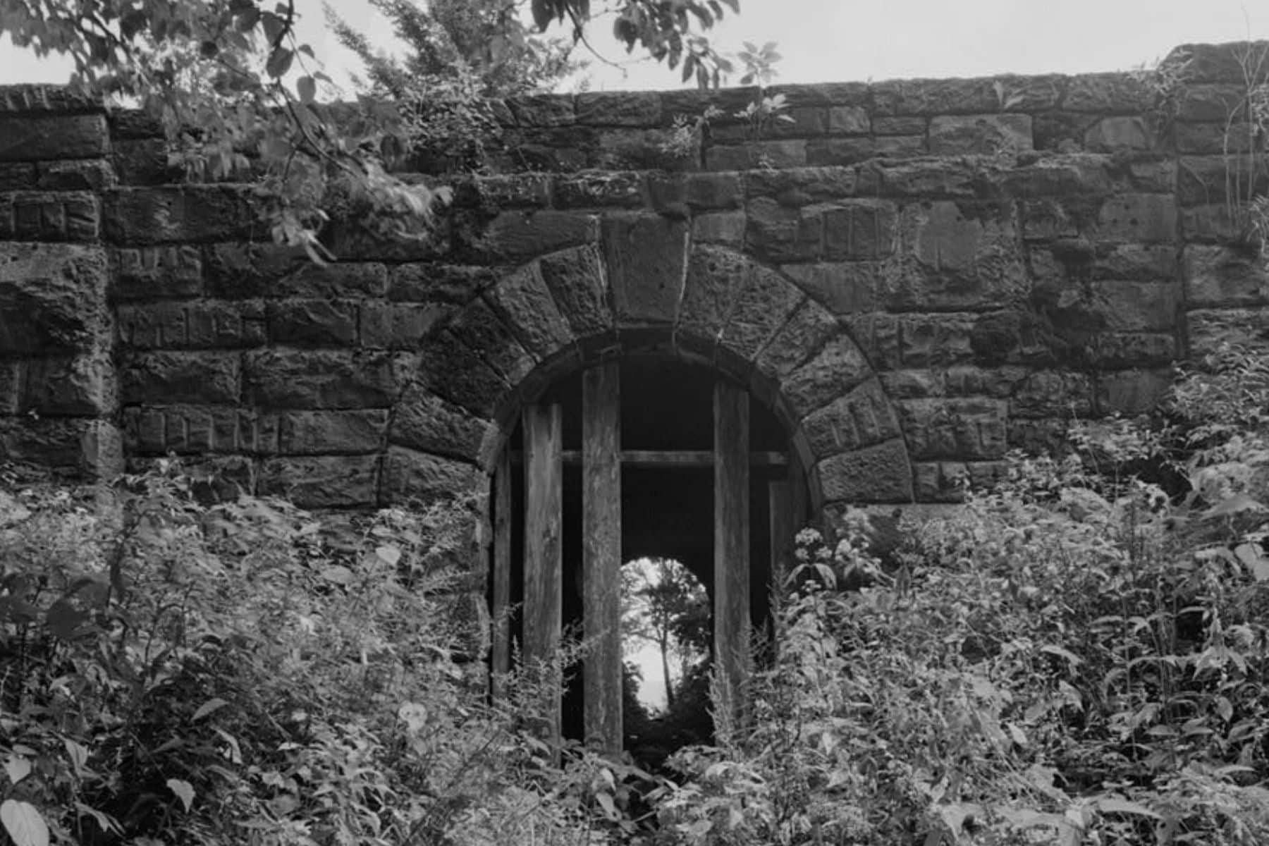
I hope the force of my eye roll didn’t shake your screens as you read that headline. Yes, there’s a “secret tunnel” in the vicinity of Clingmans Dome, as much as there are “secret” caves in the park. Perhaps my melancholy comes from knowing way too much about the drama that went into building the park roads between the feds and the states to be impressed by one secret tunnel.
However, the tunnel is not under Clingmans Dome. It is under Clingmans Dome Road, near where it meets Newfound Gap Road – almost seven miles from the tower.
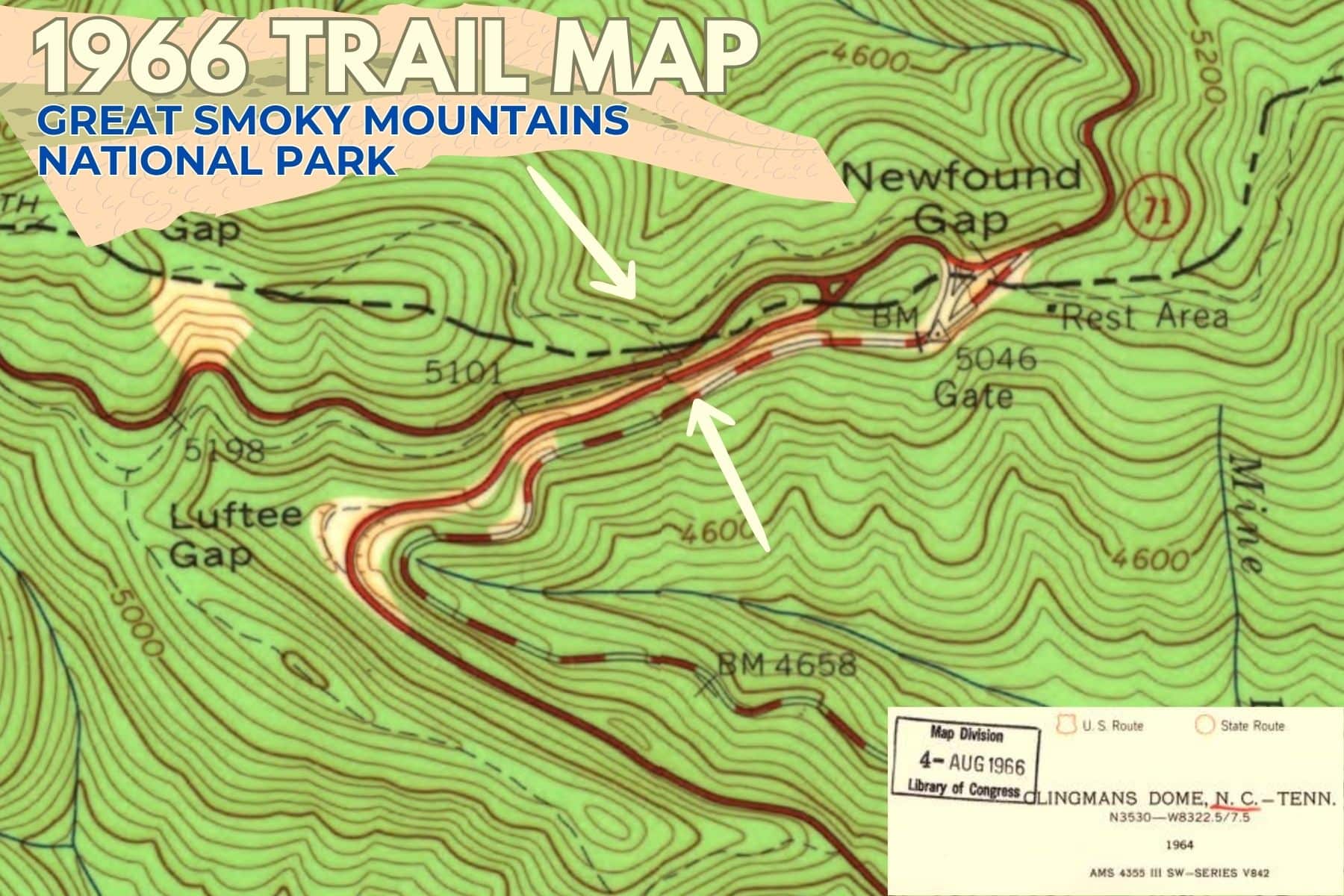
While some reports say it was a trail designed for hikes to avoid the road, the Library of Congress called it a “mule trail tunnel” built between 1930 and 1939.
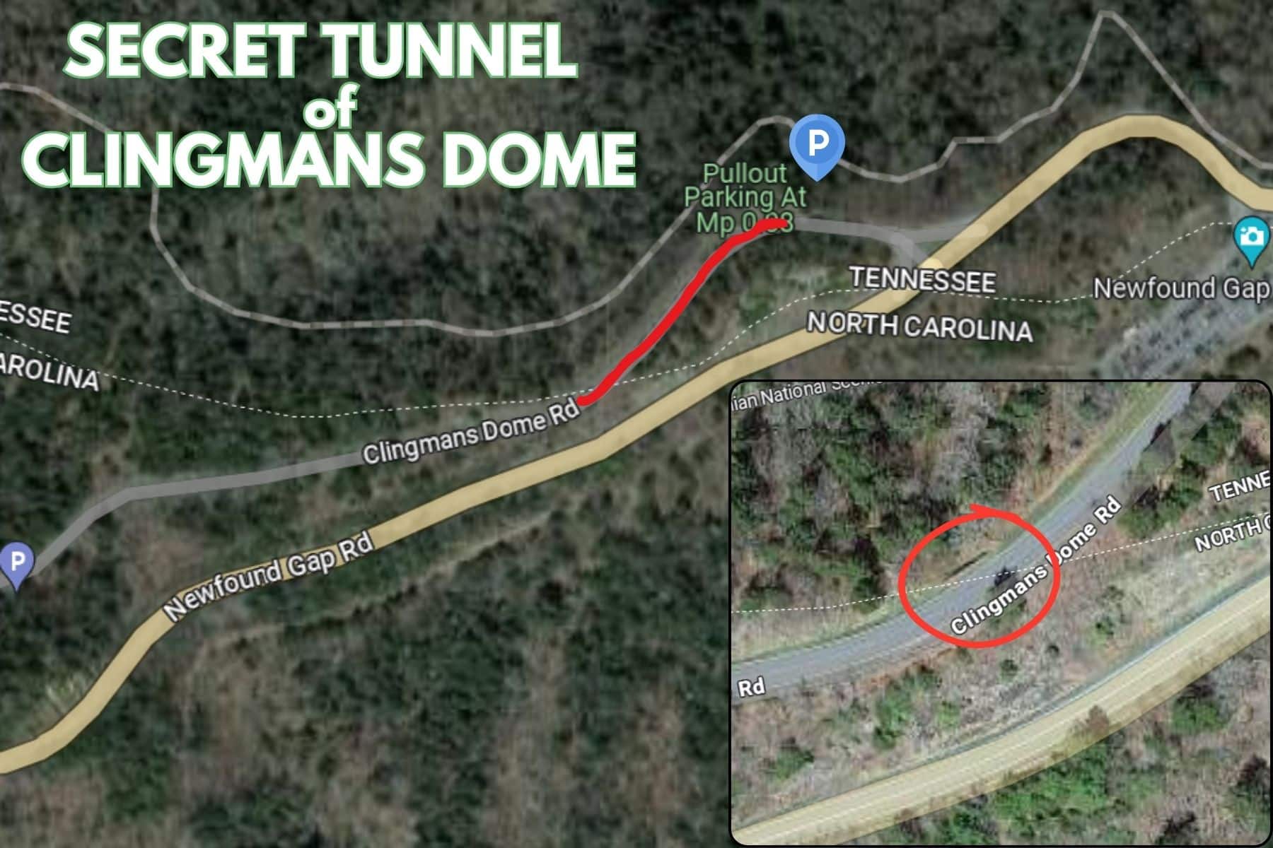
I dug through dozens of old mountain and park maps from the late 1800s through the 1960s. I finally found one from 1966 showing the exact trail that crossed over the roadway and connected to another, now obsolete, trail. To get there, you park in the first pull-out on Clingmans Dome Road, walk about 450 feet and go down the short ravine.
History of the Smokies’ Highest Point
As with much of the Great Smoky Mountain region we know today, the Cherokee people were the first inhabitants going back thousands of years.
The Sacred Mountain of Kuwahi
The Cherokee the highest mountain Kuwahi, meaning Mulberry Place. This sacred site still holds special meaning for the Eastern Band of Cherokee Indians who live in the surrounding communities and the Qualla Boundary.
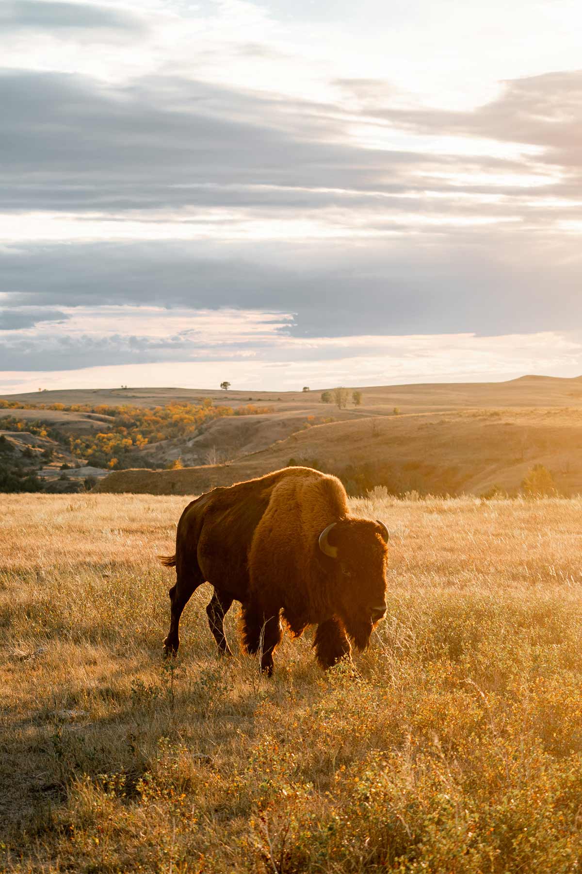
Bears are particularly sacred to the Cherokee, as they are said to be ancient tribal descendants who chose to live like animals but walk upright like a man. Mulberry Place (Kuwahi) is said to be the home of White Bear, chief of all the Cherokee bears.
During the Trail of Tears in the late 1830s, some Cherokee hid at Kuwahi to avoid being forced off the land.
TRAVEL TIP: Learn more about the Indigenous culture by visiting the Museum of the Cherokee People.
Settlers & National Park in the Smokies
Clingmans Dome was named in 1859 in honor of Thomas Lanier Clingman, a prominent American politician, scientist, and explorer who conducted surveys in the area. He was also a pro-slavery Confederate general, which is one of several reasons why efforts are underway to change the mountain’s formal name back to Kuwahi in 2024.
Here’s a timeline of the Great Smoky Mountains National Park and related dates associated with Clingmans Dome:
- 1926: Great Smoky Mountains National Park is authorized by the United States Congress, along with Shenandoah National Park.
- 1934: The park is officially established.
- 1935: Clingmans Dome Road is completed, providing access to the highest point in the park, Clingmans Dome.
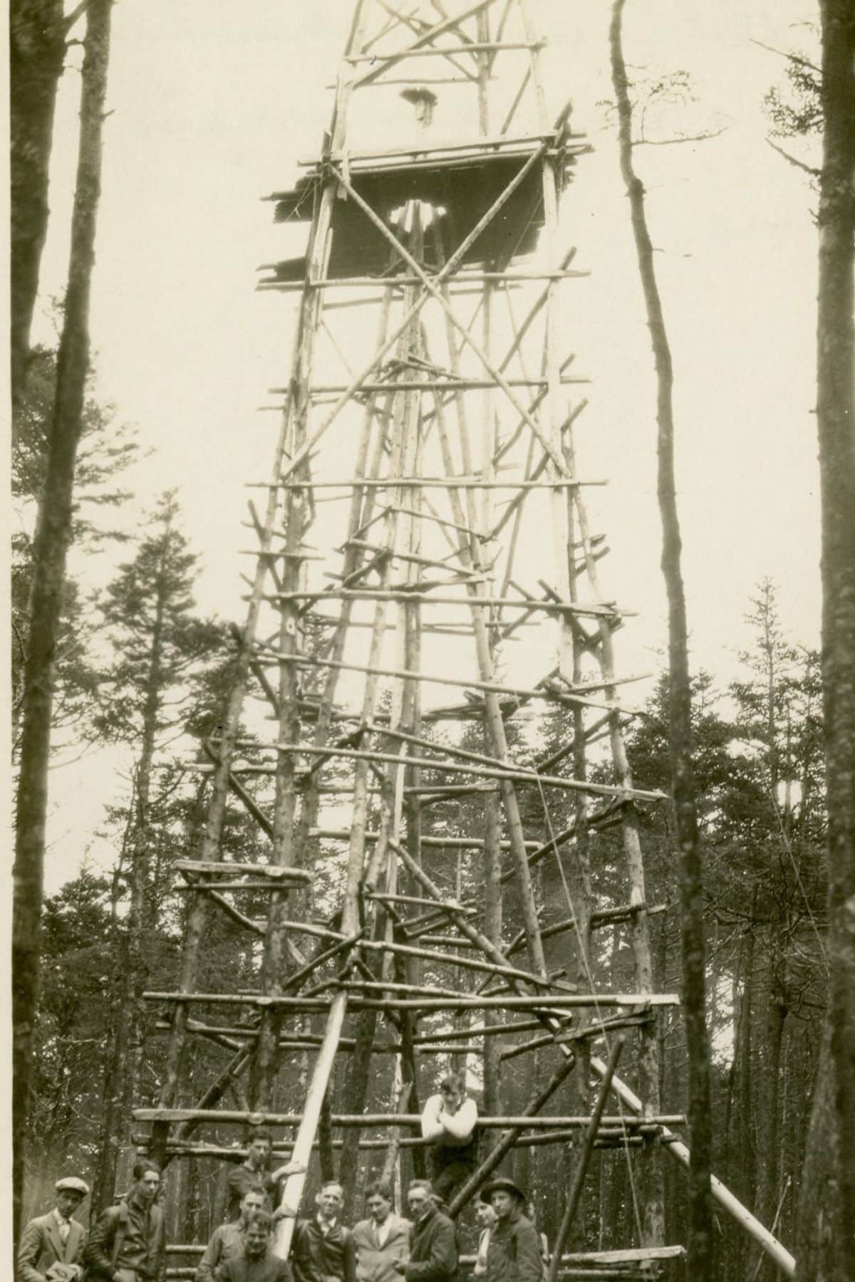
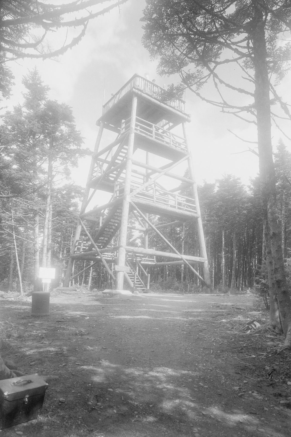
- 1938: The second Clingmans Dome observation tower is built. By 1950, it was unsafe to use and torn down.
- 1940: Great Smoky Mountains National Park is dedicated by President Franklin D. Roosevelt. Clingmans Dome Road was paved that same year.
- 1960: The construction of the third Clingmans Dome Observation Tower is completed, offering visitors panoramic views of the surrounding Smoky Mountains.
Is Visiting Clingmans Dome Worth It?
It would be nonsensical to say that the highest point in the Smokies and Tennesse wasn’t worth it, but strategy is a must to make this trip worth it beyond measure.
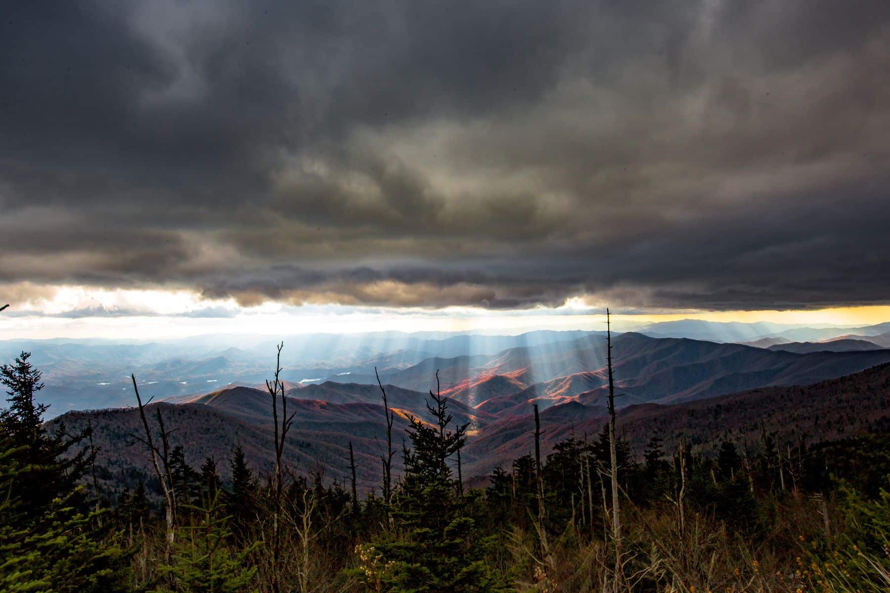
Most importantly, check the weather – not the weather in Gatlinburg. That might as well be the weather in Germany. You need to know conditions at the summit.
Equally as important – know the air quality. The top of Clingman’s Dome has the potential for 100-mile views. Yet, air quality can limit that view to 20 miles or less. Here’s more about pollutants and haze in the Great Smoky Mountains.
Then, determine your patience for crowds, traffic, and parking spot frustration. For example, I saw a super low tolerance and would rather get somewhere at 5am and wait than spend 1-2 hours at noon hawking over parking lots. You can add on a 3.6-mile roundtrip hike to Andrews Bald to explore more of the park before the morning rush. The trail starts at the Clingmans Dome parking lot.
Finally, peak baggers will want to head to the summit regardless of any of that. It’s an easy checkbox on the “highest point in Tennessee.”
Other Excellent Smoky Mountains Views
In my research for this article, a historical document about road construction stated that Park Service Director Arno Cammerer believed Mount LeConte to be “one of the grandest views in the world.”
Even the construction of Newfound Gap Road was almost changed since it might “ruin the view from what was considered the most beautiful peak in the future park (Mount LeConte).” The challenge with Mount LeConte comes with access only by moderate to strenuous hikes, ranging from five to nine miles each way.
The redeeming quality of Clingmans Dome remains its drivability. However, plenty of scenic spots await on various roads in the park.
- Newfound Gap: The main road through the park is also the most maintained during severe or winter weather. Scenic viewpoints line the route from Gatlinburg to Cherokee.
- Cataloochee Valley: Don’t let the name “valley” give you the wrong impression – this is a winding, tough, steep road that leads to the Elk-filled valley.
- Foothills Parkway: This road wraps around the east side of the park, with wooded views and scenic viewpoints of the mountain peaks.
- Roaring Fork: The scenic one-way drive is more suited for waterfall seekers. Be sure to look at Google Street View to get a feel for traffic and narrow roads.
- Blue Ridge Parkway: The parkway starts in the Qualla Boundary at Cherokee and goes for about 40 miles before exiting the park’s views. Plenty of stopping points line the road.
VIDEO: Great Smoky Mountains National Park Film
How Do You Spell Clingmans Dome?
I’m sure those eagle-eyed among you are twitching a bit at the lack of apostrophe in Clingmans Dome throughout the article. The Board of Geographic Names (under the Department of Interior) long holds that apostrophes are discouraged and not used in all but five instances – Martha’s Vineyard is one of them. Clingmans Dome is not.
“The possessive form should be avoided whenever it can be done without destroying the euphony of the name or changing its descriptive application.”
– Decisions of the United States Geographic Board, 1906-1908
While it goes against the rules of grammar and punctuation, the goal to avoid allowing possessive names of natural features is clear.
Pin Clingmans Dome at Great Smoky Mountains National Park
Helpful Related Articles
Great Smoky Mountains NP Guide: Expert Guide to Great Smoky Mountains National Park
Things to Do in Great Smoky Mountains NP: 15 (INCREDIBLE) Things to Do Great Smoky Mountains National Park
Best Hikes Great Smoky Mountains: 15 Best Hikes in Great Smoky Mountains National Park
Visiting Cades Cove: Cades Cove Visiting Guide (Helpful Tips + Map)
Tennessee National Parks: 15 AMAZING Tennessee National Parks Worth Visiting (Guide + Photos)
Best East Coast National Parks: Top 10 Best East Coast National Parks Ranked
National Monuments Ranked: ALL 128 US National Monuments Ranked (Best to Worst)
National Parks Ranked: ALL 63 US NATIONAL PARKS RANKED By Experts
Free Downloadable National Parks Map: LIST & MAP of National Parks By State (+ Printable Checklist)
Most Visited National Parks: Top 10 Most Visited US National Parks
Georgia National Parks: 10 Amazing Georgia National Parks Worth Visiting
South Carolina National Parks: 8 Epic South Carolina National Parks Worth Visiting
North Carolina National Parks: 12 Epic North Carolina National Parks Worth Visiting
National Parks Road Trip: 10 EPIC National Parks Road Trips (Expert Guide)
Leave a Reply