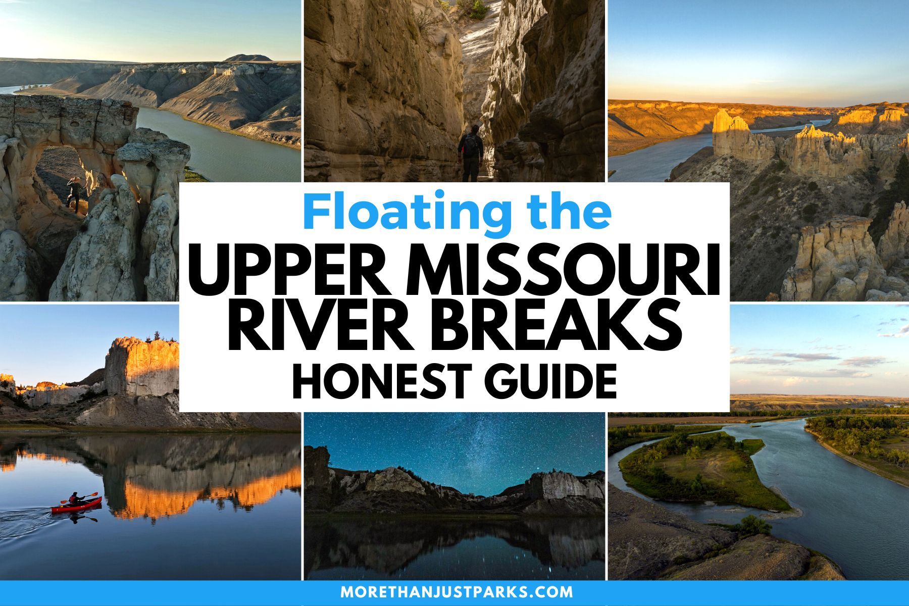
Article Overview: Floating Upper Missouri River Breaks National Monument
Imagine you’re meandering along the lazy currents of the Wild & Scenic Upper Missouri River, flanked by towering limestone cliffs and a labyrinth of intricate coulees, all within the heartland of Montana’s Upper Missouri River Breaks National Monument. Sounds pretty idyllic, right?
Well, it’s time to turn that fantasy into a thrilling reality. This article is your guide, offering invaluable insight and advice to have you well on your way to this grand adventure. So, sit back and soak in the knowledge as we guide you on an immersive journey down a river less traveled. It’s time to step out of the mundane and venture into the wild for your next public lands trip.
In this guide I’ll cover things you’ll need for the trip, where to rent boats and which one’s to rent, permitting, the best times to go, what to see, how long to make your trip, and everything else you need to know before setting out on this once-in-a-lifetime type of adventure.
And don’t forget to check out our Upper Missouri River Breaks film featured below! If it doesn’t get you excited about your trip I’m not sure what will!
Table of Contents: Upper Missouri River Breaks Guide
Floating Upper Missouri River Breaks National Monument
A Guide to Floating Upper Missouri River Breaks National Monument
About Upper Missouri River Breaks National Monument
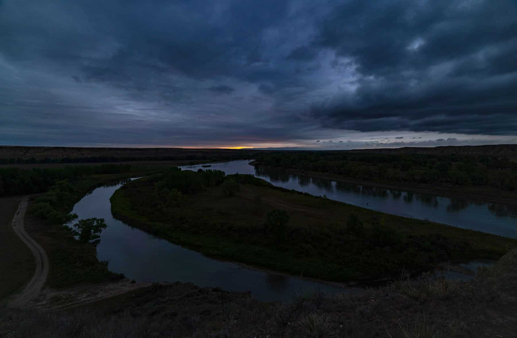
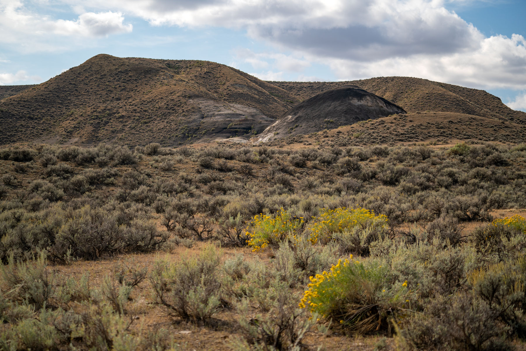
When one talks about visiting Upper Missouri River Breaks National Monument it’s almost always in the form of a float trip – which is what I’ll mostly be covering in this article. That said, the monument actually covers 377,000 acres of beautifully rugged central Montana, most of which is pretty inaccessible – without some serious backpacking.
The part of the Upper Missouri River Breaks National Monument that everyone refers to is the 149 miles of the Upper Missouri River that is classified as Wild & Scenic. This is the river Lewis & Clark traveled as they made their way to the Pacific and thanks to conservation efforts it’s remained largely the same as it was when they made their epic journey in 1804.
Floating the river you’ll have the opportunity to experience nature on a grand scale, much in the same way Lewis & Clark did all those years ago. Stopping along the shore you can visit some of the expedition’s historic campsites, left largely untouched.
You’ll also have the opportunity to discover intricate petroglyphs and explore the fascinating geological formations that help make this are so uniquely beautiful.
Wondering what a Wild & Scenic River is? Check out our short explanatory video!
Upper Missouri River Breaks Film
Join the filmmakers at More Than Just Parks on an spectacular journey through vast untamed landscapes brimming with history and boundless exploration opportunities.
Things to Know Before Floating the Upper Missouri River Breaks
Embarking on a float trip down the Upper Missouri Wild & Scenic River is sure to be an unforgettable experience. Here are a few things to keep in mind before you set off:
- Locals and frequent visitors refer to the monument as “the Breaks”: I’d recommend doing the same if you don’t want to sound like a total tourist.
- Prepare for Changing Weather: Montana’s weather can change rapidly, from hot, sunny days to sudden storms. Pack waterproof gear and layers for changing temperatures.
- Know Your Route & Your Abilities: It’s important to research your route and plan your trip based on your abilities. Is it realistic for you to paddle 20 miles each day? Keep these things in mind as you make your plans.
- Respect Wildlife: You’ll likely see a variety of wildlife. Always observe from a distance, don’t feed animals, and secure your food at campsites.We were warned about problem raccoons at certain campsites, while we didn’t encounter any (that we know of) make sure to secure your food and not invite them in.
- Pack In, Pack Out: Follow Leave No Trace principles. Bring reusable water bottles, pack out all trash, and use biodegradable soap.
- Safety First: Always wear a life jacket when on the water. Be aware of water levels, as they can fluctuate greatly depending on the season and weather conditions.
- Beware of Possible Hazards: Possible hazards include rattlesnakes, Cottonwood tree limbs falling, fragile sandstone cliffs, sudden storms, submerged rocks, and heat exhaustion.
- Respect Historical Sites: The monument is rich in cultural and historical sites. Look, but don’t touch, take or disturb these amazing sites.
- Be Self-Sufficient: Services are limited, and cell service is almost totally unavailable. Be prepared with maps, first aid supplies, extra food and water, and emergency gear.
- Fire Restrictions: Be aware of fire restrictions or bans, particularly in the dry summer months. Use a camp stove for cooking instead of making a fire if these are in effect.
- Stay Hydrated: Don’t forget to stay hydrated, especially during the summer. The dry climate can dehydrate you quickly with little warning.
Best Time to Visit the Upper Missouri River Breaks National Monument
Spring
Springtime in the monument sees winter loosening it’s icy grip and late spring brings mild temperatures and blooming flowers, providing a great setting for hiking, bird watching, and camping. Of course spring can also bring unpredictable weather, with potential rain showers, snowstorms, and highly variable temperatures.
Late spring is a good time to visit, when the possibility of snow has gone and temperatures are mild.
Summer
Peak season for the Upper Missouri River Breaks is predictably the summer, particularly July and August. During this time, the weather is warm, the skies are generally clear, and the landscapes of the monument come alive in their fullest splendor – it’s Montana at its finest. Of course, thanks to it’s remote location, logistical requirements, and hidden gem status, even peak season here is relatively quiet.
I should also note that at the height of summer it can get quite hot here, so be sure to plan accordingly and bring plenty of water.
Fall
Fall is a quiet time at the Breaks, when the anglers and boaters of summer have faded away with the warm weather. During this time of change the cottonwoods along the shores of the river are ablaze in golden yellow and wildlife can be seen on the move throughout the monument. Mornings and evenings are cold and days are mild and pleasant, with great temperatures for hiking and exploring.
Fall can be a great time to visit the Breaks, but in this remote part of the country things can change quickly and winter storms can blow in on a seemingly nice day so be prepared for anything. I should also note that the winds tend to pick up this time of year which can make paddling quite a bit more difficult if the winds aren’t with you.
Winter
I wouldn’t recommend packing your bags for a winter expedition. From late November through March, the Montana winter can be an unforgiving beast, serving up a cocktail of heavy snowfall and biting cold temperatures that can make even the most seasoned outdoors person regretful.
What to Bring for Your Upper Missouri River Float Trip
A multi-day float trip through Upper Missouri River Breaks National Monument requires solid preparation, smart packing, and a zest for adventure. Keep your gear minimal yet versatile, and you’ll float by with ease. Here’s what you’ll need for a successful journey:
(Note: All products linked below are products we use in the field)
- Water: This is the most important item on your packing list. Once you set off you’d better have enough for your journey because the river water is not safe to drink. We used these durable 6-gallon jugs from Walmart’s Ozark line. They’re definitely the most cost-effective and we found them to be perfectly suited for our needs.
- Food: Depending on whether or not you’re bringing a cooler your options here can be vast or relatively small. Make sure to bring plenty of easy snacks like trail mix, jerky, or dried fruit that can give you a boost while you’re paddling. Beyond that we loved these high quality dehydrated backpacking meals, and they made packing, cooking, and cleanup a lot easier.
- Cooler: Depending on your space (how many people/boats are in your party) a hard sided cooler like this one can drastically expand your food and beverage options on the river. If space is limited we recommend this awesome roll-top backpack cooler that’s waterproof and buoyant. Of course you can also go no cooler and cook backpacker meals.
- Camp Kitchen: Make sure you have a reliable camping stove, fuel, lightweight cookware, utensils, and plates. You’ll also want enough water to drink and to boil anything you plan to cook.
- Camping Gear: A solid, weather-resistant tent that can stand up to the elements (the winds tend to pick up at night) is what you want here. You’ll also want a toasty sleeping bag and a comfortable sleeping pad for those riverside camping nights.
- Safety Essentials: A packable comprehensive first aid kit, a good map of the area, a trusty multi-tool, a flashlight or headlamp, and waterproof matches or lighters are musts.
- Fire Building: Along with a lighter or waterproof matches, we like to bring packable fires starters like fire sticks or these great little cedar discs. In wet or challenging conditions these easy to pack items can make all the difference.
- River Kit: Along with your watercraft of choice, life jackets, paddles, and oars are of course needed before shoving off. Dry bags are a must for keeping gear and essentials protected from the river’s splash. All of this can be rented with Missouri River Outfitters, where you’ll get your boat, at very reasonable prices. More on that below.
- Apparel: Quick-drying, breathable clothing layers, a trusty sun hat, and solid waterproof hiking boots are key. Pack warm clothes for cool evenings and layers for when it gets hot. Sunglasses and eco-friendly sunscreen are also crucial components of any river trip.
- Personal Items: Biodegradable soap, toothpaste, toilet paper, and a quick-dry towel are good ideas.
- Bug Defense: You may want insect repellent if you’re paddling in the summer. We use this one for our clothes and this one for our skin. Both are highly effective and EPA approved.
- Garbage Management: Carry durable trash bags to ensure you leave nothing behind but footprints and amazing memories.
- Capture the Journey: Make sure to bring a camera and keep it safe from the water so that you can take plenty of pictures.
- Wildlife Viewing: Binoculars make wildlife spotting a lot easier and safer, keeping you a respectful distance from the animals that call this area home.
- Permits: Make sure to bring cash for your fees which you’ll pay before shoving off at your launch point. More on this below.
- Navigation Tech: A waterproof, portable GPS device can be a handy supplement to your traditional navigation tools.
- Communication Device: A satellite phone or two-way radios can provide a critical line of communication in the event of an emergency.
- Comfort Items: Consider compact, lightweight items that can make the wilderness more comfortable, such as a camp pillow or lightweight camping chairs.
Upper Missouri River Trip Logistics
Navigating the river is pretty easy, after all it only goes in one direction. Guided trips are available in the summer season, but I highly recommend doing this yourself. What you need to figure out is where you want to put in and where you want to take out.
Upper Missouri River Breaks Map
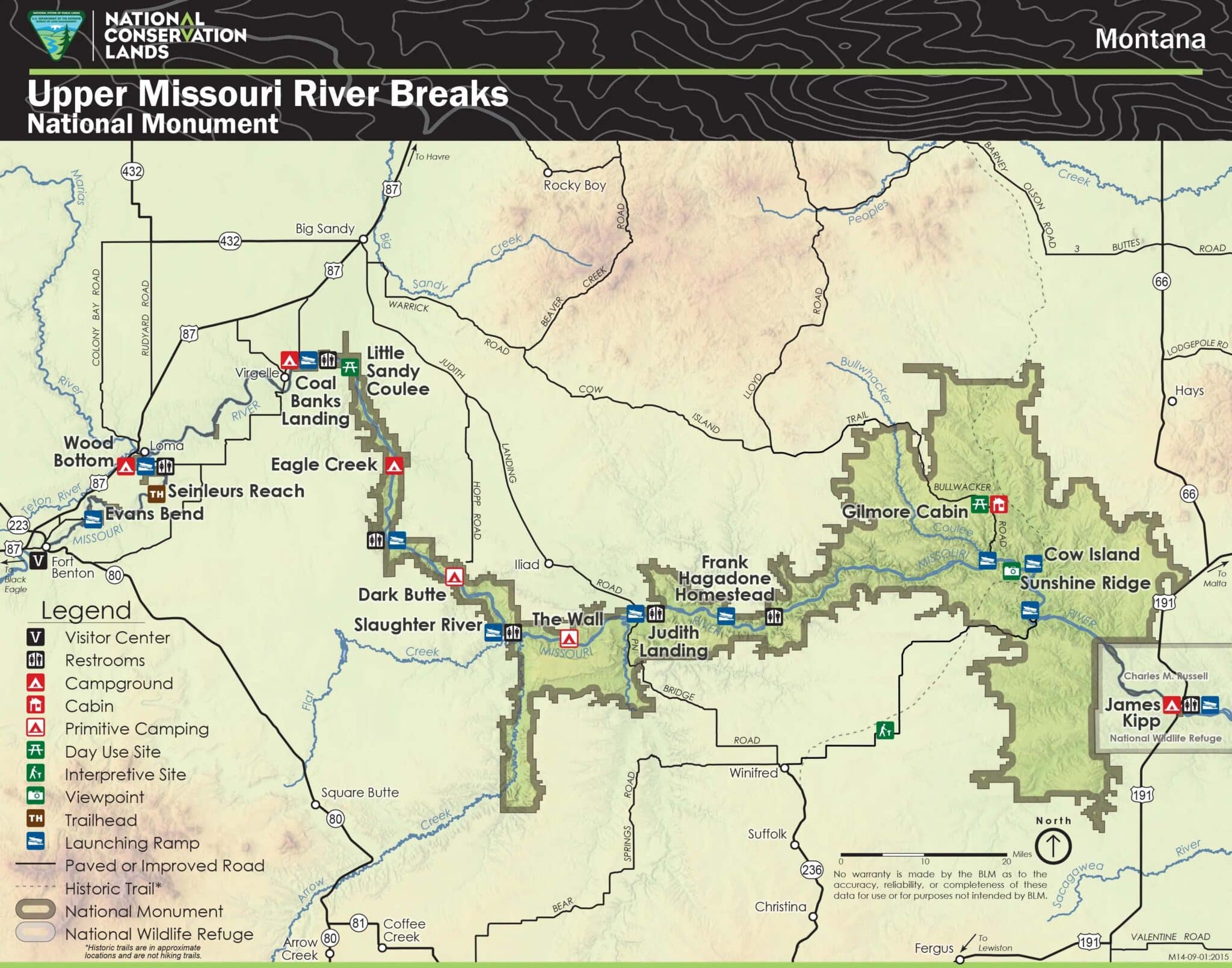
The map above gives you a great birds eye view of the monument as a whole. A higher resolution map of the monument can be viewed online on the BLM’s website here. Of course you’ll also want a hard copy which can be purchased for a small fee at any of the field offices within the monument.
Obtaining a Boaters Guide
The BLM offers two great boaters guides, one covering Fort Benton to Judith Landing (river miles 0-88.5), and the other covering Judith Landing to James Kipp Recreation Area (river miles 88.5-149). I found the boaters guide to be indispensable both in planning my trip and once on the river.
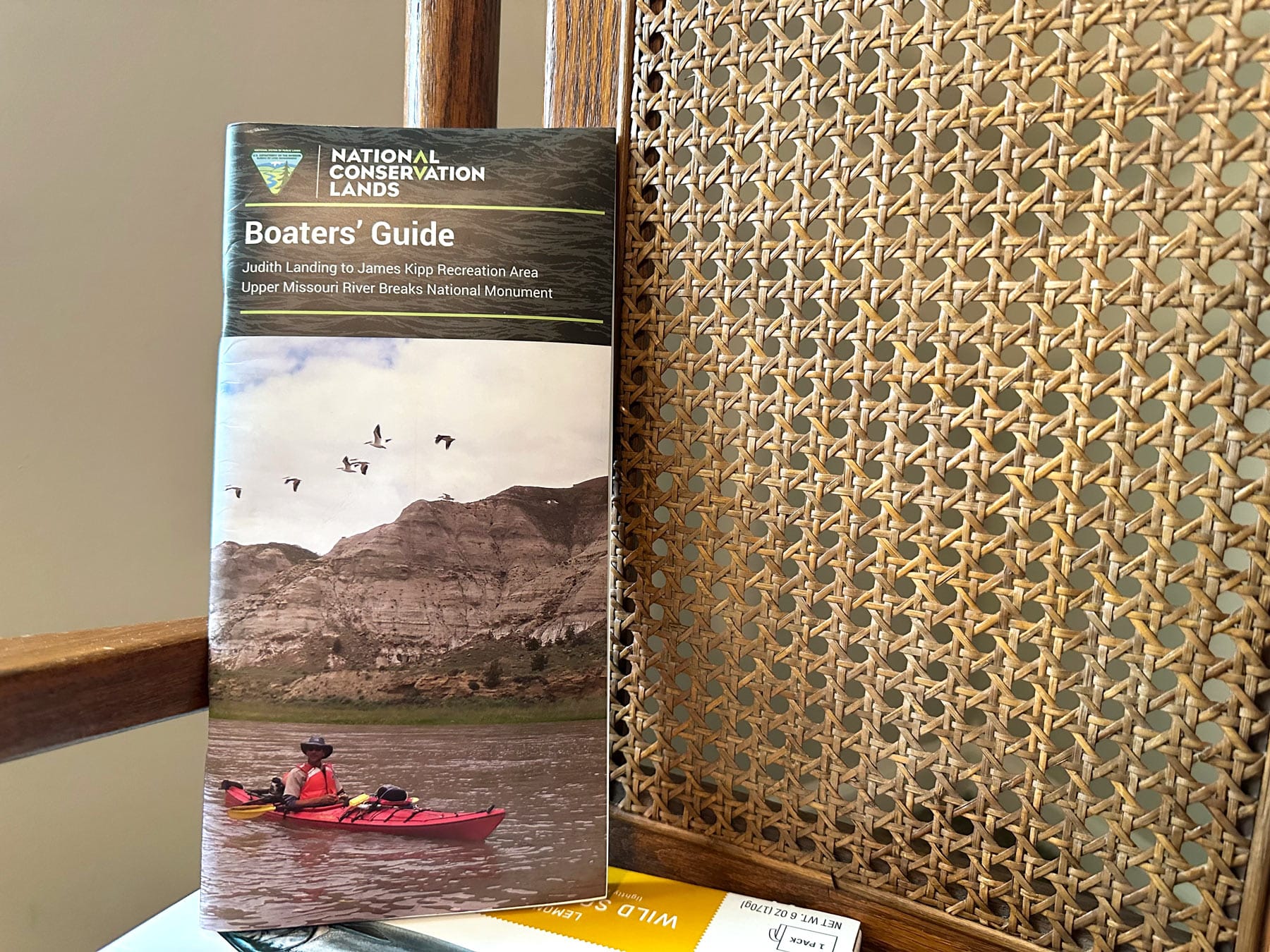
The boaters guides are a bargain at $4 each, but you haven’t heard how to obtain one yet! To get your boaters guide you’ll need to mail a check or money order payable to “DOI/BLM” to the folowing address:
BLM
P.O. Box 1389
Fort Benton, MT 59442
That’s right, just like you’re purchasing a piece of furniture from Sears & Roebuck! I included a brief note specifying which boater’s guide I was requesting, when I was planning on going, and my return address where the guide can be mailed.
While the process to obtain the guide may feel like you’re already retracing the footsteps of Lewis & Clark, the comprehensive guide is an essential resource for planning your trip – offering a wealth of information to help you make the most of your river journey.
Determining Your Route
| Launch Point | Mile |
|---|---|
| Fort Benton Canoe Launch | 0 |
| Wood Bottom | 20.3 |
| Virgelle Ferry | 39.1 |
| Coal Banks Landing | 41.5 |
| Judith Landing | 88.5 |
| McClelland (or Stafford) Ferry | 101.8 |
| James Kipp Recreation Area | 149 |
Above is a handy guide to the different river launch points with their corresponding river mile. This shows you your options for put in and take out points. Most people like to do Coal Banks to Judith Landing, which is what I did. This section covers 47 miles of some of the most scenic parts of the monument and is typically done in 4 days.
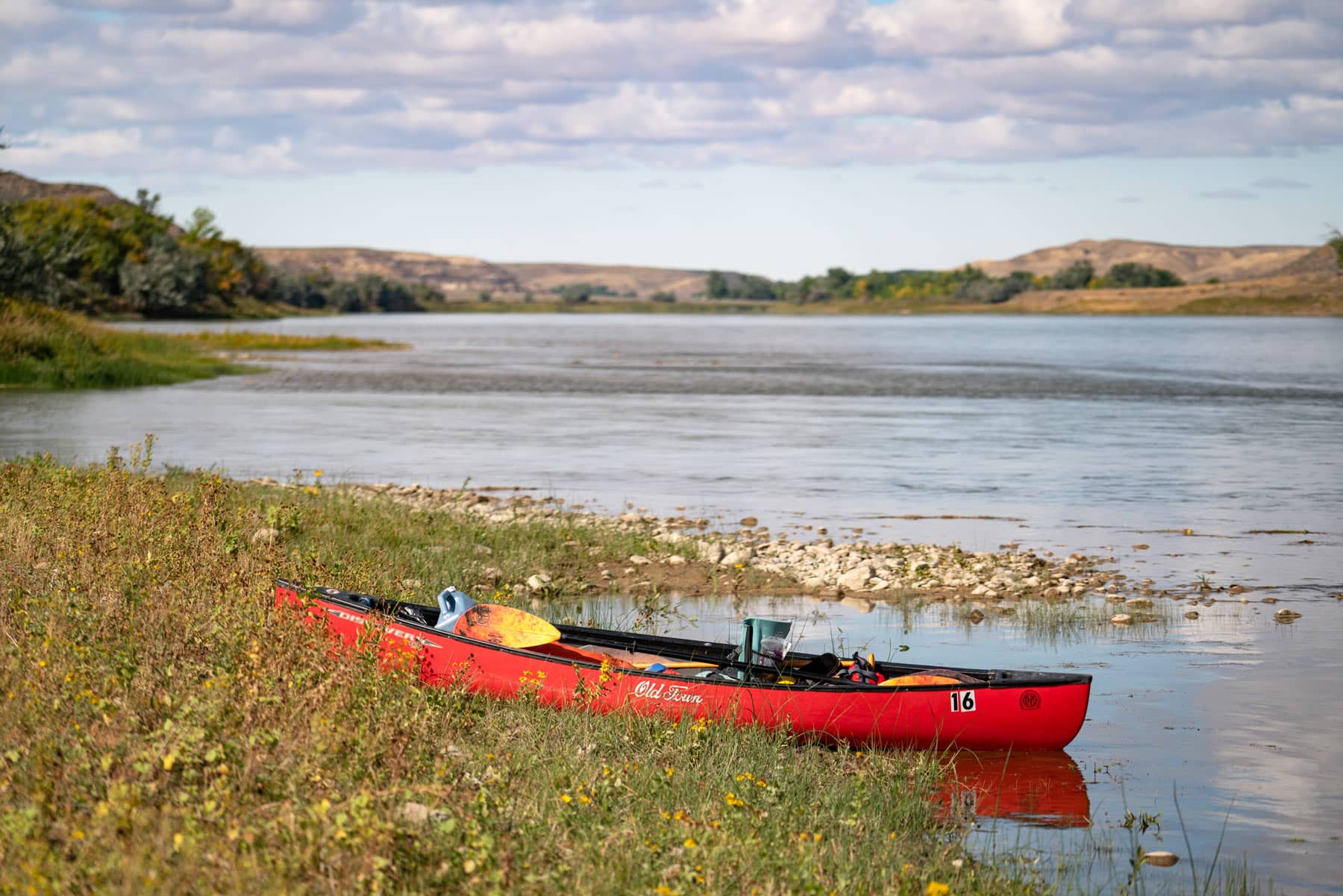
Renting a Boat & Equipment
Missouri River Outfitters in Fort Benton is the place you’ll want to go to rent your boat and most of your generic equipment. They offer reasonable prices and are very friendly and conveniently located. You pick up any rented equipment at their store and the boats will be waiting for you at your launch point.
Below is a helpful list of boats and equipment that can be rented along with their prices as of this writing:
| Equipment | Price Per Day |
|---|---|
| Canoe- Old Town 169 | $35 |
| Solo Canoe- Old Town 119 | $35 |
| Canoes- Wenona Escape (Kevlar) | $60 |
| Kayak- Old Town Loon | $35 |
| Kayak- Castine 145 | $35 |
| Canoe- Grumman Aluminum | $50 |
| Coolers | $10 |
| Action Packer | $10 |
| Tables | $10 |
| Camp Chairs | $2 |
| Canoe Seat-Backs | $2 |
| 2 or 4 Person Tents | $10 |
| Bathroom Bucket System (bags sold separately) | $3 |
| Sleeping Bag | $5 |
| Sleeping Pad | $5 |
| Camp Pillow with Pillow Case | $2 |
| Big Dry Bag 65 Liter | $5 |
| Mid-Size Dry Bag 45 Liter | $2 |
| Toilet and Tent (Wag bags sold separately) | $10 |
| Camp Stove | $10 |
| Throw Ropes | $2 |
| Kitchen Box (Doesn’t include food or a stove) | $25 |
As you can see everything is pretty reasonable and though the costs do add up they can easily be split by members of your party. Renting equipment also cuts down on waste and the burden of traveling with these items prior to starting your trip. You can find out more information on equipment rentals here.
Upper Missouri River Breaks Car Shuttle Service?
Missouri River Outfitters offers a convenient service to drive your car from where left it when you launched to your take out point for you. I wouldn’t call it cheap, but it’s by far the most sensible option and allows you to pack up and be on your way when you’re all done.
If you plan on using a rental car for your shuttle then you’ll need to call ahead to figure out extra logistics about that.
You can check out the prices as of this writing below:
| Route | Shuttle Distance (Round Trip) | 1 Vehicle | 2 Vehicles | 3+ Vehicles |
|---|---|---|---|---|
| Fort Benton to Coal Banks | 73 miles | $100 | $75 each | $65 each |
| Fort Benton to Judith Landing | 157.2 miles | $225 | $200 each | $175 each |
| Wood Bottom to Judith Landing | 167.7 miles | $225 | $200 each | $175 each |
| Coal Banks to Judith Landing | 168.4 miles | $225 | $200 each | $175 each |
| Fort Benton to James Kipp Recreation | 290 miles | $375 | $350 each | $325 each |
| Wood Bottom to James Kipp Recreation | 310 miles | $400 | $350 each | $325 each |
| Coal Banks to James Kipp Recreation | 363 miles | $425 | $400 each | $350 each |
| Judith Landing to James Kipp Recreation | 320.3 miles | $400 | $375 each | $335 each |
There’s definitely incentive here to only use one vehicle, but keep in mind that you’ll need space to transport your party as well as all of your equipment (minus the boats). Our large SUV filled up pretty quickly between 3 people and all of our equipment.
Do I Need a Permit to Float Upper Missouri River Breaks?
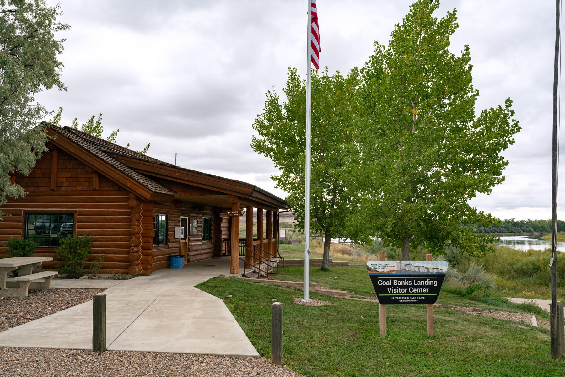
Permits are not required, however you’ll need to pay for your trip prior to shoving off using the blue BLM envelopes available at your launch point. It’s also a good idea to speak with an employee at the visitor center and inform them of your trip as a safety precaution.
Below you’ll find the fees you’ll need to take into account.
| Duration | Fee |
|---|---|
| Single Day (any boat type/size) | $5 per boat |
| Multiple Day (Adults 16 years and older) | $4 per person per day |
| Multiple Day (Children 7-15 years) | $2 per person per day |
| Multiple Day (Children under 7 years) | Free |
For multiple day trips the fee is per person per day and there are no additional boat fees. If your group size is more than 30 you’ll need to apply for a Special Recreation Permit by contacting the Missouri Breaks Interpretive Center at (406) 622-4000. Be sure to check out the BLM website for the latest information.
NOTE: Be sure to bring the correct amount of money in cash with you to your launch point!
Floating the Upper Missouri River Breaks
Decision Point
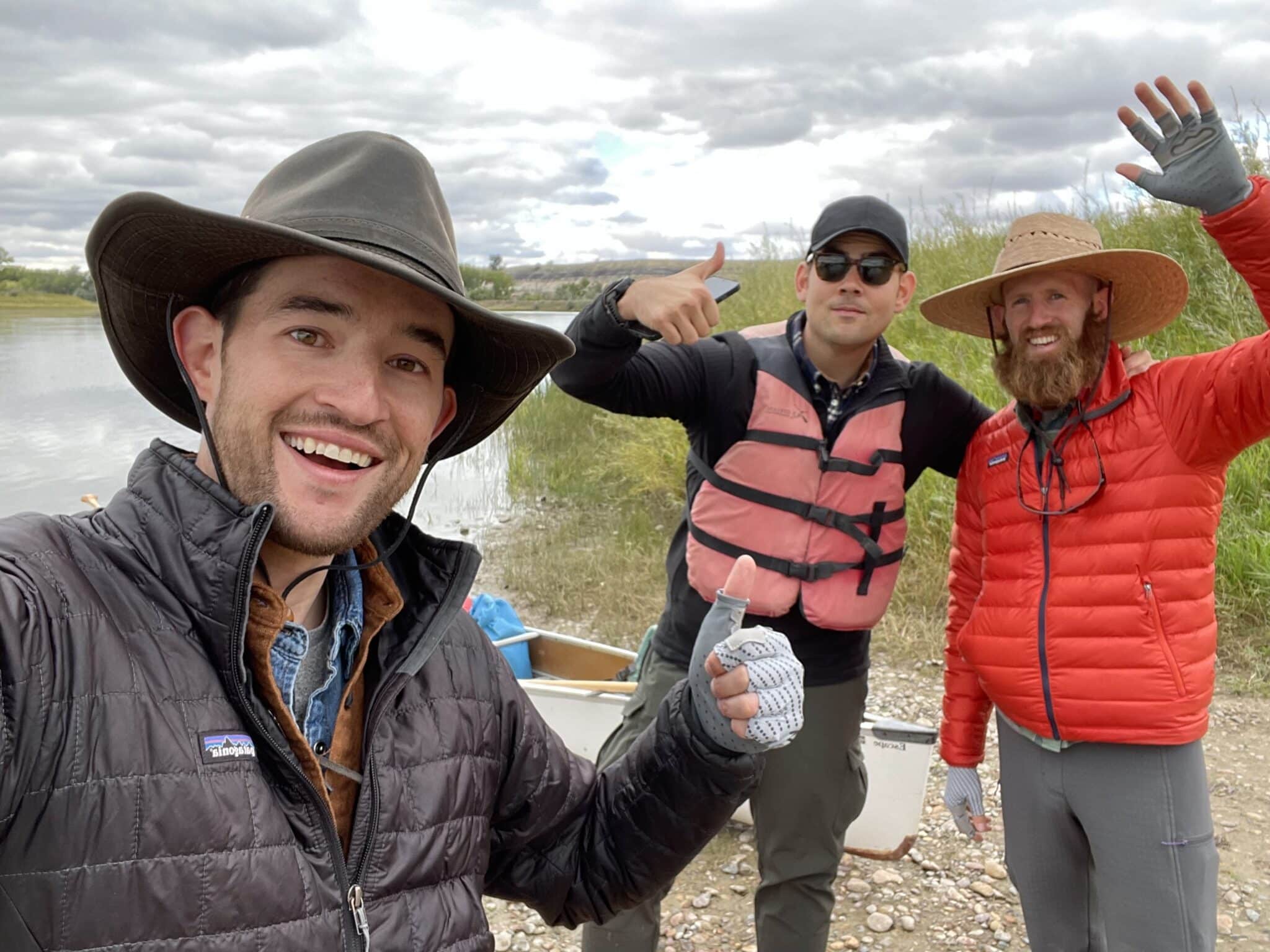
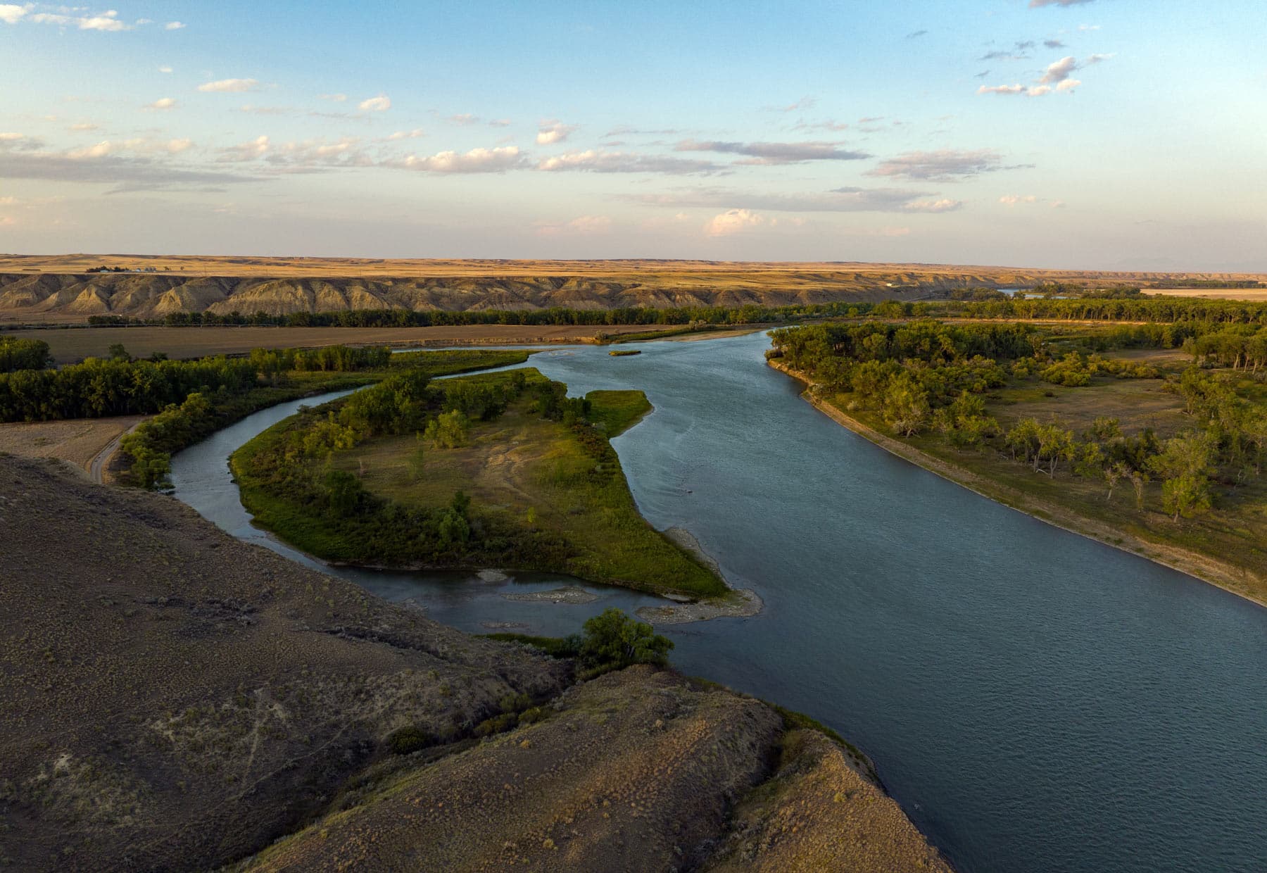
Before setting off on our float trip we stayed the night in Fort Benton, which has great accommodations in case you’re wondering. That evening we drove out to Decision Point, the spot where Lewis and Clark faced a crucial choice: which river – the Marias or the Missouri – would guide them on their westward journey.
Today, this picturesque vista, overlooking the confluence of these two mighty rivers, still whispers stories of past determination and exploration.
Standing on the bluff looking out at the confluence in the fading light with nothing but the sound of the water and the wind was a terrific way to begin our adventure.
Eagle Creek
After chatting with the friendly BLM employee at the Coal Banks Visitor Center and letting him know our rough itinerary (always a good idea), we loaded the boats and set off. Our first stop was Little Sandy, where we found some interesting topography to explore and set up a few short timelapses. This spot can be missed though if you’re short on time.
We made a few more stops before arriving at Eagle Creek for sunset. We had investigated Burned Butte, but decided Eagle Creek was the place to spend our time and obtain the high quality shots we were going for. It definitely didn’t disappoint.
We found a beautiful petroglyph of a horse after a short hike and later Lewis & Clark’s May 31, 1805 campsite. The campsite wasn’t easy to locate and required a bit of wandering around until we stumbled upon the small historical marker. But how amazing it was to stand in a spot largely unchanged since their historic visit more than 200 years ago.
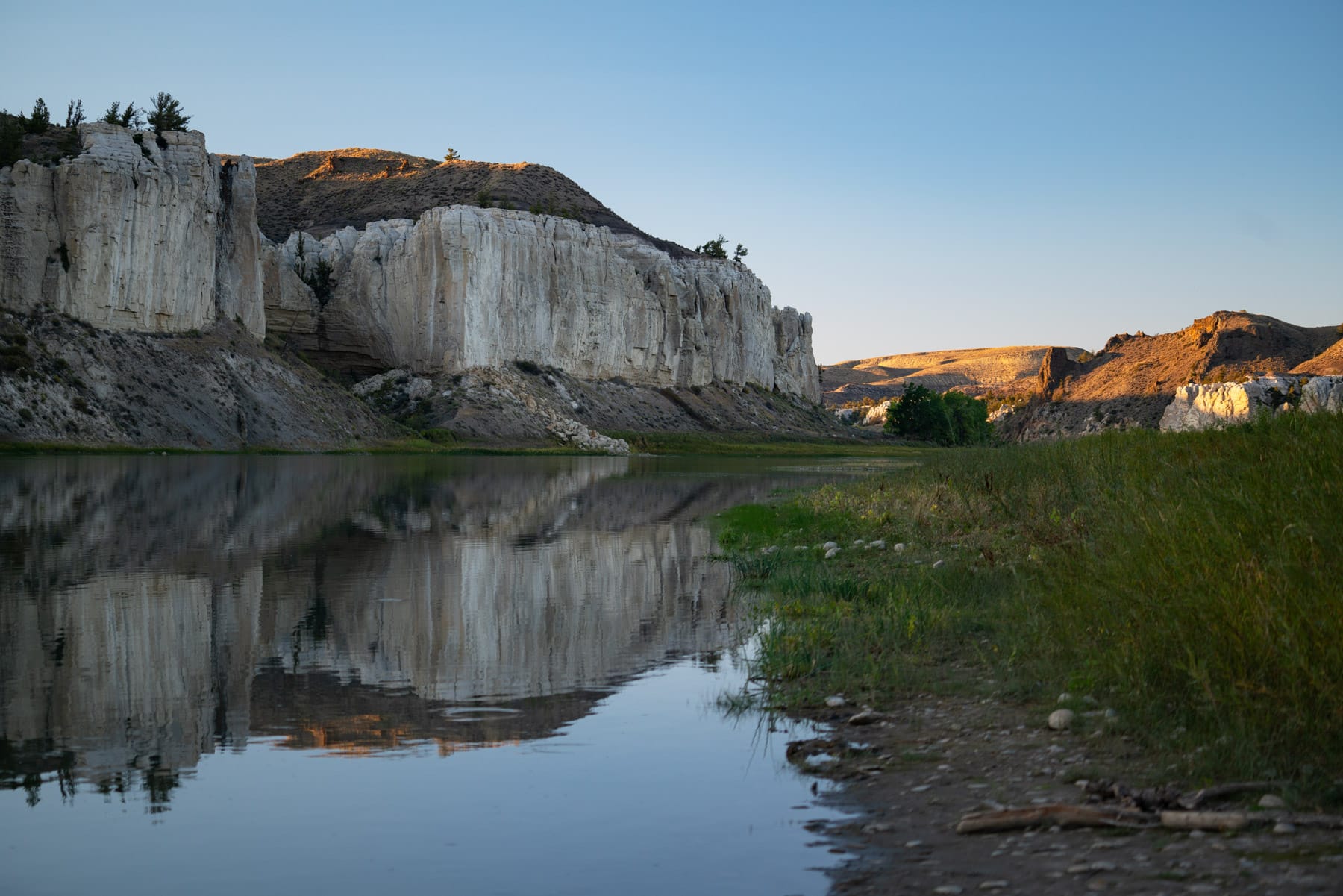
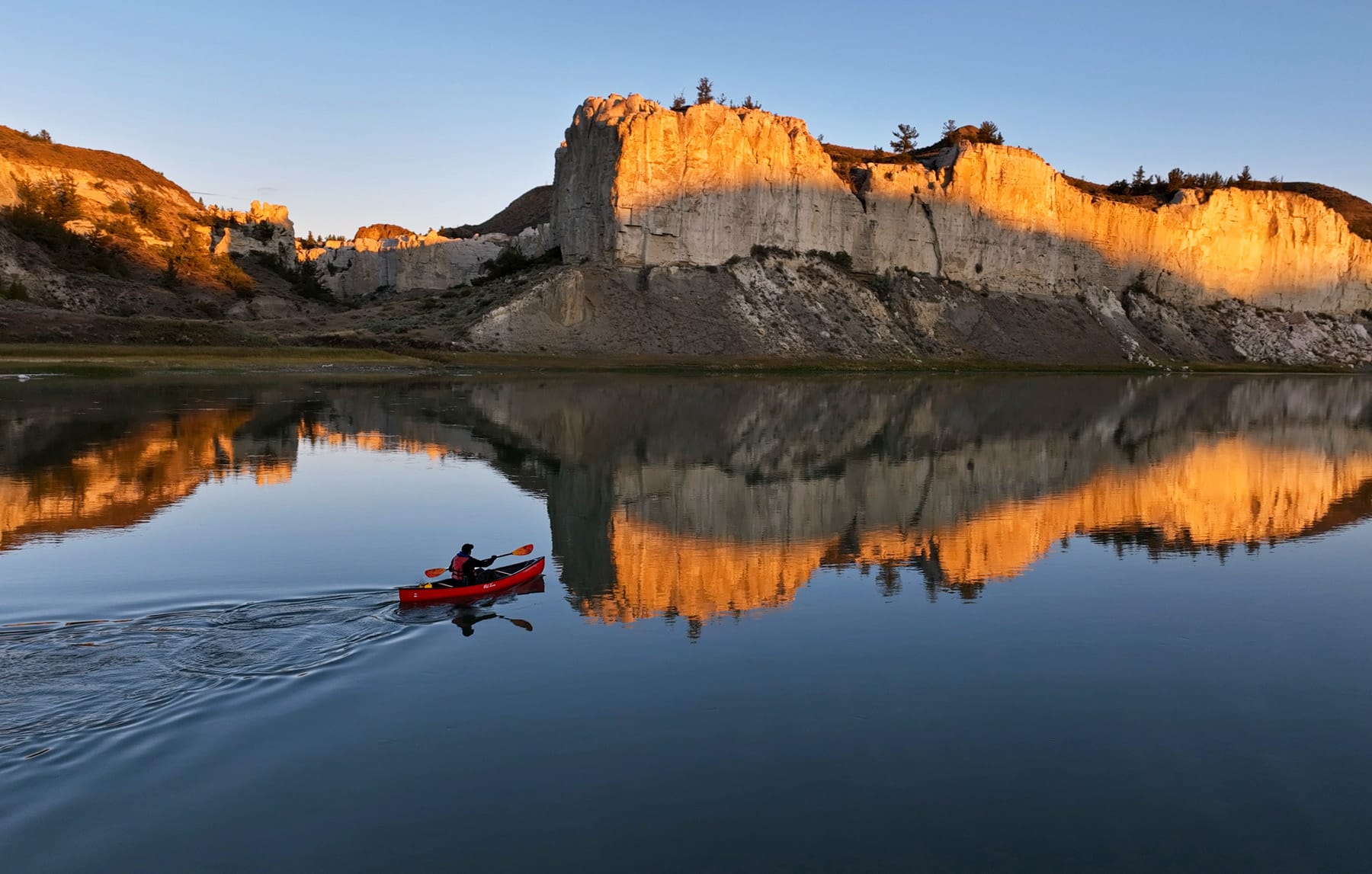
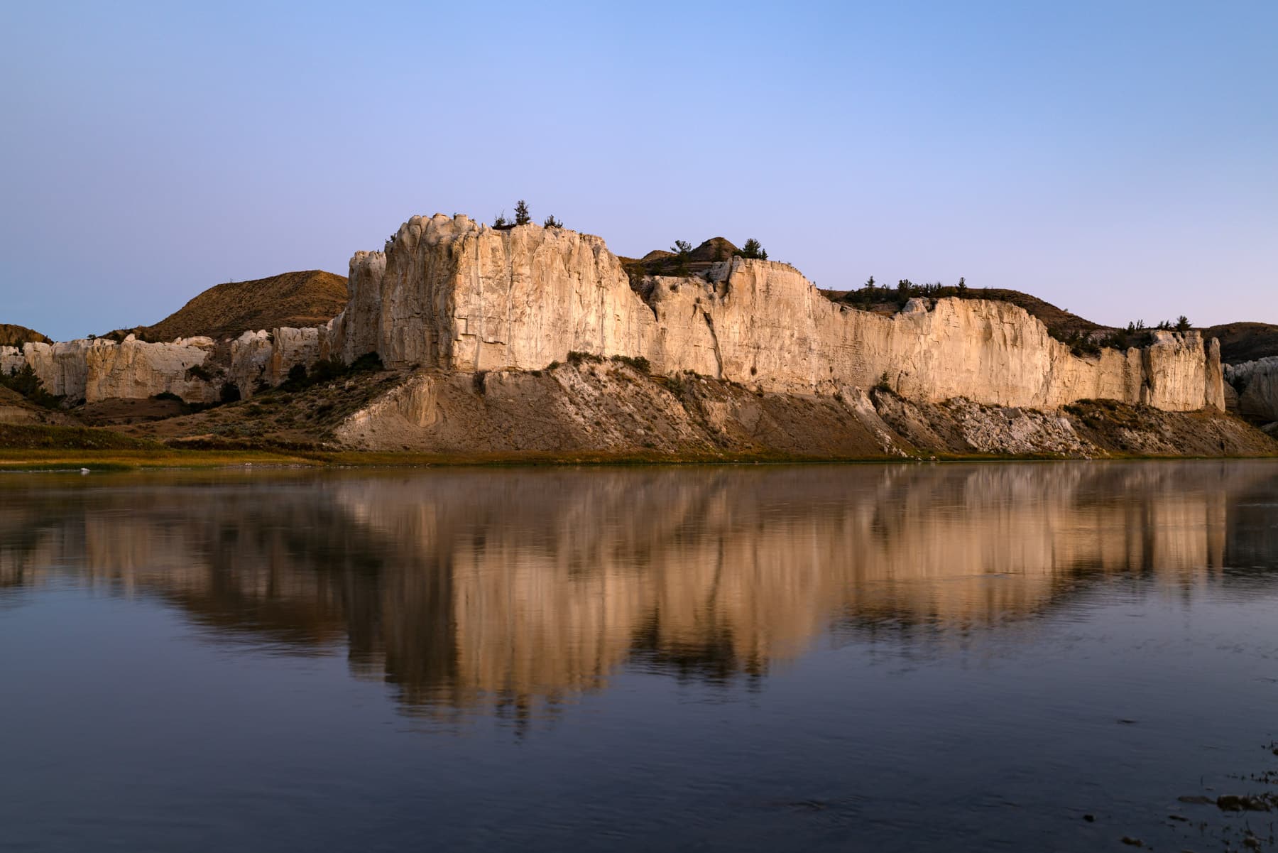
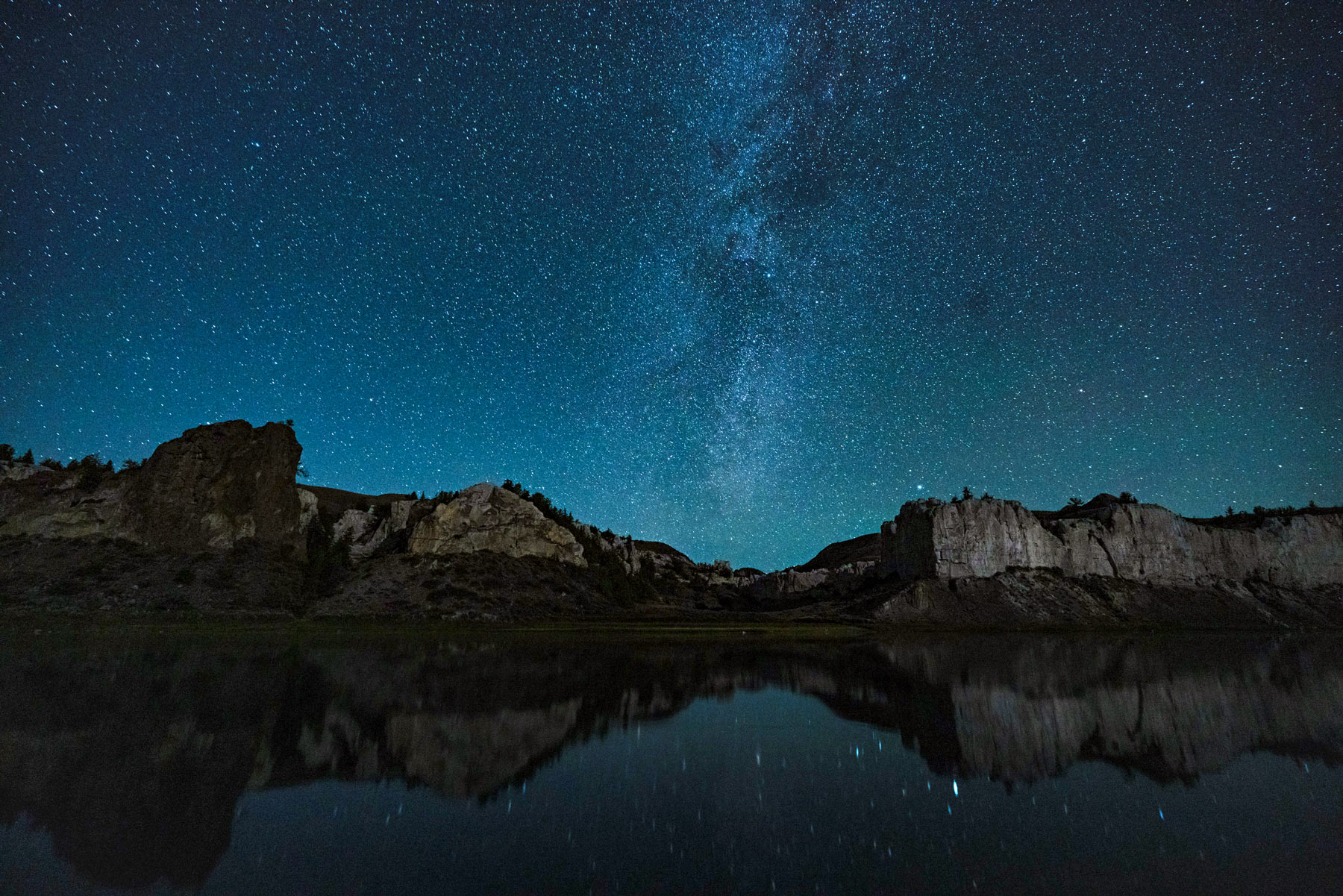
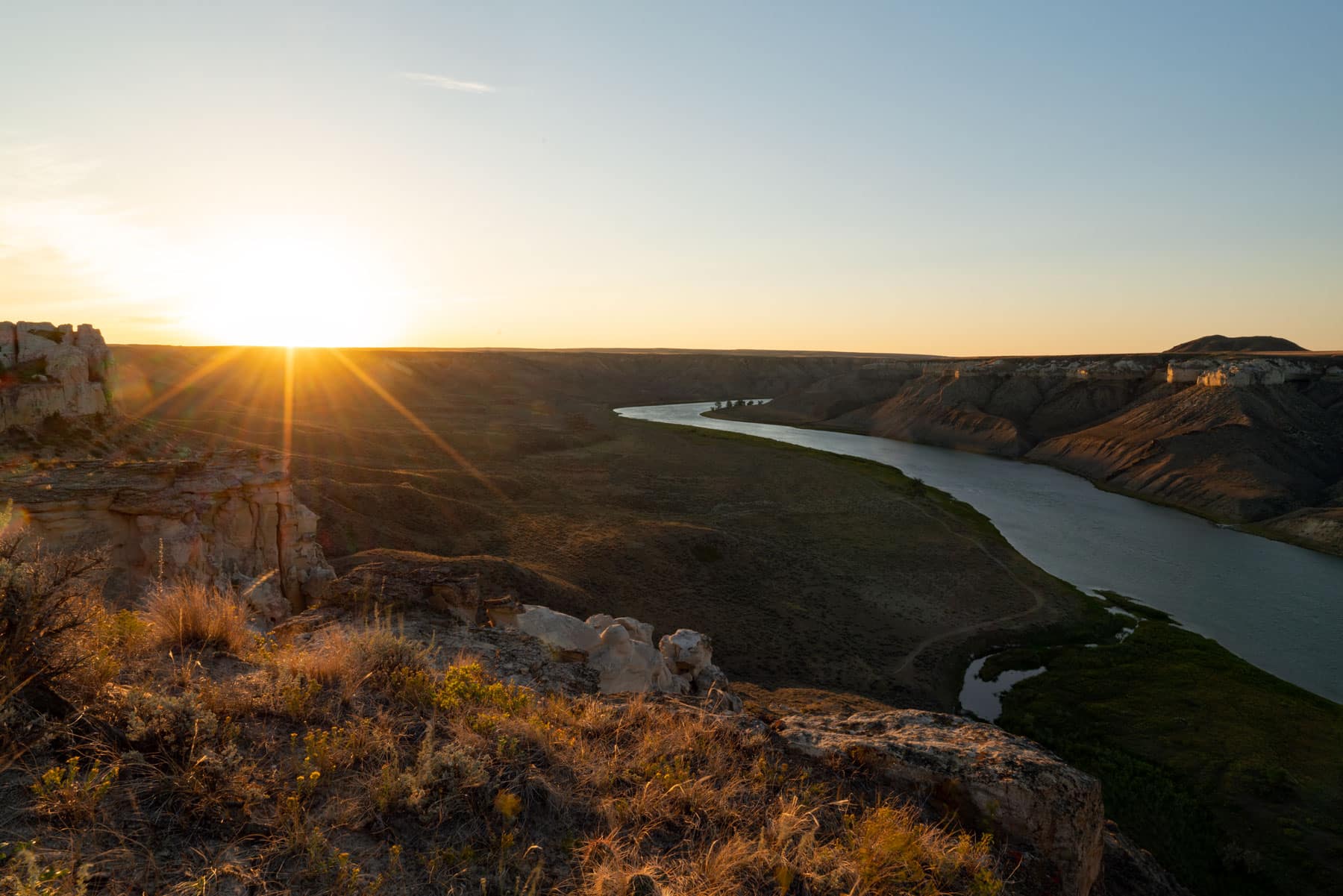
The sunset was beautiful and yielded plenty of great footage, but the sunrise was the real show-stopper. In the morning the tall white cliffs across from the campground take on the brilliant changing hues of the rising sun. This was quite possibly the best scenery on the trip and so soon!
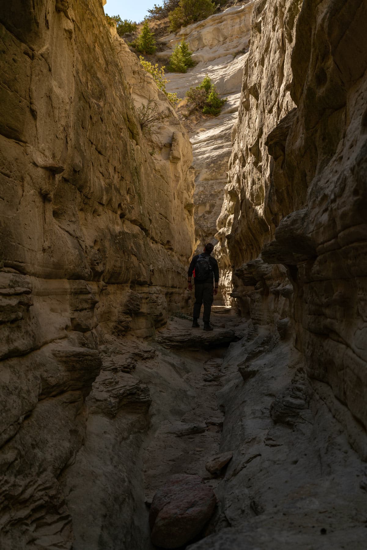
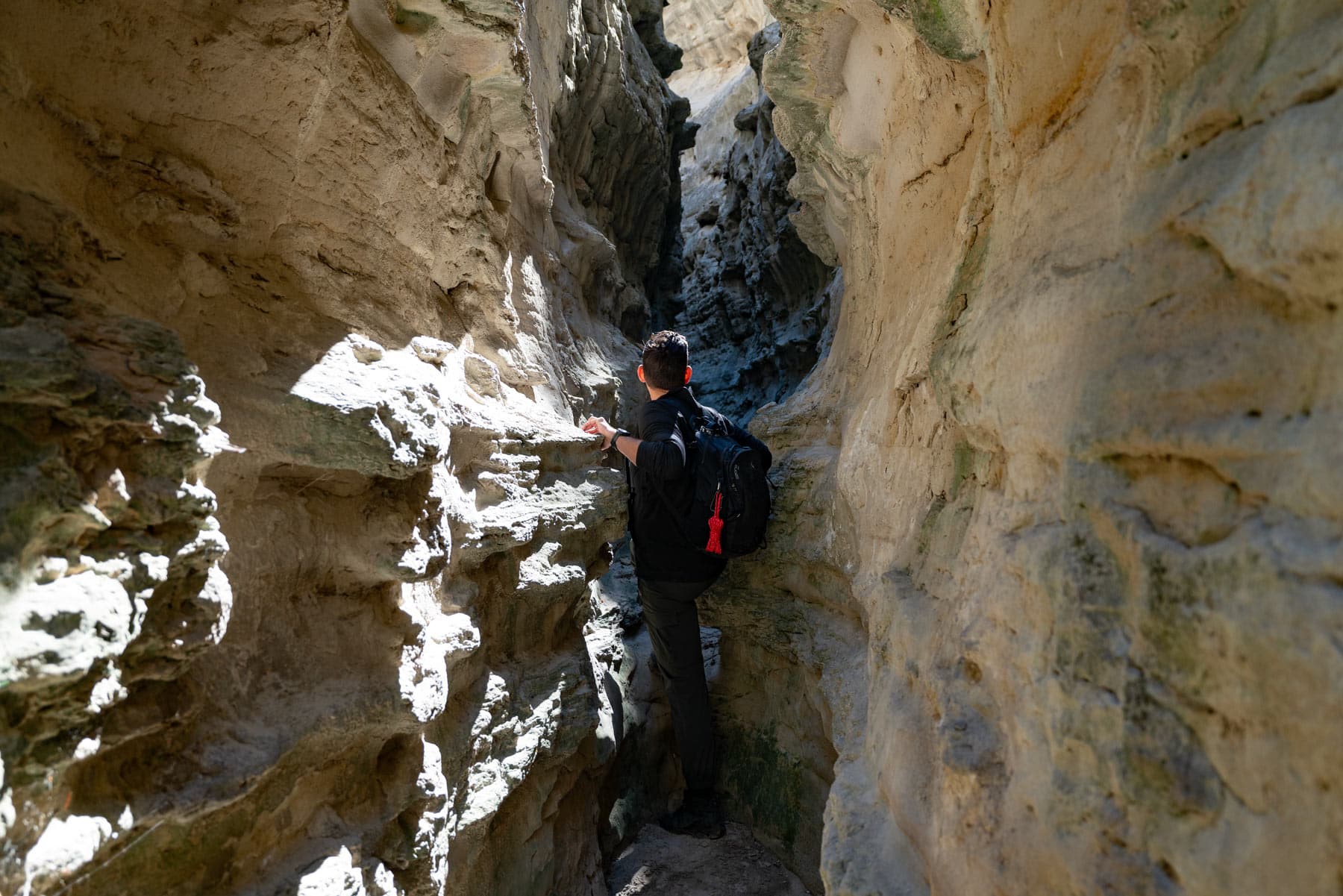
Neat Coulee
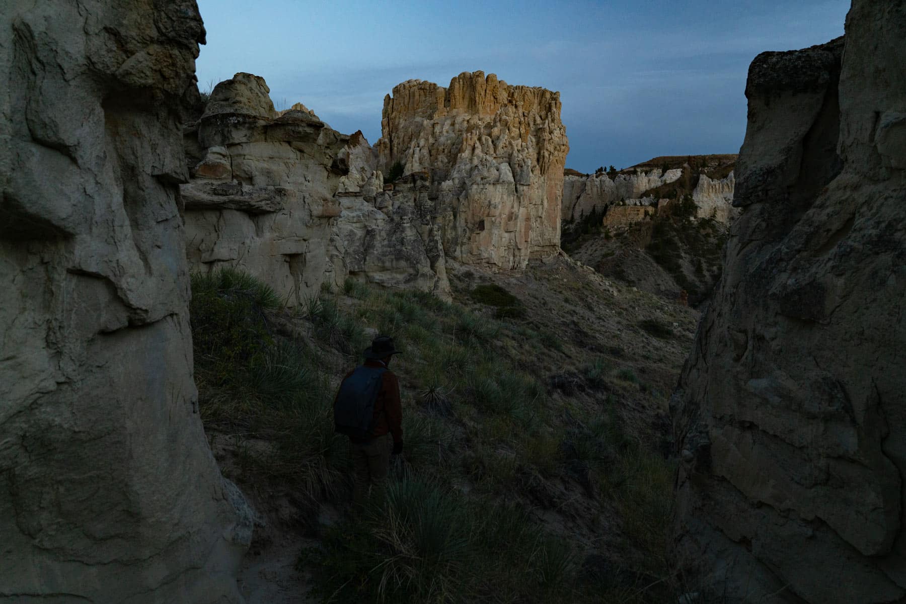
The next day at Eagle Creek we made the hike to Neat Coulee, a slot canyon of some repute. Following a wash we made it into the canyon and immediately felt the coolness of the narrowing sandstone around us. It was a welcome respite from the noon heat.
Further into the canyon the sun’s rays filtered down from the narrowing slits above, casting a beautiful, dappled light onto the canyon walls. What made Neat Coulee truly neat, if you don’t mind the irresistible pun, were the unique knobs dotting the sandstone walls. Seen up close they added a beautiful contrast to the smooth curves and edges of the canyon.
I highly recommend building in the time for this hike as it’s not like anything else you’ll find in the area and offers a nice escape from the mid-day heat.
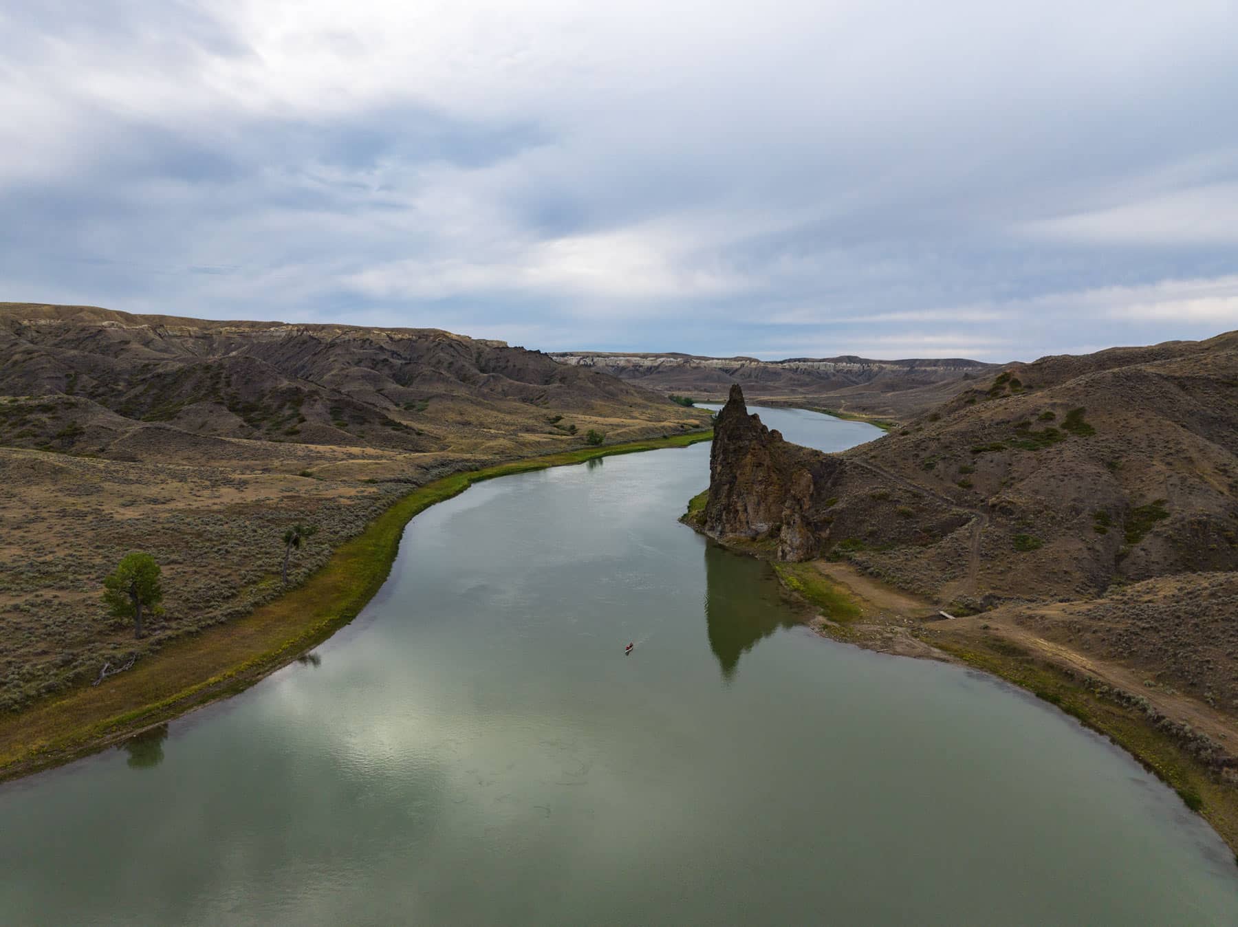
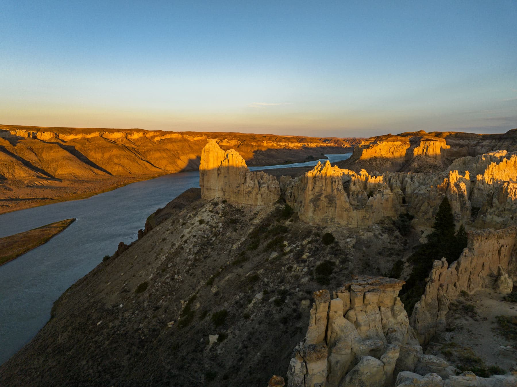
Citadel Rock
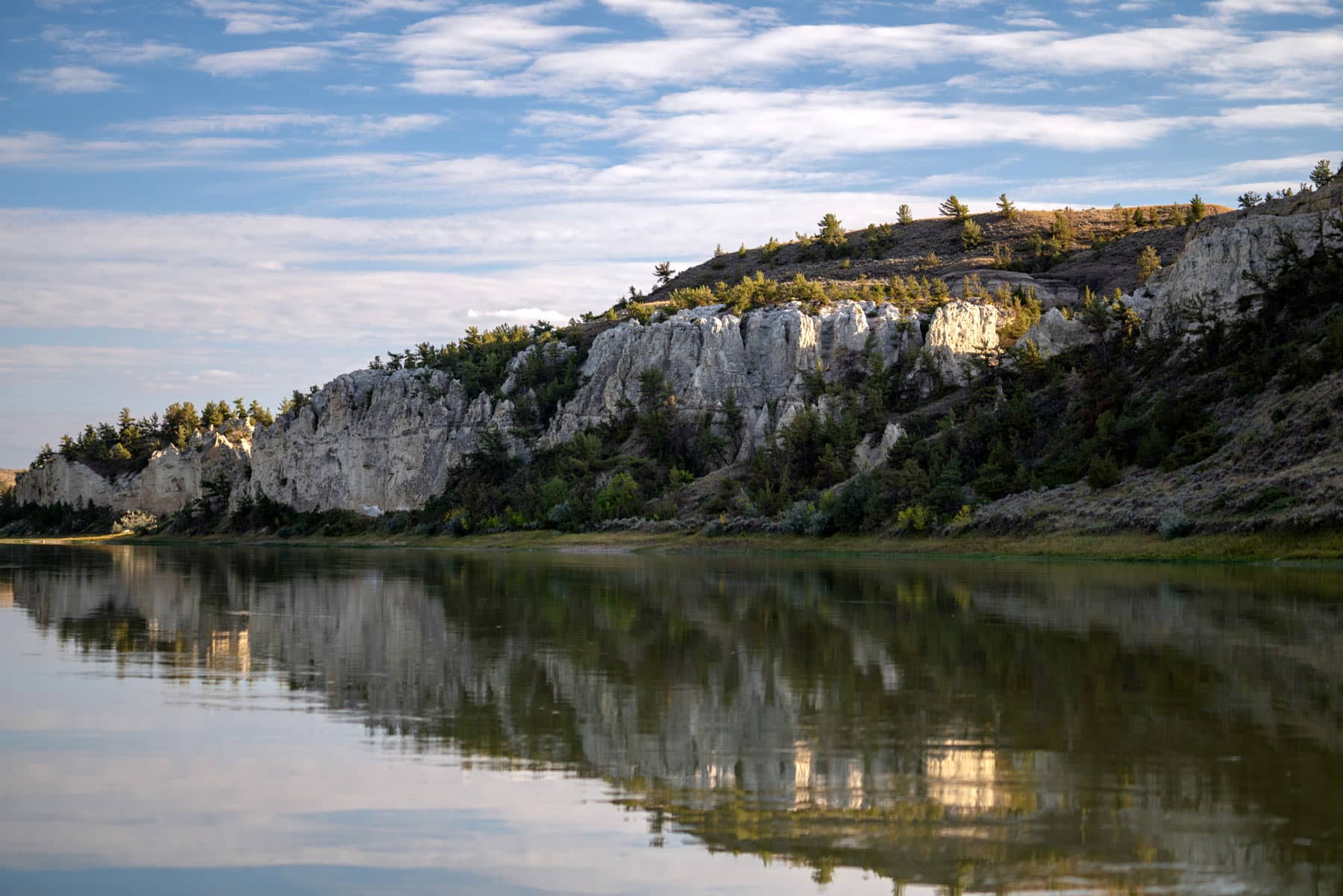
Citadel Rock juts out from the landscape and towers over the river at mile 62. This was a feature we knew we wanted to see and photograph. Passing under the giant citadel you really get a feeling for its massive size as you drift in it’s dark shadow.
It wasn’t easy to get the right angles to photograph the rock as the currents were strong as we passed by. We actually ended up reaching Hole-In-The-Wall Campground a mile ahead and hiking back later to get some shots, but the light had turned on us. Regardless, you won’t miss this iconic feature as you make your way downriver.
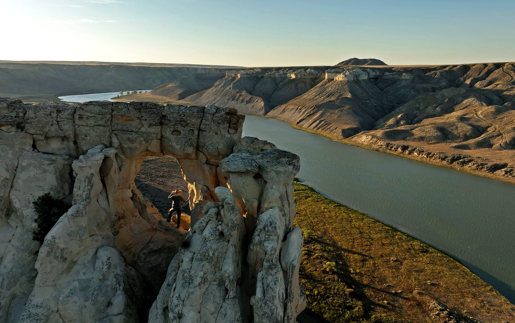
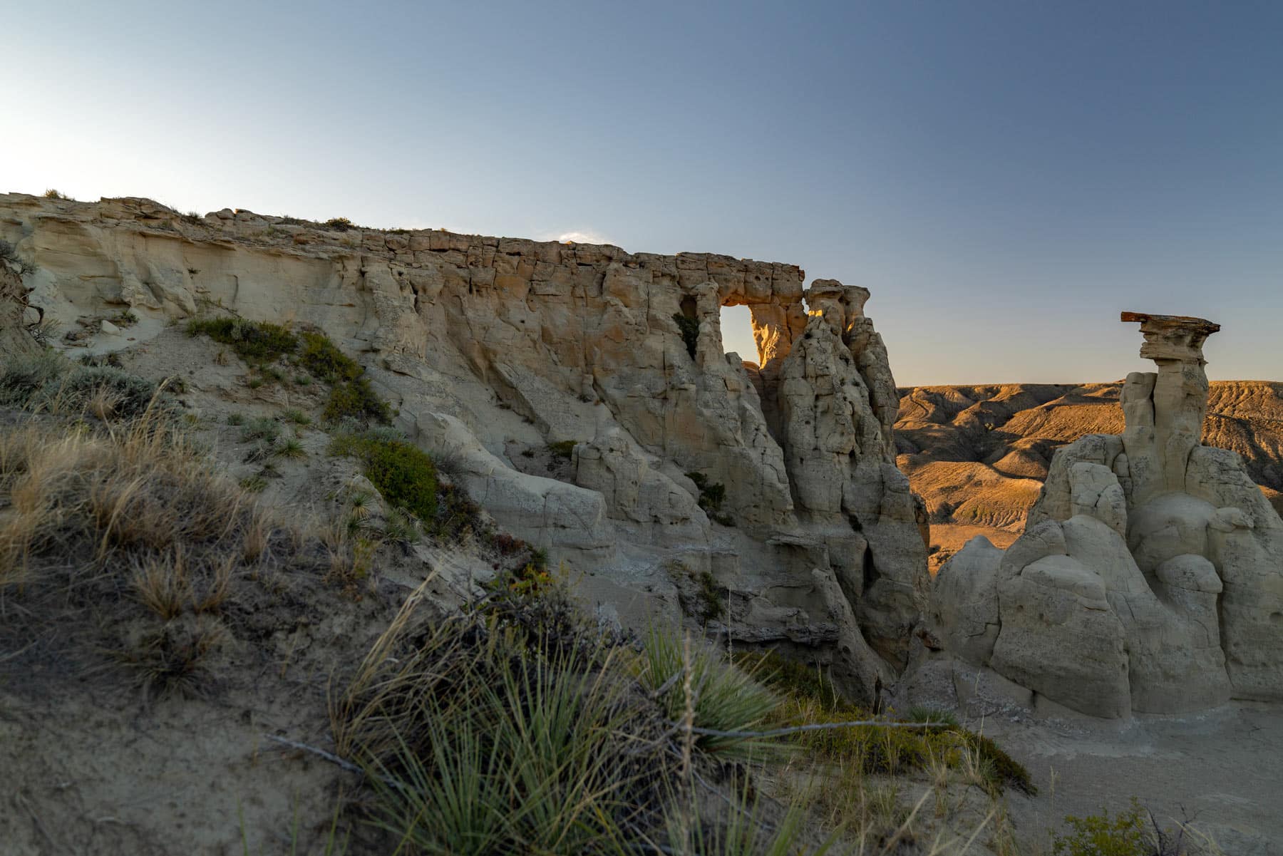
Hole-In-The-Wall
The next day we made it to Hole-In-The-Wall Campground after a few stops along the way. The campground sits a mile from the towering geological feature that gives it its name.
That evening we hiked to the hole in the wall, which was a solid hike, requiring a bit of scrambling. The views from the top were sensational.
Looking out in every direction the views were jaw-dropping as the sun started to dip below the horizon. Red and orange lit up the pinnacles and spires that dotted the landscape like giant trees. Looking downriver from this vantage you really get an appreciation for the vastness of it all.
We hiked back in the dark and definitely lost the trail which I think doubled our time reaching the campsite as we tried to find our way around the ridge in the dark.
The only other campers at the site, who we had befriended the night before, laughed the next morning with us as they recalled the guesses they had made about what sort of fate might have befallen us.
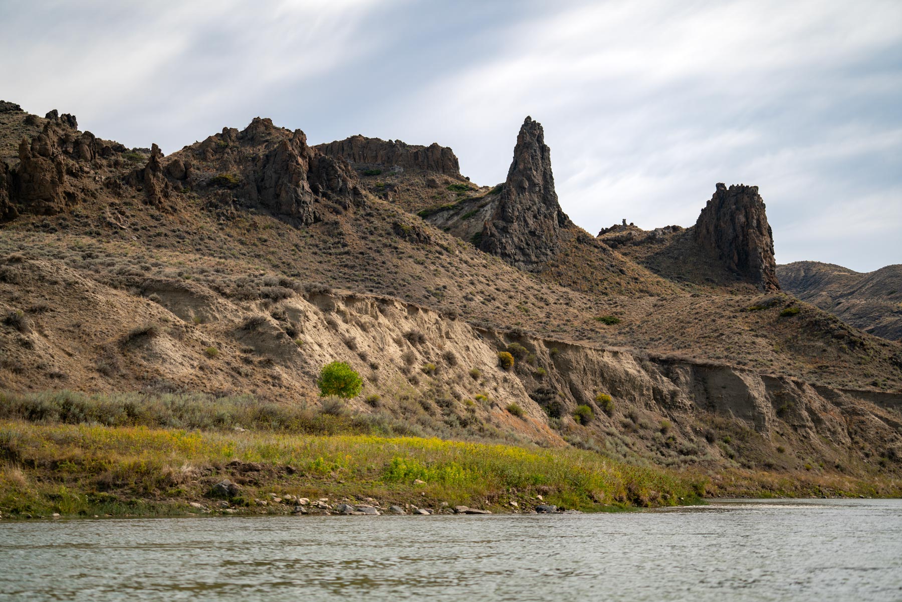
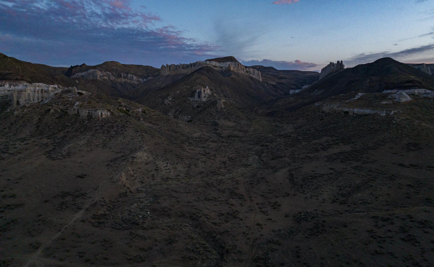
Valley of the Walls
Between Hole-In-The-Wall and Dark Butte you’re swept into a world of sky-high pinnacles, intricate ridge lines, and remarkable geological formations. We stopped off at several points here, but mostly just enjoyed floating along and gazing at the incredible scenery.
Drifting through this section was one of the highlights of the trip. An awe-instilling quietude permeated the landscape, broken only occasionally by the rustling wind, the lapping of the water, and the far-off cries of birds.
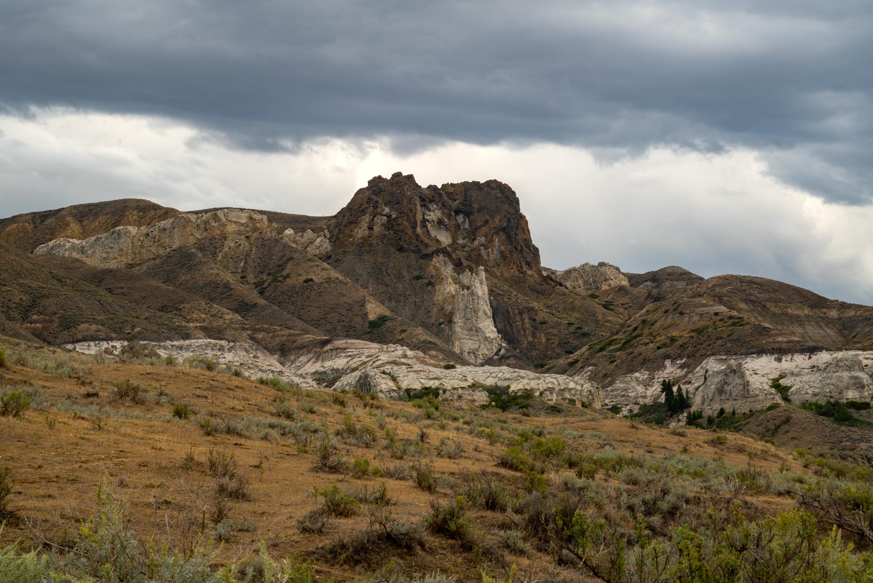
Dark Butte
We reached Dark Butte in the late afternoon and were immediately enamored with the scenery surrounding us at the primitive campsite. After exploring around and taking pictures we decided rather than continuing to Slaughter River, we were going to make camp here and have a longer paddle the next day.
The mixture of clouds, sun, and the spectacular setting of the small campground was ripe with photographic opportunities. Of course, it’s Montana though, and in a little more than an hour later a storm blew in that didn’t relent until long after dark.
The winds were howling in our forsaken corner of the river and all we could do was hole up in the tent and try to keep it from blowing away.
Judith Landing
The next day we set off on a 20 mile paddle to Judith Landing. There are two Lewis & Clark Corps of Discovery sites to visit and ample white cliffs scenery before you reach the Slaughter River Boat Camp.
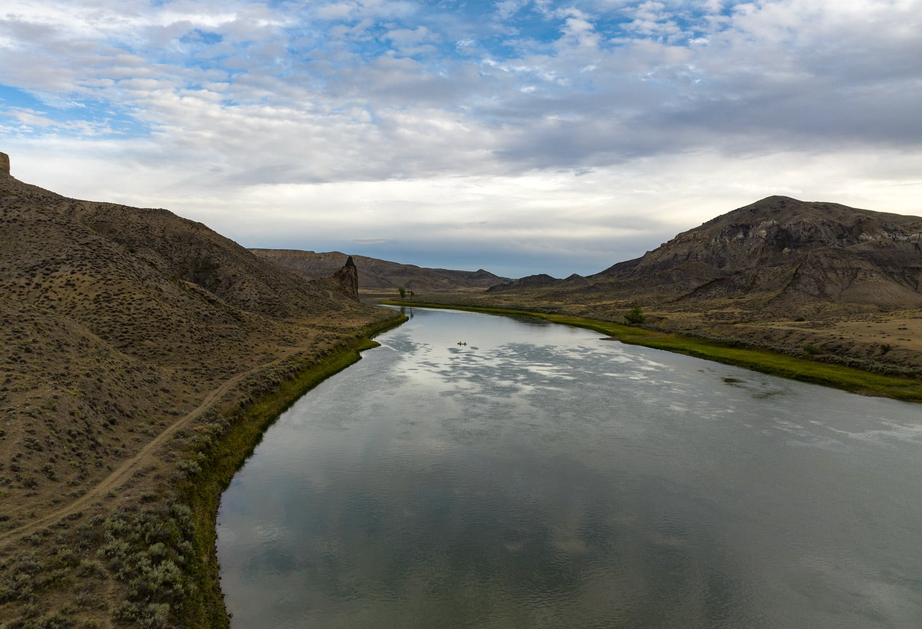
After Slaughter River the landscape widens and the cliffs fade away into the distance. The river flattens out and farmland becomes a more common sight as you make your way to Judith Landing.
At the take out, which wasn’t easy to navigate into due to the high winds, we ran into a party of Lewis & Clark re-enactors which was quite a sight! They wore period clothing and used canoes and equipment that looked like the genuine article.
They even kept their whiskey in a barrel if you can believe it! We enjoyed chatting with them about their travels as we unloaded our boats and our journey concluded.
Other Upper Missouri River Float Options
As I mentioned earlier, the above trip is one of many that can be done in the monument. Some people like to do the whole thing from Coal Banks to James Kipp Recreation Area. However most boaters choose between Coal Banks to Judith Landing or Judith Landing to James Kipp Recreation Area.
While the Coal Banks to Judith Landing stretch has awe-inspiring geologic formations, steep sandstone cliffs, and significant historic sites to go along with Neat Coulee and Hole-in-the-Wall, Judith Landing to James Kipp transitions from dramatic cliffs to the sprawling badlands of Montana, offering abundant wildlife viewing, historic landmarks like Cow Island, and a widening, more tranquil river.
Upper Missouri River Breaks FAQ
No permits are required for groups of less than 30, however fees are required for all river trips. You can find more information on fees here.
Unfortunately due to hazardous agricultural runoff from lands adjacent to the monument, none of the the river water is safe to drink, even after being filtered. Be sure to bring enough water for your entire trip.
The “breaks” refers to the landscape breaking away around the river. Once there you’ll better understand the term.
You can camp at any of the developed campgrounds in the monument as well as any undeveloped dispersed campsite within the river corridor. Be aware that there is a patchwork of private lands that abut the river and landowner permission is always required to camp on private land.
There actually aren’t any official trails in the monument, however there are a number user hiking trails throughout the area and visitors are welcome to hike anywhere on public lands within the monument.
All camping in Upper Missouri River Breaks is done on a first-come, first-served basis.
Technically yes, but they’re class 1 rapids, which are considered very easy. The river is generally lazy, even novice boaters should find it simple to navigate.
Canoes and kayaks are the preferred method of travel along the Upper Missouri River.
There is virtually no cell service within the monument, though signal can sometimes be attained atop the bluffs overlooking the river.
Generally yes, the BLM strongly encourages visitors to use existing fire rings. Be sure to check with the Fort Benton River Management Station prior to your trip to ensure there aren’t any fire restrictions in place.
Fishing is allowed, however a Montana resident or non-resident fishing license is required to fish.
Upper Missouri River Breaks Summary
I hope this guide helps you plan your own adventure and gives you a deeper understanding of the unique experience that can be had here.
The magic of this place lies in its ability to transport us back to a time when nature was vast and untamed, and man was just a small piece of a grand puzzle.
Remember, this remote monument is more than just a location, it’s an experience. So get out there, explore, and make some memories!I hope you’ll let us know about your journey. Safe travels and happy exploring!
Pin Upper Missouri River Breaks Guide
Related Articles
10 Epic National Park Sites in Montana
The Best Hikes in Glacier National Park
15 Amazing Historic Sites in Montana
The Best Things To Do in Glacier National Park
The 15 Best Trips of a Lifetime
The 32 Best Gifts for Hikers (2023 Guide)
The Best Camping Equipment You Didn’t Know You Needed
Upper Missouri River Breaks National Monument, Upper Missouri River Breaks National, Upper Missouri River Breaks National Monument, Upper Missouri River Breaks National, Upper Missouri River Breaks National Monument, Upper Missouri River Breaks National, Upper Missouri River Breaks National Monument, Upper Missouri River Breaks National , Upper Missouri River Breaks National Monument, Upper Missouri River Breaks, Upper Missouri River Breaks National Monument, Upper Missouri River Breaks National, Upper Missouri River Breaks National Monument, Upper Missouri River Breaks National Monument, Upper Missouri River Breaks National Monument, Upper Missouri River Breaks National Monument, Upper Missouri River Breaks National Monument, Upper Missouri River Breaks National, Upper Missouri River Breaks National Monument
Leave a Reply