ARTICLE OVERVIEW: Mount Fremont Lookout Trail
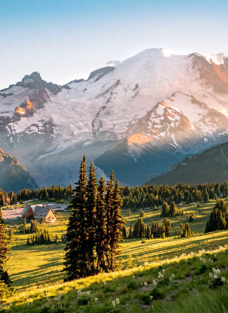
Mount Fremont Lookout Trail in Mount Rainier National Park offers one of the best vantage points in any section of the park, with 360-degree sweeping and humbling views that are quite addictive. That’s pretty much par for the course Mount Rainier brings so many amazing views, so what makes Mount Fremont Lookout Trail so special?
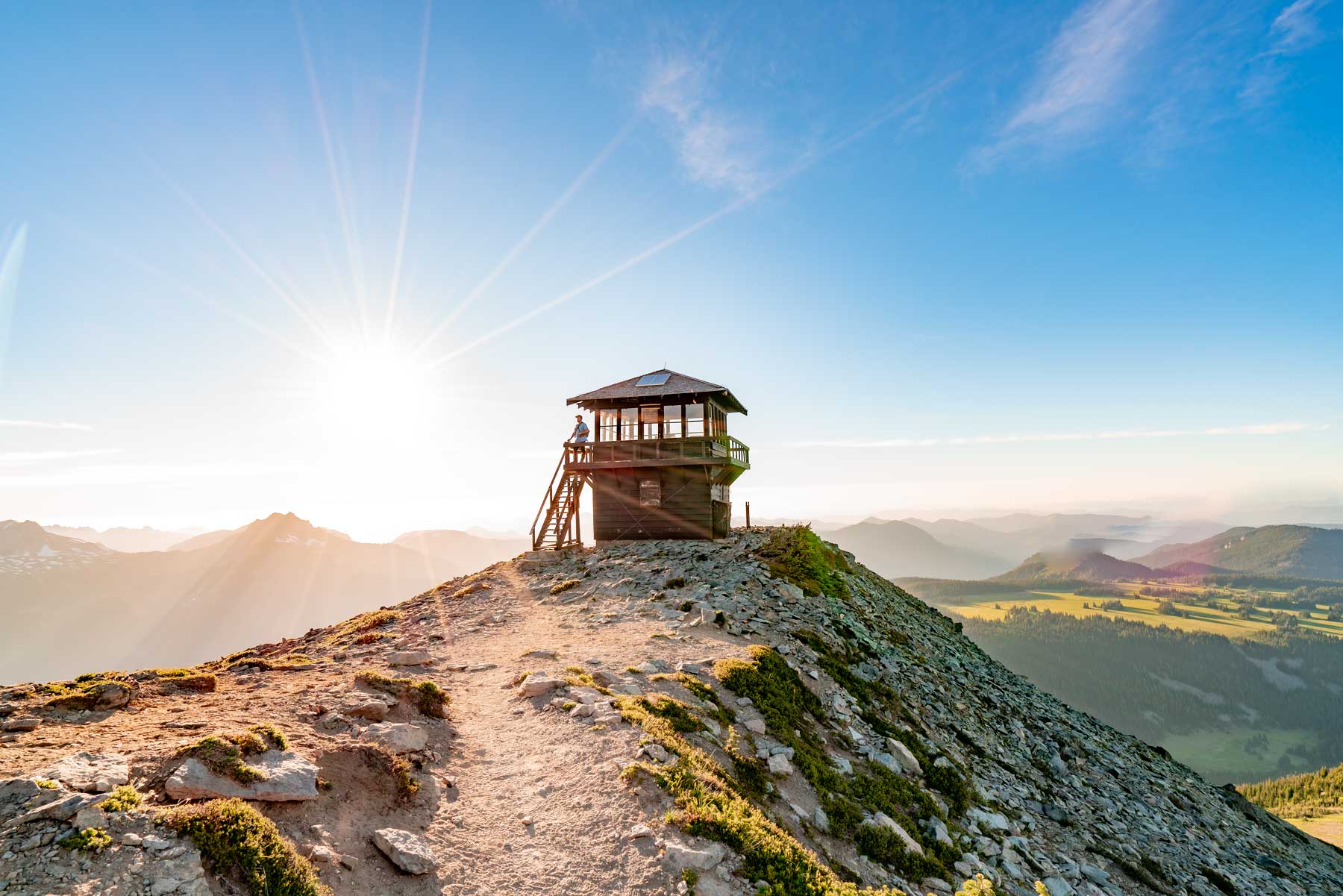
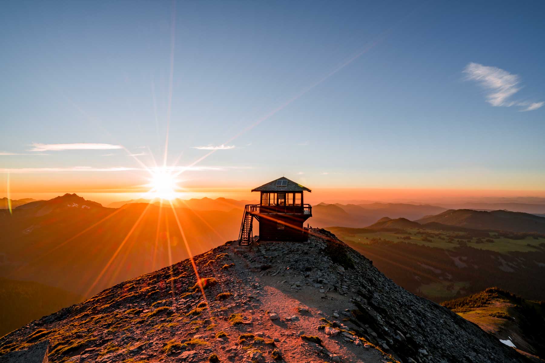
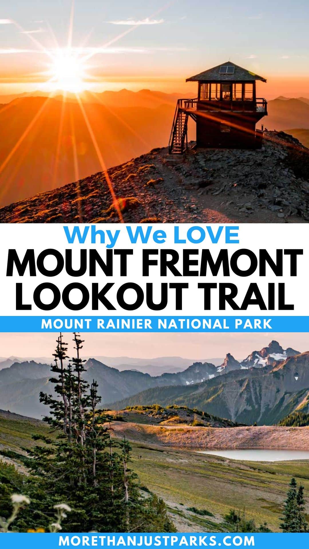
The most compelling reason to trek three miles uphill comes with the tallest fire tower in the park and the omnipresence of Mount Rainier just across the valley. It also brings the additional challenge of crowds, especially for those who think the early bird gets the trail to themselves.
In this comprehensive guide, we’ll delve into every aspect of the Mount Fremont Lookout Trail, from its trail map and parking logistics to its difficulty level and safety considerations.
I embarked on this enchanting trail, dreading the crowds but finding a brilliant comraderie among those soaking in the sunrise at one of the most epic spots in America.
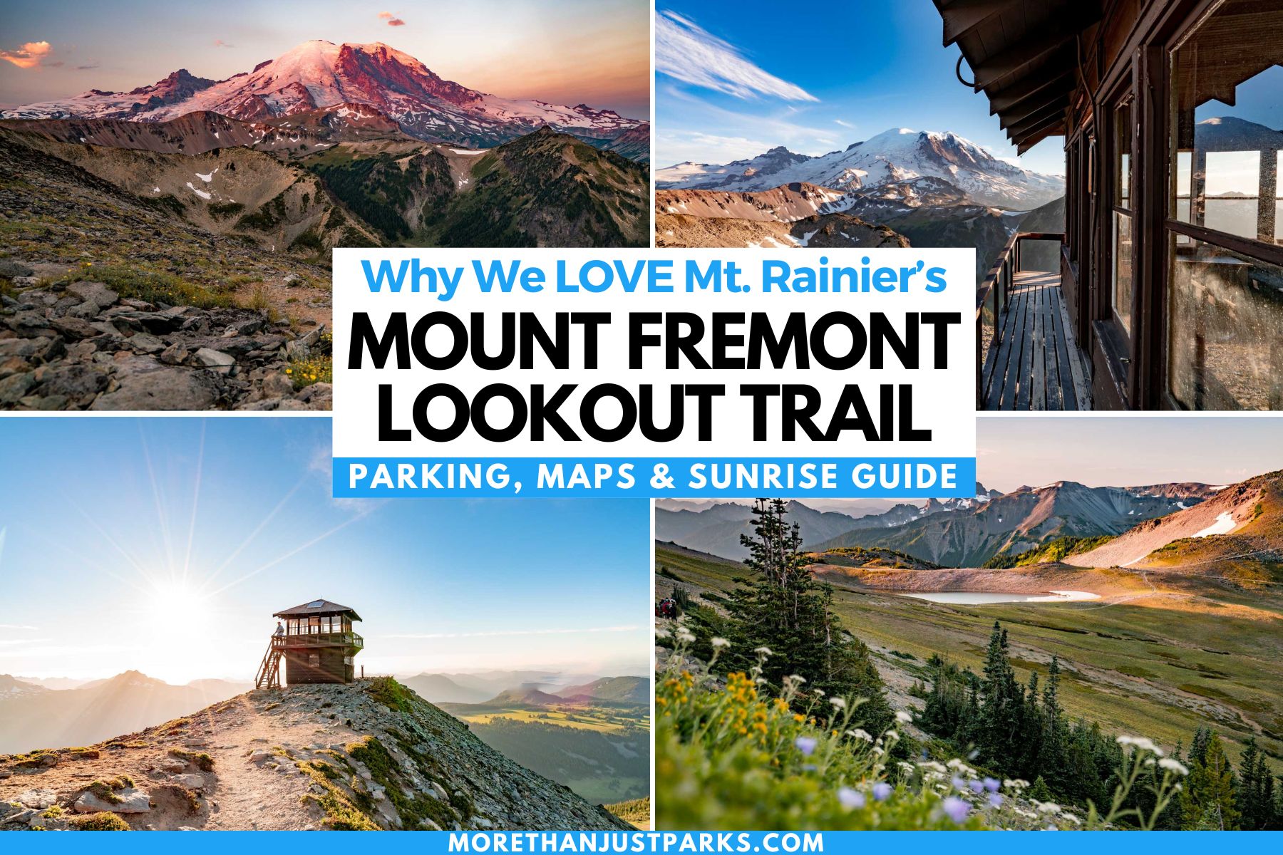
TABLE OF CONTENTS: Mount Fremont Lookout Trail
Table of contents: Mount Fremont Lookout Trail
- 5 Quick Things to Know About Mount Rainier National Park
- Mount Fremont Lookout Trail Stats
- Mount Fremont Lookout Trail Map
- Parking at Sunrise Corridor at Mount Rainier Park
- Quick Summary of the Mount Fremont Lookout Trail
- Mt Fremont Lookout Things to Do and See
- Seeing the Sunrise at Mount Fremont Lookout
- Mount Fremont Lookout Weather
- More Mount Rainier National Park Resources
- Helpful Related Links
5 Quick Things to Know About Mount Rainier National Park
- Mount Rainier’s entrance fee is $30 per vehicle, valid for seven days in a row. If you have an America the Beautiful interagency pass, you can get in for free, along with your carload of people.
- This trail is in the Sunrise Corridor and is now subject to timed-entry reservations from July 3 through September 2. Those hiking the Mount Fremont Lookout Trail for (the actual) sunrise will not need reservations since it’s before 7:00am.
- Sunrise corridor roads close for winter, which means mid-September through early July in this part of the mountains. At nearly 6,500 feet, it’s the highest driveable part of the entire park, and the less-than-three-month window of access makes it even more in demand.
- You cannot trust your GPS in this park. Bring a map and/or a guidebook and use that from the moment you enter the park. To be close to the park entrance, we recommend staying at the LOGE Alta Crystal Resort.
- Those planning to see the sunrise or sunset need to have good light equipment, like a headlamp and a red-tinted flashlight, to navigate the trail in the dark. The red light helps limit light pollution in the night skies. This trail is far too rocky and slopes to attempt without a headlamp. To that end, bring trekking poles to save your thigh/calf muscles and protect your knees on the descent.
Mount Fremont Lookout Trail Stats
A spiderweb of trails weaves around this part of the Sunrise corridor at Mount Rainier National Park. We took the Mount Fremont Lookout Trail via Sourdough Ridge Trail.
- Length: 5.7 Miles Out and Back
- Time: 2-4 Hours, depending on effort and experience
- Difficulty: Moderate
- Starting Elevation: 6,400 feet
- Elevation at Lookout: 7,181 feet
- Total Elevation Change: 781 feet
The park is open 24/7, and many people will be hiking in the dark pre-sunrise or post-sunset. Add an extra hour to be safe. I didn’t gain any time on the descent due to my runner’s knee and witnessed several slips and subsequent trail rash. My time for just hiking was 3 hours and 15 minutes.
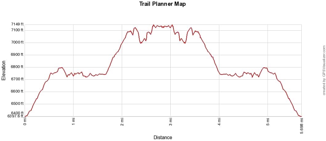
Mount Fremont Lookout Trail Elevation Profile
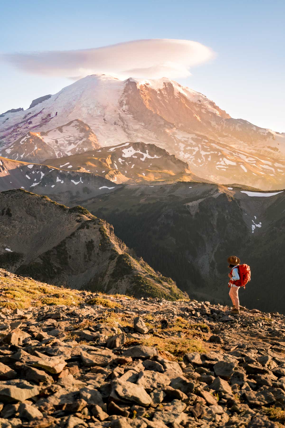
You’ll see from the elevation profile of Mount Fremont Lookout Trail that the two big elevation pushes await early and as you get toward the top. The drop-off to the valley below gets more intense with each step. A fall here would mean more of a dramatic tumble than a sheer drop.
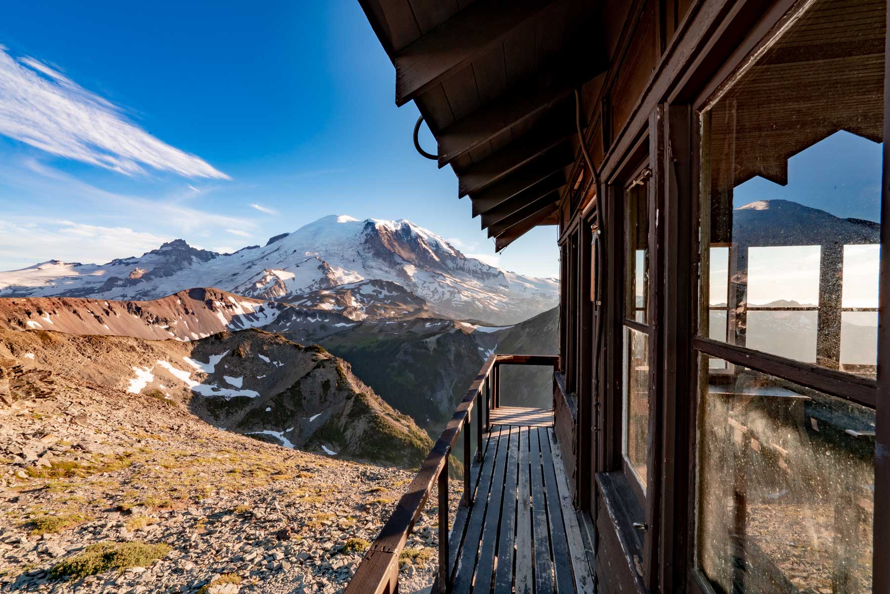
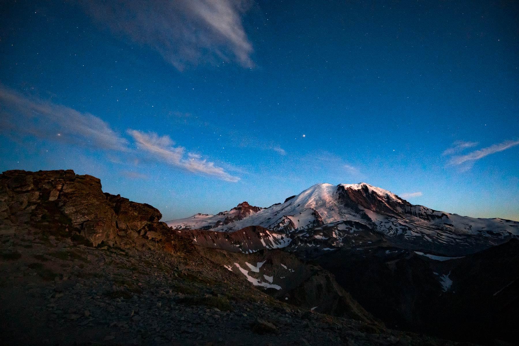
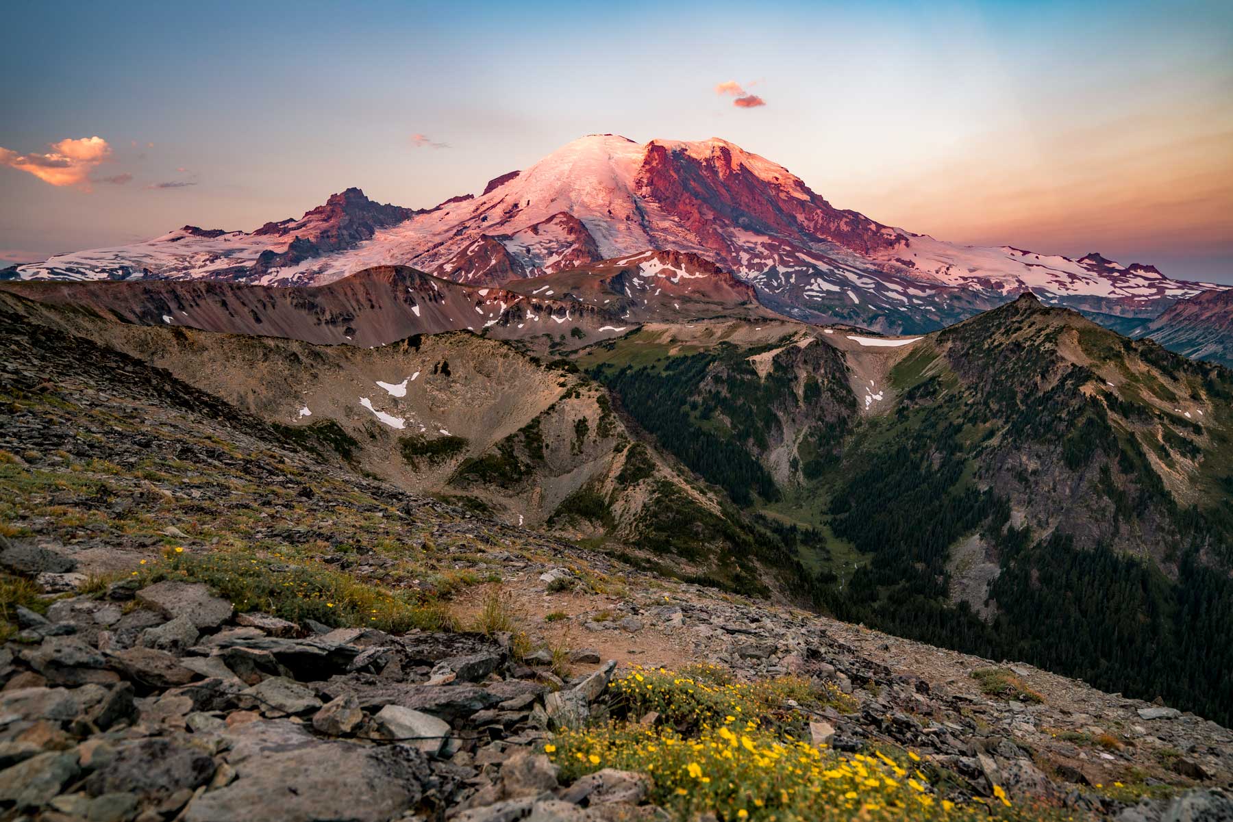
During the entire hike, Mount Rainier sits seven miles away and in full view.
The moderate rating for Mount Fremont Lookout Trail is due to the following reasons:
- Altitude: The trail starts at a high elevation of 6,400 feet, which can be challenging for some people, especially those who are not used to being at high altitudes.
- Exposure: This trail is exposed the entire length, meaning there are no shade or trees to protect you from the sun, wind, rain, or storms. This can be especially challenging on hot days.
- Surface: The trail can be rocky and uneven in some places, which requires good balance and sturdy footwear. Toward the top, you’re walking on a sea of rocks that resembles a quarry instead of a trail. That was my least favorite part.
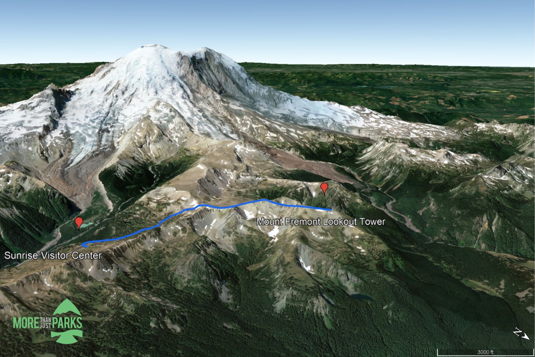
Mount Fremont Lookout Trail Map
Parking at Sunrise Corridor at Mount Rainier Park
You’ll see on that map I added the road to get to the parking area for the Mount Fremont Lookout Trail, which is a winding tale of ecology. Parking is available at the trailhead.
Throughout the twists and turns on Sunrise Road, pull-outs allow you to soak in the views while reviewing educational kiosks along the way. That includes ancient mudflows and lava formations. Only passenger vehicles and trailers less than 25 feet long should attempt this 15-mile drive. Sunrise Park Road ends at the parking lot for the Sunrise Visitor’s Center. I counted about 300 spots available here.
A backup parking area is available about 2/7 miles at Sunrise Point, where 50 or so spots turn over faster for those who just want to take in the view and leave. If you park at Sunrise Point, the walk to Mount Fremont Lookout Trail will be 5.8 miles each way.
WARNING: Do not try to camp at Sunrise’s parking area. You will get ticketed.
Quick Summary of the Mount Fremont Lookout Trail
As noted above, we’re taking the Mount Fremont Lookout Trail via Sourdough Ridge Trail starting from the parking lot at the Sunrise Visitor Center.
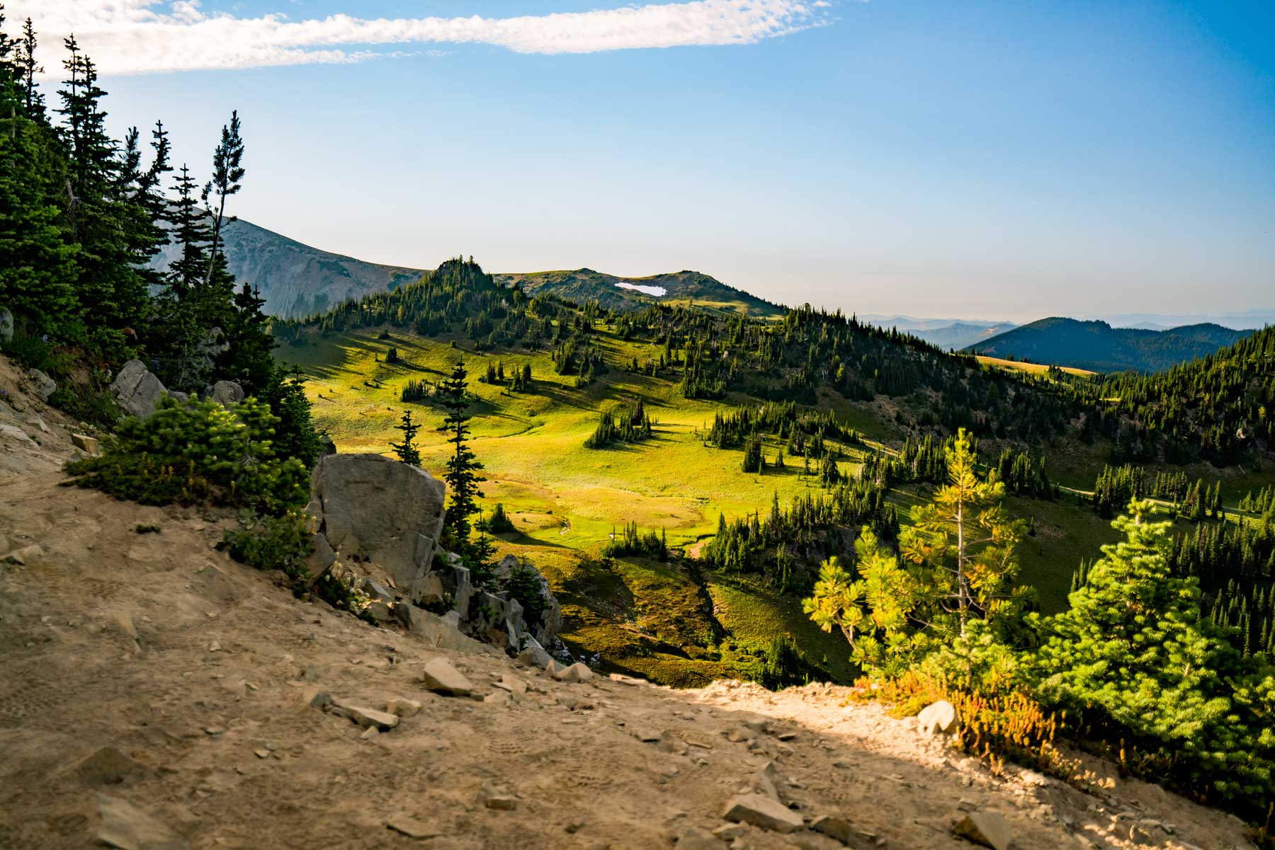
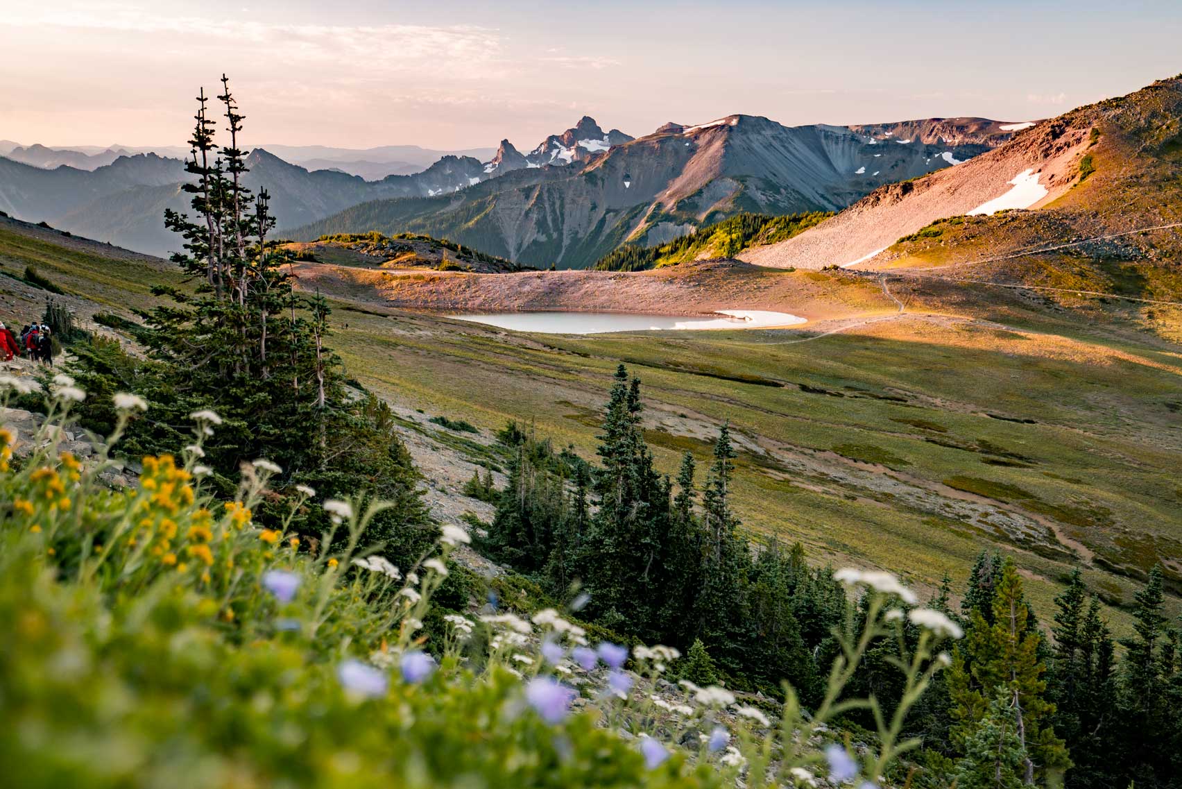
The trail starts easy enough with a wide path and some haphazardly placed giant rocks. The trail scoops around Frozen Lake and drops down into a valley for a short time. You’ll see wildflowers during peak season, which is early August. Check the Currently Blooming updates from the park before your summit visit to Sunrise Corridor at Mount Rainier.
At several intersections, you’ll be at a crossroads of trails. I mistakenly went a mile the wrong way but easily backtracked. Follow signs for Sourdough Ridge Trail until the signs begin to point to Mount Fremont. After 1.6 miles, you’re on the only trail to the lookout.
MT. FREMONT SUMMIT: You’ll notice the peak of Mount Fremont along this path, but as part of the 7 Principles of Leave No Trace, don’t go off the trail to attempt to summit the peak or sub-peaks.
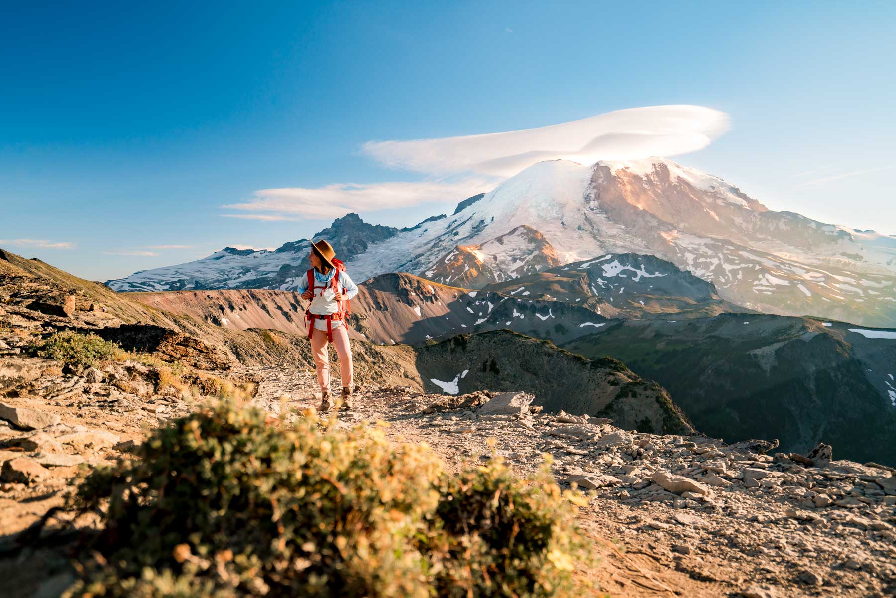
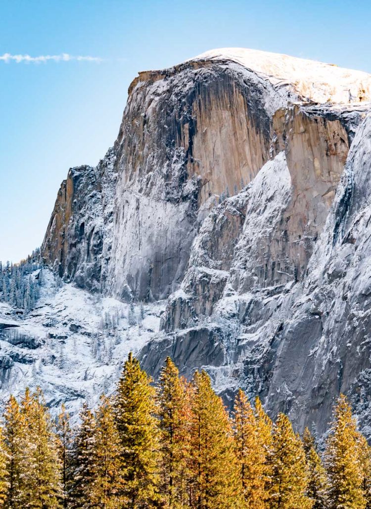
The hike takes you out of the meadows and up the ridgeline. It’s a rigorous ascent but nothing too challenging and without the dreaded switchbacks. You’ll see the trail laid out in front of you. The final few steps up the spine reminded me of Clouds Rest Trail in Yosemite without the narrow path.
The two-story fire tower awaits in front of you, which is usually open for you to explore.
Mt Fremont Lookout Things to Do and See
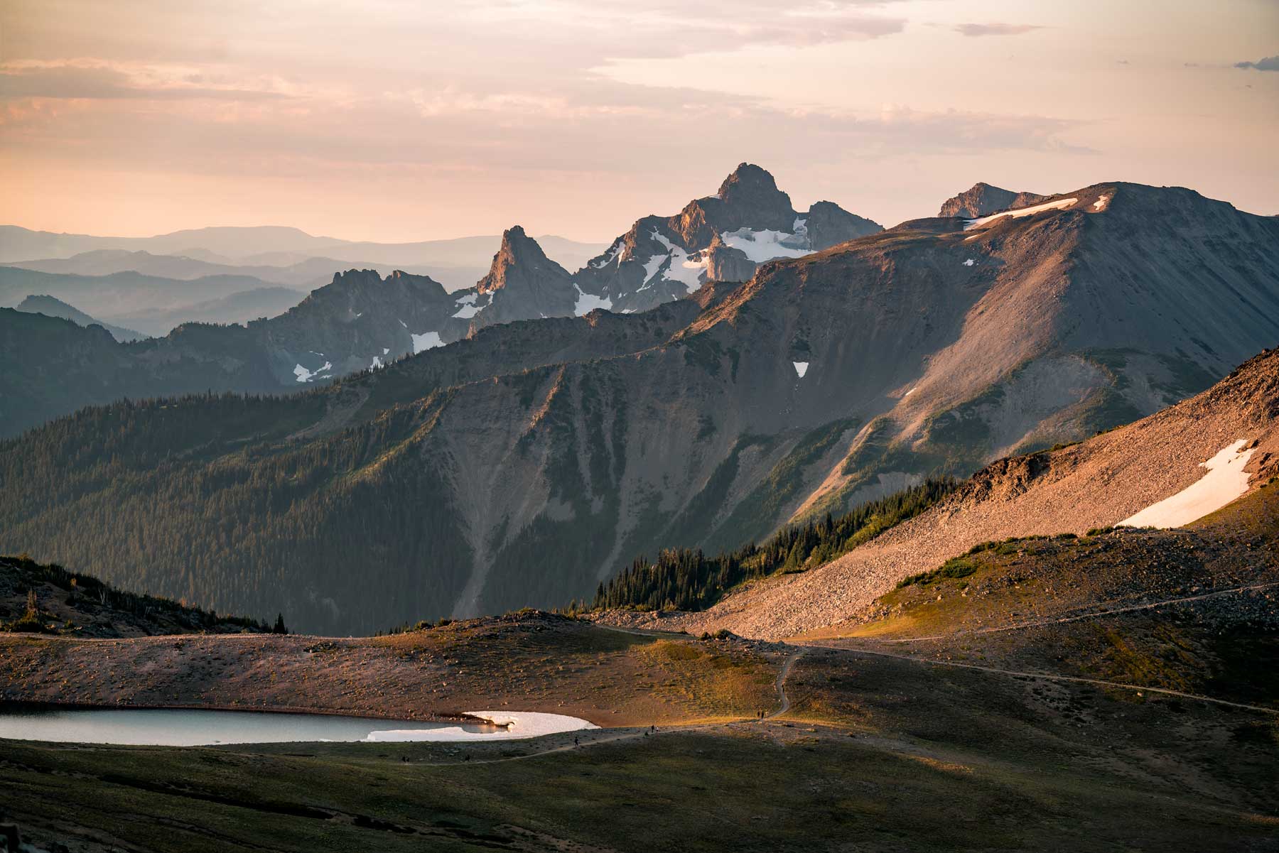
With 360° views, you’ll be able to see for miles in all directions if the weather doesn’t get in the way. Ideally, you get a clear weather day so you can see some of the following places:
- Mount Rainier: Being the tallest peak in the Cascade Range, Mount Rainier dominates the skyline and is the centerpiece of the view from Mount Fremont Lookout.
- Skyscraper Peak: Its distinctive rocky features between the lookout and Mt Rainier make it a notable landmark in the area.
- Emmons Glacier: One of the largest glaciers in the contiguous United States, the Emmons Glacier is visible from the lookout. It’s located on the northeastern flank of Mount Rainier.
- Grand Park: This is a vast, open meadow area visible from Mount Fremont Lookout. It lies to the northwest of the lookout and offers stunning views, especially during wildflower season.
- Berkeley Park: Another beautiful meadow area, Berkeley Park, is also visible from the lookout. It’s located to the west of Mount Fremont and offers picturesque landscapes.
One thing you cannot do at Mount Fremont Lookout Tower is camp overnight. Sleeping in your car to catch the sunrise isn’t allowed either.
The closest campground to Mount Fremont Lookout Trail is White River, which is a first-come, first-served permit campsite. Get there before 7:00am and you won’t need a timed-entry permit to access Sunrise. However, your White River Campground permit will not get you into the Paradise area.
Seeing the Sunrise at Mount Fremont Lookout
Between June and September, the sunrise varies from 5:15am to 6:30am. However, it’s important to know the different twilight types to plan your sunrise trip to Mount Fremont Lookout. Do you want to watch the entire process at the top and hike in the dark? Would you prefer twilight as you hike and then the final sunrise view at the top? I would recommend being at the parking lot no later than 4:00am. The earlier you get to the summit, the fewer crowds there will be to pick the perfect spot.
Here are the types of twilight:
- Astronomical Twilight: Happens when the Sun is 12 to 18 degrees below the horizon. It’s the darkest stage of twilight, ideal for observing faint celestial objects before sunrise.
- Nautical Twilight: Occurs when the Sun is 6 to 12 degrees below the horizon. Named for its significance to navigation, this stage allows sailors to use the stars for orientation.
- Civil Twilight: Begins when the Sun is 0 to 6 degrees below the horizon. There is enough light for outdoor activities without artificial lighting.
Use this Date and Time web app to see the twilight, sunrise and sunset times.
Expect at least 30-50 people to share this moment with you, but you still have plenty of room to spread out if you want more solitude.
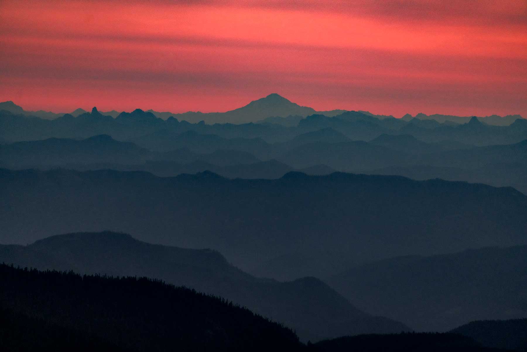
Sunset at Mount Fremont Lookout
One of the benefits of seeing the sunset at Mount Fremont Lookout in Mount Rainier National Park is the night skies afterward. You must get up super early to see the skies for the sunrise, and the sunset is just a practical time for stargazers, too.
While Mount Rainier National Park is not a certified International Dark Sky Park, it still boasts stunning night images. Always try to plan a stargazing trip during the new moon so you’ll see more stars.
You could argue that Mount Fremont Lookout is best for the sunrise and Tolmie Peak Trail is ideal for the sunset, but you’ll need to drive two hours between the two. A bonus for Tolmie Peak is that the entrance is off Mowrich Lake Road, and not part of the timed-entry region.
Mount Fremont Lookout Weather
Don’t let the word “summer” fool you at Mount Rainier National Park, especially as you take the Mount Fremont Lookout Trail above 7,000 feet. Expect snow along the trail and peaks through mid to late July. Temperatures rarely get above 70°, even in the hottest part of summer. Expect lows in the 40s.
Weather can change quickly on this trail, with fog or clouds moving in quickly. Sunsets are known to have inversion layers of clouds. Also, storms could cause damage that leads to trail hazards or closures, even a few days later. Check the Trail Conditions before setting out on the Mount Fremont Lookout Trail.
The weather at Mount Rainier National Park determines the wildflower peak season, but you can track the blooms using the Northwest Wildflowers website. Expect to see some from mid-June through August.
More Mount Rainier National Park Resources
Here at More Than Just Parks, Mount Rainier National Park is one of our favorites. Will has even gone as far as to say that Mount Fremont Lookout Trail is one of his favorites, and he’s tackled it several times. You can read his summary of the best hikes in Mount Rainier National Park after you’ve wrapped up here.
While you’re there, check out the Skyline Trail at Mount Rainier I reviewed, which is another epic adventure, though without the ideal sunrise or sunset views.
You simply can’t beat the Mount Rainier views from the Sunrise side. Prove me wrong in the comments below.
MORE: 10 AMAZING Mount Rainier National Park Facts (Trivia & Quick Facts)
Pin Mount Fremont Lookout Trail
Helpful Related Links
Washington National Parks: Washington’s National Parks Ranked Best in the World
Things to Do North Cascades: 20 Amazing Things to Do at North Cascades National Park
Best Hikes North Cascades: 15 Epic Hikes in North Cascades National Park
Things to Do Crater Lake: 20 Amazing Things to Do at Crater Lake National Park
Things to Do Olympic National Park: 20 Best Things to Do at Olympic National Park
Olympic NP Guide: Comprehensive Guide to Olympic National Park
Best Hikes Olympic NP: 9 Epic Olympic National Park Hikes
National Parks Rankings: ALL 63 US National Parks Ranked By Experts
Most Visited National Parks: Top 10 Most Visited National Parks
National Monuments Ranked: ALL 128 US National Monuments Ranked (Best to Worst)
Leave a Reply