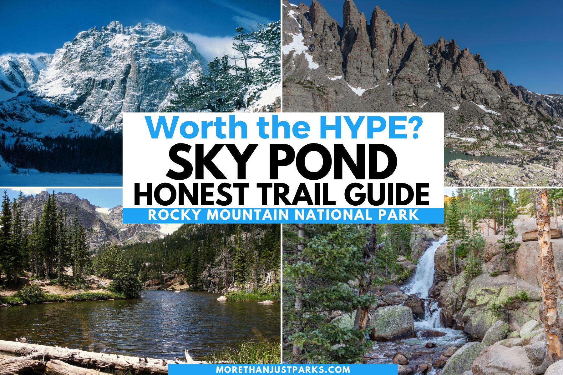
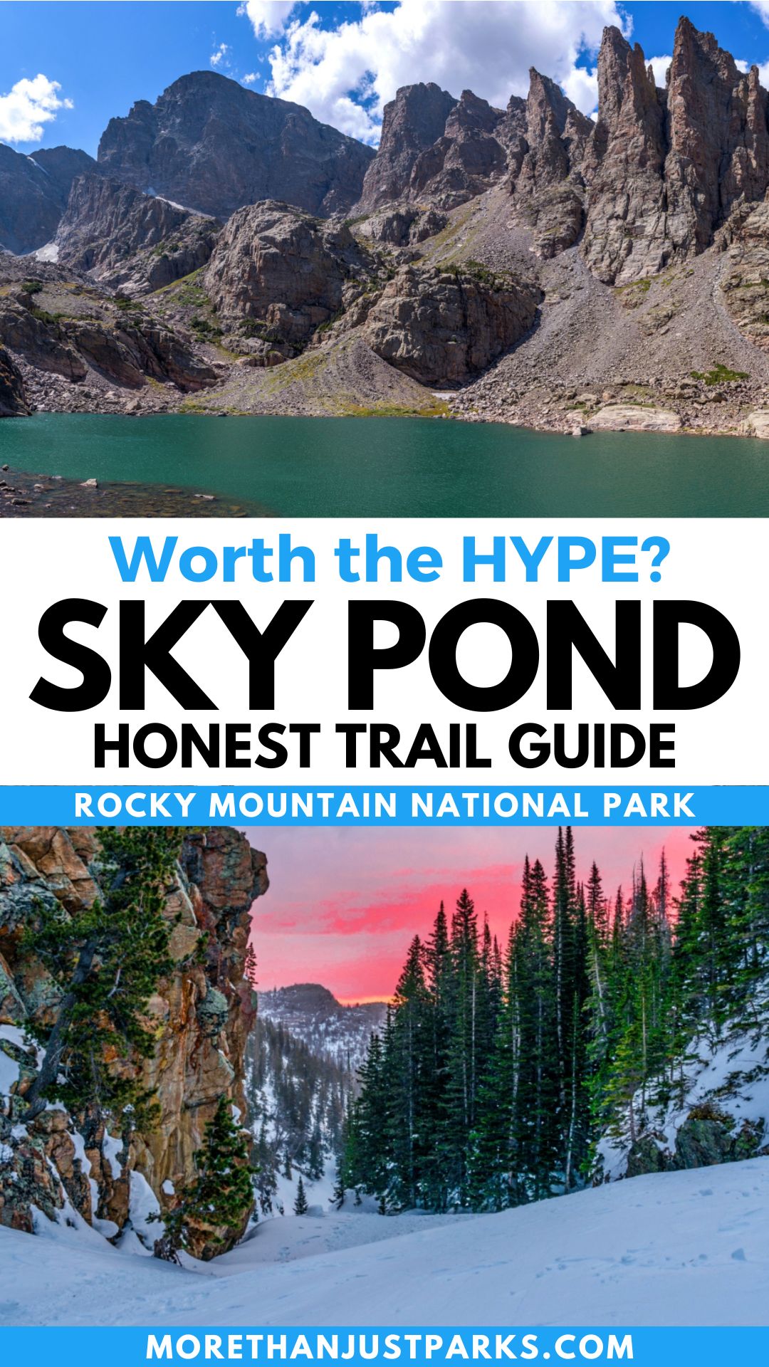
Article Overview: Sky Pond Hike Rocky Mountain National Park
The Sky Pond Rocky Mountain hike waves 10+ miles through the national park with epic features back-to-back along the way. The journey starts at the Glacier Gorge Trailhead and winds through mountainous terrain past waterfalls, Loch Vale, and the Lake of Glass.
Sky Pond is at the very end, and only the most daring and experienced hikers will make it there.
It’s me. Hi. I’m the daring hiker, it’s me. Quite frankly, this trail had me hooked as soon as I heard “climbing a waterfall as part of the trail.”
The trail starts at 9,200 feet or so, which meant I would plan directions to Estes Park while acclimating to the altitude (7,500 feet).
As a Type-A personality, my epic planning skills pay off tenfold as I can help you through the 10-mile Sky Pond hike Rocky Mountain National Park offers. No matter how far you go on this trail, you’re in for a legit hard hike in Rocky Mountain National Park.
Sky Pond Hike Rocky in Mountain National Park
Table of Contents: Sky Pond Hike Rocky Mountain National Park
Table of contents: Sky Pond Hike in Rocky Mountain National Park
- Sky Pond Hike Rocky in Mountain National Park
- Sky Pond Rocky Mountain Section Guide
- Getting to Sky Pond Hike in Rocky Mountain National Park
- Finding and Following Sky Pond Hike Signs
- Map Of Sky Pond Hike in Rocky Mountain National Park
- Winter on the Sky Pond Hike
- Weather Risks on the Sky Pond Hike
- FAQ – Sky Pond Hike in Rocky Mountain National Park
- Helpful Related Links
HAVE YOU HIKED SKY POND OR THE LOCH? We’d love to hear your experience in the comments below.
Quick Things to Know Before You Visit Rocky Mountain National Park
- A park entrance pass costs $30 per vehicle and Rocky Mountain National Park does not accept cash. Please bring a credit/debit card. You can avoid the pass by purchasing an America the Beautiful Pass giving you a year of access to 2,000+ public lands.
- Starting May 24, 2024, timed entry will once again be required at Rocky Mountain National Park. This runs through mid-October, 2024.
- Bring sunscreen and apply as needed, especially if you go into the lakes or waterfalls. I like this one best and it’s eco-friendly! Bug spray comes in very handy, too!
- Don’t rely on mobile service. Bring a guidebook and a map with you.
- This is my preferred hotel as it is so close to the park entrance and has great amenities.
Sky Pond Rocky Mountain Section Guide
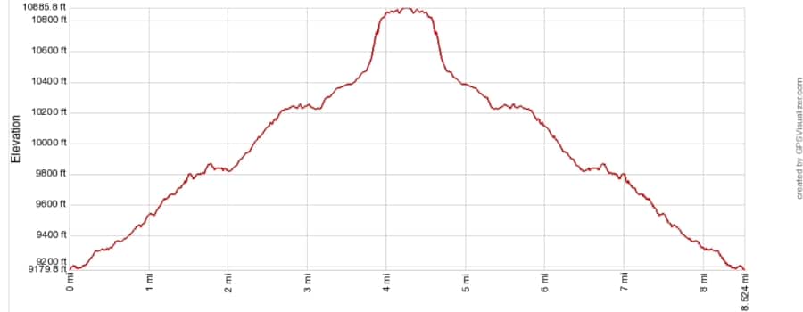
Elevation: 9,240 with 1,660 foot gain by the end of the trail.
By 6:30 am, the parking lot at Glacier Gorge trailhead was almost full. Read the trail bulletin board for any safety warnings on the trail. During the busiest time of year, a park ranger will be here answering questions. Ask all the questions.
The sign will point you to Loch Vale, Alberta Falls, and Mills Lake. When in doubt, follow the Loch Vale signs.
First, A few highlights on this first half mile or so:
- You’ll have three water crossings, two bridges, and one plank walk across a stream.
- Once get to the section where the trail parallels Glacier Creek, the gorge walls will rise.
- Access to the water is possible, but it will take some careful scrambling.
FIRE TRAIL: If you are taking the fire trail to bypass Alberta Falls, the well-hidden entrance is .4 miles into this trail section.
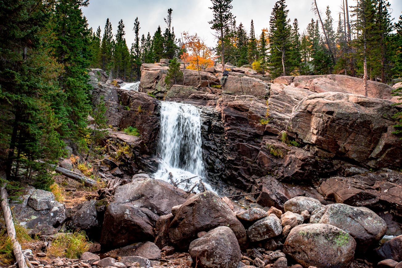
Alberta Falls
Trail Distance: 0.8 miles
Elevation: 9,394 feet
Less than a mile into the trail, Alberta Falls roars. The trail weaves around the western edge of the waterfall, but feel free to climb and explore the 30-foot cascade drops of this stunning sight.
Large slabs of rock line the edge of the gorge, with plenty in safe spaces where you aren’t at risk of slipping over the edge. Beware of hungry critters hoping you’ll share those snacks with them.
The falls are named after Alberta Sprage, the wife of Abner Sprague. He was a Rocky Mountain pioneer and among the first to offer lodging and services to passing tourists. Sprague Lake is named after him, where a mountain resort once stood.


Be prepared for crowds during any season that the access road is open to the trailhead. As the first waterfall, many people chose to come this far and sometimes only this far.
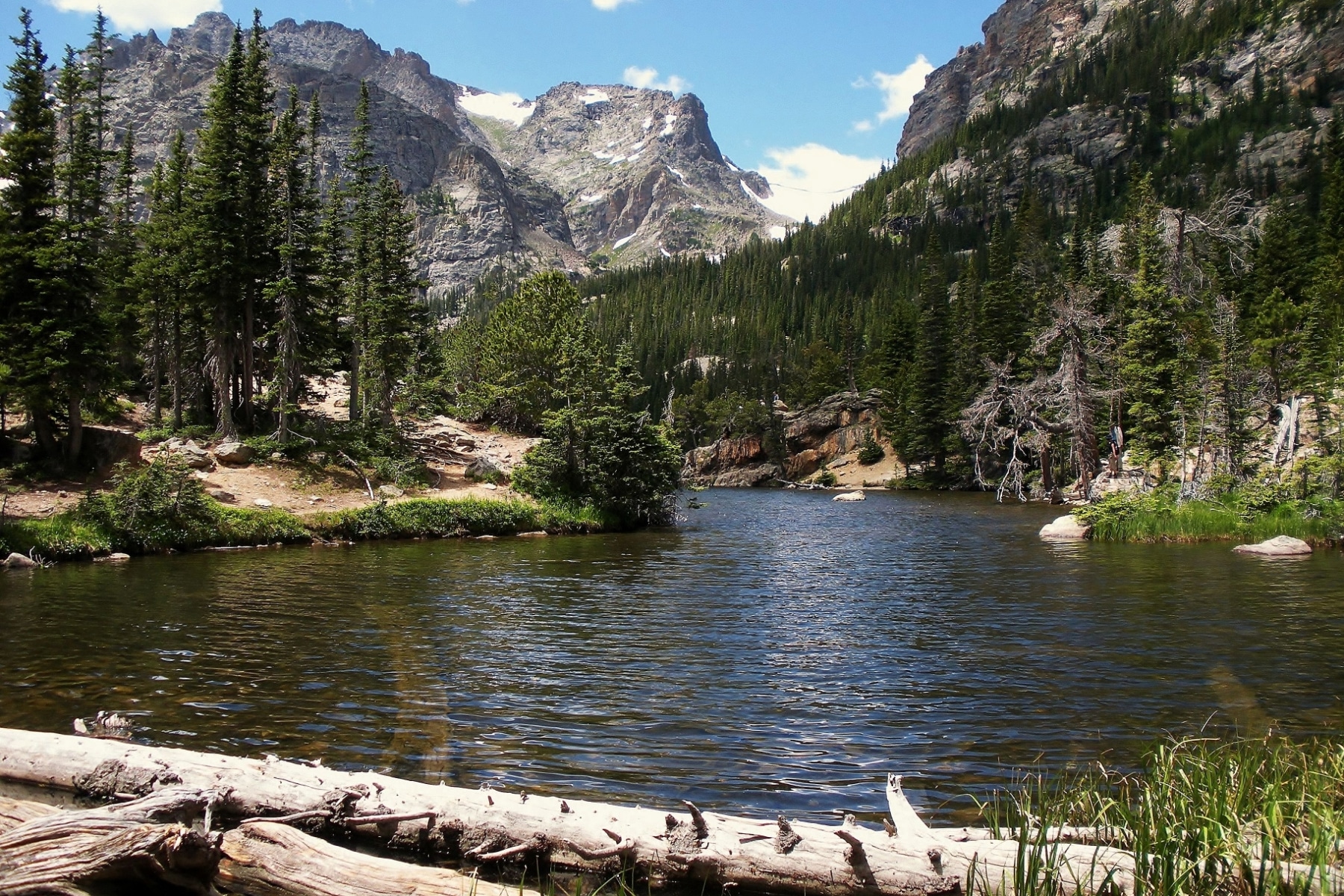
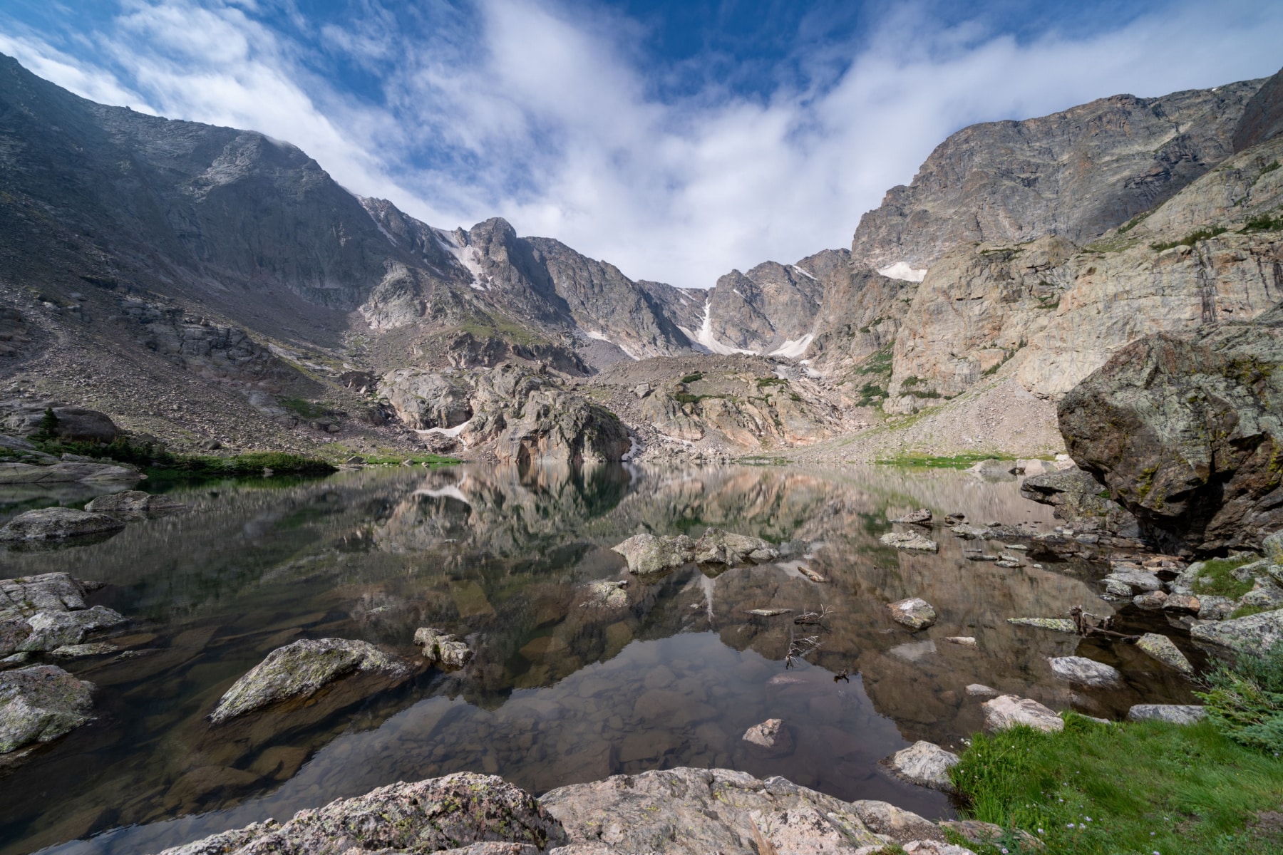
The Loch
Trail Distance: 2.3
Alberta Falls to The Loch Distance: 1.7 miles
Elevation: 10,190 feet
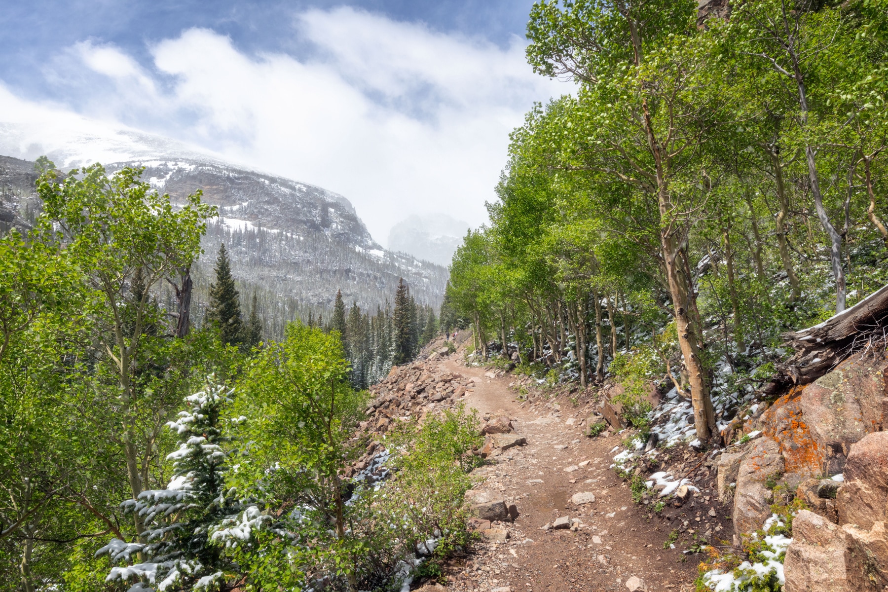
It’s important to realize that the next stretch of trail is the longest between two “main attractions” on the Sky Pond hike at Rocky Mountain National Park. Less than a mile in, you’ll see East Glacial Knob to the west (and possibly some rock climbers up there).
About .3 of a mile later, the Loch & Mills Lake Junction provides that spiderweb of trails. Keep heading toward the Loch.
A glacial knob is an isolated, rounded bedrock hill or small mountain sculpted by the erosive action of flowing glacial ice. They are composed of resistant bedrock that was able to withstand glacial erosion while a glacier eroded the surrounding rock. This left the knob exposed as an isolated rocky hill.
The trail weaves through a series of switchbacks, but as someone with a moderate fear of heights, I didn’t feel uncomfortable anywhere on this trail.
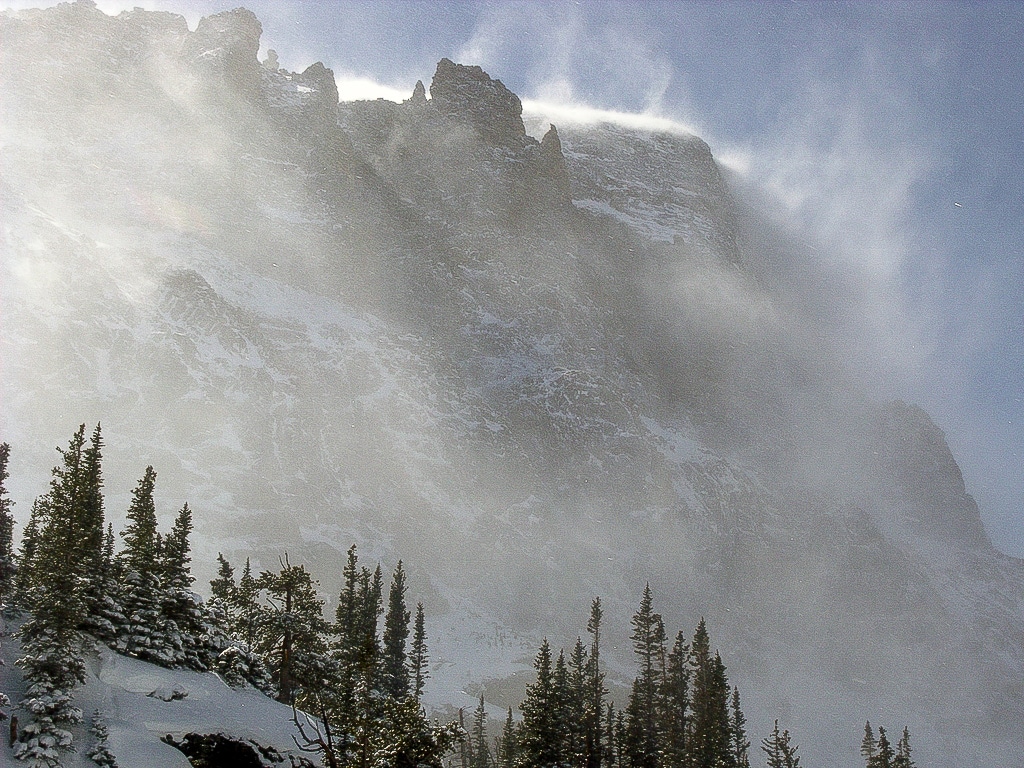
Beware of intense winds on this trail. The Loch Vale took my breath away figuratively and literally.
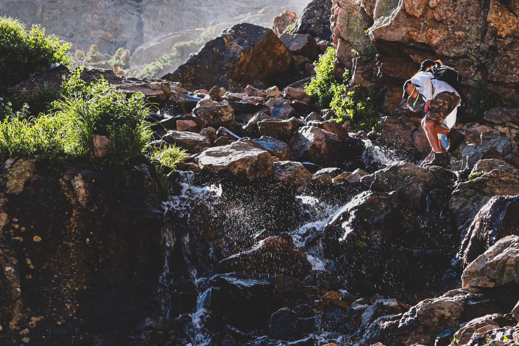
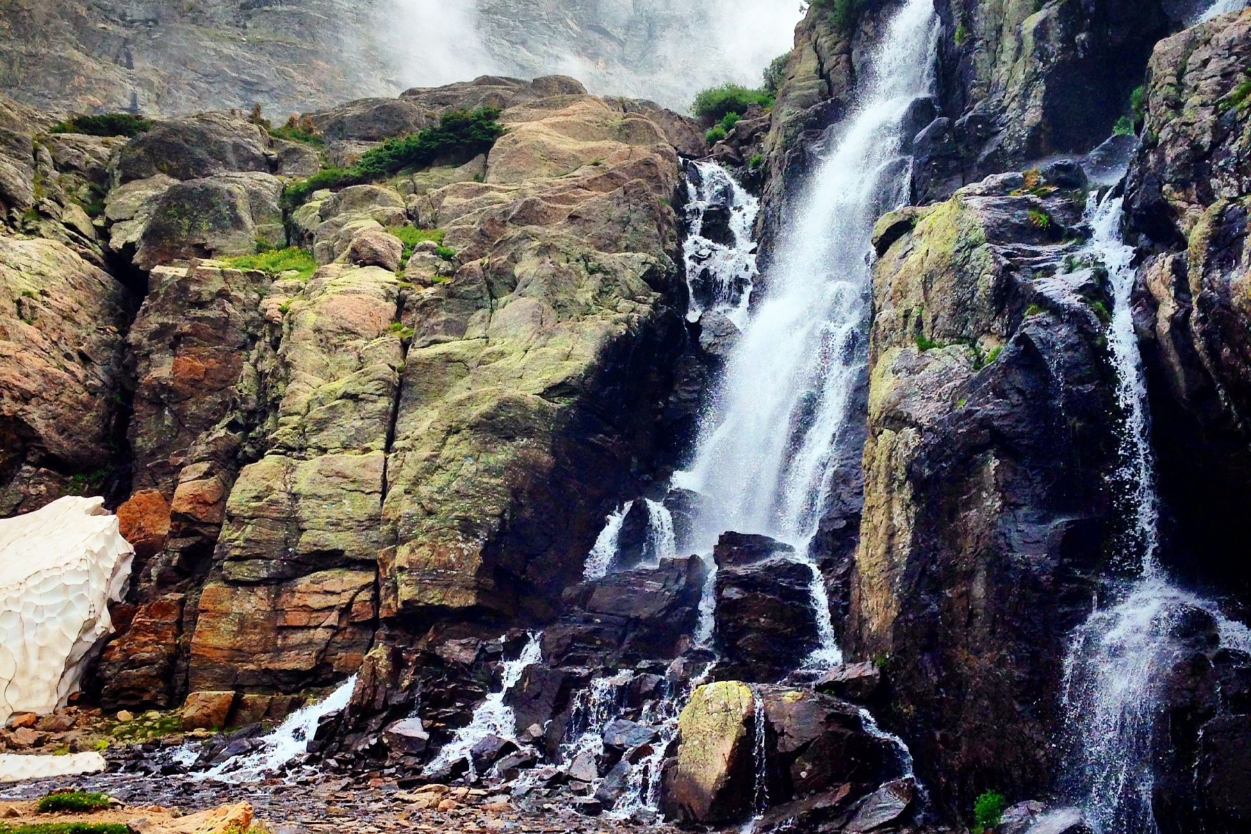
Timberline Falls
Trail Distance: 3.3 miles
The Loch to Timberline Falls Distance: 1 mile
Elevation: 10,660
At this point, the trail becomes strenuous, with even snow in many places well into summer. Luckily, the winds died down enough beneath the trees to pull out my crampons. I didn’t come this far to only come this far.
Timberline Falls is a 100-foot waterfall. The first thing to remember is that the waterfall edge IS the trail. You can’t get to Lake of Glass or Sky Pond without scaling the side. You’ll also lose some of the trail traffic at the Loch.
In any event, you’re going to get wet on this trail, whether it’s mist or flat-out climbing through streams of water edging down the rock.
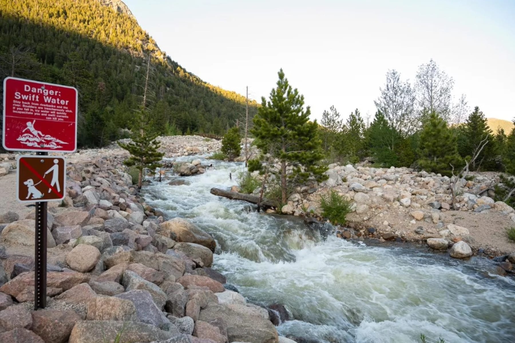
WARNING: Most accidents that happen on this trail involve hikers who weren’t wearing hiking boots with a good grip or didn’t bring crampons to this snowy area.
(CLICK TO EXPAND ANY OF THE PHOTOS ABOVE)
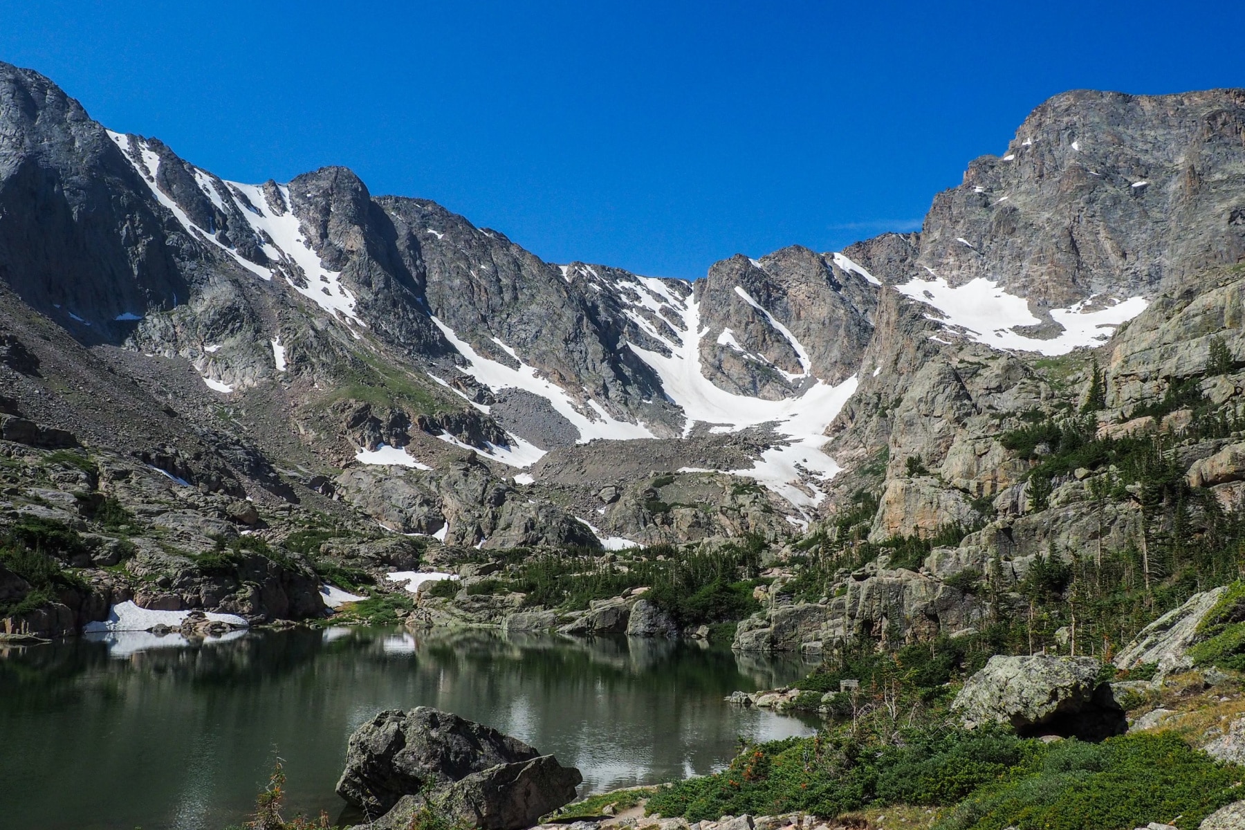
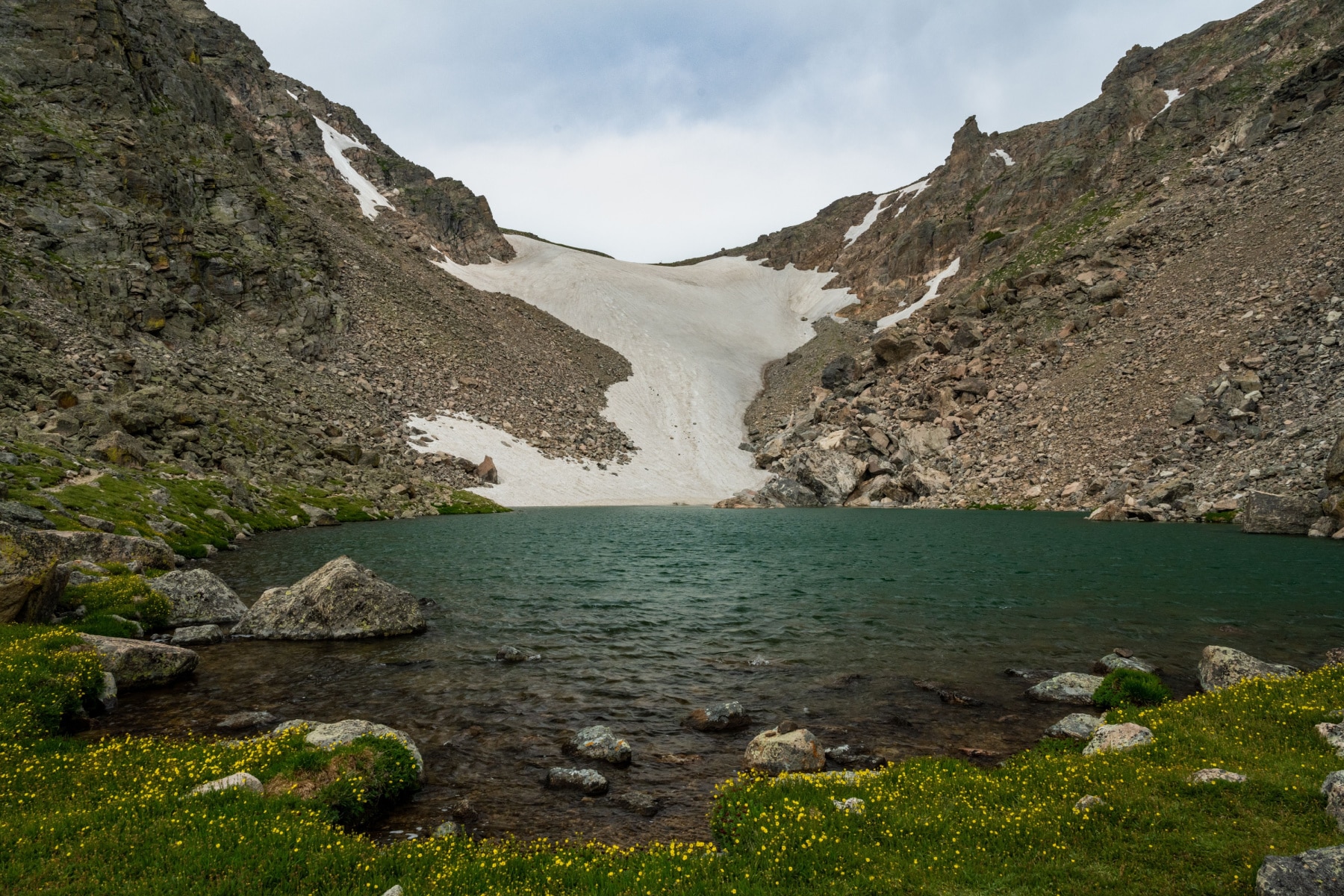
Lake of Glass
Trail Distance: 3.5 miles
Timberline Falls to Lake of Glass Distance: 0.2 miles
Elevation: 10,808
The last two lakes on this trail sit on rocky shelves, sort of a “peekaboo” lake that you won’t see until you’ve scrambled to lake level. Staring at the reflection of the mountains into the water hypnotized me. To catch my breath and get some energy, I sat down to eat.
We found another waterfall here, just before you climb the lip to the Lake of Glass.
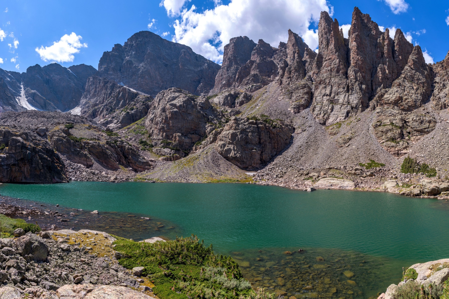
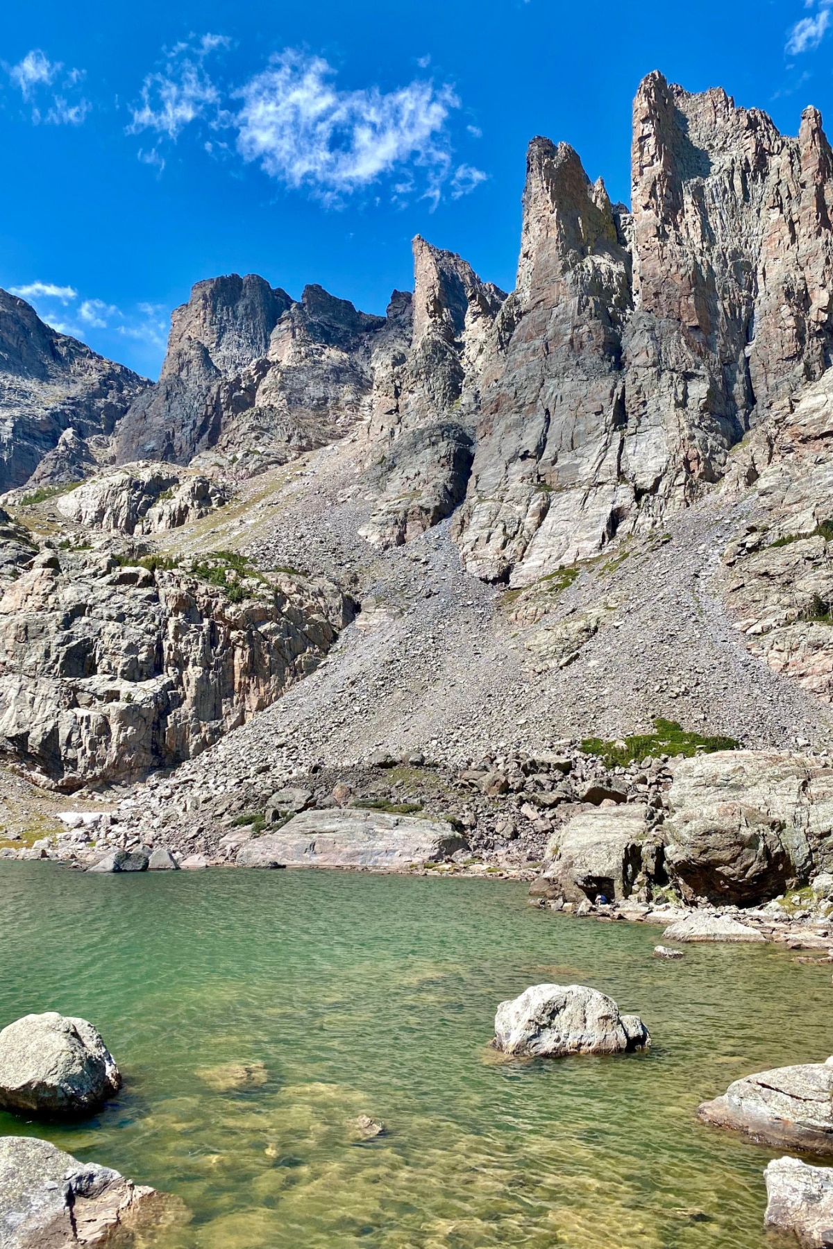
Arrive at Sky Pond
Trail Distance: 3.8 miles
Lake of Glass to Sky Pond Distance: 0.2 miles
Elevation: 10,900 feet
Like a dead-end on a cul-de-sac, the trail comes to an abrupt yet breathtaking view when you get to Sky Pond.
Taylor Peak stands in front of you and the intimidating Cathedral Spires, including Sharkstooth and Petit Grepon, two popular climbing routes. The other spires are the Foil and the Saber.
We spent a good hour here, climbing the edge of the lake and as far as we could go up without technical equipment. If there’s a heaven, I bet it looks a lot like Sky Pond.
Getting to Sky Pond Hike in Rocky Mountain National Park
To access the Sky Pond Hike in Rocky Mountain National Park, you’ll go through the Beaver Meadows Entrance Station leading to Bear Lake Road.
The timed entry is generally from late May through late October. Access permits are required between 5:00 am and 6:00 pm during this period. Reservations open on the first day of the month for the month BEFORE you plan to visit. That means July visitors should book reservations on June 1. September visitors need a reminder on August 1.
The reservation fee is $2, money above and beyond the price of the park access pass. No guaranteed parking comes with that reservation. It just gets you into the park. Reservations are available in two-hour intervals, starting from 5:00 am – 7:00 am through 4:00 pm to 6:00 pm.
Finding Parking for Sky Pond Hike in Rocky Mountain National Park
Accessing the trailhead for the Sky Pond hike in Rocky Mountain National Park comes with three options.
- Park & Ride: Park at the lot 5.2 miles from the turn on Bear Lake Road. Bear Lake Shuttle Route transit starts at 6:30 am and ends at 7:30 pm. Winter guests will need to drive to the parking areas up the road. Exit the shuttle at the Glacier Gorge Junction Trailhead.
- Glacier Gorge Junction Trailhead: The easiest access point to the Sky Pond hike is here, but parking is limited to fewer than 50 spaces. Unless you’re starting an early morning hike, this lot will be full, possibly even in winter.
- Bear Lake Trailhead: Just another mile up the winding road is the Bear Lake Trailhead, with a larger parking lot with 200 spaces. Starting the Sky Pond hike from Bear Lake only adds 0.3 miles to the journey, and you get to see Bear Lake!
Finding and Following Sky Pond Hike Signs
At first glance, parts of the Sky Pond hike in Rocky Mountain National Park looked more like a spider web than trail intersections.
Too many things can go wrong (snow-covered signs, missed trail markers, cairns knocked down, etc.) that I leave as little to chance as possible.
As you can see on the trail signs to the right, Sky Pond isn’t always mentioned.
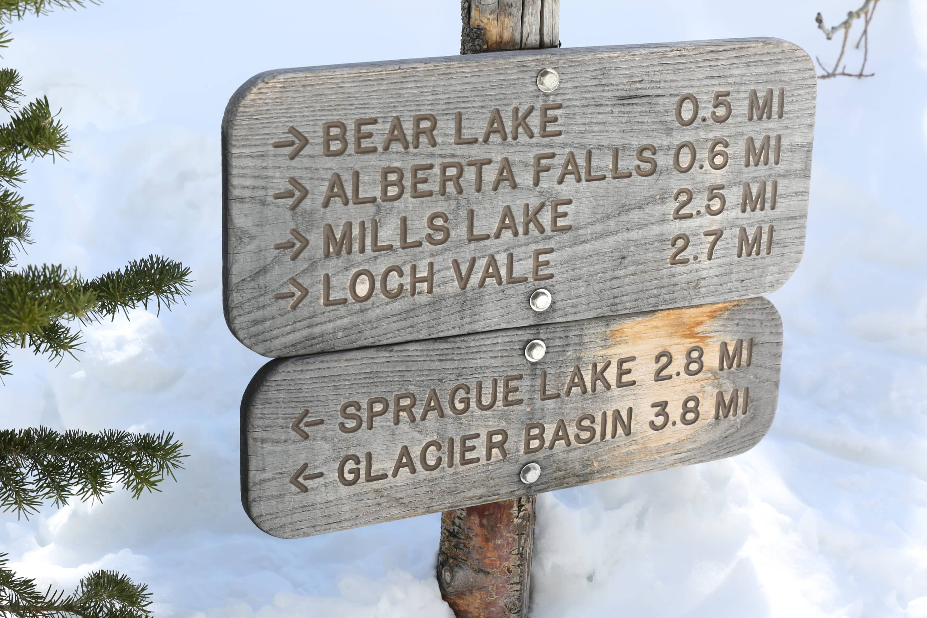
NOTE: Distances are rarely 100% accurate. This trail is estimated to be between nine and 10 miles roundtrip.
Trailhead to End of Trail Terms for Sky Pond Hike
This quick guide will help you learn the names associated with landmarks along the Sky Pond hike.
- Glacier Gorge: As the name suggests, it’s a gorge carved by an Ice Age glacier and also the name of the main trailhead for the Sky Pond hike in Rocky Mountain National Park. Searching for “Glacial Gorge” will take you to many wrong places.
- Alberta Falls: The first waterfall on the trail to Sky Pond. It is less than a mile from the trailhead and very crowded in summer.
- The Loch/Loch Vale: “Loch Vale” translates from Scottish to Lake Valley. The valley is where three lakes are located, one being “The Loch,” which is on the Sky Pond hike in Rocky Mountain National Park.
- Cathedral Wall: The towering western wall of mountains at Loch Vale, is also a popular rock climbing site.
- Timberline Falls: Another name that’s a definition, as this waterfall marks “above the tree line.” You cannot go forward without scaling the falls.
- Lake of Glass: The second to last lake on the trail.
- Sky Pond: Don’t let the name “Pond” fool you–this is a lake by every definition, and sometimes lake and pond are used interchangeably.
- Sharkstooth/Petit Grepon: The spires that stand on the northwest side of Sky Pond, with Petit Grepon being a popular spot for rock climbers.
- Fire Trail(s): Trails that are not usually marked on the map but provide shortcuts to get around the backcountry or busy trail spots.
EPIC Sky Pond Hike Add-On Trail
At the same time, you can easily parlay the Sky Pond hike at Rocky Mountain National Park into a trip to Mills Lake, which is just a one-mile roundtrip detour.
We hiked in good time under ideal weather conditions. The climb down the waterfall took us more time than the ascent. We saw others struggling as well. Take your time.
After turning onto Andrews Creek/Andrews Glacier Trail and taking the 1,000-foot ascent in .9 miles through rugged terrain, we enjoyed solitude we couldn’t get on any other trail section.
The USGS claims this is the only REAL glacier left in Rocky Mountain National Park and that I thought this detour was necessary since it might not be around much longer with climate change.
In the end, at 11,390 feet, the side trail was worth it. You can do this trail and camp at the Andrews Creek campsite with a wilderness permit.
Map Of Sky Pond Hike in Rocky Mountain National Park
The map shows the route from the trailhead at Glacier Gorge Junction parking area to Sky Pond. The red route shows a fire trail that you can use in warm weather to cut a mile off the hike, avoid crowds, and ski Alberta Falls. This will require bushwhacking and should only be done by experienced hikers.
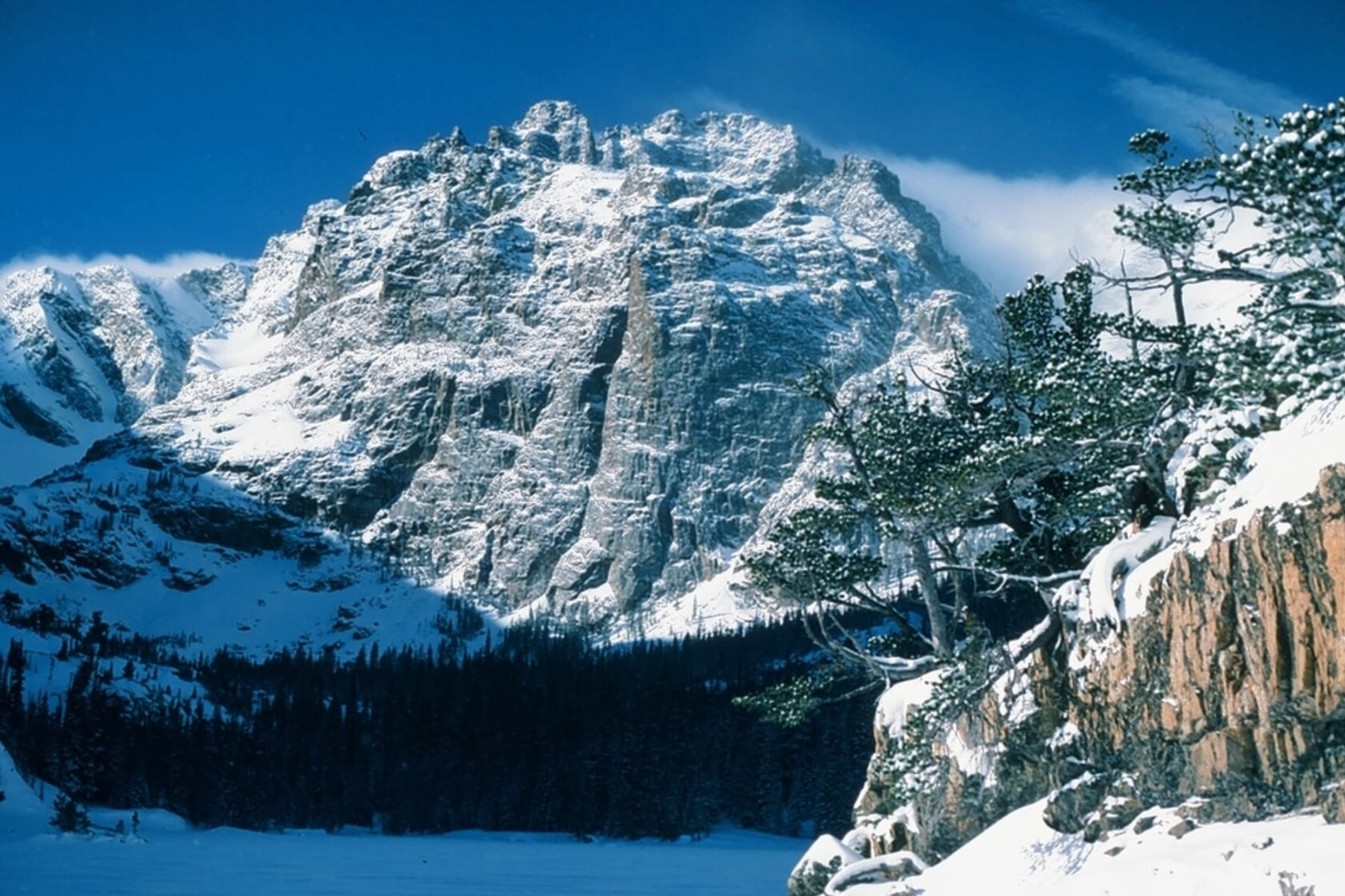
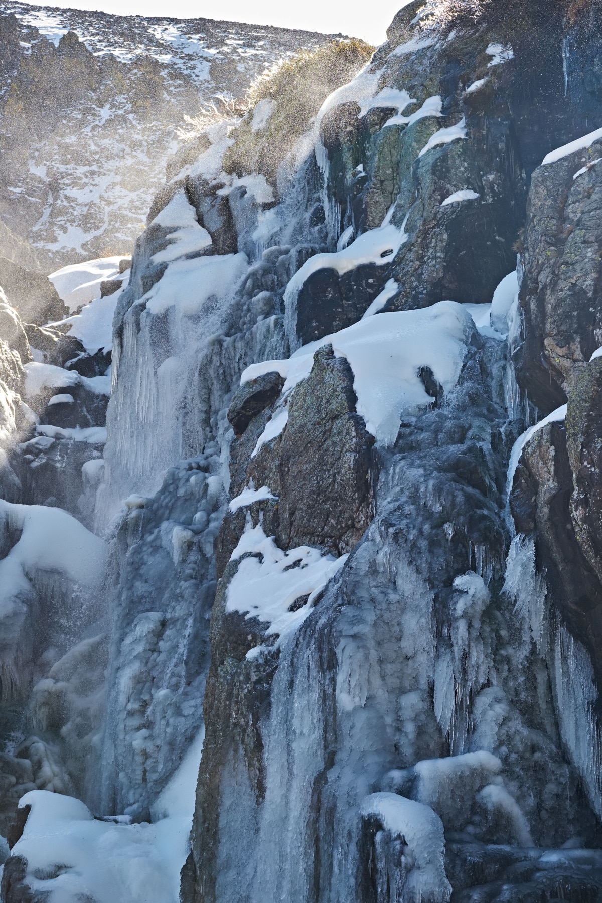
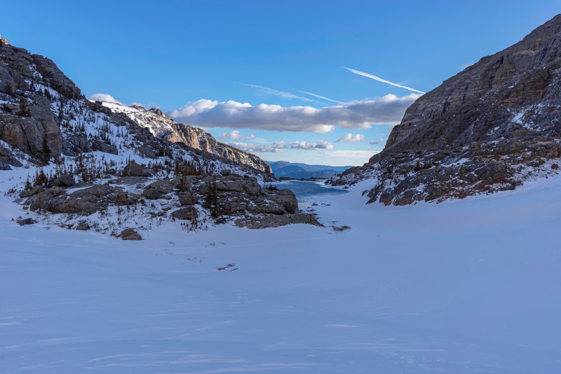
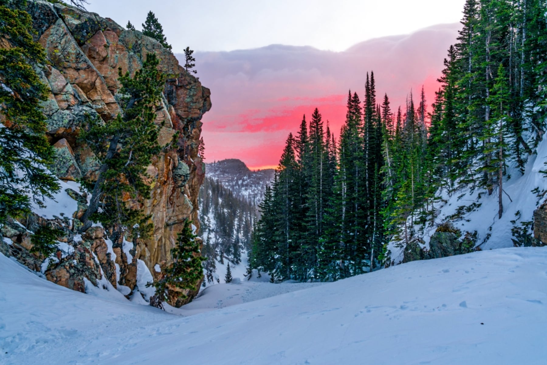
Winter on the Sky Pond Hike
Rocky Mountain National Park is open year-round, and the Sky Pond hike route turns into beautiful snowshoeing or cross-country skiing trails with frozen lakes that shave some time off the hike since you can walk right across them.
Review this Bear Lake Winter Trail Guide to see adjustments to the trails. Take a close look at that map to see avalanche danger zones after the Loch. You should not continue on this route without an avalanche beacon, a shovel, and a snow probe.
Rocky Mountain National Park offers a free avalanche beacon training area where you can test your skills before going into the wilderness. The training area is 14 miles from the Glacier Gorge trailhead.
Here are a few more winter resources to bookmark:
- Trail conditions are updated daily on the RMNP website.
- The Colorado Avalance Information Center provides risk updates around the clock.
- Snow depth information for Bear Lake through SNOTEL sites.
- National Weather Service-Boulder provides updated forecasts for microclimates and various elevations.
Don’t wait until you get to Rocky Mountain National Park to get snow gear. Stop in Estes Park for snowshoe, skiing, or accessory rentals.
Snow continues to fall heavily at times through March and April. Some parts of the Sky Pond hike will have snow at least through June, if not year-round. Treat a spring trip with the same tactics as a winter hike. You can see in the post below that hikers were dropping deep into snow as of June 6, 2023.
In June 2021, Rocky Mountain National Park rescue teams saved two people near Loch Vale who were not prepared for snow.
Weather Risks on the Sky Pond Hike
September and October provide the best weather conditions of the year at Rocky Mountain National Park. That falls in the sweet spot between the spring and summer thunderstorm patterns and (if you’re lucky) before the first big snowfall.
Thunderstorms and Lightning
The most likely time for lightning strikes comes between June and September. This graphic shows you the safest place to be if you’re stuck in a lightning storm.
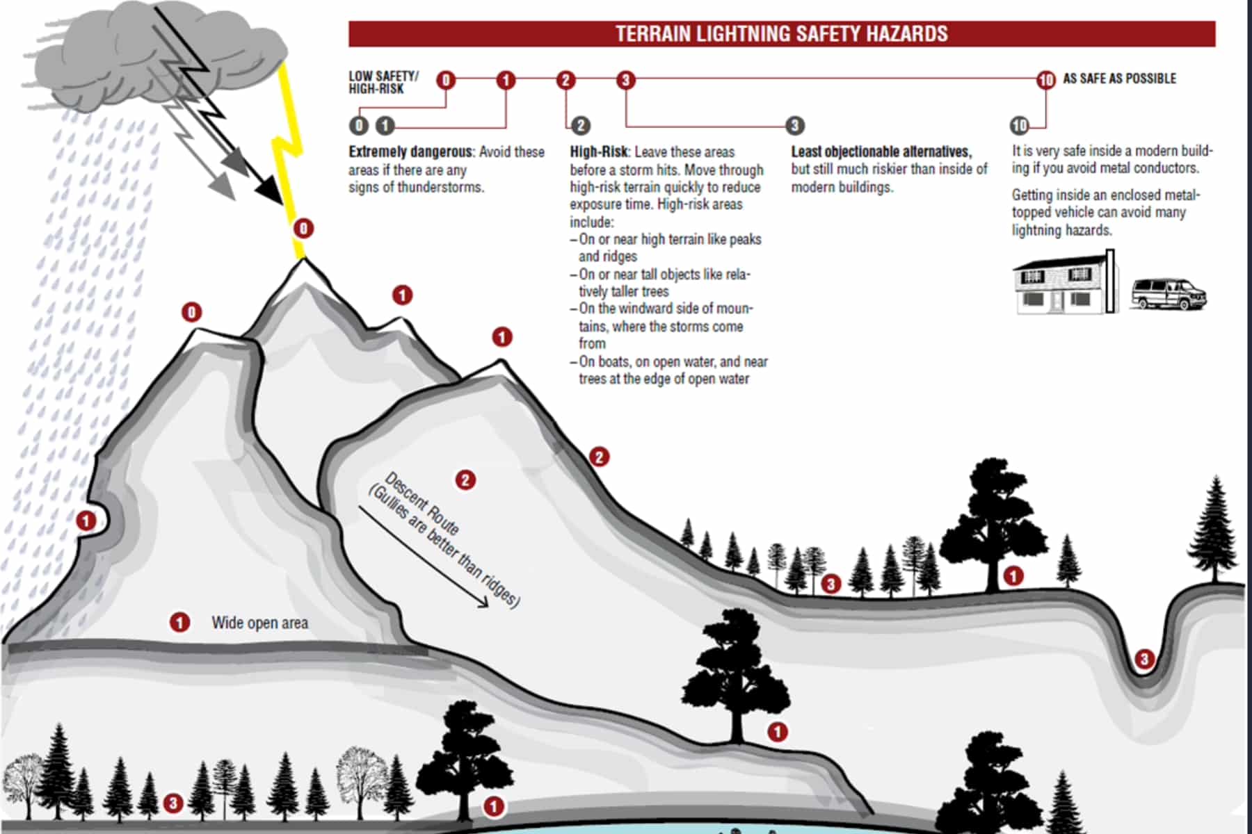
HIKING TIP FOR SKY POND: If you see a storm approaching and you’re at Sky Pond, there’s a small cave near the base of Sharkstooth.
Wildfires
Rocky Mountain National Park works tirelessly to educate visitors about wildfire safety steps. Some parts of the park will stay off limits until further notice from devasting 2020 wildfires.
With lightning and thick brush on this sub-alpine trail, mixed with the intense winds, a wildfire could easily spark anytime.
“Rocky Mountain National Park always has Stage 1 fire restrictions in place, where campfires are prohibited in the park, except within designated campfire rings in picnic areas and front-country campgrounds. Fireworks are always prohibited within the park. Park visitors are urged to use caution and vigilance regarding the use of fire in authorized locations.”
Rocky mountain national park website
Check the air quality before you hike. With high-altitude hiking, oxygen is depleted and having smoke particles in the air can just make you more prone to Acute Mountain Sickness.
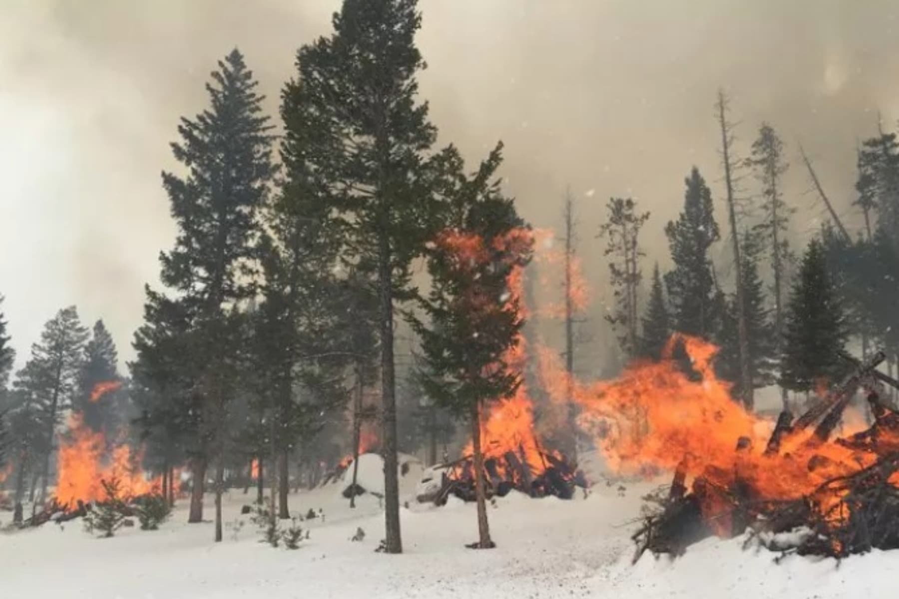
Don’t be surprised if you see fires burning in winter that look like the photo to the right.
These “fuel treatments” burn during controlled/prescribed burns to reduce wildfires by taking away some of the fuel.
Flash Flooding
Along the Sky Pond hike in Rocky Mountain National Park, Glacier Creek and Icy Brook follow the path. “Creek” and “Brook” underestimate the power of these water troughs. Warm weather and a high snowpack send torrents of water down the beds and over the waterfalls.
The intensity could create an impassible Timberland Falls or flood parts of the trail.
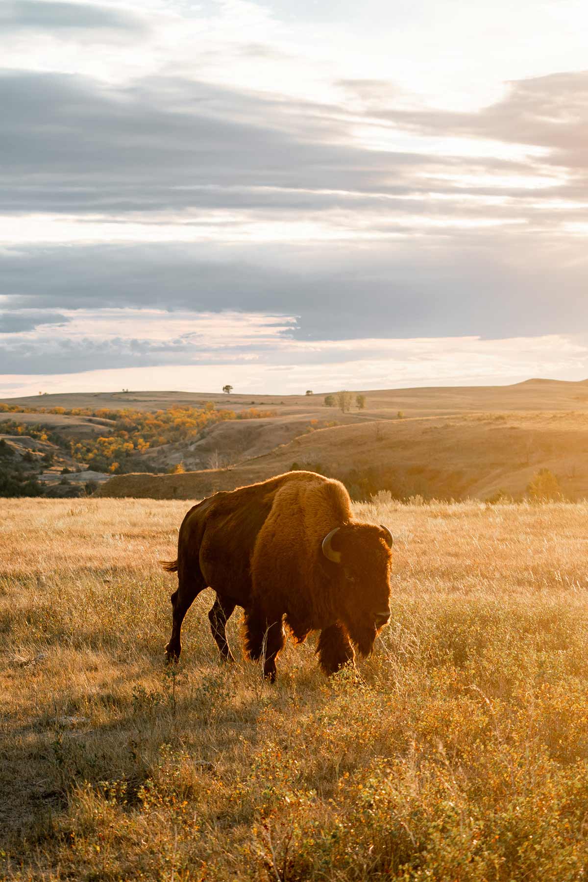
Wildlife on Sky Pond Hike
Imagine if you were walking on the trail and someone shouted, “Hey, I’d like to see YOUR North Face!” That’s just the kind of harassment you wouldn’t tolerate, and you shouldn’t do it to wildlife, either. In fact, federal laws ban trying to get the attention of wildlife.
I don’t need to detail the damage a bear can do to a human when startled or provoked, but even those cute little bunnies and chipmunks spread disease. Not to mention that ticks can survive up to 10,000 feet in elevation and carry diseases like Rocky Mountain Spotted Fever and Colorado Tick Fever.
STOP SHED HUNTING: Rocky Monuntain National Park doesn’t allow hunting the shed antlers of elk.
“By federal regulation, nothing may be possessed, destroyed, injured, defaced, removed, dug up, or disturbed from its natural state, including antlers. Many species gnaw or chew on shed antlers as a source of vitamins and minerals.”
Rocky mountain national park staff
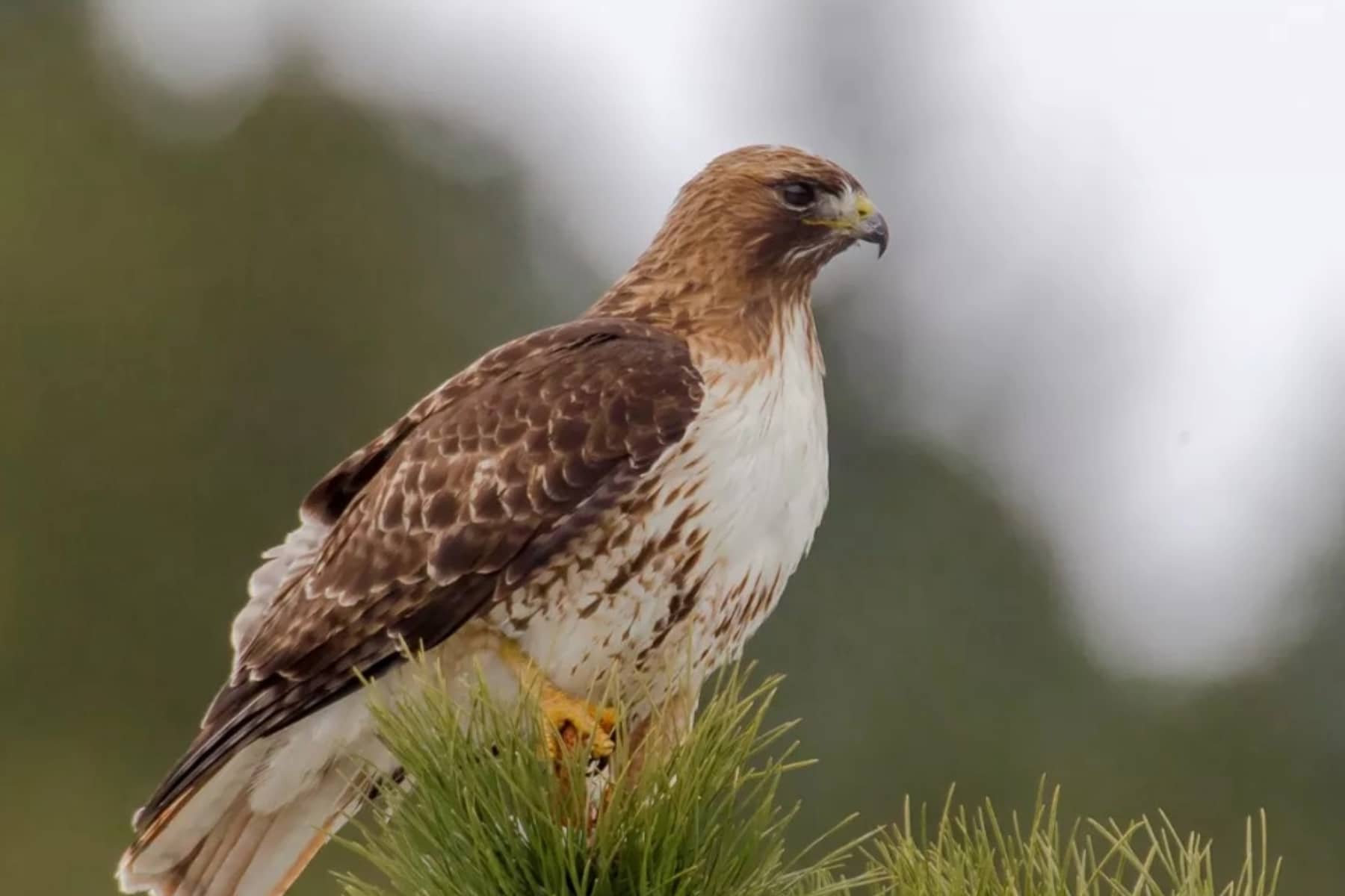
Raptors Lead to Trail Closures on Sky Pond Hike
Before planning a trip between February and July for a Sky Pond hike in Rocky Mountain National Park, recognize the raptor impact that could close a trail. A similar closure gets put in place on some of the best hikes in Acadia National Park in Maine for the Peregrine Falcon.
The birds need to breed and nest in peace, and that means rock climbing and hiking can be shut down in areas where the birds of prey decide to nest.
Check the park’s Raptor Closures before you go.
Sky Pond Hike Gear List
Sky Pond Hike Warm Weather Checklist
Sky Pond Hike Winter Checklist
Avalanche transceiver
Avalanche probe & shovel
High Altitude/Glacier Sunglasses
Goggles
Hand Warmers
FAQ – Sky Pond Hike in Rocky Mountain National Park
The hike to Alberta Falls is very easy. Heading to the Loch is the easy side of Moderate. Beyond the Loch, expect moderate and strenuous sections. What obstacles the mountains put in your way are emphasized by the altitude health effects with a dose of everchanging weather.
Most importantly, overdress for whatever you expect on the trail, as snow will likely be somewhere along the trail as you pass the Loch. Temperatures rarely get above 70°F in the summer and still go as low as the 40s. Winter layering is essential to prevent frostbite and hypothermia, while highs will be near or below freezing for high temperatures from November through March.
The National Park Service says this trail is 4.9 miles, with a roundtrip of 9.8. Using Google Maps, the trail shows 3.7 miles, with 7.4 miles roundtrip. Other expert hikers claim it’s a 9-mile roundtrip hike exactly. However, you spend so much time climbing rocks or walking the edge of the lakes that the trail can be up to 11 miles long.
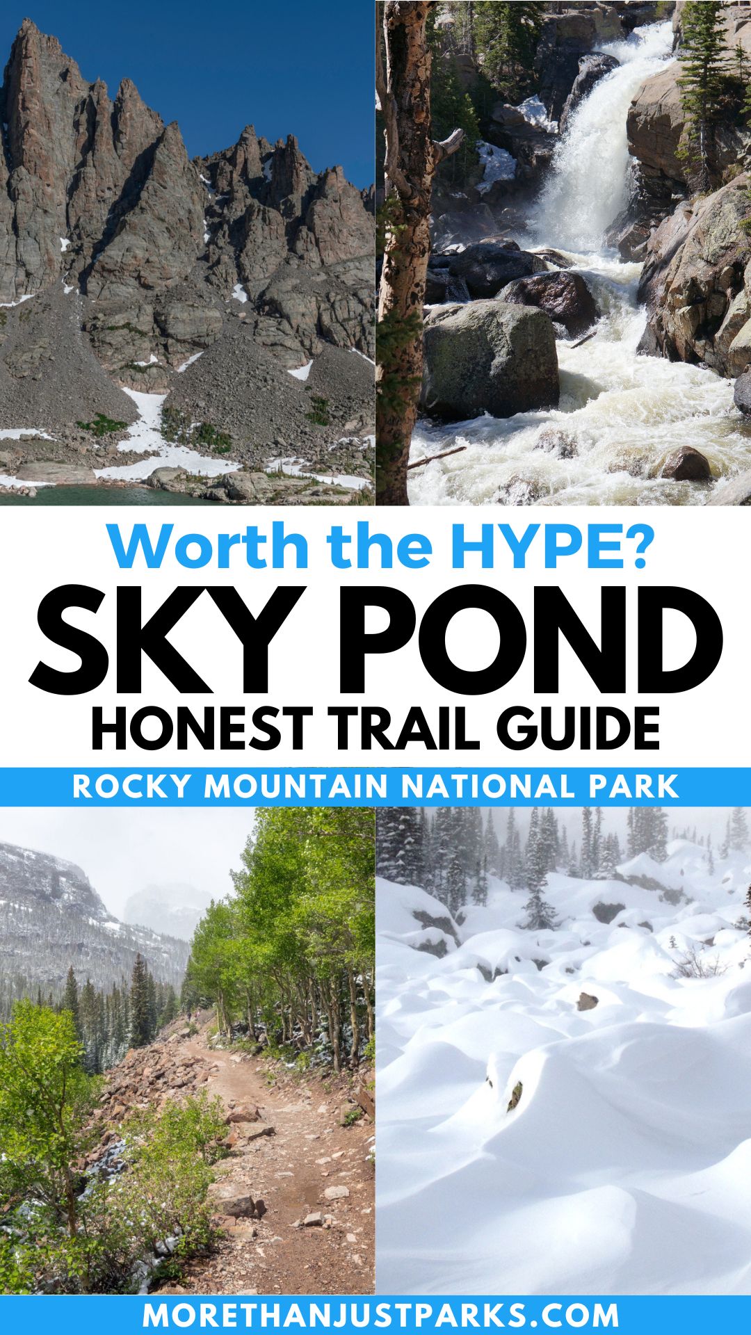
Pin Sky Pond Hike in Rocky Mountain National Park
Helpful Related Links
Is Rocky Mountain National Park the Most Photogenic?: Rocky Mountain National Park: An (Epic) Photo Guide to Colorado’s Gem
Learn More About the Park: 14 AMAZING Facts About Rocky Mountain National Park
Explore More Colorado National Parks: These 12 Colorado National Parks Will Blow Your Mind
Need a Break from Elevation?: 25 AMAZING Things to Do in Death Valley National Park
How About More Alpine Lakes?: 9 EPIC Hikes in Olympic National Park
Is Rocky Mountain National Park the Most Popular?: 10 MOST VISITED US National Parks (Updated + Complete List) 2023
Ready for a Roadtrip?: 10 BEST National Park Road Trips (+ Stops You’ll Love) 2023

I second the comments about the crowds at the waterfall. It definitely didn’t feel like “escaping” to nature. More like a popular watering hole just down the street. Keep going, people! It’s worth it!