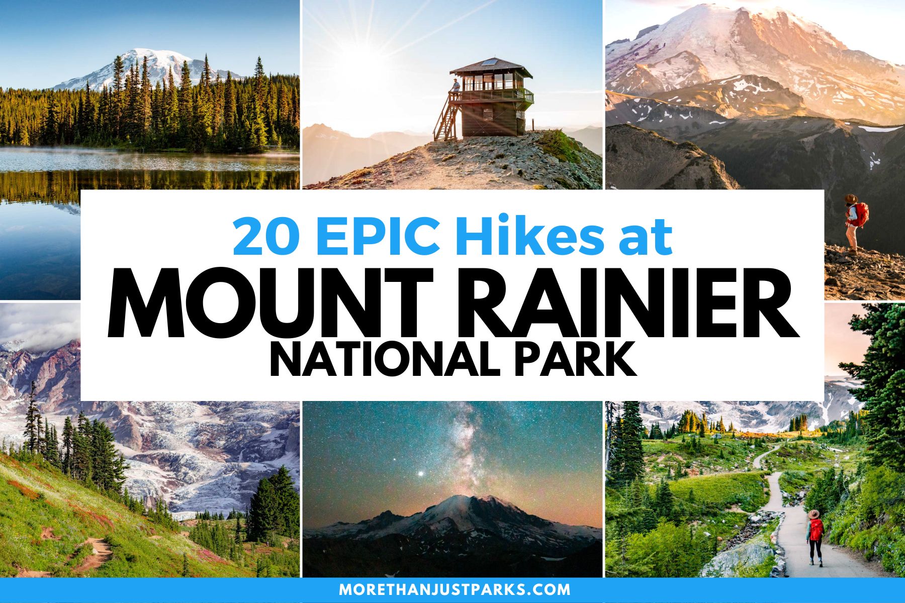
Article Overview: Best Hikes Mt Rainier National Park
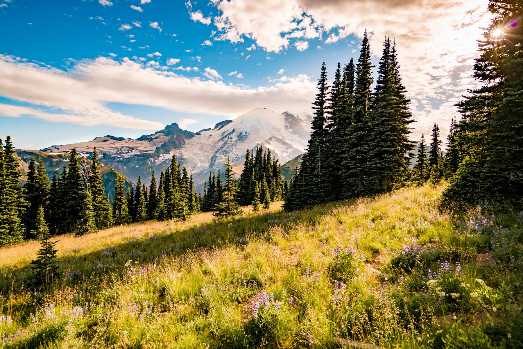
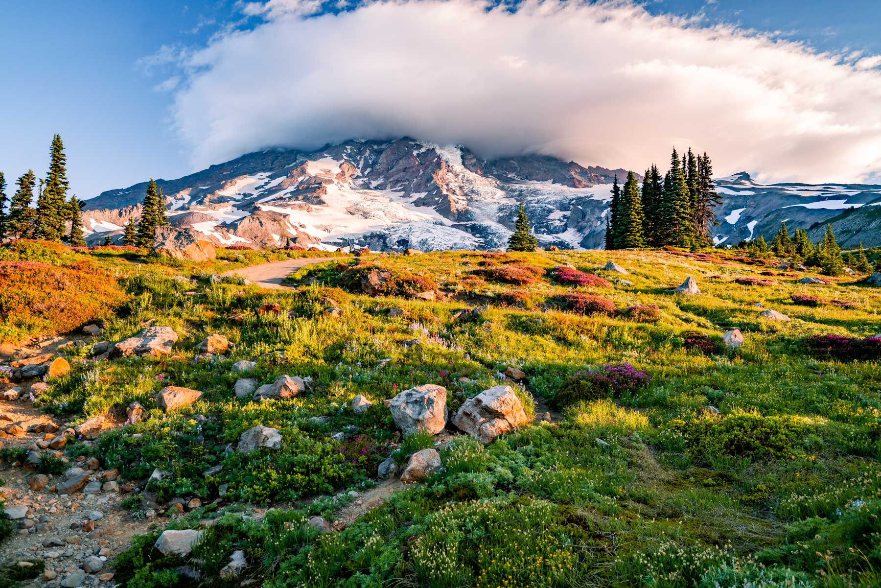
I’ve said it before and I’ll say it again, Mount Rainier’s hikes are the most beautiful you’ll find anywhere in the world. Maybe I’m a sucker for this most heavily glaciated peak in the contiguous US but hiking the trails at Mt Rainier never gets old, nor do the incredible scenery and adventures in this national park.
Living in the great pacific northwest I’ve done more Mt Rainier hikes than I can count. I’ve hiked these trails in summer, spring, winter, and fall and know the best times to hike each one (pretty much mountain spring / summer).
In this article I’ll gush about my favorite Mt Rainier hikes and spill the beans with insider tips on where/when to go and what not to miss on each trail. As a professional photographer by trade I’ll also be including some (way too many) photos of each hike so you know what to expect on the trails.
In sum, I’ll be chatting about the following:
- Things to Know Before You Visit Mount Rainier National Park
- The Four Regions of Mount Rainier
- What to Pack for Mt Rainier Hiking
- Where to Stay at Mount Rainier
- Best Easy Mt Rainier Hikes
- Best Mt Rainier Hikes (Overall)
- Waterfall Hikes at Mt Rainier
- Winter Hikes at Mt Rainier
Sound great? Let’s begin!
Best Hikes in Mount Rainier National Park
Table of Contents: Best Hikes at Mount Rainier National Park
Table of Contents: Best Hikes at Mount Rainier National Park
- Best Hikes in Mount Rainier National Park
- Mount Rainier National Park Hiking Map & Regions
- Top 20 Best Hikes at Mt Rainier National Park
- Top 15 Best Hikes Mt Rainier
- Top 10 Best Mt Rainier National Park Hikes
- Top 5 Best Mt Rainier Hikes
- Summary & List of the Best Hikes in Mt Rainier
- Map of the Best Hikes at Mount Rainier
About My Time Hiking Mt Rainier
I first visited Mt Rainier back when I was fresh out of college and was totally taken aback by its epic grandeur. Looking at that unfathomably massive peak up close was mesmerizing. I compare it to gazing upon the Grand Canyon – one can look for hours and still not fathom the size and scale of the scene before them.
Ever since that first trip I’ve returned dozens of times hiking most of the trails in the park, trying all of the things to do in Mt Rainier. I’ve visited Mount Rainier in every season and while they all have their beauty nothing compares to the summer wildflower season.
I’m Will Pattiz, and along with my brother Jim, we’re collectively known as the Pattiz Brothers (and sometimes the Parks Brothers) and we absolutely LOVE the national parks.
Our goal here at More Than Just Parks is to share the beauty of America’s national parks and public lands through stunning short films in an effort to get Americans and the world to see the true value in land conservation.
7 Quick Things to Know About Visiting Mount Rainier National Park
- Effective for the summer of 2024, reservations are required between May 24 and September 2 if you want to enter the park between 7am and 3pm. One reservation includes one vehicle and a two-hour window to enter. For example, a noon reservation will allow you to enter between noon and 2pm. Those arriving before 7am or after 3pm don’t need a reservation.
- Entrance fees are $30 per vehicle. Purchase the America the Beautiful Pass to pay $80 for a full year of access to more than 2,000 public lands, including Mount Rainier National Park.
- Fill up on gas before you get to the park. Drive times from popular destinations can be 3+ hours apart.
- Wear an eco-friendly sunscreen like this one. The high elevation means you can get sunburned easily, even on a cloudy day.
- Cell Service is spotty in the park, but there is some sporadically at Paradise and Sunrise. Bring a Mount Rainier Guidebook and/or a map of Mount Rainier with you.
- The Best Time to Visit Mount Rainier National Park is during the summer when temperatures are warm and the wildflower meadows are exploding with kaleidoscopic colors. For peak wildflower viewing, I recommend the first couple of weeks in August.
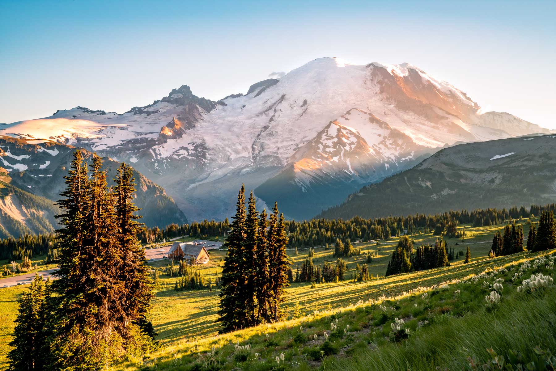
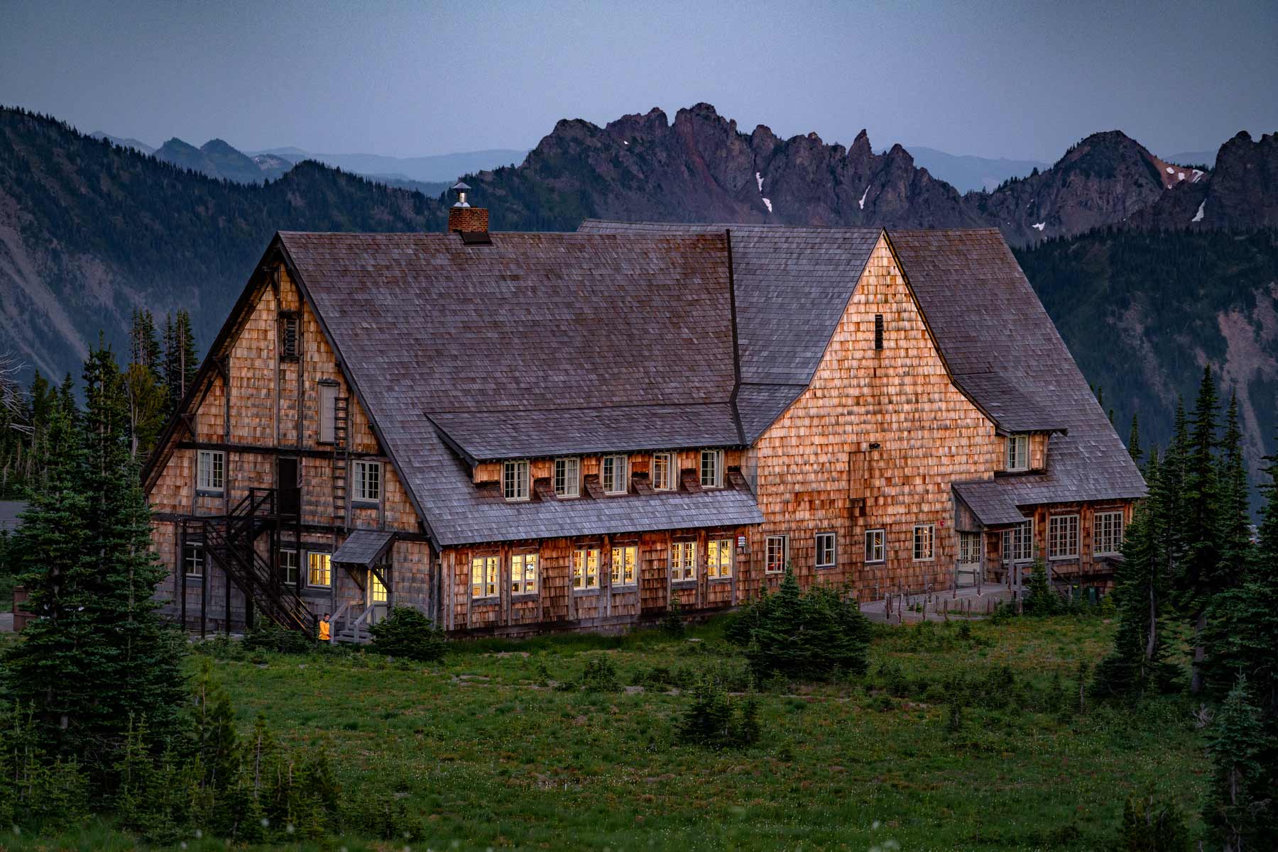
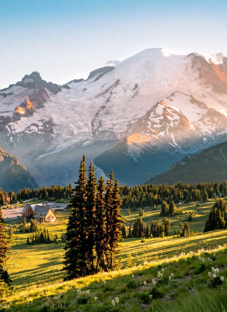
- If you haven’t decided where to stay (yet), check out our favorite hotel in Mount Rainier in Summer & our favorite hotel during the rest of the year. I’ve also listed where to stay in the few towns near Mount Rainier with accommodations: Enumclaw (epic views of Rainier), Packwood, & Ashford. There are also two lodges located within the park itself: The National Park Inn (Longmire) & the famous Paradise Inn (Paradise).
Mount Rainier National Park Hiking Map & Regions
Mount Rainier National Park has five distinct regions you should be aware of while planning your trip. Despite being relatively close to each other on the map, drive times between each of these regions can be significant.
The reason? There’s no road across the top of the mountain meaning you’ve got to drive around it which can take a long time.
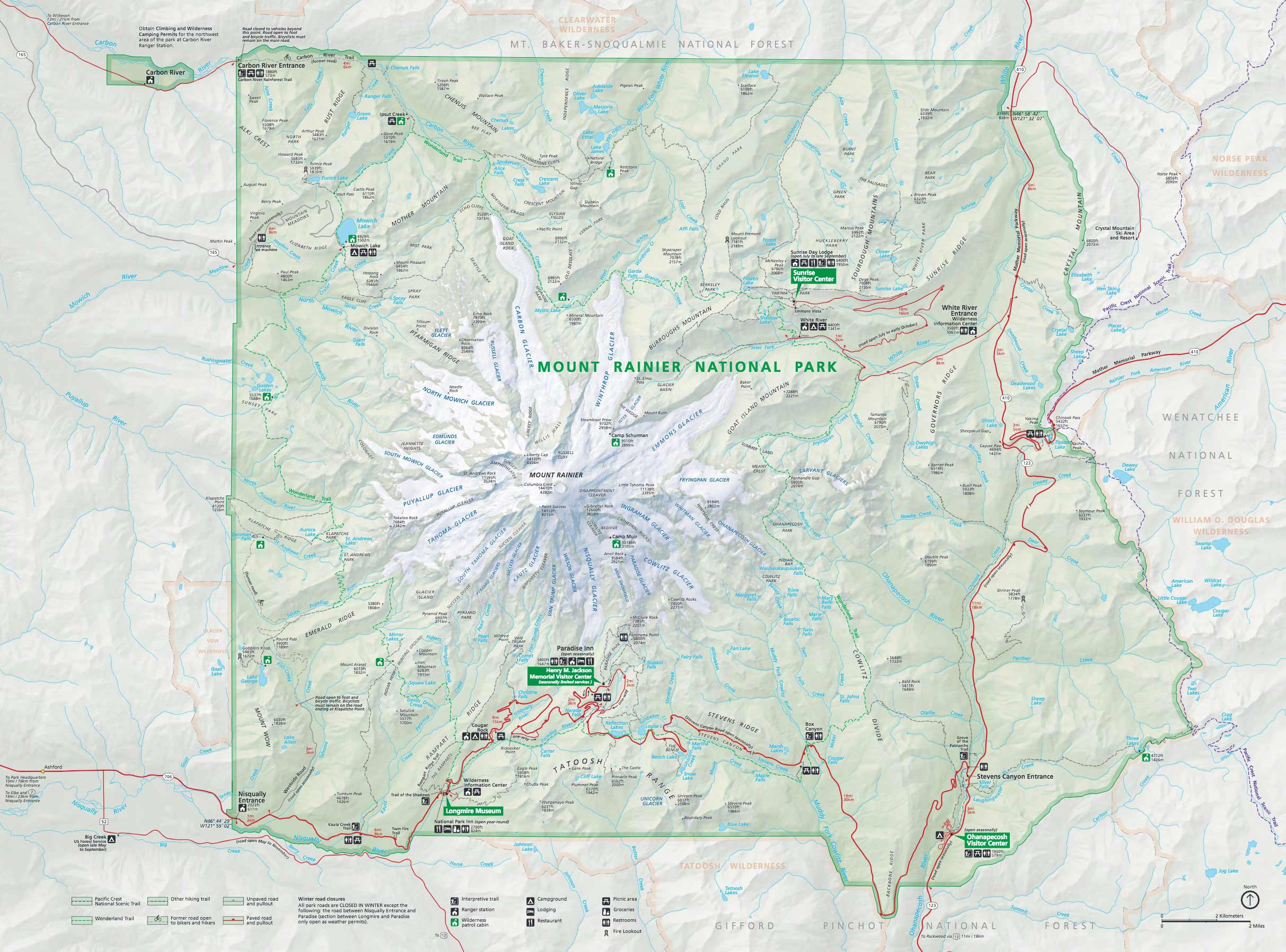
Download this printable Mount Rainier National Park Map: JPG | PDF
The 5 Regions of Mount Rainier National Park
- Mowich Lake / Carbon River (Northwest)
- Longmire (Southwest)
- Paradise (South)
- Ohanepecosh (Southeast)
- Sunrise/White River (Northeast)
Drive Times Between Popular Areas at Mount Rainier
- Sunrise to Mowich Lake – 2.5 hours
- Paradise to Sunrise – 1.5 hours
- Paradise to Tipsoo Lake – 1 hour
- Tipsoo Lake to Sunrise – 45 minutes
- Longmire to Paradise – 20 minutes
- Longmire to Mowich Lake – 2.5 hours
Top 20 Best Hikes at Mt Rainier National Park
20. The Wonderland Trail
Location: Circles the Entire Park
- Distance: 93 miles
- Difficulty: Strenuous
- Elevation: 23,000+ feet
- Time Required: 8 – 14 days
Hiking The Wonderland Trail at Mt Rainier
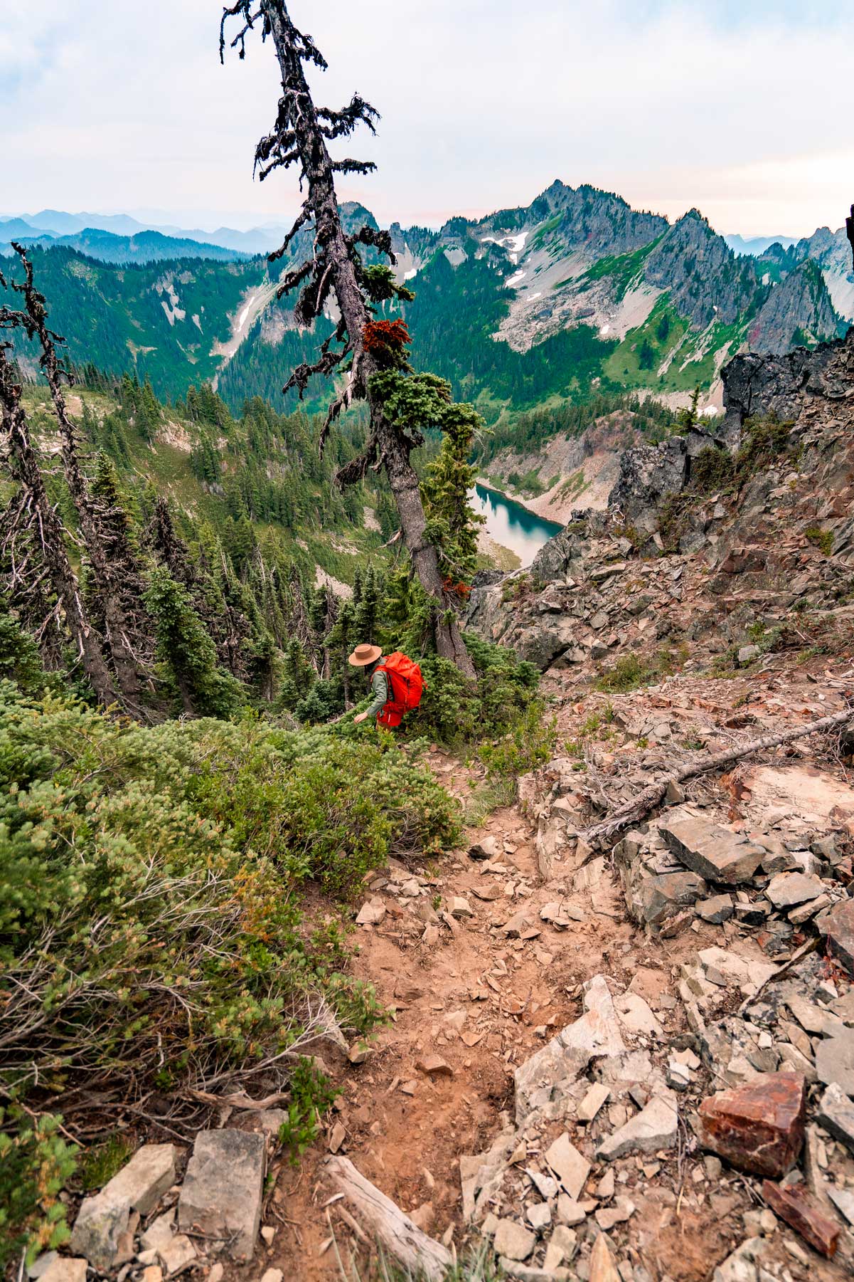
I figured we’d start this list of best hikes at Mt Rainier off with a bang – the 93 mile Wonderland Trail. This is a trail for the more die-hard hiking & backpacking crowd who are game for a Mt Rainier hike that will last days (or weeks). Most folks seem to complete it at about the 10-12 day mark but it can take as long as you want.
I even know some people who break this hike up into several parts and hike it over the course of a summer. Needless to say there are plenty of ways to hike it. The trail itself wraps around Mount Rainier giving hikers vantages from every side of the mountain.
If you’re interested in hiking the Wonderland Trail I recommend starting your journey with a visit (or call) to the backcountry office at Mount Rainier National Park to chat with one of the friendly rangers there who can give you all the details you’re looking for.
19. Tipsoo Lake Loop Trail
Location: Cayuse Pass
- Distance: .8 miles
- Difficulty: Easy
- Elevation: Minimal
- Time Required: 20 minutes
Hiking the Tipsoo Trail at Mount Rainier National Park
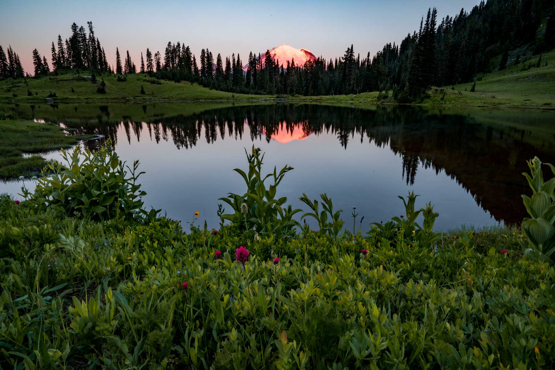
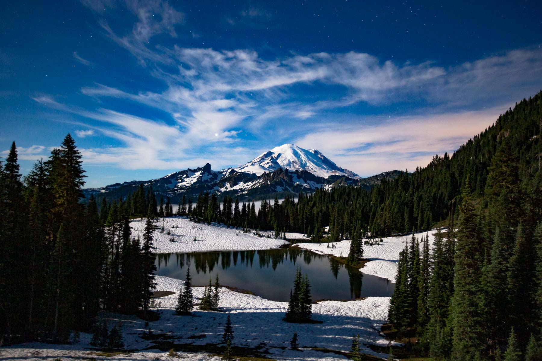
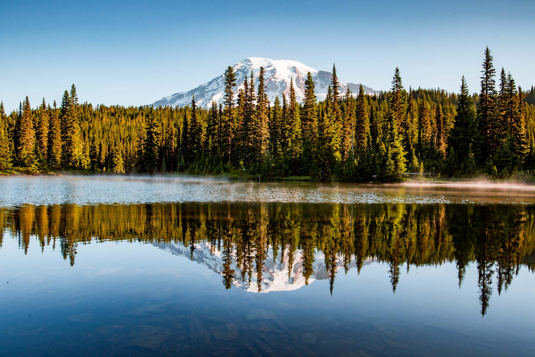
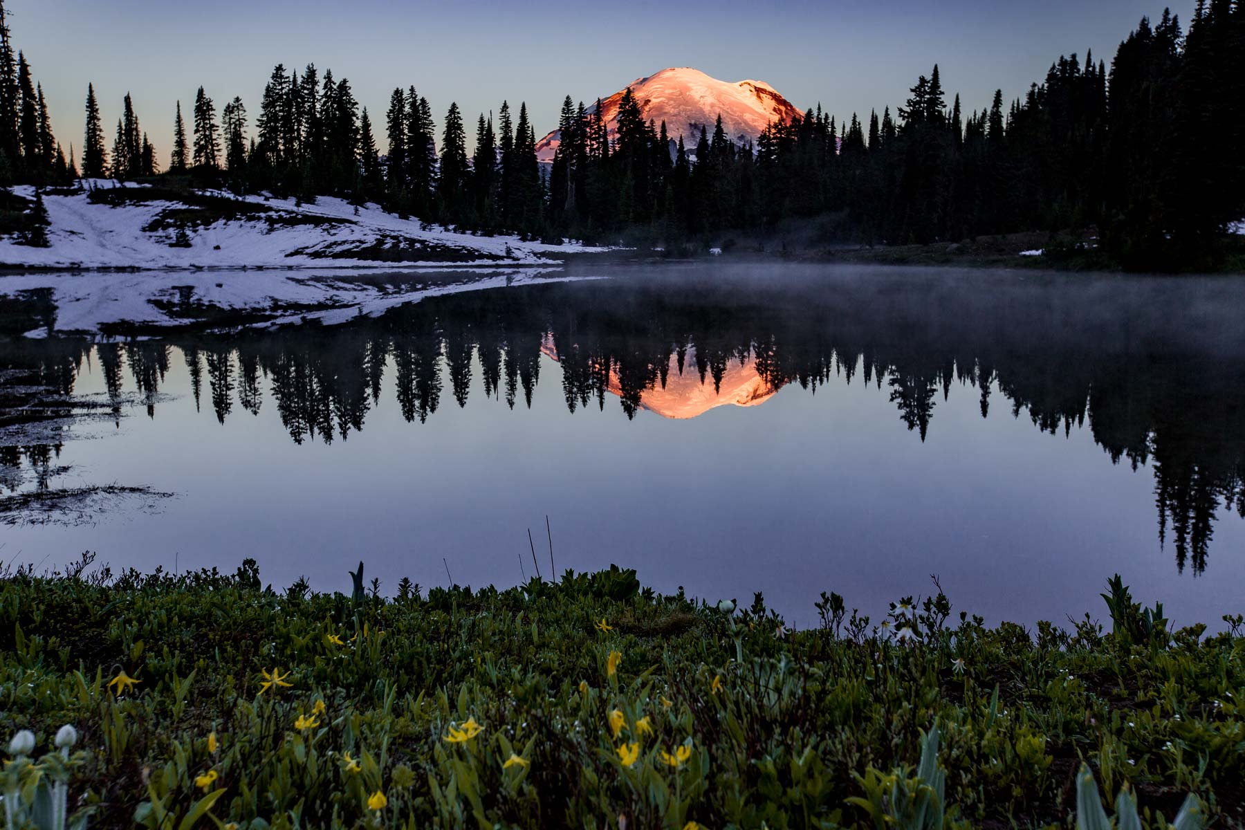
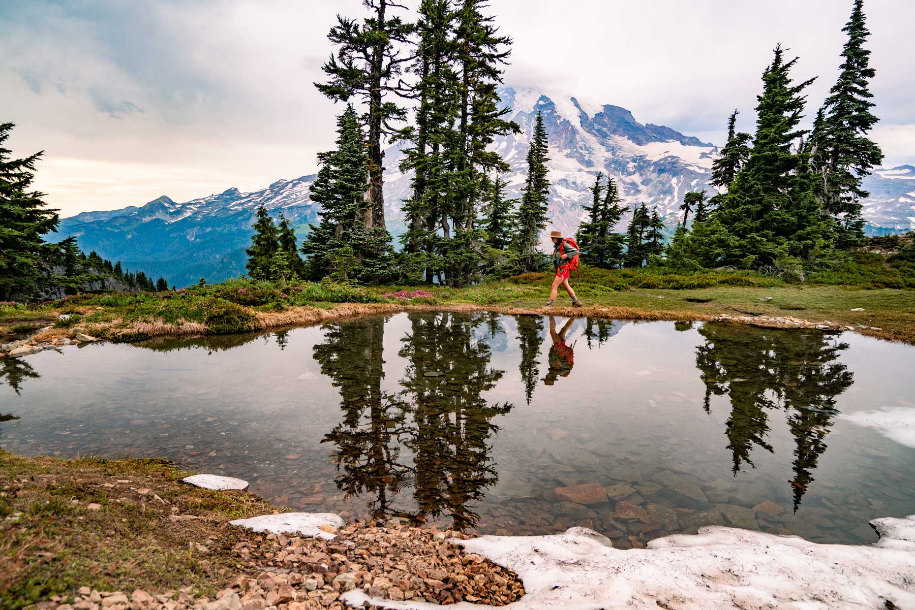
If you’re looking for easy Mt Rainier hikes then add the Tipsoo Lake Loop Trail to your list! I prefer to do this hike around sunrise when the mountain lights up and its reflection can be seen from the far side of the lake. Any time of day is great to hike this trail though, even at night!
Tipsoo Lake is located at Cayuse Pass on the Sunrise / Ohanepecosh side (east) of Mount Rainier National Park. The lake can be easily accessed by car but is only open seasonally from late May to mid-October.
Hiking the Tipsoo Lake Trail is a breeze as it’s less than a mile long with minimal elevation gain making it one of the easiest hikes at Mt Rainier.
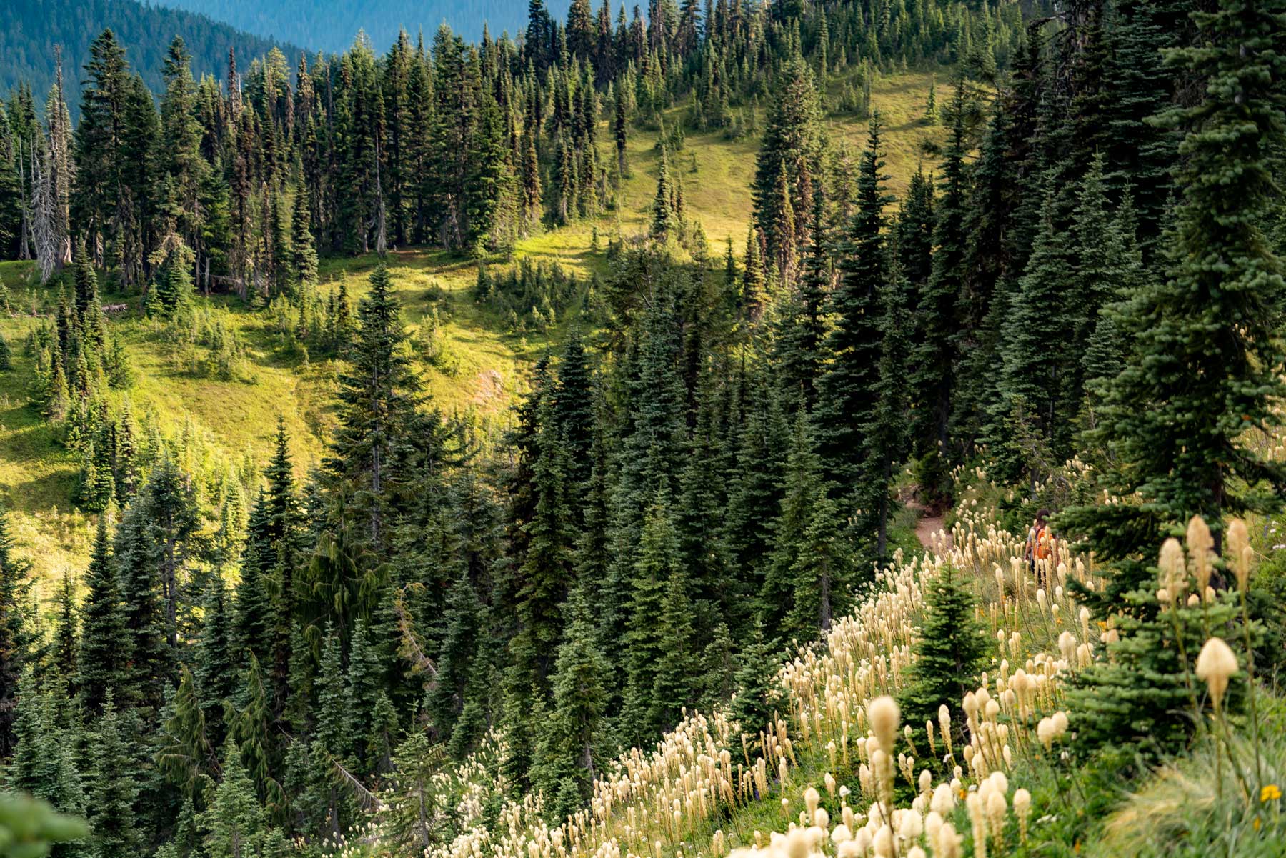
18. Spray Park Trail
Location: Mowich Lake / Carbon River
- Distance: 8 miles
- Difficulty: Challenging
- Elevation: 1700 feet
- Time Required: 4 – 6 hours
Hiking the Spray Park Trail at Mt Rainier
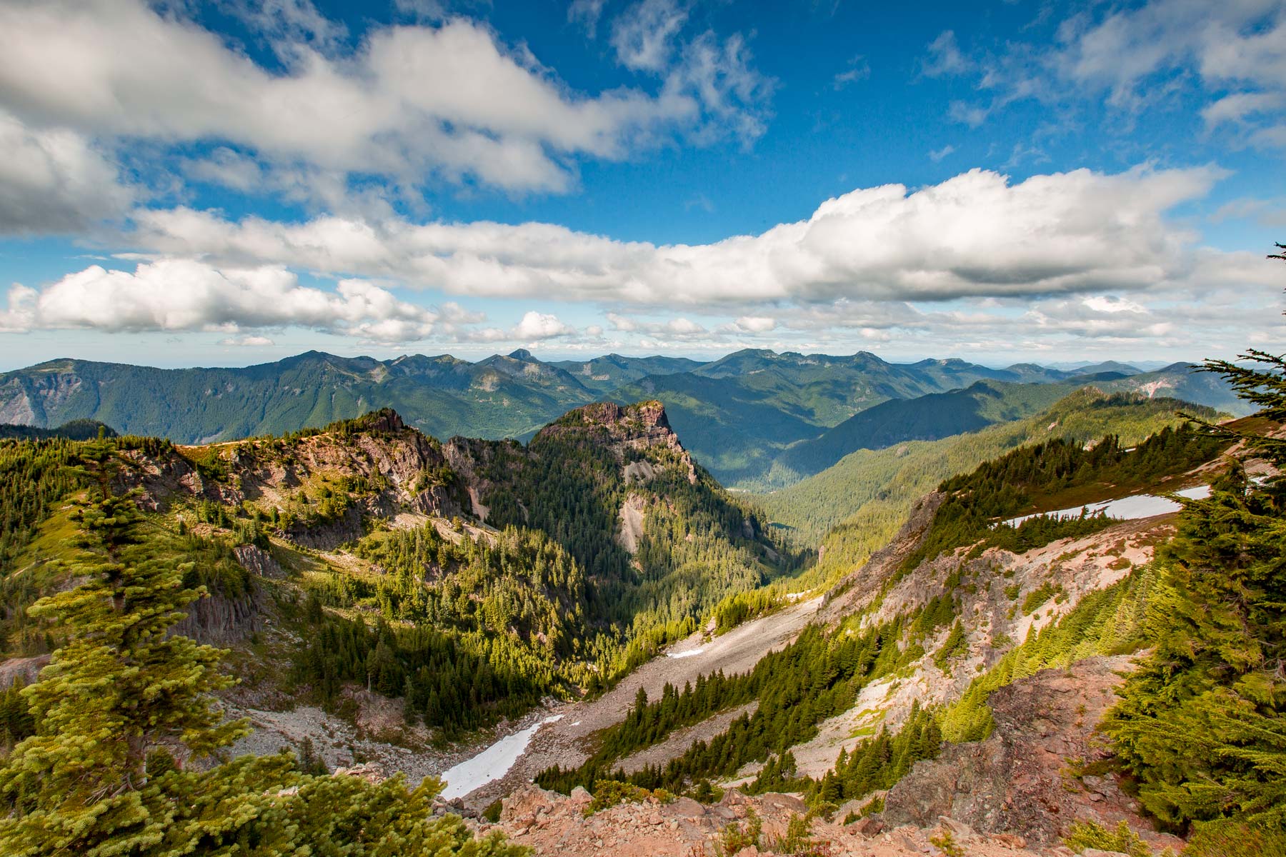
If you’re looking for a challenging Mt Rainier hike with lots of solitude and a decent possibility of encountering black bears, Spray Park is just the trail for you. Spray Park is one of the most scenic and lesser traveled hikes at Mount Rainier.
The reason for this is that getting to the Spray Park Trailhead is a bit tedious, requiring an hour long (15 mile) drive down a fairly rough gravel road that is completely disconnected from the more popular Paradise & Sunrise areas of the park. While you can do this with a regular 2WD drive vehicle (I’ve done it in a prius several times) drives should use caution.
Once you’re at the the trailhead (located in the Mowich Lake Campground next to the third bathroom) the trail is fairly straightforward following the Wonderland Trail for the first few tenths of a mile before connecting onto the Spray Park Trail.
After about two miles you’ll hit your first set of switchbacks where you could detour to Spray Falls or continue on to Spray Park. At the top of the switchbacks is where the views start to get great.
17. Reflection Lakes to Narada Falls Trail
Location: Paradise
- Distance: 3.6 miles
- Difficulty: Easy to Moderate
- Elevation: 931 feet (down)
- Time Required:
Hiking Narada Falls Trail to Reflection Lakes at Mt Rainier
For this Mt Rainier Hike, depending on the time of year you hike this trail you’ll either be starting at Narada Falls (winter) or Reflection Lakes (summer). The reason for this is that during the winter the Reflection Lakes road is closed so you’ll have to strap on the snowshoes and start from Narada Falls.
During summer, the easiest (and most enjoyable way to hike the trail) is starting at Reflection Lakes and hiking down to Narada Falls. The trick is you’ll need someone to pick you up at the Narada Falls parking lot or else have to walk back up to Reflection Lakes. The hike is 1.8 miles each way.
16. Trail of the Shadows
Location: Longmire
- Distance: .75 miles
- Difficulty: Easy
- Elevation: Minimal
- Time Required: 20 minutes
Hiking Trail of the Shadows Trail at Mount Rainier
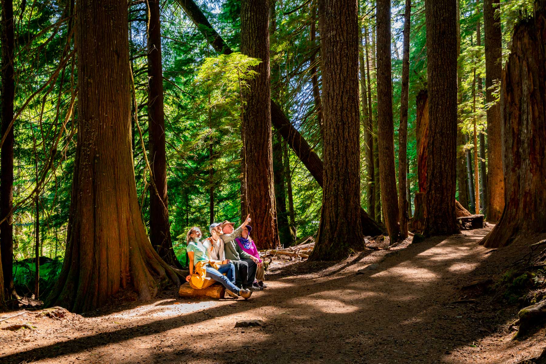
The Trail of the Shadows is a great, family friendly hike located at the lower elevations of Longmire. It is one of the best easy hikes at Mt Rainier. Here you’ll find minimal elevation gain along with old and massive trees. Shade is your friend along this hike courtesy of the old-growth forest the trails weaves through.
At just .75 miles long Trail of Shadows is an easy hike for folks of all ages. You’ll find the trailhead just across the street from the National Park Inn. From here it couldn’t be easier – just follow the trail around the meadow until you reach the starting point.
Along the way you might notice a small bubbling pool just off the trail in the meadow. This is actually a thermal work caused by the active volcano! Don’t step in or around it as it’s a treasured part of the park.
Top 15 Best Hikes Mt Rainier
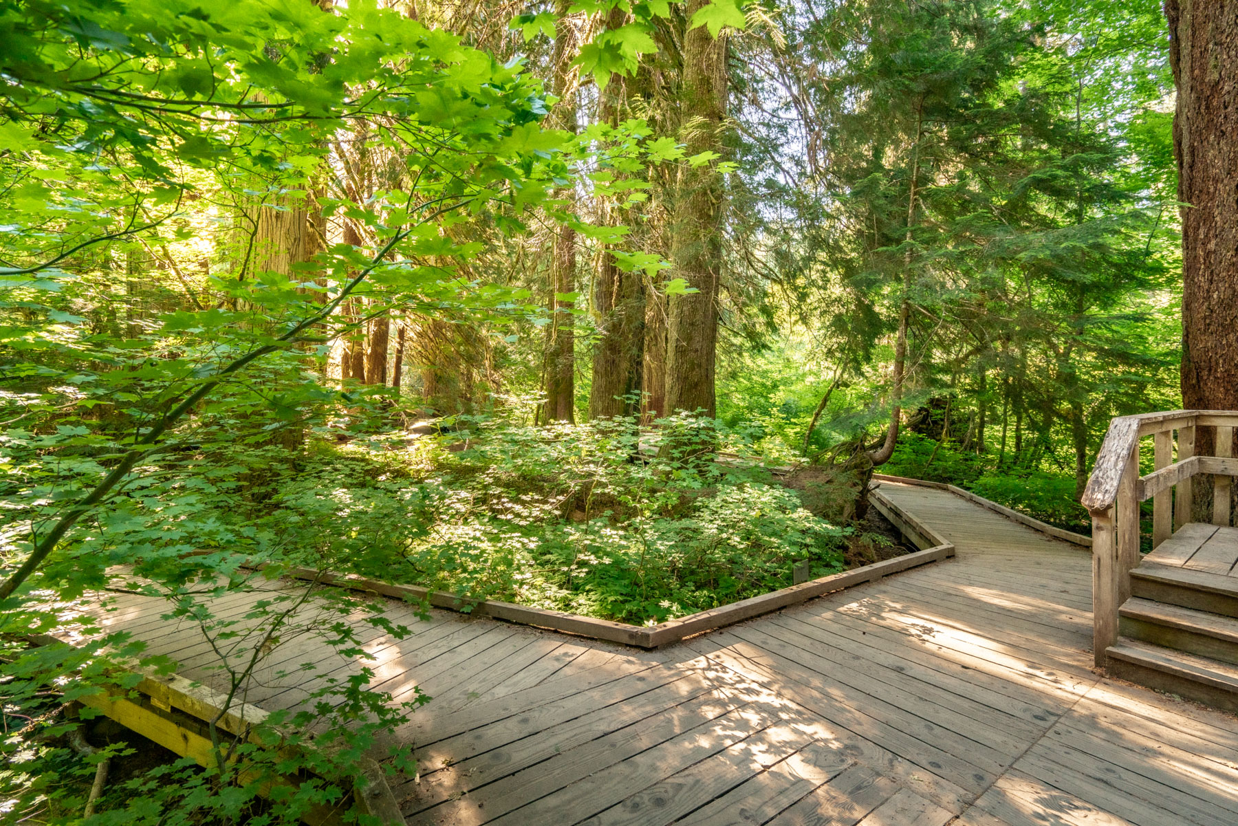
15. Grove of the Patriarchs Trail
Location: Ohanepecosh
- Distance: 1.5 miles
- Difficulty: Easy
- Elevation: Minimal
- Time Required: 30 – 45 minutes
Hiking the Grove of the Patriarchs Trail at Mt Rainier
If you’re looking for an easy, kid-friendly hike, add Grove of the Patriarchs to your list of hikes to do at Mount Rainier. At 1.5 miles long, practically no elevation gain, and full of fun boardwalks and enormous trees, Grove of the Patriarchs is a wonderful stroll in the park for folks of all ages.
In this magical grove you’ll find massive, hundreds of years old, Douglas-fir, silver fir, hemlock, and Western red cedars. The temperature in the grove is typically many degrees warmer than what you’ll find in the higher elevation sections of Mount Rainer.
Note: As of the writing of this article the Grove of the Patriarchs Trail is currently closed due to damage done to the suspension bridge during a recent flooding event. Check the Rainier NPS website for updates.
14. Bench & Snow Lakes Trail
Location: Paradise
- Distance: 2.5 miles
- Difficulty: Moderate
- Elevation: 600 feet
- Time Required: 2 hours
Hiking the Bench & Snow Lakes Trail at Mount Rainier
The Bench & Snow Lakes hike is a popular one located at the Paradise area of Mount Rainier. This trail differs from most others on this list as the main feature is not the views of the mountain but rather the solace of two peaceful alpine lakes.
Getting to the trailhead is easy though as it’s located just 3 minutes down Stevens Canyon Road from Reflection Lakes and the Pinnacle Peak Trailhead. The trail is a bit deceiving as you actually descend prior to ascending to the lakes. At about the .75 mile mark you’ll reach a short turnoff for Bench Lake.
The views looking across Bench Lake toward Mount Rainier are pretty great with nice reflections similar if not better than what you’ll find at Reflection Lakes.
Just a bit further up the trail you’ll find the junction for Snow Lake which features deep waters with fish and a couple of backcountry camps for those lucky enough to obtain a permit.
13. Nisqually Vista Trail
Location: Paradise
- Distance: 1.1 miles
- Difficulty: Easy
- Elevation: 180 feet
- Time Required: 30 minutes
Nisqually Vista Trail Hike at Mt Rainier
The Nisqually Vista trail is one of the several trails which originate from the Henry M. Jackson Visitor Center area of Paradise Mt Rainier. At just 1.1 miles long with only 180 feet of elevation gain and totally paved, it’s the easiest of the Mount Rainier Paradise Hikes.
In summer, the wildflowers on this trail are spectacular with marmots playing in the meadow in the middle of the loop. During winter you can still pop on the snowshoes and go for a stroll here as well with totally different scenery.
Nisqually Vista is a great trail for families with strollers and folks with limited mobility.
12. Shriner Peak Trail
Location: Ohanepecosh
- Distance: 8.5 miles
- Difficulty: Challenging
- Elevation: 3434 feet
- Time Required: 4 – 6 hours
Hiking Shriner Peak Trail at Mt Rainier
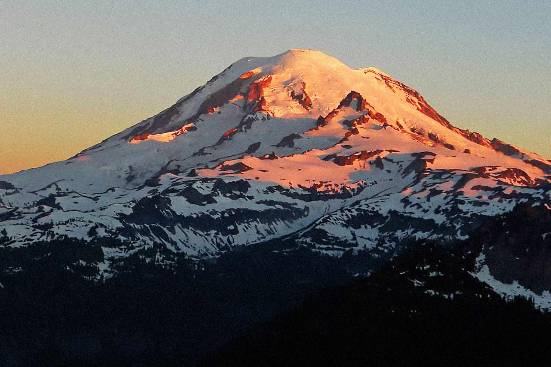
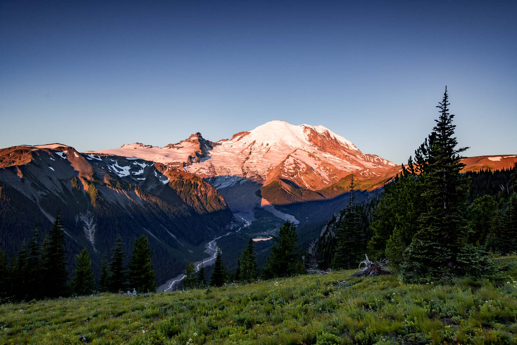
Shriner Peak is one of the more challenging hikes in Mount Rainier National Park featuring 8.5 miles of pretty strenuous hiking, climbing more than 3400 feet. For those in for a good hike, the rewards are great. The views from the top are among the best in the park providing a singular of view of Mount Rainier.
Early in the morning around sunrise is the best time to hike this trail to give yourself enough time and enjoy the cooler parts of the day.
The first .75 miles of the trail are fairly well shaded amongst massive cedars and firs. From there the trail continues to ascend through and older burn area leaving hikers exposed to the sun. After this you’ll find a section of switchbacks that lead to the ridgeline.
Looking back from the way you ascended on the hike you can see Mount Rainier and depending on the time of year either snow, spectacular wildflower meadows, or brilliant fall color – all of which provide pretty remarkable foreground.
From here it’s another 1.75 miles or so to the peak itself. Along the way you’ll catch views of Shriner Lake down below.
11. Naches Peak Loop Trail
Location: Cayuse Pass
- Distance: 3.2 miles
- Difficulty: Moderate
- Elevation: 600 feet
- Time Required: 1.5 – 2 hours
Naches Peak Loop Trail Hike at Mt Rainier
This is a fun little Mt Rainier hike that combines a few trails to make for an interesting loop with lots of different views. Along the way you’ll be popping onto the Tipsoo Lake Loop Trail and Pacific Crest Trail.
For starters, I recommend doing this trail clockwise so you’re looking toward Mount Rainier instead of away from it for all of the best views.
The hike starts down near Tipsoo Lake and then climbs fairly steeply up toward Naches Peak. Depending on the time of year you’ll either be treated to snow (I don’t recommend hiking this in the snow), stunning wildflower meadows, or beautiful fall colors.
From here the trail passes by Dewey Lake and eventually reaches a crossroads with the PCT where you’ll want to steer to the right to head back into the national park (believe it or not you’ve actually left Mount Rainier National Park in the dust for Wenatchee National Forest at this point).
This is the most scenic part of the trail where you won’t be able to put your phone down or camera away especially if the wildflowers are in full bloom (late July / early August). From here it’s a short ways back down to the parking area.
Top 10 Best Mt Rainier National Park Hikes
10. Glacier Basin Trail & Emmons Moraine Trail
Location: Sunrise
- Distance: 4.1 miles
- Difficulty: Moderate
- Elevation: 931 feet
- Time Required: 2 hours
Hiking Glacier Basin Trail & Emmons Moraine Trail at Mt Rainier
The last time I hiked this trail it was at about 2am in an attempt to get some unique astro shots of Rainier. I went with a good friend, a bad headlamp, and a little liquid courage. While my views were largely determined by my night vision, the views achievable on this trail are quite singular and reminiscent of something you might see in Glacier National Park or North Cascades.
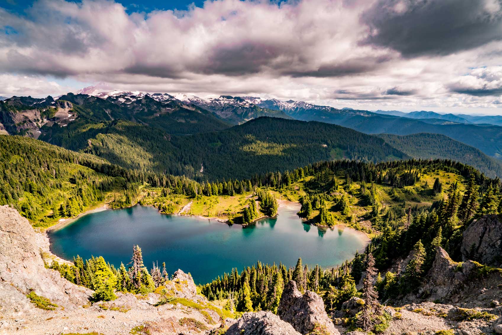
The highlight for a lot of folks on this hike is the turquoise water of Emmons Moraine which is quite striking and different from any of the other lakes in Mount Rainier National Park.
The trailhead is accessed via the White River Campground on the Sunrise side of the park. From here the trail is 2 miles each way with a cool log bridge crossing the Interfork (glacial runoff from the Inter glacier). A log bridge marks the the turnoff for the Emmons Moraine Trail from the Glacier Basin Trail.
If you skip the turnoff you’ll continue up toward a junction with the Burroughs Mountain Trail (on your right) and eventually Glacier Basin and The Wedge.
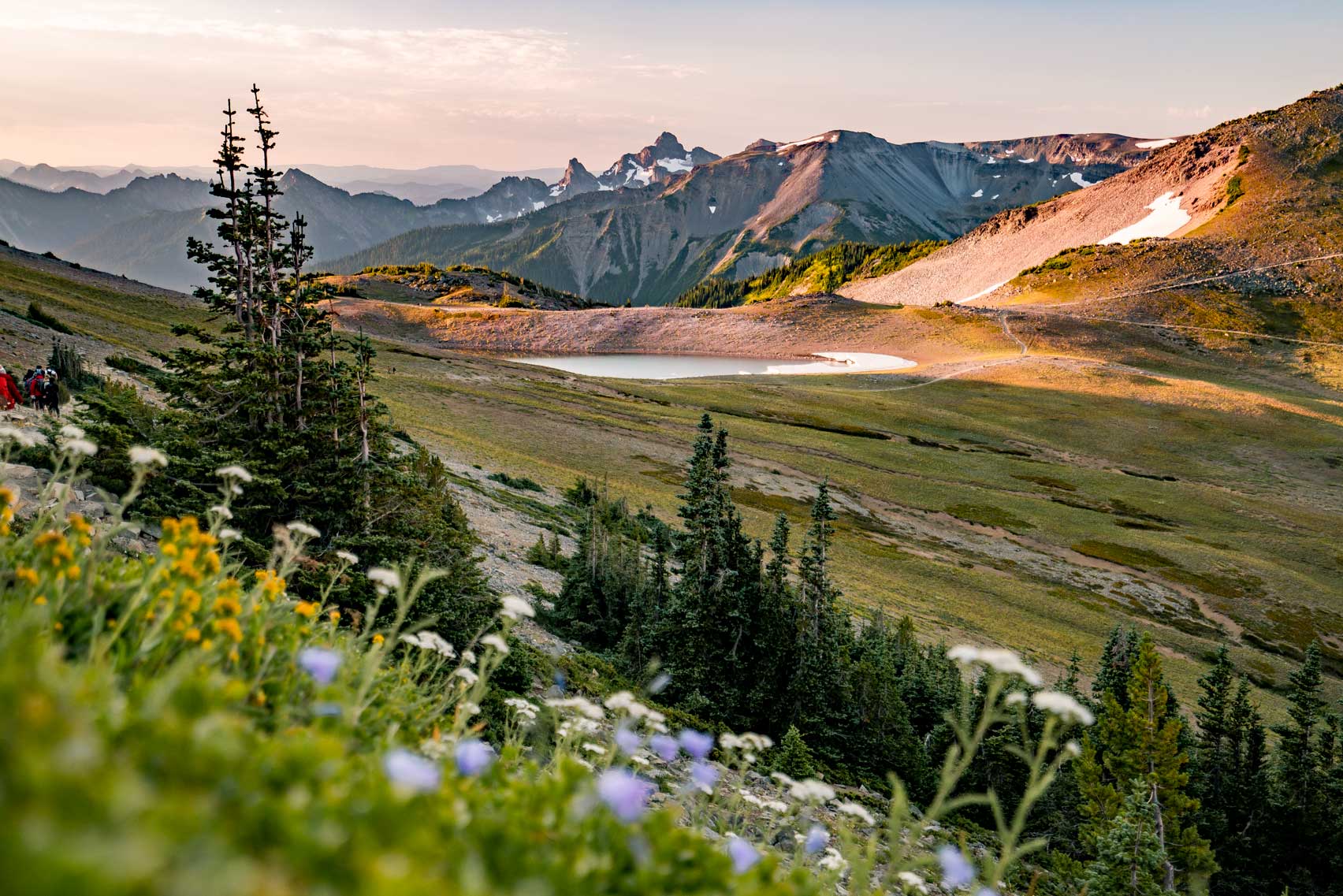
9. Sunrise Rim Trail
Location: Circles the Entire Park
- Distance: 5.5 miles
- Difficulty: Moderate
- Elevation: 1,100 feet
- Time Required: 3 – 4 hours
Hiking the Sunrise Rim Trail at Mt Rainier
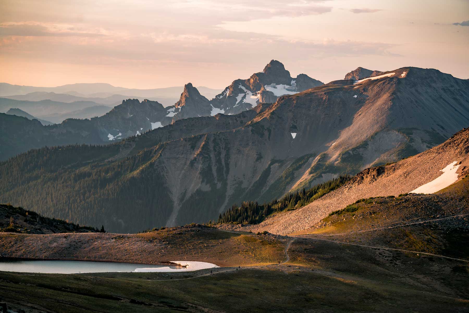
The Sunrise Rim hike is a great, lesser-traveled trail in the Sunrise region of Mount Rainier. Along the way you’ll see stunning views (recommend going clockwise) of Mount Rainier with the option of a short detour to Shadow Lake.
If you feel like heading back early then Shadow Lake is a great stopping point prior to scaling the Burroughs Mountain portion of the trail.
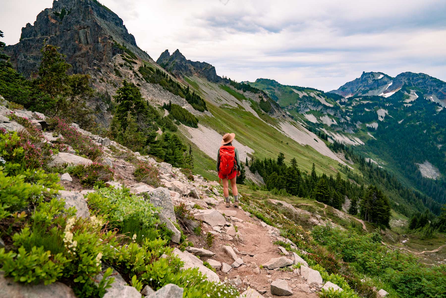
8. Alta Vista Trail
Location: Paradise
- Distance: 1.8 miles
- Difficulty: Moderate
- Elevation: 600 feet
- Time Required: 1.5 hours
Alta Vista Trail Hike at Mt Rainier
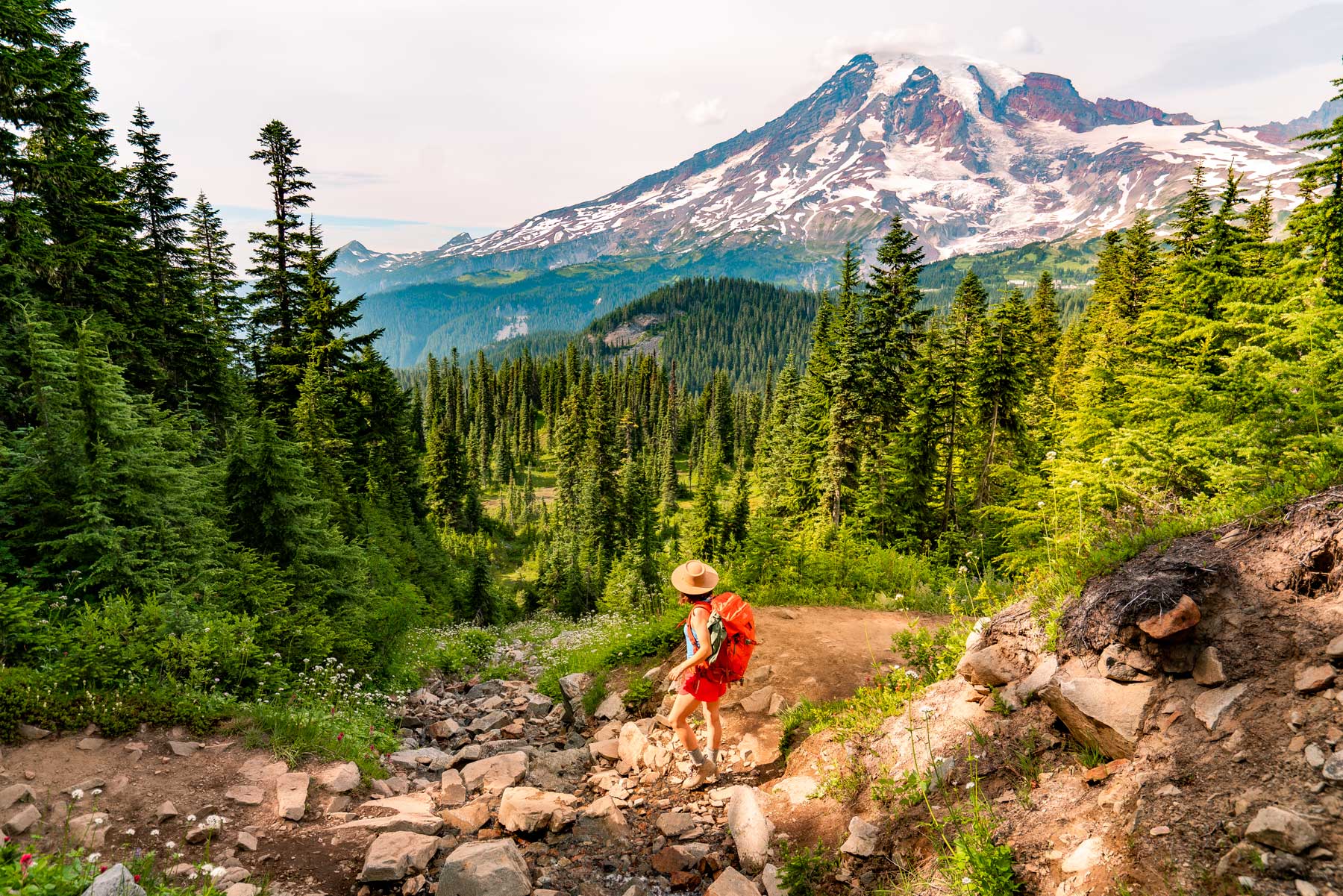
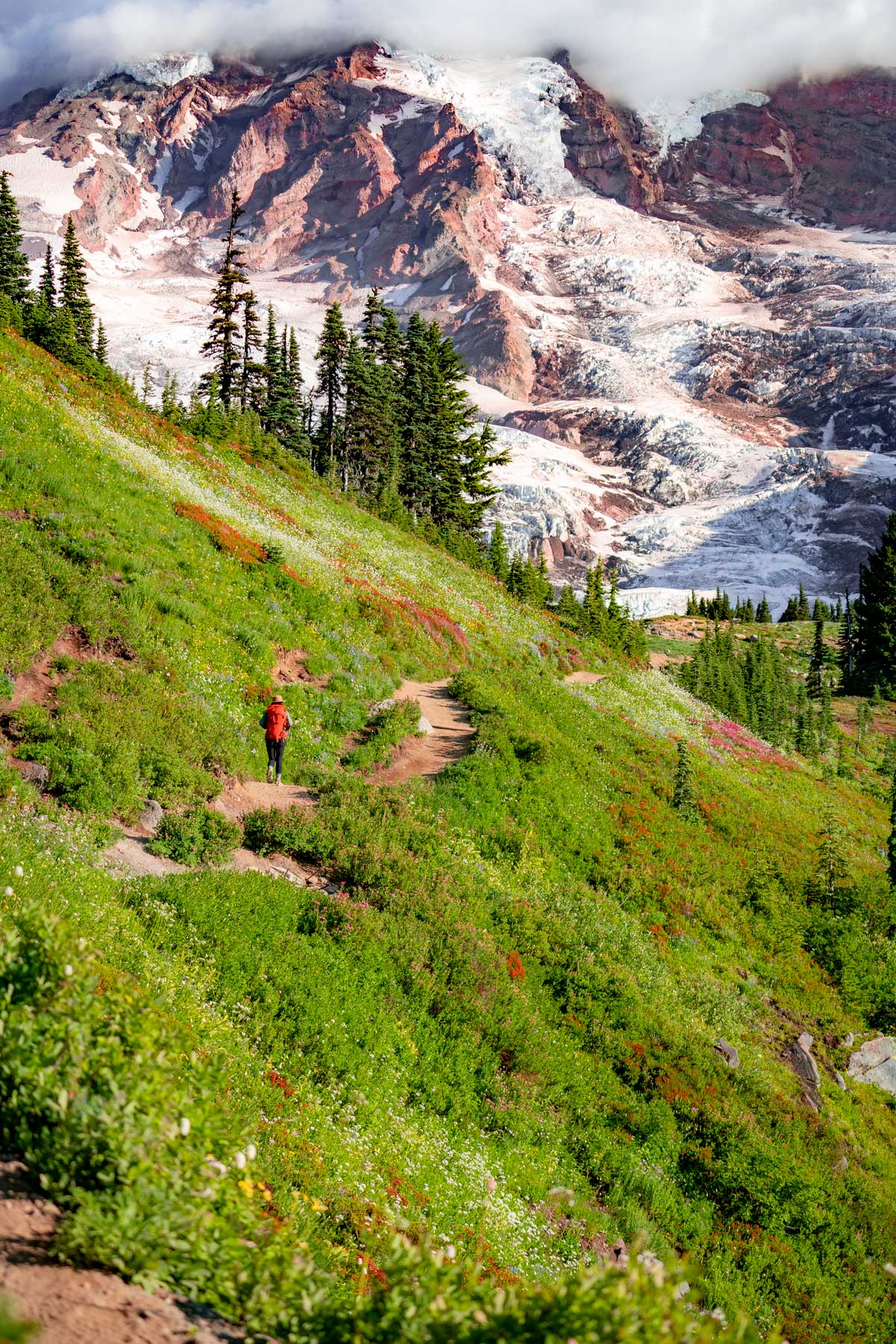
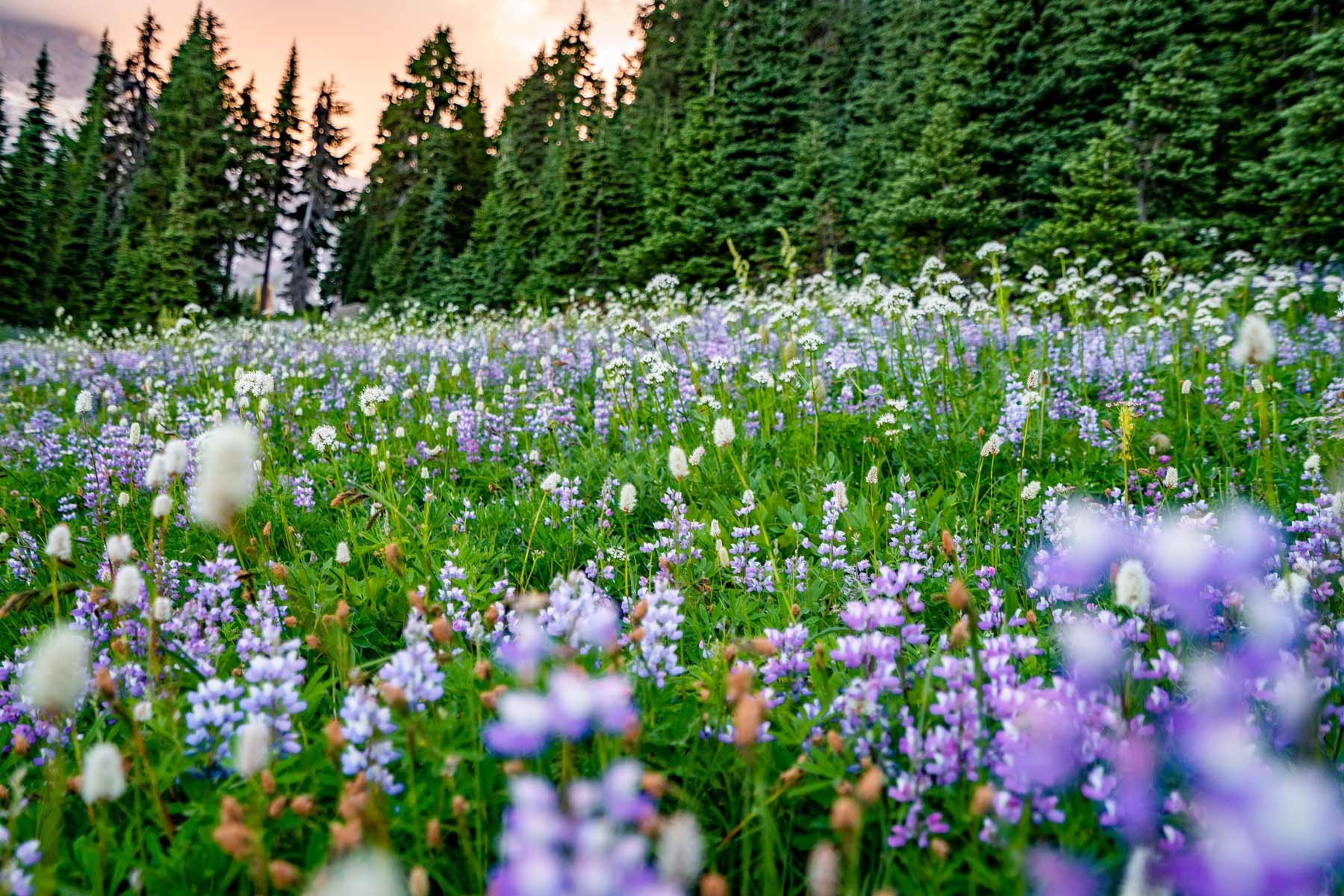
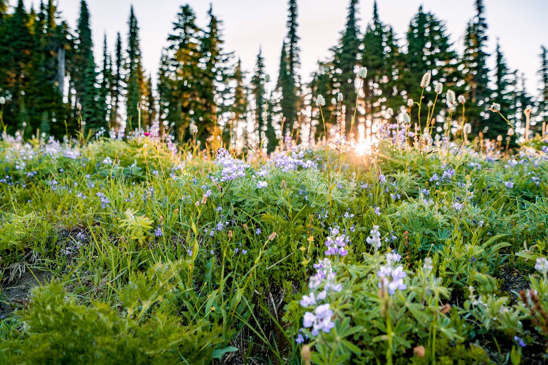
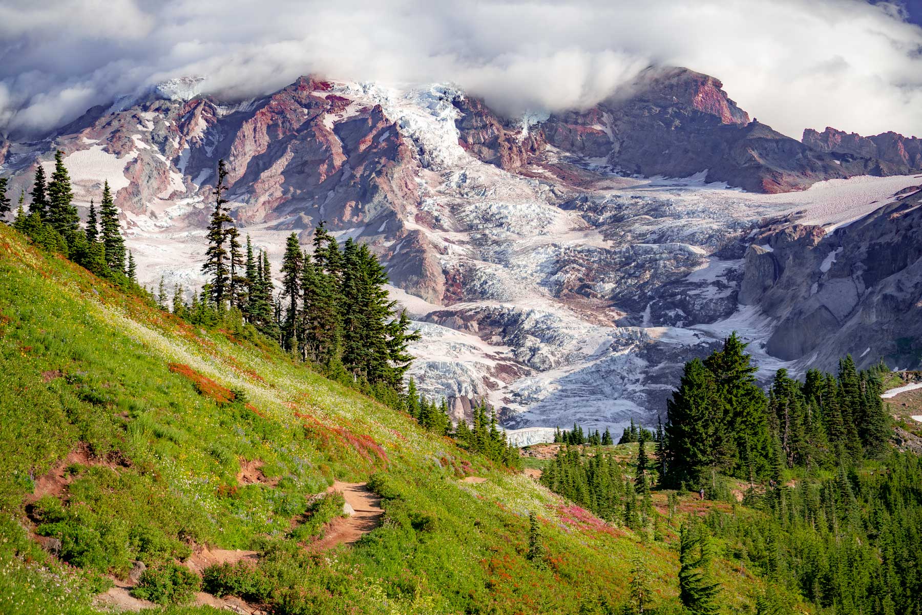
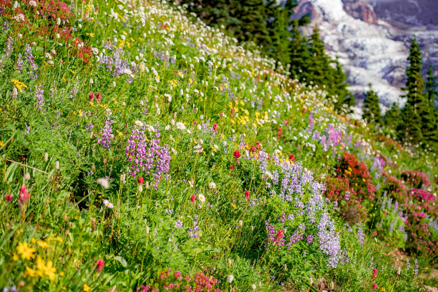
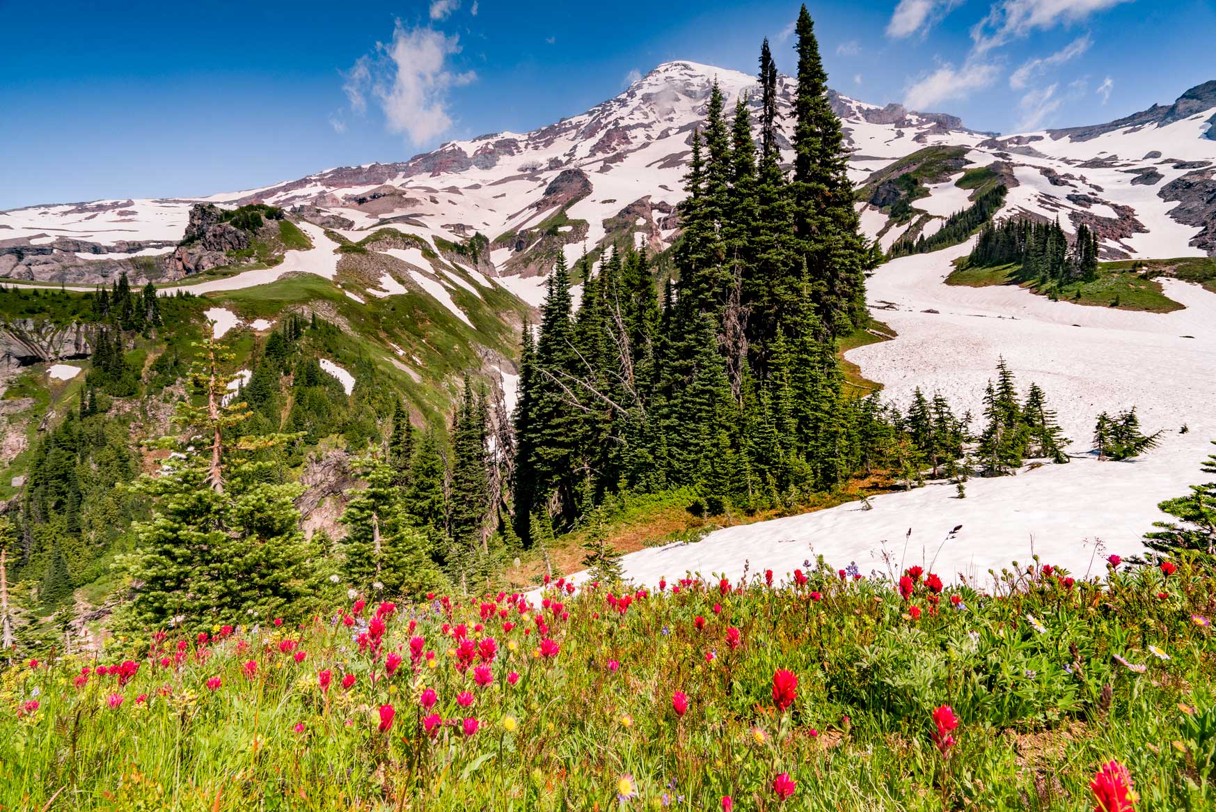
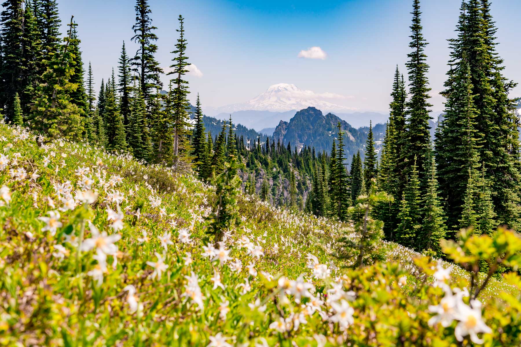
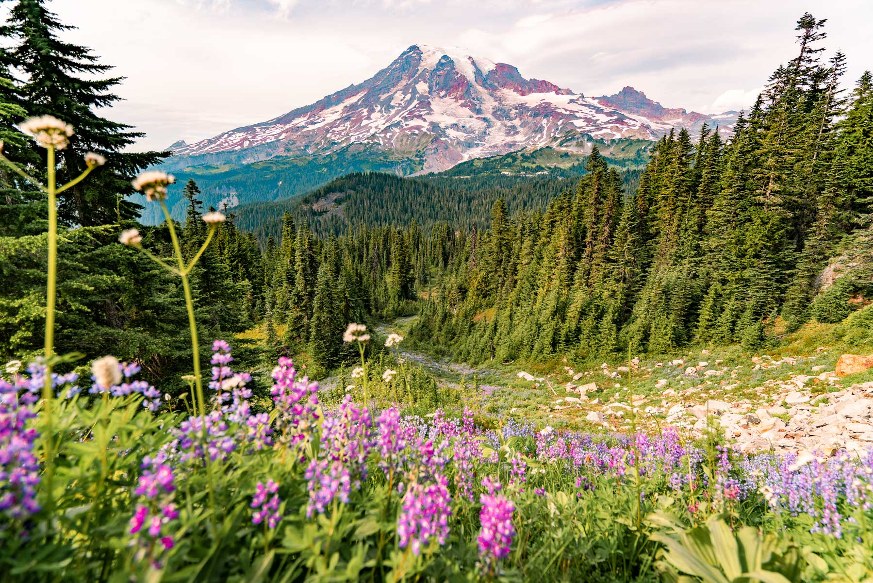
The Alta Vista Trail is one of the most visually stunning hikes at Mount Rainier National Park. The views you’ll get here are among the best and most easily accessed in the park. I finally hiked this trail during wildflower season for the first time in 2020 and was completely blown away by the kaleidoscopic array of wildflowers on hand here.
The Alta Vista Trail is a 1.8 mile lollipop loop trail with 600 feet of elevation gain that intersects the Skyline Trail in multiple places. It’s easier than the Skyline Trail but has excellent scenery including the famous Paradise wildflowers and marmots.
I recommend hiking up the Skyline Trail and back down the Alta Vista as a great loop that provides an array of views. This way you’ll be soaking in the beauty of the Tatoosh Range on the way back down the trail.
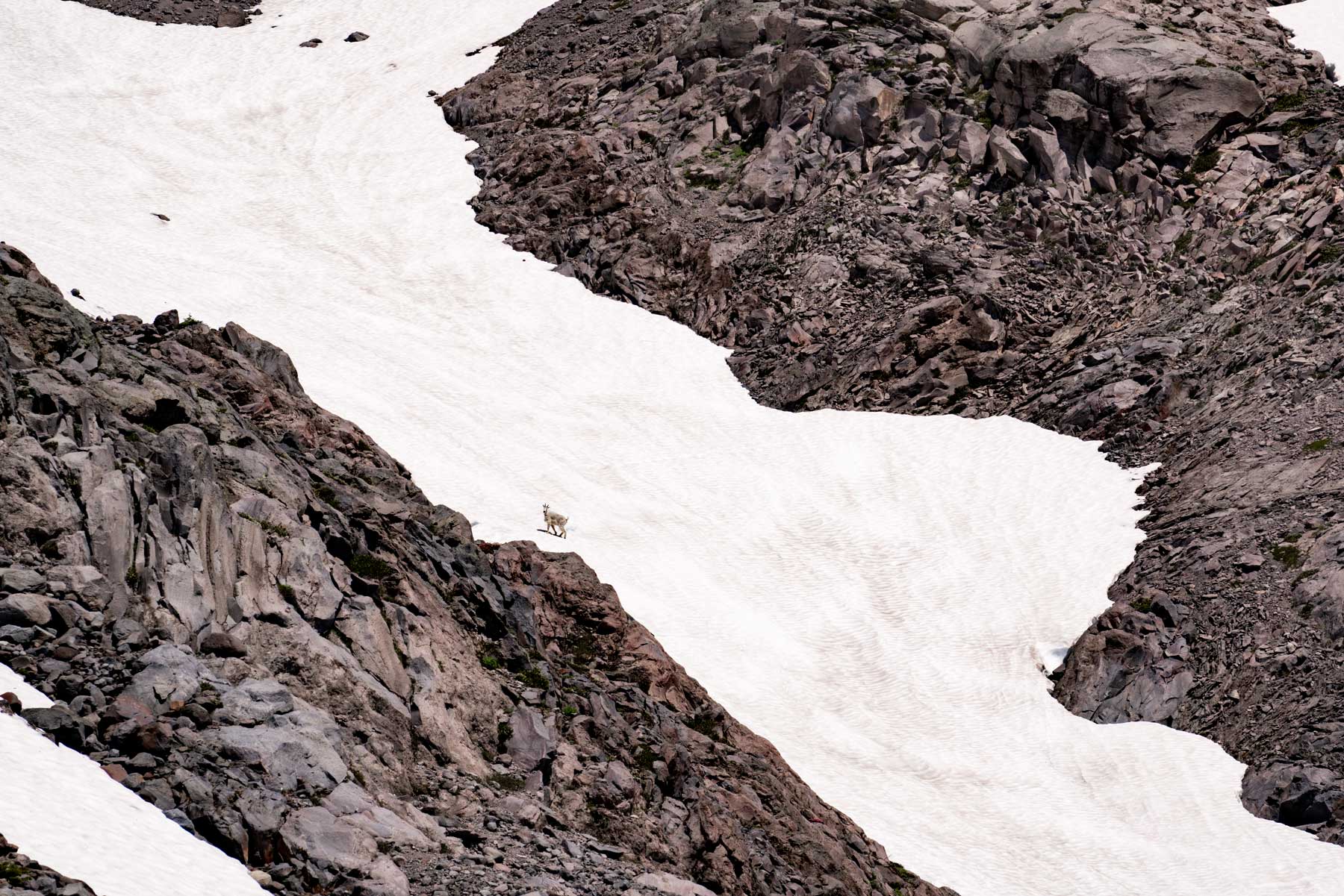
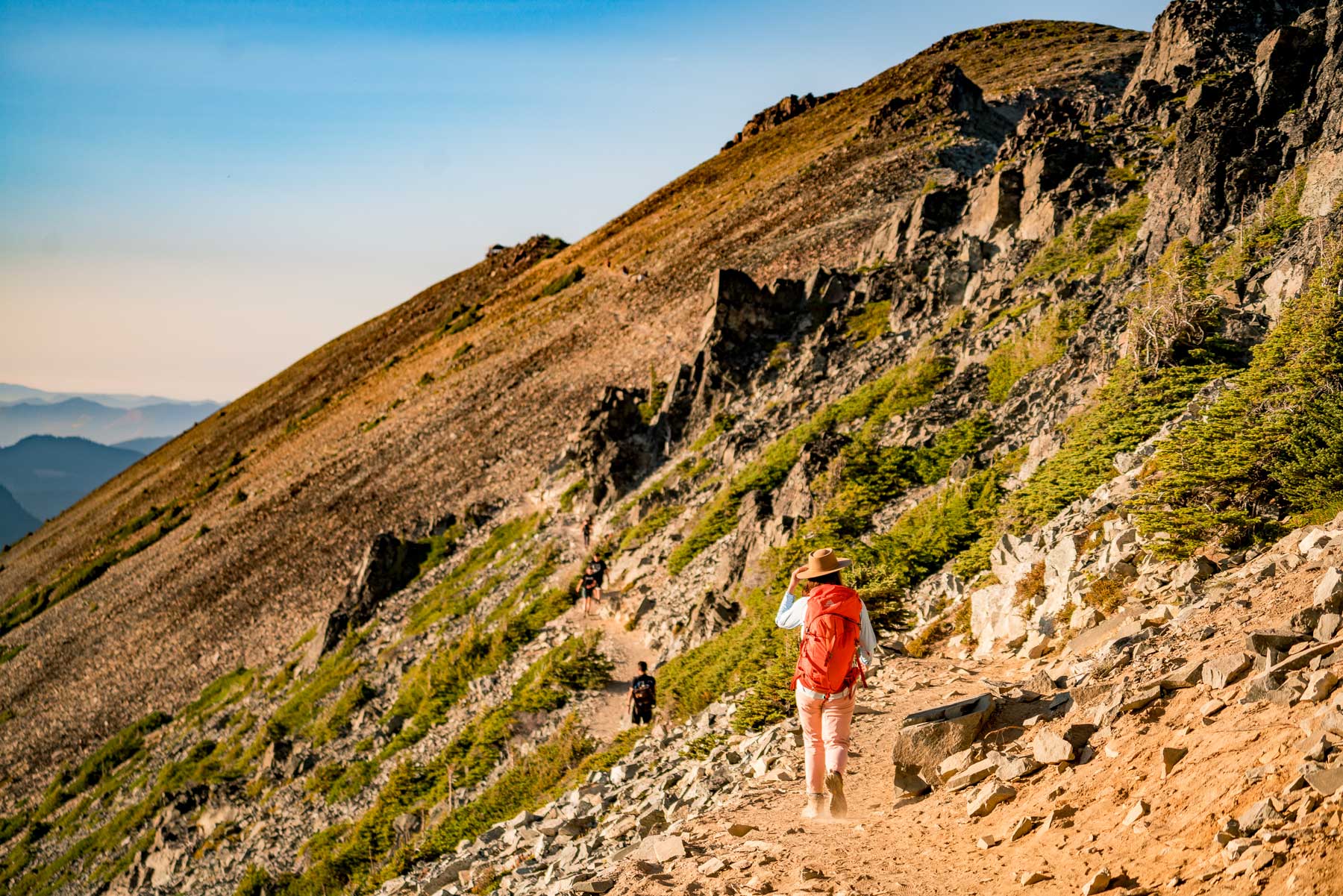
7. Burroughs Mountain Trail
Location: Sunrise
- Distance: 9 miles
- Difficulty: Challenging
- Elevation: 2500 feet
- Time Required: 5 – 6 hours
Hiking the Burroughs Mountain Trail at Mount Rainier
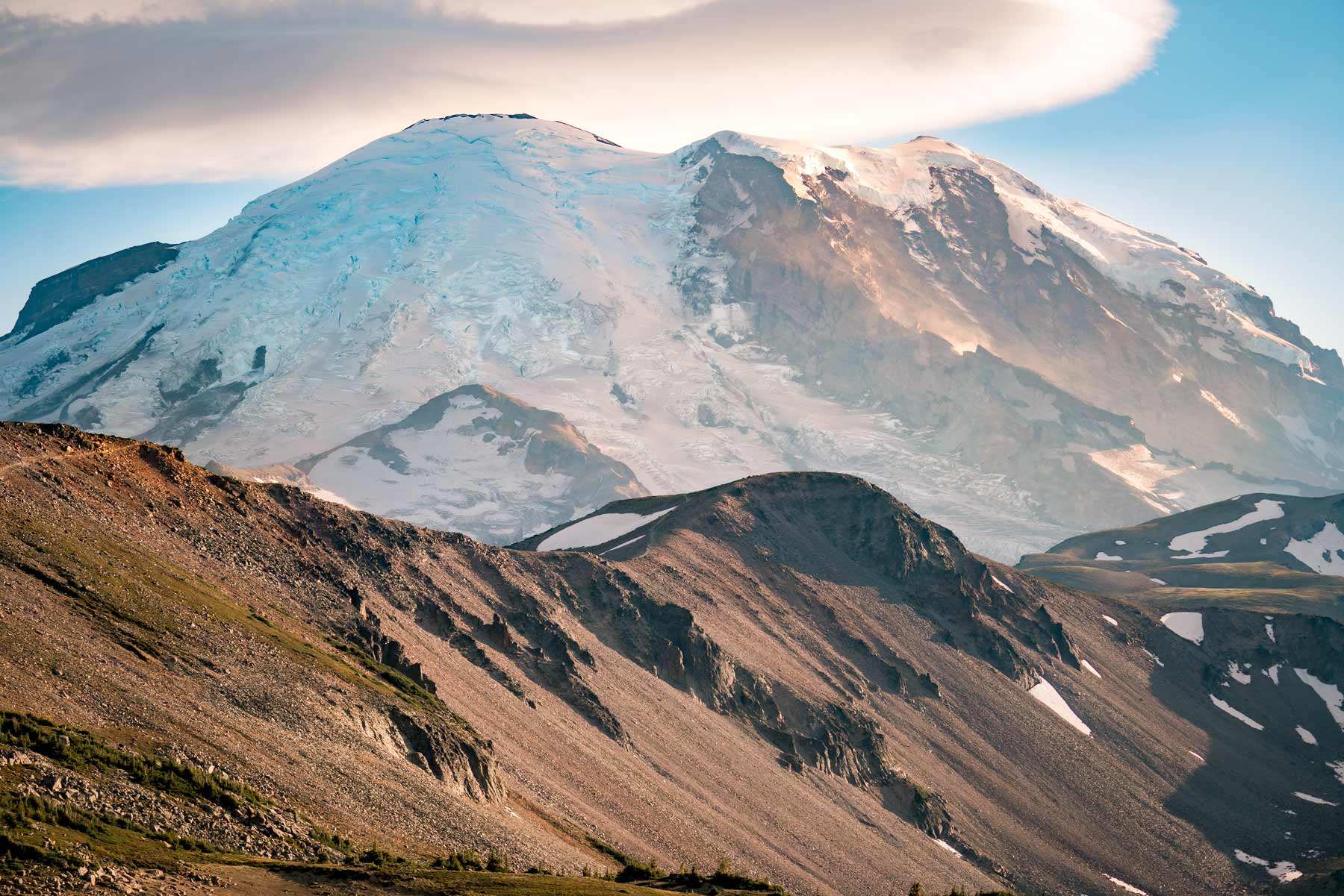
The Burroughs Mountain Trail is one of the most challenging and rewarding hikes at Mt Rainier. At 9 miles long with over 2500 feet of elevation gain this trail is not to be taken lightly and is for folks prepared for a hardy hike.
The views on this hike are some of the best in all of Mount Rainier National Park and at times it feels like you’re heading up the peak of the mountain! Burroughs Mountain is a small nob next to Mount Rainier located on the Sunrise side of the park.
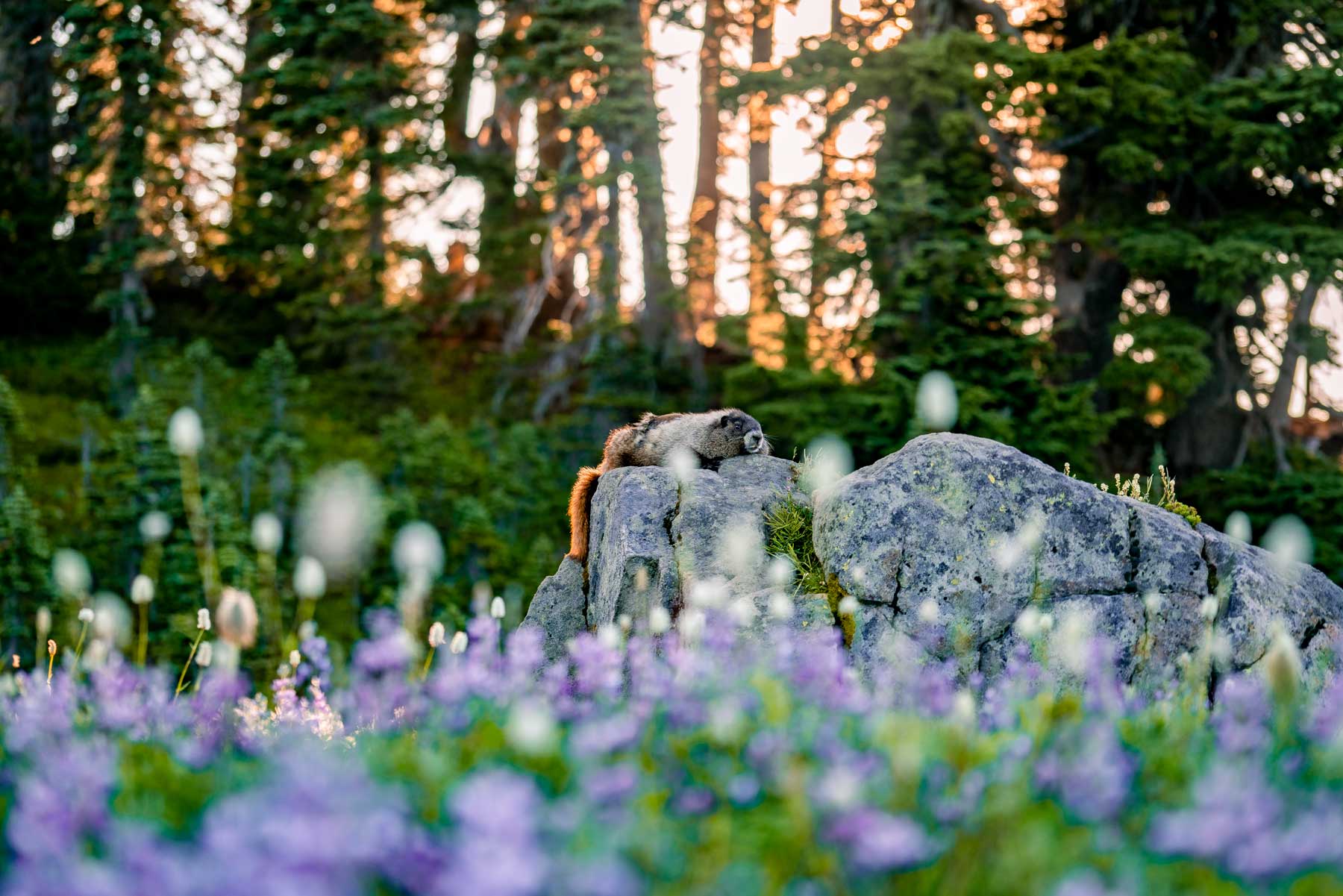
Expect to see some mountain goats on this epic Mount Rainier trail along with some marmots as well.
The trailhead for the Burroughs Mountain hike is located at the Sunrise parking lot and is easy to find.
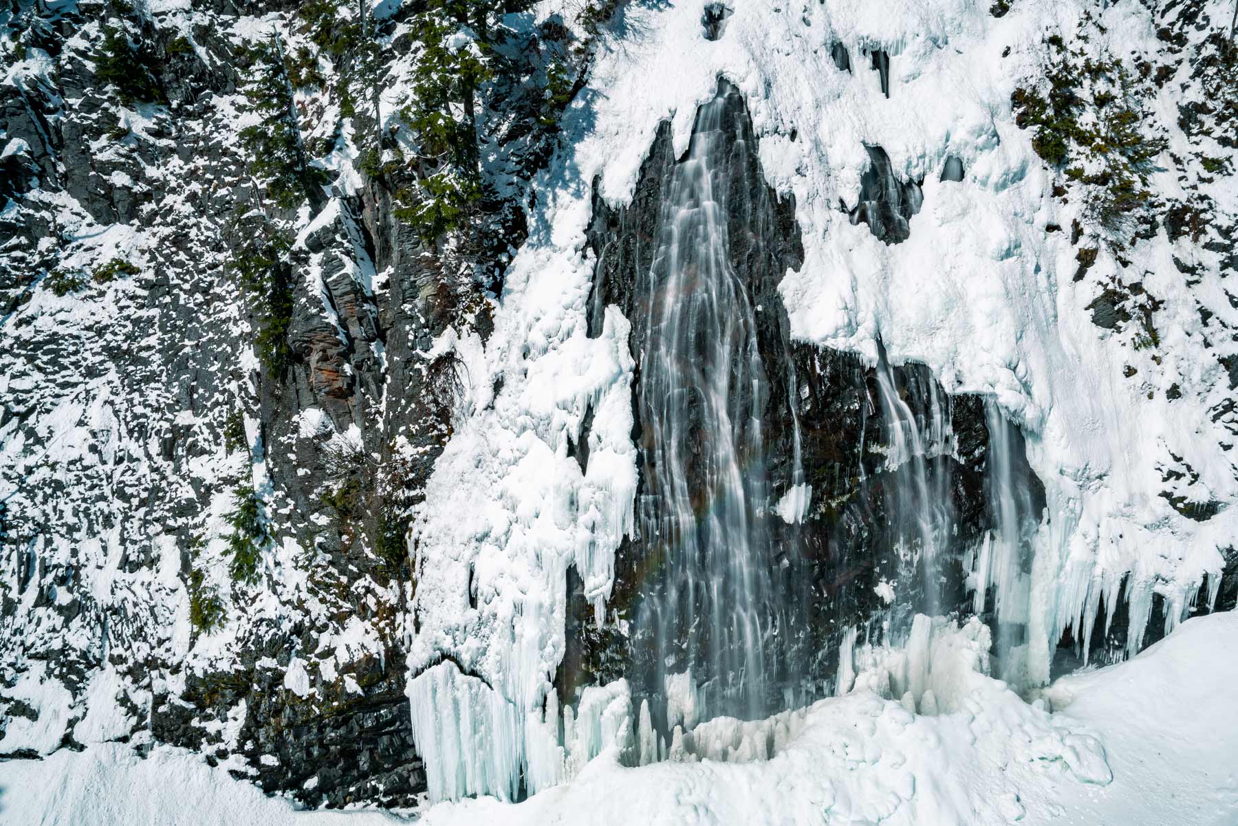
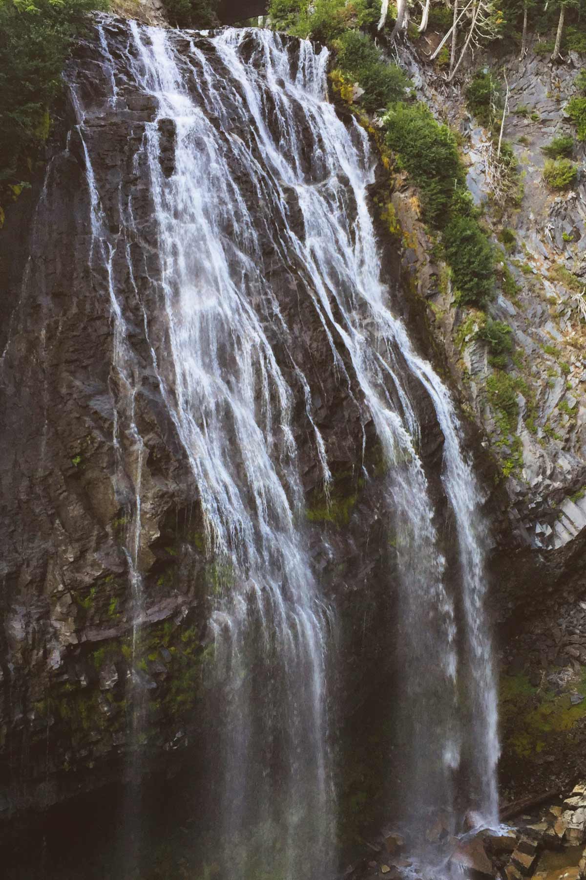
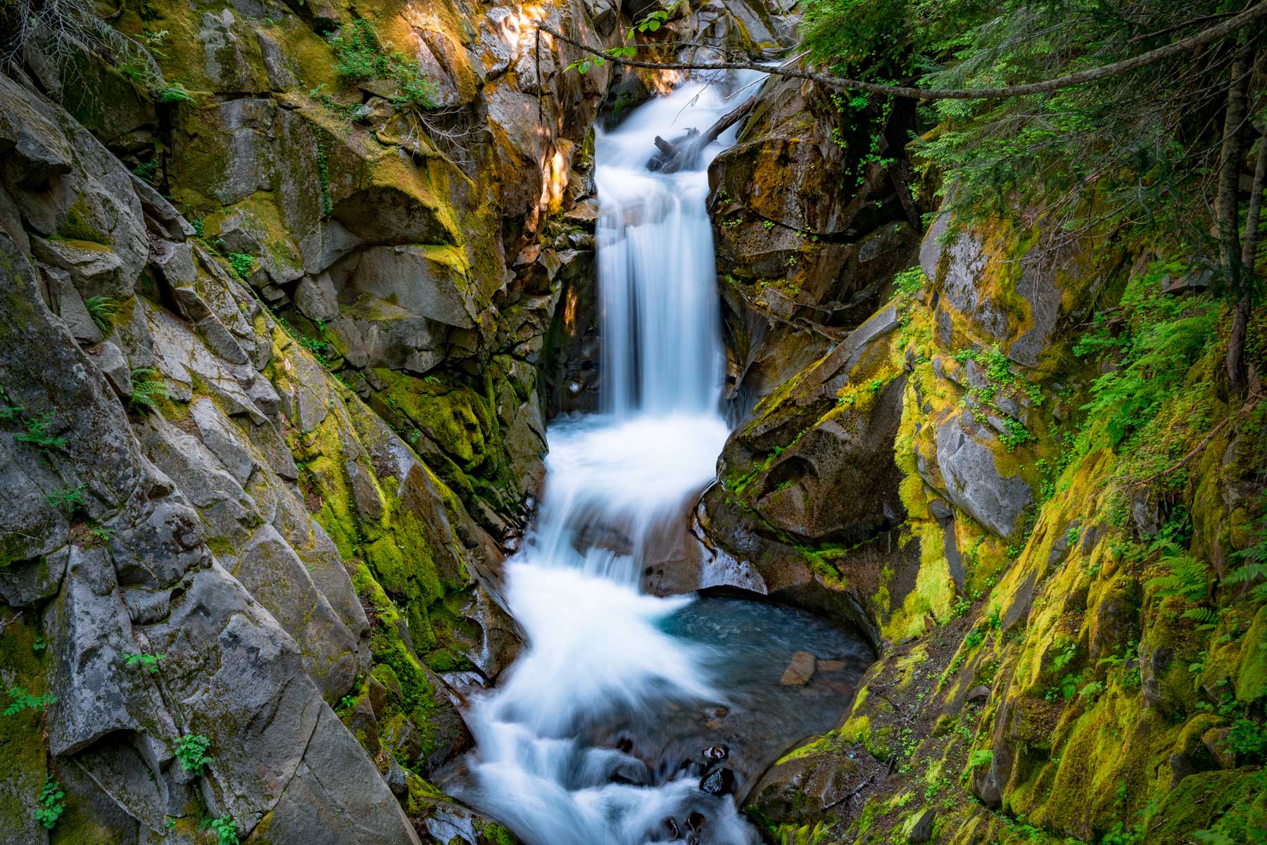
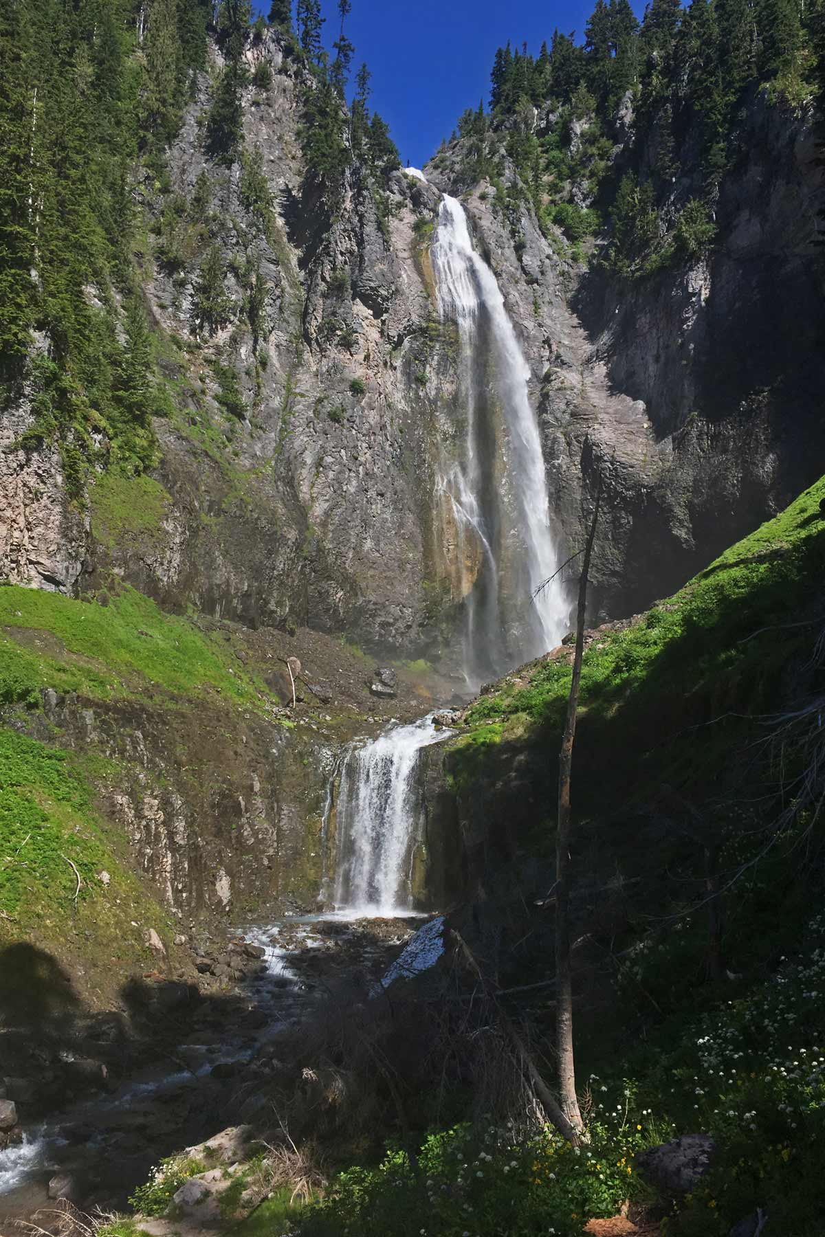
6. Van Trump Park & Comet Falls Trail
Location: Paradise
- Distance: 6 miles
- Difficulty: Challenging
- Elevation: 2150 feet
- Time Required: 4 hours
Hiking Van Trump Park & Comet Falls Trail at Mt Rainier
Hiking to Comet Falls & Van Trump Park is one of the more memorable Mt Rainier hikes in that you get to see the tallest waterfall in the park and epic up close mountain views (and maybe even a mountain goat or two!).
At 462 feet tall, Comet Falls is a sight to behold with two dazzling drops for visitors to gaze upon. The spray from the waterfall is usually intense so getting a good non-iPhone photo can be tricky! This is easily my favorite waterfall hike at Mt Rainier.
Starting from the parking lot you’ll ascend up the trail toward Comet Falls following Van Trump Creek. This is the most crowded section of the trail which sees quite a bit of traffic on regular days. Once you reach Comet Falls take a moment to soak it in and then continue up the set of switchbacks through the forest.
Here the crowds weed out substantially as most folks decide Comet Falls is a great turnaround point. Once you break through the forest the views really start becoming interesting. We noticed lots of goat fur on trees the last time we hiked this.
Eventually you’ll reach a sign that says “end of maintained trail”. We ventured a decent bit further and ended up running out of water so make sure you pack enough!
The views at the top are some of my favorite in all of Mount Rainier.
Top 5 Best Mt Rainier Hikes
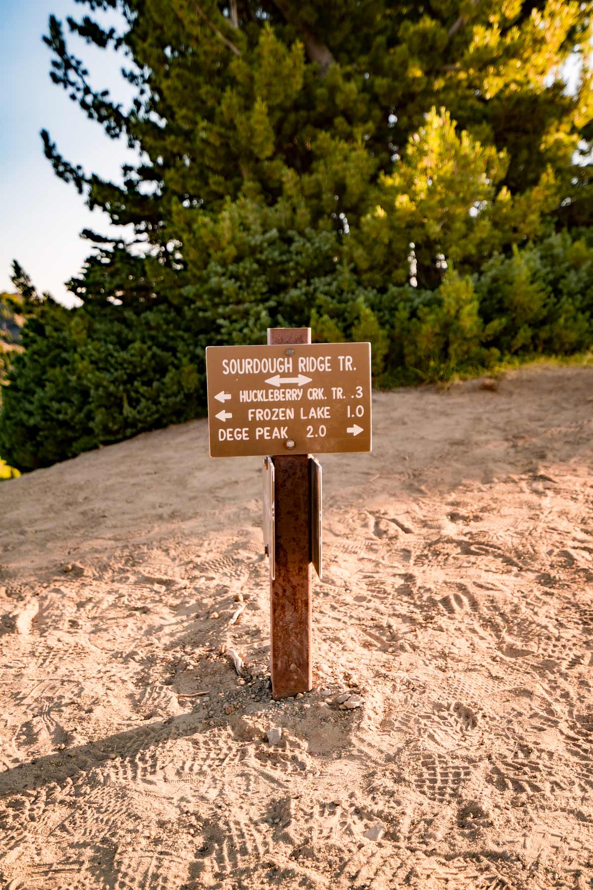
5. Sourdough Ridge Trail
Location: Sunrise
- Distance: 2.5 miles
- Difficulty: Easy – Moderate
- Elevation: 400 feet
- Time Required: 1.5 hours
Hiking the Sourdough Ridge Trail at Mt Rainier
The first time I saw the views from the Sourdough Ridge hike it was as a default screensaver of my smart TV. At the time I thought to myself that it must be quite difficult to get to such a stunning vantage of Mount Rainier. Turns out it’s not.
Starting at the Sunrise parking lot head up the trailhead and veer to the right. After about 10 minutes the views start to get really amazing. Pick a spot up here and snap away.
If you want to continue the trail it follows all the way down to the Sunrise Point Lookout to the east and Frozen Lake to the west. Some folks park at the Sunrise Lookout parking area and start their hike their as it’s a more logical out and back that way. The quickest way to the best views are from the Sunrise parking area, however.
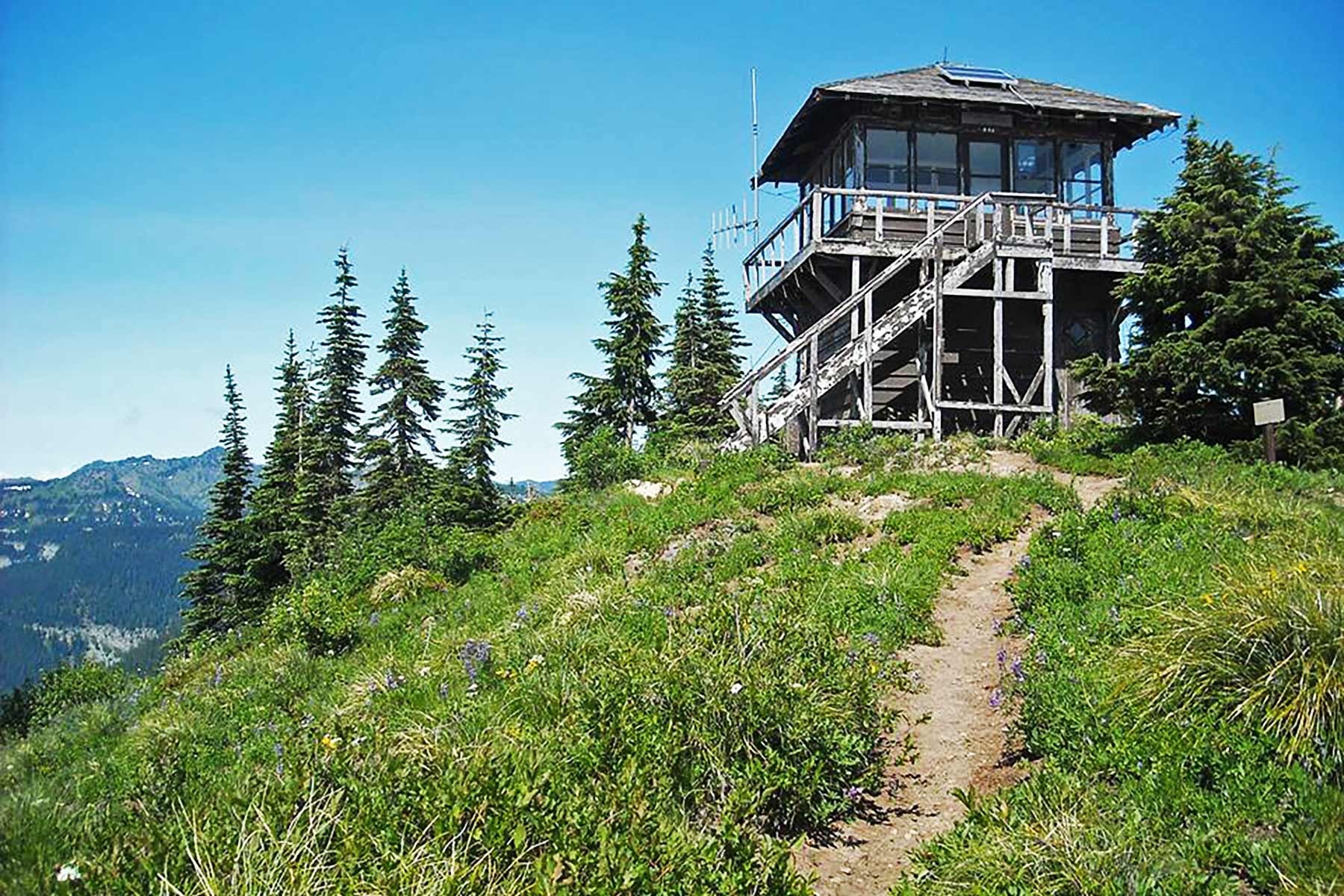
4. Tolmie Peak Trail
Location: Carbon River / Mowich Lake
- Distance: 5.6 miles (9km)
- Difficulty: Moderate
- Elevation: 1500 ft (470m)
- Time Required: 3 – 4 hours
Hiking Tolmie Peak Trail at Mt Rainier
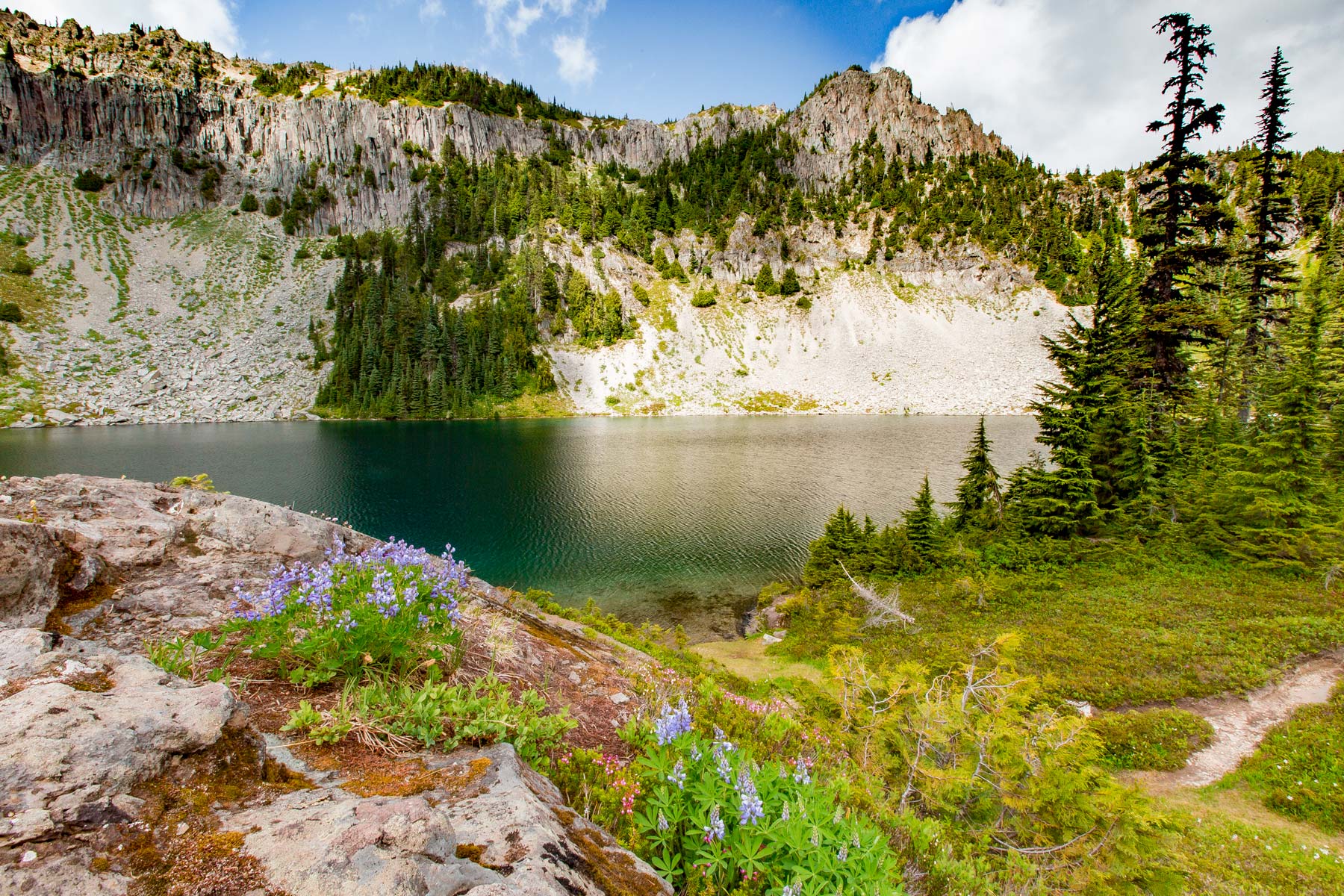
The views on a clear day from Tolmie Peak are said to be among the best in the park – some people say THE best. I wouldn’t know as the only time I’ve hiked this trail the mountain peak was hiding behind clouds. What a pity. The trail was still extremely scenic.
The only catch, and what a catch, were the mosquitoes. I’ve never experienced such horrendous and dreadful mosquitoes as what I encountered on this trail in July and I’ve been to Alaska. At one point at the lookout tower at the top of the trail I saw a man wearing some sort of strange dark colored cap over his head.
Then he brushed it and the “cap” flew off temporarily revealing his poor bare, bloodied scalp.
A good rule of thumb I’ve found for hiking in the mountains is if the bear grass is blooming the mosquitoes are hatching. Best to check instagram etc before you attempt the hike to see if this is the case.
If that doesn’t scare you off the Tolmie Peak Trail then you should know the trailhead is locate at the Mowich Lake parking area which gets awfully crowded in the summer so you might spend some time looking for a spot.
The trail starts at Mowich Lake and slowly begins to climb after you reach the far side. From there it climbs steadily up to Eunice Lake – that’s where the mosquitoes suddenly got fierce for us. From there it’s a short and steep ascent up to the Fire Lookout.
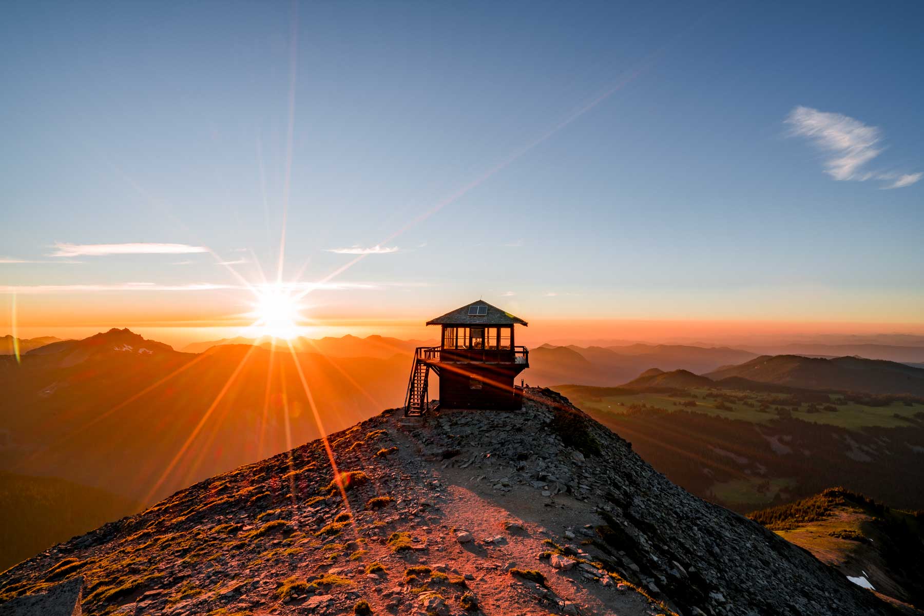
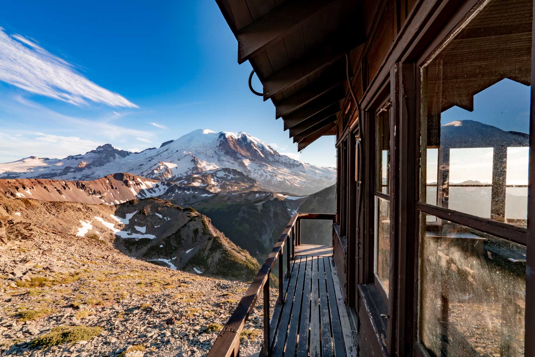
3. Mount Fremont Lookout Trail
Location: Sunrise
- Distance: 5.7 miles
- Difficulty: Moderate
- Elevation: 1200 feet
- Time Required: 3 hours
Hiking the Mt Fremont Lookout Trail at Mt Rainier
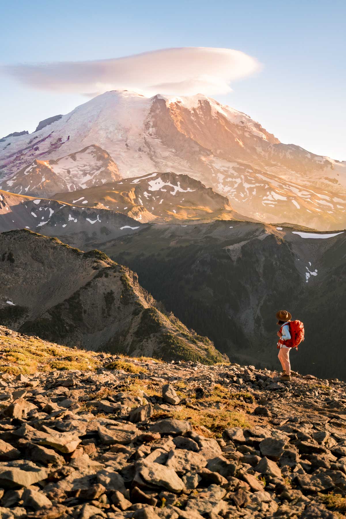
While it may not be the absolute best hike at Mt Rainier, Mt Fremont Lookout is my personal favorite trail in the park. I’ve hiked this trail a half a dozen times and it never gets old. The views are surreal, the scenery sublime, the wildlife is great, and the hike itself is really enjoyable.
On top of that, as a photographer I find the views of Mount Rainier I find to be the most compelling from Mt Fremont Lookout (so please excuse the excessive photos I’ve included below).
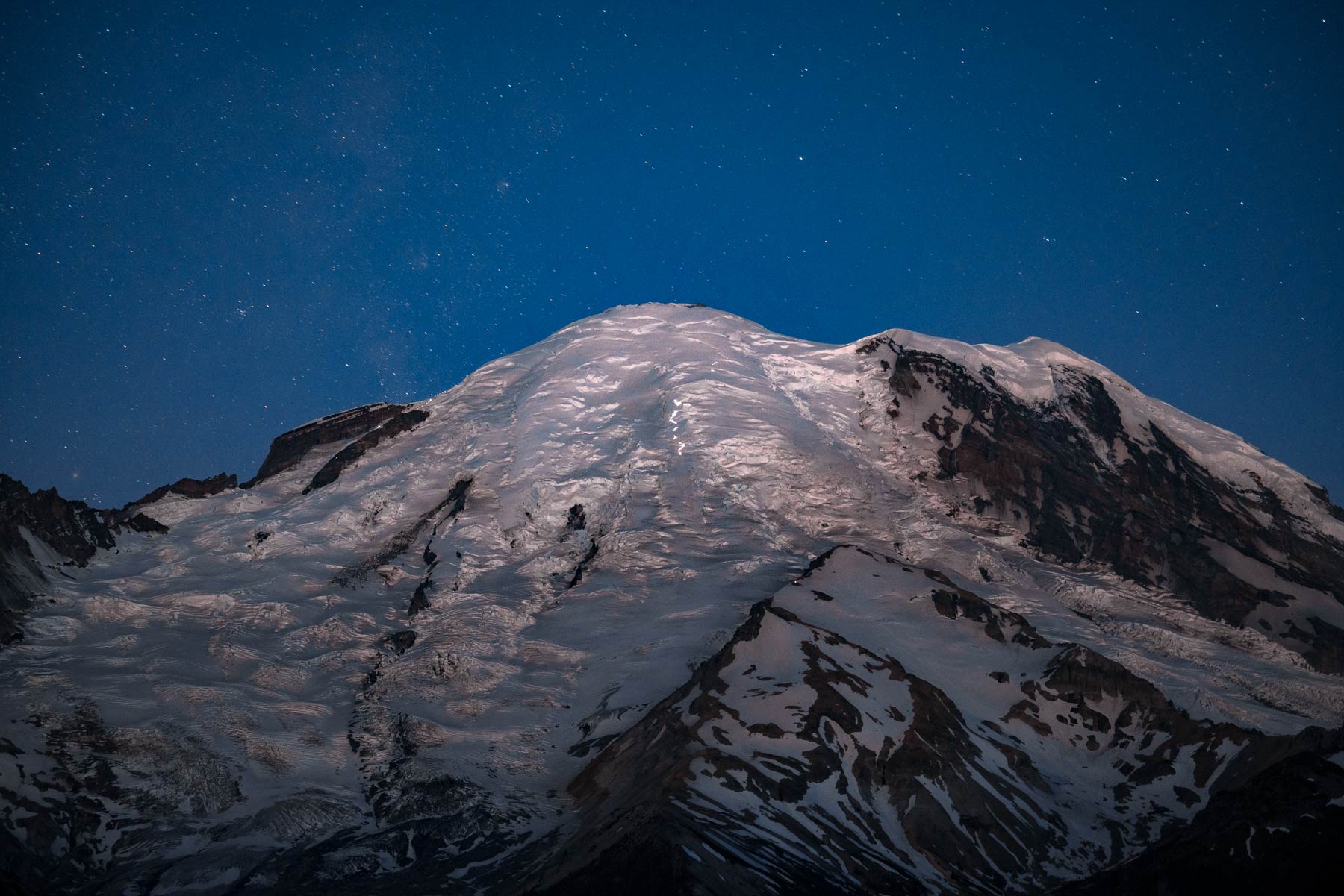
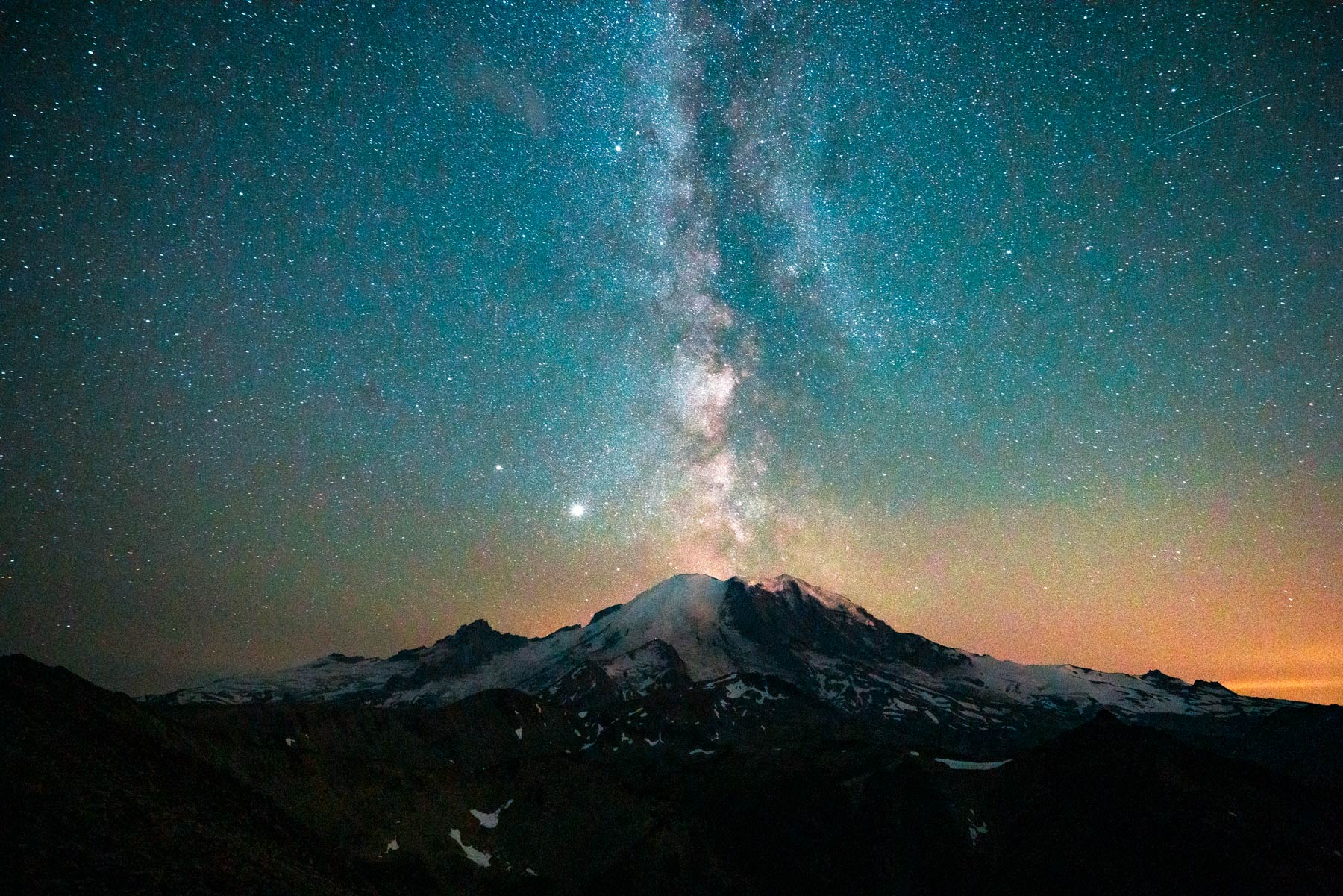
My favorite time of day to hike Mt Fremont is sunset as the views of the mountain here around that time are really epic. If you’re up for it, bring a good headlamp and stick around for the stars. I’ve stayed from sunset to sunrise before completely mesmerized by the views here.
The trail starts at the Sunrise parking lot and gradually ascends to Frozen Lake. From Frozen Lake you’ll hang a right and continue your ascent up a rocky ridge toward the Mt Fremont Lookout Tower. I see goats just about every time I hike this trail so be on the lookout! Once you reach the tower note that it is closed to the public but you can still climb the stairs for the view.
2. Pinnacle Peak Trail
Location: Paradise
- Distance: 2.5 miles
- Difficulty: Moderate
- Elevation: 1000 feet
- Time Required: 1.5 hours
Hiking the Pinnacle Peak Trail at Mt Rainier
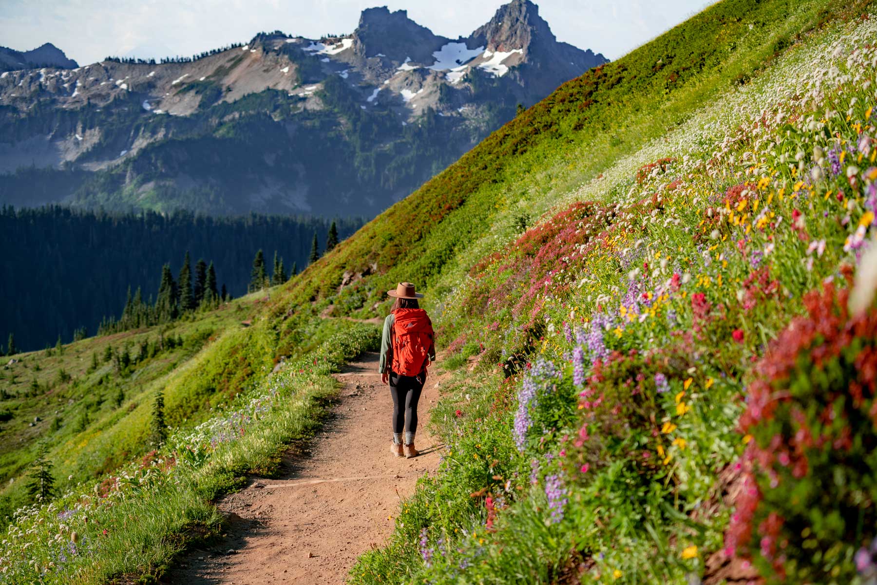
I have to say, hiking up to Pinnacle Peak is an unexpectedly incredible thing to do at Mount Rainier. In the summer this trail is chocked full of Lupine along with a variety of other wildflowers and always provides some of the most epic, panoramic views of Mount Rainier in the park.
From the top of the trail you’ll be able to see Mount Rainier in all its glory and the Paradise area to the north, and Mt Adams in the distance to the south.
I’ve seen playful marmots every time I’ve hiked this trail. At just 2.5 miles long with 1000 feet of elevation gain, Pinnacle Peak has some of the biggest bang for your buck of any of the things to do at Rainier.
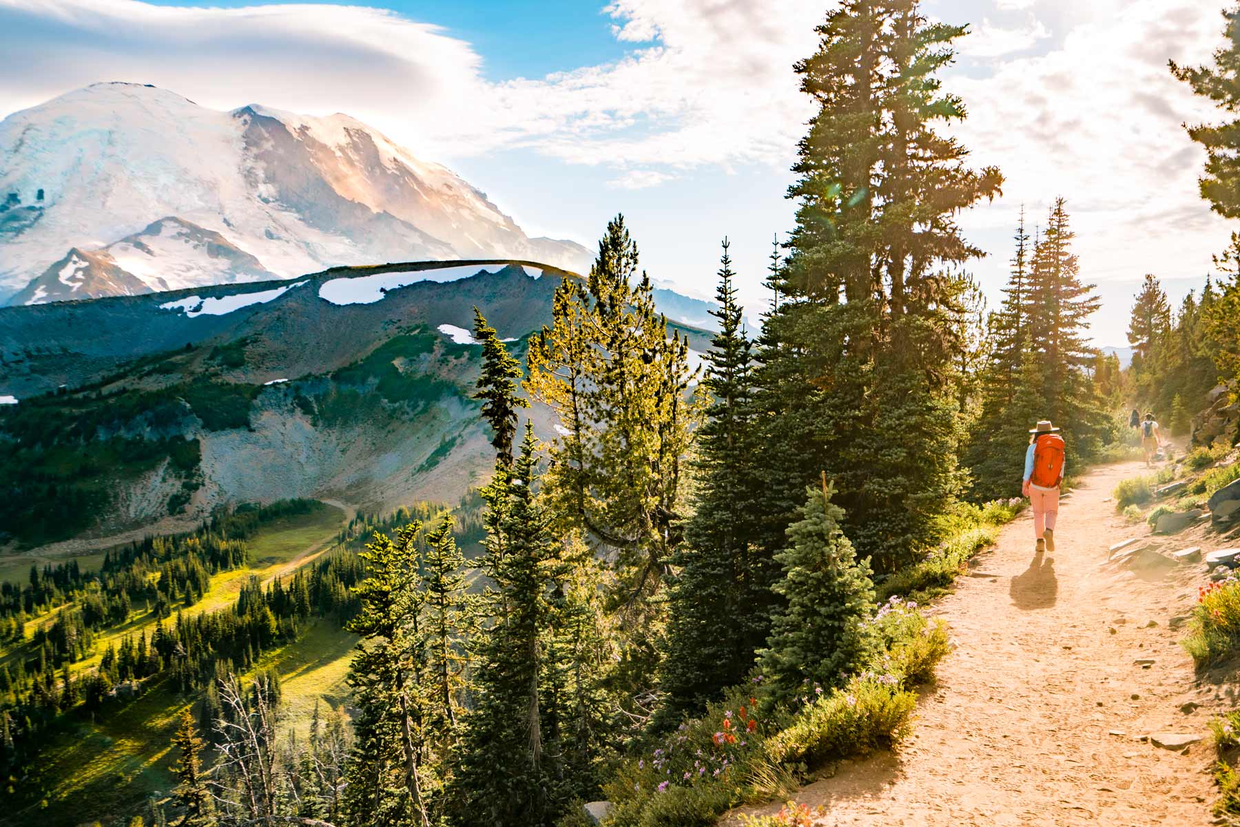
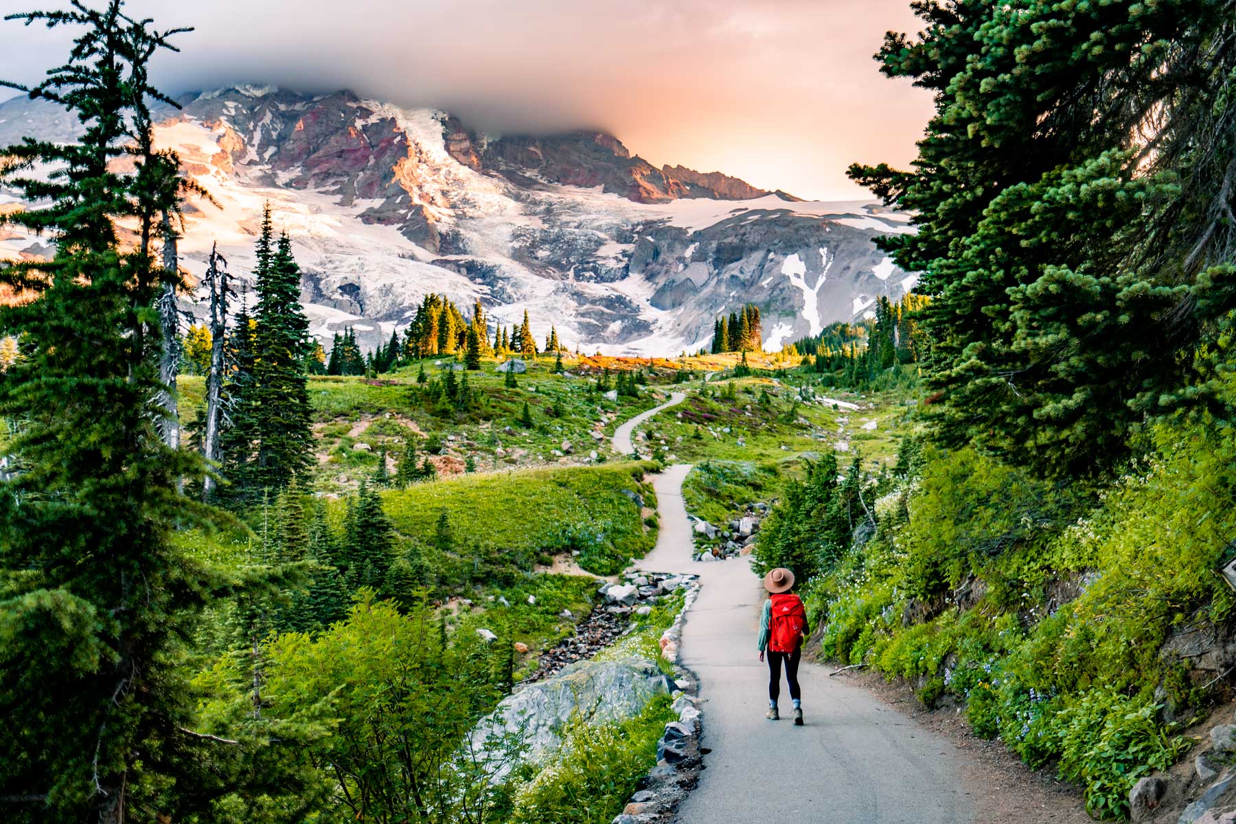
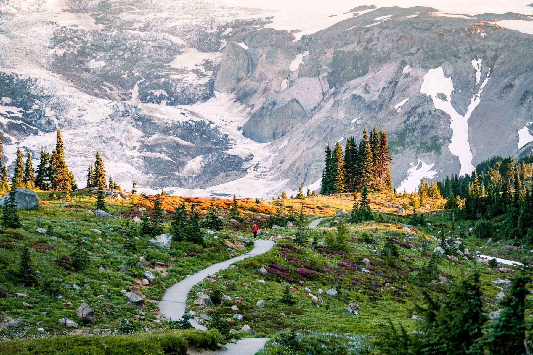
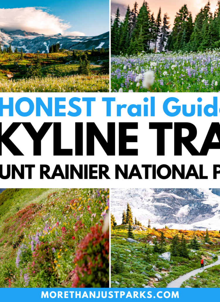
1. The Skyline Trail
Location: Paradise
- Distance: 5.4 miles
- Difficulty: Moderate
- Elevation: 1,700 feet
- Time Required: 4 hours
Hiking the Skyline Trail at Mt Rainier
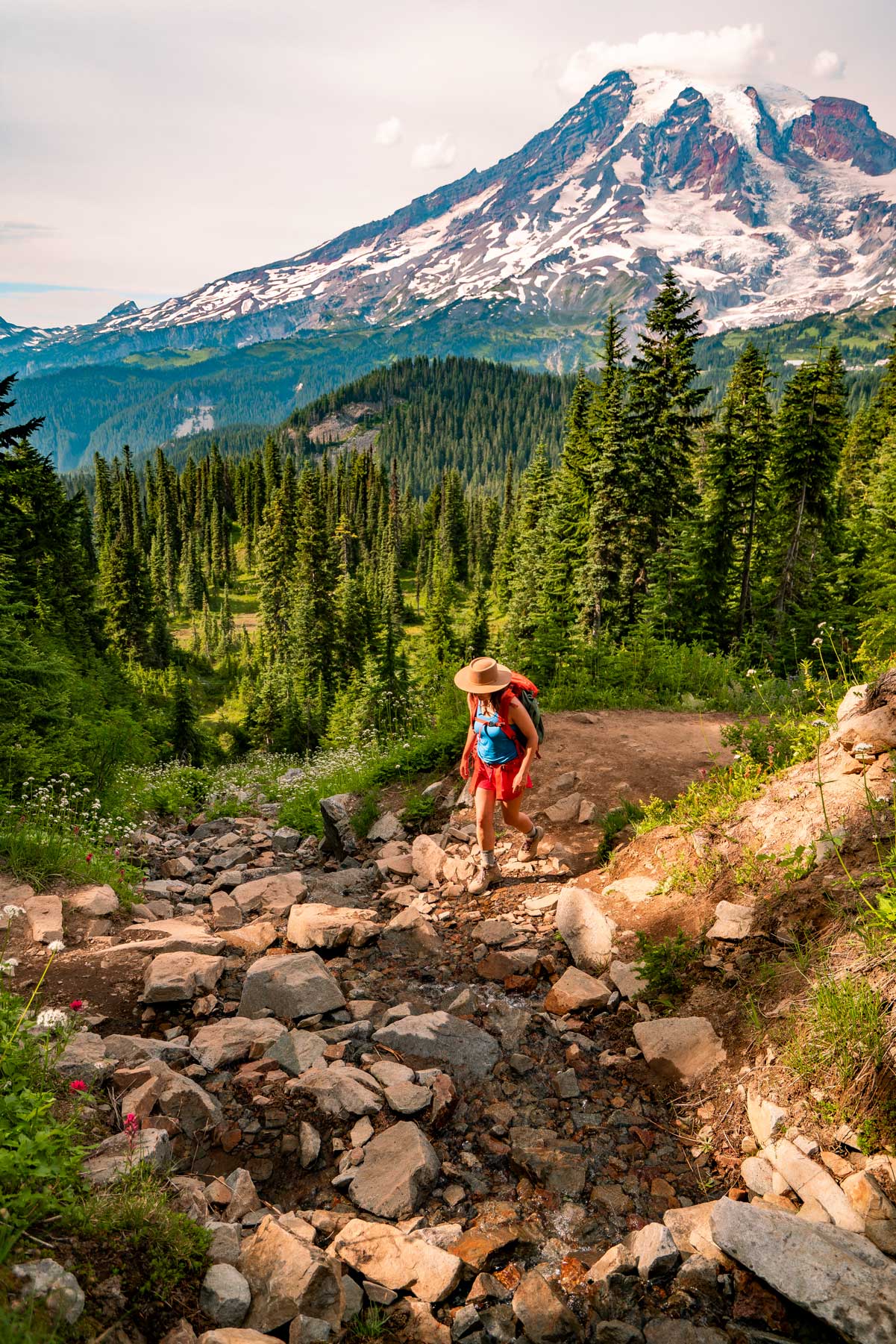
This is “the hike” to do if you can only do one at Mount Rainier. During wildflower season it just doesn’t seem real. Every color of the rainbow is represented in seemingly endless kaleidoscopic fields.
At 5.4 miles round trip with 1,700 feet of elevation gain you’ll definitely “feel the burn” on the way up but this is the must-hike trail in Mount Rainier. Visit early in the morning at sunrise for the most magical views and none of the crowds.
This is one of those trails that you can hike endless amounts of times and still enjoy the beauty in different ways.
The Skyline Trail is a veritable fairyland where one expects to see hobbits happily prancing about at any moment to accompany the marmots through wildflower meadows.
Summary & List of the Best Hikes in Mt Rainier
- Skyline Trail
- Pinnacle Peak Trail
- Mount Fremont Lookout Trail
- Tolmie Peak Trail
- Sourdough Ridge Trail
- Van Trump Park & Comet Falls Trail
- Burroughs Mountain Trail
- Alta Vista Trail
- Sunrise Rim Trail
- Emmons Moraine Trail & Glacier Basin Trail
- Naches Peak Loop Trail
- Shriner Peak Trail
- Nisqually Vista Trail
- Bench & Snow Lakes Trail
- Grove of the Patriarchs Trail
- Trail of the Shadows
- Narada Falls to Reflection Lakes Trail
- Spray Park Trail
- Tipsoo Lake Loop Trail
- Wonderland Trail
Where to Stay at Mount Rainier
There are two lodges located in Mount Rainier National Park:
- Paradise Inn (Paradise)
- National Park Inn (Longmire)
You’ll also find great hotels located just outside Mount Rainier National Park at the Crystal Mountain Ski Resort Complex (I put my parents up here last year and they loved it) and beyond – see these accommodations:
There are also four campgrounds at Mount Rainier with 459 individual campsites:
- Cougar Rock Campground (Paradise) – 179 sites reservable
- Ohanepecosh Campground (Ohanepecosh) – 179 sites
- White River Campground (Sunrise / White River) – 88 sites
- Mowich Lake Campground (Carbon River / Mowich Lake) – 13 primitive walk-in tent sites
Map of the Best Hikes at Mount Rainier
More Helpful Mount Rainier Articles
- Best Hikes at Mount Rainier: 20 Best Hikes at Mount Rainier National Park
- Visiting Paradise Mount Rainier: 15 Reasons Paradise Mt Rainier is the Most Beautiful Place in America
- Mount Rainier Facts: 15 AMAZING Mount Rainier Facts (Interesting Trivia + Quick Facts)
- Reservations: All the National Parks That Require Reservations (Updated List + Guide)
Explore Other Washington National Parks
- Washington National Parks: Washington’s National Parks Ranked Best in the World
Things to Do North Cascades: 20 Amazing Things to Do at North Cascades National Park - Best Hikes North Cascades: 15 Epic Hikes in North Cascades National Park
- Things to Do Crater Lake: 20 Amazing Things to Do at Crater Lake National Park
- Things to Do Olympic National Park: 20 Best Things to Do at Olympic National Park
- Olympic NP Guide: Comprehensive Guide to Olympic National Park
- Best Hikes Olympic NP: 9 Epic Olympic National Park Hikes
More From the National Parks
- National Parks Rankings: ALL 63 US National Parks Ranked By Experts
- Most Visited National Parks: Top 10 Most Visited National Parks
- National Monuments Ranked: ALL 128 US National Monuments Ranked (Best to Worst)

I loved the Pinnacle Peak Trail, but you should specify that the maintained trail doesn’t actually go to the peak, but to a sadle about 600 feet below the peak. I didn’t do the peak, coz it was extremely windy on the other side of the saddle. But the views are already amazing, so it wasn’t necessary. Didn’t do any marmots (October hike a couple of days ago) but plenty of pikas.
My favorite hike was combining the Fremont lookout with the second burrough. In fact it was what most people did, coz independently these hikes are rather short and easy (2 hours each). Combined, plus following the mountain goats on the wonderland trail below, it was about 5 hours. I also saw a cascade red fox on the way back… He was just walking on the gravel road, some rangers saw him too…
I believe there’s two things they should do in the park though, and that’s lengthening the maintained trails at Trump Park and at Skyline. It would be nice to be able to access higher elevation areas like that with maintainted trails, something you can easily do in the European alps, but that’s not done in the US except in Colorado. It would be easy in Trump Park to access the waterfalls you see in the distance. In the Alps or in Norway, you have many hikes that take you to the foot of glaciers, or lookouts overlooking them (actual glaciers, not just moraine). Not so much in the US.
I hope they reintroduce wolves soon too, coz you can clearly see an issue with too many mountain goats and deer destroying the forest, especially in the Sunrise meadows near frozen lake. The land is becoming baren, there should be more trees and shrubs than that. Same thing but less severe in Trump park.