Article Overview: Best Hikes in Great Smoky Mountains National Park
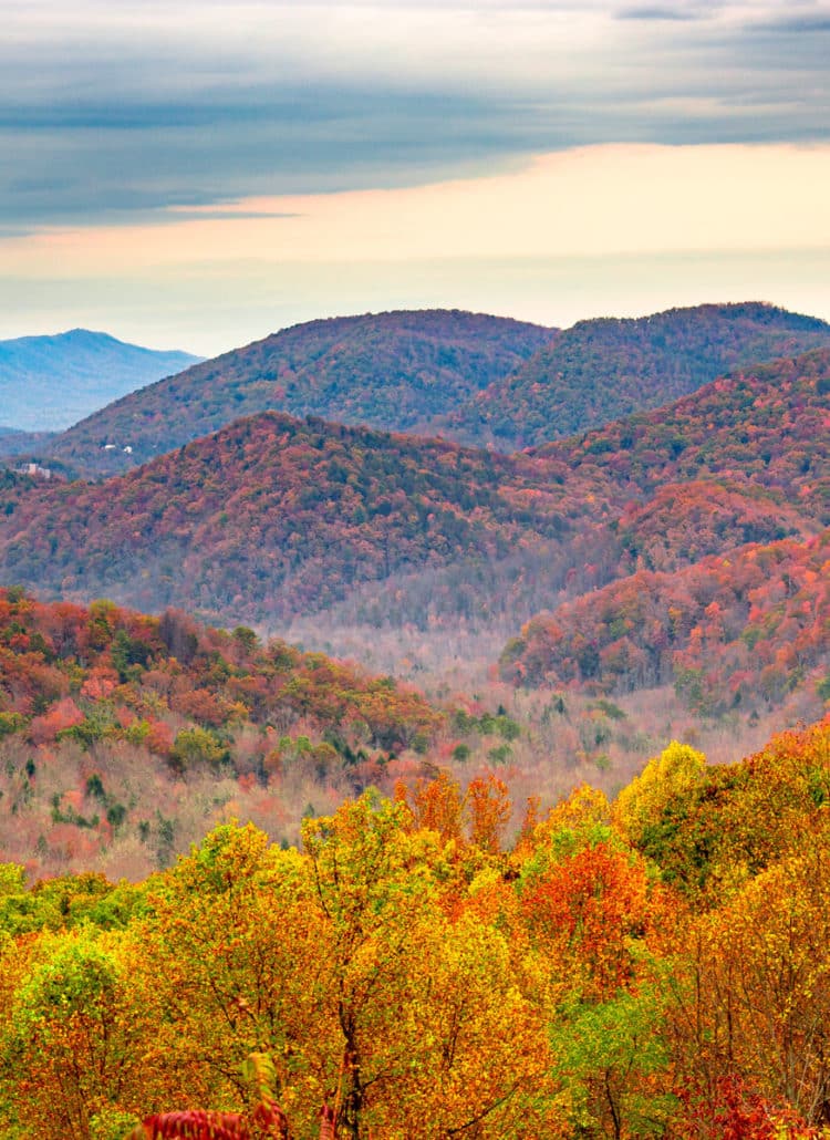
If you’re looking for the best hikes in Great Smoky Mountains National Park there’s a few things you should know first. Great Smoky Mountains National Park is the most visited national park in the country. That’s a reflection of a combination of factors: its proximity to many large metropolitan areas, sure, but also the immense beauty of its Southern Appalachian wilderness.
The park includes some of the biggest expanses of roadless country—and some of the most extensive old-growth forest—left in the eastern U.S. It also happens to cover most of the namesake range that ranks as the second-loftiest, and one of the most massive, in the Appalachians.
This park straddling the Tennessee-North Carolina line is also a straight-up paradise for hikers. There are more than 800 miles of hiking trails in Great Smoky Mountains National Park, and they cover everything from short, fully paved loops to some of the roughest, most remote footpaths in the East.
Here’s our roundup of the 15 best hikes in Great Smoky Mountains National Park. Ready to get started? Let’s go!
Things to Know Before You Visit Great Smoky Mountains National Park
Entrance Fees
$5 vehicle OR if you plan to visit more National Parks within the next 12 months I suggest you go ahead and purchase the America the Beautiful Pass (which can be found at the entrance gates to most national parks). This pass gets you into all National Parks, Forests, Monuments, and more including 2,000 sites for free after a one time $79 fee.
Sunscreen
Use it. Lots of it. Especially this one which I never leave the house without because it plays nice with our dear friend, earth 🙂
Insect Repellent
If you’re looking for a good insect repellent that plays nice with our good friend earth, we recommend this one or this one if you’re a DEET person.
Guide Book
The Best Guide Book for Great Smoky Mountains National Park is this one which we’ve marked up and highlighted quite a bit.
Map
The Best Map: I like this map best for Great Smoky Mountains National Park.
National Parks Checklist Map: This beautiful National Parks Checklist Map can be ordered to your house.
Framed National Parks Map: We’re a sucker for maps, this framed national parks map is the best.
Where to Stay in Great Smoky Mountains National Park
Planning a trip to Great Smoky Mountains National Park but haven’t decided on a place to stay? This is our favorite hotel in/around Great Smoky Mountains National Park.
Top 15 Best Hikes in Great Smoky Mountains National Park
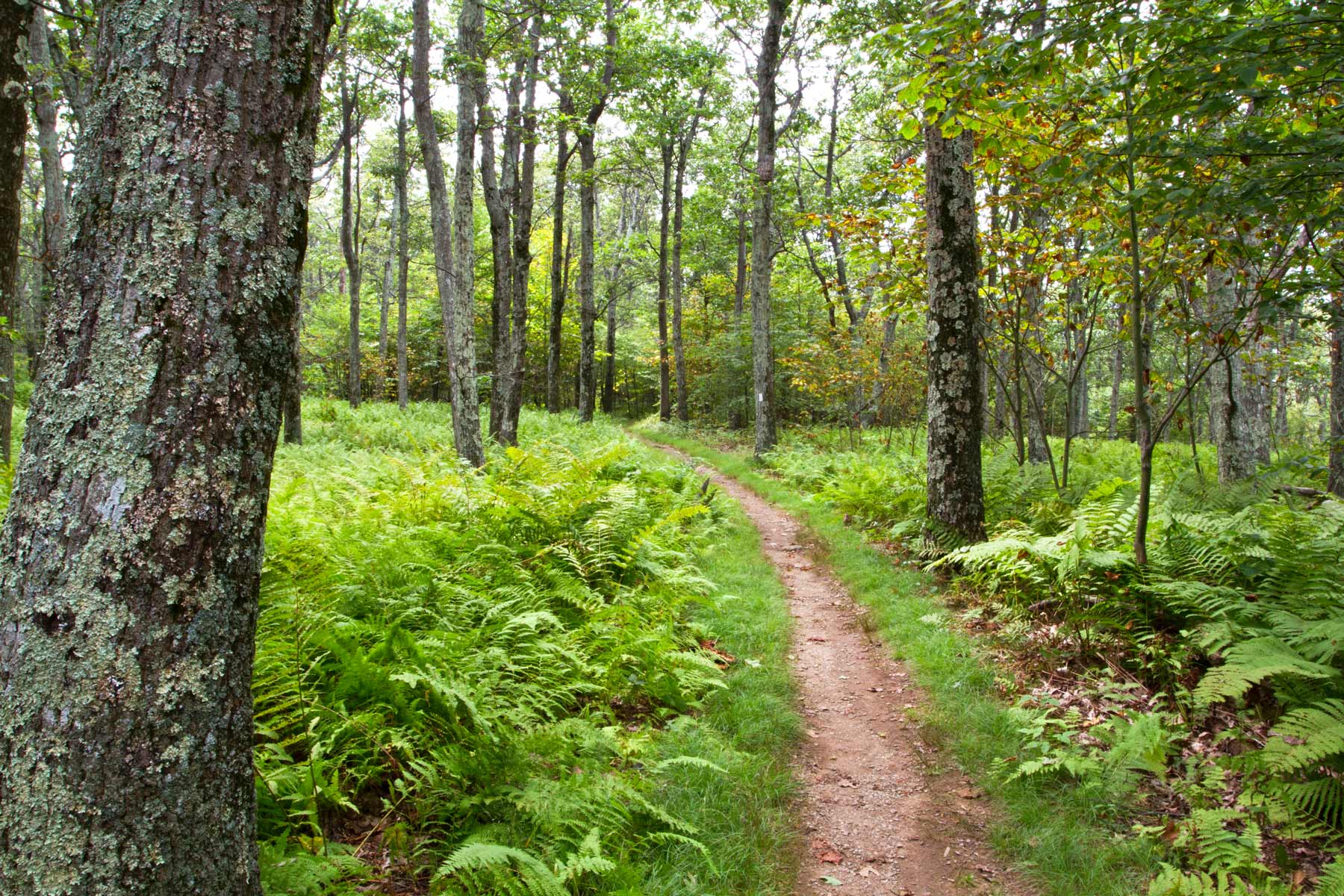
15. Rich Mountain Loop
- Distance: 8.5 miles
- Difficulty: Strenuous
- Elevation Gain: 1,700 feet
- Time Required: 4 – 6 hours
Hiking the Rich Mountain Loop in Great Smoky Mountains National Park
The Rich Mountain Loop offers a welcome escape from the crowds along the roadway in Cades Cove: a legitimately beautiful basin packed with critters and historic landmarks, but most of the time a hard place to find true solitude.
Yet that’s just what you’re likely to find, at least for long stretches, on this walkabout, which combines the Rich Mountain Loop, Indian Grave Gap, and Crooked Arm Ridge trails into a clockwise trek from lowlands to highlands and back down again.
Along the way you’ll pass the John Oliver Cabin, the oldest standing structure in Great Smoky Mountains National Park; an early white settler to Cades Cove—John Oliver, surprise surprise—built it in the early 1820s. (Past the cabin, you’ll be heading upslope initially via Marthas Branch, a creek named after John and Lucretia Oliver’s daughter that drops off Double Mountain between Cave and Leading ridges.)
Other landmarks along the way include Cerulean Knob—the actual summit of Rich Mountain, reached via a spur path—and Crooked Arm Falls or Cascades, a roughly 25-foot drop of the Crooked Arm Branch.
The all-around best season for hiking in Great Smoky Mountains National Park on the Rich Mountain Loop is probably between late fall and early spring, when the leafless deciduous canopies provide the most extensive views down to Cades Cove and north into Tuckaleechee Cove from the ridgetops.
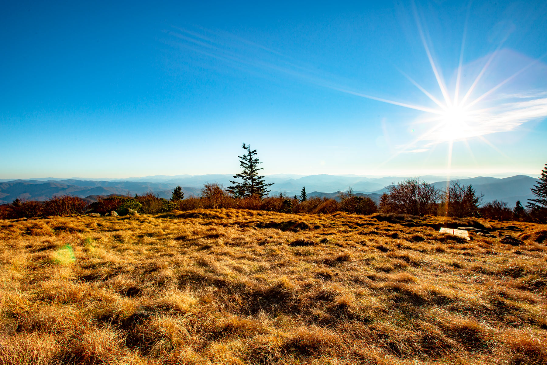
14. Andrews Bald
- Distance: 3.6 miles
- Difficulty: Moderate
- Elevation Gain: 1,200 feet
- Time Required: 2 – 3 hours
Hiking to Andrews Bald in Great Smoky Mountains National Park
Once quite a bit more demanding to reach, Andrews Bald has become more broadly accessible thanks to renovation along the Forney Ridge Trail that leads here from Clingmans Dome. It’s mostly downhill from the Dome to Andrews Bald.
At some 5,920 feet, Andrews Bald is the highest-elevation of the Southern Appalachian balds in the Great Smokies. These are somewhat mysterious high grassy or shrubby meadows situated along ridge-crests or mountaintops.
Ecologists have long debated just how they formed in a range entirely below natural timberline, though historically grazing and burning (the latter still used by the Park Service today) appeared to be important in keeping trees from encroaching and eventually closing the balds.
Edged by spruce-fir forest and hardwood stands, Andrews Bald lies on the southwestern slope of Forney Ridge. The all-out best time for hiking in Great Smoky Mountains National Park to Andrews Bald is in June or early July, timed to coincide with the blooming of this grass bald’s scattered rhododendrons and flame azaleas.
13. Sugarland Mountain Trail
- Distance: 12.1 miles
- Difficulty: Moderate
- Elevation Gain: 4,422 feet
- Time Required: 6 – 8 hours
Hiking the Sugarland Mountain Trail in Great Smoky Mountains National Park
Sugarland Mountain isn’t as high-profile a Smoky Mountain landmark as, say, Clingmans Dome or Cades Cove, but it’s just as linchpin-level to the topographic mosaic.
It’s less a mountain peak than a huge ridge splitting northwest off the main divide of the Great Smokies, between the LIttle River and the West Prong of the Pigeon, and the Sugarland Mountain Trail runs its length.
It’s best to do this trail—one of the top hikes in Great Smoky Mountains National Park for solitude and scenery—from top to bottom: that is, from the upper trailhead along Clingmans Dome Road to the lower one along Little River Road.
There are plenty of little ups-and-downs involved with this south-to-north route, but overall it’s the downhill way to go. Arranging a shuttle or dropoff makes it a one-way adventure.
From open woodland stands and clearings, you’ll nab amazing looks out over the drainages to nearby heights such as Mount Collins, Mount Mingus, and Mount LeConte—and to the Chimney Tops, which jut their pointy selves from a spur of Sugarland Mountain. There are some thrillingly narrow (but not freaky) sections of ridgeline along this hike.
12. Abrams Falls
- Distance: 5 miles
- Difficulty: Moderate
- Elevation Gain: 675 feet
- Time Required: 3 – 4 hours
Hiking the Abrams Falls Trail in Great Smoky Mountains National Park
Those unfamiliar with the Southern Appalachians in general may not realize that hiking in Great Smoky Mountains National Park offers some of the richest waterfall-“bagging” in the country. Abrams Falls is one of the most impressive, and just a few miles’ hike from the hubbub of Cades Cove.
Actually, just going off its height—a mere 20 feet or so—you might question whether Abrams Falls is worth trekking to. But it’s the overall size of this waterfall on Abrams Creek (which flows from Cades Cove to follow a twisty-turny mountain course to the Little Tennessee River) that’s notable: Indeed, this is the park’s most voluminous falls.
Use caution when admiring this burly waterfall and its inviting-looking—but potentially dangerous—plunge pool. Quite a few injuries and even deaths have occurred here. It’s best to admire dryshod the broad plunge and its forest surrounds.
11. Rocky Top
- Distance: 13.9 miles
- Difficulty: Strenuous
- Elevation Gain: 3,665 feet
- Time Required: 7 – 10 hours
Hiking to Rocky Top in Great Smoky Mountains National Park
Offering one of the most showstoppingly scenic hikes in Great Smoky Mountains National Park, Rocky Top is a 5,447-foot subpeak of commanding Thunderhead Mountain, which reaches 5,527 feet at its highest point.
Among several choices, the Lead Cove and Bote Mountain trails provide the most direct approach to this vantage, leading you from the Laurel Creek Road trailhead to the Appalachian Trail hugging the crest of the Great Smokies.
You’ll be tracing the footsteps (and hoof-steps!) of an old herder’s trail bringing livestock up to graze at Spence Field, the ridgetop bald where you’ll join the A.T. Its shrubby clearing, which still affords some nice views, is another of the highlights of this hike.
You then head eastward along the divide a bit more than a mile to reach Rocky Top, named for its sandstone outcrops and boulders and likely the inspiration behind the Tennessee state song of that name.
This westernmost of Thunderhead Mountain’s peaks may be the lowest, but it serves up probably the most spectacular viewshed, stretching from Clingmans Dome downslope south to Fontana Lake and north to Cades Cove—and beyond to the valley of the Tennessee River.
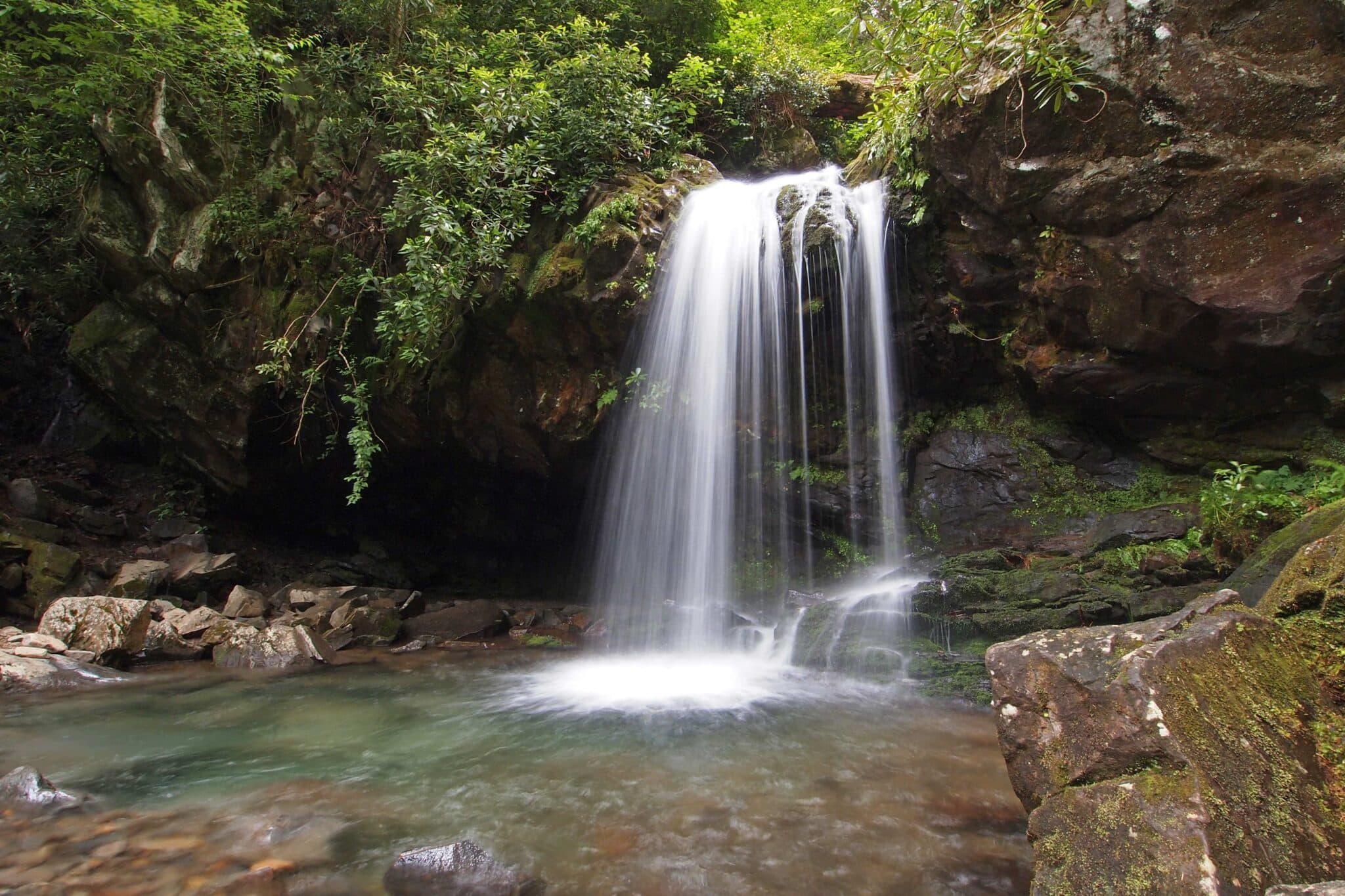
10. Grotto Falls
- Distance: 2.6 miles
- Difficulty: Easy – Moderate
- Elevation Gain: 585 feet
- Time Required: 2-3 hours
Hiking to Grotto Falls in Great Smoky Mountains National Park
Grotto Falls is far from the tallest or most powerful of the many waterfalls in Great Smoky Mountains National Park, but it’s definitely on the shortlist of most magical.
This 25-foot drop lies along the rough-and-tumble course of the Roaring Fork, which drains from the northern slopes of huge Mount LeConte north and northwestward to empty into the West Fork Little Pigeon River in Gatlinburg.
Indeed, the Trillium Gap Trailhead used to reach Grotto Falls isn’t all that far from Gatlinburg, but a drive up the lush Roaring Fork Motor Nature Trail quickly makes you feel worlds away from its bustling streets and tourist traps. The waterfall itself is mesmerizing, and unlike most Great Smokies plunges you can actually walk behind it.
But the Trillium Gap Trail en route is entrancing in and of itself—among the most serene and immersive hikes in Great Smoky Mountains National Park, really—given the abundance of seasonal wildflowers (in spring, trilliums very much included) and the luxuriance of the old-growth hemlock forest.
While Grotto Falls makes a worthy hiking goal, you can also use the Trillium Gap Trail to reach the summit of Mount LeConte from the north.
9. Cove Hardwoods Nature Trail
- Distance: 0.75 miles
- Difficulty: Easy
- Elevation Gain: 226 feet
- Time Required: 1 hour
Hiking the Cove Hardwoods Nature Trail in Great Smoky Mountains National Park
Hardcore hikers sometimes glaze over when they hear “nature trail” or “interpretive trail,” but that’s a real loss. While you’ve got world-class backcountry hiking in Great Smoky Mountains National Park, some of its easiest front-country footpaths offer incredible scenery and ambience. And that’s definitely true of the short, easy, but knockout-lovely Cove Hardwoods Nature Trail, picked up from the Chimney Tops Picnic Area off Newfound Gap Road.
The loop takes you through one of the finest remaining examples of an old-growth cove hardwood forest anywhere. This lower-elevation forest zone, located in hollows and along valley benches, presents the Southern Appalachians at about their lushest and most eye-popping, with—in the pre-logging era—truly enormous trees lording over tangled shrubs and dense beds of herbs and wildflowers.
This forest, nestled against the northern foot of Sugarland Mountain, includes some magnificent old trees, including tulip-poplars, buckeyes, hemlocks, sugar maples, Carolina silverbells, and yellow birches. And particularly in spring, it’s one of the best spots in the park for wildflower-viewing, with stunning displays of trilliums, fringed phacelia, anemones, and other groundcover blooms.
8. Mount Cammerer
- Distance: 11.2 miles
- Difficulty: Strenuous
- Elevation Gain: 3,045 feet
- Time Required: 6 – 10 hours
Hiking to Mount Cammerer in Great Smoky Mountains National Park
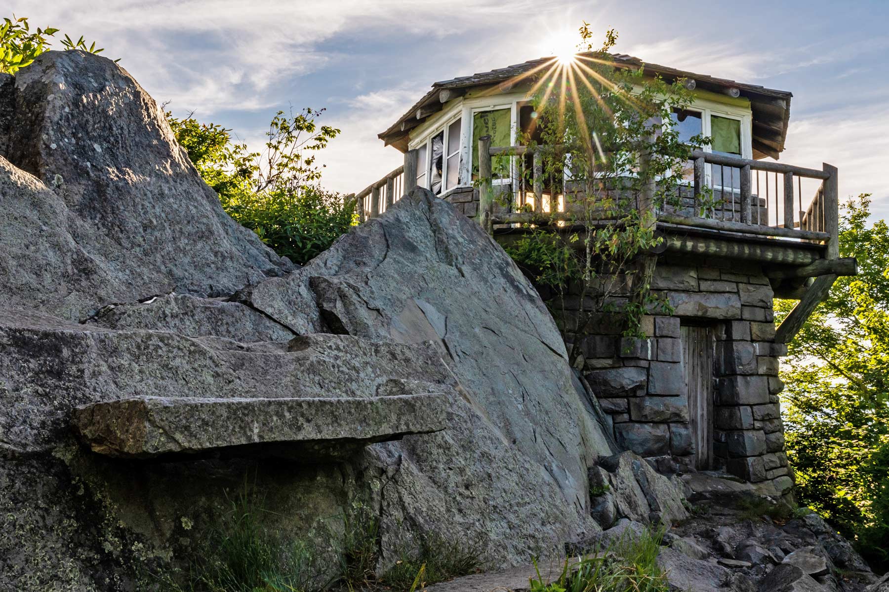
Readily admired from Cosby to the north, looming high over the confluence of Big Creek and the Pigeon River, 4,928-foot Mount Cammerer offers one of the best hikes in Great Smoky Mountains National Park. Set along the Smoky Mountain divide in the east of the park, it’s a fairly demanding, full-day sort of destination, but the views from its summit rank among the grandest in the range.
You can reach this remote peak a couple of different ways, but we suggest the approach from Cosby via the Low Gap Trail, which switchbacks its grueling way up to meet the Appalachian Trail. The climb to Low Gap is the toughest part of the hike; the ridgetop walk on the A.T., skirting Rocky Face Mountain and Sunup Knob, is comparatively easy.
Close to five miles from the trailhead, you’ll reach the rocky spur trail off the A.T. leading to the Mount Cammerer summit. There you’ll find the CCC-built fire tower and a staggering panorama that stretches far north into the lowlands and up and down the rugged Great Smokies crest.
The Southern Appalachian majesty within view is all the more spellbinding in the autumn, when richly painted with fall colors.
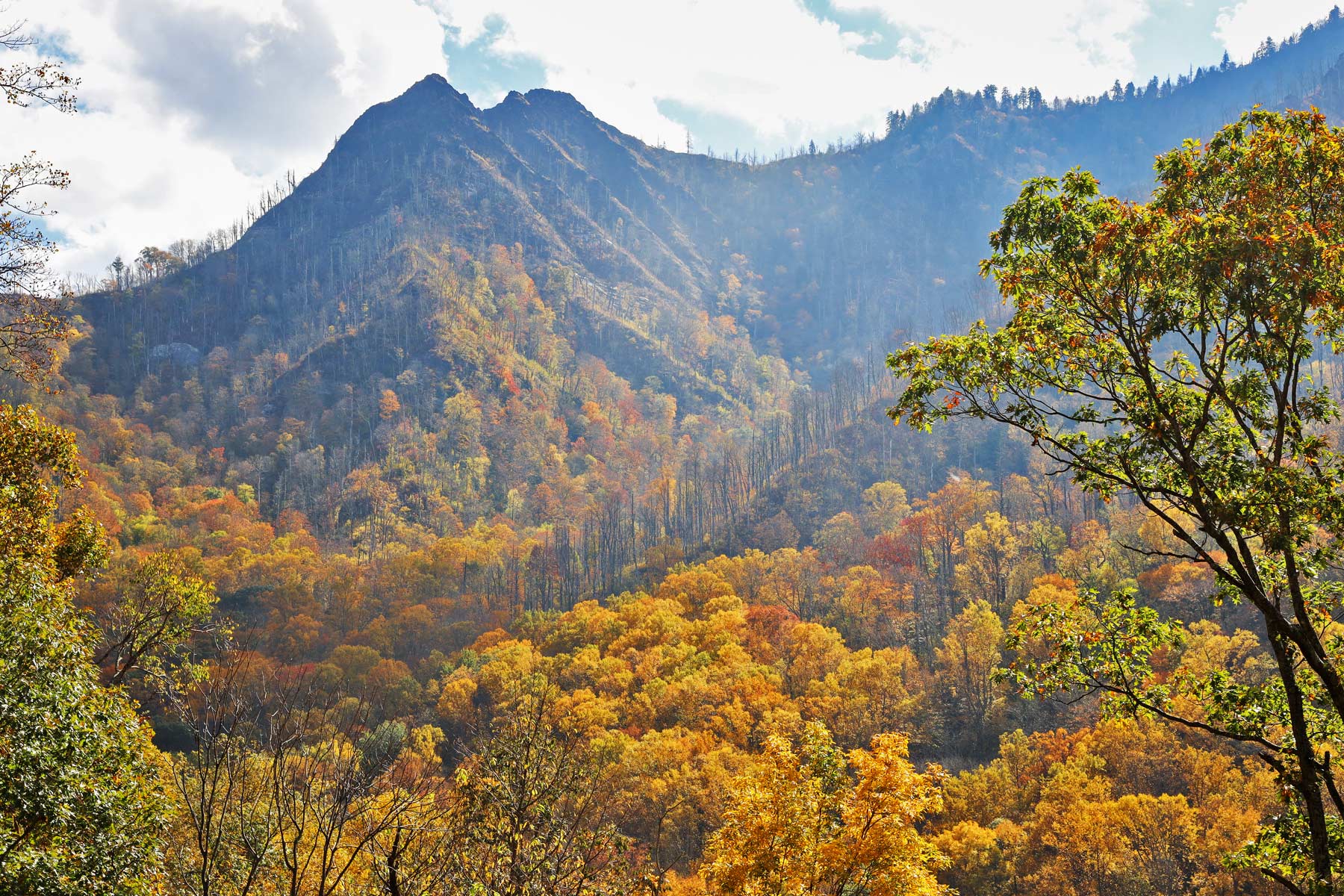
7. The Chimney Tops
- Distance: 3.5 miles
- Difficulty: Moderate – Strenuous
- Elevation Gain: 1,400 feet
- Time Required: 3 – 4 hours
Hiking the Chimney Tops Trail in Great Smoky Mountains National Park
Among the classic hikes in Great Smoky Mountains National Park, the Chimney Tops form one of the range’s iconic geologic formations. These rugged slate peaks are another of the relatively few places in the heavily forested Great Smokies where bare rock creates bold crags, and like a number of such sites, the Chimney Tops belong to the outcrop-forming Anakeesta Formation.
The 2017 wildfires heavily impacted the Chimney Tops area, and it’s taken hard work by Trails Forever crews to restore and reroute the trail. There’s a new turnaround point that still yields a fine view of the pinnacles.
The trailhead lies along Newfound Gap Road close to the Loop. You’ll head up the Road Prong drainage, then split off westward and huff your way up to the spur off Sugarland Mountain that culminates in the Chimney Tops.
The view of those rocky teeth set against a grand, rugged backdrop that includes the majestic loom of Mount LeConte and Mount Mingus is unforgettable.
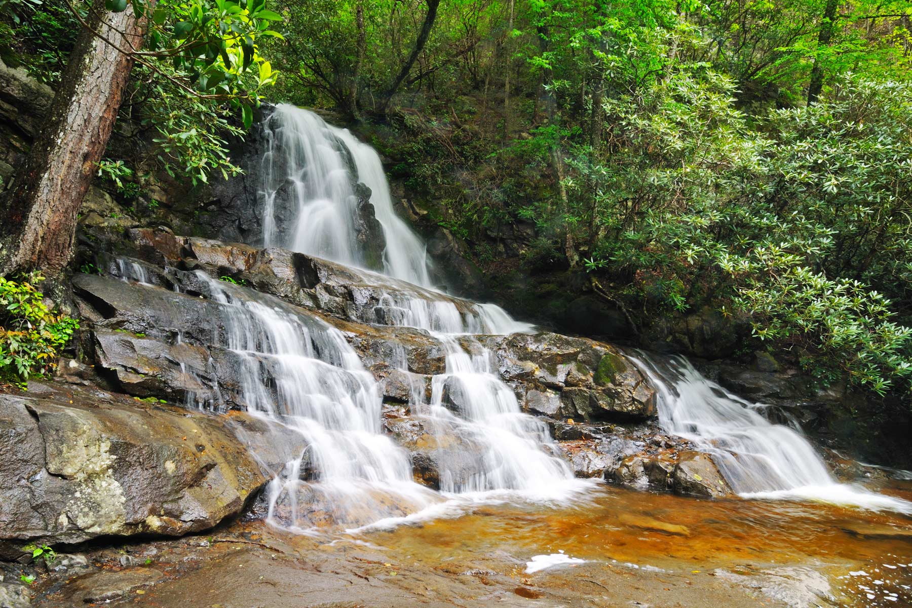
6. Laurel Falls Trail
- Distance: 2.6 miles
- Difficulty: Moderate
- Elevation Gain: 314 feet
- Time Required: 2 hours
Hiking the Laurel Falls Trail in Great Smoky Mountains National Park
This is easily one of the most popular hikes in Great Smoky Mountains National Park. The path’s paved, but nonetheless rough and steepish in places. It’s a good choice for parkgoers with kids or older folks still keen on a bit of a huff-and-puff trek.
And the scenic payoff is a big one. Laurel Falls makes a two-tiered, 80-foot plunge of the Laurel Branch, a tributary of the Little River. The end of the trail is a walkway that swings you right between the upper and lower drops of Laurel Falls.
The waterfall is the main attraction, but the forest and the babbling run of the Laurel Branch along the trail add to the pleasure. And if you happen to be hiking the Laurel Falls Trail in spring, you might luck out and see the exuberant blooms of the mountain laurel that lends its name to the creek, waterfall, and trail.
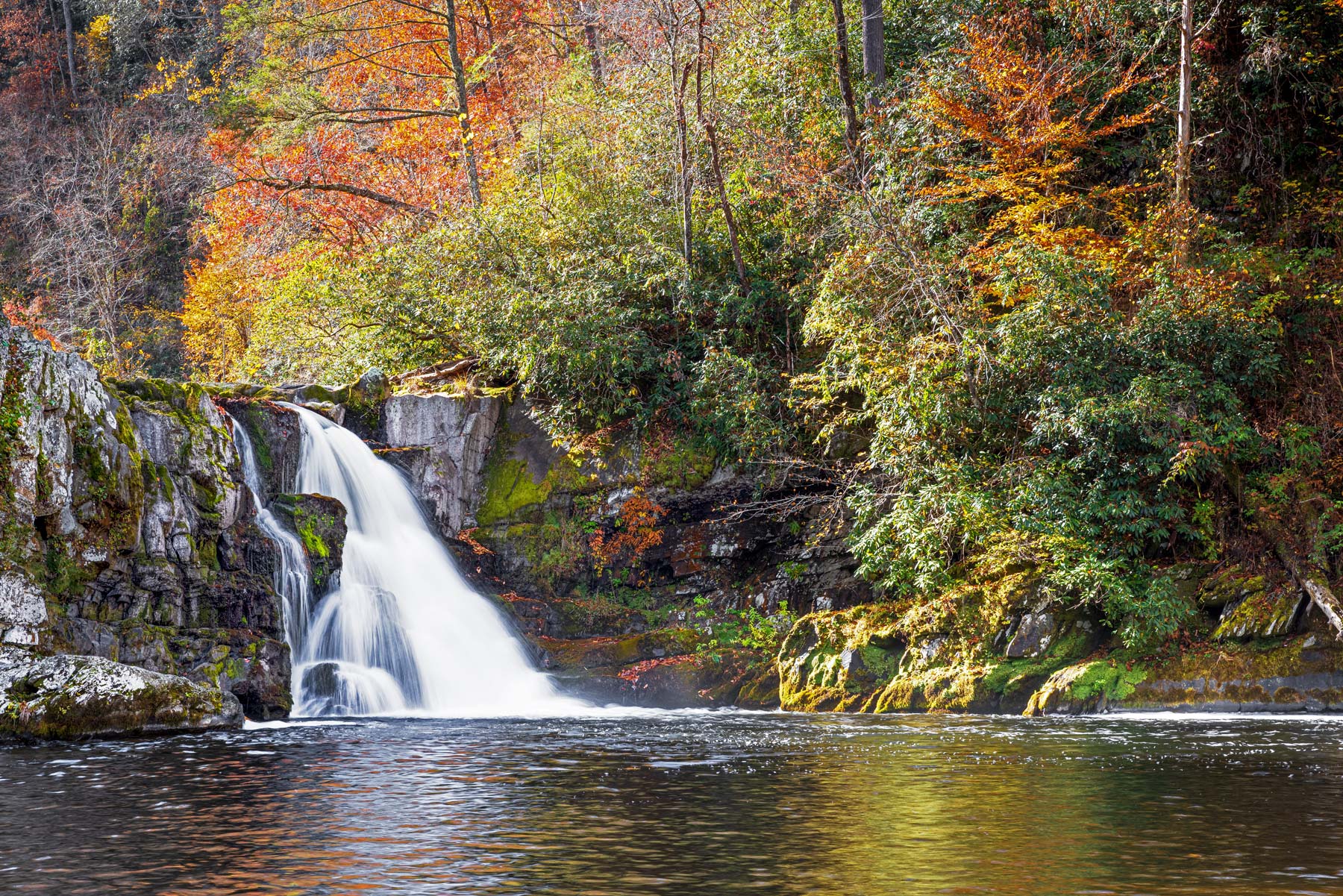
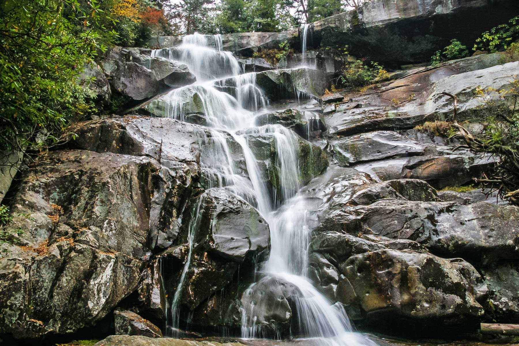
5. Ramsey Cascades
- Distance: 8 miles
- Difficulty: Moderate – Strenuous
- Elevation Gain: 2,190 feet
- Time Required: 5 – 7 hours
Hiking the Ramsey Cascades Trail in Great Smoky Mountains National Park
The 100-foot whitewater tumble of Ramsey Cascades marks the tallest waterfall in Great Smoky Mountains National Park. And the demanding hike there passes through some of the park’s most spectacular forestland. What more could you ask for, really?
The waterfall lies along the Ramsey Prong of the Middle Prong Little Pigeon River, which rises between two of the loftiest peaks in the Great Smokies: 6,621-foot Mount Guyot and 6,370-foot Old Black. The Ramsey Prong follows a westward course to meet the Middle Prong at the southern foot of Greenbrier Pinnacle. Ramsey Cascades itself lies between Pinnacle Lead to the north and the Guyot Spur to the south.
The hundred-foot cascade may be the headliner, but it’s hard not to be bowled over by the cove hardwood forest the trail passes through, which includes significant old-growth and some accordingly whopping tulip-poplars, silverbells, yellow birches, basswoods, hemlocks, and other big trees.
All things considered, this is one of the finest hikes in Great Smoky Mountains National Park, even though it falls under the radar of many visitors.
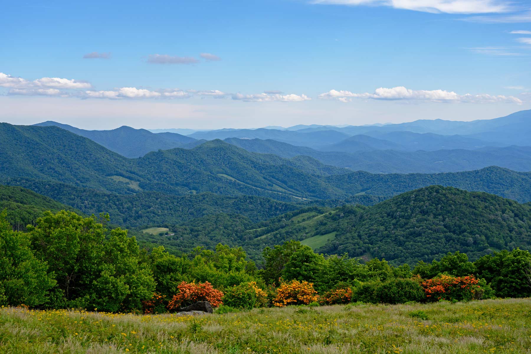
4. Gregory Bald via Gregory Ridge Trail
- Distance: 11.3 miles
- Difficulty: Strenuous
- Elevation Gain: 3,020 feet
- Time Required: 6 – 9 hours
Hiking the Gregory Bald Trail in Great Smoky Mountains National Park
It’s no easy feat trekking up to perhaps the most celebrated high-elevation bald in the Great Smokies, but the rewards are immense. Gregory Bald lies right along the main divide of the Smokies, set between Sheep Pen and Rich gaps.
While some balds in the Great Smokies and elsewhere in the Southern Appalachians appear to have been created in historical times by clearing, evidence suggests Gregory Bald has existed in one form or another for a long time.
The Cherokee knew this site as Tsistuyi, the Rabbit Place, said to be the haunt of the Great Rabbit. Euro-American settlers (including the bald’s namesake, Cades Cove resident Russell Gregory) drove livestock up here, as at other high balds, for summer grazing.
While Gregory Bald is reachable via several approaches, the Gregory Ridge Trail is the most popular. (The slightly shorter Gregory Bald Trail is another possibility, but you have to drive the one-way Parson Branch Road to reach that trailhead, so it’s not altogether convenient.)
The Gregory Ridge Trail makes for a long uphill slog, but the wide-open, top-of-the-world views from Gregory Bald—which take in everything from Cades Cove and Fontana Lake far below to such noble Smoky Mountain peaks as Rich Mountain, Thunderhead Mountain, and Clingmans Dome, plus more distant Southern Appalachian ranges such as the Yellow Creek Mountains to the south—tend to make you immediately forget about sore calves and feet.
There’s no more celebrated time to hoof it up to Gregory Bald than mid- to late June, when its dense population of wild hybridized azaleas puts on a truly spectacular show of blossoms—all the more incredible for the mountainscape viewshed all around.
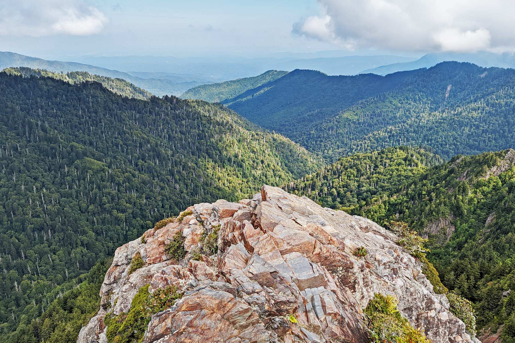
3. Charlies Bunion
- Distance: 8.1 miles
- Difficulty: Strenuous
- Elevation Gain: 1,600 feet
- Time Required: 5 – 8 hours
Hiking to Charlies Bunion in Great Smoky Mountains National Park
OK, so it’s not the most appealing name for a destination. But, as it happens, Charlies Bunion—yes, bunion—ranks among the best hikes in Great Smoky Mountains National Park.
The story behind the name is pretty great: Horace Kephart, a well-known author and advocate for the Southern Appalachians, came here with Charlie Connors, and named the prominent crag for its resemblance to a sore on Connors’ foot. (In fact, the crag was originally called Charlie Connors Bunion, just to be as specific as possible.)
This raw, rugged outcrop of Anakeesta Formation—the same geologic layer producing the impressive Sawteeth to the near northeast along the same Smoky Mountain divide—offers an incredible vantage, enhanced by a long-ago wildfire and later storm-induced washouts that opened up the vista.
You’ll reach the side path to Charlies Bunion following one of the world’s most famous hiking thoroughfares, the Appalachian Trail. Through gaps in the spruce-fir forest along the divide, you’ll gain plenty of fine prospects both north and south.
But the showstopper scenery awaits from the Bunion itself, which affords amazing sightlines out to Mount Kephart, Mount LeConte, Mount Guyot, Mount Chapman, and other fine peaks and ridges. Just watch your footing!
By the way, if you have the time and energy, work in a side trip to a similarly homerun vantage, the Jumpoff, to your Charlies Bunion hike; it’s along the way between the Bunion and the trailhead, near Mount Kephart.
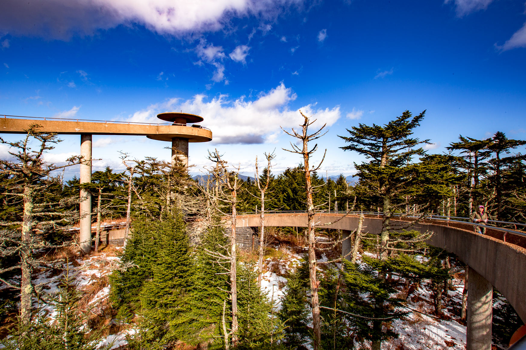
2. Clingmans Dome
- Distance: 1 mile
- Difficulty: Easy
- Elevation Gain: 332 feet
- Time Required: 30 min to 1 hour
Hiking the Clingmans Dome Trail in Great Smoky Mountains National Park
A visit to Clingmans Dome is definitely a must-do on any exploration of the Great Smokies. After all, this 6,643-foot peak is the loftiest in the range and the third-highest mountain in the U.S. east of the Mississippi, outranked only by Mount Mitchell and Mount Craig in the Black Mountains of North Carolina.
Even those who, for whatever reason, can’t hike the steep, half-mile paved path leading to the observation tower atop Clingmans Dome can appreciate the view from the parking lot. And given the stunning panorama awaiting from the tower, that path must be ranked among the best hikes in Great Smoky Mountains National Park, short as it is.
If you luck out with exceptionally clear conditions, the sightlines from the Clingmans Dome summit can extend 100 miles or more. Even more restricted visibility can yield a feast of high ridges, peaks, and deep ravines and valleys; heck, even if you’re fogbound up top, it’s super-atmospheric!
If you ever get the chance, try to head up Clingmans Dome in the fall, especially in October: It can be an unbeatable vantage for long-range leaf-peeping in one of the best places in the Southeast for autumn foliage.
1. Alum Cave Trail to Mount LeConte
- Distance: 10 miles
- Difficulty: Strenuous
- Elevation Gain: 2,700 feet
- Time Required: 7 – 8 hours
Hiking the Alum Cave Trail to Mount LeConte in Great Smoky Mountains National Park
There are multiple trails leading up to the 6,593-foot summit of Mount LeConte, the third-highest and most topographically imposing peak in the Great Smoky Mountains, and all of them have their special virtues. For those with a geologic bent, though, it’s hard to top the Alum Cave Trail, which is the southwestern approach up the great mountain.
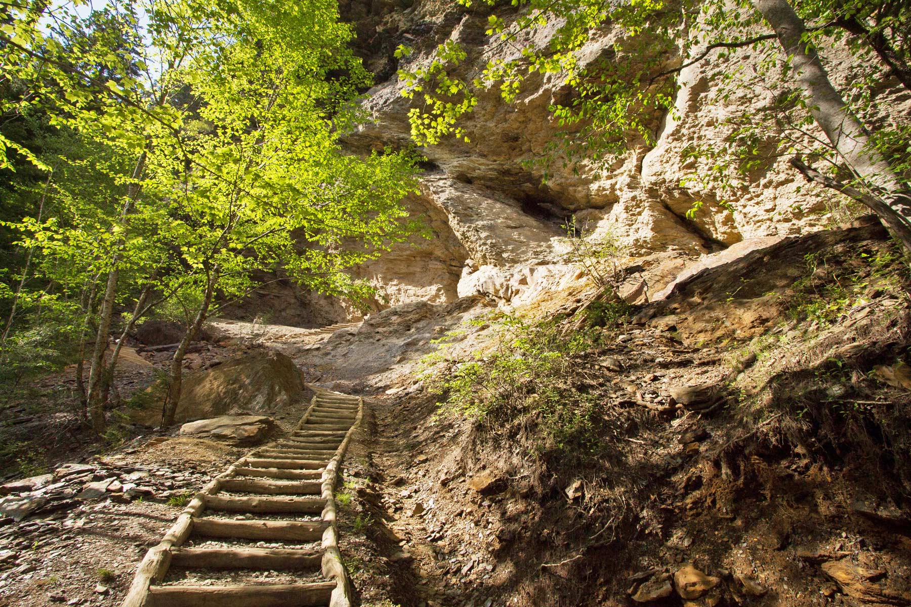
Starting from Newfound Gap Road, this challenging but scenery-blasted trail commences its way along Alum Cave Creek, which heads below Anakeesta Knob (a peak on the other side of Alum Gap from the long southeastern LeConte ridge-spur called the Boulevard, its own awesome trail). It then swings up the Styx Branch to slip through the natural, freeze-thaw-created tunnel of Arch Rock via stone steps. Reach the heath bald of Inspiration Point and admire the view, which includes the unmistakable Chimney Tops—and, for the keen-eyed, the Eye of the Needle window in Little Duck Hawk Ridge.
At about 2.5 miles in, you’ll reach Alum Cave Bluffs, which form a huge Anakeesta Formation overhang stretching several hundred feet along the flanks of Peregrine Peak. Wintertime hikers can often see fantastic icicles festooning the Bluffs (but need to beware of falling frozen daggers!).
While many day hikers turn back here, keep on slogging upwards to eventually attain the summit of the LeConte massif. Those overnighting it atop the mountain (at a campsite or in the LeConte Lodge) get to enjoy the famed sunsets from the Cliff Top subpeak—and, next morning, the equally famed sunrises from Myrtle Point.
WATCH: Award Winning Video of Great Smoky Mountains National Park
Map of the Best Hikes in Great Smoky Mountains National Park
List of the Best Hikes in Great Smoky Mountains National Park
- Alum Cave Trail
- Clingmans Dome
- Charlies Bunion
- Gregory Bald
- Ramsey Cascades
- Laurel Falls
- Chimney Tops
- Mount Cammerer
- Cove Hardwoods Nature Trail
- Grotto Falls
- Rocky Top
- Abrams Falls
- Sugarland Mountain Trail
- Andrews Bald
- Rich Mountain Loop
FAQ – Best Hikes in Great Smoky Mountains National Park
The best hike in Great Smoky Mountains National Park is either the Alum Cave Trail or Clingmans Dome.
The best easy hike in Great Smoky Mountains National Park is Clingmans Dome.
Pin the Best Hikes in Great Smoky Mountains
Helpful Related Articles
Great Smoky Mountains NP Guide: Expert Guide to Great Smoky Mountains National Park
Things to Do in Great Smoky Mountains NP: 15 (INCREDIBLE) Things to Do Great Smoky Mountains National Park
Best Hikes Great Smoky Mountains: 15 Best Hikes in Great Smoky Mountains National Park
Visiting Cades Cove: Cades Cove Visiting Guide (Helpful Tips + Map)
Tennessee National Parks: 15 AMAZING Tennessee National Parks Worth Visiting (Guide + Photos)
Best East Coast National Parks: Top 10 Best East Coast National Parks Ranked
National Monuments Ranked: ALL 128 US National Monuments Ranked (Best to Worst)
National Parks Ranked: ALL 63 US NATIONAL PARKS RANKED By Experts
Free Downloadable National Parks Map: LIST & MAP of National Parks By State (+ Printable Checklist)
Most Visited National Parks: Top 10 Most Visited US National Parks
Georgia National Parks: 10 Amazing Georgia National Parks Worth Visiting
South Carolina National Parks: 8 Epic South Carolina National Parks Worth Visiting
North Carolina National Parks: 12 Epic North Carolina National Parks Worth Visiting
National Parks Road Trip: 10 EPIC National Parks Road Trips (Expert Guide)
Virginia National Parks: 30 EPIC Virginia National Parks Worth Visiting (Helpful Guide + Photos)
Pennsylvania National Parks: 22 EPIC Pennsylvania National Parks Worth Visiting (Guide + Photos)
Maryland National Parks: 27 EPIC Maryland National Parks Worth Visiting (Helpful Guide + Photos)
Maine National Parks: An Epic Guide to Maine’s National Parks

Leave a Reply