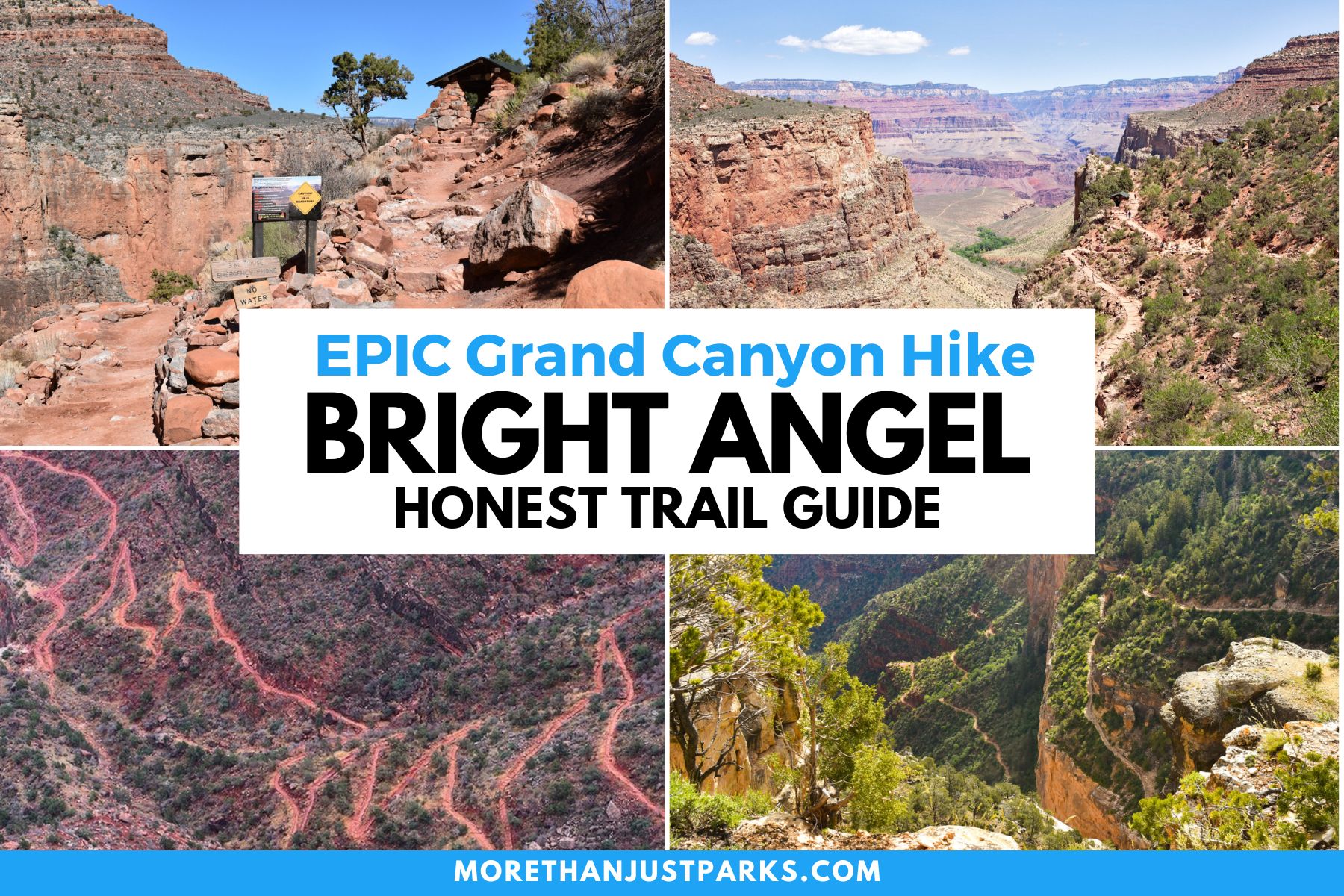
Article Overview: Hiking the Bright Angel Trail in Grand Canyon
Bright Angel Trail in Grand Canyon National Park stands out as the most popular and prestigious, but don’t let that endearing name give you any indication that it’s easy.
It’s a trail that praises angels with a devil along the way, and the purgatory in between holds a wealth of important information we’ll go through by chapter and verse.
The trail was named by Grand Canyon pioneer John Wesley Powell, who led the first recorded expedition through the canyon in 1869. He chose the name from a hymn to juxtapose a creek he previously named Dirty Devil.
“Shall we gather at the river, Where bright angel’s feet have trod.”
– Robert Lowry Hymn, 1965, “At the River.”
The rewards of this trail are earned only by knowing the potential risks. It’s cathartic for me to write about this, as the most common mistake on this trail is one I made in my early hiking days near Donner Summit, California.
I caught the perfect sunrise as I descended 2,000 feet from Sugar Bowl to the edge of Donner Lake. It was as perfect of a hike as I could imagine, especially since my golden retriever, Donner, was with me. Then I had to go back up the mountain, in thin air, during the heat of the day. It was brutal… and all my fault for not planning ahead.
While Sir Isaac Newton coined the phrase, “What goes up, must come down,” if you want to complete the Bright Angel Trail, you need to reverse the law of gravity to realize what you walk down; you must walk back up.
Here, I’m going to take you step-by-step to earn your wings on Bright Angel Trail in the Grand Canyon.
Bright Angel Trail in Grand Canyon
Table of Contents: Bright Angel Trail
Things to Know Before You Visit Grand Canyon National Park
Entrance Fees
$35 per vehicle OR if you plan to visit more National Parks within the next 12 months, I suggest you go ahead and purchase the America the Beautiful Pass (which can be found at the entrance gates to most national parks). This pass gets you into all National Parks, Forests, Monuments, and more, including 2,000 sites for free after a one-time $80 fee.
Grand Canyon National Park also offers a $70 annual park entrance pass.
Sunscreen
Use it. Lots of it. Especially this one, which I never leave the house without because it plays nice with our dear friend, Earth 🙂
Insect Repellent
If you’re looking for a good insect repellent that plays nice with our good friend Earth, we recommend this one or this one if you’re a DEET person.
Guide Book
The Best Guide Book for Grand Canyon National Park is this one which we’ve marked up and highlighted quite a bit.
Map
The Best Map: I like this map best for Grand Canyon National Park.
National Parks Checklist Map: This beautiful National Parks Checklist Map can be ordered to your house.
Framed National Parks Map: We’re a sucker for maps; this framed national parks map is the best.
Where to Stay in Grand Canyon National Park
Where to Stay: This is our favorite hotel in/around Grand Canyon National Park.
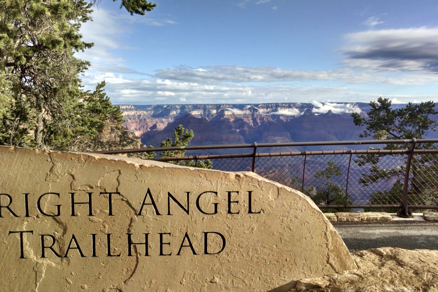
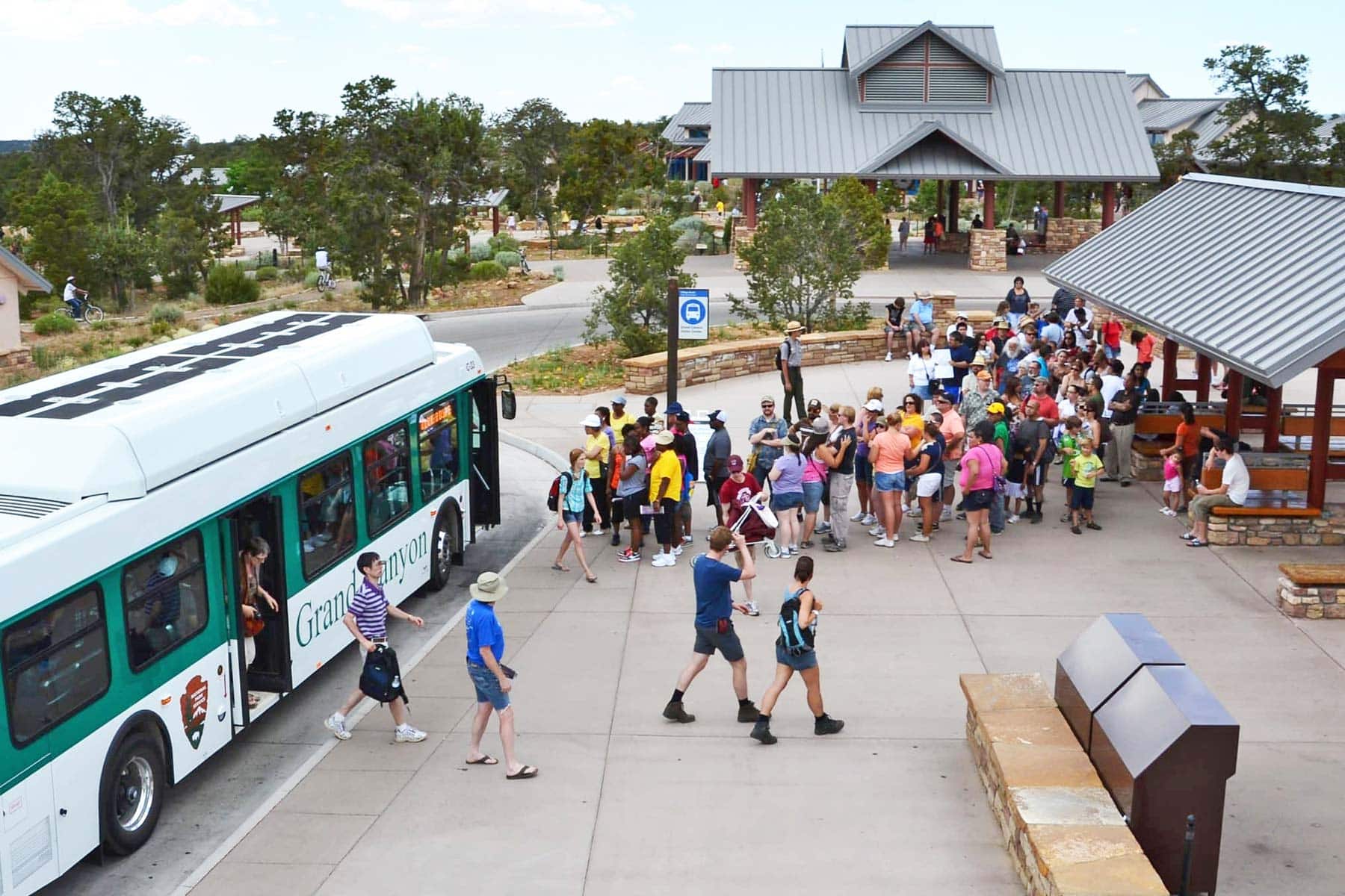
Getting to the Bright Angel Trailhead
Bright Angel Trail starts at the South Rim, which means you’ll need to enter through the busy South Entrance. This should give you even more motivation to arrive early for the long hike ahead. Buy your tickets in advance to get through faster, as there’s an entire lane dedicated to pass holders.
You can also skip the lines by taking the Grand Canyon Railway from Williams, Arizona. The train drops you off near the trailhead.
Grand Canyon National Park also offers a free shuttle service. The Blue Line takes you to Bright Angel Trail’s epic entrance.
Bright Angel Trail Rim-to-River vs. Day Hike
Several trails will lead to intersections with the Bright Angel Trail, but this walkthrough is the full Bright Angel Trail, known as the “From Rim to River” option.
Bright Angel Trail has two options. One is a day hike that takes you from the canyon rim to Havasupai Gardens or Plateau Point. That’s six miles each way.
WATCH: Here’s a live look at the Bright Angel Trail
The other is a backcountry trip that spans almost 10 miles and takes you from the South Rim, down the canyon, across the river, and to the Bright Angel Campground. A backcountry permit is required.
You should not attempt to do the “Rim to River” route in one day, even if you are an experienced hiker. Several people have died trying to take the strenuous trail on one hike.
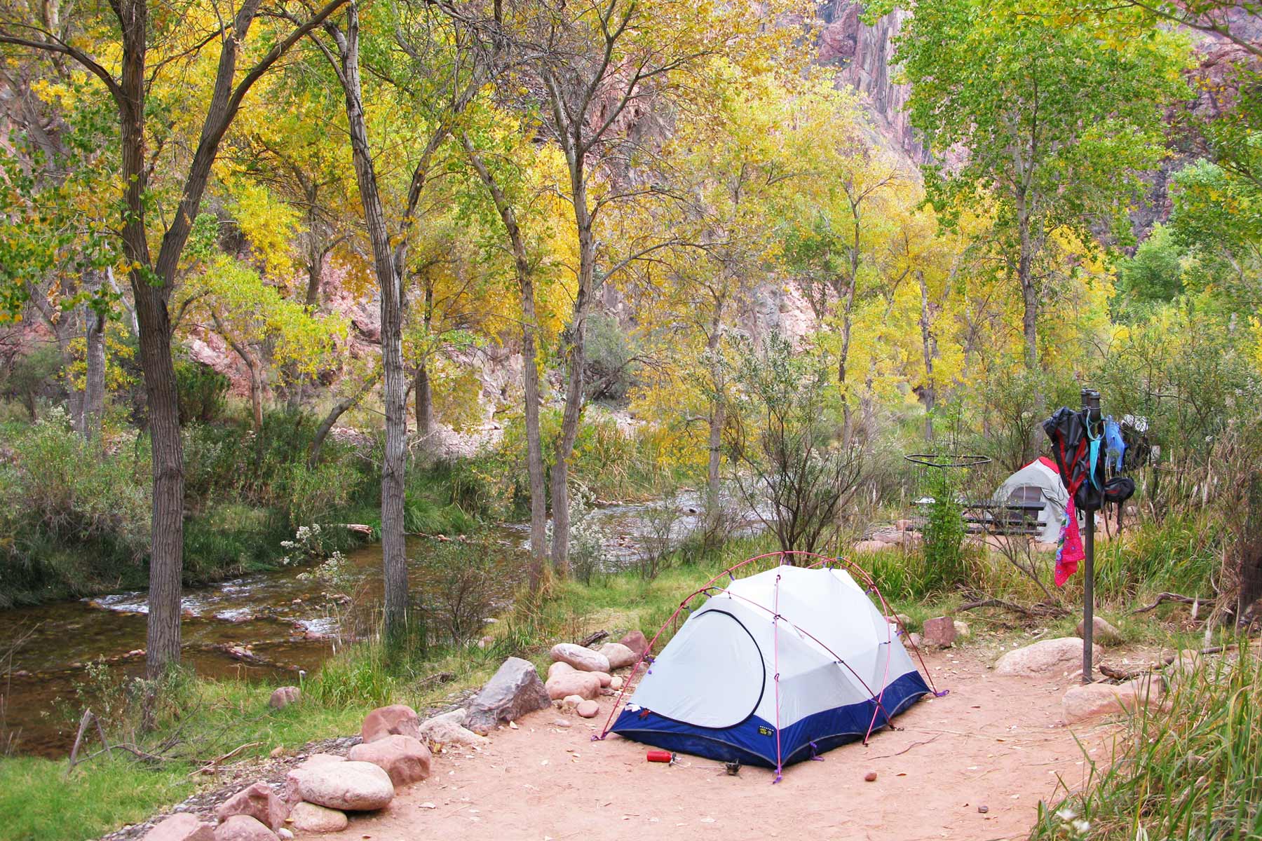
Camping at Bright Angel Campground
Getting a backcountry permit to stay at Bright Angel Campground is going to be challenging through 2024. If you are one of the lucky ones, you should go buy a lottery ticket. They are that rare. Due to the ongoing work on the Transcanyon Waterline, access to the campground will be very limited through the 2024 season.
TIP TO GET PERMIT: Look at the Last Minute Permit option to get a spot at the Havasupai Gardens or Bright Angel Campgrounds. You must visit the Backcountry Information Center to get on the waitlist.
For the most elite adventurers reading this, you can get to the Bright Angel Trail via the North Kabib Trail on the rim-to-rim hike, but you won’t be able to get a permit to camp at Havasupai Campgrounds. It’s just too far. You should opt for Cottonwood Campground or Phantom Ranch instead.
Similarly, those taking the South Rim entrance on Bright Angel Trail can’t get a last-minute permit for Cottonwood Campground due to the distance.
Bright Angel Trail Overview
If you can only hike one trail in Grand Canyon National Park, Bright Angel Trail should be your first choice.
Here’s why:
- Unparalleled views every step of the way.
- Frequent stops with water (seasonally) and resthouses.
- The trail is one of the best maintained in the entire National Park Service system.
- Easy access from Canyon Village.
- Shaded tunnels and sun-blocked mountains along the way.
- Restrooms are available along the trail.
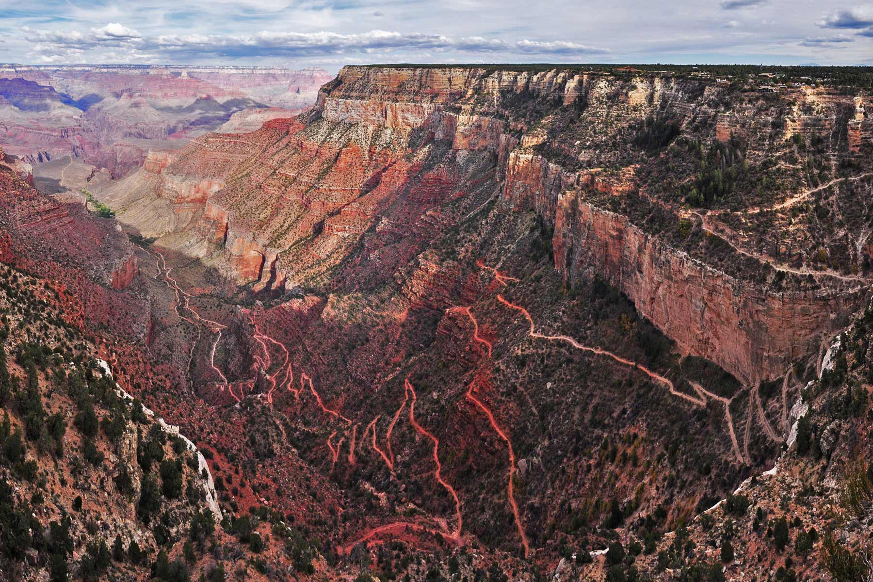
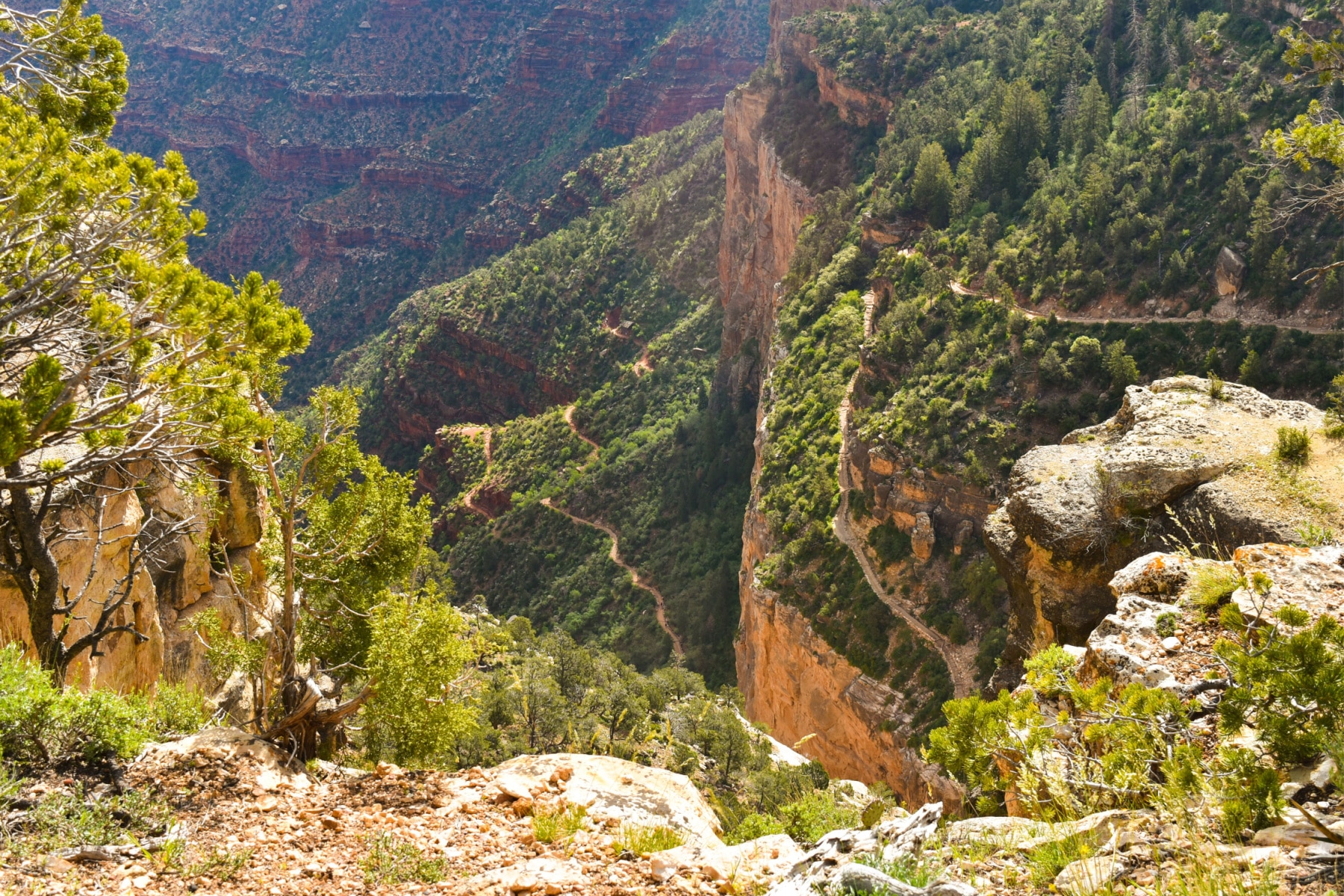
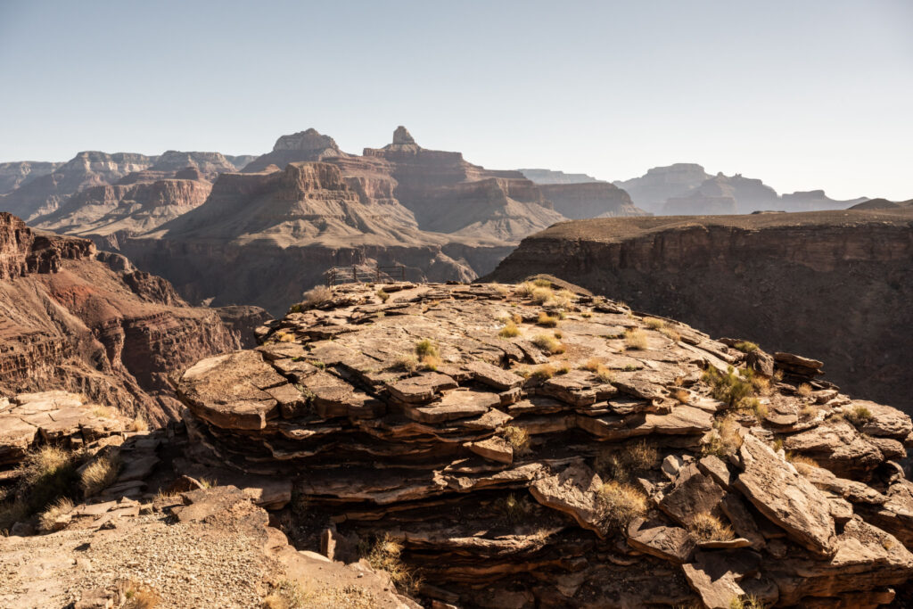
The trail weaves its way down the canyon walls in a dizzying number of switchbacks. From your first step, you get stunning views. You’ll descend through two billion years of geologic fault lines along the way as you hug the canyon walls while facing steep drops on the other side.
WALKING IN ANCIENT FOOTSTEPS: This trail has been used since ancient times by people seeking precious water at the bottom of the canyon. Future generations of Native Americans crafted the trail until the NPS took over and finalized the trail you will walk.
As you reach Havasupai Gardens, 4.5 miles into the hike, the trail flattens out a bit to reach Plateau Point. To reiterate, this should be the limit for less-than-expert hikers. If you are backcountry hiking, you can continue on where you’ll meet switchbacks so tough and exposed that they are nicknamed “Devil’s Corkscrew.” The National Park Service simply calls it the Corkscrew.
Is Bright Angel Trail Safe?
Before we get to the step-by-step walk on the trail, I wouldn’t be able to sleep well tonight without pointing out some common safety mistakes first. It’s not so much the inherent dangers of the trail—which do exist—but there’s also a potential false sense of safety if you don’t know the details we’re sharing here.
Going Down vs. Going Up
Day hikers heading to Plageau Point will descend more than 3,000 feet in six miles, while those heading to the Bright Angel Campground will drop nearly 4,400 feet in less than 10 miles.
With the first part of the hike, when you’re hydrated, well-rested, and full of energy, you’ll take the trek down the canyon wall much faster, even with the switchback. After a day of hiking in the elements, the climb back up will be tough.
“The steepness of the trail is very misleading on the way down. Plan on taking twice as long to hike up as it took to hike down.” – Grand Canyon National Park Rangers
Steep Drops
You’ve heard the saying, “Jumping into the deep end,” right? The Bright Angel Trail starts similarly, with the first step being an awe-inspiring view with a steep drop. The trail is four feet wide and well-maintained, but there are no barriers to stop someone from falling, and you have miles of trails before you’re not literally on the edge.
The trails also have spur trails that are not meant for visitors. Going off the trail can be deadly. Sadly, a man fell to his death after going off the main trail in March 2023.
Water On the Trail
If I have one amazing habit developed from living in the desert, it’s that I drink a lot of water each day. When hiking, I’d rather carry a heavy bulk of water than risk being without it deep on a trail. With four stops along the Bright Angel Trail with potable water from May through October, it’s too easy to assume that there is water ahead.
- Don’t rely on potable water, even during those aforementioned months. Water access is never guaranteed.
- Bring your own supply of water AND a way to treat water by filtering or with cleaning tablets.
- Be prepared to boil water if necessary to kill bacteria and other toxins from spring water.
- Set designated amounts of water to consume as you go. Drink up to one quart of water per hour when desert hiking. DO NOT OVERDRINK. “Water Intoxication” is a real risk.
- Remember this rule of the desert, “By the time you are thirsty, you are already dehydrated.”
HYDRATION FACT: Hiking at the hottest time of day in direct sunlight can lead to fluid and electrolyte loss of up to two quarts per hour.
Find your favorite brand of electrolytes and add them to the water. You won’t realize how much sweat you are losing since it evaporates faster in the desert. Keep salty snacks handy to keep up energy levels.
Seasonal Risks
Summer trips to the Grand Canyon are just dangerous for those who want to hike long distances.
Throw out whatever you might think about “cooler altitude changes” because the Grand Canyon averages triple-digit highs from June through August. May and September still peak in the 90s.
Even with shaded spots along the way, there’s little relief from the sweltering heat. With the Bright Angel Trail starting on a descent, you’ll get hotter temperatures as you go.
EXAMPLE: I’m writing this article in mid-July. There’s an Excessive Heat Warning in the Grand Canyon with the inner canyon high expected to hit 118°(F).
Grand Canyon National Park officials recommend you don’t hike between 10:00 am and 4:00 pm in the summer, and that’s not going to give you enough time to take the Bright Angel Trail.
The best seasons to take the Bright Angel Trail are spring and fall.
Winter hikes are stunning, too, but there’s the additional risk of snow and ice on the trail. The first snowfall is usually in November.
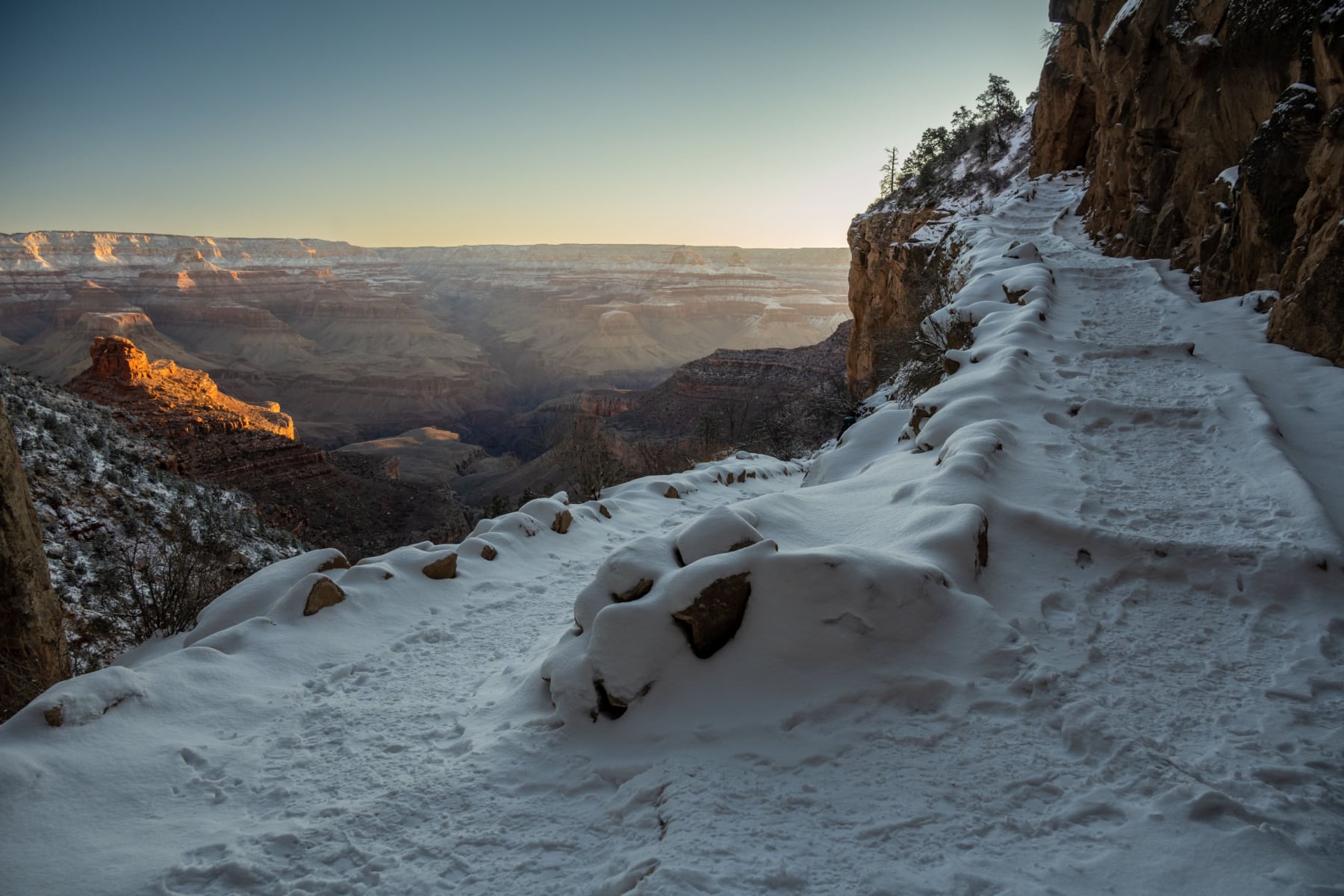
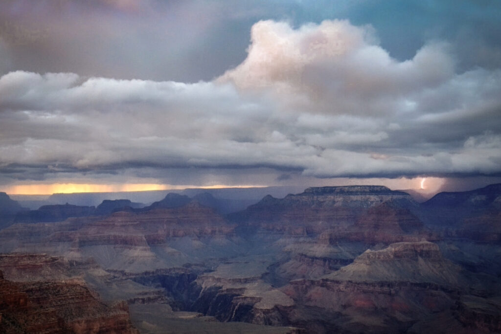
- Flash flooding, lightning strikes, and lightning-sparked wildfires are other risks. The forecast should play a big part in your decision to take the Bright Angel Trail.
- Did I mention this trail has a history of rockslides and landslides? Yep, gotta watch out for those, too. It might cause trail sections to close or lead to some scrambling over boulders.
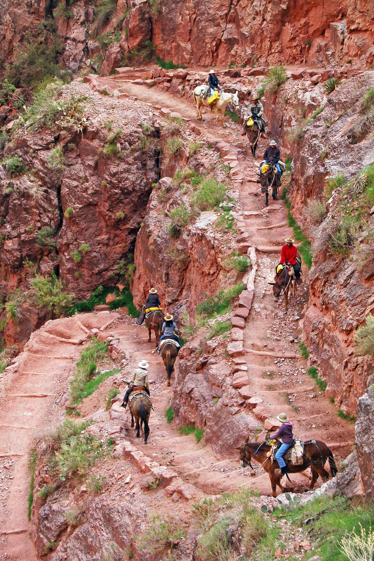
Are There Mules on Bright Angel Trail?
If you’ve seen a video of mules walking along Grand Canyon trails, it has likely been on Bright Angel Trail. I’ve been waiting all day to give this safe advice for hiking Bright Angel Trail—”Don’t be an ass.” Mules always have the right of way.
- Mules are unpredictable when startled.
- The mule wrangler will give hikers instructions as they pass.
- Hikers should hug the side of the canyon and not move until the mule is 50 feet away.
Mule ride availability is being impacted by the same rehab project that impacts the backcountry campsites. However, it usually takes 15 months to reserve a mule ride anyway, so it’s a great chance to plan ahead.
Bright Angel Trail FAQ
You aren’t the first person to ask that question, but I’m going to let the National Park Service answer.
“It will take most hikers between 4 and 5 hours to get to the (Bright Angel) campground. Oddly enough, very few people ask how long the return hike will take. The return hike may take twice as long, though 7 to 8 hours seems to be average.“
Each person should have one gallon of water. Do not rely on water sources along the way. If water is available, fill up. You also don’t want to overhydrate. Try to keep water consumption to one quart per hour, and don’t forget to add electrolytes.
Before the Grand Canyon was a national park, this was a fee-based route popular with tourists. Due to battles between Coconino County and the National Park Service, the South Kaibab trail was developed as a free route to get to the river faster. South Kaibab’s Trail has fewer amenities but is just as tough.
Bright Angel Trail and Bright Angel Point are on opposite sides of the canyon. The trail and lodge bearing the name are on the South Rim. The Bright Angel Point Trail is one of the best hikes on the North Rim. What gives? The name Bright Angel was given to the creek and canyon that was carved down from the North Rim to the Colorado River. Bright Angel Point provides a view of that canyon. The trail takes you to it from the other side.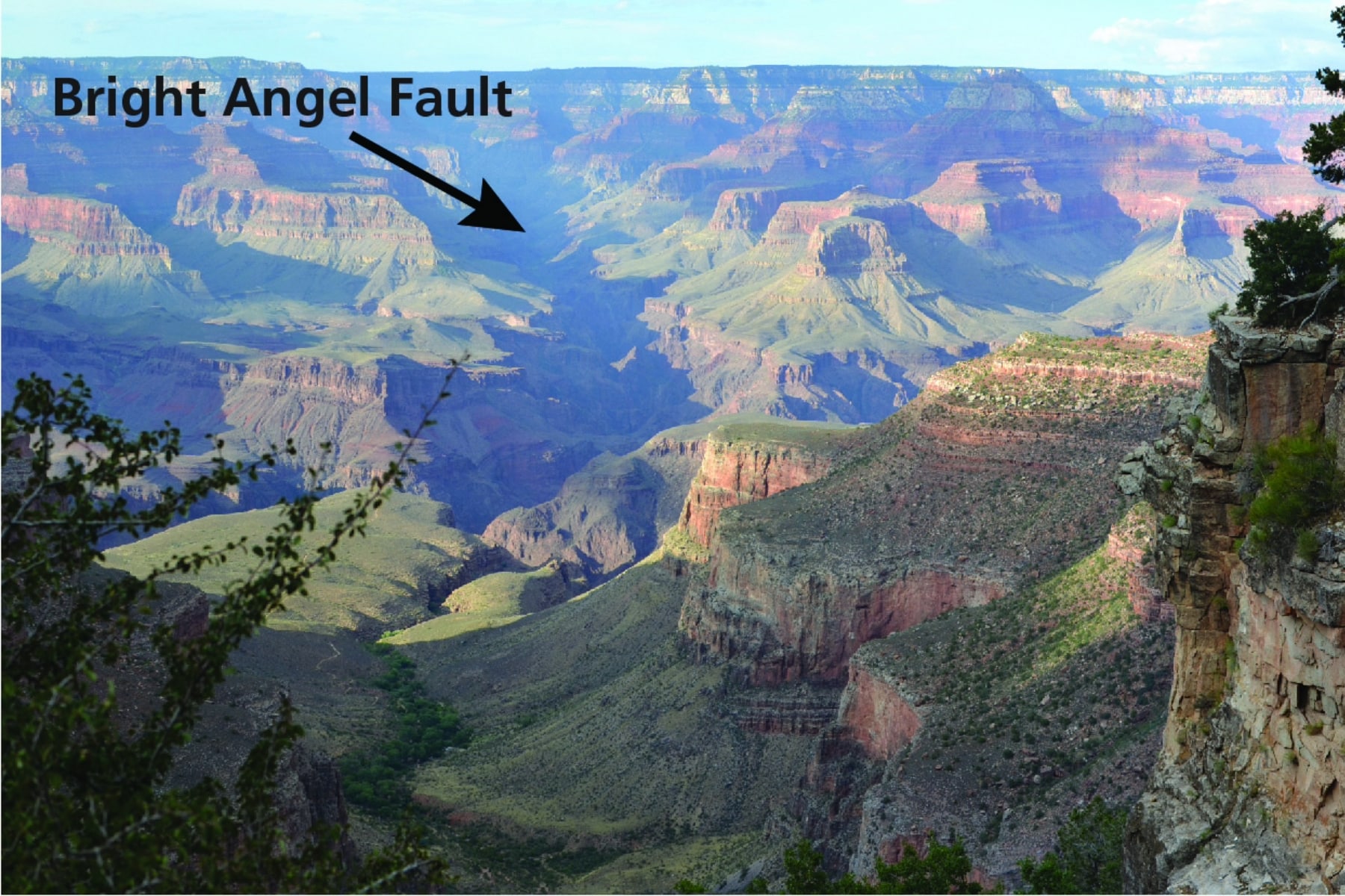
Bright Angel Trail: Section-by-Section Guide
The Bright Angel Trailhead is tucked behind the Rim Trail near Grand Canyon Village. Signs along the way will give you historical notes, warning you of dangerous overlooks, and tell you where to stand if a mule is passing.
Here’s a great podcast to listen to as you descend through the layers of rock.
Trailhead to 1.5 Mile Resthouse
Section Length: 1.6 miles
Total One-Way Length: 1.5 mile
Round Trip Length: 3 miles
Elevation Change by Section: 1,120 feet
Total Elevation Change: 1,120 feet
The trail entrance gives a sweeping view of the canyon that lies ahead. You’ll pass through two short tunnels blasted into the rocks on the way down, with two big switchbacks on the way. Those tunnels come at 0.1 miles and 1.8 miles in. This is not the time to say, “These switchbacks aren’t so bad.” Up next is a tighter series of switchbacks with views that tunnel through the canyon.
This part of the trail is shaded much of the day.
1.5 Mile Resthouse to 3 Mile Resthouse
Length: 1.5 miles
Total One-Way Length: 3 miles
Roundtrip Length: 6 miles
Elevation Change by Section: 1,000 feet
Total Elevation Change: 2,120 feet
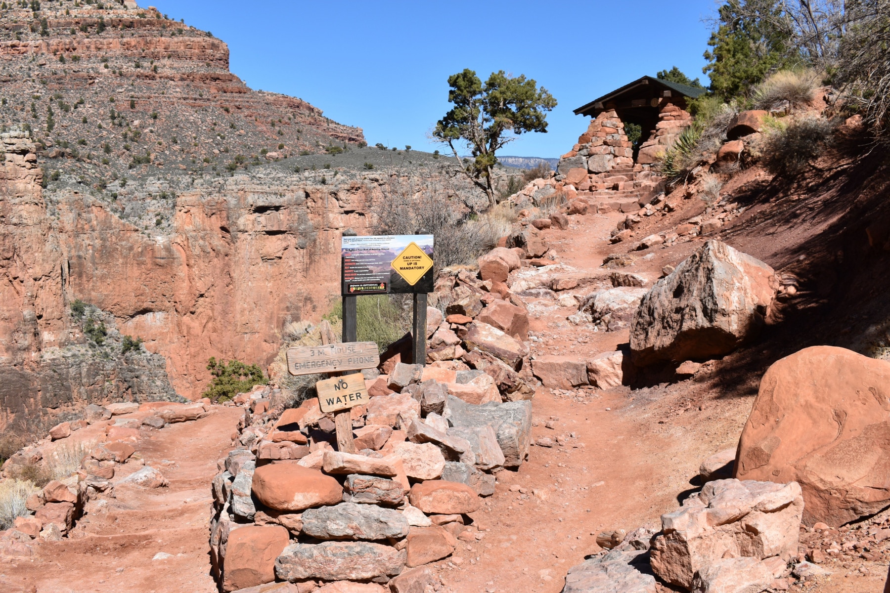
The first resthouse is a stone structure tucked into the canyon wall. A potable water fountain is here, so fill up if water is available. True to its name, the resthouse is about 1.5 miles into the trail. This could be a great turnaround spot for summer hikers, making the length of the hike three miles. An emergency phone is available, too.
The trail continues down several switchbacks, but the rocks here are much more fiery red than the higher portion of the trail. You still have great shade.
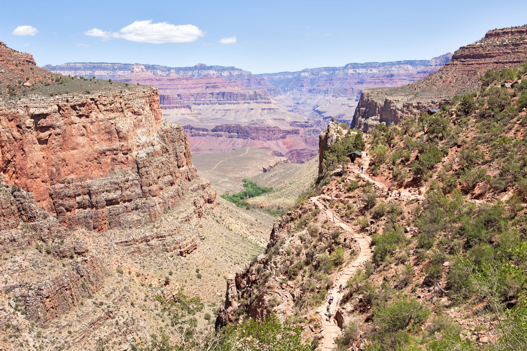
3 Mile Resthouse to Havasupai Gardens Campground
Length: 1.7 miles
Total One-Way Length: 4.5 miles
Roundtrip Length: 9 miles
Elevation Change by Section: 948 feet
Total Elevation Change: 3,040 feet
You’ll come to another resthouse with bathrooms, a shaded stone building to rest, and a water option. It’s no different than the first one, just further down the trail.
From the resthouse, you’ll come to a series of switchbacks known as Jacob’s Ladder through Redwall Limestone. The trail eventually flattens out, and if you’re only doing a day hike, there are no more switchbacks ahead.
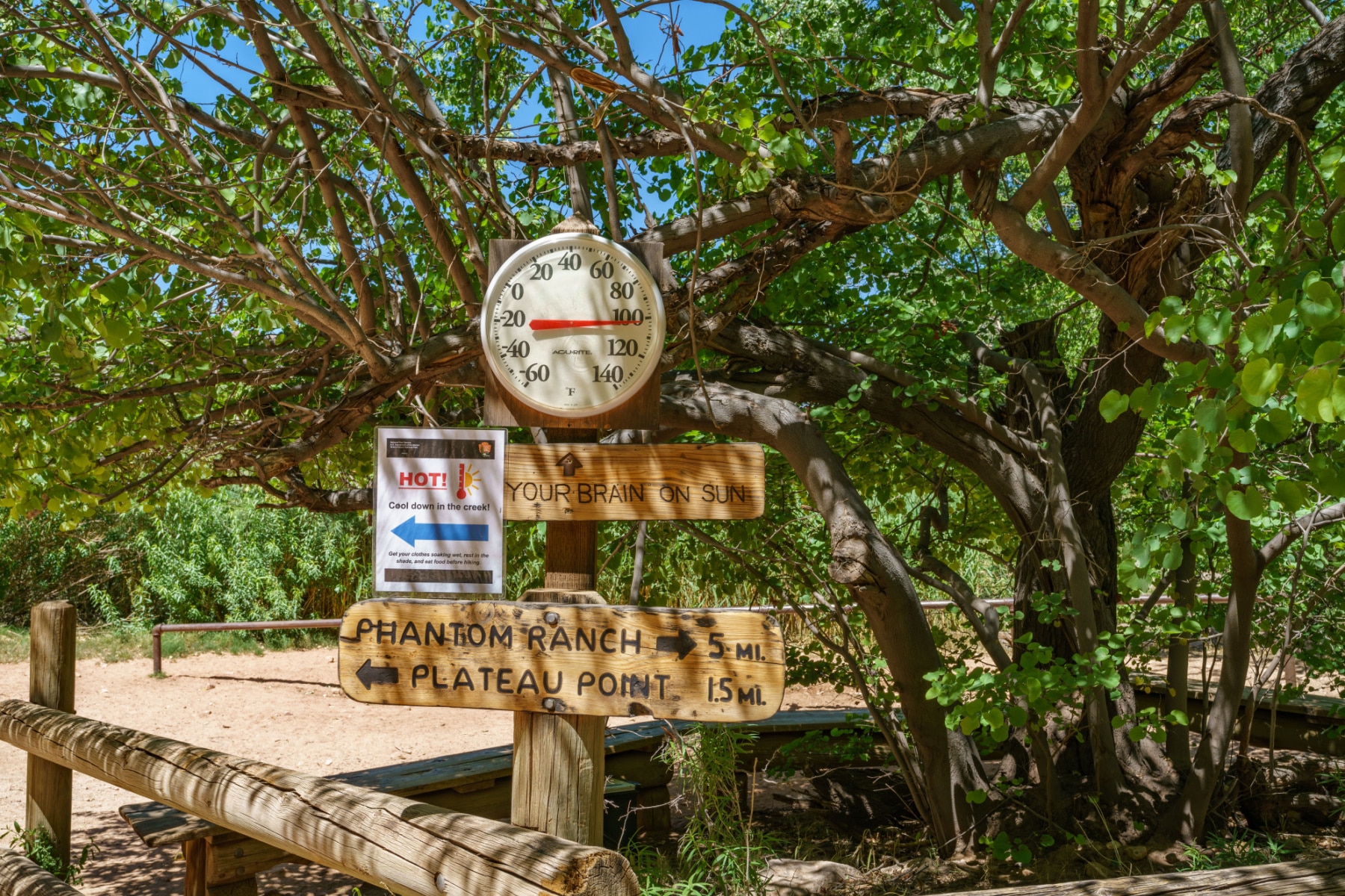
Havasupai Gardens Campground to Plateau Point
Length: 1.5 miles
Total One-Way Length: 4.5 miles
Roundtrip Length: 9 miles
Elevation Change by Section: 40 feet
Total Elevation Change: 3,080 feet
Havasupai Gardens (formerly Indian Garden) is a true oasis in the desert, with a campground, rest area, bathrooms, and water. For summer day hikers, you’ll see signs warning you not to go any further.
“The eviction of Havasupai residents from Ha’a Gyoh coupled with the offensive name, Indian Garden, has had detrimental and lasting impacts on the Havasupai families that lived there and their descendants. Every year, approximately 100,000 people visit the area while hiking the Bright Angel Trail, largely unaware of this history. The renaming of this sacred place to Havasupai Gardens will finally right that wrong.”
– Chairman Thomas Siyuja Senior, Havasupai Tribe of the Havasupai Reservation
To get to Plateau Point, it’s another 1.5 miles ahead on a side trail. Look for the fork in the trail with the arrow pointing to the correct trail. This part of the trail is more exposed to the sun but has minimal elevation change and no tight switchbacks.
You’ll come to a precipice with a guardrail (and be amazed by the people beyond the guardrail) for expansive views and a deep look down to the Colorado River. Return to the gardens the same way you came.
Bright Angel Trail Turnaround Point for Day Hikes
You should be prepared to turn around here and go back for day hikes. The next stretch is strongly recommended for backcountry hikers only with reservations at a campsite or Phantom Ranch.
There is no tolerance for “I’m just too tired to go on. I guess I’ll have to sleep here tonight.” If you have health concerns about going back up, please speak with park rangers at Havasupai Gardens Ranger Station.
Havasupai Gardens to River Resthouse: “The Death Zone”
Length: 3.2 miles
Total One-Way Length: 8 miles
Roundtrip Length: 16 miles
Elevation Change by Section: 1,320 feet
Total Elevation Change: 4,380 feet
This is the longest section of the trail without water or shade. This is why it’s referred to as The Death Zone. If you are feeling fatigued, sick, or don’t have enough supplies, DO NOT PROCEED. Know the signs of heat stroke and heat exhaustion. There is a Ranger Station at the gardens if you need help.
For those backcountry hiking, you can add Plateau Point to your mileage or continue on the Bright Angel Trail. Now that you’ve had the views of an angel, it’s time to face some demons. The next set of switchbacks is called “Devil’s Corkscrew.”
The switchbacks are:
- Steep
- In direct sunlight
- Surrounded by dark canyon walls made of schist that absorb and emanate heat
Garden Creek is one respite in “The Death Zone,” but this waterfall shouldn’t be relied upon for clean water.
At the same time, if water is available, make sure you clean it before consuming it with a filter or tablet.
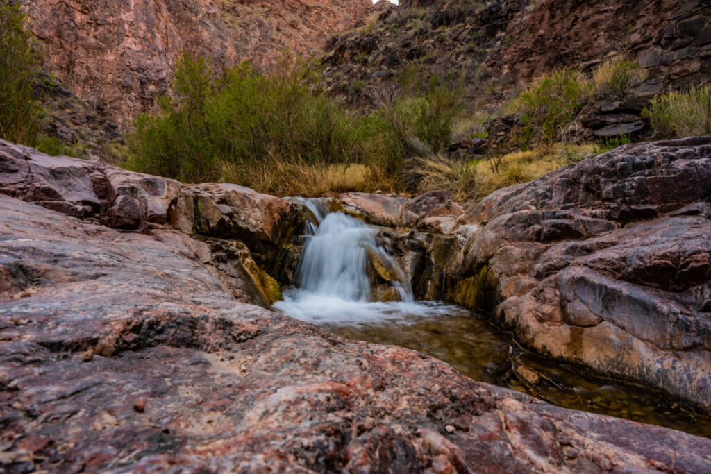
In addition, the trail waves along 500-million-year-old rock in a section known as the Tapeats Narrows. Here’s a sample of what to expect.
You’ll eventually come to the River Resthouse/Pipe Creek Resthouse, with bathrooms, water, and easy access to the Colorado River.
River Resthouse to Bright Angel Campground
Length: 1.5 miles
Total One-Way Length: 9.5 miles
Roundtrip Length: 19 miles
Elevation Change by Section: 0 feet
Total Elevation Change: 4,780 (including the 200 feet you’ll lose then gain after crossing the river)
The trail rides the edge of the river for a while before a few more curves that increase and then decrease in elevation. The lowest point on the hiker by the river is 2,400 feet. However, the altitude gain from spot to spot is even. You get a little bit of shade when you hug the canyon wall during this walk.
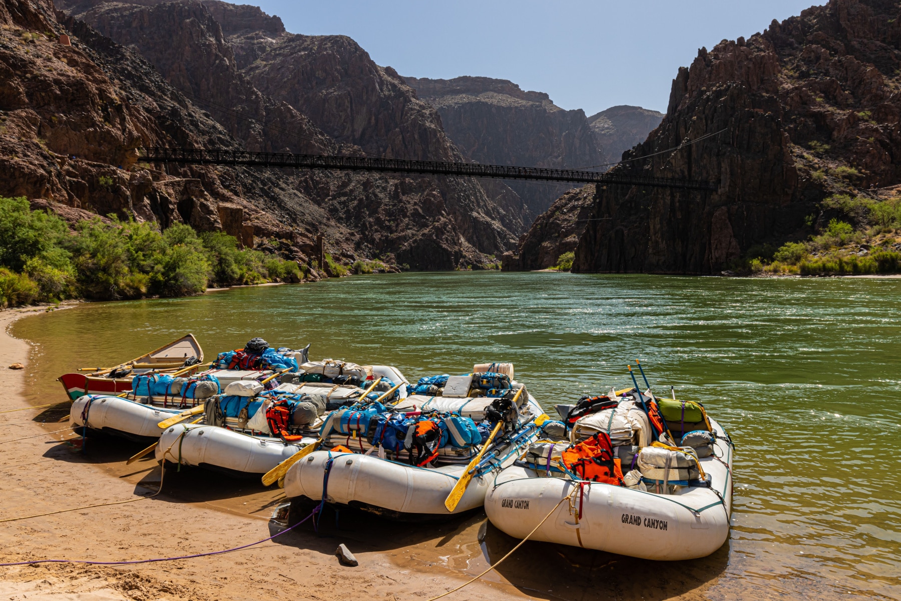
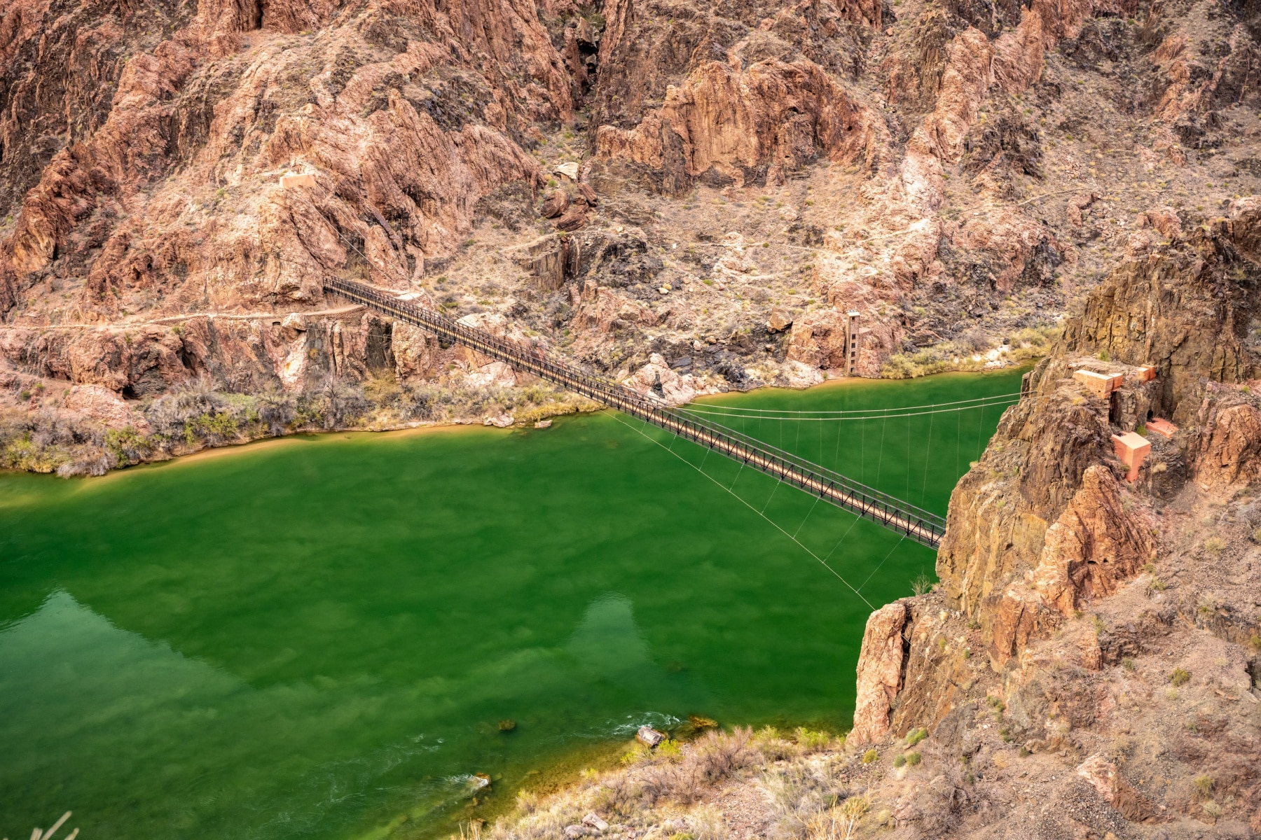
From here, all that’s left is to cross the narrow pedestrian bridge over the river, and then you’re at Bright Angel Campground.
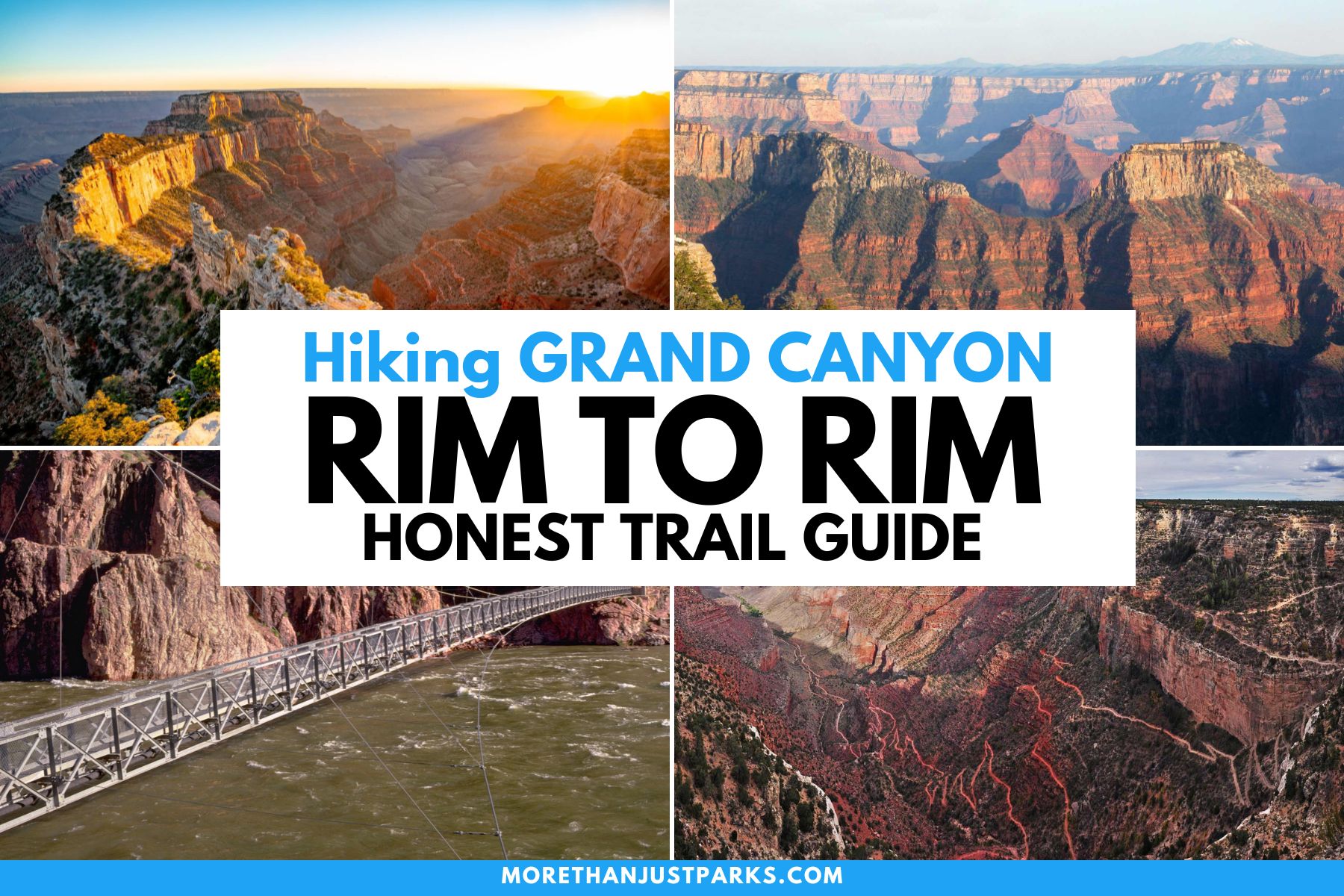
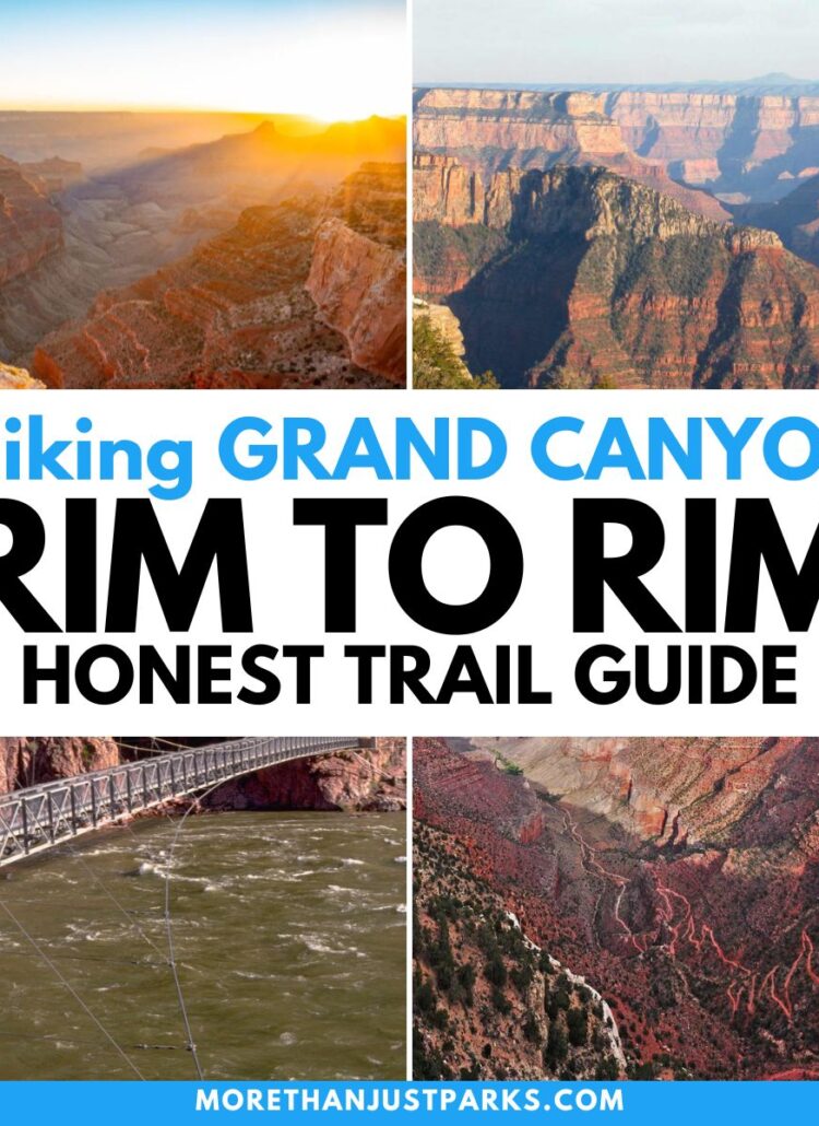
Hiking Rim to Rim at Grand Canyon National Park
While Bright Angel Trail takes you from the South Rim to the Colorado River, you don’t have to stop there or even start there. Bright Angel Trail meets up with the North Kaibab Trail, which then ascends to the North Rim. South Kaibab Trail also takes you on a shorter route to the river.
Click on the image below for the ultimate guide for hiking rim-to-rim in the Grand Canyon.
Starting Planning Bright Angel Trail Hike Now
I mentioned earlier that the mule rides get booked up to 15 months in advance. So are the accommodations at Phantom Ranch, one of the enclosed accommodations just past the Bright Angel Trail. In fact, you can’t even make a reservation. You put your name into a lottery.
You can also choose to take a guided hiking and rafting tour, where you take a hike with a group and then continue on a rafting adventure on the Colorado River.
Every danger on the Bright Angel Trail is one you can avoid with proper planning and discipline. Even the Grand Canyon National Park rangers say, “…it is without question the safest trail in Grand Canyon National Park,” and note that North Kaibab Trail is the most difficult.
However, many publications say the Bright Angel Trail offers one of the most dangerous in the state. Of the 250 people rescued from the canyon each year, almost all of them made a decision that was outside of safety guidance.
While I hope you now understand the risks better, it’s important to mention that there are rangers staged along the trail to check on hikers. This is the only trail in the park with as many resthouses, restrooms, and water supplies. The more you plan, the safer this trail becomes.
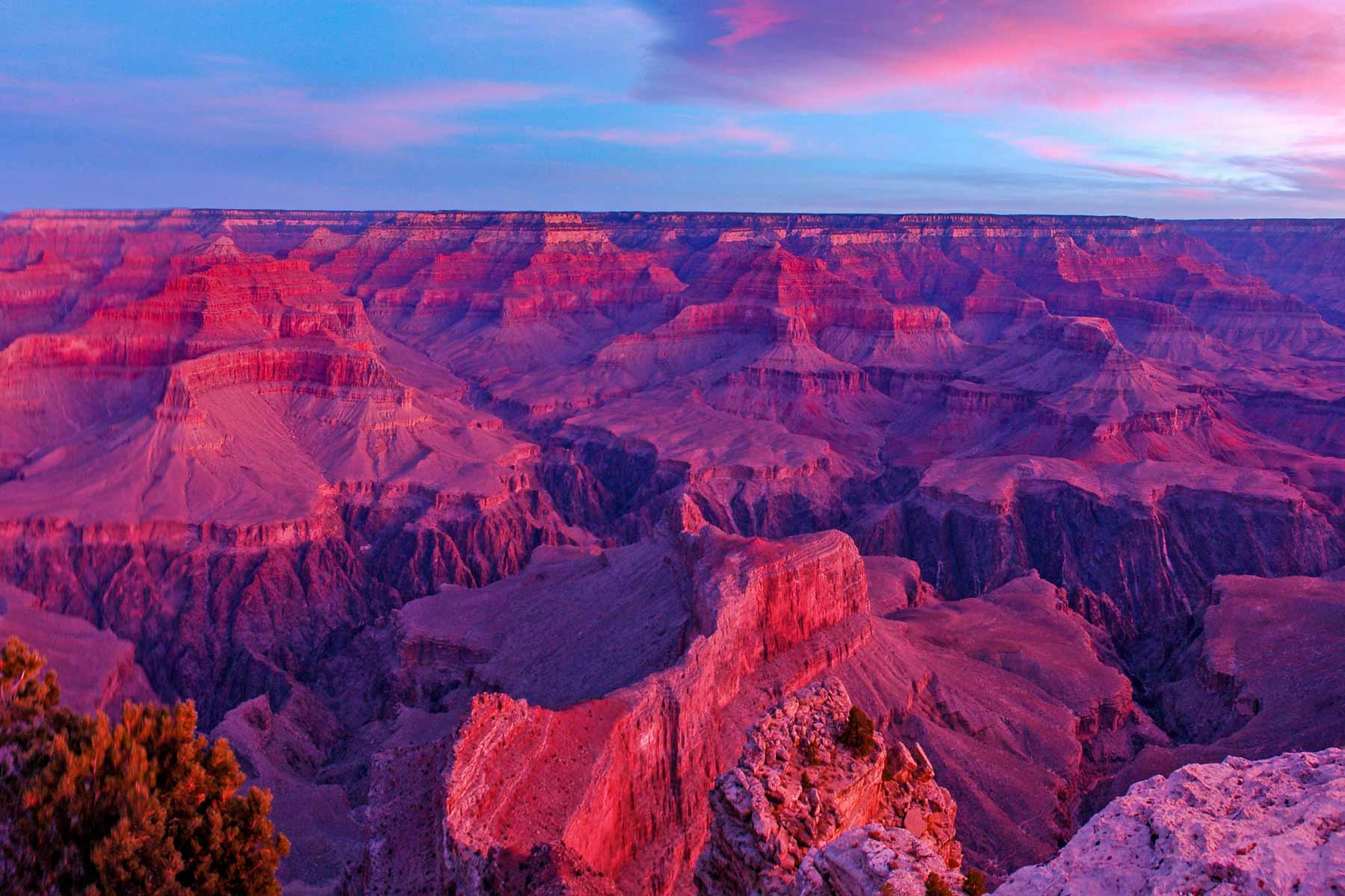
Take your time, too, because these views are truly among the most incredible you’ll ever see.
Map of Bright Angel Trail
Pin Bright Angel Trail
Helpful Related Links
Free Help Planning Your Grand Canyon Trip: Ultimate GRAND CANYON ITINERARY (Visiting 1 to 3 Days)
Hiking Rim to Rim: Detailed Guide to Hiking Rim to Rim in the Grand Canyon
Go North, You Can Thank Us Later: The North Rim of the Grand Canyon is Better
Ready to go to the Rockies?: Rocky Mountain National Park: An (Epic) Photo Guide to Colorado’s Gem
Need a Winter Backup Plan?: 15 Best National Parks to Visit in December (+2 to Avoid!)
An Epic Summer Park Visit Without the Heat: SUMMER in Acadia (Helpful Guide + Video)
The OTHER South Rim: 15 EPIC Things to Do in Black Canyon of the Gunnison National Park
Leave a Reply