Article Overview: Navajo Loop Trail in Bryce Canyon National Park
Navajo Loop Trail in Bryce Canyon National Park gets beat up a lot. Despite the seasonal closures and almost annual weather damages, this trail remains one of the most popular in Bryce Canyon–and for good reason.
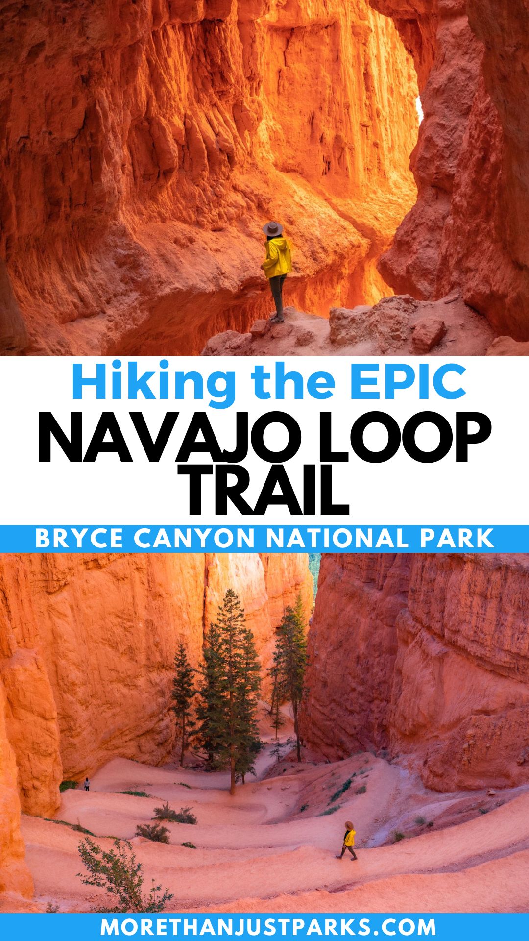
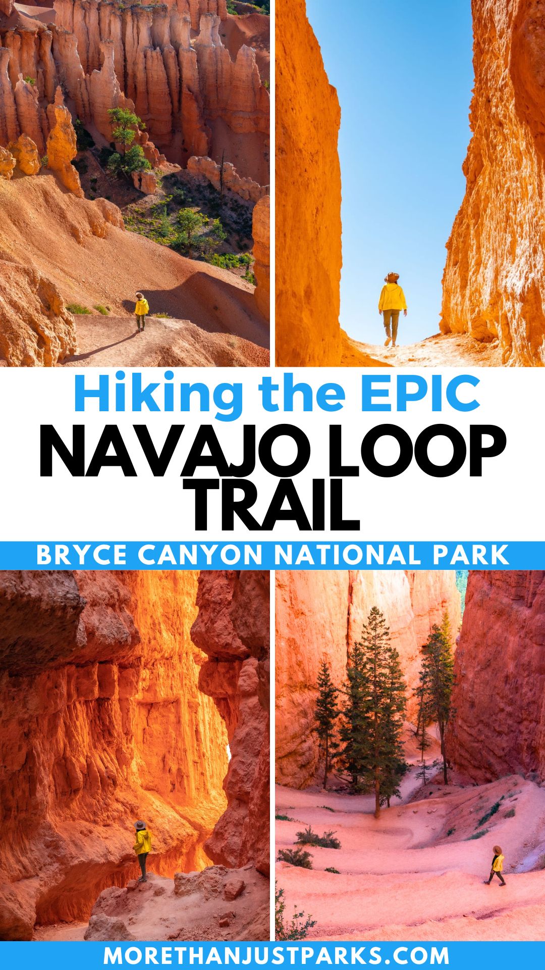
If nature could design a rollercoaster suitable for everyone, it would be the Navajo Loop Trail. You get some steep drops, switchbacks steaming with rust-colored rocks, and tight squeezes through canyon walls. All that in just 1.2 miles makes Navajo Loop Trail one of the best hikes in Bryce Canyon National Park.
What’s more? The trail itself opens up the possibility of longer treks. You can take the trail to:
- Queen’s Garden
- Peak-A-Book Loop
- Tropic Trail
In a land of hoodoos, Thor’s Hammer stands as the largest, and the Navajo Loop Trail is the best way to see it. Our guide includes step-by-step directions on the trail and some awesome options to expand the experience. That includes on trail that will keep you away from the crowds and traffic!
Navajo Loop Trail in Bryce Canyon
Table of Contents: Navajo Loop Trail
Navajo Trail Loop Know Before You Go
You’ll need to know a few things to experience the Navajo Trail Loop as easily as possible. From parking to hiking directions to seasonal closures, let’s run through them really quickly.
Parking for Navajo Trail Loop
Getting to the Navajo Loop Trailhead goes through the main entrance to the Sunset Point Parking lot. As I like to say, “Parking at Bricey is dicey.” Get there early, like with the rise of the sun, if you want a spot. Take the shuttle to avoid the hassle.
TRAVEL TIP: If you want a longer hike and smaller crowds, take the 3-mile Tropic Trail. No other trail enters Bryce Canyon’s amphitheater below the rim aside from this one.
Seasonal Closures on Navajo Trail Loop
Two routes stem from Sunset Point. You can go clockwise through the Two Bridges section or counterclockwise through a narrow passage known as Wall Street. Yes, much like the narrow passage of Wall Street in Zion’s Narrows section.
Wall Street is just as chaotic as the one in New York, with a risk of rockfalls, icy, impassible sections, and other winter weather dangers. Because of that, Wall Street is usually closed from November through April. That leaves the only Navajo Loop Trail option in winter and spring to be an out-and-back on the Two Bridges side.
When the full loop opens, park rangers at Bryce Canyon tell me the suggested route is counterclockwise through Wall Street and circling around to Two Bridges.
TRAVEL TIP: When Wall Street is closed, you can take the Two Bridges/Queen’s Garden 3-mile loop.
Weather Challenges on Navajo Trail Loop
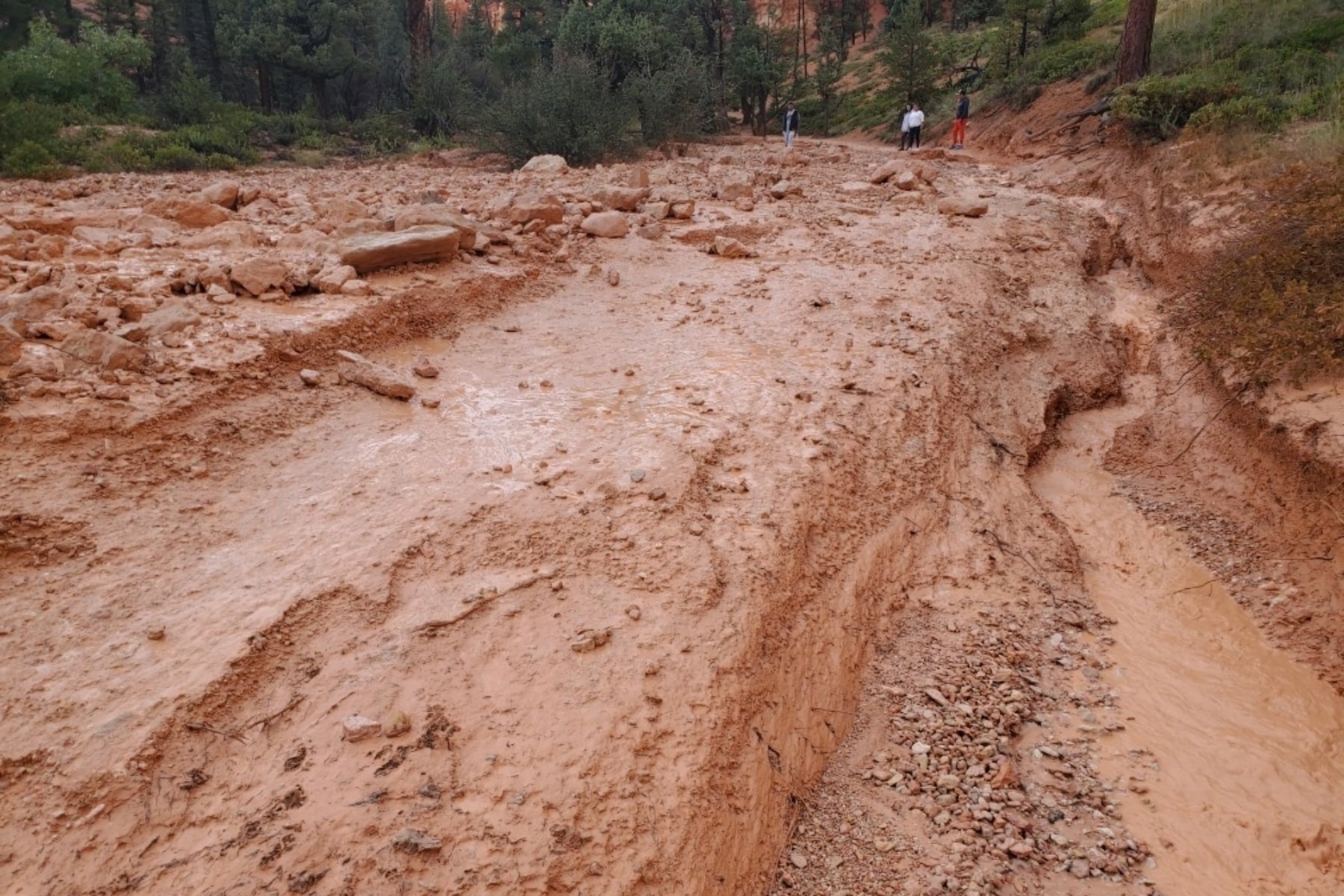
Both sections of the trail experienced bad weather conditions and trail closures over the past two years. Two Bridges’ retaining walls failed in fall 2022. They now stand repaired and safer than ever. Then, in the fall of 2023, a major rockslide and mudslide clogged access to the entire Wall Street section. The trail is expected to re-open in May 2024.
Always check the park conditions before you arrive to see if there’s a closure on your preferred trail.
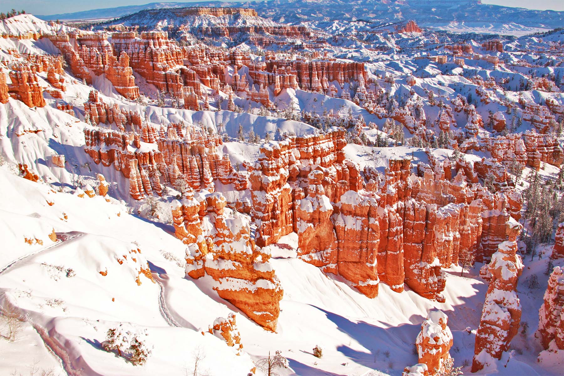
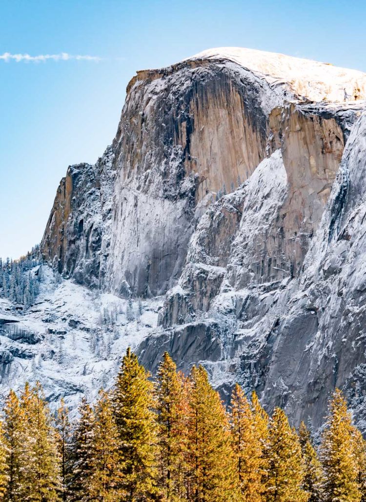
Bryce Canyon National Park’s Geology
The Paunsaugunt Plateau helps form the top of one of North America’s most spectacular terrain systems called the Grand Staircase. This gigantic series of cliffy risers and broad benches stagger upwards in stairstep fashion from the Grand Canyon and the Kaibab Uplift northward some 100 miles to Bryce Canyon and the Paunsaugunt Plateau.
Due to this staircase setup, Zion, Bryce Canyon, and the Grand Canyon all share levels of rocks, but not in the same places.
- Bryce Canyon’s bottom rock layer, Dakota Sandstone, is the top layer at Zion National Park.
- Zion’s bottom rock layer, Kaibab Limestone, is the top layer of the Grand Canyon.
- The bottom layer of the Grand Canyon, Vishnu Schist, is among the oldest exposed rocks on Earth, dating back 1.7 billion years.
In Bryce Canyon National Park, the Paunsaugunt Plateau looms at or above 8,000 feet above sea level, rising to the loftiest elevation in the park at 9,105-foot Rainbow Point, from which you can enjoy sweeping views along the Pink Cliffs and down the Grand Staircase all the way to the Kaibab Plateau.
Hiking the Navajo Loop Trail
The Navajo Loop Trail Guide
- Distance: 1.3 miles
- Difficulty: Moderate
- Elevation Gain: 550 feet
- Time Required: 1 – 2 hours
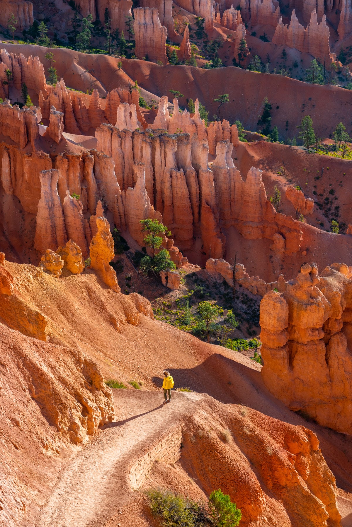
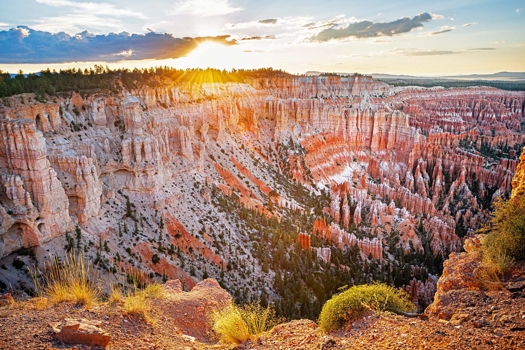
The Navajo Loop Trail drops down from the rim of the Paunsaugunt Plateau into the breaks of the Bryce Amphitheater, offering an unforgettable taste of this epic landscape.
The trailhead starts off with one of the signature viewpoints called Sunset Point, set at just about the 8,000-foot level along the plateau edge. Look closely at trail signs here–as different trails spawn out like a spiderweb at Sunset Point.
Sunset Point to Wall Street
Distance: 0.5 miles
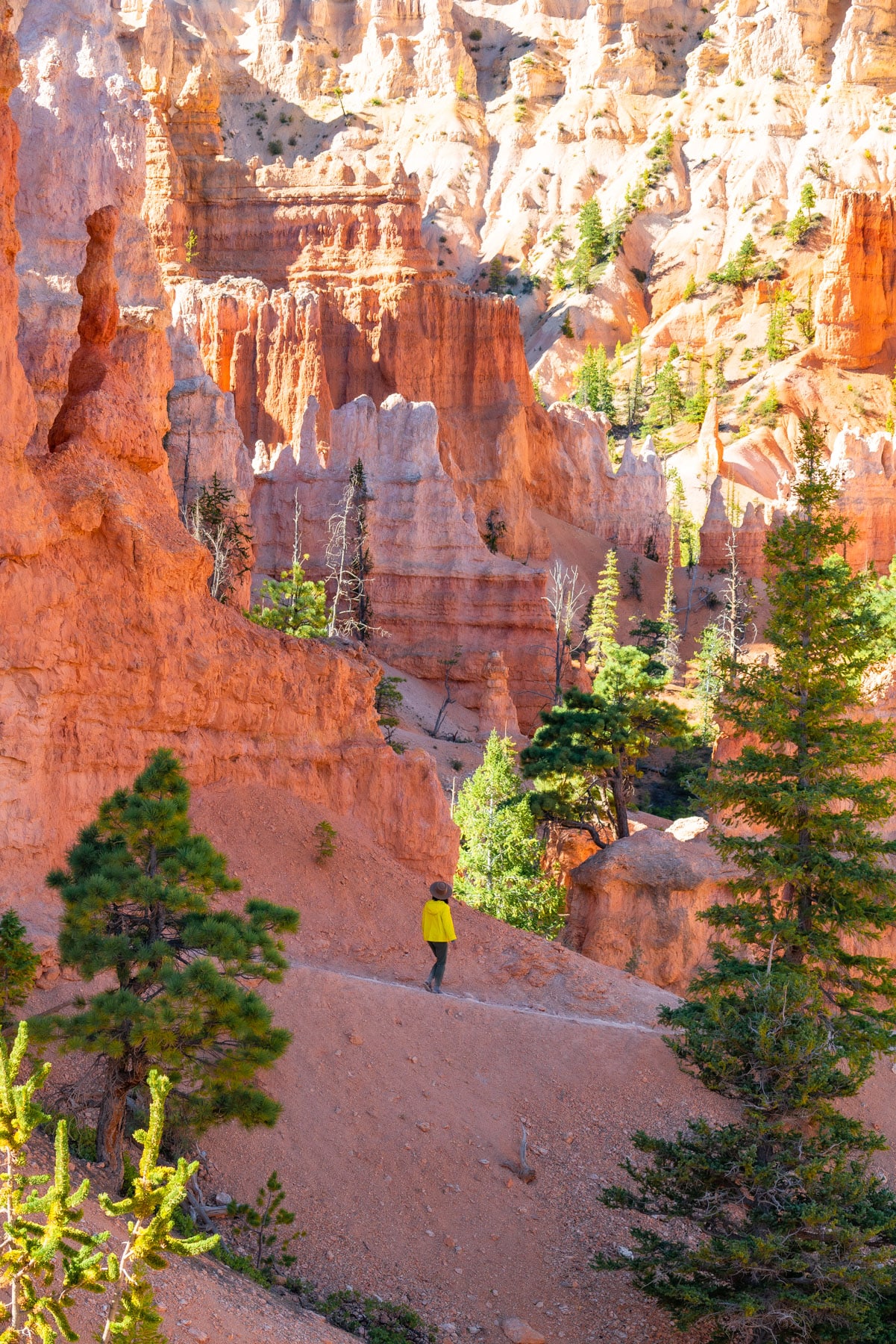
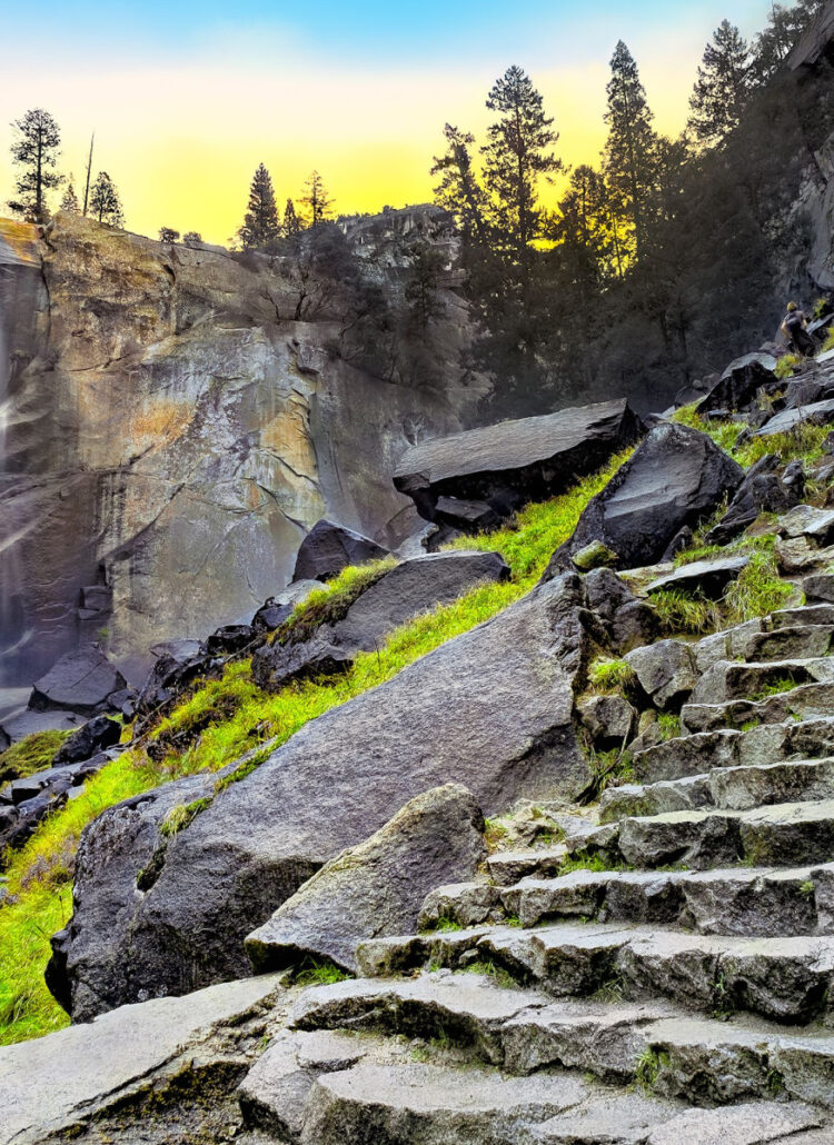
After an initial, handrail-aided descent from Sunset Point, you’ll reach the main fork of the Navajo Loop. A short trail takes you to Juliet’s Balcony, which is as gorgeous of a view as it is a reality check. That’s because you’ll be looking down as the switchbacks at bat.
On a scale of “Not so bad” to “I’m gonna fall to my death,” these switchbacks are in the middle. It’s a landscape of weaving trails, making it feel less steep unless you look ALL THE WAY DOWN into the canyon next on the list. Steep, yes, but the path awaits with broad, tight switchbacks, so it’s not especially grueling.
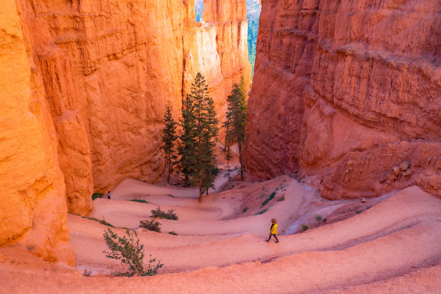
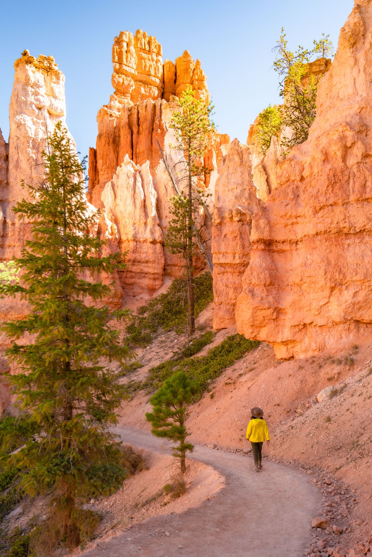
These switchbacks segue into the amazing defile known as Wall Street, which resembles a slot canyon and gets its name from its narrowness and high-walled sides. The rockscape is rad, and note the surprisingly large Douglas-fir trees that soar skyward within the slot.
Be mindful of rockfall risk. I wouldn’t blame anyone who wore a helmet.
Wall Street to Queen’s Garden Intersection
Distance: 0.5 miles
Below Wall Street, the Navajo Loop Trail scoops around the edge of the natural amphitheater, and trees become more abundant. You’ll get a few ledges here, but nothing scary. Handsome ponderosa pines and views of hoodoo walls define this more open section of trail below the upper breaks.
At the end of this section, you can take the Peak-A-Boo Loop connector or Queen’s Garden connector, the latter of which is the most popular blending on the best hikes in Bryce Canyon National Park. Staying righteous on the path, it’s all uphill from here to reach Two Bridges.
Trail Intersection to Two Bridges
Distance: 0.2 miles
The namesake of the eastern side of the trail, Two Bridges, comes along less than a quarter mile on the return loop. Along the way, you’ll come out of the sun into the shady and (slightly, at times) suffocating walls of the canyon. Two Bridges, the feature, is on a short side trail. Chains will stop you from getting dangerously close to the bridges.
Perhaps I’ve seen too many amazing things in my hiking lifetime, but Two Bridges (the rock feature) didn’t impress me. While slightly interesting that two pieces of rock managed to stay attached to their respective canyon walls, I wouldn’t think this feature would be enough to name a trail after.
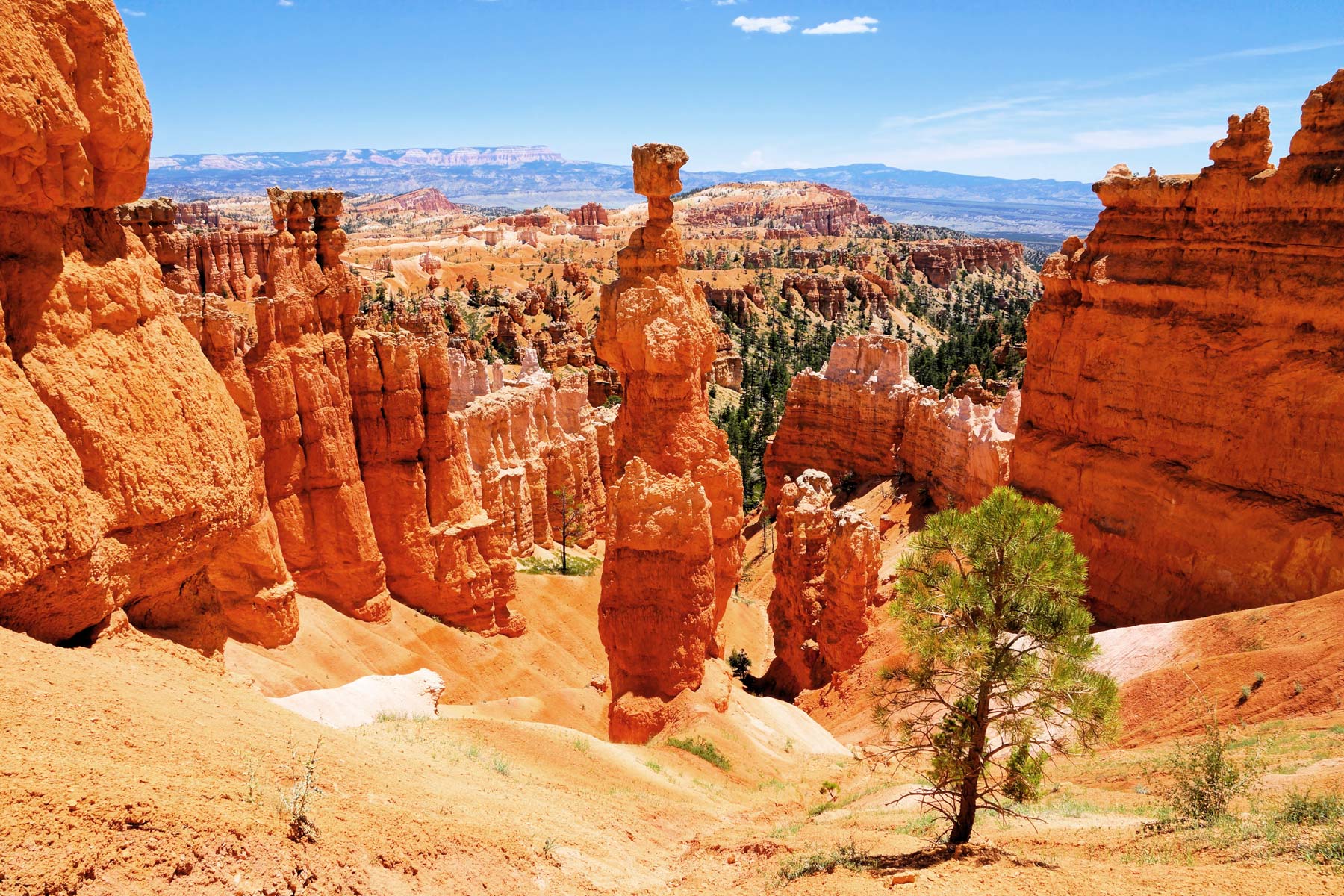
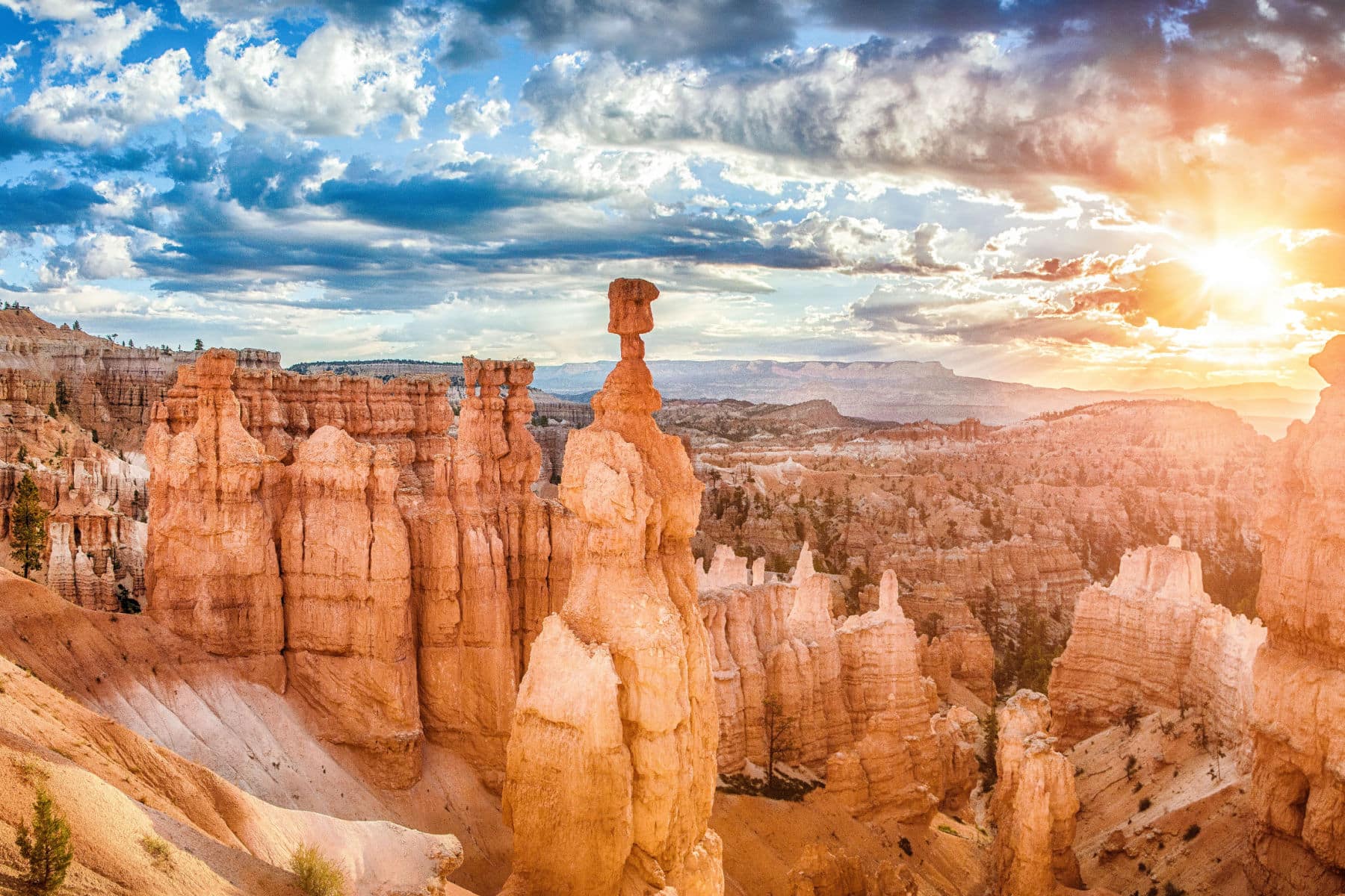
Especially when Thor’s Hammer was still ahead.
Two Bridges to Thor’s Hammer
Distance: 0.2 miles
Two Bridges comes along the path when you’re out of the sun again and back in a narrow canyon with switchbacks ahead. Once you reach a post just below Sunset Point, you’ll get great close-up views of one of Bryce Canyon National Park’s most impressive hoodoo spires, Thor’s Hammer.
Thor was the Norse god of thunder, of course, and that’s especially appropriate, given how frequently lightning licks this plateau margin.
From there, you’ll arrive back at the trailhead with throbbing calves and an appetite for more.
Navajo Loop Trail Add-On Hikes
The Navajo Loop Trail is awesome in and of itself, but it’s commonly combined with other trails. Options range from a three-mile to nearly seven-mile roundtrip adventure.
Queen’s/Navajo Loop
Distance: 2.9 miles
Time: Up to 3 hours
Elevation Change: 625 feet
Difficulty: Moderate
Indeed, the Park Service considers the Queen’s/Navajo Loop, which links the Navajo Loop Trail with the Queen’s Garden and Queen’s Garden connecting trails, the most popular of the hikes in Bryce Canyon National Park.
That combo loop can begin from either Sunset Point or Sunrise Point to the north. Because of the better setup for scenery-gazing and better traction coming up the Navajo Loop section, it’s best to tackle it clockwise.
The Queen’s Garden Trail is the gentlest of the trails, dropping from the rim into the Bryce Amphitheater. It shows off plenty of gorgeous hoodoos, including the distinctive one called Queen Victoria that’s viewable via a short spur trail.
Navajo/Peakaboo Loop
Distance: 4.9 miles
Time: Up to 4 hours
Elevation Change: 1,475 feet
Difficulty: Strenuous
Another option for a longer hike combines the Navajo Loop Trail with the strenuous, 5.5-mile-long Peekaboo Loop Trail. Demanding a 1,560-foot elevation gain, the Peekaboo Loop gets you deeper into the Bryce Amphitheater hoodoos, edging such features as the Wall of Windows, the Fairy Castle, the Cathedral, and the spired divide called the Alligator.
NOTE: Horse and mule riders can be found on the Peekaboo Trail and should always be given the right-of-way.
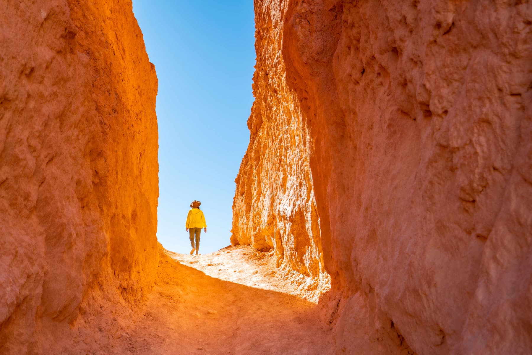
Figure 8 Loop
Distance: 6.4 miles
Time: Up to 5 hours
Elevation Change: 1,575 feet
Difficulty: Strenuous
The most EPIC hike that includes the Navajo Loop lies in the Figure 8 option, combining Navajo Loop, Peak-A-Boo Loop, and Queen’s Garden.
For those tackling this route, here are the suggested directions.
- Descend Queen’s Garden clockwise.
- Take Peak-A-Boo Loop clockwise, too.
- Choose your own path to return on the Navajo Loop Trail, but remember that Wall Street closes in the winter.
If you have a choice between the two, choose Wall Street every day and twice on Tuesday.
Bryce Canyon National Park Background
Bryce Canyon stands as my longtime favorite National Park for many reasons, and I’m proud to tell you that my bestie turned 100 years old as a National Park in 2023.
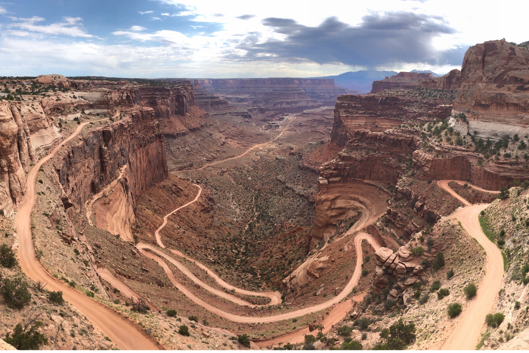
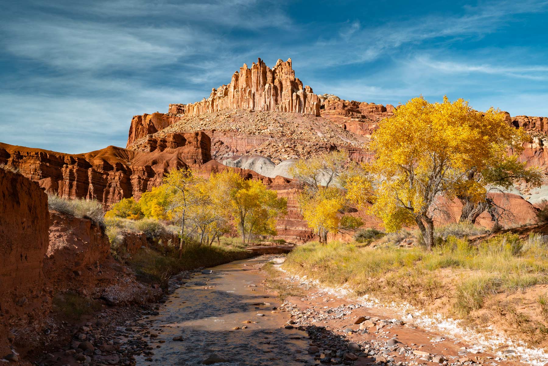
Covering some 36,000 acres, Bryce Canyon is the smallest of Utah’s Mighty 5.
- Arches National Park
- Bryce Canyon National Park
- Capitol Reef National Park
- Canyonlands National Park
- Zion National Park
By size, Bryce is the smallest, being less than half the area of the next-smallest, Arches. By comparison, Canyonlands National Park, the largest, sprawls out across almost 340,000 acres.
But don’t let that pint-sized extent fool you. Bryce Canyon National Park easily holds its own with any of those other marvelous parks in the scenery department.
Tell us your favorite of the Mighty 5 in the comments below.
Is Bryce Canyon Really a Canyon?
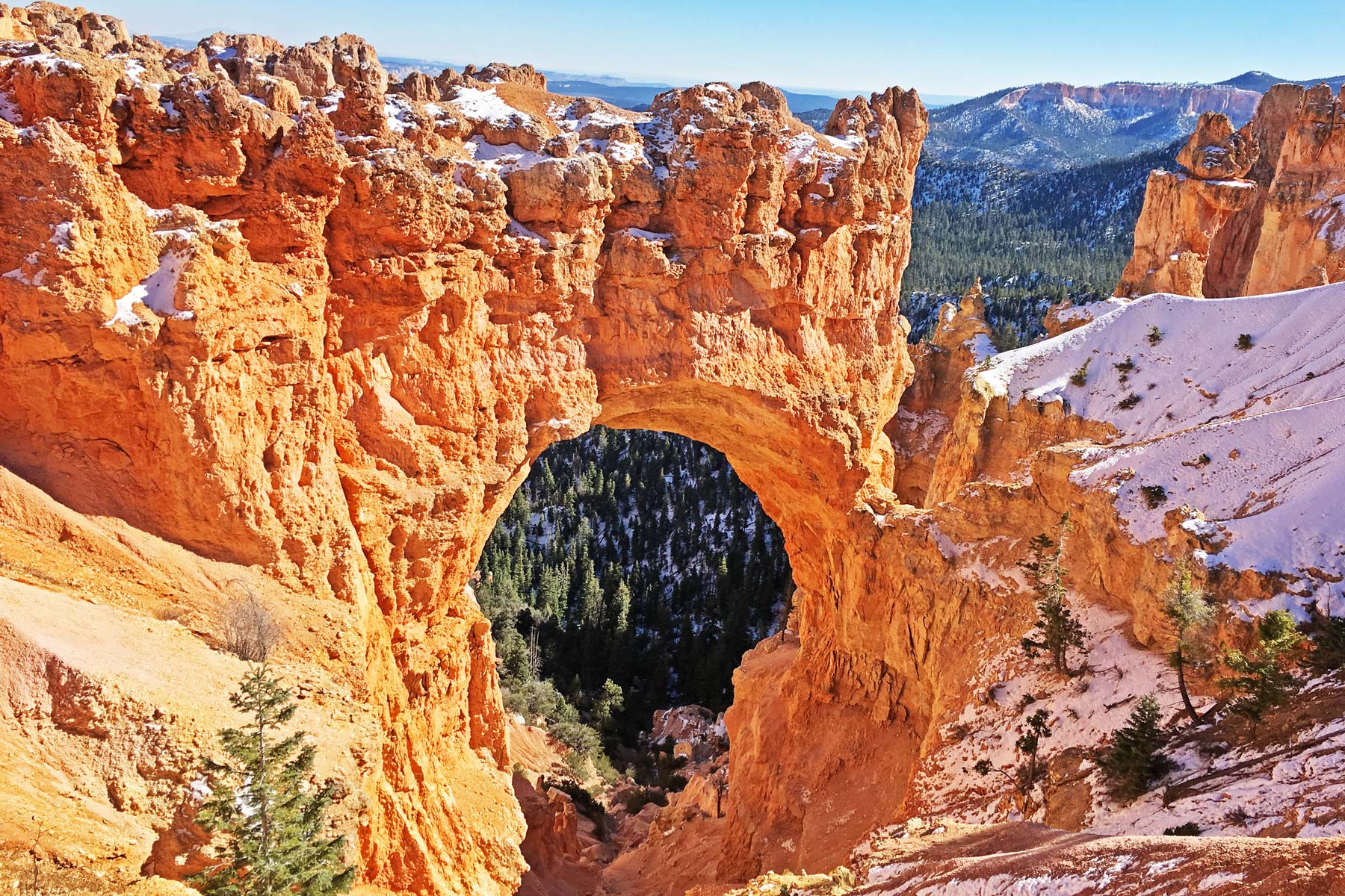
The name of the national park is a big-time misnomer: Bryce Canyon isn’t a canyon at all. A canyon is a deep-cut valley carved by a river. What Bryce Canyon National Park protects is a huge system of hoodoo breaks along the eastern flank of the Paunsaugunt Plateau.
Sure, flowing water helped sculpt the landscape in the form of snowmelt and flashy cloudburst runoff. At the same time, frost wedging, in which freeze-thaw cycles bust apart the yielding sedimentary rocks, etches away at the rocks. That includes limestones, sandstones, shale, and other layers of the Claron Formation, deposited as a long-ago lakebed to open crevices and clefts. Hence, the ongoing rockfall risk.
The result is a series of gaping amphitheaters eaten into the edge of the Paunsaugunt Plateau, the grandest of which is the Bryce Amphitheater itself, where the Navajo Loop Trail explores.
The knobby spires that wall these amphitheaters constitute the world’s greatest collection of the landforms geologists call hoodoos. The edge of the plateau is retreating due to weathering and erosion at a rate of about a foot every half-century or so.
FAQ – Navajo Loop Trail in Bryce Canyon
If crowds answer that question, then Zion National Park wins with nearly double the number of Bryce Canyon visitors. At the same time, Bryce Canyon has smaller crowds, which is a winning point if you’ve ever sat in Zion traffic. The two experiences ideally go in tandem. You just need to be willing to shave a day off your Zion trip to see Bryce Canyon. Also worth noting is that Bryce Canyon starts at about 8,000 feet and goes up to 9,000 feet. Zion’s popular Angel’s Landing is not even 6,000 feet.
The park stays open around the clock, but your best adventure is a ranger-guided moonwalk. At the same time, hoodoos become hauntingly beautiful under the full moon. Don’t wait to plan that trip, as you’ll need to get in the Moon Hike Lottery to score a spot.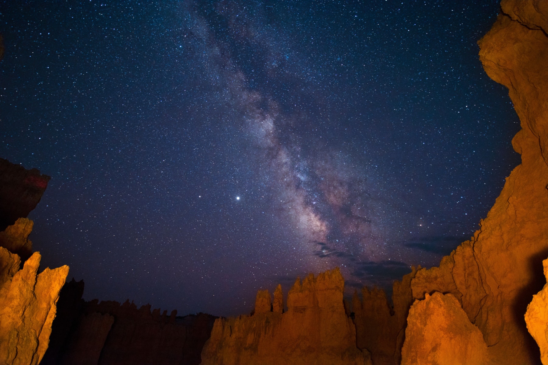
The inaccessibility half the year makes Wall Street desirable, but Thor’s Hammer is an attractive lure on the east side. Both sides offer switchbacks and narrow spaces, while the Two Bridges side is more of an incline (or decline). Keep in mind that most injuries in Bryce Canyon National Park come from people descending, not ascending. It’s best if you take the loop, but you won’t be disappointed with just one side or the other.
Things to Know Before You Visit Bryce Canyon National Park
Entrance Fees
$35 per vehicle OR if you plan to visit more National Parks within the next 12 months, I suggest you go ahead and purchase the America the Beautiful Pass (which can be found at the entrance gates to most national parks). This pass gets you into all National Parks, Forests, Monuments, and more, including 2,000 sites for free after a one-time $80 fee.
Sunscreen
Use it. Lots of it. Especially this one, which I never leave the house without because it plays nice with our dear friend, Earth 🙂
Insect Repellent
If you’re looking for a good insect repellent that plays nice with our good friend Earth, we recommend this one or this one if you’re a DEET person.
Guide Book
The Best Guide Book for Bryce Canyon National Park is this one which we’ve marked up and highlighted quite a bit.
Map
The Best Map: I like this map best for Bryce Canyon National Park.
National Parks Checklist Map: This beautiful National Parks Checklist Map can be ordered to your house.
Framed National Parks Map: We’re a sucker for maps; this framed national parks map is the best.
Where to Stay in Bryce Canyon National Park
Where to Stay: This is our favorite hotel in/around Bryce Canyon National Park.
Map Of Navajo Loop Trail
Pin Navajo Loop Trail
Helpful Related Links
Bryce Canyon Mindblowing Facts: 15 SURPRISING Facts About Bryce Canyon National Park
Road Trip Essentials: 35+ ROAD TRIP ESSENTIALS (You’ll Love + Packing List)
Road Trip Planning Tools: 15 BEST FREE ROAD TRIP PLANNING Tools (& Apps) 2022
Zion National Park Guide: Ultimate Guide to Zion National Park
Things to Do in Zion: 18 EPIC Things to Do in Zion National Park
Best Hikes in Zion: 16 EPIC Hikes in Zion National Park
Things to Do in Arches: 16 EPIC Things to Do in Arches National Park
Utah’s Manti-La Sal National Forest: Manti-La Sal National Forest: The Forest As Beautiful as Utah’s Parks
Utah National Parks Road Trips: 5 Best Utah National Park Road Trips
National Parks Rankings: ALL 63 US National Parks Ranked By Experts
Most Visited National Parks: Top 10 Most Visited National Parks
Least Visited National Parks: Top 10 Least Visited National Parks

Leave a Reply