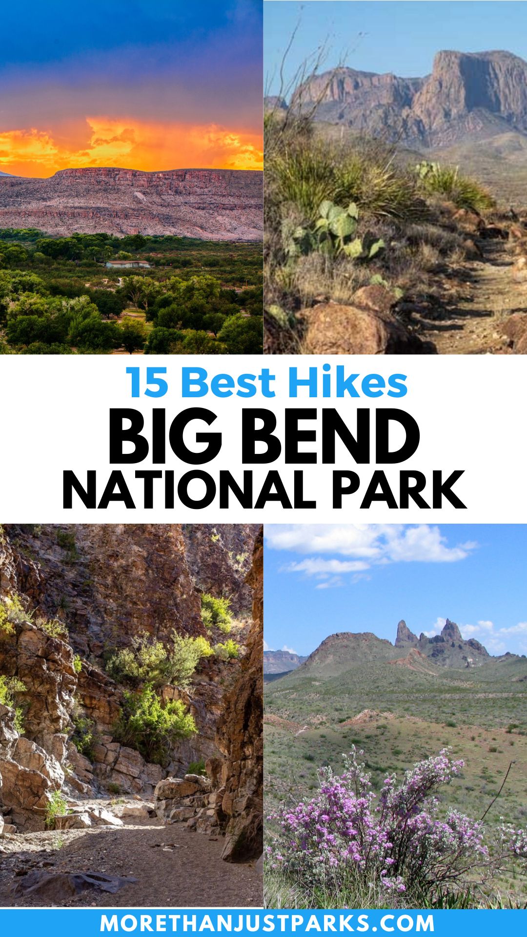
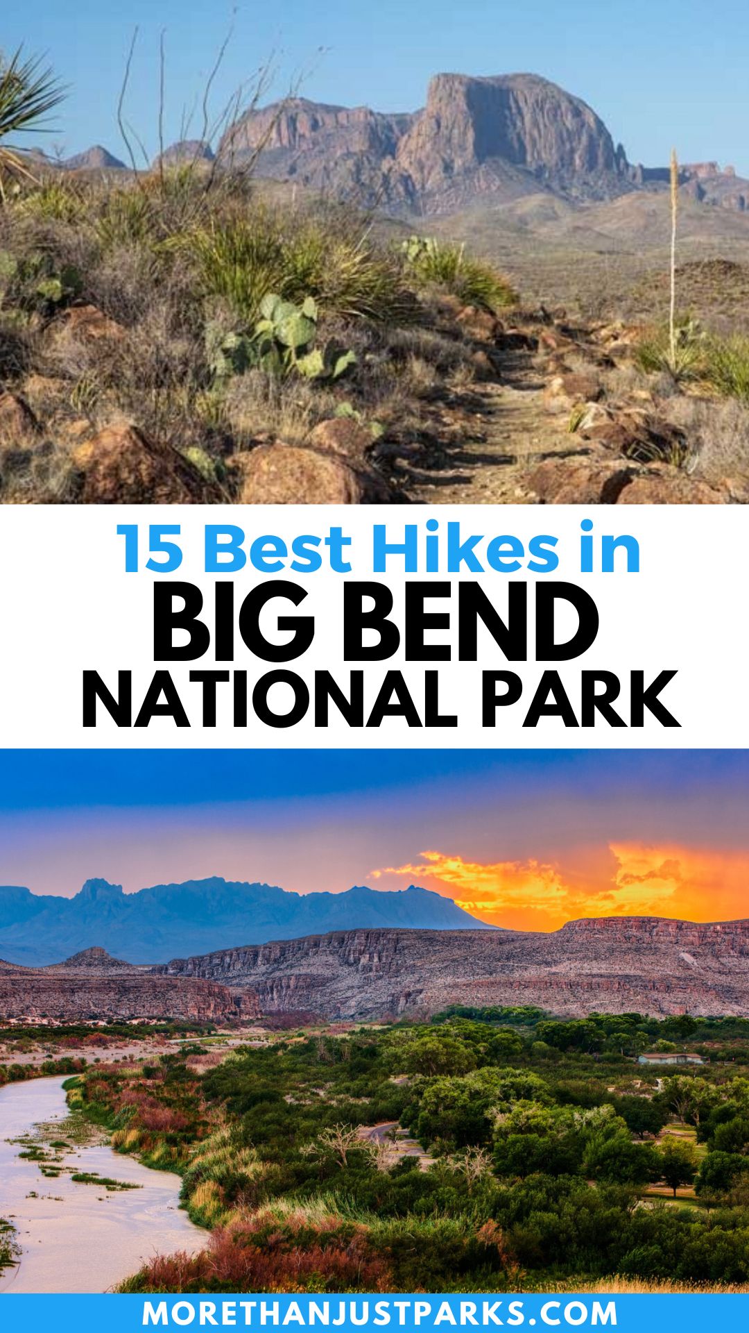
Article Overview: Best Hikes in Big Bend National Park
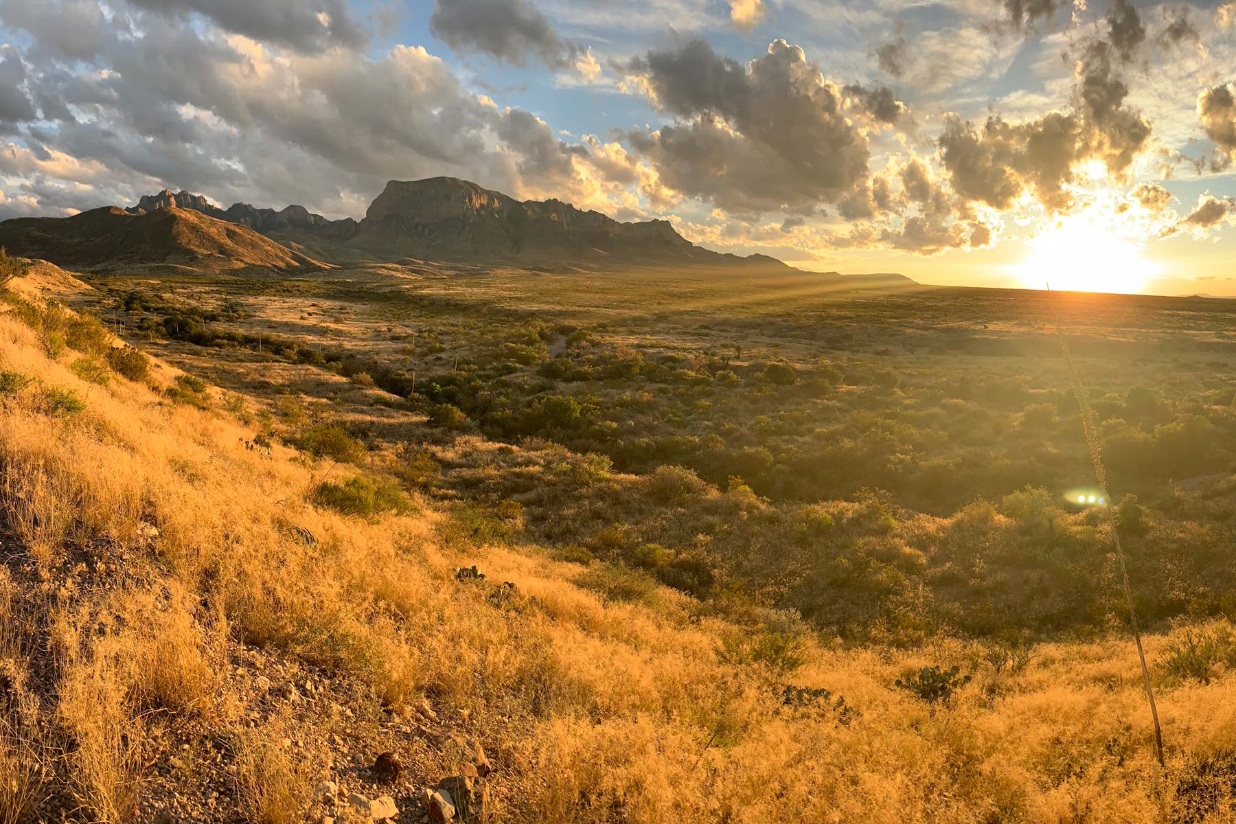
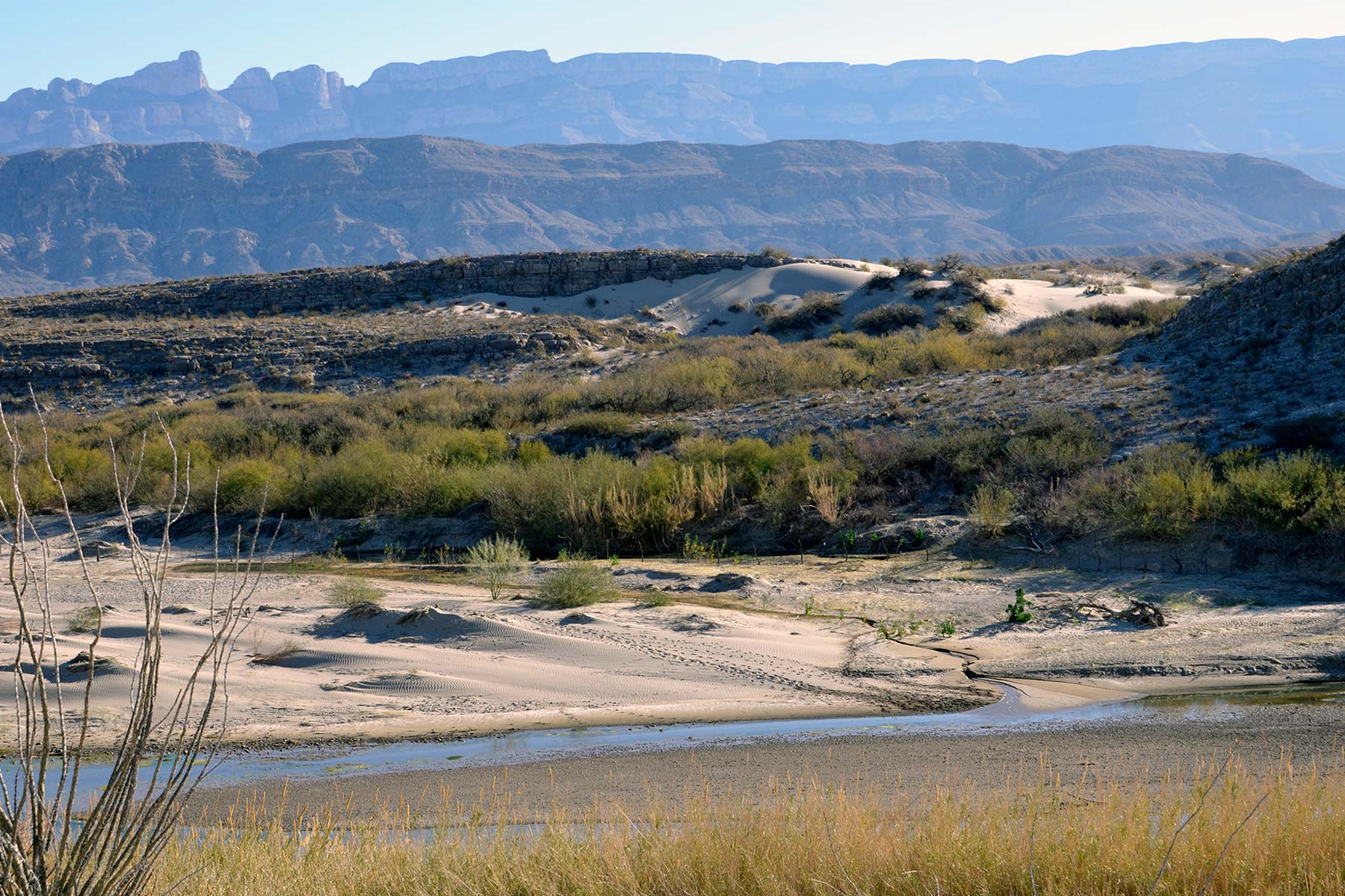
The best hikes in Big Bend National Park of Southwest Texas tell many tales. First, explore its 801,000 acres as if you were visiting three parks—one in the mountains, one along the famed Rio Grande River, and a third in the desert. Plus, you have an international option by crossing into Boquillos, Mexico.
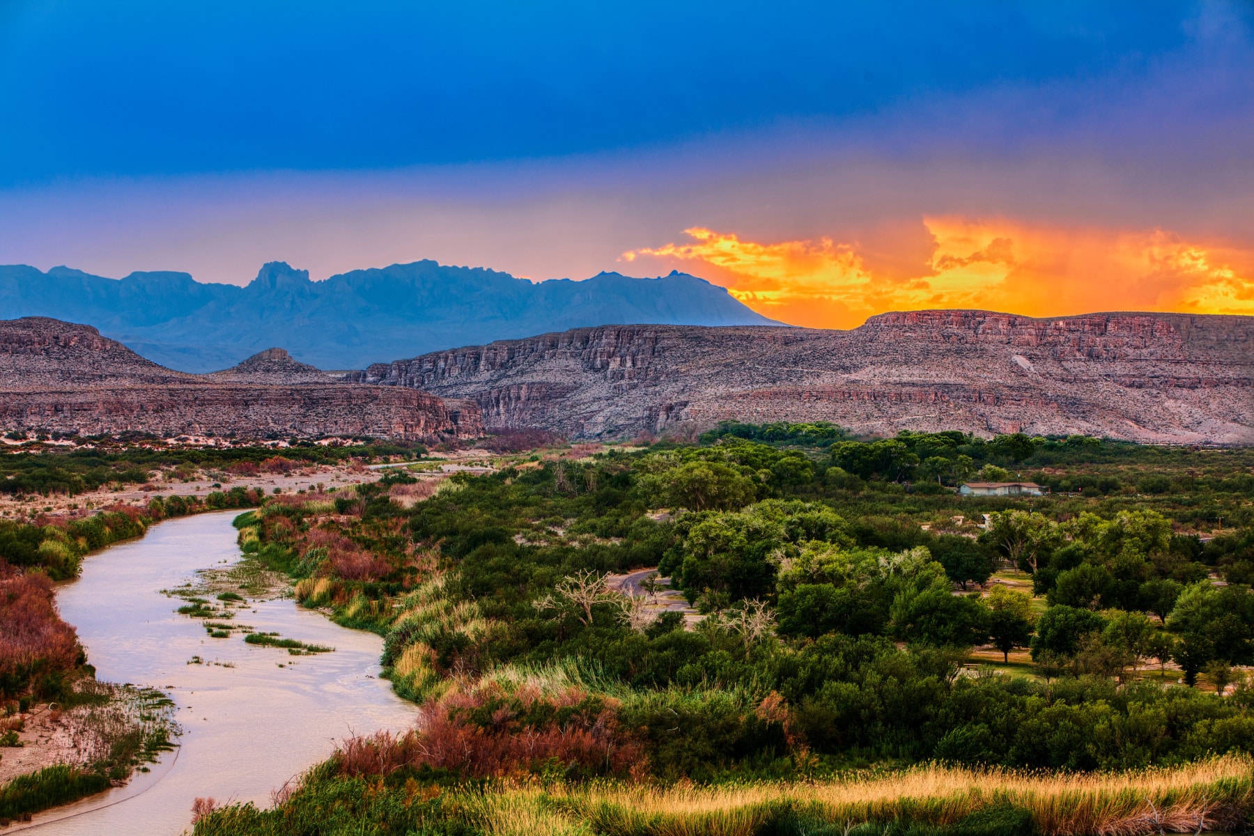
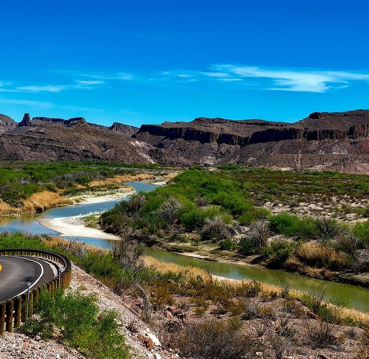
The name “Big Bend” comes from the Rio Grande’s turn north after traveling south across southern Colorado and New Mexico before entering Texas.
That water carves the edge of the desert, and beautiful flowers seemingly grow right from rocks. All that with the best hikes in Big Bend National Park offering fewer crowds than you might expect. Just over 518,000 people visited in 2022, compared to the 4.7 million that visited Zion National Park.
Go before this secret gets out – visitation increased by 64% since 2015. I’m excited to take you through my journey of the best hikes and some amazing photos of Big Bend National Park.
Best Hikes in Big Bend National Park
EXPAND Table of Contents: Best Hikes in Big Bend National Park
Table of Contents: Best Hikes in Big Bend National Park
- Best Hikes in Big Bend National Park
- 5 Big Things to Know About Best Hikes in Big Bend National Park
- Directions to Big Bend National Park
- 15 Best Hikes in Big Bend National Park
- 15. Rio Grande Village Nature Trail
- 14. Mule Ears Trail
- 13. Boquillas Canyon Trail
- 12. Lone Mountain Trail
- 11. Window View Trail
- 10. Big Bend South Rim
- 9. Chimneys Trail
- 8. Upper Burro Mesa Pouroff Trail
- 7 Lower Burro Mesa Pouroff Trail
- 6. Grapevine Hills
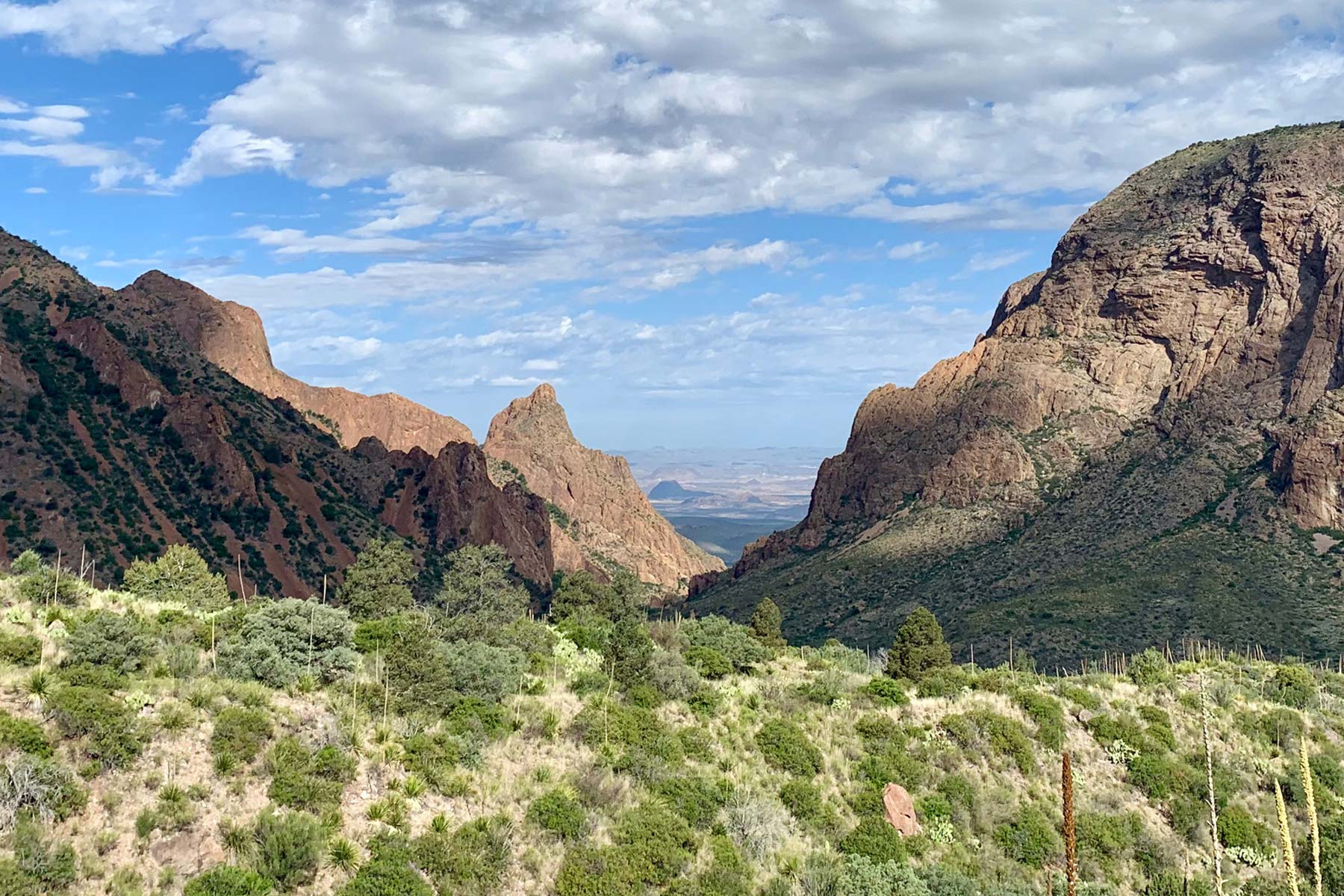
- 5. The Window
- 4. Hot Springs Trail
- 3. Emory Peak Trail
- 2. Lost Mine Trail Big Bend
- 1. Santa Elena Canyon Trail
- Safety Tips for Best Hikes in Big Bend National Park
- Map of the Best Hikes in Big Bend National Park
5 Big Things to Know About Best Hikes in Big Bend National Park
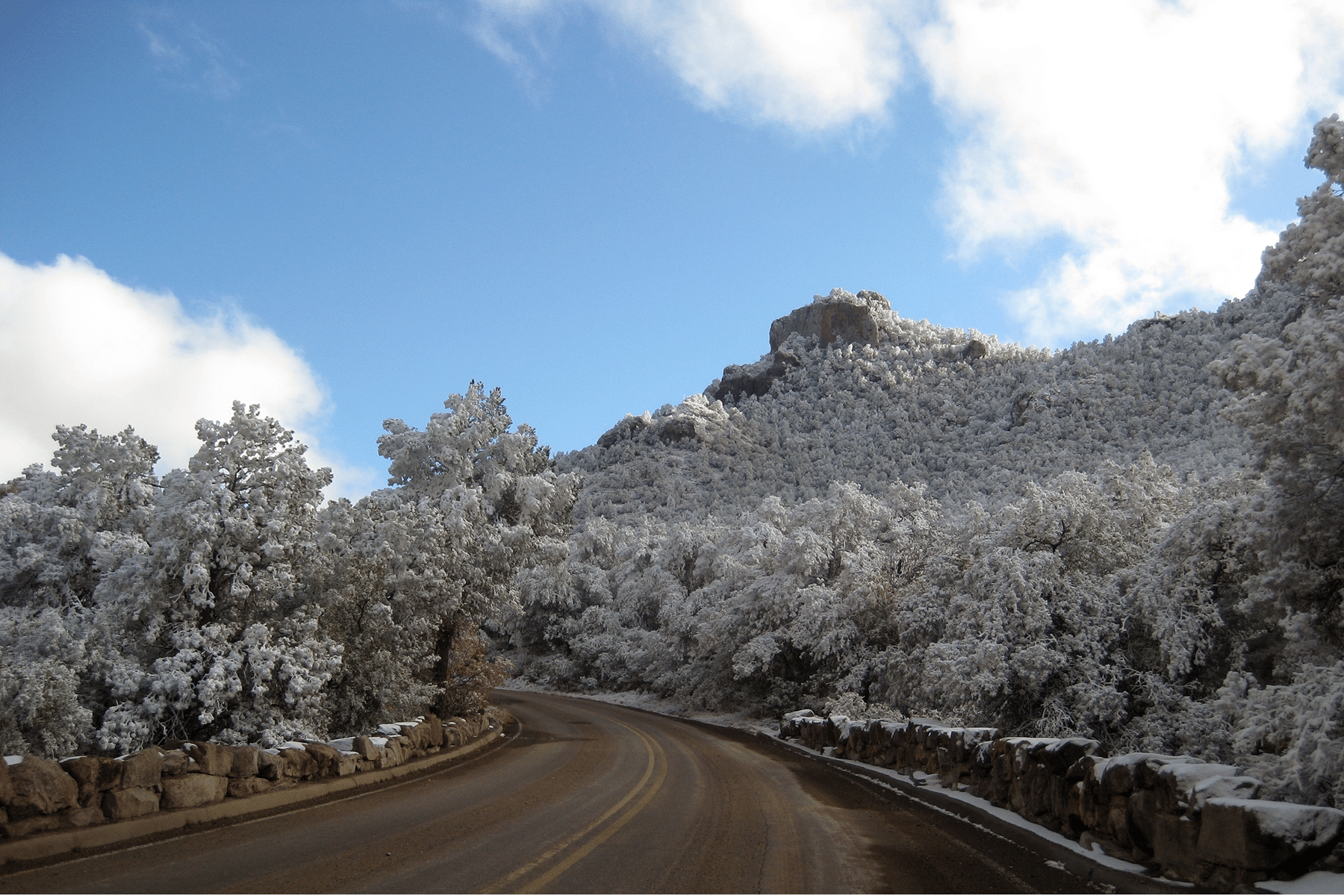
- Big Bend National Park’s weather ranges from highs in the 60s during winter to scoring heat in the summer near triple digits. Night lows can go from near freezing in the winter to the low 70s in summer. May through September brings the most rain, with August getting the most at two inches on average. Check the zone forecast before you go, as the different elevations bring different weather. (You will need sunscreen!)
- Entrance fees are $30 per vehicle. Cash is not accepted. You can also use the America the Beautiful Pass here, which is $80 for access to all public lands (2,000+ locations) for a full year. You’ll want a vehicle that is high clearance for many of the best hikes in Big Bend and stock an emergency kit and extra water. Big Bend National Park reservations are not required, but the busiest months are November through April.
- My favorite Big Bend National Park lodging is the Lajitas Golf Resort. It’s about 20 miles from the entrance, but you won’t find a better option closer. Big Bend National Park camping includes four options within the park.
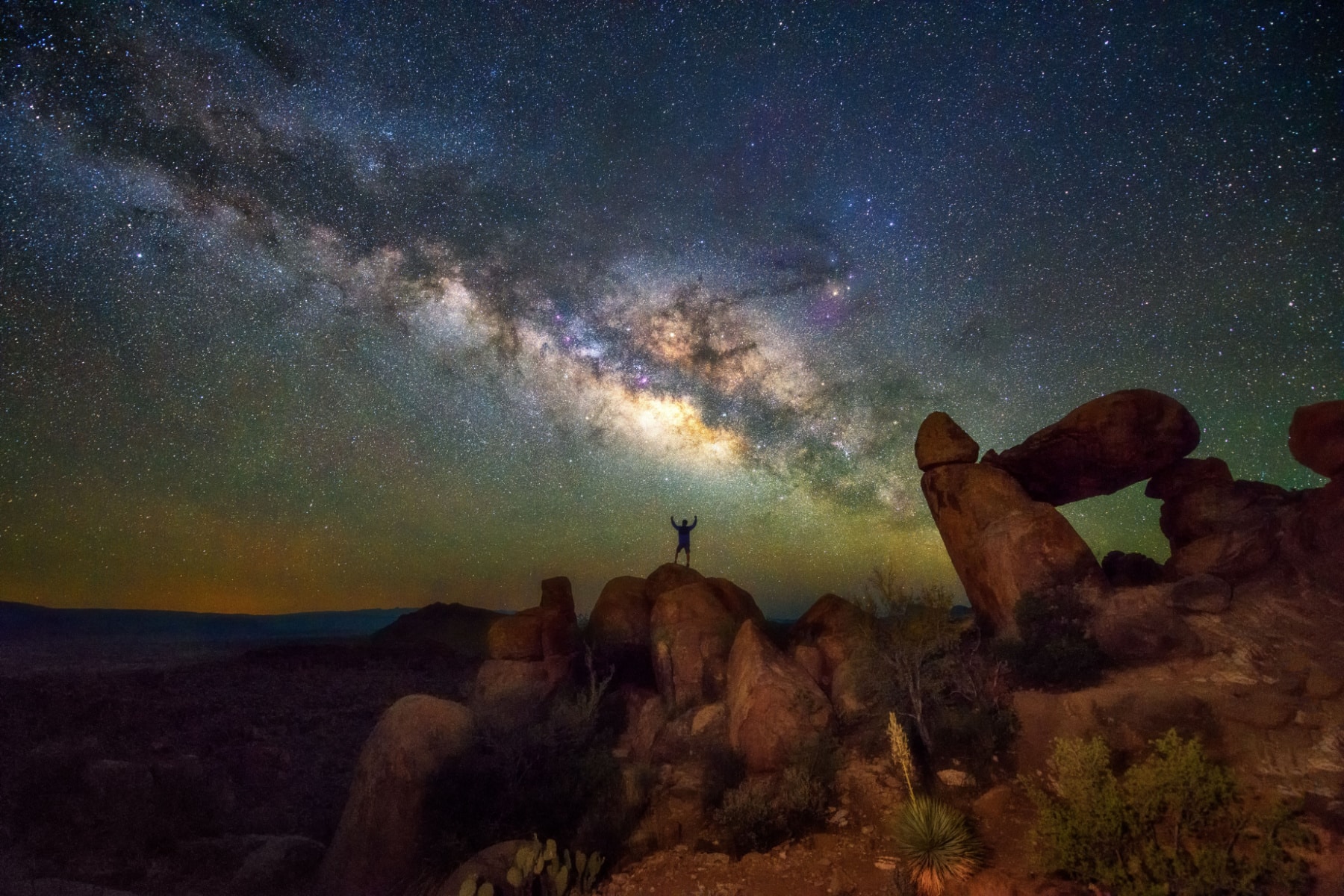
- Big Bend National Park stargazing is among the most popular things to do. Big Bend has been an International Dark Sky Park since 2012. You won’t find a darker night sky at a national park in the contiguous United States.
- Directions to Big Bend National Park should be downloaded or saved before you start the trip due to its remote location in southwest Texas. Here’s a distance chart to help you out.
| Origin City | Miles | Drive Time | ||
| Austin to Big Bend National Park | 437 miles | 6:45 | ||
| Houston to Big Bend National Park | 563 miles | 8:30 | ||
| Dallas to Big Bend National Park | 533 miles | 8:00 | ||
| El Paso to Big Bend National Park | 292 miles | 4:30 |
Directions to Big Bend National Park
Carrying a Big Bend National Park map is a must. I like this one best. You could also get a huge help from this Big Bend National Park Guidebook.
15 Best Hikes in Big Bend National Park
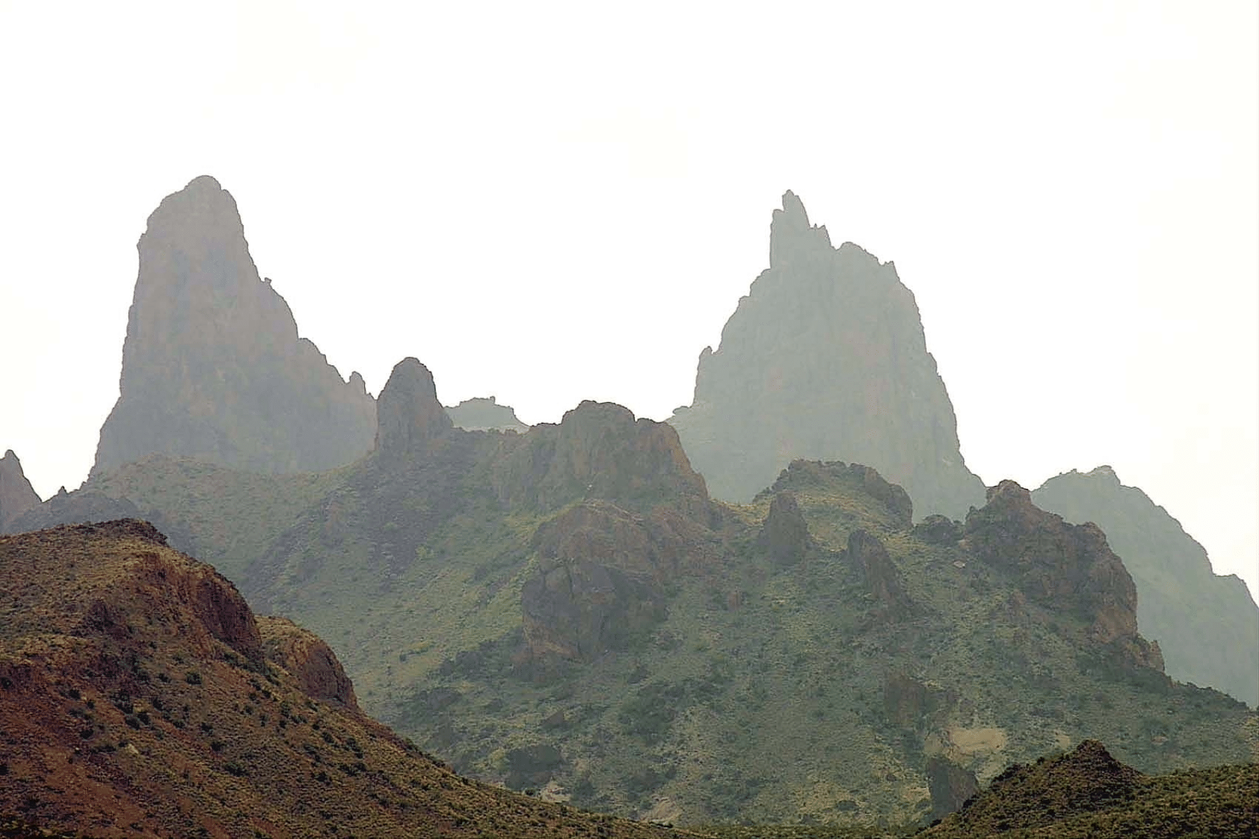
The best hikes in Big Bend National Park are broken up into three options. You can hike the Chihuahuan Desert, the Chisos Mountains, or the edge of the Rio Grande River.
15. Rio Grande Village Nature Trail
Length: 0.75 Mile Loop
Time: 30 Minutes
Elevation Gain: 200 feet
This short and easy trail is one of the best hikes in Big Bend National Park for beginners or to test your limits when hiking in the desert. It’s also a great trail for seeing the birds of Big Bend.
Although short and easy, the trail is very scenic and has fantastic opportunities for wildlife viewing, especially birds. The trail has a boardwalk over the wetlands and climbs up a short hill for panoramic views.
This is a perfect spot to see the sunrise (or sunset), and the first 100 yards are wheelchair accessible.
14. Mule Ears Trail
Length: 3.8 Miles
Time: 2 Hours
Elevation Gain: 880 feet
I have to admit that I’m a sucker for a natural formation that looks like *something. That’s why I love the Mule Ears Trail. It looks like a mule poking the top of its head out of the canyon, with distinct “ears” and visibility on the trail as well as on the scenic drive.
I also love that the best hikes in Big Bend National Park have water somewhere along the way. Sometimes it comes with the path; other times, it’s an earned hike through the raw desert. This is a rocky trail that requires solid footing, and hiking poles would be ideal. The payoff is a spring at the end of the trail, but water isn’t guaranteed during the height of summer.
Watch for mountain lions on this trail. If you come across one, make yourself as “big” as possible and make lots of noise. Generally, they will avoid you unless they feel threatened.
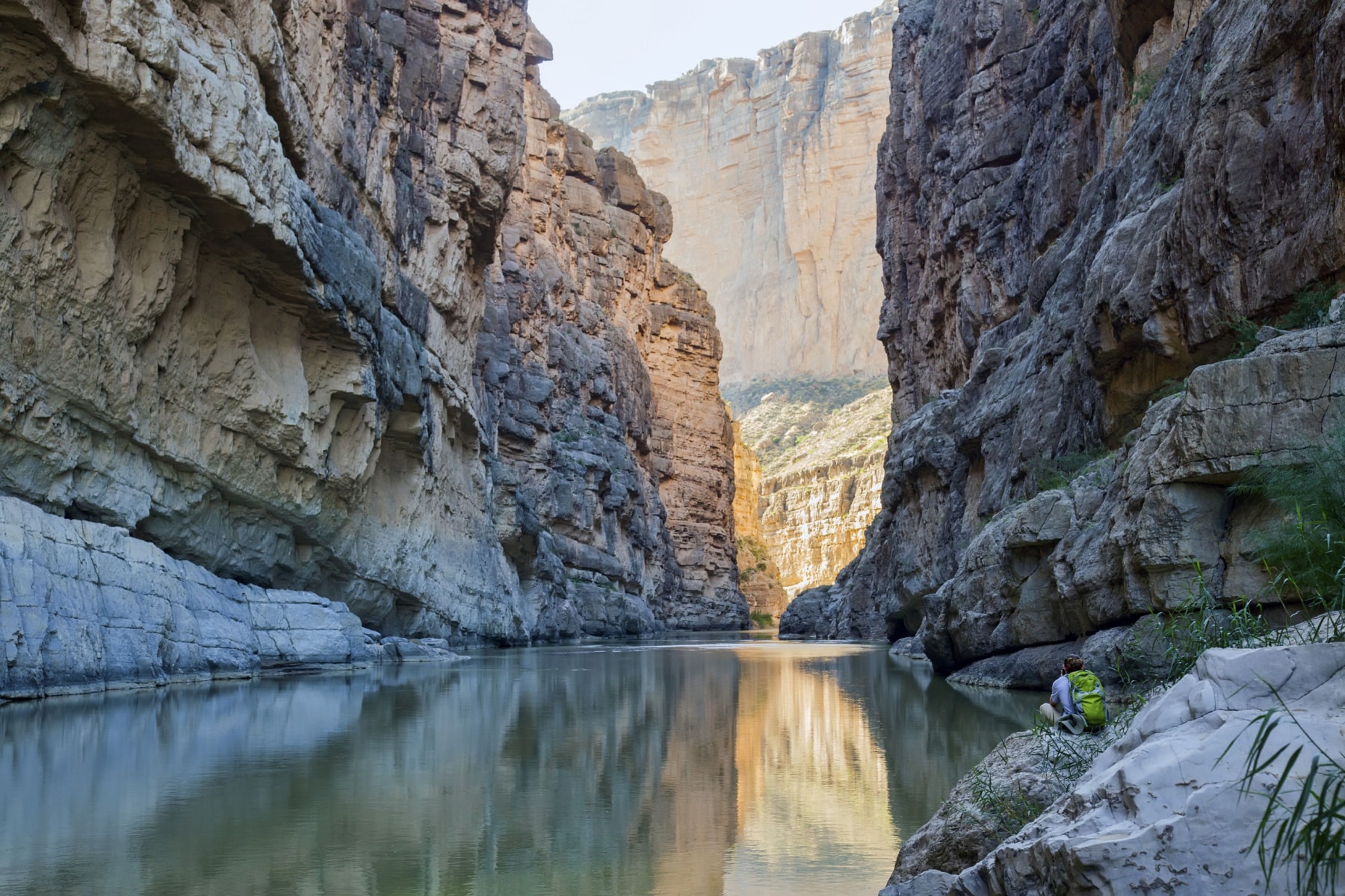
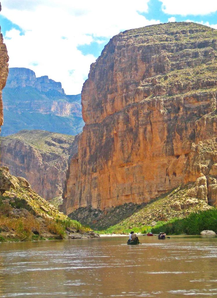
13. Boquillas Canyon Trail
Length: 1.5 Miles
Time: 1 Hour
Elevation Change: 150 Feet
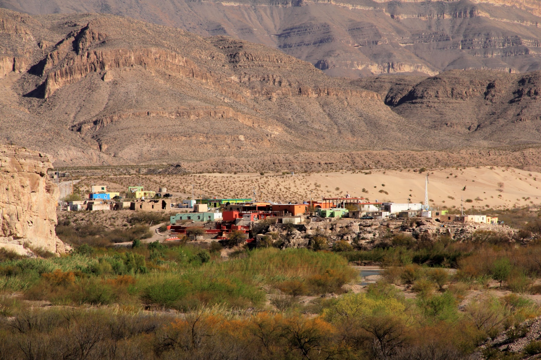
The Boquillas Canyon Trail is one of the best hikes in Big Bend National Park to explore the canyons as you get to go through the three major ones in the park. Boquillas (“Bow-KEY-as”) is the Spanish word for “little mouths,” meant to highlight the narrow canyon walls here.
I love this trail because it goes right along the Rio Grande River but also rises and falls over rocky summits where you can dip your toes in the water or soak in Rio’s grandness from above. Watch for the sand-filled edges of the inclines. It’s like walking on a beach uphill.
WARNING: You might see some items for sale here or see an occasional Mexican crossing the river. Do not interact with them, buy anything from them, or give them supplies. You could end up having a tough conversation with the Border Patrol, and they could end up being arrested.
12. Lone Mountain Trail
Length: 3 Miles
Time: 1 Hour
Elevation Change: 200 Feet
Big Bend National Park gave birth to a new trail in 2022 – the Lone Mountain Trail. It has quickly become one of the best Big Bend hiking locations for those who want to experience a new path in this remote wilderness.
With a more elevated trail than the surrounding desert, the views are epic.
“Highlights of the route include spectacular views of the Chisos, Rosillos, and Dead Horse Mountains, a wide variety of desert plants and animals, and the interesting volcanic features of Lone Mountain itself,” according to the opening statements during the trail celebration in 2022.
Building the trail required extensive excavation work to create a maintainable route up steep grades. Safety cables and rebar supports were installed along sections for hiker stability.
The trail is part of an evolving plan to reduce the impact on the more popular trails and preserve the natural integrity of the park.
11. Window View Trail
Length: 0.3 Miles
Time: 30 Minutes
Elevation Change: 50 Feet
Unlike the much longer Window Trail, The Window View Trail is easy Big Bend hiking and among the best places in the park to see a sunset. It is also wonderfully accessible for wheelchairs.
If it’s too hot to explore other trailheads, this one is perfect for a reasonable walk to see the sun paint the sky as it descends.
Another reason to consider this one of the best hikes in Big Bend is that you can still see the splendor of the park if storms are building in the distance. The Chisos Basin Visitor’s Center is at the trailhead, offering easy access to safety when storms start.
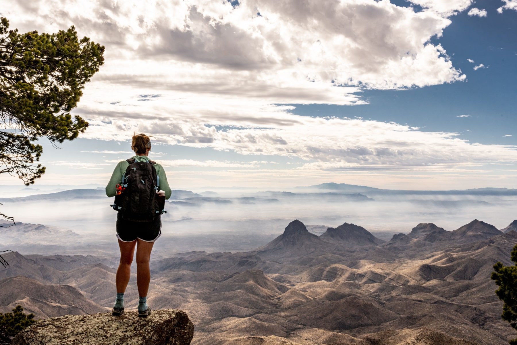
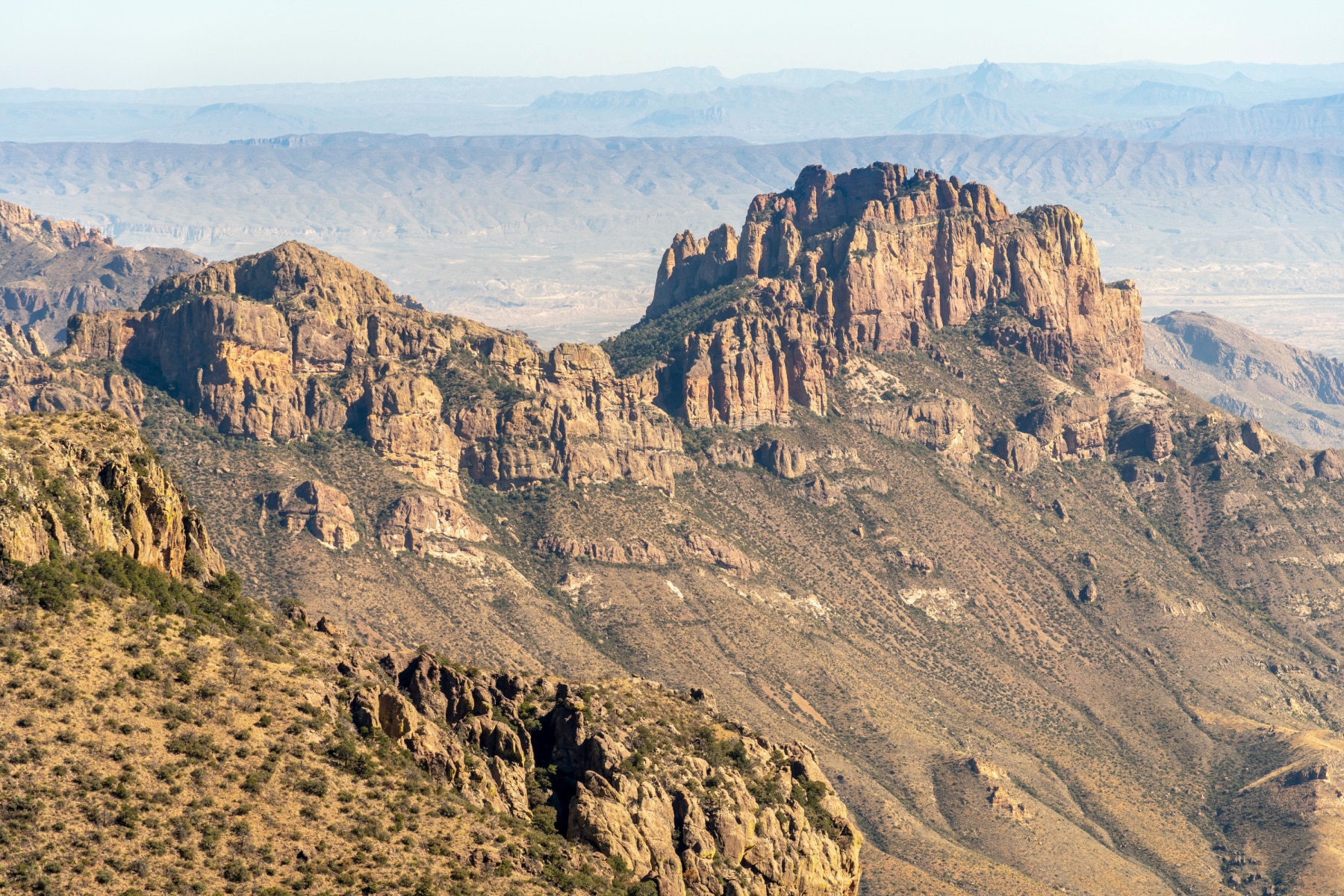
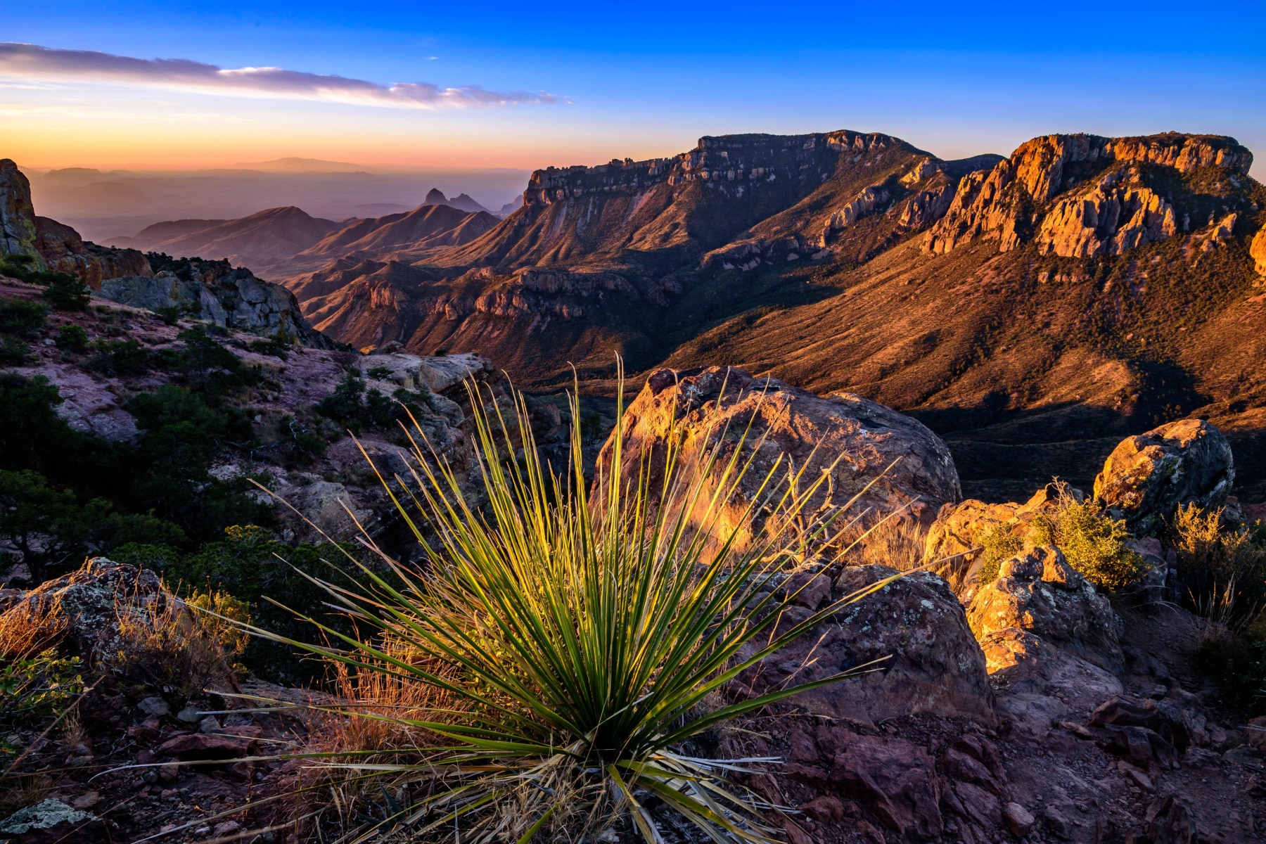
10. Big Bend South Rim
Length: 12-14.5 Miles
Time: 6 Hours
Elevation Change: 2,421 Feet
The Grand Canyon offers an epic South Rim, just not the ONLY South Rim in the park system. The South Rim Trail is one of the best hikes in Big Bend National Park during winter, especially if you like the longer trails.
The demanding South Rim trail offers breathtaking views of the surrounding mountain ranges with several access options.
Hikers can choose either the Laguna Meadows route with its more gradual ascent or the steeper Pinnacles Trail, but you won’t avoid switchbacks on either route. At the South Rim overlook, the panorama spreads across northern Mexico’s mountain landscape.
You make the 12-mile trail longer by adding the East Rim Trail, for a total length out and back of 14.5 miles. Talk to a park ranger about this trail, as several sections were destroyed by a wildfire in 2021. While all the trails are now open, there could be some spots where the views are still blacked out.
9. Chimneys Trail
Length: 4.6 Miles
Time: 2.5 Hours
Elevation Change: 364 Feet
Chimneys Trail is one of the best hikes in Big Bend National Park to see pictographs and petroglyphs along the way. Beware of the long exposure on this trail, with no shade and the sun beating down on you. This is not a good summer trail.
The “Chimneys” are volcanic dikes, which is a fancy way to say they are the overflow of magma through a crack in the rock. Imagine you were eating an ice cream sandwich. The soft ice cream between the harder layers of cookie or cake can ooze through like the magma did here. When that magma was exposed, it hardened.
TRAIL EXPERT TIP – There’s an arch on this trail if you climb around the backside of the ridge. You’ll be scrambling and climbing some challenging rocks, but it shouldn’t be an issue for experienced hikers.
WATCH OUT FOR THE CACTI ON THIS TRAIL. I accidentally stumbled onto my backside while tying my boot and got an armful of angry cactus spines. It’s a good thing I carry my first aid kit with me at all times.
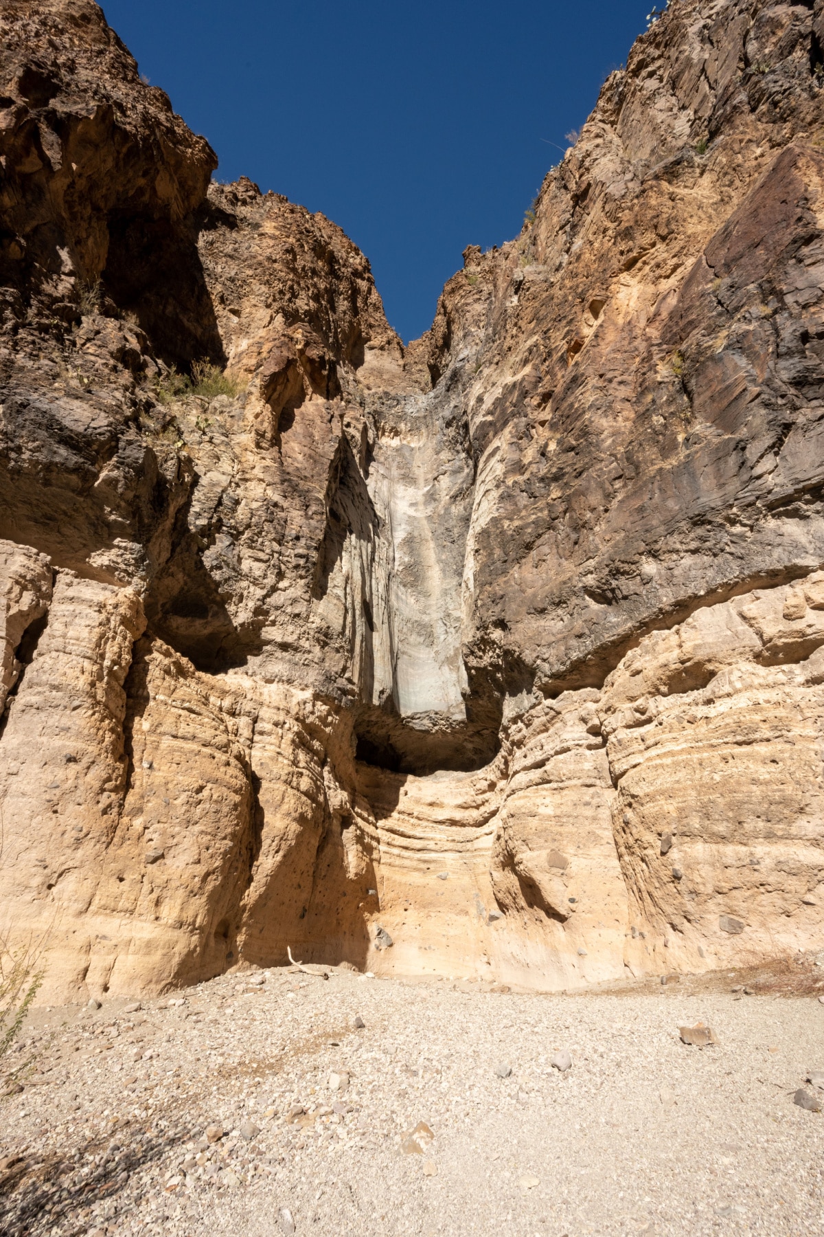
8. Upper Burro Mesa Pouroff Trail
Length: 3.5 Miles
Time: 2 Hours
Elevation Change: 500 Feet
Burro Mesa has two trails, an upper and a lower, that don’t have the same trailhead. I’ll take you through both. The Upper Burro Mesa Pouroff Trail is one of the best hikes in Big Bend National Park to get a longer hike in while scrambling to a cavern (aka SHADE!).
I am always suspicious of a trail that starts going down, and it’s necessary to bring a snack so you can have the energy to make your way back up.
That especially holds true of this trail because, in the end, you have to use some pretty solid bouldering skills DOWN to the Pouroff. Going in is easy. Climbing back out isn’t always as much fun. You will come to a point where you can see Lower Burro Mesa Pouroff Trail.
Do NOT attempt this trail if it has rained or rain is in the forecast. The narrow canyon fills with water and could carry you away.
7 Lower Burro Mesa Pouroff Trail
Length: 1 mile
Time: 30 Minutes
Elevation Gain: 120 Feet
Lower Burro Mesa Pouroff Trail is one of the best hikes in Big Bend National Park for seeing the landscape geology.
You want to take this trail when there hasn’t been rain for a few days, and none is in the forecast on the day of the hike. That’s because this follows a gravel wash that is prone to flash flooding.
This trail is relatively flat, but it does have some haphazard stairs along the way. The canyon walls will rise above you until you reach the end (aka the Pouroff). This would be where a waterfall would come from, 100 feet above you, but it’s often too dangerous to be here when the water would be falling anyway.
As an additional option, you can scramble down some boulders near the end of the trail.
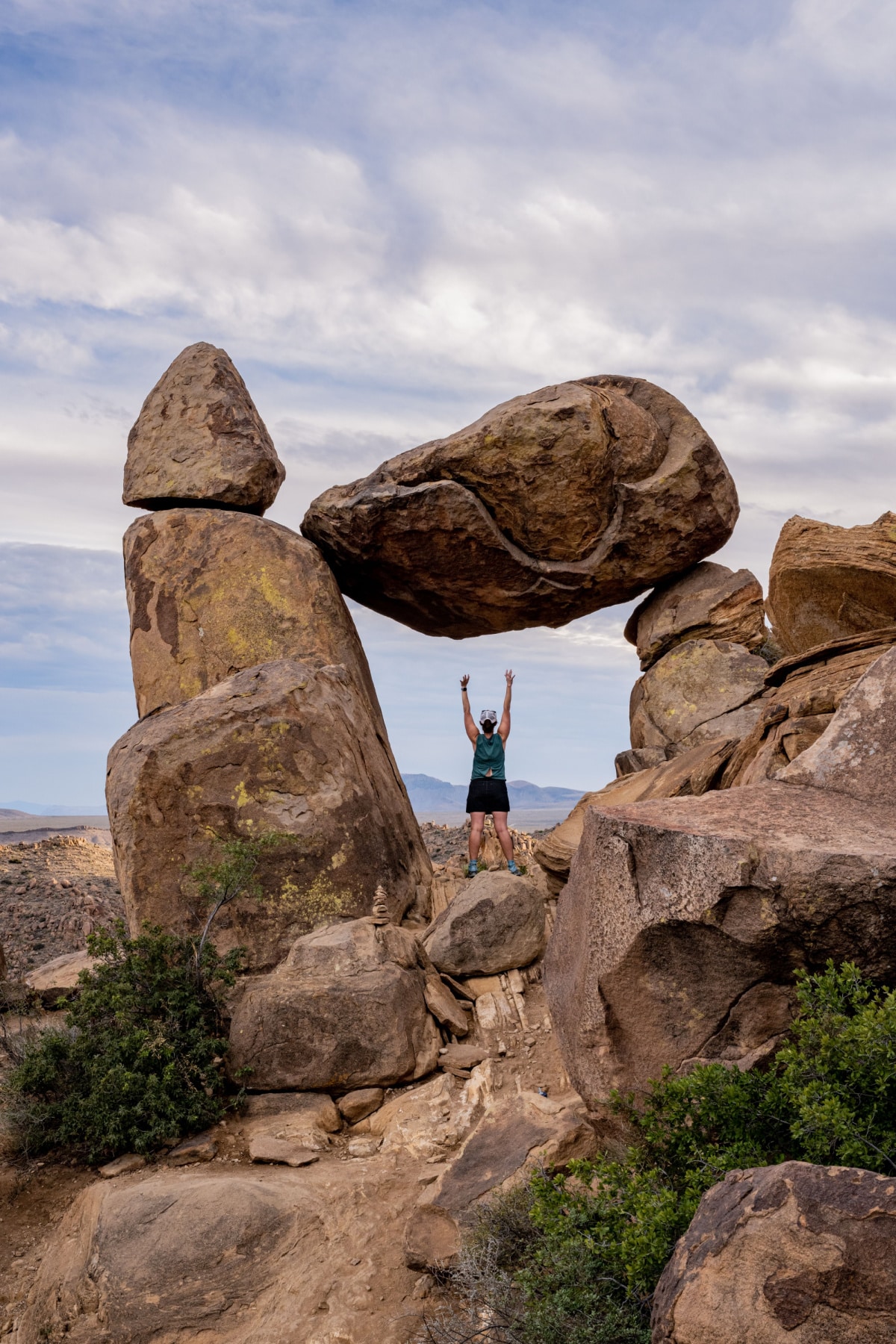
6. Grapevine Hills
Length: 2.2 miles
Time: 1-2 Hours
Elevation Gain: 80 Feet
Grapevine Hills Trail is also known as Balanced Rock Trail, and it’s one of the best hikes in Big Bend National Park to take an Instagram photo. I quickly renamed Grapevine Hills Trail the “Grapes of Wrath” trail. You just have to keep telling yourself, “There’s a really cool, balanced rock at the end.”
The road to get here is about as bumpy and rugged as they get. Don’t try to drive it without a high-clearance vehicle. The first part of the trail is simple enough as you navigate through a sandy wash. The last quarter of a mile is a beast—be prepared to scramble.
The rocks here have a bubbly, rounded appearance but are also known for having shaded spots where snakes and scorpions like to hang out. Never stick your hand into a shaded area without looking inside first.
Be patient at the end of this busy trail as people take a photo beneath the “frame” created by a balanced rock. Watch your footing on the way down; Big Ben National Park Rangers tell us this is one of the top places rescuers are called to due to hikers slipping on the sand-covered rocks.
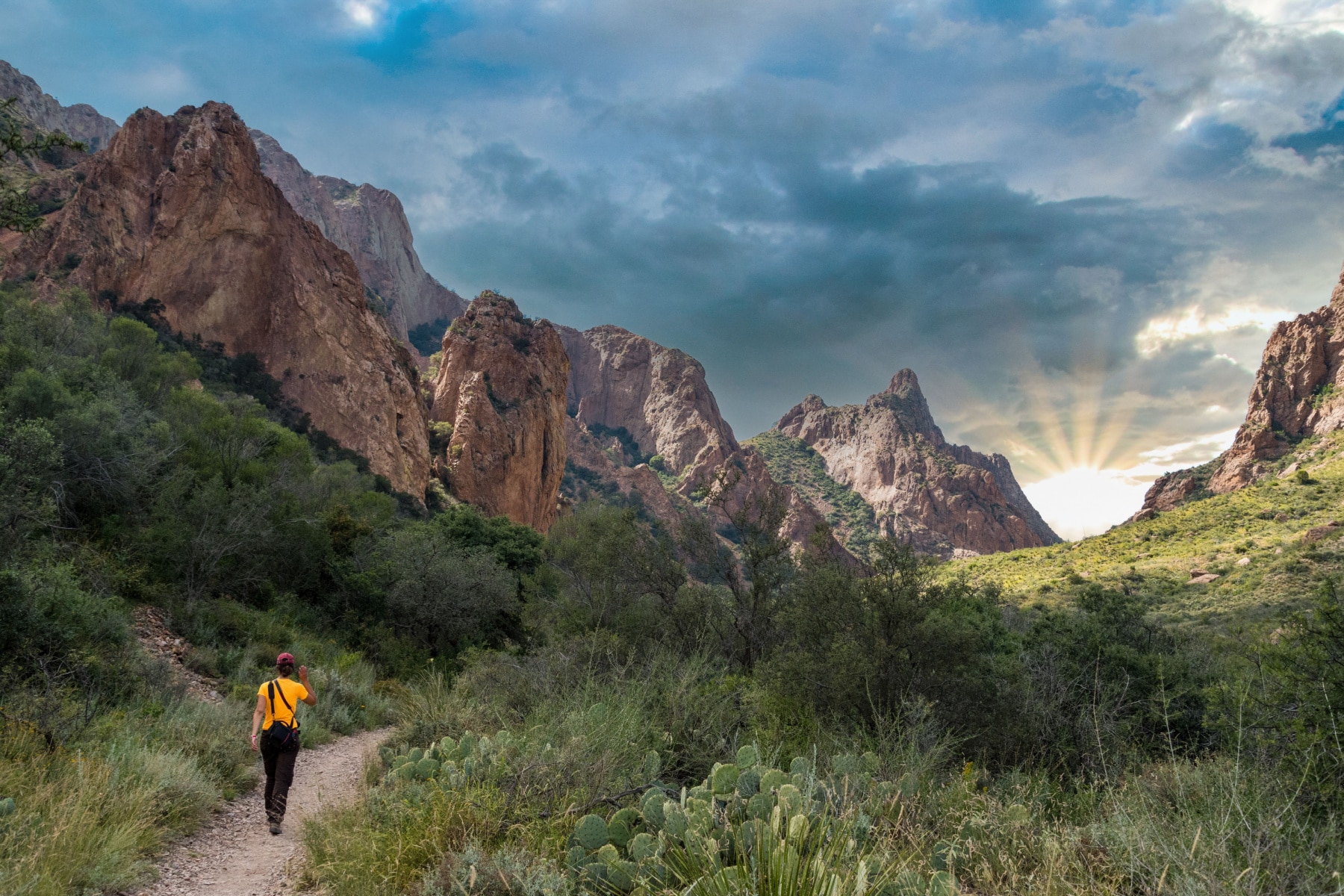
5. The Window
Length: 5.5 miles
Time: 2-3 hours
Elevation Gain: 900 feet
The name “The Window” sort of gives away the payoff of this trail, but this is one of the Big Bend hiking treasures with the most unique views at the end. Your mind might automatically go to the Angel’s Window of the Grand Canyon or Arches National Park, but this “window” is different in all the right ways.
You’ll stroll through Oak Creek Canyon, which could have water seasonally as you weave across its basin. Some shaded spots on the way give relief, but this isn’t a trail where you want to be at midday in the summer.
At the end, you’ll do some light scrambling and walk on smooth rocks to a window through canyon walls that provide multi-dimensional views of the Big Bend region.
SAFETY TIPS: The first mile of the path is the steepest, so save energy for the way back. Do NOT go too close to the edge of The Window, as there is no railing, and the slick rock is unforgiving of missteps.
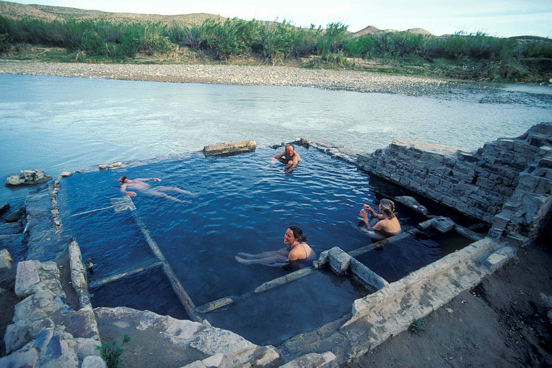
4. Hot Springs Trail
Length: 1.2 Roundtrip
Time: 30 Minutes (not counting time spent in the hot springs)
Elevation Gain: 144
Hot Springs Trail takes you through a short desert trail off a bumpy dirt road. You’ll end up at the Rio Grande River, where a walled-off hot spring tub is waiting. This was a resort destination 100 years ago before Big Bend National Park was established. You’ll see some structures from the Langford Bathhouse, long since closed.
Ideal access to the springs happens during low river levels, as flooding can leave the spring underwater or filled with mud and gunk from previous flooding.
The water temperature reaches 105°(F) year-round. A bathing suit is required, and don’t put your head underwater.
Some visitors enjoy the cool plunge of the Rio Grand and the hot water of the spring, but the Rio Grande River is unpredictable, with a strong current, debris, and holes beneath that you can’t see. Use extreme caution.
WARNING: You might come across various items for sale in rouge places, like randomly on a rock. DO NOT PURCHASE THESE ITEMS. Here’s why:
“Mexican Nationals may leave items for sale such as walking sticks, bracelets, and other crafts on the U.S. side of the Rio Grande. If you purchase their items or make a donation, you are encouraging illegal crossings of the river, which may result in the individuals’ arrest and deportation. Items purchased are considered contraband and can be seized by officers.”
– Big Bend National Park Rangers
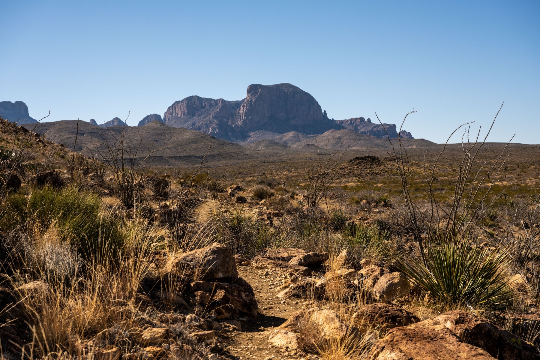
3. Emory Peak Trail
Length: 10.5 Roundtrip
Time: 6-8 Hours
Elevation Gain: 2,500 feet
The Emory Peak Trail is one of the best hikes in Big Bend National Park for those who want a strenuous hike to the apex of the park. For the first few miles of this trail along the Pinnacles, I kept saying, “This isn’t so bad.” A few times, I thought, “Yeah, I guess this is strenuous,” when the trail would even out again.
Prepare for the last quarter mile. The last 25 feet of the trail is technically “scramble,” but it’s as close to the line between scrambling and free climbing as I’ve done. I’m of a moderate experience level, and I am so thankful I always carry my gloves with me to help when I need more grip.
The payoff is the 360° view from 7,825 feet above the Big Bend region. I will add that the hike back down offers amazing views that were to your back on the way up. Visitors during warm months should start this trail before sunrise.
2. Lost Mine Trail Big Bend
Length: 4.8 Roundtrip
Time: 3 Hours
Elevation Gain: 1,100
The Lost Mine Trail in Big Bend is by far one of the most popular and best hikes. Everything that makes Big Bend awesome is found on the Lost Mine Trail. Hikers are immersed in the diverse landscape of the Chisos Mountains.
The trail climbs steeply from the Basin Road parking area, traversing oak and juniper groves before leveling out along a ridge. From this vantage point, Pine Canyon and Mexico’s Sierra del Carmen mountains unfold in stunning panoramic views.
After just one mile, a scenic saddle overlooks the surrounding Casa Grande peak, Juniper Canyon, and the Chisos Basin below. This is also a great turnaround spot if it’s too hot or you are having trouble on the trail.
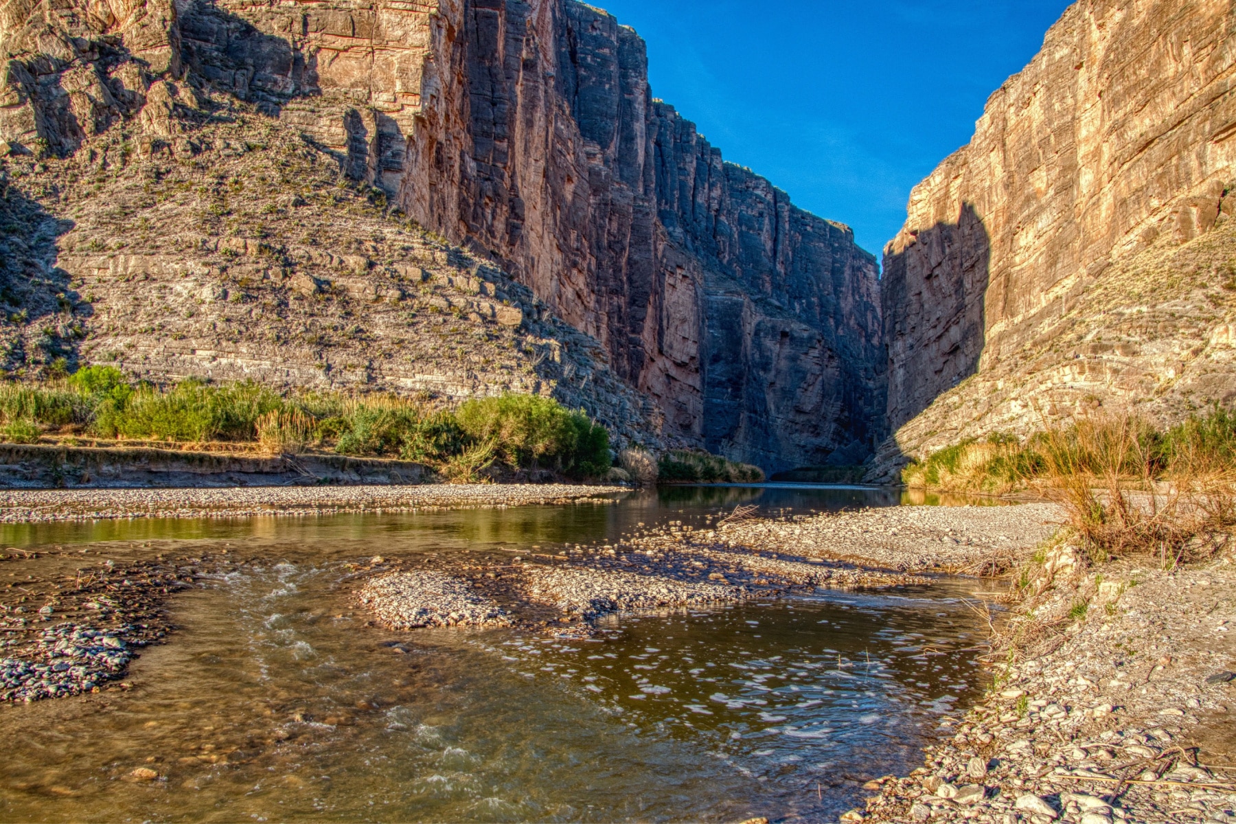
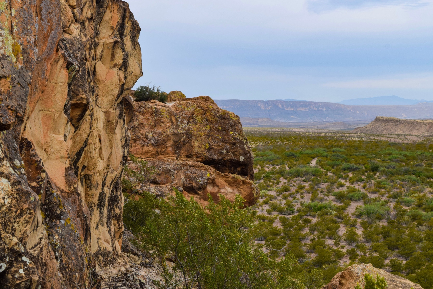
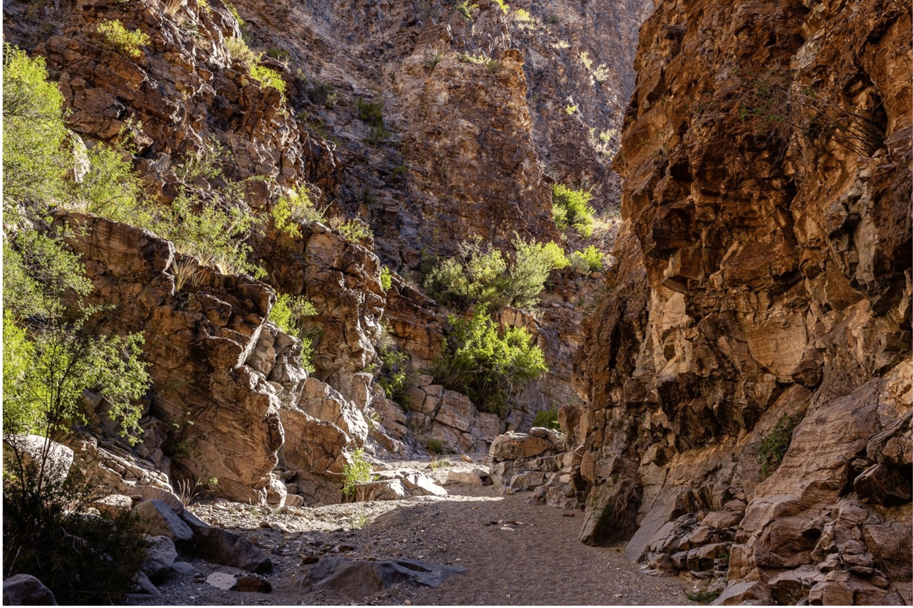
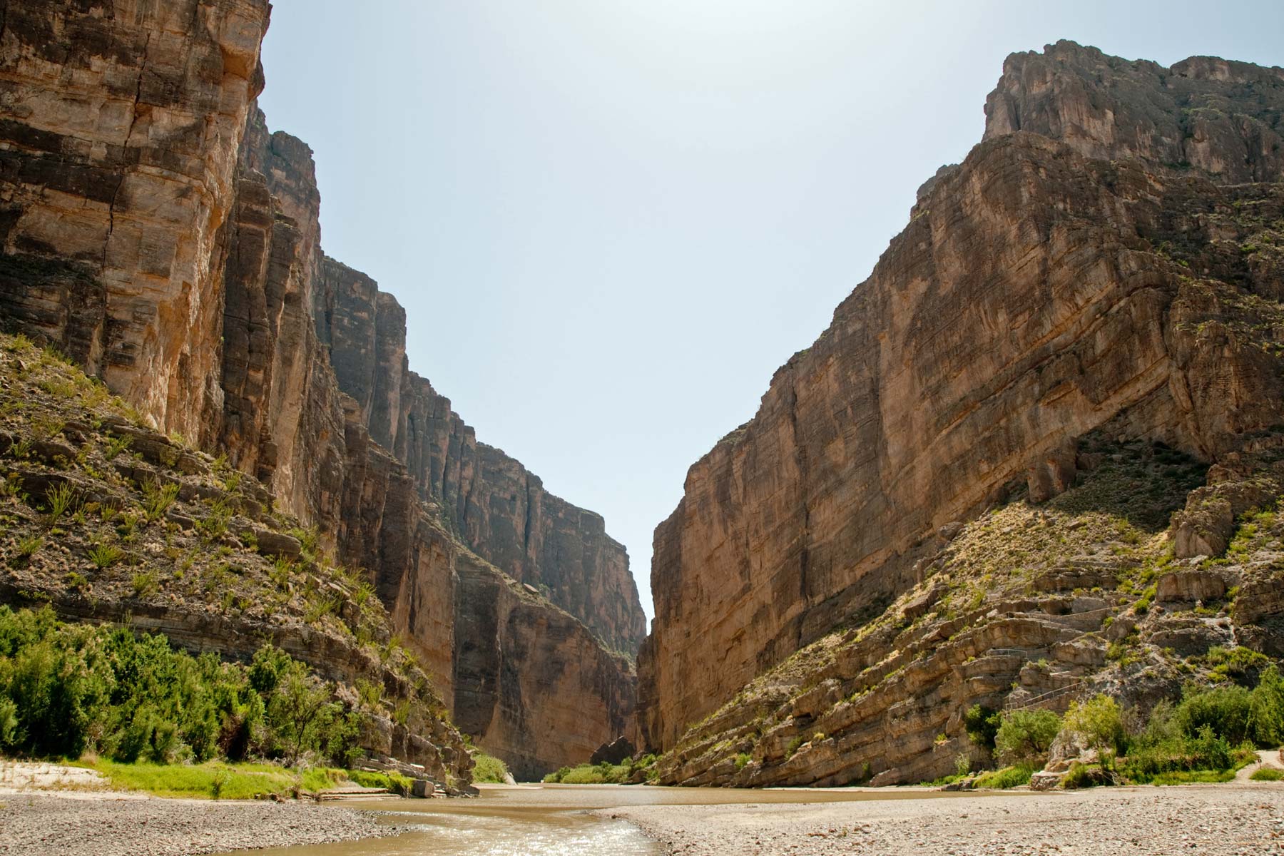
1. Santa Elena Canyon Trail
Length: 1.7 Roundtrip
Time: 40 Minutes
Elevation Gain: 1,100
The end of the Ross Maxwell Scenic Drive is the beginning of this trail. It’s a moderate hike but short enough that most hikers should be able to power through.
This is one of the best hikes in Big Bend National Park for seeing sheer rock walls and watching the sunset as it descends between the connecting canyon walls at the mouth of Santa Elena Canyon.
You will be crossing water here as the trail goes across Terlingua Creek. Views are stacked here, whether you want to stare up the sheer side of a cliff or get a vantage point where you can look out for miles. The National Park Service calls this hike a “Big Bend Classic.”
WARNING: Do not drink the water here or let it get into your eyes, nose, or mouth if you plan on swimming.
Safety Tips for Best Hikes in Big Bend National Park
If you don’t take proper precautions, the best hike in Big Bend National Park could turn into a nightmare. Here is what park rangers tell me are the four biggest risks in the park.
Driving Safety
Your riskiest behavior in Big Bend National Park will be how you drive. With more than 304 miles of road at a 45 mph maximum speed limit, you can’t treat the remote roads like a racetrack.
Dangers include:
- Steep drop-offs on the road
- Limited shoulders on roadways
- Drivers going too fast on winding roads
- Drivers not giving space to bicyclists
- Drinking & driving
- Stopping in the middle of a road to take photos
Nearly 140 miles of the park roads are crude, unpaved, and rough. Always have a spare tire (make sure it’s inflated!) and the ability to change it yourself. Do NOT attempt the backcountry roads with a compact car or traditional SUV.
Heat & Desert Exposure
The warning against the heat and exposure of Big Bend National Park has too many cautionary tales. In June 2023, a Big Bend hiking death made headlines after a father and stepson visiting from Florida were hiking at temperatures topping 119°(F).
The 14-year-old son died from heat exposure, and the 31-year-old father died after going for help and ending up crashing his car.
If you have never hiked in a hot desert climate, you truly don’t understand how quickly the heat and arid conditions can drain you of energy, electrolytes and water. The dry air evaporates your sweat faster. You might not even realize you’re getting sick at first.
Always underestimate your ability on a desert trail. Ask park rangers how much water you need for your chosen trail of the day.
Getting Stranded or Lost
Forget Google Maps or any mobile mapping system that relies on cell or Wi-Fi signals while you’re here. You likely won’t have service, and phones will overheat quickly anyway. Bring a map (or two, just in case) and know how to use a compass.
You need more than just water. You need salty snacks or electrolytes to replace what you’ve lost.
Always let someone know where you are going and when you plan to be back. Be specific about which trail you are taking, and don’t change plans without letting someone know.
HELP IS HERE: We’ve compiled the best hiking apps for all skill levels, including offline maps that could save your life.
Wildlife Among Best Hikes in Big Bend National Park
Wildlife safety requires education here, as mountain lions, black bears, and javelinas are the biggest animals you’ll see. There are also scorpions, rattlesnakes, and deadly spiders.
I was once trapped on a set of stairs by angry javelinas at the base. While they look like friendly pig-like animals, they are unpredictable and can be aggressive. I’ve also suffered two scorpion stings, and it’s the pain of a dozen bee stings.
To avoid snakes, stay on the trails, listen for the rattle, and wear boots that cover your ankle. Get the tallest boots you can find. (Now you know why Cowboy Boots are so popular in these climates!)


Is It Safe to Visit Mexico or Be This Close to the Mexican Border?
Nothing separates the border in many places aside from the Rio Grande River. While you’re smart to have safety concerns, incidents between refugees and park visitors are rare.
You can always check the latest safety guidance from the U.S. State Department. The border crossing at Boquillas is in the state of Coahuila, which, as of this publication, has an “Exercise Increased Caution” advisory.
Bouquillas is not mentioned as a city where there is any risk, and since it’s right across the border with plenty of law enforcement, there’s no reason for you to worry either.
Checklist for Best Hikes in Big Bend Safety
Checklist for the Best Hikes in Big Bend National Park
Bear spray, which should be attached to your hip or easily accessible.
Bear-proof containers to carry food.
Stargazing flashlight for safely finding your way at night to see the stunning skies.
Sunglasses for hiking in bright sunlight.
Cooling towels for the extreme heat of the trails.
Binoculars for safely spotting wildlife at a distance.
Hiking First Aid Kit for scrapes and bug bites along the trails.
Water bottle to stay hydrated in the arid climate.
Map of the Best Hikes in Big Bend National Park
Summary of 15 Best Hikes in Big Bend National Park
- Lost Mine Trail
- Santa Elena Canyon Trail
- Emory Peak Trail
- Hot Springs Trail
- The Window
- Grapevine Hills
- Lower Burro Mesa Pouroff Trail
- Upper Burro Mesa Pouroff Trail
- Chimneys Trail
- Big Bend South Rim
- Window View Trail
- Lone Mountain Trail
- Boquillas Canyon Trail
- Mule Ears Trail
- Rio Grande Village Nature Trail
Pin 15 Best Hikes in Big Bend National Park
Helpful Related Links
Big Bend Blows Your Mind: 12 Amazing Facts About Big Bend National Park
Big Bend National Park Beyond Hiking: 20 BEST Things to Do in Big Bend National Park
More National Parks in Texas: 16 MAGNIFICENT Texas National Parks
More Next Door in New Mexico: The ULTIMATE Guide to New Mexico National Parks
Guadalupe Mountains National Park Facts: 10 Fascinating Facts About Guadalupe Mountains National Park
San Antonio National Parks: 8 Amazing National Parks Near San Antonio
National Parks Near Dallas: 5 Great National Parks Near Dallas
Ranking All National Parks: ALL 63 US NATIONAL PARKS RANKED By Experts (Best to Worst)
TOO HOT? Wait Until You See Winter in National Parks: 15 Stunning National Parks in Winter Worth Visiting
This whole park is such a treasure. Thank you for the information on the new trail! Can’t wait to go back.