Article Overview: Hiking Skyline Trail in Mount Rainier
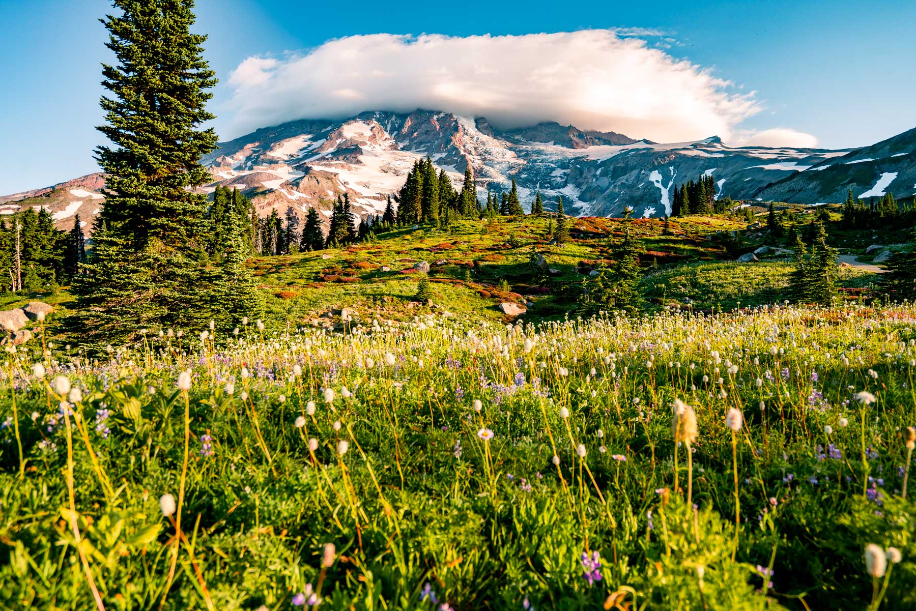
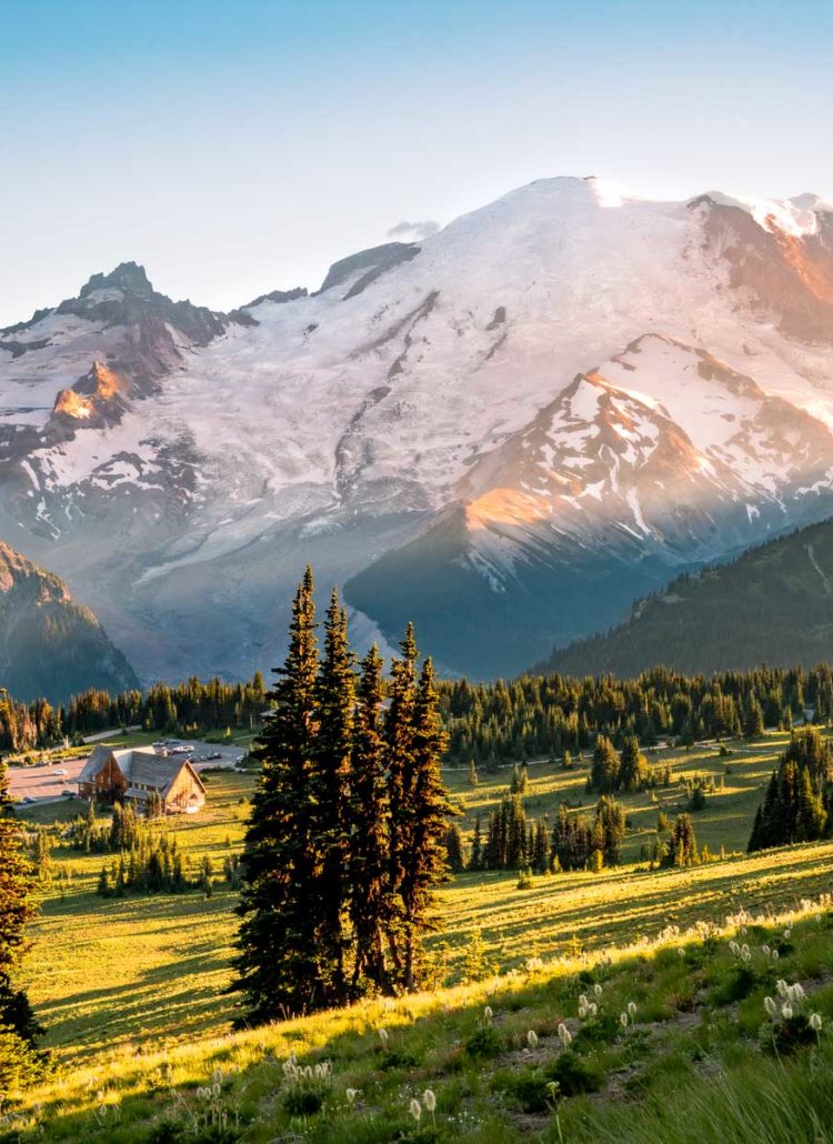
Paradise can be found at the heart of Mount Rainier National Park, with the Skyline Trail being one of the most iconic walks you’ll ever take. The explosive contrast of hundreds of wildfires sweeping the landscape is ironic, considering Mt. Rainier is an “episodically active” volcano.
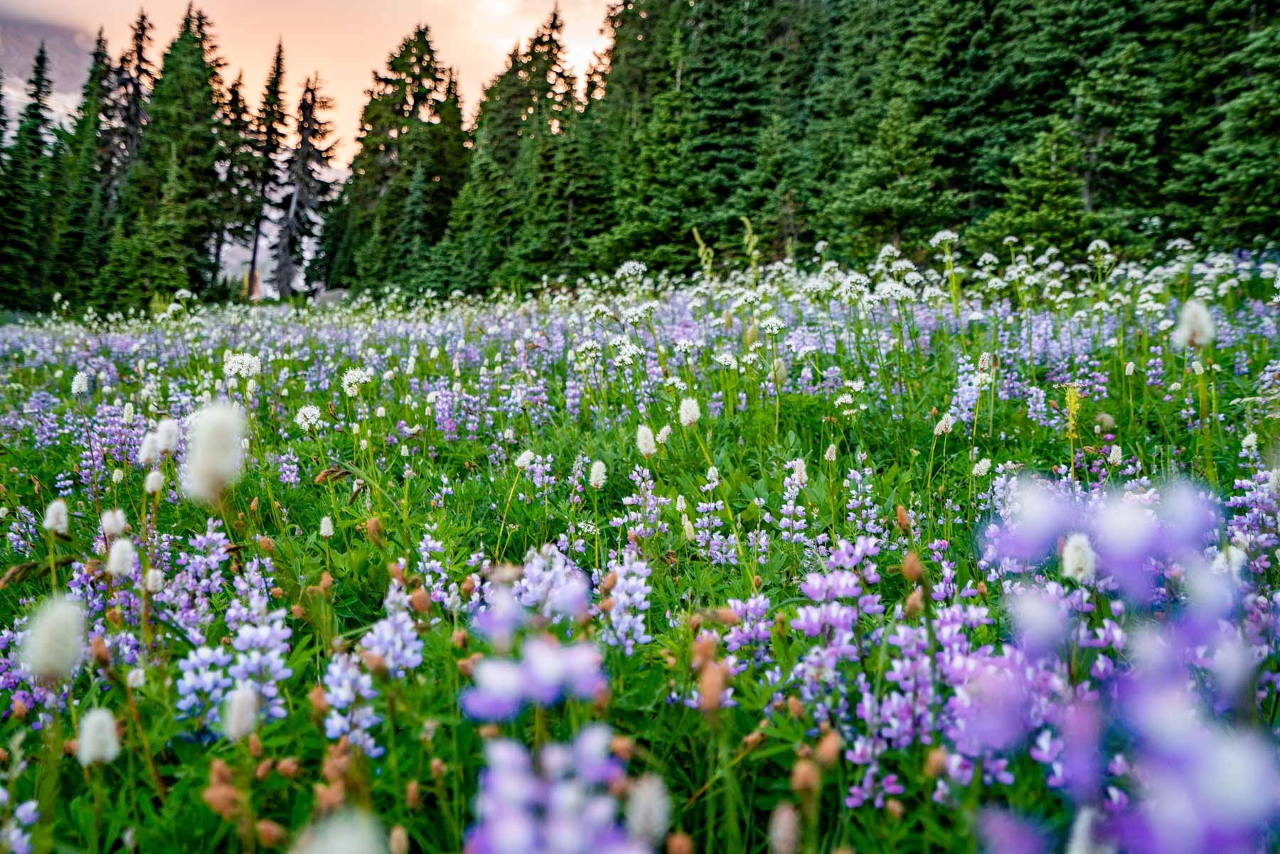
I’m a sucker for flowers, especially ones that grow in unseemly places, like the robust blooms in desolate Death Valley. Mount Rainier runs the other way, with plenty of precipitation but snowfall that averages 640 inches a year—that’s the equivalent of a five-story building. Yet, flowers here are ecologically agile enough to sprout through the snow.
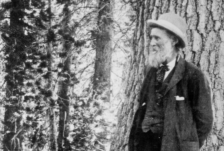
It was that scene that led the Father of National Parks, John Muir, to make one of the boldest statements of his lifetime.
“…the most luxuriant and the most extravagantly beautiful of all the alpine gardens I ever beheld in all my mountain-top wanderings.” – John Muir upon seeing Mt. Rainier
Skyline Trail is located in the Paradise section of Mount Rainier, which is a hint as to how beautiful of an experience you’re in for. As of 2024, access to Paradise and the Skyline Trail Mt Rainier offers is by reservation only from 7am to 3pm between May 24 and September 2.
At the same time, Mount Rainier is a different experience for everyone because no two days on the trail will ever be the same. Heck, you can have a different experience from a morning to an afternoon hike.
As Eddie Money said, “I’ve got two tickets to Paradise,” and our tour starts now.
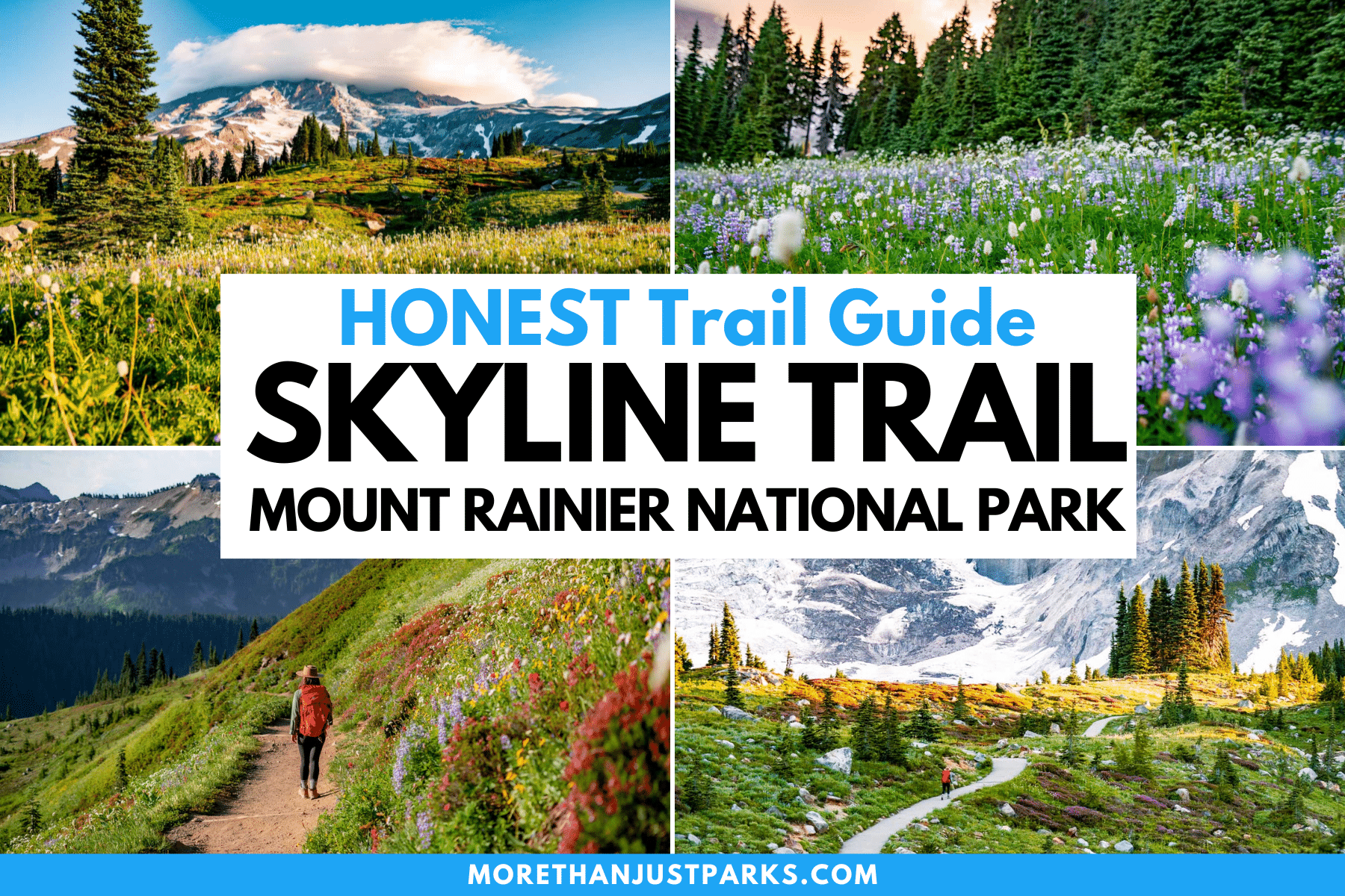
Table of Contents: Hiking Skyline Trail in Mount Rainier
5 Things When Visiting Mount Rainier National Park
- Entrance fees are $30 per vehicle. If you have the interagency America the Beautiful Pass, you’ll skip this payment as the $80 fee covers public land entrances for a year.
- Please carefully review the timed-entry reservation information before planning a trip here. The easiest way to avoid all that reservation confusion at Mount Rainier is to arrive before 7:00am or after 3:00pm.
- This is the best Mount Rainier National Park Guidebook to help you plan and explore the different regions. If you’re a fan of just having a map, here’s a Mt Rainier map option.
- Here’s a great hotel recommendation near the Paradise Corridor entrance in Ashford. If you are staying at a hotel within the park, you can skip the timed entry and enter after 1:00pm.
- Peak wildflower season is late July through mid-August. That’s it. That’s the window. Bookmark the Currently Blooming website for updates.
Hiking Skyline Trail in Mount Rainier Weather Updates
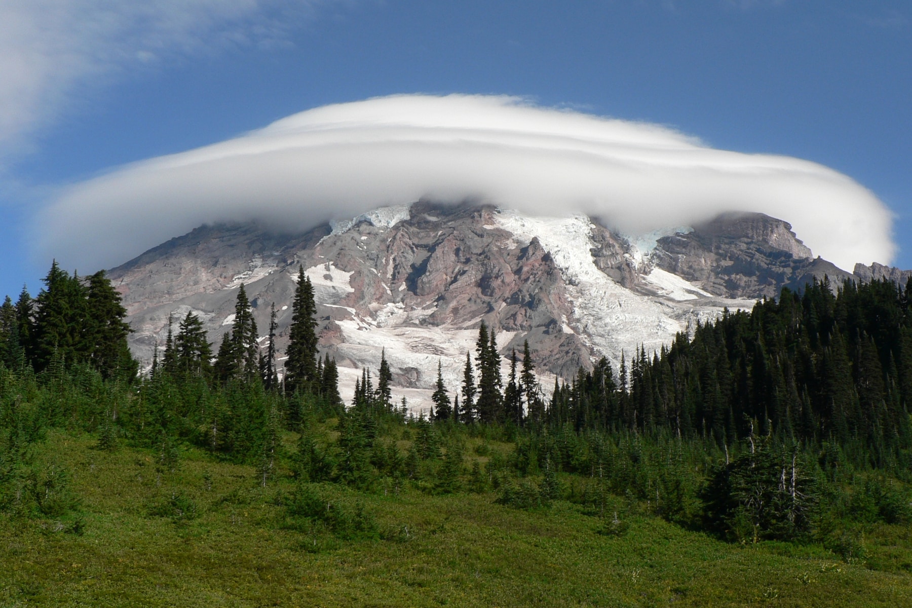
At the same time, you also need to know the weather forecast, which determines if you’ll be able to get the scenic views the Skyline Trail provides. One of the top questions to ask is, “Is the mountain out today?” which means the visibility of Mt. Rainier in current weather conditions.
| Weather Website | What You’ll Need to Know |
| Mt. Rainier Recreation Forecast | Weather elements in each part of the park with risk potential and temperatures. |
| Northwest Avalanche Center | Current snowpack and winds |
| Paradise SNOTEL Report | Snow/precipitation for the last seven days |
| National Weather Service | Regional weather information |
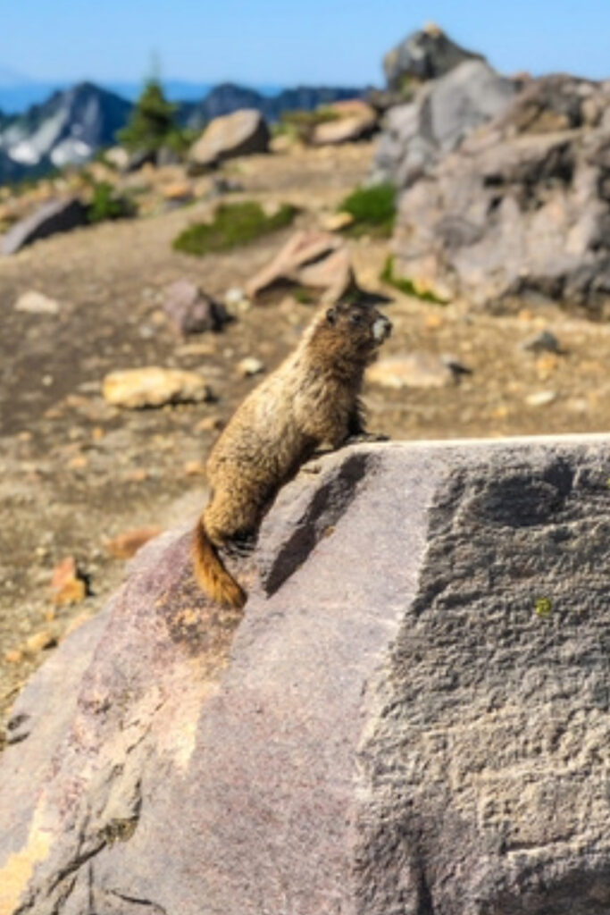
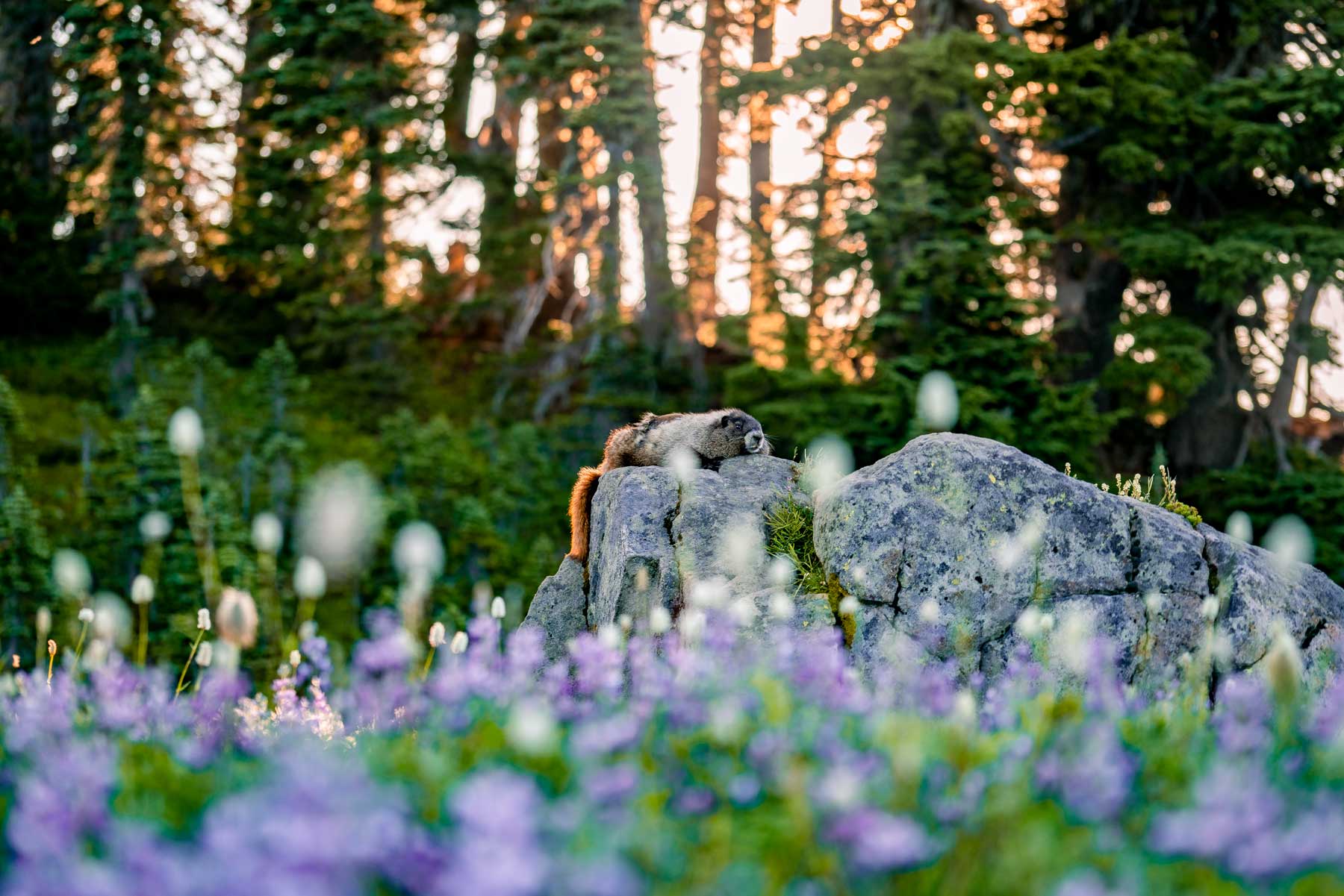
Hoary (Whistling) Marmot: “A heavily built, gregarious, burrowing rodent.”
If you hear whistling on Skyline Trail, that’s not someone letting you know how good you look in those hiking clothes. The marmots make a whistling sound (though it sounds more like a shrill scream to me) as a defense mechanism. These animals aren’t aggressive, but they are abundant on the Skyline Trail as they thrive in the subalpine ecosystem.
Hiking Skyline Trail in Mount Rainier Step-by-Step Guide
1. The Skyline Trail Starting Point
Skyline Trail is a loop that can be taken in either direction, though the majority of people (including the National Park Service Rangers) suggest that clockwise gives the best views and experience.
HIKING TIP: If you go counterclockwise, you’ll see the waterfall early into the hike and have a less aggressive ascent up the trail.
The trail starts as you walk up the stairs with the John Muir quote near the Jackson Visitor Center. Grab a trail map here. I like to grab two and tuck one away after one incident where my map was blown away mid-hike on Mount Charleston.
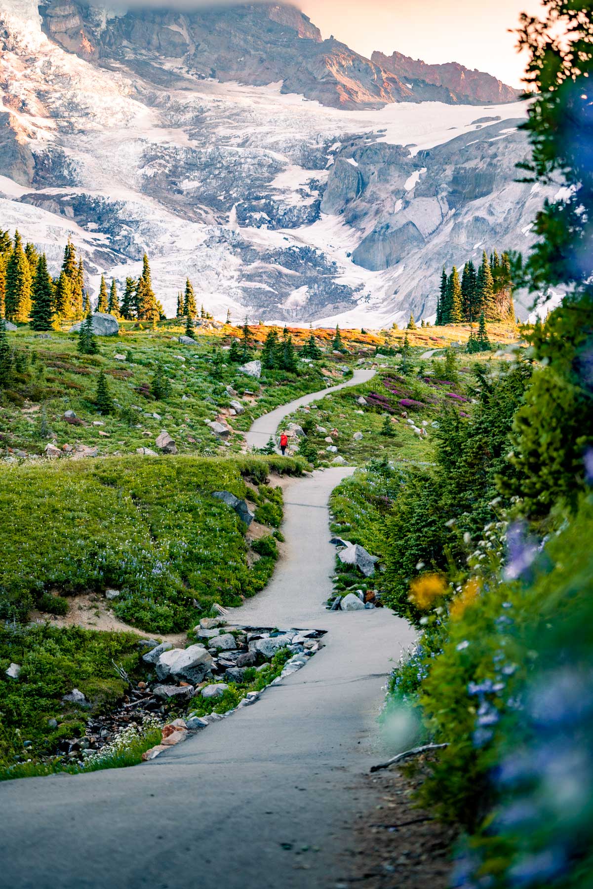
The first half mile is an intense incline. The trail is wide enough and paved, but you’ll burn up the calf muscles. I used the stairs as a nice calf stretch spot. In just a few minutes of walking, Mount Rainier stands proudly above you. One reason the clockwise route is so popular is that you can see the mountain as you climb instead of having it at your back.
There is little shade on this trail, so bring a hat, sunglasses, and lather on the sunscreen.
2. Trailhead to Panorama Point
Length: 2 miles
Elevation Gain: 1,700 feet
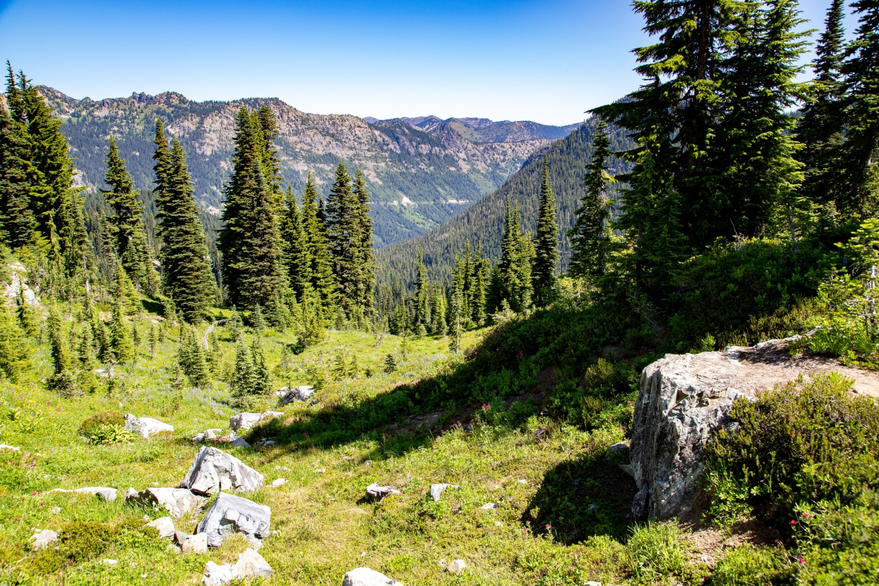
About half a mile into the hike, the trail leaves the paved, wide trail and turns into a more traditional wilderness trail. Just past the mile mark, you can take a detour on Glacial Vista Trail to get a closer look at the mountain and (you guessed it) glacier! The trail leads back to the Skyline Trail with not much extra mileage.
HEADS UP: If you accidentally take Deadhorse Creek Trail, it will meet back up with the Skyline Trail, too.
This is the wildflower area in summer, and the closest thing I can compare it to is the scene from The Wizard of Oz when Dorothy is almost to the Emerald City, and she’s in the poppy fields.
WATER FOR WATERFALL: If you look to the side of Mt. Rainier, you might catch a massive waterfall coming off the base of the mountain. That is Wilson Glacier Falls horsetails down to Nisqually Glacier.
About 2/10th of a mile, the trail will turn into a rocky series of stone steps, and you’ll eventually be on the edge of a mountain. Expect snow on this portion of the trail, even in summer. Look for Nisqually Glacier near the hairpin turn.
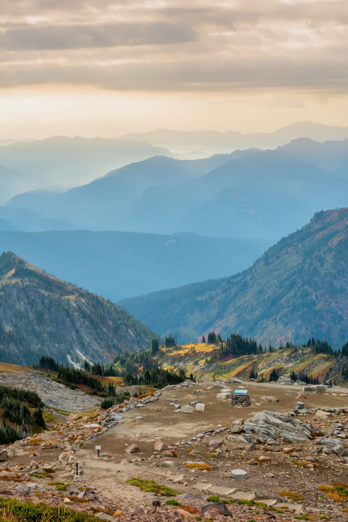
You’ll have Panorama Point above you, but you still need to make it to the top of the trail and then walk along the bottom edge of the vista before the final ascent to the stunning view.
3. Panorama Point to Golden Gate Trail
Length: 2 miles
Total Length: 3 miles
Elevation Gain: 1,700 feet
From Panorama Vista, you have two choices. The Skyline Trail splits, where you can walk straight across a year-round ice field. Mt. Rainier Rangers say it’s a “dangerous icy slope that does not melt.” Unofficially, this is referred to as the Low Skyline Trail.
You can also opt for the High Skyline Trail, which is the length and route most commonly taken.
- Low Skyline Trail to Golden Gate Trail: 0.9 miles, technical skills required, snow & ice present
- High Skyline Trail to Golden Gate Trail: 1.3 miles, more scenic views, easier route
The majority of hikers will turn around at Panorama Point, so any crowds should thin out here. I actually had to keep saying to myself, “You need to keep hiking,” because the views were just that addicting. I gave a few high fives to the group I’d been pacing as they went up Pebble Creek Trail on the way to the summit.
I sat to eat my lunch while soaking in the views and saw what was arguably one of the highlights of the day—a descending trail. In another half a mile, I met up with my friends who had taken the low trail with a thumbs-up and “Glad you didn’t fall off the mountain!”
Keep descending another half mile until you get to Golden Gate Trail, where you can take the shortcut back to the parking area. Or, continue on with us.
4. Golden Gate Trailhead to Stevens-Van Trump Monument
Length: 0.6 miles
Total Trail Length: 3.6 miles
Elevation Loss: Roughly 1,030 feet from the top trail height
The trail continues to descend as you weave your way to the next historic stop on the trail.
The Stevens-Van Trump Memorial on Mount Rainier honors Hazard Stevens and Philemon Van Trump, who first summited the mountain in August 1870.
“…all this impressed me so indescribably, enthused me so thoroughly, that vowed, almost with fervency, that I would some day stand upon its glorious summit, if that feat were possible to human effort and endurance.”
– P.B. Van Trump, upon seeing Mt Rainier for the first time.
There’s a wide gravel area with additional seats where you can rest or have a meal. During wildflower season, this is a perfect place to reflect on the unique environment of the mountain and what it must’ve been like to be the first footsteps to the top.
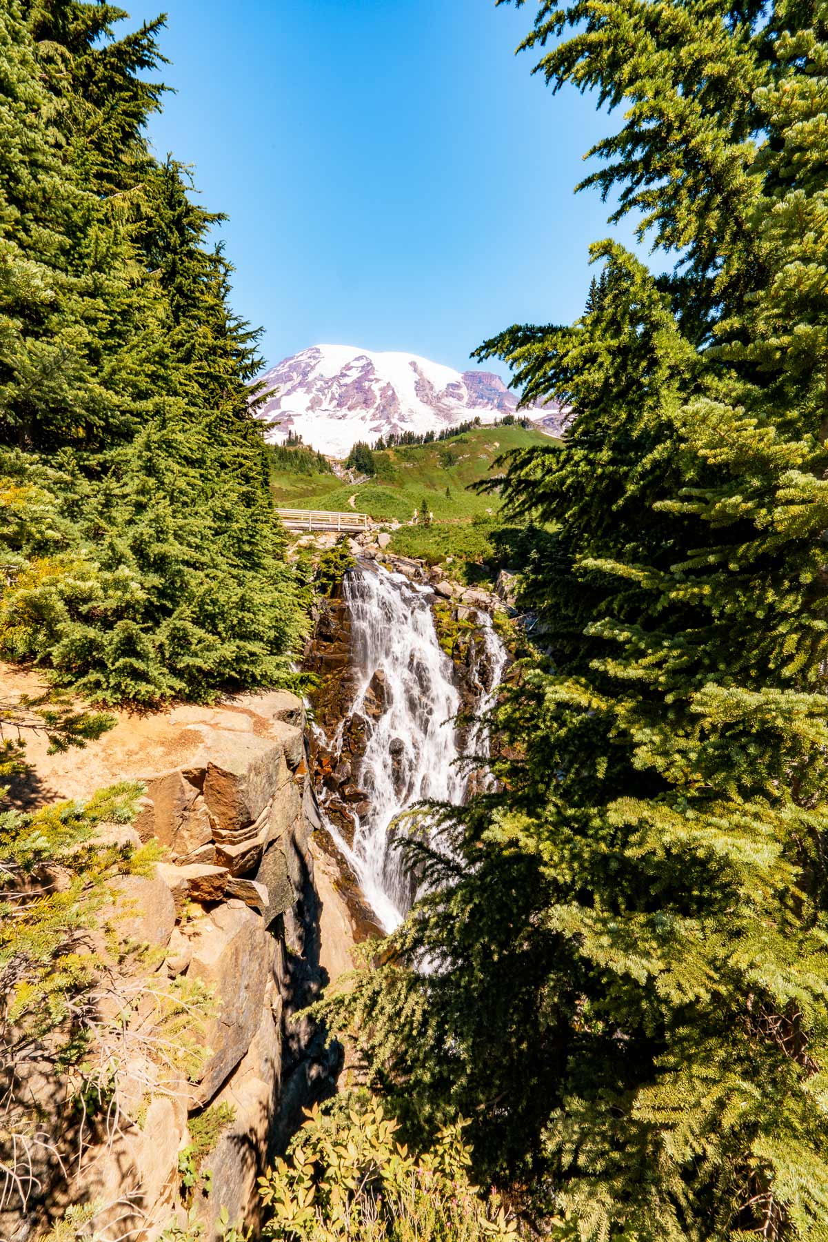
5. Stevens-Van Trump Monument to Myrtle Falls
Length: 1.4 miles
Total Trail Length: 5 miles
Elevation Drop: About 500 feet
Myrtle Falls is a showstopper, even in a park of this magnitude. The 60-foot drop of water is viewed from above on the footbridge, which is also Skyline Trail. Then there’s a viewing platform with a perfect shot of you, then the waterfall, and then Mount Rainier, perfectly positioned in the background.
There are a few warnings about Myrtle Falls:
- First, avoid this section of the trail in winter. I quote NPS, saying, “Avoid the Myrtle Falls area until snow-free. Several hazards exist at Myrtle Falls, including punching through snow, snow cornices, and steep, icy slopes.”
- Second, use caution in the spring when the melting snow can turn this waterfall into a raging torrent of water.
If the trail is impassable by water or snow, backtrack to the Fourth Crossing Trail, which will lead you back to the parking lot.
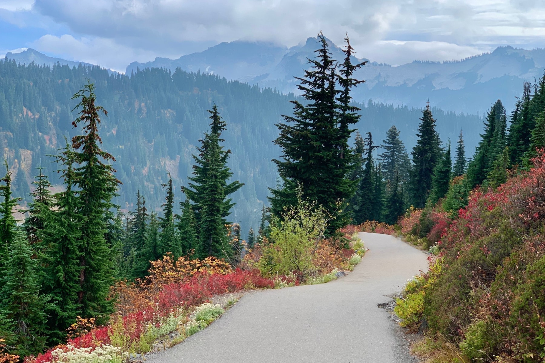
From Myrtle Falls, the trail widens and is paved again, with just a half mile until you’re back at your starting point.
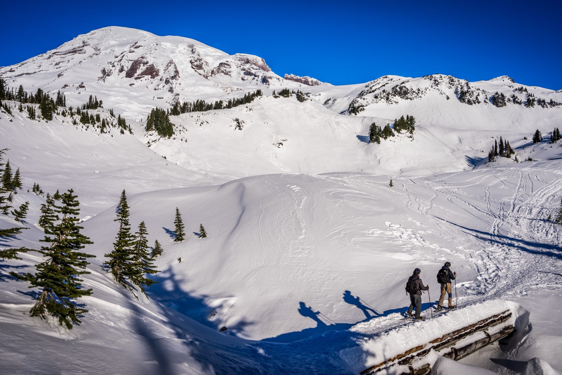
What is Skyline Trail Like in Winter?
The trail is open in the winter but is only for serious, experienced, and prepared snowshoers.
“While beautiful, the greater Paradise area contains avalanche zones, unstable snow bridges and deceptively steep drop offs where sledding activities are unsafe.”
Mt. Rainier NPS Rangers
You’ll have only the trail of those before you to guide you, as the signs and benchmarks are hidden beneath feet of snow. Please review all the winter dangers and shoulder season safety advice before you consider a trip outside of prime summer viewing.
The Paradise Sledding Area is the ONLY place where sledding is allowed in this part of the park.
Hiking Skyline Trail in Mount Rainier Summary
You’ve likely seen a lot of stunning, sunny photos of Skyline Trail or watched videos of this epic hike. With nearly 43 inches of rain (that peaks in the fall) and 640 inches of snow, you’re playing against the odds to get that idyllic day on the trail. Don’t set unrealistic expectations for the hike.
While the Grand Canyon might all but guarantee a sunny day, that’s just not the case in the Pacific Northwest. Every experience is special, whether you’re seeing Mt. Hood in the distance on a clear day or walking through a cloud of fog.
Hiking Skyline Trail in Mount Rainier Checklist
Although the Skyline Trail is 5.5 miles and is considered a moderate hike, beginning hikers can take it out and back to their own comfort level. There’s a 1,700-foot elevation gain, with a starting elevation of 5,400 feet and a peak of 7,100 feet.
| What to Bring | Why You Need It |
| Hiking/Trekking Poles | For slippery, muddy, rocky, or steep trail sections |
| Waterproof Socks | You’ll likely cross water or streams |
| High-Altitude Sunglasses | To avoid snow blindness |
| Crampons | Sections of this trail can be covered in ice or snow year-round |
| Water Filter | Never drink water right from a stream in Mt. Rainier |
FAQ – Hiking the Skyline Trail
Public comments and park, local, and federal leaders were all collaborating to come up with a plan, as timed entry is controversial for those who use this park often locally. You can stay up-to-date by checking the park’s news releases regularly.
The National Park Service says Liberty Ridge is the toughest trail in the park. Skyline Trail is not, but don’t let that make you think it’s easy.
Nope. Nothing to see here. Keep walking. Okay, there *can be ice caves on the trail. The safest ones were lost to warmer climate conditions year-round. Ice caves look really cool, but Mount Rainier National Park officials warn that they are dangerous due to the conditions inside and the risk of spontaneous collapse at any time. Stay on the trail and out of snow caves. Here’s a cool photo to scratch that itch. 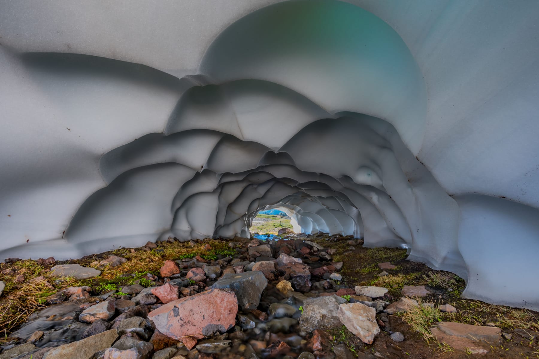
Map Of Hiking Skyline Trail Mount Rainier
Pin Hiking Skyline Trail in Mount Rainier
Helpful Related Links
Best Hikes at Do Mount Rainier: 20 Best Hikes at Mount Rainier National Park
Visiting Paradise Mount Rainier: 15 Reasons Paradise Mt Rainier is the Most Beautiful Place in America
Mount Rainier Facts: 15 AMAZING Mount Rainier Facts (Interesting Trivia + Quick Facts)
Things to Do North Cascades: 20 Amazing Things to Do at North Cascades National Park
Best Hikes North Cascades: 15 Epic Hikes in North Cascades National Park
Things to Do Crater Lake: 20 Amazing Things to Do at Crater Lake National Park
Washington National Parks: Washington’s National Parks Ranked Best in the World
Things to Do Olympic National Park: 20 Best Things to Do at Olympic National Park
Olympic NP Guide: Comprehensive Guide to Olympic National Park
Best Hikes Olympic NP: 9 Epic Olympic National Park Hikes
National Parks Rankings: ALL 63 US National Parks Ranked By Experts
Most Visited National Parks: Top 10 Most Visited National Parks
Least Visited National Parks: Top 10 Least Visited National Parks
National Monuments Ranked: ALL 128 US National Monuments Ranked (Best to Worst)

Leave a Reply