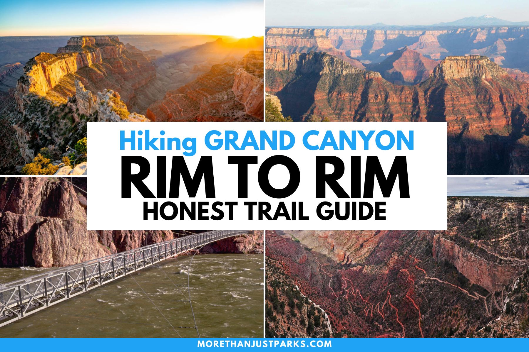
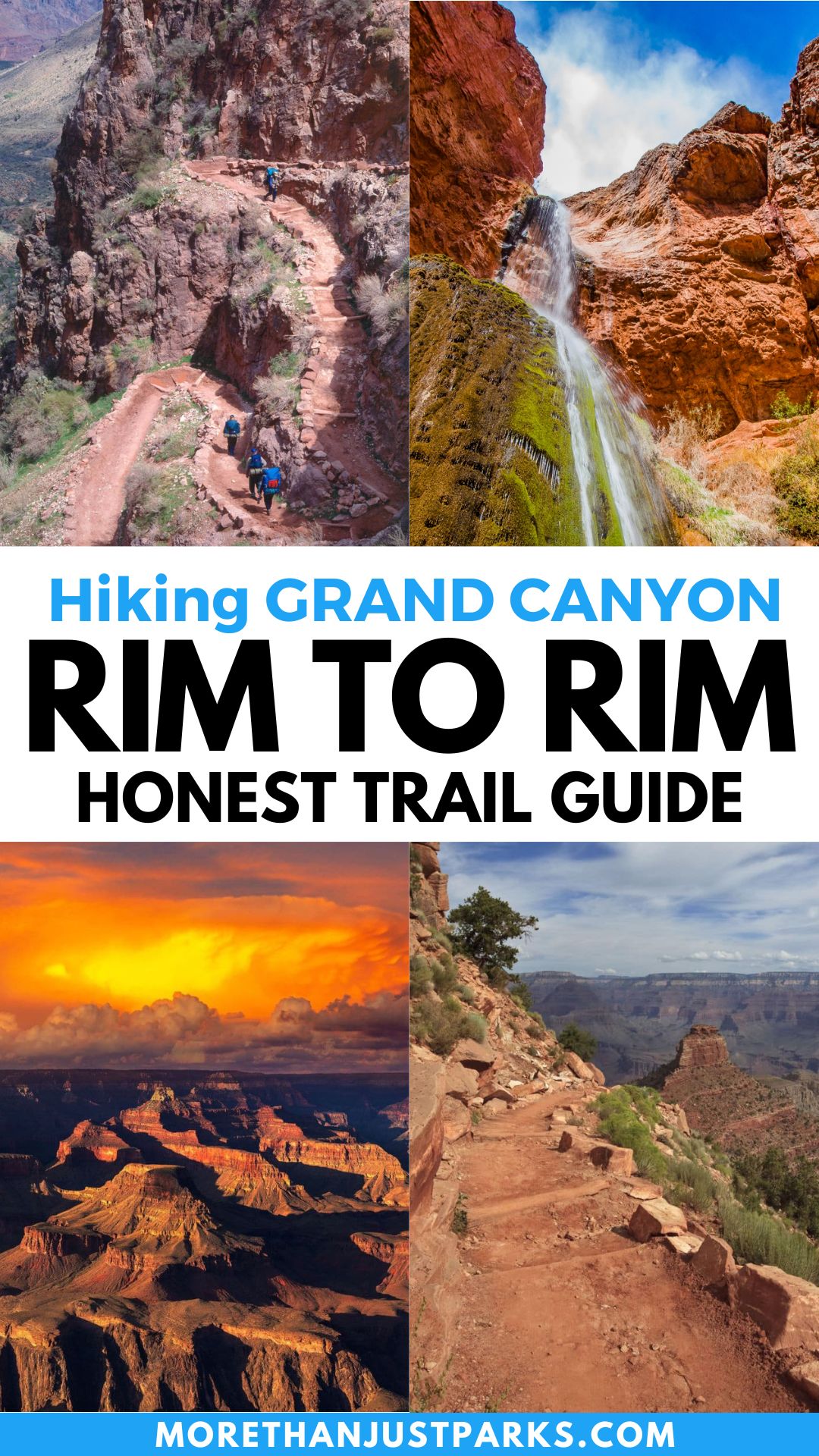
Article Overview: Hiking Rim to Rim Grand Canyon
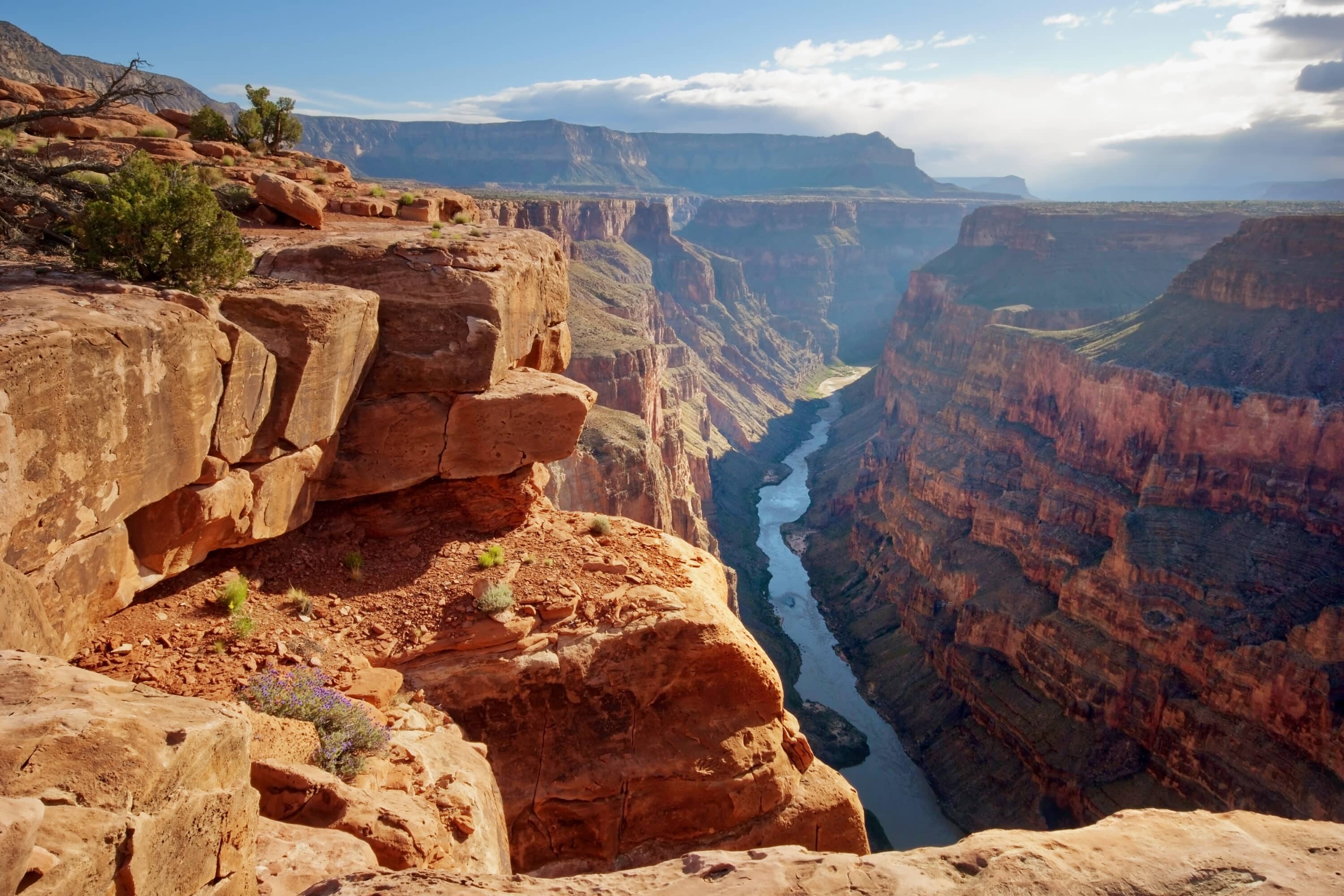
Hiking from rim to rim of the Grand Canyon will put you in the 1%. No, it won’t change your tax bracket, but you’ll be among the less than 1% of the nearly five million visitors who get to experience the long trek between the North Rim and South Rim.
The rim to rim Grand Canyon hike hits the sweet spot of being too intense to take lightly but too epic to avoid. It takes you to the edge of your fears (and heights) through steep canyon switchbacks through a hellish hot walk through “The Box.” Risks and rewards change with the ecosystems as you ascend and descend through the height of 10 Chrysler Buildings.
Then you’re thrown the curve ball that the North Rim is closed during the snowy months, meaning hiking rim to rim of the Grand Canyon can only be done during the six hottest months of the year.
When hiking the rim to rim Grand Canyon trails, you’re going down to the bottom of the canyon and back up on trails that have been carved by nature, man and beast for centuries through billions of geological years.
This hike will test your limit, try to break you, and offer a triumph few people have the bravery to achieve. Let’s get you started for an EPIC hiking rim to rim Grand Canyon trip.
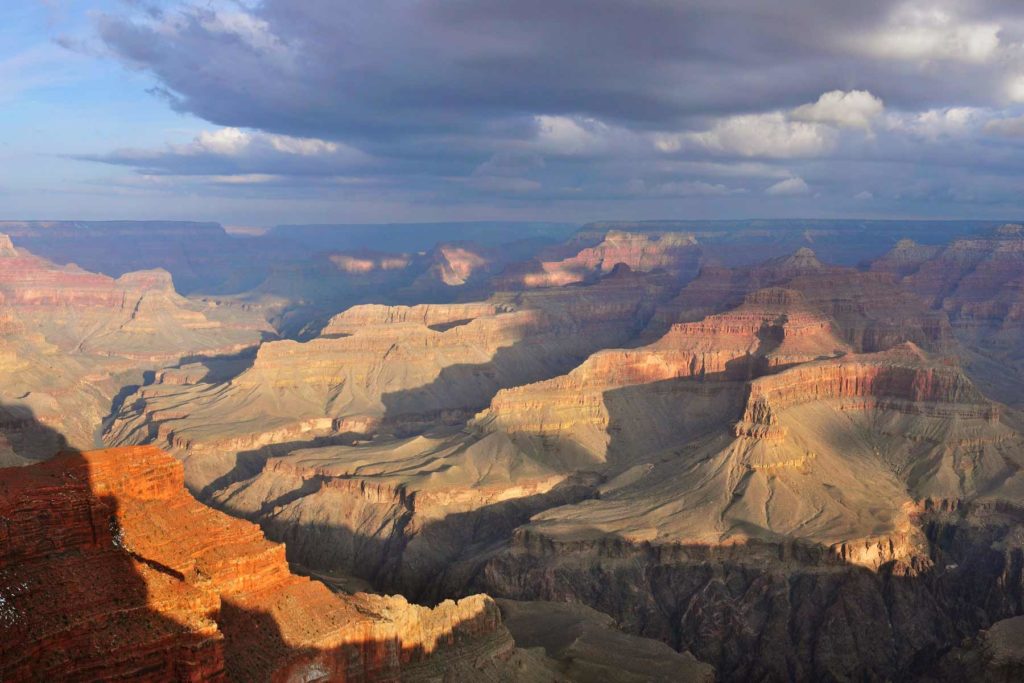
Hiking Rim to Rim Grand Canyon
Table of Contents: Hiking Rim to Rim Grand Canyon
Table of Contents: Hiking Rim to Rim Grand Canyon
- Hiking Rim to Rim Grand Canyon
- Overview of Hiking Rim to Rim in Grand Canyon
- Map Of Grand Canyon National Park Rim to Rim Trails
- Hiking Rim to Rim Grand Canyon: Day Hike or Backpacking?
- Hiking Rim to Rim Backpack Permit
- Staying at Phantom Ranch while Hiking Rim to Rim
- Plan Transportation for Hiking Rim to Rim in Grand Canyon
- Mule Rides in Grand Canyon
- Hiking Rim to Rim in Grand Canyon Strategy
- The Boundary Battle of the Rim to Rim Trails
- Rim to Rim in Grand Canyon Trail Guide
- Rim to Rim North Kaibab Trail
- Rim to Rim Trail Transition to South Rim
- Rim to Rim Bright Angel Trail
- Rim to Rim South Kaibab Trail
- FAQ – Hiking Rim to Rim Grand Canyon
- Pin Hiking Rim to Rim Grand Canyon
Things to Know Before You Visit Grand Canyon National Park
Entrance Fees
$35 per vehicle OR if you plan to visit more National Parks within the next 12 months, I suggest you purchase the America the Beautiful Pass (which can be found at the entrance gates to most national parks). This pass gets you into all National Parks, Forests, Monuments, and more, including 2,000 sites for free after a one-time $80 fee.
Sunscreen
Use it. Lots of it. Especially this one, which I never leave the house without because it plays nice with our dear friend, Earth 🙂
Insect Repellent
If you’re looking for a good insect repellent that plays nice with our good friend Earth, we recommend this one or this one if you’re a DEET person.
Guide Book
The Best Guide Book for Grand Canyon National Park is this one, which we’ve marked up and highlighted quite a bit.
Map
The Best Map: I like this map best for Grand Canyon National Park.
National Parks Checklist Map: This beautiful National Parks Checklist Map can be ordered to your house.
Framed National Parks Map: We’re a sucker for maps; this framed national parks map is the best.
Where to Stay in Grand Canyon National Park
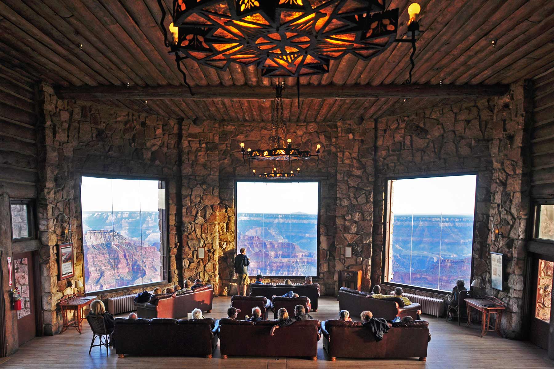
Where to Stay: This is our favorite hotel in/around Grand Canyon National Park if you’re staying at the South Rim. If you will be staying the night at the North Rim, you only have one choice in the park – the Grand Canyon Lodge North Rim.
Overview of Hiking Rim to Rim in Grand Canyon
Hiking rim to rim in Grand Canyon National Park starts with a few simple decisions. As you can see in the map below, there’s one trail that runs from the North Rim and then two trails that come from the South Rim.
You can hike north to south or south to north. We aren’t going to recommend either one because this is the adventure of a lifetime. We just want you to have the best information to make your decision. I could personally argue both directional trails with strong convictions.
Trail Name Note
The park’s Rim Trail goes 13 miles along the South Rim but never below the rim.
The only trails that are part of the rim to rim are:
- North Kaibab Trail
- South Kaibab Trail
- Bright Angel Trail
Let’s break down the details of each trail for hiking rim to rim in Grand Canyon National Park. Depending on which south route you choose, the North Rim rises anywhere from 1,400 to 1,000 feet higher than the South Rim trailheads.
For your South Rim trail choice, Bright Angel Trail is three miles longer than South Kaibab Trail.
| Trail | Length | Starting Elevation | Ending Elevation | Elevation Change | Which Rim? | |
| Bright Angel Trail to Bright Angel Campground | 9.5 miles | 6860 feet | 2480 feet | 4380 feet | South Rim | |
| South Kaibab Trail to Bright Angel Campground | 7 miles | 7260 feet | 2480 feet | 4780 feet | South Rim | |
| North Kaibab Trail to Bright Angel Campground | 8241 feet | 2480 feet | 5761 feet | North Rim | ||
| Rim to Rim Trail Options | Length | Elevations | Total Elevation Change | Pros | Cons | |
| North Kaibab Trailhead to Bright Angel Trailhead (or vice versa) | 23.5 miles | 5761 feet down 4380 feet up | 10,141 feet | Bright Angel Trails isn’t as steep as South Kaibab | Shortest rim to rim hike. South Kaibab trail is 400 feet higher than Bright Angel Trailhead | |
| North Kaibab Trailhead to South Kaibab Trailhead (or vice versa) | 20.6 miles | 5761 feet down 4780 feet up | 10,541 | Shortest rim to rim hike. South Kaibab trail is 400 feet higher than Bright Angel trailhead | No water access on North Kaibab Trail |
When is the North Rim Closed?
There’s a point of clarification that’s important for those hiking rim to rim in Grand Canyon National Park. The North Rim is closed from October 15 through May 15. However, that is applies to visitor services and campgrounds. Vehicle traffic is allowed through December 1 and trails are open to day hikes.
Grand canyon National Park
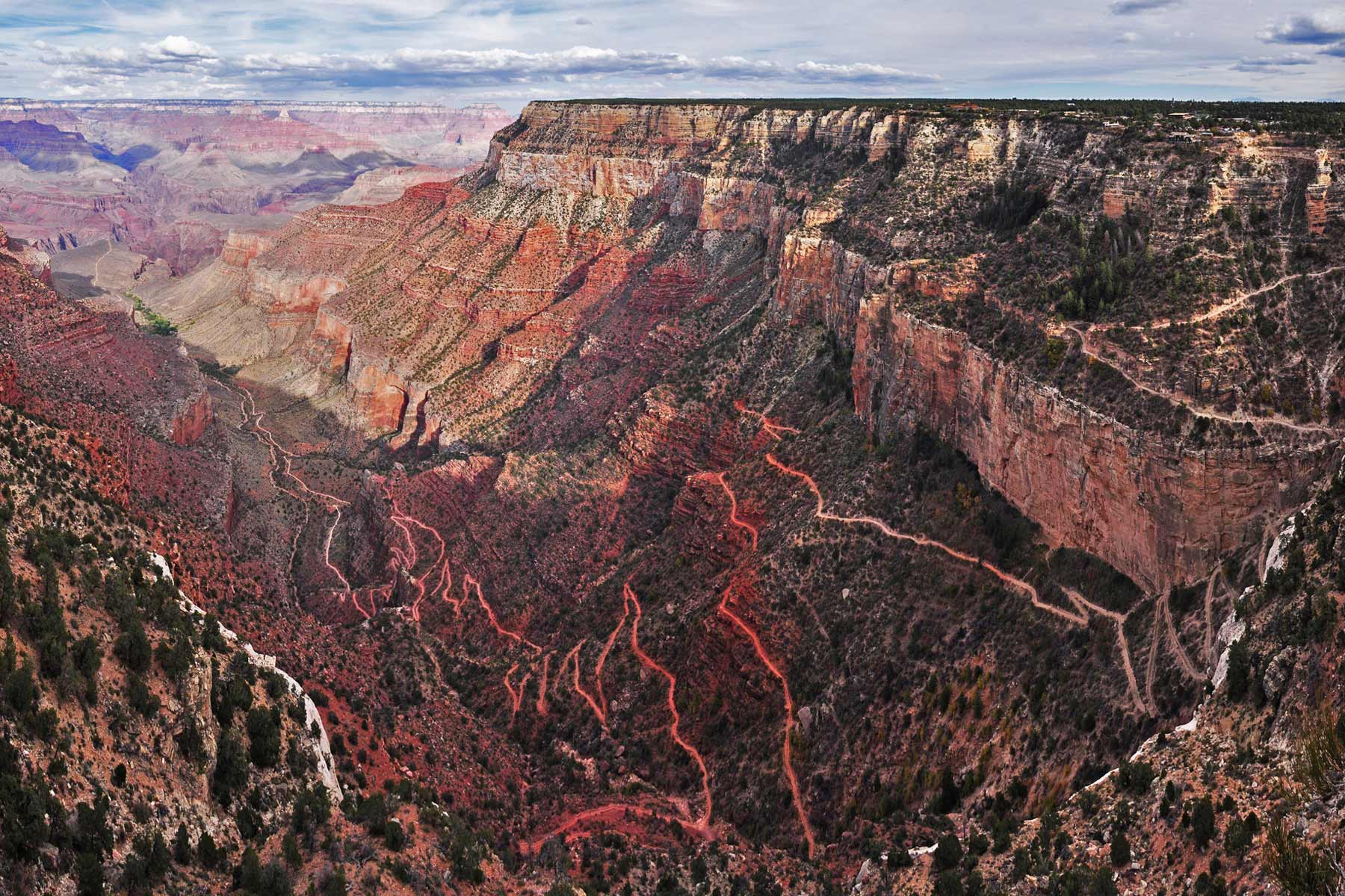
Map Of Grand Canyon National Park Rim to Rim Trails
This map shows you the extent of both routes, with campground locations marked to help you plan.
Hiking Rim to Rim Grand Canyon: Day Hike or Backpacking?
Grand Canyon National Park Rangers strongly discourage hikers from tackling the rim-to-river route in one day, much less hiking the rim to rim Grand Canyon adventure, but they won’t stop you either.
Quite frankly, enough of the 1% complete it without rescue that you shouldn’t write it off IF YOU ARE AN EXPERIENCED HIKER. The day hike rim to rim is anywhere from 12 to 15 hours long in perfect weather conditions covering 20-25 miles of 10,000 feet in elevation change (some of it precarious and steep).
Much like tackling El Capitan in Yosemite National Park without technical climbing experience, hiking rim to rim as a day hike without experience becomes downright dangerous.
DID YOU KNOW? The National Park Service calls this “The Corridor” and not rim-to-rim. Any reference to the Grand Canyon Trans Canyon Corridor on the park’s website means the rim to rim trails.
You will get the most immersive experience by taking your time and staying overnight on a backpacking trip. On average, more than 43,000 people backpack while hiking the rim to rim Grand Canyon trails each year. Backcountry users used nearly 11,000 permits in 2022.
Hiking Rim to Rim Backpack Permit
Pay attention here. The backpacking permit could be the single most determining factor for hiking rim to rim in Grand Canyon National Park. You can’t even get one if you’re first in the proverbial line. The park gives out permits by lottery.
Those day hiking do not need a permit. Those who plan to stay overnight must have a permit.
Read all of the fine print and process details here, but to motivate you ACTUALLY to click on that link, here are a few headlines you need to know:
- Early access lottery opens months in advance. For example, if you want to go hiking rim to rim with a backcountry permit in September 2024, you need to be in the advance lottery on April 16, 2024.
- You are requesting a permit for a group, not as individuals. People can make requests for “small groups” of 1-6 people or “large groups” of 7-15 people. The permits are not transferable, so list yourself as the permit holder and designate a backup permit holder.
- You must have your planned itinerary ready when you register for the lottery. Know your trails, preferred overnight location, and departure point. If you are an expert-level hiker, you can get a ranger to help you plan a more aggressive itinerary once approved.
- The corridor campgrounds are Bright Angel Campground (CBG), Havasuapi Gardens Campground (CIG) and Cottonwood Campground (CCG).
- You MUST print your permit and bring it with you. They will not allow you to stay overnight if you don’t have a printed version (they don’t count mobile versions).
Last-Minute Rim to Rim Permits
Additionally, if you are denied a permit but still want to try your luck with a trip to the Grand Canyon, you can attempt to get a Last Minute Permit.
“Last minute permits are issued by the Backcountry Information Center, located inside the park on both the South Rim and the North Rim. A small, limited number of last minute permits are available exclusively for… Havasupai Gardens, Bright Angel, and/or Cottonwood Campgrounds. These permits are issued in person only, are for one or two consecutive nights, and cannot be purchased more than one day prior to the start of a hike.”
Grand Canyon NPS website
Finally, you can only get backcountry permits for two consecutive nights. That means the longest trip you can do is a three-day/two-night adventure.
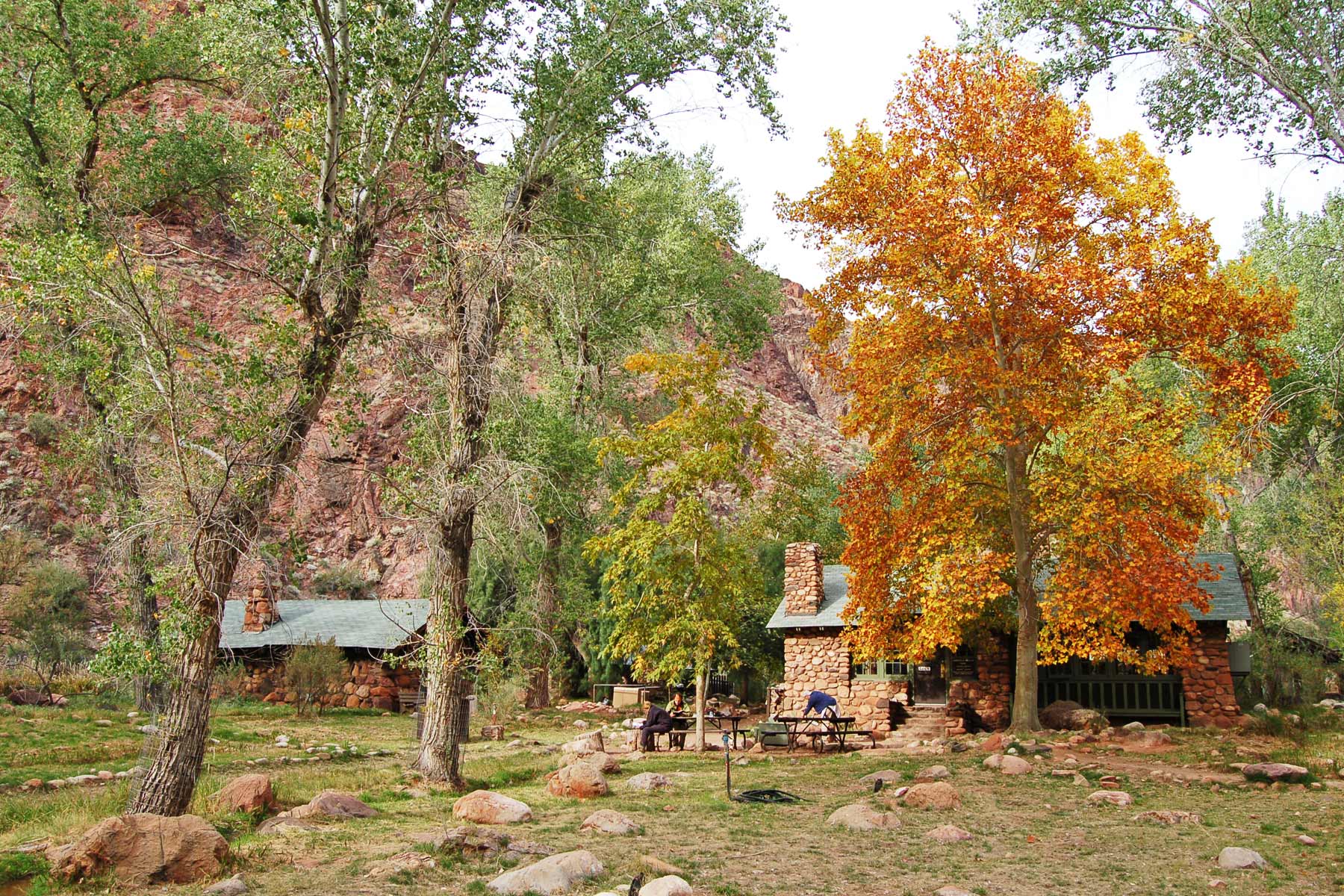
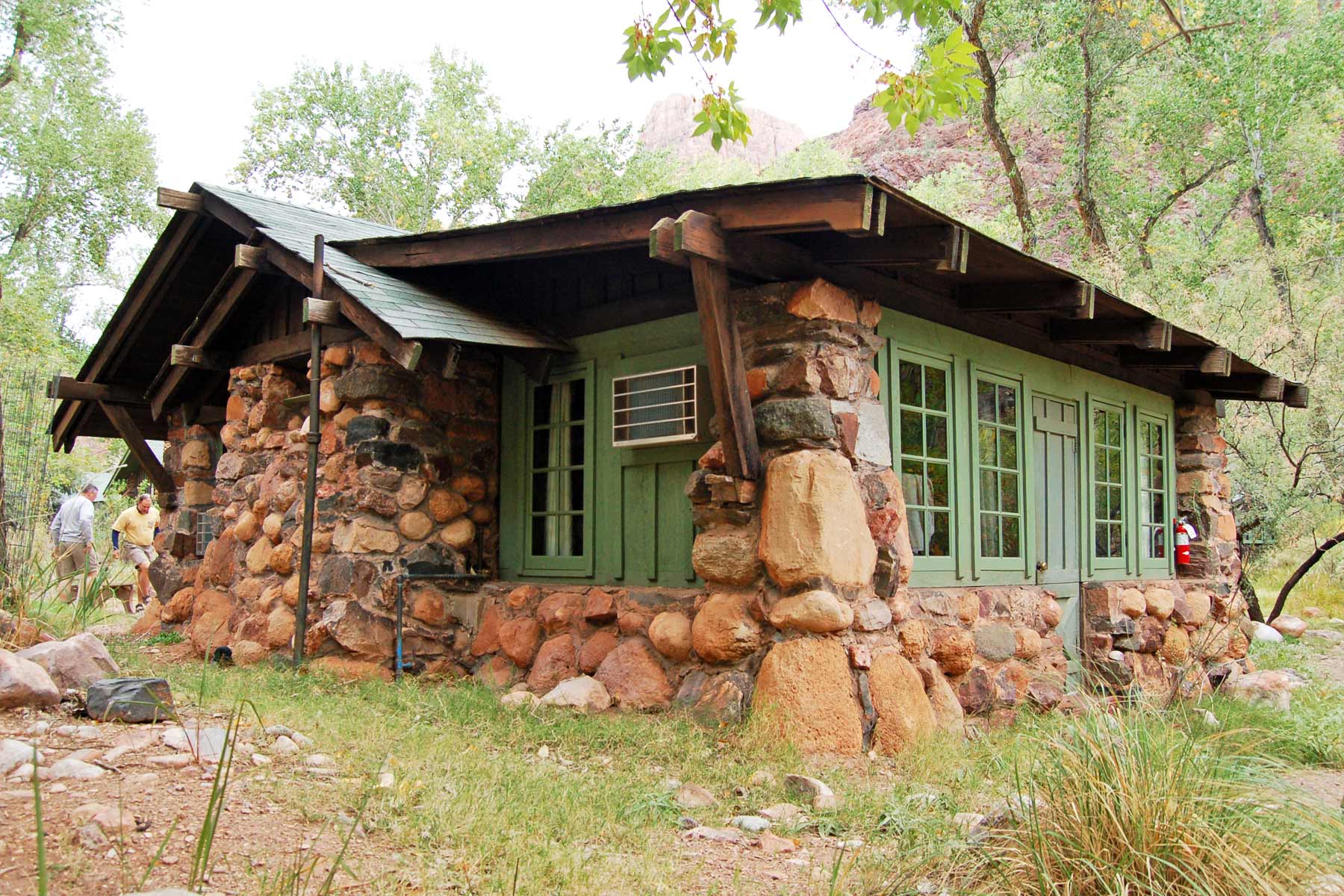
Staying at Phantom Ranch While Hiking Rim to Rim
A true treasure nestled in the rim to rim hike is Phantom Ranch. However, you need to plan even further in advance for a reservation.
Phantom Ranch is a remote lodge and group of cottages at the bottom of the Grand Canyon. It sits more than 10 miles from either rim. Phantom Ranch provides a rare overnight oasis for hikers riders making the strenuous descent into the canyon.
The ranch’s design blends in with its natural surroundings and has since it opened in 1922. Phantom Ranch has a separate reservation system from the wilderness permit. The permit lottery for this unique overnight stop opens 15 months in advance.
Meals at Phantom Ranch
“I could eat” is one of my most common sayings on long trails when someone suggests taking a break. The bonus of hiking rim to rim in the Grand Canyon is that you can make a reservation to eat at Phantom Ranch without staying overnight.
You can choose from the following options:
- Breakfast (5:00 am, 6:30am) and/or dinner (5:00 pm, 6:30 pm)
- Dinner selections are steak, stew, or vegetarian. Breakfast is a mix of traditional breakfast foods and drinks.
- A snack and drink window is open from 8:00 am to 8:00 pm.
- Prices range from $30 to $60 for meals.
Checklist of Items for Hiking Rim to Rim Grand Canyon
Pack as lightly as possible without sacrificing important options. As a good rule of thumb, your stocked backpack shouldn’t be more than 20% of your body weight, and 10% is ideal for day hikes. That means a 125-pound person shouldn’t carry more than 25 pounds.
- Look for lightweight versions of everything–hiking boots vs. trail runners, backpack weight, layers of clothing instead of a heavy coat, etc.
- Meals shouldn’t take up more weight than 2.5 pounds per day, but get closer to 1.5 pounds if possible. I even look at the weight of protein bars, with one popular brand being 14 ounces for a box and another being 7 ounces. (Also, ditch the box to save a little weight)
- Choosing clothing carefully. Can you wear the same T-shirt two days in a row? Do you really need to change every article of clothing in the morning? Can your group share a tube of toothpaste?
- Prioritize what you pack. I start with the “So I Don’t Die” list. First aid kit, headlamp, compass/navigation system, multi-use tool, water treatment tablets or kit, water bottle (up to four liters per day), powdered electrolyte packets (lighter than carrying a bottle), waterproof socks, and cooling towels (which doubles as a hat to keep my scalp from getting sunburned).
- Share the load with your hiking group by packing together.
Plan Transportation for Hiking Rim to Rim in Grand Canyon
While the hike spans 20+ miles, the road between the start and end of the trail goes much longer. It’s a 213-mile drive around the canyon that can take up to five hours. The National Park Service works with approved vendors who provide shuttle (and hiking rim-to-rim in Grand Canyon National Park planning) services for a hefty fee.
Consider the drive time between the rims when choosing overnight accommodations. Especially for day hikers, after a 15-hour hike, you’ll need a place to sleep. If you don’t choose one of the hotels in the park, you still need (additional) reservations for campsites that aren’t part of the backcountry. Be sure to book a place at the rim where you’ll be finishing the hike.
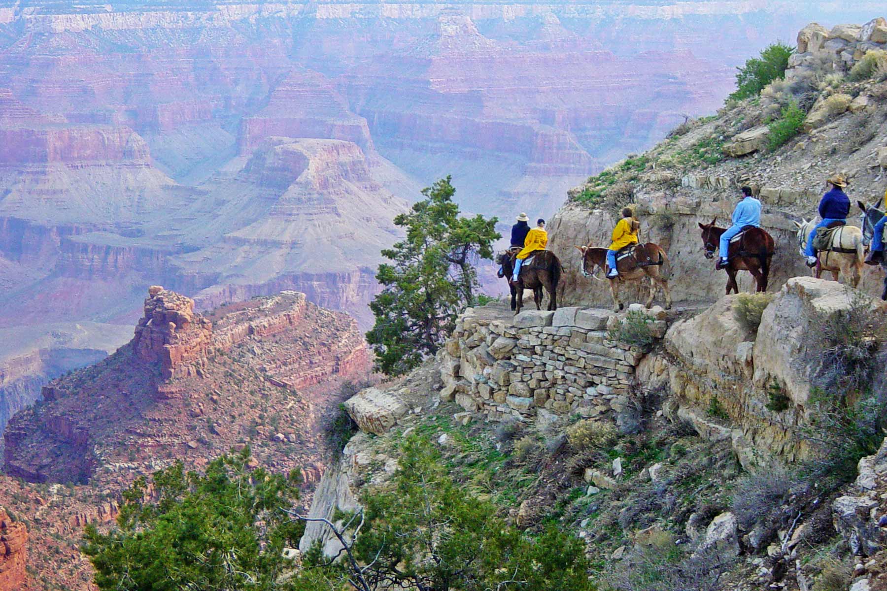
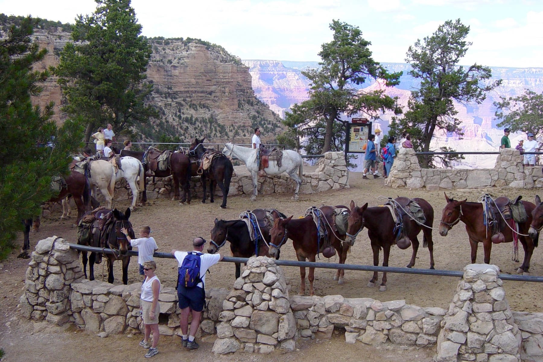
Mule Rides in Grand Canyon
Guests can take mule rides from South Rim and North Rim departure points. After some extensive searching, I can’t find a tour company offering rim to rim mule rides. Most companies offer an overnight stay at Phantom Ranch but keep in mind the 15-month reservation system.
Mule tour groups get the right-of-way on trails. Riders can’t weigh more than 225 pounds. Talk with a park ranger about the potential of hiking rim to rim with a mule ride for one stretch of the trail if that interests you.
Hiking Rim to Rim in Grand Canyon Strategy
Are you leaning toward the north or south route right now? Besides the elevation difference on the trails and the length of the South Rim trails, several other factors come into play.
Time of Year
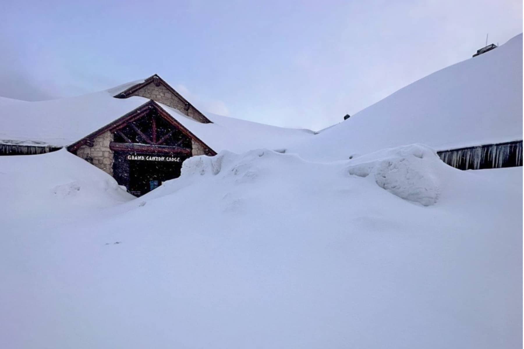
Even though the North Rim is scheduled to open May 15, winter weather impact poses a delay risk. By April 2023, more than 250 inches of snow fell on the North Rim. Check out that photo of the Grand Canyon Lodge from April!
Planning a late May or early June trip helps avoid the heat of summer, but it can also be risky if the weather delays the opening. It was June 2 before the North Rim roads and trails were ready in 2023.
Weather Conditions
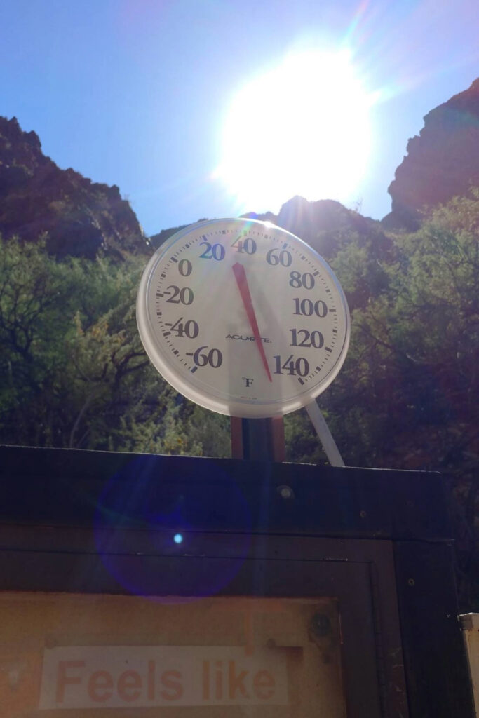
Temperatures in the Grand Canyon can swing between 20 and 50 degrees from the rims to the river. The inner canyon averages 100°F temperatures for all of June, July and August.
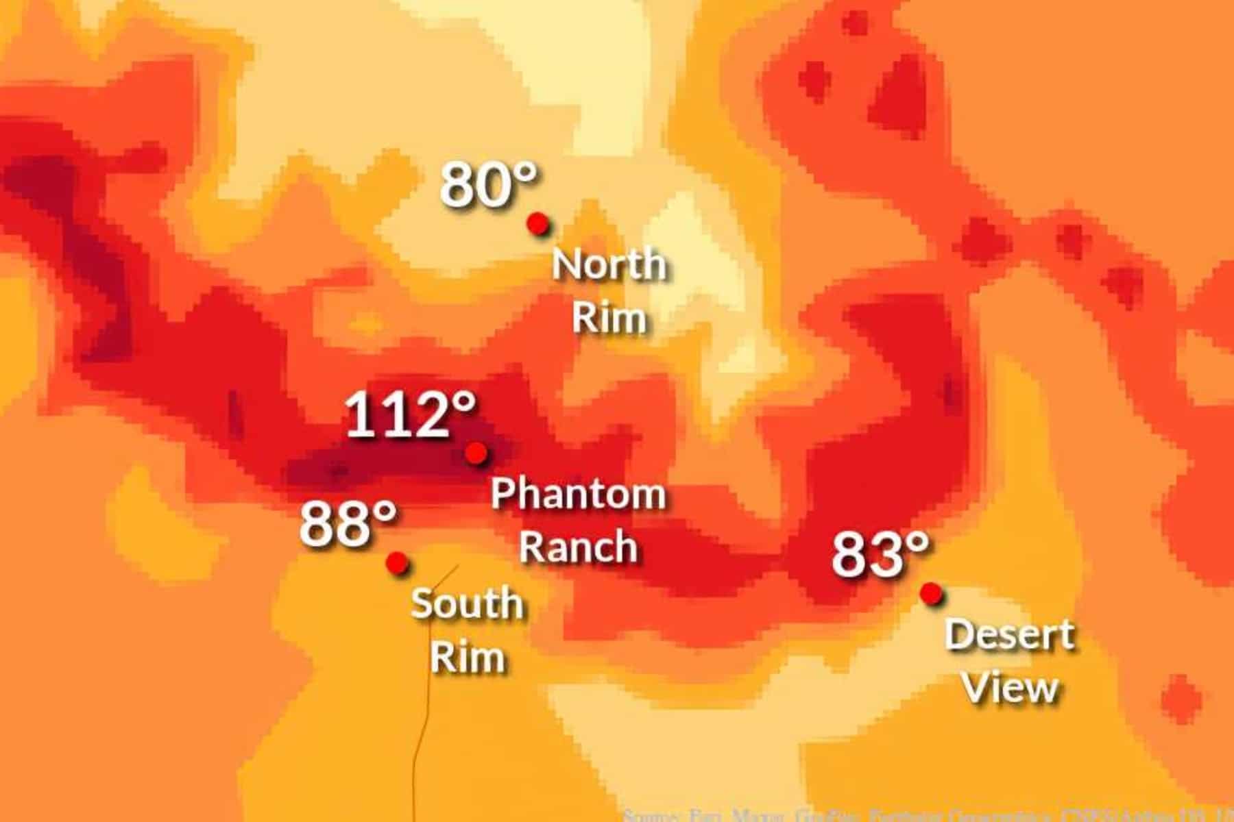
September and early October make the best months for hiking rim to rim in the Grand Canyon simply to avoid the excessive heat. You’ll still face temperatures in the upper 80s and mid-90s at the bottom of the canyon.
Grab a late May spot, too, if the weather allows.
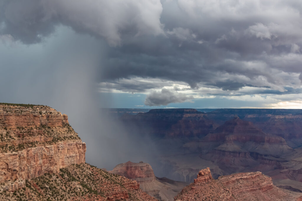
I lived in the desert for 15 years of my adult life. How fast monsoon storms develop out of crystal blue skies still amazes me. The monsoon season runs from June 15 to September 15.
These storms form in the afternoon, creating flash floods, wind damage, and intense lightning, then dissipate for clear night skies.
Learn how to stay safe in monsoons and when lightning is present.
Since mobile phone service is unreliable in the Canyon, bring a battery-powered NOAA weather radio with you.
Timing of Trail Milestones
Study the milestones on the trail as if you were Christopher Columbus in 1492. While the National Park Service will list the major campgrounds and trail markers for water, restrooms, and picnic areas, there are a few places you need to know about when planning.
Regardless of what route you take, you’ll have to go through either “The Death Zone” or “The Box,” two of the hottest stretches of the Grand Canyon near the bottom. You’ll go through both if you take North Kaibab to Bright Angel.
You can also note the water availability on the trail to schedule refills. South Kaibab Trail offers no water along the way. Bright Angel Trail has several water stations available seasonally, but that’s not 100% guaranteed.
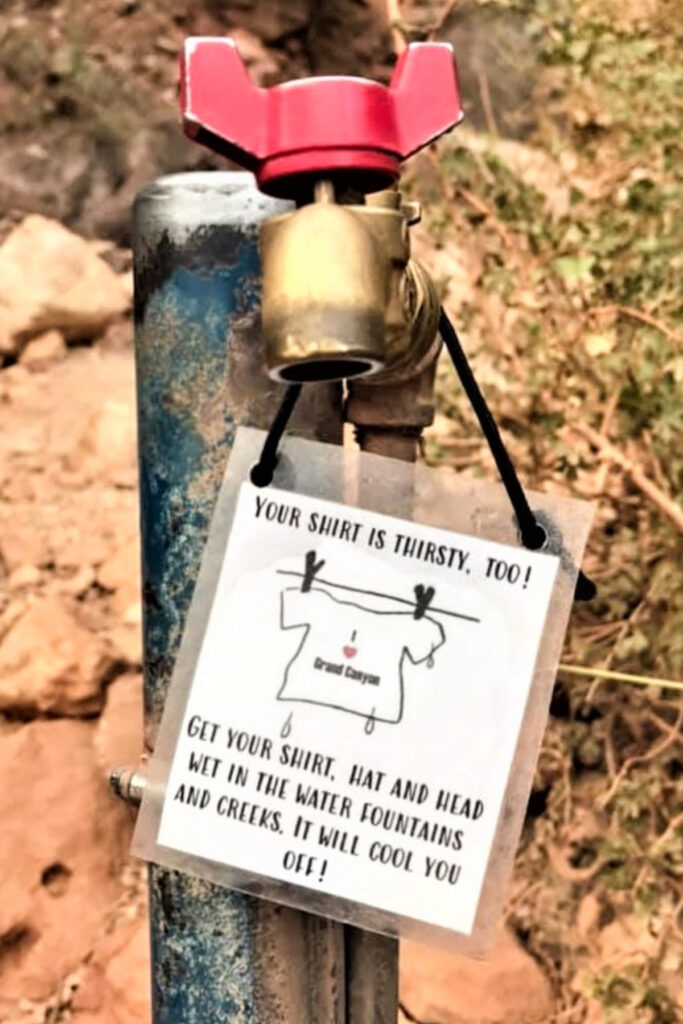
Water access on the trail should be treated as a gift, not an expectation. You should also have ways to clean the water, as its purity is not guaranteed either.
The ideal time to start hiking rim to rim in the Grand Canyon is 4:00 am. You’ll get an added bonus of a spectacular sunrise on the trail. If you leave at 7:00 am, you’re going to enter one of these brutal hot sections of the park during the highest temperatures of the day.
The North Kaibab Trail is also less crowded than Bright Angel or South Kaibab Trail. You’ll decide if you want to do with larger crowds at the start of your adventure or at the end.
The Boundary Battle of the Rim to Rim Trails
As I charted my path I found myself torn between the South Rim trails. Just wondering, “Why are there two trails on the South Rim and just one on the North Rim?” I stumbled upon a lesser-known salacious piece of Grand Canyon history. It will definitely make you think about the South Rim trail of your choosing.
Before the Grand Canyon was a National Park, Bright Angel Trail hosted the only access point to the river. It was privately owned, and a toll was charged to use it. When the Grand Canyon became a National Monument (1908) and then a National Park (1919), the Bright Angel Trail section was then under the control of Coconino County, Arizona.
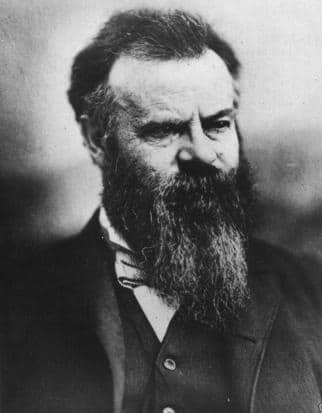
John Wesley Powell named Bright Angel Creek in 1869, inspired by the hymn lyrics, “Shall we gather at the river, Where bright angel’s feet have trod.”
Following that, the canyon, trail, and lodge took on the same name. Powell initially wanted to name the creek “Silver Stream.”
Now, back to spilling the tea–while the full story is detailed in this historic document, this is where it gets interesting. The county demanded $150,000 ($2.7 million in 2023) to let the National Park Service have control of Bright Angel Trail. NPS said, “Fine, we’ll build our own darn trail!” or something along those lines.
“We found ourselves face to face with a barrier more formidable than the Rocky Mountains – an abyss 280 miles long containing an unbridged, unfordable, dangerous river.”
F. E. Matthes, U.S. Geological Survey, 1927
The Yaki Trail, as it was first called, had one goal–”to provide fast, efficient access to the Colorado River.” Others referred to it as “a trail in a hurry to get to the river.” It took six months to complete.
That is why South Kaibab Trail is shorter than Bright Angel Trail and why the two trails follow similarly precarious paths. Once the former Rust Trail, named after Utah businessman David Rust in 1903, was turned into the North Kaibab Trail, the Yaki Trail was renamed South Kaibab Trail.
Both names pay homage to Kaibab National Forest, established in 1909.
Rim to Rim in Grand Canyon Trail Guide
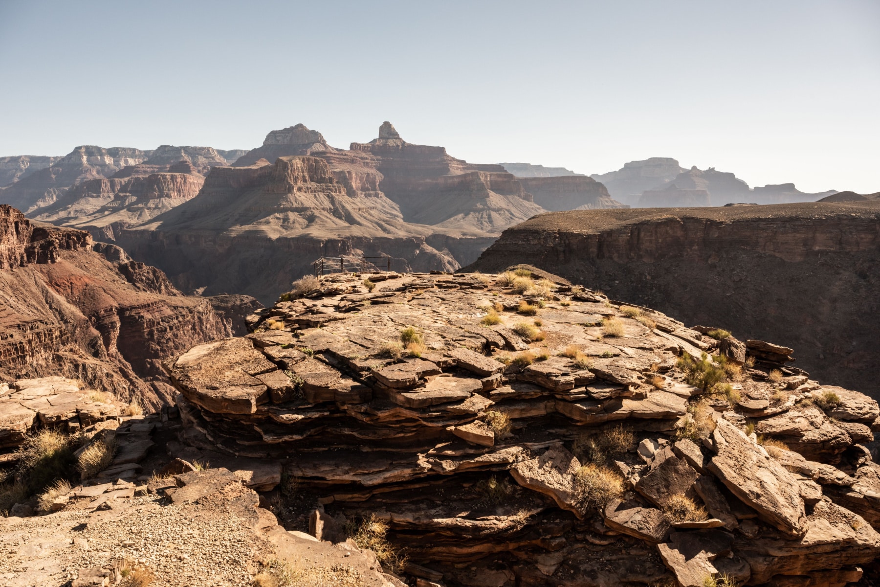
I’m going through each trail on its own merit, detailing the journey to Phantom Ranch/Bright Angel Campground, as all paths lead there. Hiking rim to rim in Grand Canyon National Park shines so hard that even words and pictures don’t do it justice.
I would also warn that photos and videos tend to showcase the brilliance, while the true steep drop-offs, extreme heat, and challenging footing don’t always translate well unless you’re experiencing it firsthand.
To reiterate, there are three main trails that take you from rim to rim–North Kaibab Trail, South Kaibab Trail, and Bright Angel Trail.
Kaibab is the name of many locations in and around the Grand Canyon, including the South Kaibab and North Kaibab Trails. Kaibab is a Paiute phrase for “mountain lying down” and it is pronoucned “Ky-BAAB” (rhymes with sky and grab. It does not rhyme with Bob.)
A connecting section, known as the River Trail, runs 1.5 miles to connect Bright Angel Trail to South Kaibab Trail.
Rim to Rim North Kaibab Trail
Length: 14 miles
Elevation at Trailhead: 8,241 feet
Elevation at Bright Angel Campground: 2,480
While 14 miles as the first leg of a hike sounds exhaustive, you should know that “…hikers on the North Kaibab Trail pass through every ecosystem to be found between Canada and Mexico.” One plus for starting at the North Kaibab Trail is that even if you start in the pre-dawn hours, with a headlamp and shoelaces tied, you can easily tackle the first bit in the dark.
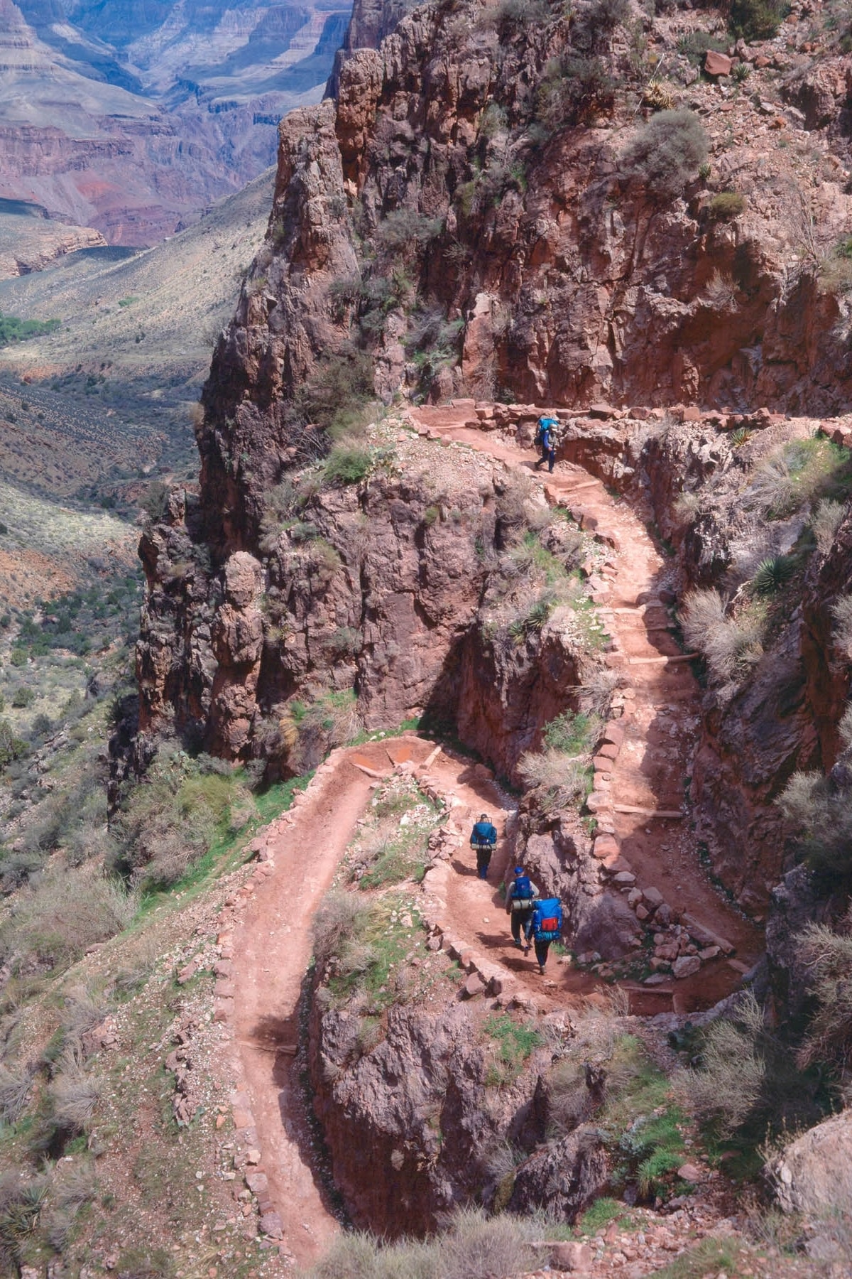
At 0.7 miles into this hike, you’ll reach the Coconino Overlook. Sunrise views here are spectacular. From here, you’ll tackle the first set of one trillion switchbacks (rough estimate) while hiking rim to rim in Grand Canyon National Park.
The Supai Tunnel greets you after another mile, at just 20 feet long, but quite an engineering feat to blast this hole into the trail. More switchbacks follow, and then you’ll cross a bridge that was built after the devastating flood of 1966. To see the high water mark of that massive event, check out the ranger station at Phantom Ranch.
Other milestones on this trail include:
- Roaring Springs: A 0.3-mile side trail to the main water source of the park.
- Manzanita Rest Area: Restrooms, benches, and seasonally-available water await 5.5 miles into this 14-mile trail.
- Cottonwood Campground: Available by reservation only, but this marks the halfway point of North Kaibab Trail (nearly 7 miles). You’ve also descended more than 4,100 feet!
- Ribbon Falls: This is another side trail to a beautiful waterfall. As of late 2023, it is closed due to bridge repairs.


The Box of North Kabib Trail
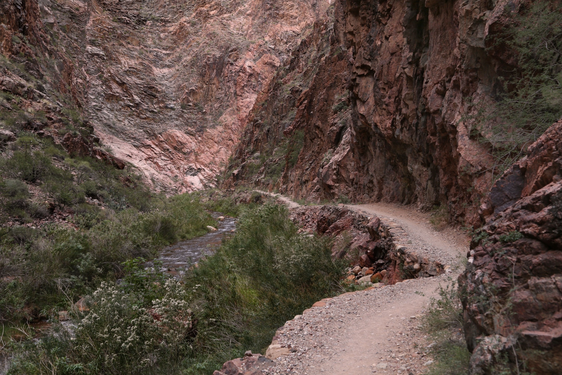
Between Cottonwood Campground and Phantom Ranch comes the most dangerous part of the trail if you’re hiking in the heat–The Box. The trail here spans seven miles of claustrophobic canyon walls made of Vishnu Schist. It would be impressive to know it’s 1.7 billion years old, older than any other rock in the park, if that dark-colored wall of heat-absorbing rock didn’t radiate like a furnace.
The trail is pretty even here with a lower elevation, but my goodness, the heat is intense. Avoid this section between 10:00 am and 4:00pm in summer. Time your trip to get to Bright Angel Campground by 10:00 am.
Once you’re hiking outside of the box, you come to Phantom Ranch and Bright Angel Campground before you cross the river and follow your South Rim route.
NOTE: If you are camping at Havasupai Gardens, you’ll need to take the Bright Angel Trail, not South Kaibab Trail.
Rim to Rim Trail Transition to South Rim
The Colorado River lures me like a magnet to metal. Spending time at the inner canyon along the river is one reason I would argue that taking an overnight (or two) backpacking trip is well worth the frustration of a permit system and the patience needed to get a spot.
Before you head on your chosen South Rim ascent, you have this amazing social and wilderness location where strangers become friends. Rafters from the river meet with weary hikers on beaches and rocky shores. I took a moment of solace and gratitude, climbing up a rock to meditate. This river before you tirelessly and persistently carved this grandest of canyons that rise around you.
The fierce nature of the Colorado River strongly discourages hikers from swimming in it.
The Bridges of the Inner Grand Canyon
The Black Bridge (aka Kaibab Suspension Bridge) and the Silver Bridge (aka Bright Angel Suspension Bridge) offer the only two ways to cross the river. You can’t ford the river here as it’s too deep, up to 90 feet, and the current is too swift.
Due to the half-mile gap between the bridges and the curve of the canyon and river, you can’t see one bridge from another. The Black Bridge takes you to the South Kaibab Route. The Silver Bridge takes you to Bright Angel Trail.
If you have the time, leg strength, and stamina to add a half mile to your trip, I strongly recommend crossing the bridge that doesn’t take you to your preferred trail. Then you can cut over the River Trail to your chosen trail. This raised view along cliffs above the river is truly worth the extra effort.
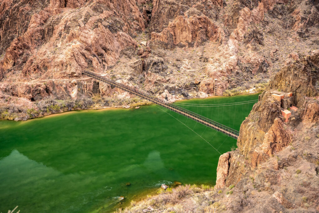
Why does the Colorado River change color?
The color of the Colorado River changes dramatically as it flows through the Grand Canyon due to variations in sediment, minerals, and algae. The striking color shifts of the Colorado reveal the unique geology and ecosystems of the Grand Canyon.


Rim to Rim Bright Angel Trail
Length: 9.5 miles
Elevation at Bright Angel Campground: 2,480 feet
Elevation at Trailhead: 6,860 feet
From the turnoff to Bright Angel Trail on the south side of the river, you’ll walk an easy 1.2 miles to the Pipe Creek Resthouse while you hug the canyon. The river follows until you take the turn south.
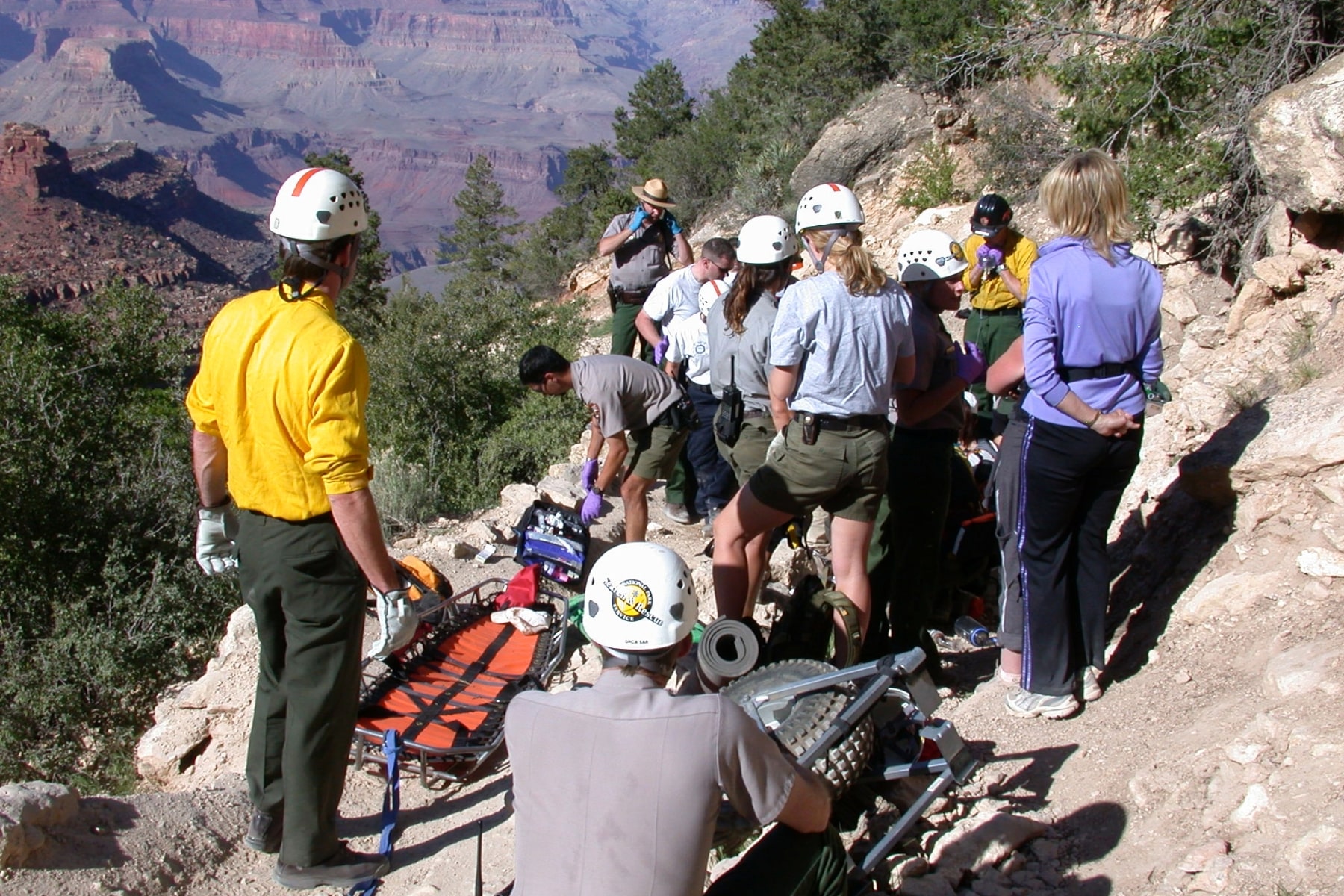
The next four miles are known as “The Death Zone” (though you won’t find that in any park publications). It’s another stretch of dark Vishnu rocks tower above you. It’s not quite as boxed in as “The Box,” but just as foreboding. The majority of rescues that happen hiking rim to rim in Grand Canyon National Park happen here. Tackle this stretch before 10:00 am.
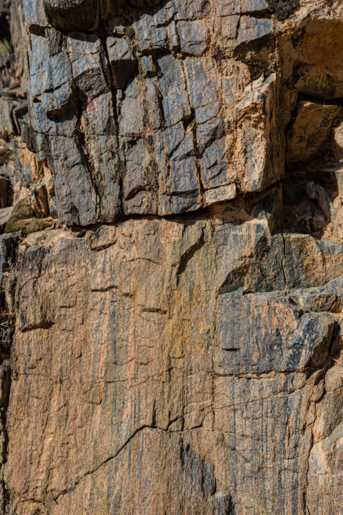
The Vishnu Rocks in the Grand Canyon are black because they are made of dark schist rock.
- Composition – The metamorphic rock formed under intense heat and pressure, altering its original composition and giving it a dark color. Minerals like biotite mica lend it a very dark gray or black appearance.
- Patina – This “desert tarnish” forms gradually as moisture evaporates, leaving behind manganese and iron oxides that stain the rock faces black.
- Algae/Lichen – Dark-colored algae or lichens may grow on the rock surfaces, turning them black. The Vishnu Rocks are located in a wetter part of the canyon where algae and lichens are more likely to thrive.
- Shadows – As the “basement” of the Grand Canyon, the rocks can also appear darker due to the lack of sunlight.
Enjoy the respite of Garden Creek, less than a mile on the journey. You’ll face more switchbacks ahead.
Havasupai Gardens on Bright Angel Trail
About halfway through the Bright Angel Trail, you come to Havasupai Gardens. A campsite is here, which requires reservations, but you’ll also find a ranger’s station, restrooms, and seasonally available potable water.
Several trails spur from this region too. I don’t recommend any of them if you’re hiking rim to rim in Grand Canyon as a day hike. A 1.5-mile hike to Plateau Point offers another stunning view of the Canyon only available to people willing to take a trek this far into the canyon.
Bright Angel Trail Final Stretch
Psych yourself up for switchbacks because Bright Angel Trail climbs a lot of them over the next few miles. The first series of switchbacks goes by the nickname Jacob’s Ladder.
The hikers who prefer the Bright Angel Trail when hiking rim to rim in Grand Canyon National Park likely do because of the resthouses along the way. At the top of Jacob’s Ladder, you’ll find Three Mile-Resthouse. Another series of steep switchbacks take you to the Mile-and-a-Half Resthouse.
These switchbacks can be brutal. You’ll also be dodging mules and one of the busiest trails in the Grand Canyon at the same time. Steep drops and narrow trails provide even more nail-biting experiences.
In August 2024, a 13-year-old was moving out of the way for others to take photos when he fell 100 feet. He survived, but it’s a solemn reminder of how dangerous this trail can be. Don’t risk your life so others can take a selfie.
You’ll go through two short tunnels before reaching the top of Bright Angel Trail, which is right by the Bright Angel Lodge.
Rim to Rim South Kaibab Trail
Length: 7 miles
Elevation at Bright Angel Campground: 2,480 feet
Elevation at Trailhead: 7,260 feet
Heading back down the canyon to the Black Bridge, you’ll immediately be on the South Kaibab Trail. No water, ranger stations, or restrooms are available on this seven-mile trail. While there are reports of emergency water supplies along the path, don’t rely on those to be available. If you find one, only use it if you are in a life-threatening situation.
South Kaibab Trail has several milestones along the way:
- The Tipoff: (4,000 feet) Nearly two miles through more Visnhu rock-line trails, you’ll weave up from the inner canyon to the Tipoff rest point. The only shelter on the trail is here, so you can find shade or shelter from storms. An emergency phone is available in the shelter. Previous restrooms here have been removed.
- Skeleton Point: (5,200 feet) This provides the last view of the Colorado River if you’re heading to the trailhead. The scenic view is well worth a stop, especially since you’ve just finished some gnarly switchbacks.
- Cedar Ridge: (6,120 feet) This 360° view will likely be crowded, as it’s the turnaround point suggested for beginning hikers starting from the South Kaibab trailhead.
- Ooh Ahh Point: (6,470 feet) You’re now less than a mile from the trailhead, but for those heading down the trail, the first below the rim is available. That’s why it’s called the “Ooh Ahh Point.”
The South Kaibab Trail is pretty straightforward, and you can tell in the design how the goal was to get to the river as fast as possible. I personally feel that the trails here are wider and provide fewer “I’m about to fall to my death” moments than Bright Angel. However, I’m also not the best at heights.


FAQ – Hiking Rim to Rim Grand Canyon
The R2R2R adventure is for elite athletes and ultra runners only. The R2R2R is “Rim to Rim to Rim,” or the “Double Rim to Rim” is going from one to the other and back again. That’s nearly 50 miles with an elevation change that totals the height of Mt. Denali twice.
My mind immediately went to the scene in Moneyball where Billy Beane talks to Scott Hatteberg about playing first base. He says, “It’s not that hard, Scott. Tell ’em Wash (Ron Washington).” Wash quickly replies, “It’s incredibly hard.”
You need excellent physical fitness, discipline, mental focus, and altitude conditioning, on top of being able to ration water and food through some of the harshest ecosystems on earth. To quote another baseball movie, A League of Their Own, “The hard is what makes it great.”
More than 250 rescues happen each year in the Grand Canyon. Most rescues are due to accidents or hikers being unprepared for the conditions. If you need to be rescued, the inner canyon rescue costs are paid for by the park service, but any ambulance by road or flight will be at your own expense. It’s another reason to really train for this hike months in advance.
Pin Hiking Rim to Rim Grand Canyon
Helpful Related Links
So Much More to Explore: 20 EPIC Things to Do in the Grand Canyon
Free Help Planning Your Grand Canyon Trip: Ultimate GRAND CANYON ITINERARY (Visiting 1 to 3 Days)
Hiking Rim to Rim: Detailed Guide to Hiking Rim to Rim in the Grand Canyon
Go North, You Can Thank Us Later: The North Rim of the Grand Canyon is Better
Ready to go to the Rockies?: Rocky Mountain National Park: An (Epic) Photo Guide to Colorado’s Gem
Need a Winter Backup Plan?: 15 Best National Parks to Visit in December (+2 to Avoid!)
An Epic Summer Park Visit Without the Heat: SUMMER in Acadia (Helpful Guide + Video)
The OTHER South Rim: 15 EPIC Things to Do in Black Canyon of the Gunnison National Park

Leave a Reply