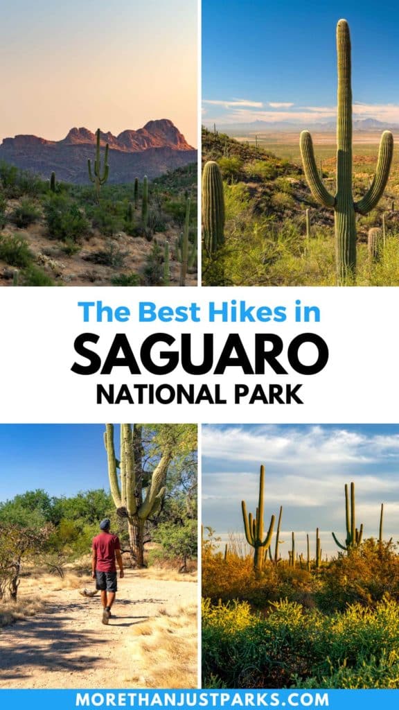
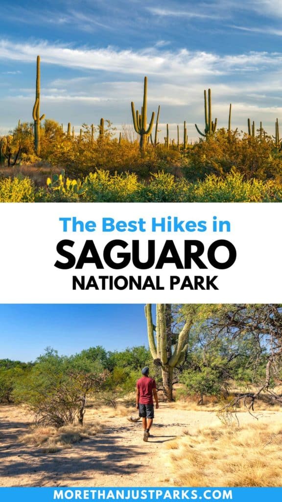
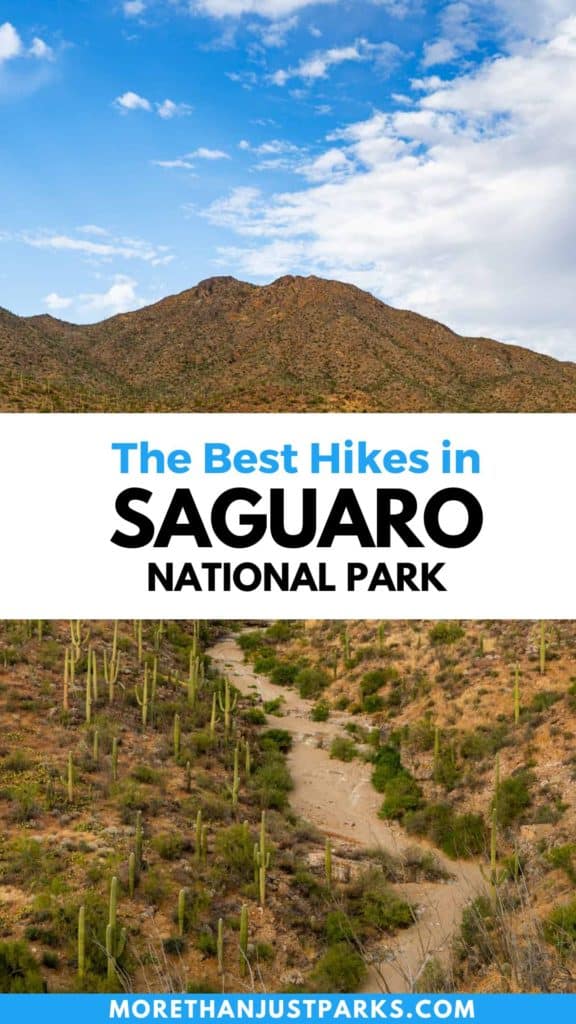
About My Travels in Saguaro
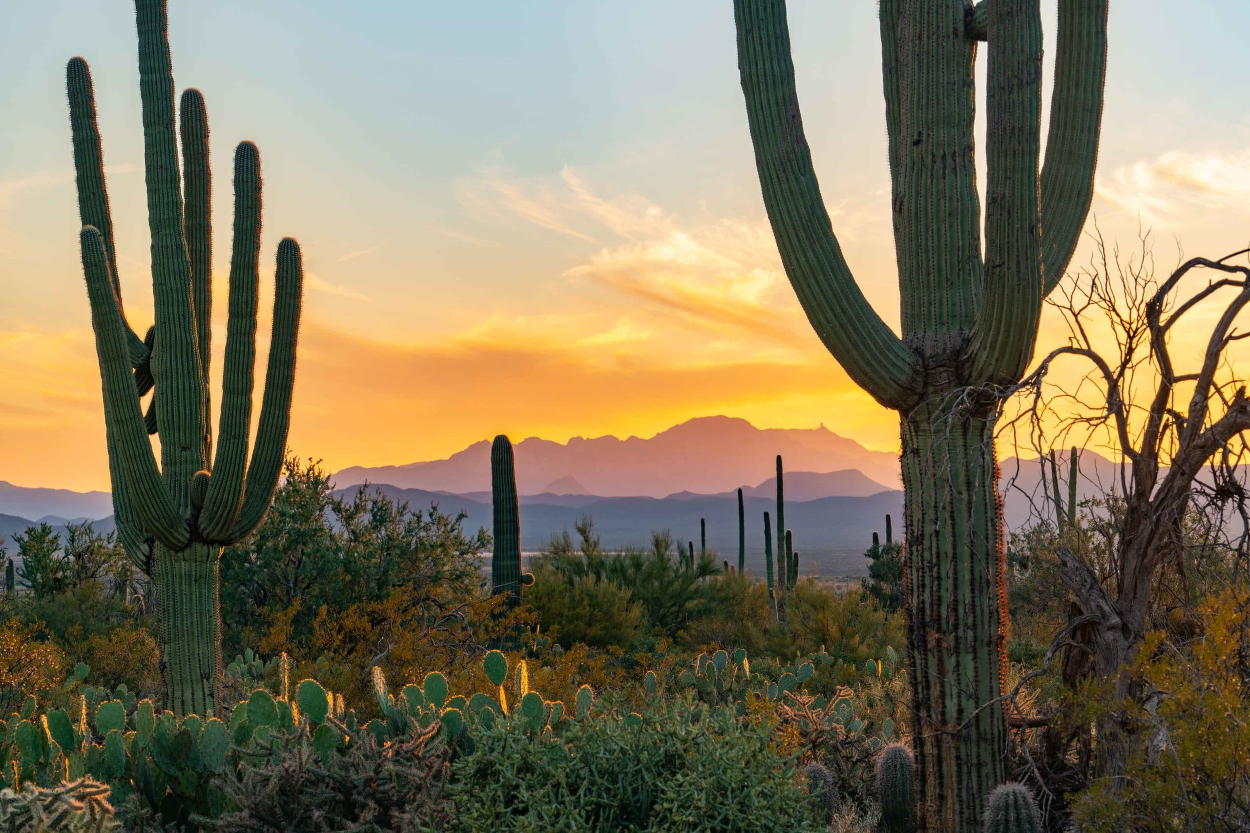
I’ve spent a great deal of time hiking in Saguaro National Park over the years and I have to say (outside of the peak summer heat) it’s a fantastic park to wander some trails. So let’s explore the best hikes Saguaro National Park has to offer.
In 2021 I visited Saguaro in the late fall with a small crew to create our SAGUARO film (you can see that below). In the making of that film we roamed more trails than I can count looking to capture the park from every angle.
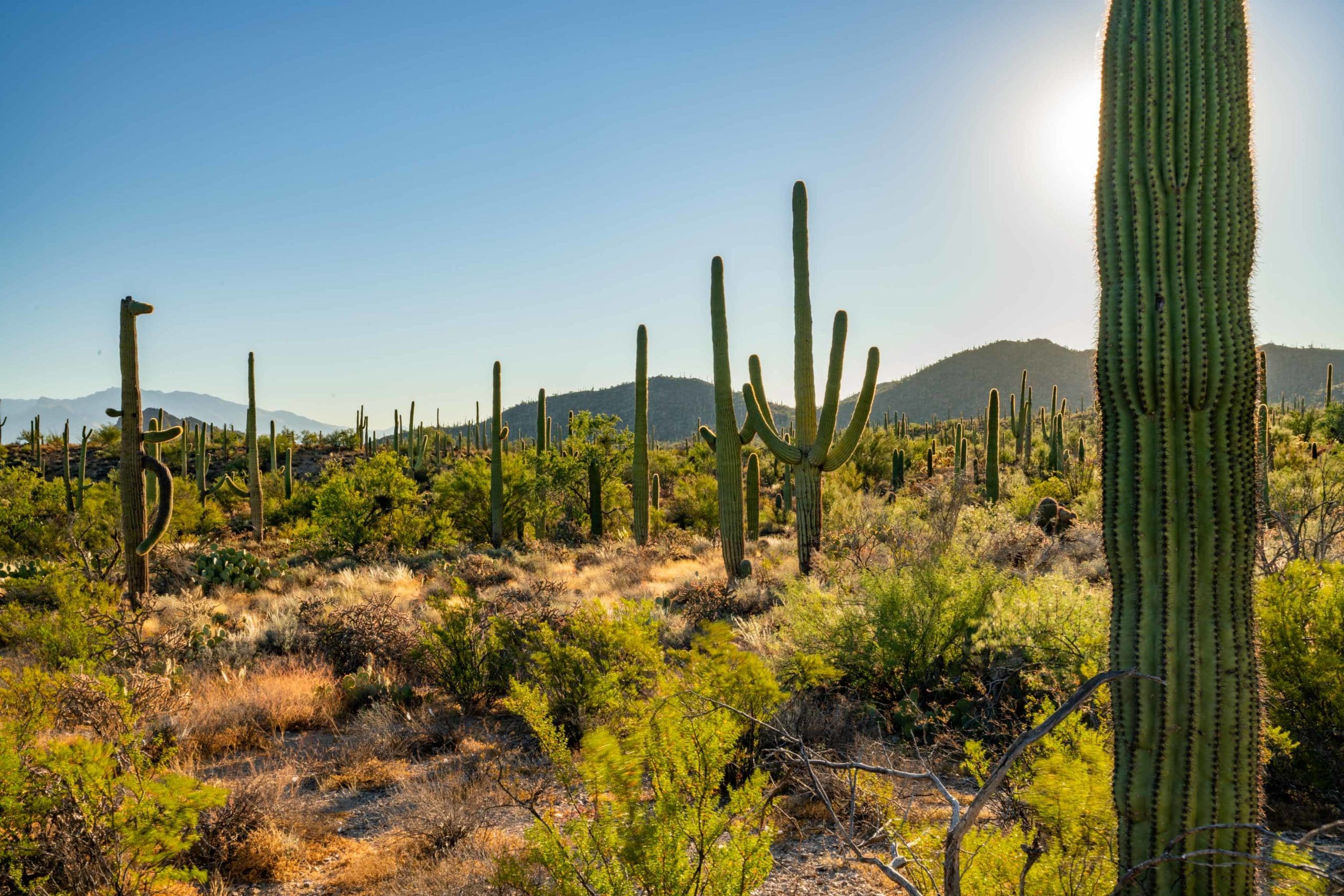
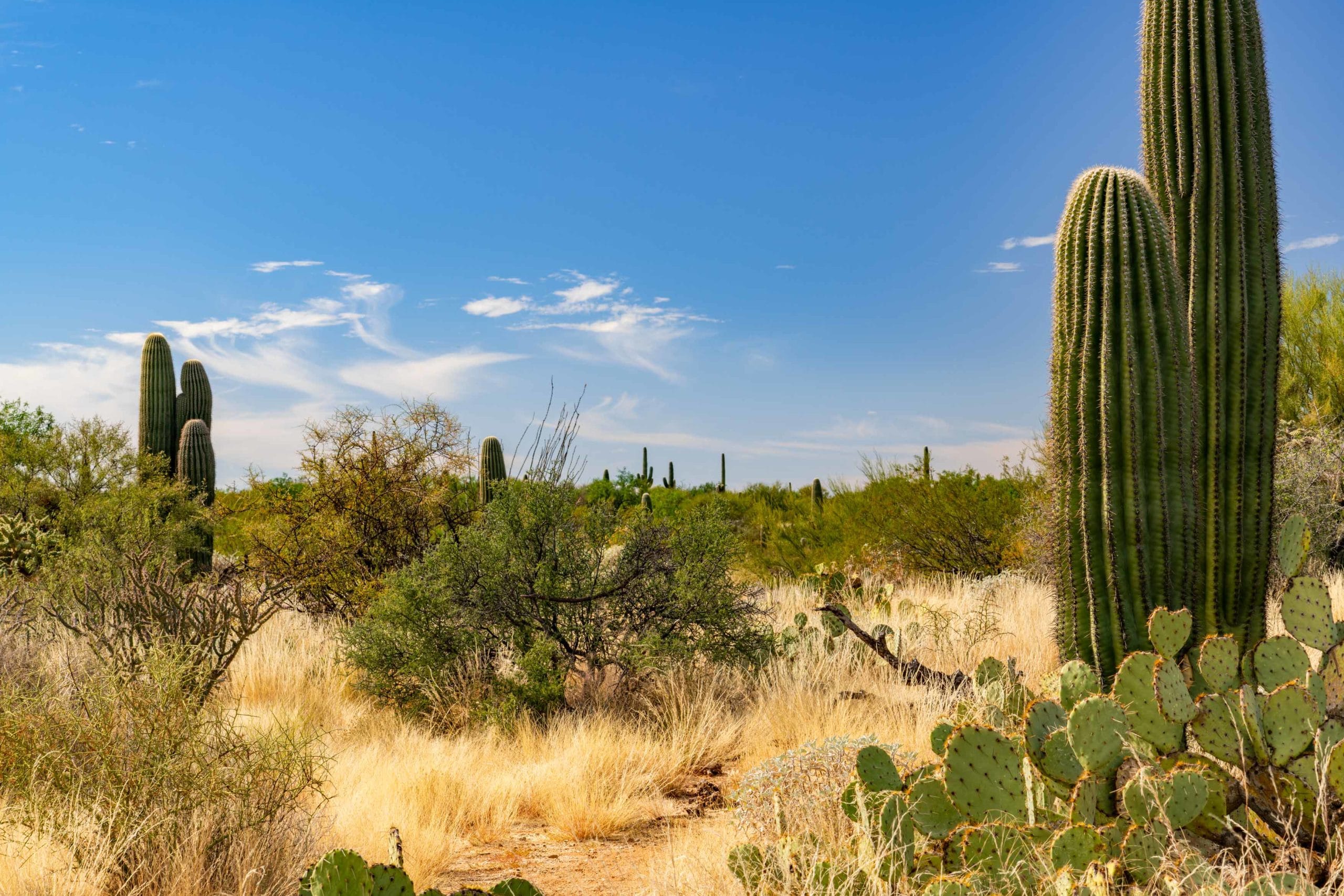
From dry washes to winding mountain trails, canyons to flat desert, we hiked it all and I found each and every trail and viewpoint to be endlessly fascinating. Maybe it’s something about this desert, or maybe it just appeals to me, but I was constantly finding new plants, animals, and terrain features to be fascinated and enamored with.
So enough introduction, let’s dive into these hikes I’ve been talking about and maybe you’ll find a few that interest you!
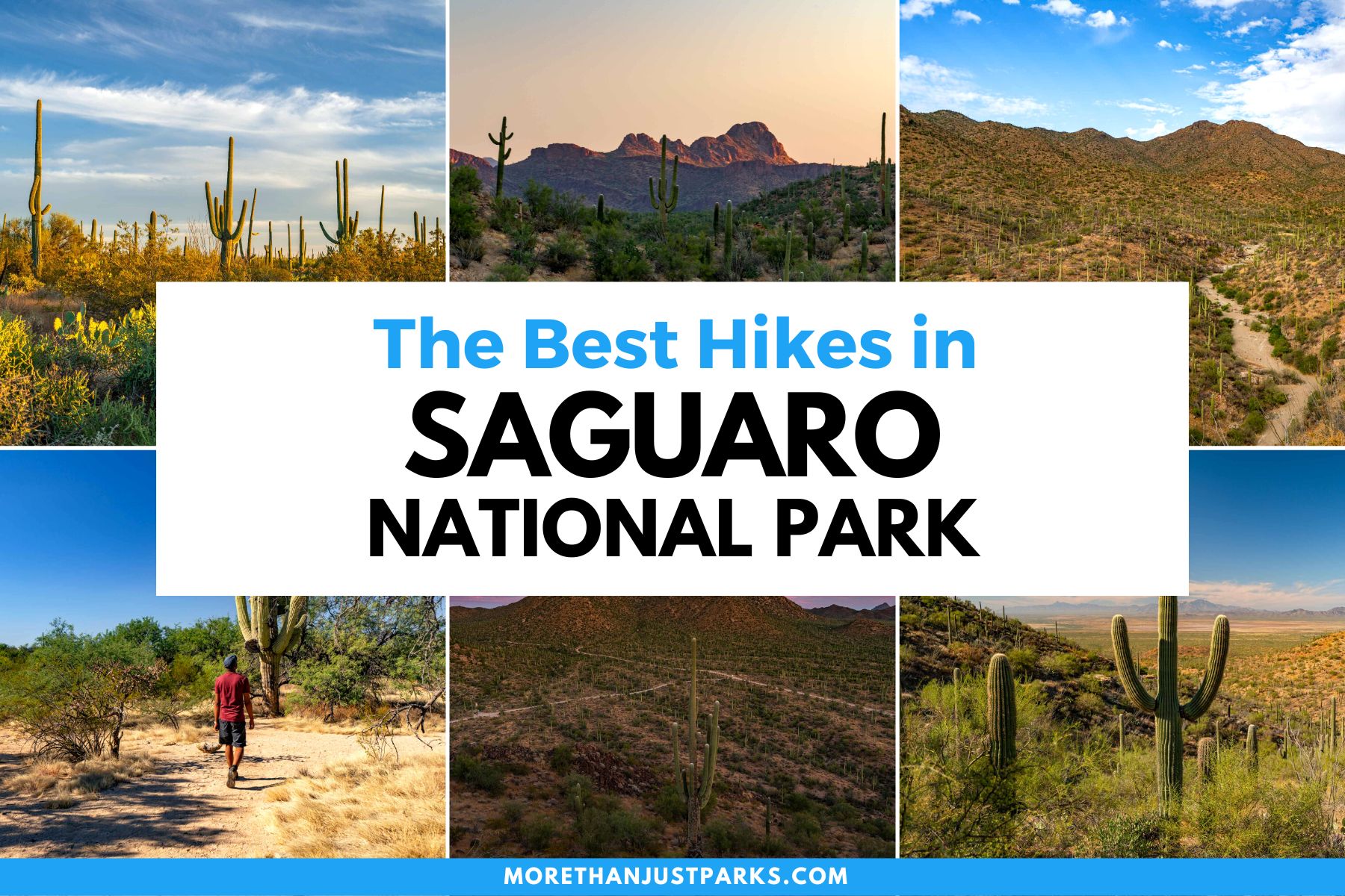
Table of Contents: Best Hikes Saguaro National Park
Best Hikes Saguaro National Park
Saguaro National Park Video
Watch our short film on Tucson’s Saguaro National Park in stunning 8K. This film was brought to you by Visit Tucson and features the wide variety of beautiful scenery and amazing recreational activities available in Saguaro National Park.
Things to Know Before You Hike in Saguaro National Park
Entrance Fees: $30 per vehicle OR if you plan to visit more National Parks within the next 12 months I suggest you go ahead and purchase the America the Beautiful Pass (which can be found at the entrance gates to most national parks). This pass gets you into all National Parks, Forests, Monuments, and more including 2,000 sites for free after a one time $79 fee.
Sunscreen: For many of us visiting national parks means lots of sun. Seriously, some of these parks can zap you if you don’t wear sunscreen. We happen to like this one because it works AND it’s not full of a bunch of chemicals.
Cell Service is actually pretty great in the park thanks to it’s close proximity to the city of Tucson.
Waterproof map with hikes: This one is the best one out there.
Water: Drink it. Lots of it. Don’t forget it in the car.
The Best Time to Visit Saguaro National Park is during the winter when the weather is mild and pleasant.
Food options are endless near Saguaro thanks again to the bustling city of Tucson. Not only are there plenty of food options within short driving distance of the park, but there are some really fantastic restaurants, grocery stores, and just about anything else you could possibly want or need in terms of food and supplies.
Dogs are not allowed on trails in most national parks due to their potentially disruptive presence with the natural ecosystem. The basic rule is they are allowed where cars can go so be sure to check the rules before bringing along your furry friend.
Where to Stay
Visiting Saguaro National Park? If you haven’t decided where to stay (yet) check out our helpful guide on visiting Saguaro National Park for tips. Don’t have time? Here’s our favorite hotel near Saguaro.
Getting to Saguaro National Park
Deciding where to fly in to visit Saguaro really all comes down to balancing the rental car and plane ticket costs. Sometimes you’ll get a great deal on flights and a rental car in Tucson, and sometimes it will make sense to fly into Phoenix because the rental car or flight is that much cheaper.
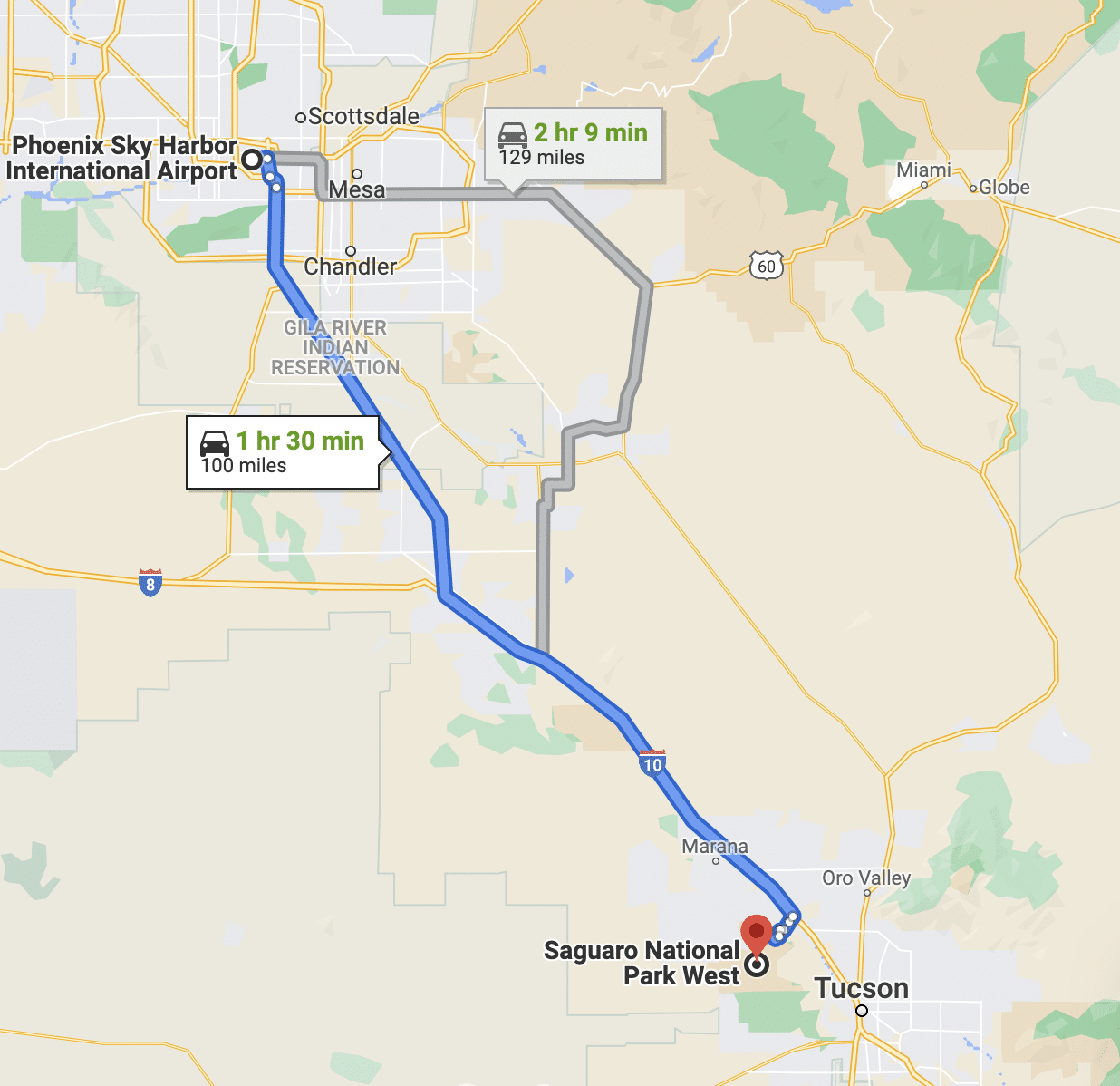
Thankfully no matter what you choose, both options are very simple, straightforward, and inexpensive compared with most parks.
- Closest Airport: TUS – Tucson International Airport (25 minutes driving from the Eastern District)
- Cheapest Airport: PHX – Phoenix Sky Harbor International Airport (An hour and a half driving from the Western District)
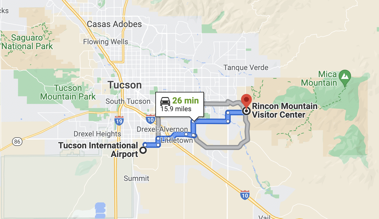
My recommendation is definitely flying into Tucson and renting a car from there because you’re basically in the park at that point. You could even bike from the airport if you wanted! The airport is serviced by every major domestic airline and flights are typically not expensive.
Best Hikes Saguaro National Park
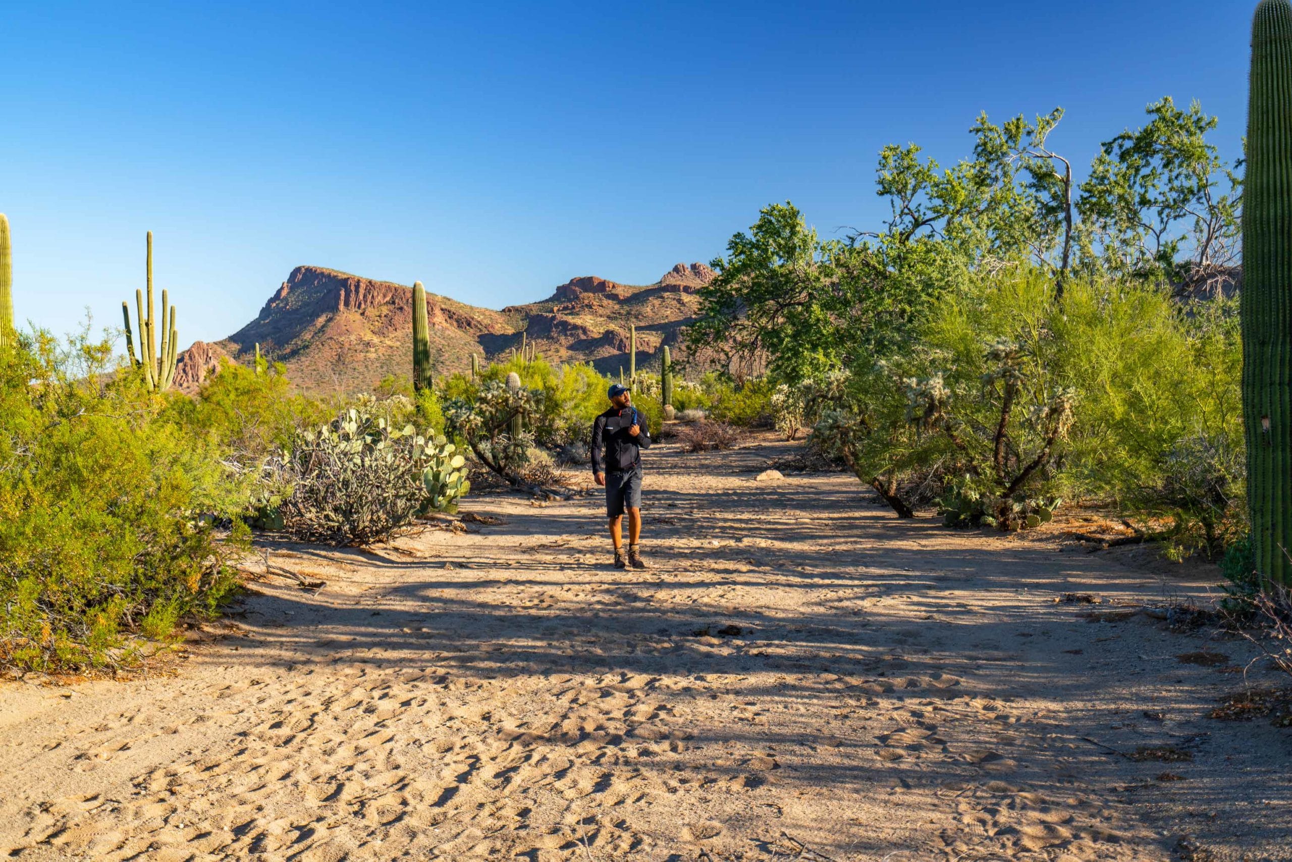
1. Loma Verde Trail
- Distance: 3.8 miles
- Difficulty: Easy – Moderate
- Time: 1.5 hours
The Loma Verde Trail is a 3.8 mile loop that offers a terrific variety of scenery.
Loma Verde is my favorite trail in the park thanks to the amazing array of plant and animal life you can experience in a relatively short hike.
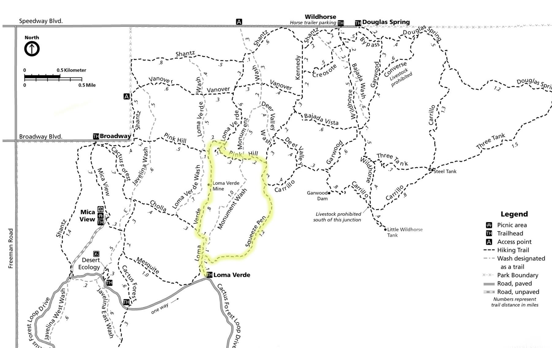
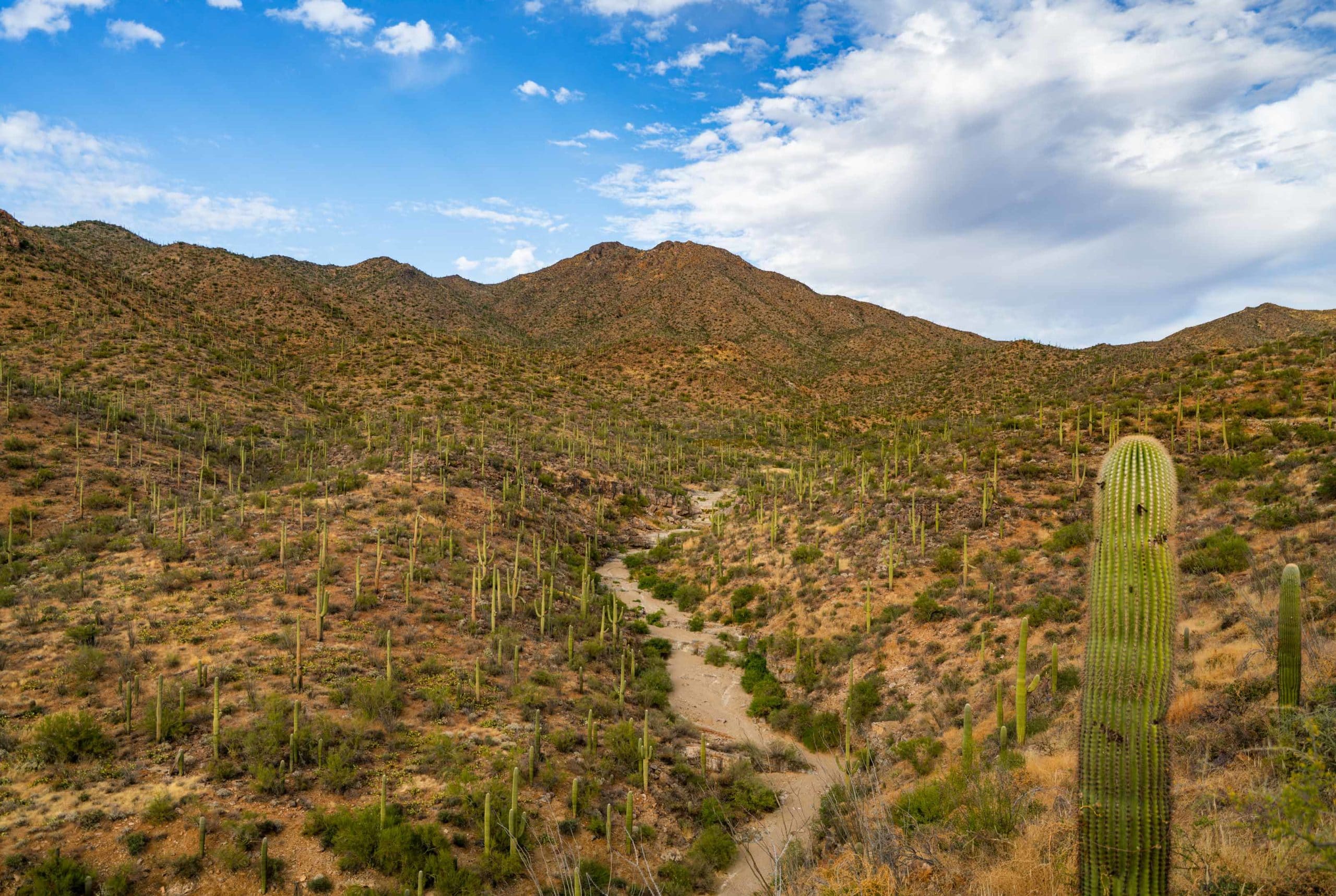
You’ll hike through a seasonal wash and eventually reach the Loma Verde Mine, an abandoned gold and copper mine. From there you’ll take a right on Pink Hill Trail and come upon an incredible view of the cactus forest below.
A few more turns and you’ll head right back.
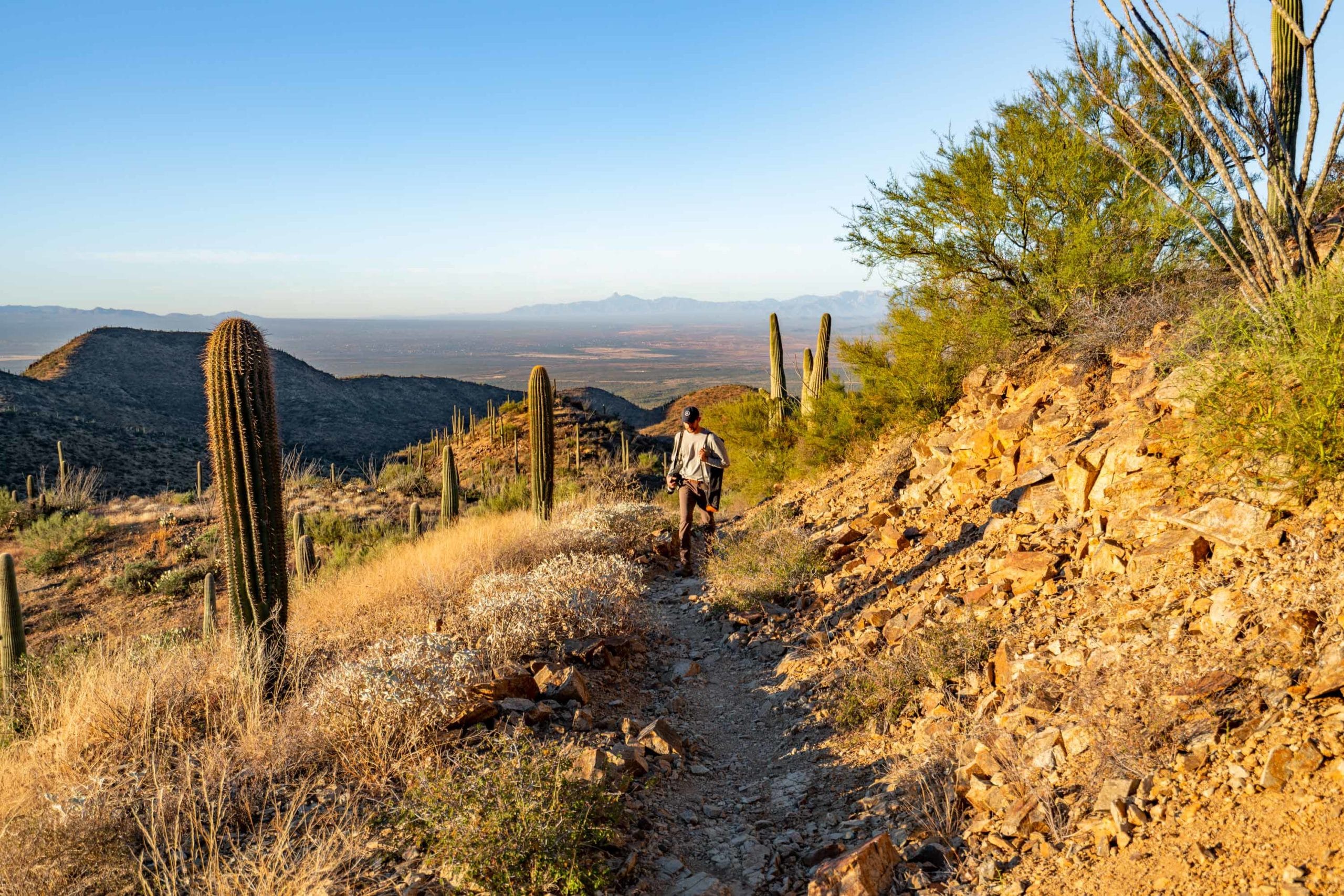
2. Wasson Peak Hike
- Distance: 6.7 miles
- Elevation: 1833 feet
- Time: 3-4 hours
- Difficulty: Moderate
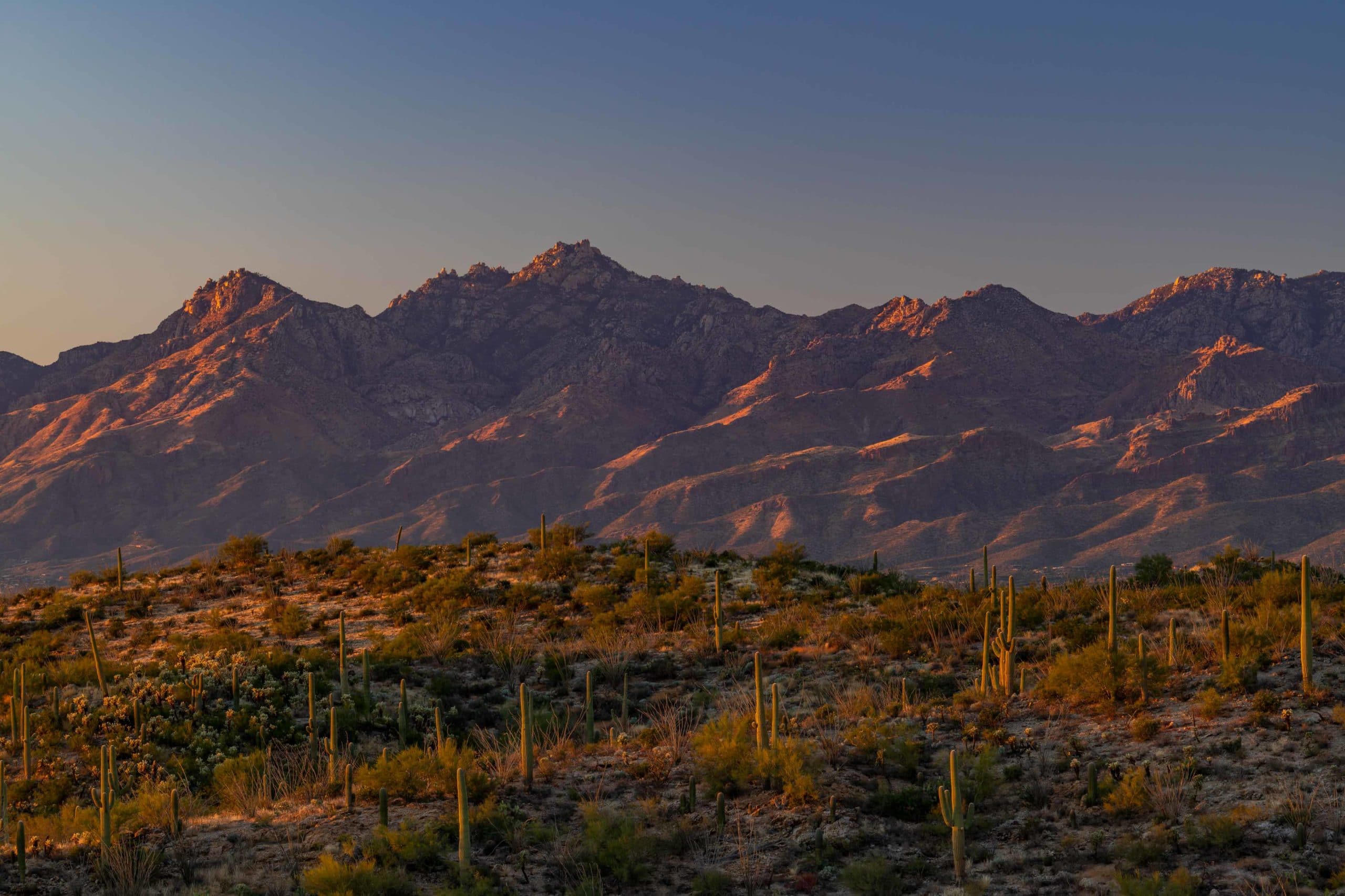
If you go very early in the morning, before sunrise, the Wasson Peak hike can be incredible. From the top you’ll have panoramic views of the surround desert and mountains stretching far into the distance.
The hike is challenging, but not so much that it should disqualify the average visitor. The perspective from the top of Wasson Peak is sensational and offers a commanding view of the incredible scenery surrounding you.
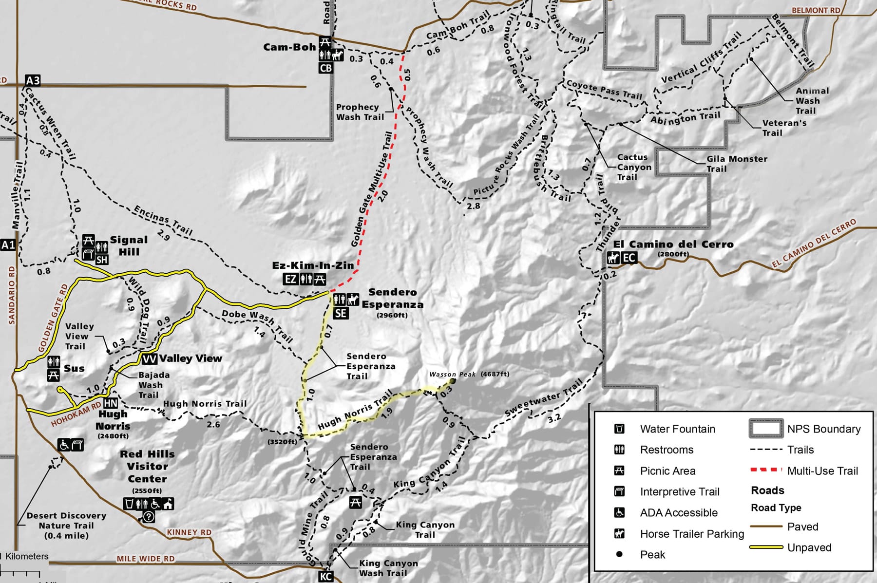
Beginning at the Ez-Kim-In-Zin Picnic Area you’ll start out on the Sandero Esperanza Trail for almost 2 miles before taking a left onto the Hugh Norris Trail. Once you’ve made you’re left the Hugh Norris Trail will take you all the way there.
Finding your left turn onto the Hugh Norris Trail can be easy to miss as the sign is set back a bit from the wash you’re hiking in and there are several user trails beforehand that can serve to confuse you. I’ve seen more than a few people miss the sign and come traipsing back asking me where to go to get to Wasson Peak so keep a sharp eye out!
The hike is several miles and more than 1500 feet of elevation gain so make sure you’re well prepared and whatever you do, avoid hiking during the afternoon when temperatures can soar into triple digits. Bring plenty of water!
3. Desert Discovery Trail
- Distance: 1/4 mile
- Elevation: None
- Time: 15 minutes
- Difficulty: Easy
This beautiful 1/4 mile paved loop trail takes visitors through a perfect subsection of the Sonoran Desert. Here visitors of all abilities have the opportunity to a close up look at what makes this part of the world so special.
Along the trail you’ll find a multitude of species of labeled desert plants along with interpretive signs full of fascinating information about how life works in this one-of-a-kind desert wonderland.
There are also a number of shelters with benches, perfect for stopping and taking in the views or resting from the desert heat.
4. King Canyon / Gould Mine Loop
- Distance: 2.4 miles
- Elevation: 380 feet
- Time: 30 minutes – 1 hour
- Difficulty: Easy
This is a great loop trail that takes hikers through prime Saguaro country. There’s some climbing up some rocky steps, but nothing difficult. Be aware of bees in the area and if you hear them swarming get away from them quickly.
A warning about bees in Saguaro National Park: Saguaro National Park is unfortunately home to some colonies of africanized bees. These bees are extremely territorial and become aggressive when they feel threatened. If you hear them swarming or making their presence felt leave the area immediately. These bees can cause fatal injuries in rare instances.
5. Freeman Homestead Trail
- Distance: 1 mile loop
- Elevation: 100 feet
- Time: 30 minutes
- Difficulty: Easy
Here’s another great trail for hikers of all ages and abilities. Hiking this easy one mile loop offers up close views of this one-of-a-kind desert. Who knows, you may even bump into a rabbit!
6. Ridge View Trail (via Hope Camp Trail)
- Distance: 2 miles
- Elevation: 400 feet
- Time: 1-1.5 hours
- Difficulty: Easy
This trail with a very modest elevation gain offers beautiful views of Rincon Peak and the surrounding desert as you go.
Depending on the time of year you visit wildflowers can be seen carpeting the hillside towards the end of the trail. Also season waterfalls can be sighted from the trail’s end.
7. Garwood Trail
- Distance: 3.3 miles (out and back)
- Elevation: 200 feet
- Time: 1.5-2 hours
- Difficulty: Easy
This is a great trail that takes hikers through a quintessential Saguaro forest and continues up towards the Rincon Mountains.
There are many options to continue hiking to Garwood Dam though the elevation gain picks up quite a bit.
8. Manning Camp Trail
- Distance: 15.4 miles
- Elevation: 4,560 feet
- Time: 6-9 hours
- Difficulty: Difficult
Hiking to Manning Camp
Manning Camp is an old cabin built by former Tucson Mayor Levi Manning as a family retreat. The camp is home to six campsites and typically has water available. A permit is required.
The hike up to Manning Camp involves over 4,500 feet of elevation gain and takes backpackers from the hot and dry desert floor into the cool pine forests high in the Rincon Mountains.
Hiking to Manning Camp is no joke. This arduous undertaking is not recommended for anyone who isn’t prepared for a grueling hike.
For those who are prepared, the hike offers sensational views and incredible changing scenery as you climb higher into the mountains.
9. Wild Dog Trail
- Distance: 1.8 miles
- Elevation: 180 feet
- Time: 1 hour
- Difficulty: Easy
Hiking Saguaro’s Wild Dog Trail
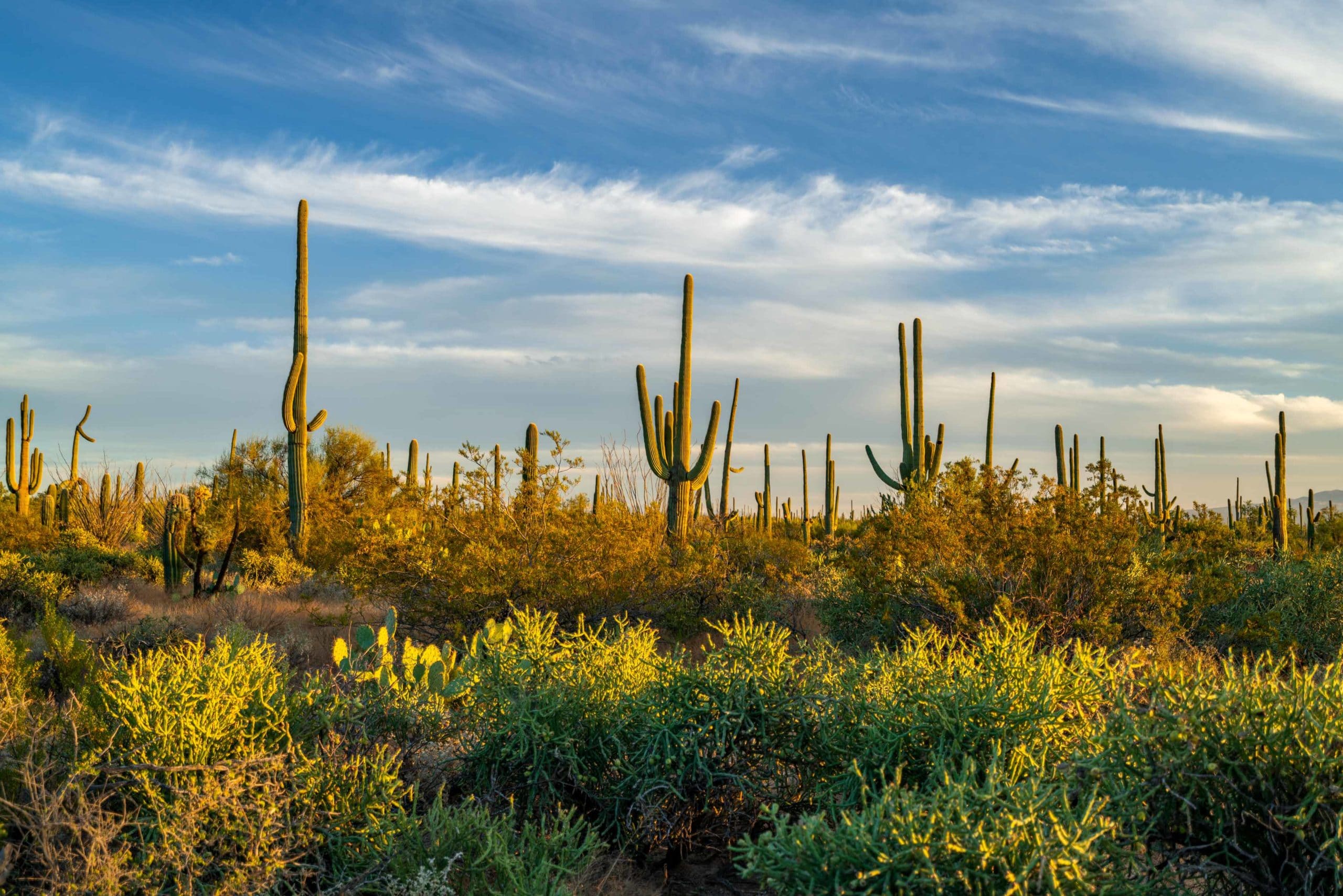
This is another easy trail that’s great for visitors of all skill levels. Lots of opportunities to see wildlife and plenty of interesting looking saguaros.
Wildflowers are common in spring and provide a beautiful punch of color as you enjoy your hike.
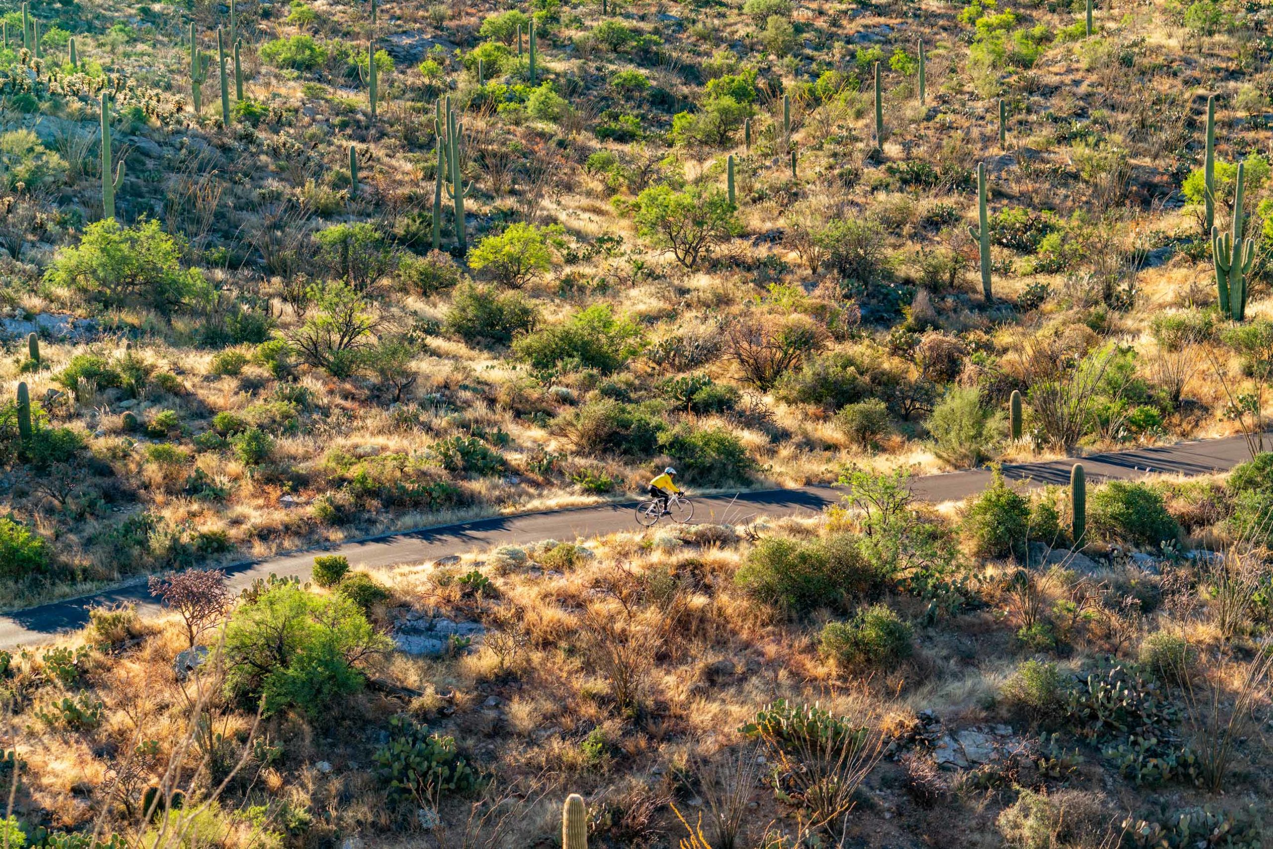
10. Bike Saguaro National Park East
Biking in Saguaro National Park
Okay it’s not hiking, but Saguaro National Park East’s one-way loop road is perfect for biking. Plus bikes can be rented from any one of the many many bike rental shops in Tucson.
Morning is the best time as you’ll feel like you have the park to yourself and will see plenty of birds fluttering across the road and perching on top of saguaros. Javelina Rocks is the perfect spot to stop and take in the views after a great ride.
List of the Best Saguaro National Park Hikes
- Loma Verde Trail Hike
- Wasson Peak Hike
- Desert Ecology Trail Hike
- King Canyon / Gould Mine Hike
- Freeman Homestead Hike
- Ridge View Trail Hike
- Garwood Trail Hike
- Manning Camp Trail Hike
- Wild Dog Trail Hike
- Bike Saguaro National Park East
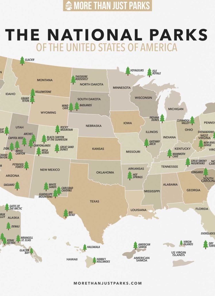
Map of Saguaro National Park Hikes
Saguaro National Park Hikes FAQ
The best place to hike in Saguaro National Park is the Loma Verde Trail, thanks to it’s wide array of scenery and location away from the busy areas.
The best place to enter Saguaro National Park is at the Red Hills Visitor Center in Saguaro National Park West. This is located very close to the Sonora Desert Museum, which we recommend visiting if you want to learn more about the beautiful desert scenery surrounding you.
There are over 15 hiking trails in Saguaro National Park spread throughout the park’s eastern and western districts.
The best easy trail in Saguaro is the Desert Ecology Trail, a paved 1/4 mile loop with shaded structures and beautiful desert views.
1-2 days is our recommendation to get an appreciation for Saguaro National Park. Thanks to it’s good roads and location in Tucson, the park can be seen relatively quickly. Whatever you do, make sure to take in a famous Saguaro sunset!
Summary of Saguaro National Park Hikes
Saguaro has a great range of hiking opportunities for visitors of all skill levels. From grueling 15 mile hikes up mountains, to easy half mile paved loops, and everything in between, Saguaro is full of adventures.
That’s a wrap folks! If you enjoyed this post about the best hikes in Saguaro National Park please leave us a comment below!
Further Reading (Best Saguaro National Park Hikes)
- Saguaro National Park – The Complete Guide
- 11 Amazing Things To Do in Saguaro National Park
- Arizona National Parks
- All 63 US National Parks Ranked
Pin Best Hikes Saguaro National Park
saguaro hikes, best hikes saguaro, hiking saguaro national park, best hikes saguaro national park, saguaro trails, best trails saguaro, saguaro hikes, best hikes saguaro, hiking saguaro national park, best hikes saguaro national park, saguaro trails, best trails saguaro, saguaro hikes, best hikes saguaro, hiking saguaro national park, best hikes saguaro national park, saguaro trails, best trails saguaro, saguaro national park hikes, hiking saguaro national park, best hiking tucson, tucson hiking, saguaro hiking trails, best hiking trails saguaro national park, hiking trails saguaro national park, saguaro hiking, hiking in saguaro national park, saguaro national park hikes, best trails saguaro national park, hiking trails saguaro national park, best places to hike saguaro, hiking in saguaro, hiking in saguaro national park, loma verde trail, loma verde hike, hiking loma verde trail, loma verde trail map, loma verde trail hike, loma verde, wasson peak hike, hiking wasson peak, wasson peak trail, saguaro national park trail map, saguaro national park trails, garwood trail hike, garwood trail, hiking garwood trail

Maps for each hike would be helpful. Looking at your Loma Verde trail description, you talk about going up the Loma Verde trail and turning right on the Pink Hill trail. I only see a left turn by looking on another site’s map.
Thanks for that comment Gil! Having hiked this one a few times I can assure you that you’ll take a right on Pink Hill Trail in order to complete the loop, but I see what you mean about there being some conflicting information out there. I think having maps is an excellent idea! Please check back here in the coming days as we work to incorporate accurate trail maps for each hike!
Hi, Guys! We’ll be visiting Saguaro next month (March 29), and we only have a modest day (maybe 8 – 10 hours). My wife is somewhat restricted in her hiking ability, but she can do easy to moderate hiking if it’s not too long; several hikes you describe would fill this bill nicely.
We love beautiful scenery and diverse biology in general, and I really appreciate your ranking along these lines – but for this park, our main goal is to see some nice “forests” of saguaros, either on flats or hillsides; the denser the better, really. When you describe the various short hikes on your list, would you say that your preferences include such a characteristic, or are some of the lower-ranked trails actually better for this specific feature? I may return on my own soon for some more in-depth exploration.
I know we’ll love the place no matter what, but if you could clarify, we’d be much obliged! Also, we want to visit a VIC, and if we have an hour or two, the AZ-Tucson Desert Museum near the western unit.
Happy explorations to you! – Bruce from CA
Hi Bruce!
Thanks for reaching out. I sure am jealous of you getting all that desert warmth and sunshine to yourselves! Regarding the hikes, one of the best is the Desert Discovery Trail, especially at sunset. It’s right near the visitor center, very flat, and lots of Saguaros. Another great one that gives you a nice view of the scale of the forest is Signal Hill (will update this article to include it). There’s some really cool petroglyphs at the top as well. Short hike with a little incline. The Bajada Wash Trail at the Sus Picnic Area is another gentle trail with great forest views as well – really puts you in it.
Hope that’s helpful and let me know if you have any more thoughts or questions!
Best,
Will
Thanks so much! – Bruce