
Article Summary: Arizona National Parks
Arizona National Parks! We’ve got 24 incredible national park sites for you to see on your next visit to the Grand Canyon State.
Arizona National Parks includes recreational areas, historic sites, incredible monuments, iconic parks, legendary trails and so much more.
I’ve been to so many of these amazing places since retiring from teaching in 2018. Did I mention that I taught history? I spent a lifetime teaching about the history behind these momentous sites. Then I got to see them firsthand. And now I’m sharing the stories of these incredible places with you. It doesn’t get any better than that!

So, What Is A National Park?
We get asked that question a lot because there’s a difference between a “national park” and a “national park site.” To help you understand that difference you might want to check out our article titled: What Is A National Park Really?
If you’re planning a trip to the Grand Canyon State then one book that I highly recommend is: Arizona Bucket List Adventure Guide & Journal: Explore The Natural Wonders & Log Your Experience!
Without further ado, we’re going to give you 29 wonderful reasons why you’ll want to make Arizona your next vacation destination.
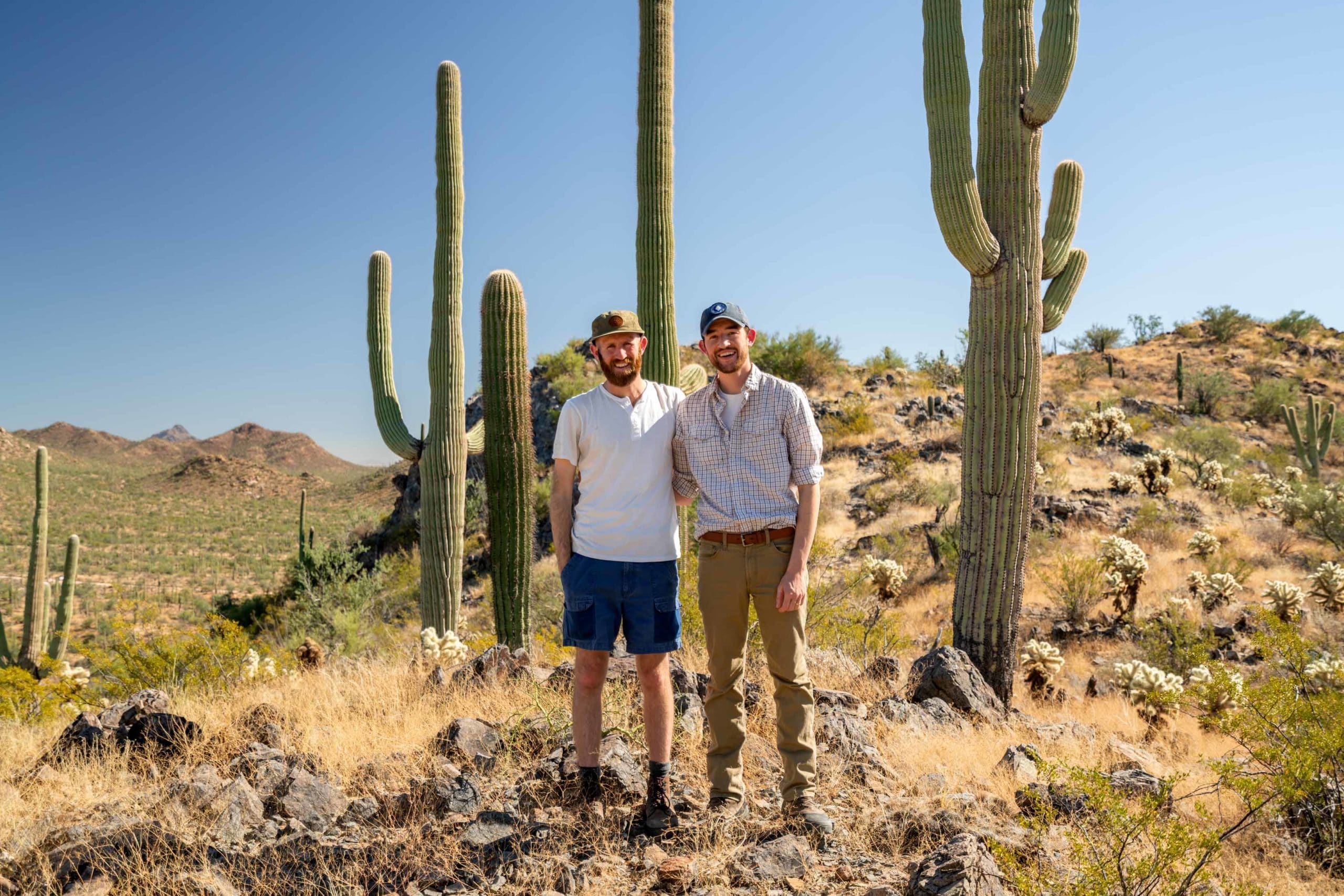
Table of Contents: Arizona National Parks
Arizona National Parks
- Arizona National Parks
- More Arizona National Parks & Monuments
- More Arizona National Parks & Monuments
- More Arizona National Parks & Monuments
- More Arizona National Parks & Monuments
- More Arizona National Parks & Monuments
- Check Out Our Saguaro Film
- Arizona National Parks FAQ
- Why Trust Us About Arizona National Parks?
- Meet The Parks Brothers
- Map Of Arizona National Park Sites
- List Of Arizona National Park Sites
- We Hope You’ll Follow Our Journey
- Helpful Related Articles
Arizona National Parks
29. Hohokam Pima National Monument
Hohokam Pima National Monument preserves what’s left of an ancient Hohokam Village which is significant to the Gila River Indian Nation who manages and controls access to this site.
The site doesn’t have much to see to the naked, untrained eye. Even if it did, the Gila River Indian Nation has decided not to open this national monument to the public. This is at least somewhat in part because of the sensitive nature of this site.
In our estimation a National Monument designation doesn’t seem quite right for an area that is not accessible by the general public. Perhaps a National Historic Site or landmark would be better suited for this site.
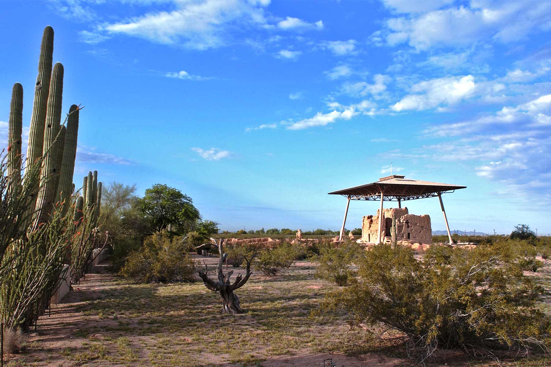
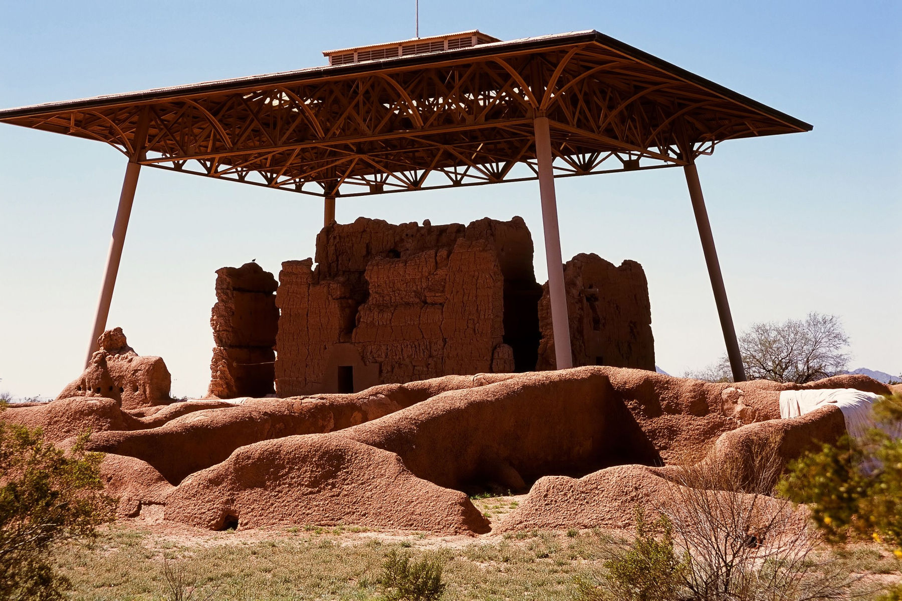
28. Casa Grande Ruins National Monument
Casa Grande Ruins National Monument is a preserved ancient Native American Hohokam ruin located in Coolidge, Arizona. The monument is named for the large four-story structure that is its main feature, known as the “Casa Grande” or “Great House”.
The history of Casa Grande Ruins National Monument can be traced back to the Hohokam people, who lived in the area from approximately AD 500 to 1450. The Hohokam were known for their sophisticated irrigation systems and innovative architecture, and the Casa Grande is one of the most significant structures that they built.
The exact purpose of the Casa Grande is still unknown, but it is believed to have served as a community center, a religious temple, or a defensive fortress.
In 1891, the ruins were first protected by the federal government when President Benjamin Harrison set aside the site as a reservation for the use of the “civilized tribes”. However, it wasn’t until the early 20th century that the site received national recognition, when President Woodrow Wilson signed legislation creating Casa Grande Ruins National Monument in 1918.
Since then, the monument has been preserved and maintained by the National Park Service, and it is now one of the most popular tourist destinations in Arizona. Visitors can tour the Casa Grande, as well as several other Hohokam structures and exhibits, and learn about the history and culture of the Hohokam people.
Casa Grande Ruins National Monument is an important piece of American history, preserving the legacy of the Hohokam people and offering a unique glimpse into the lives of one of the Southwest’s ancient civilizations.
27. Old Spanish National Historic Trail
Trade networks are as old as civilization itself. Merchants and traders sent goods from New Mexico to Los Angeles in the 18th and 19th centuries.
It was the Mexican trader Antonio Armijo who led the first commercial caravan from Abiquiú, New Mexico to Los Angeles in late 1829. Over the next twenty years, Mexican and American traders continued to use routes similar to the one he pioneered.
This trail network was a combination of indigenous footpaths, early trade and exploration routes, and horse and mule routes which became known collectively as the “Old Spanish Trail.” This is one of the most interesting and colorful of the Arizona National Parks because of the diversity of cultural activities available.
Today you will find numerous programs and activities available at sites and in communities along the Trail.
.jpg)
26. Juan Bautista de Anza National Historic Trail
There’s so much wonderful southwestern history to be uncovered in Arizona. And it’s a place which attracted travelers from nearby and far away.
In 1775-76, Juan Bautista de Anza led 240 men, women, and children on an epic journey to establish the first non-Native settlement at San Francisco Bay.
Unique among the Arizona National Parks, the 1,200-mile Juan Bautista de Anza National Historic Trail connects history, culture, and outdoor recreation from Nogales, Arizona, to the San Francisco Bay Area.
More Arizona National Parks & Monuments
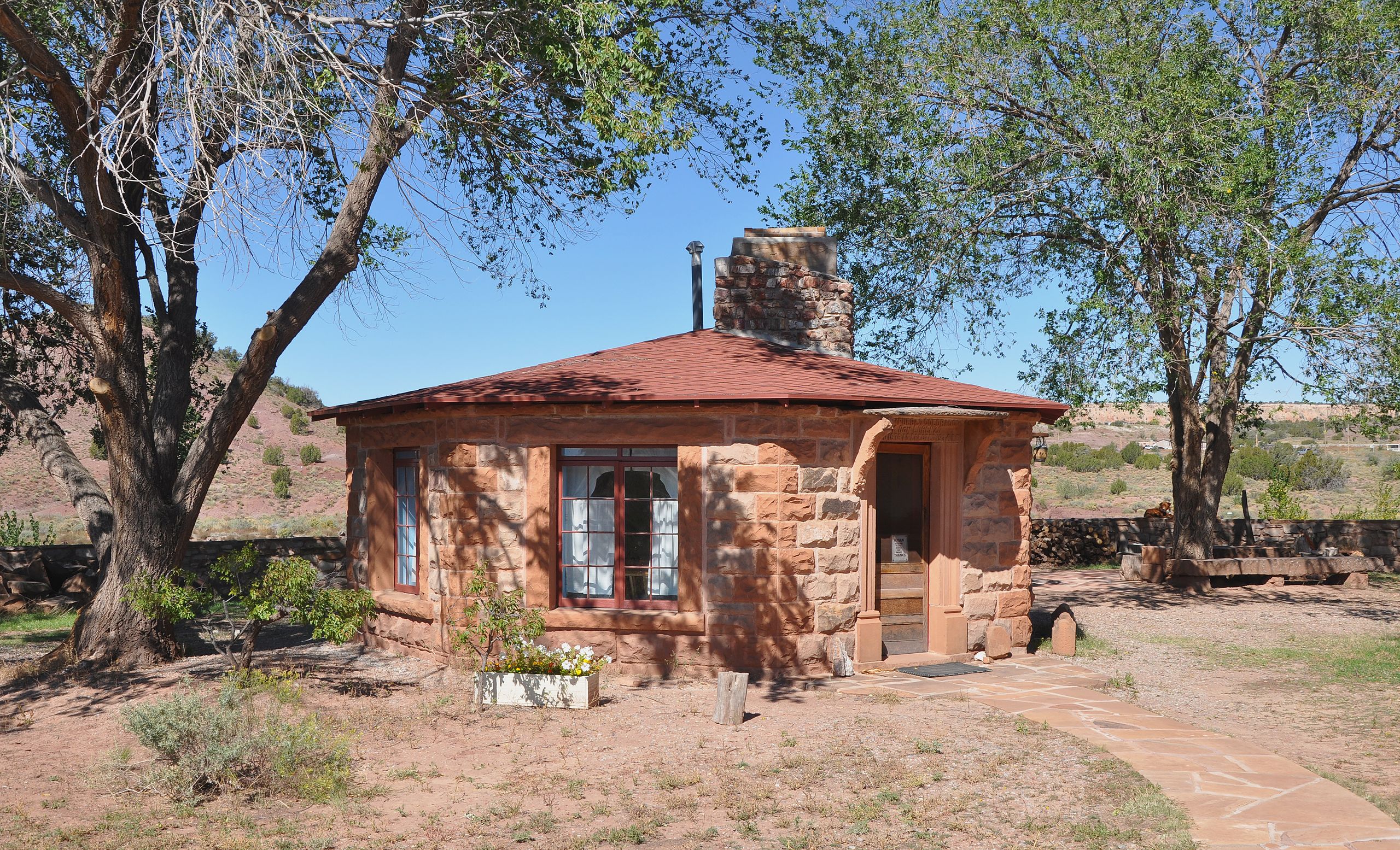
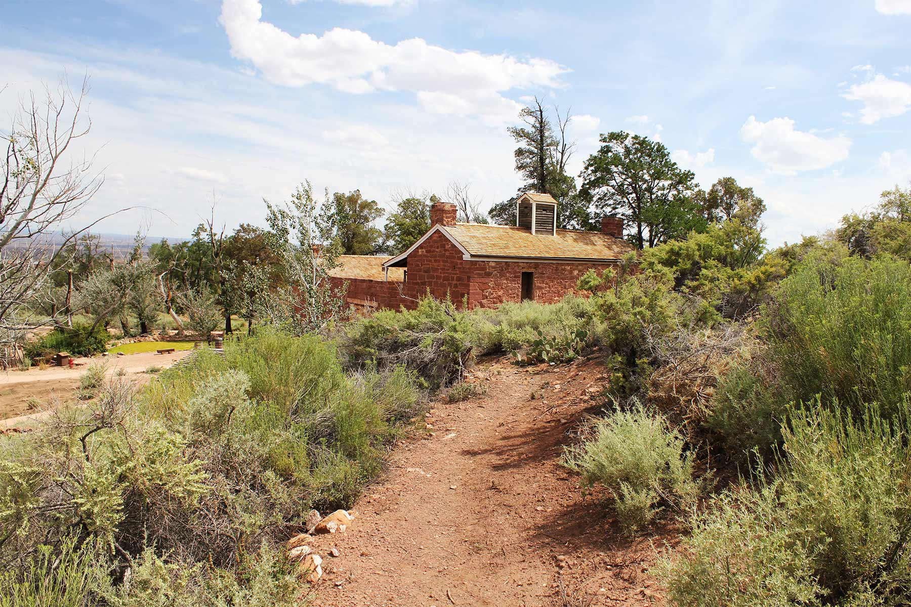
25. Hubbell Trading Post National Historic Site
One of the least known of the Arizona National Parks is the Hubbell Trading Post National Historic Site.
The Hubbell Trading Post National Historic Site preserves the Hubbell Trading Post, which was established in 1878 by John Lorenzo Hubbell, a businessman and trader of Navajo goods.
The trading post served as a center of economic activity and cultural exchange between the Navajo people and Euro-American settlers for over 90 years.
The site includes the original trading post building, as well as other historic structures and a visitor center that provides information about the history and culture of the Navajo people.
The site is now managed by the National Park Service and is open to the public for tours and educational programs.
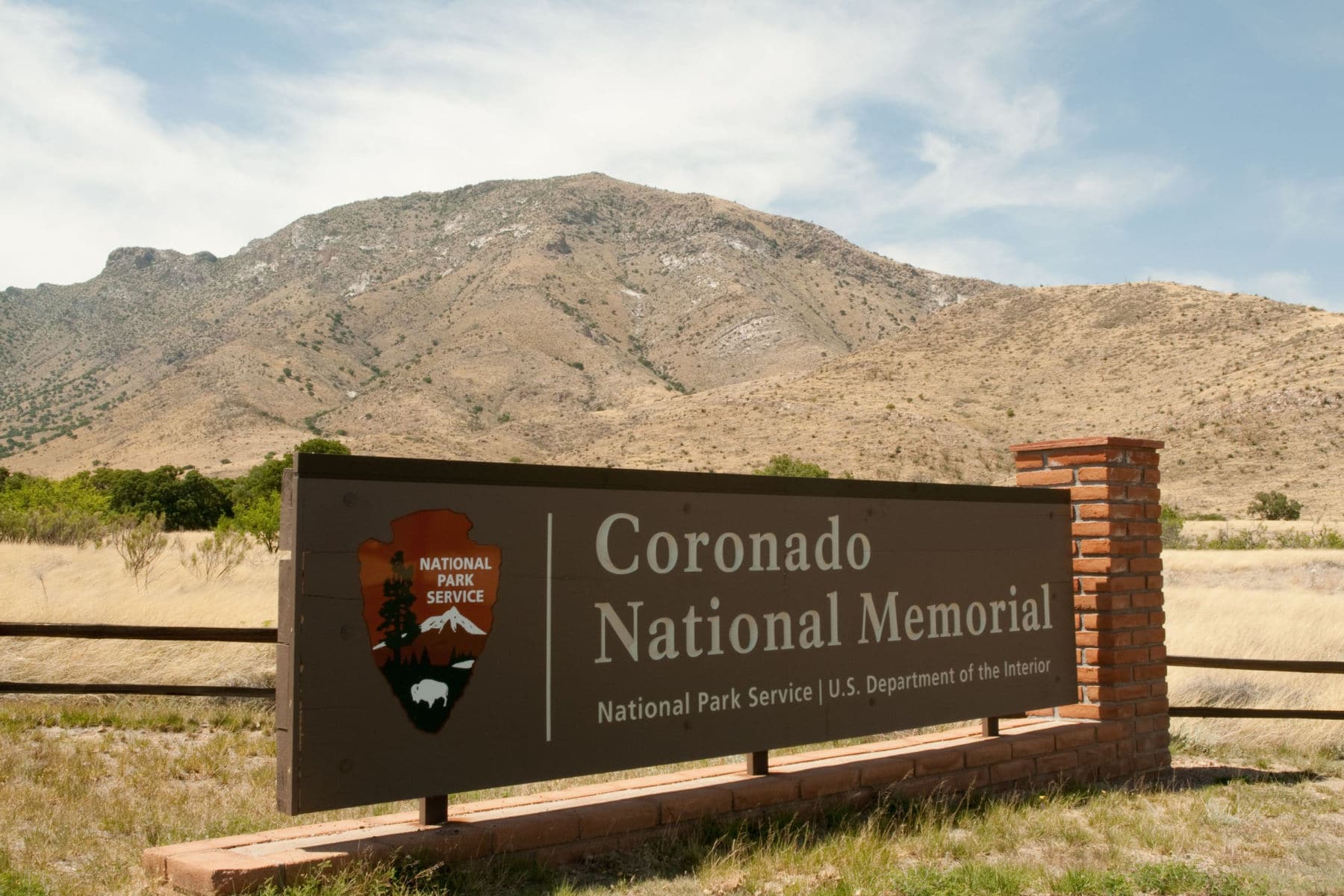
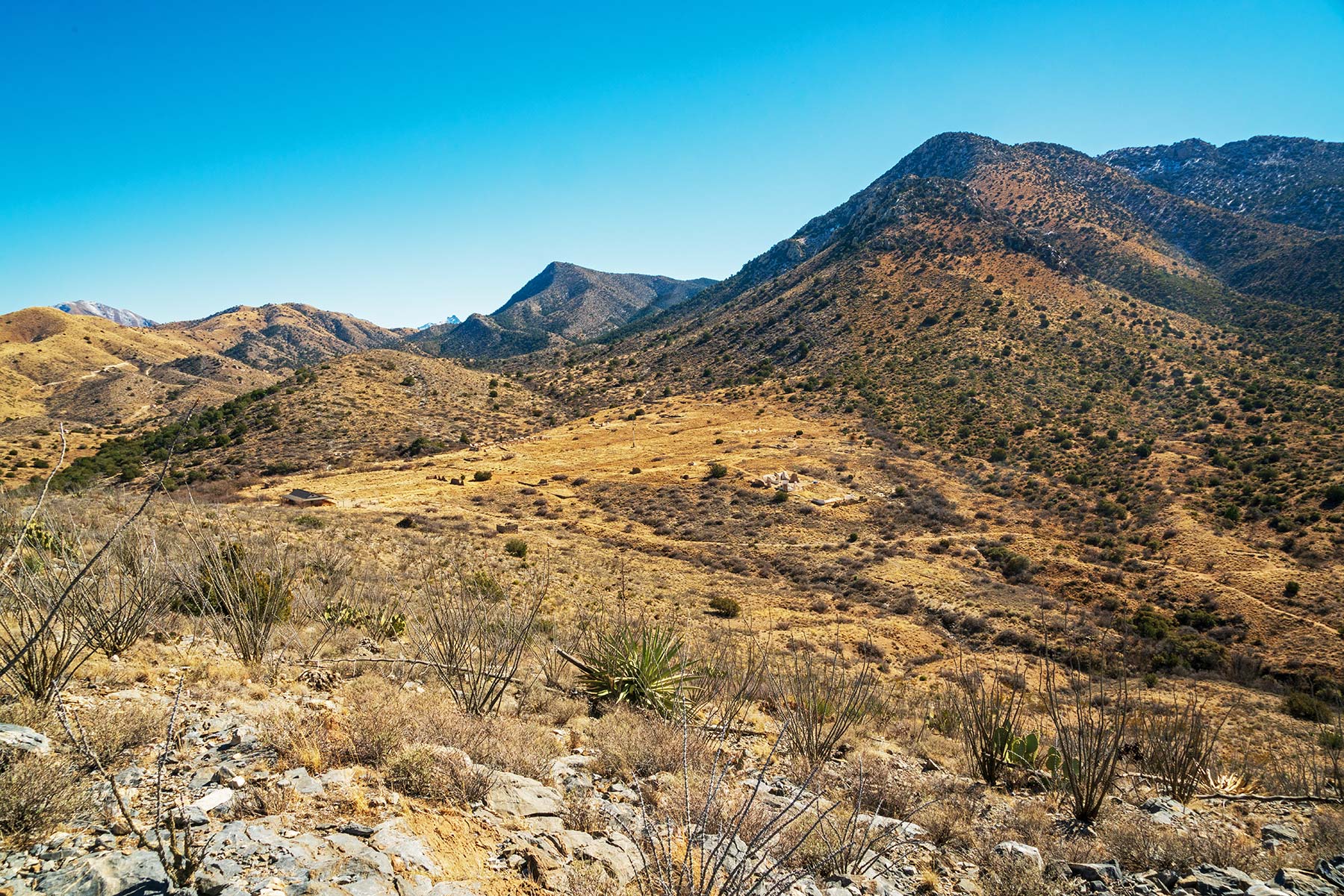
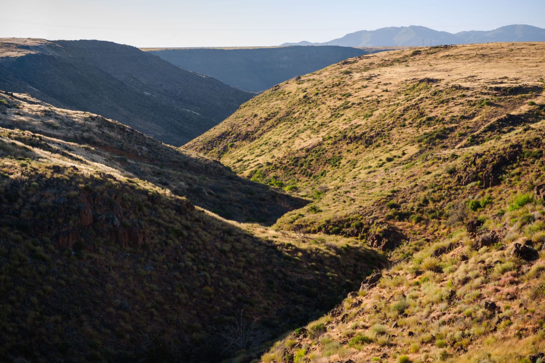
24. Coronado National Memorial
Shortly after the discovery of America, the Spanish became obsessed with the idea that somewhere in the interior of the New World, there were rich mines of gold and silver.
With a serious case of “gold fever,” Spanish Explorer & Conquistador Francisco Vasquez de Coronado set off with an expedition in search of the Seven Cities of Cibola which were rumored to be filled with gold.
Coronado’s expedition consisted of over 300 Europeans, over 1000 Aztec/Mexica allies, a handful of Franciscan priests, and scores of servants and enslaved peoples.
They didn’t find the Seven Cities of Cibola, but their arrival in northwest Mexico and the American Southwest forever changed the lives and cultures of the indigenous peoples nonetheless.
The Coronado National Memorial recognizes their historical achievements.
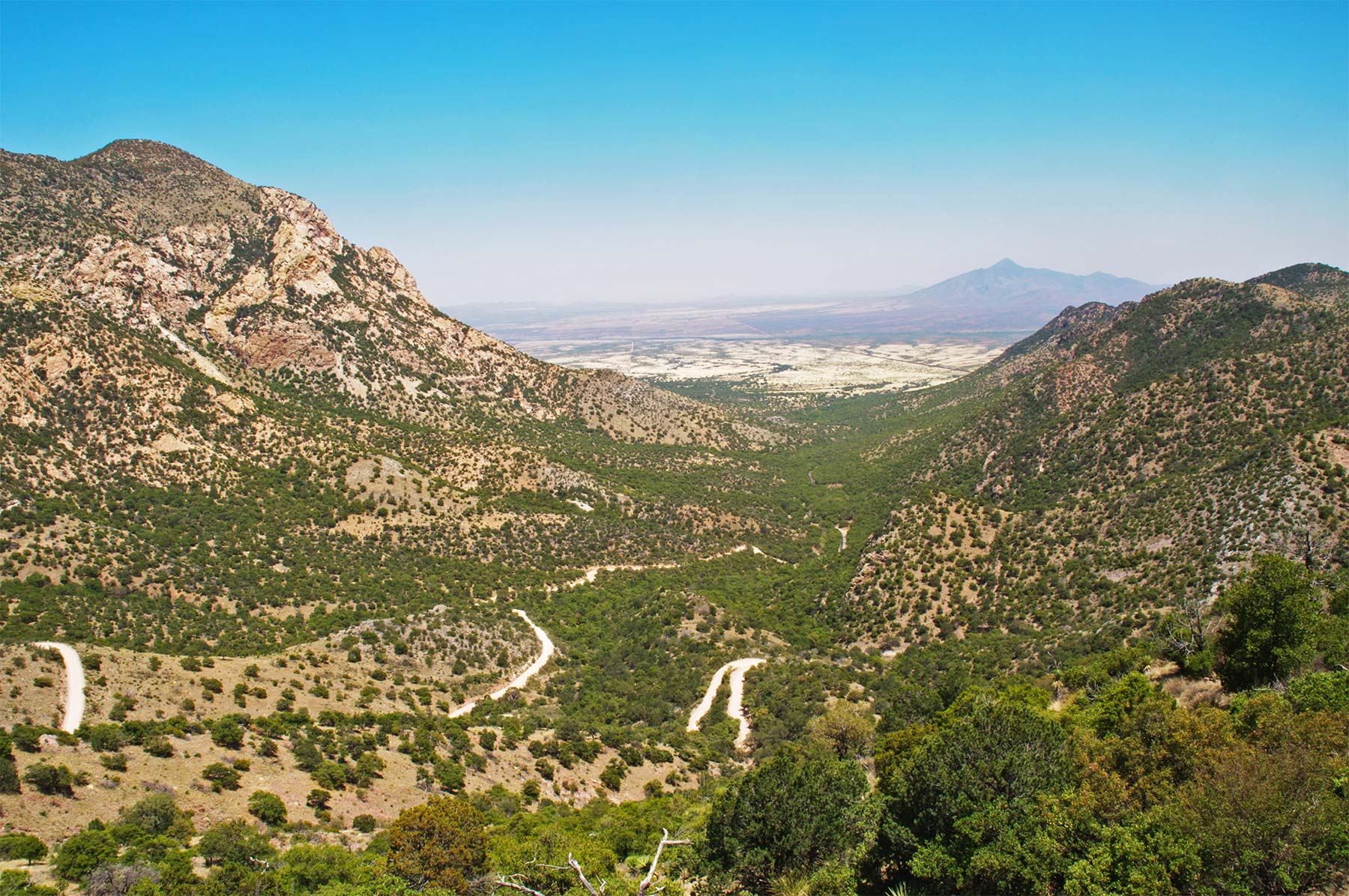
Things To Do At The Coronado National Memorial
A good place to begin your visit is at the visitor center. There’s a film which provides a brief history of the expedition.
From there you’ll have an opportunity to see the magnificence of the lands once visited by Coronado only you will be able to travel in greater comfort than he did.
The Montezuma Pass Overlook & Scenic Drive is a great place to begin your expedition. It will take you to an elevation of 6,575 feet. The pass offers sweeping views to the east of the San Pedro River Valley and to the west over the San Rafael Valley.
Hiking Opportunities At Coronado
There are some wonderful hiking opportunities at Coronado. They include:
- Coronado Cave Trail-A one mile hike which requires scrambling 25 feet down a rocky slope to the cave floor.
- Coronado Peak Trail-It’s a .8 mile interpretive trail climbs from the trailhead at Montezuma Pass to Coronado Peak. As a bonus, you’ll see incredible views of Sonora, Mexico and the San Pedro River and San Rafael Valleys.
- Joe’s Canyon Trail-It’s 6.2 miles with scenic views of Montezuma Canyon and the San Pedro River Valley.
- Yaqui Ridge Trail-It’s a 2 mile hike. The trail descends steeply to the US/Mexico border making the total length 4 miles round-trip. It marks the southern terminus of the Arizona National Scenic Trail.
- Crest Trail-A 4 mile trek which begins at the northeast end of the Montezuma Pass parking area and climbs for 2 miles to the northwestern boundary of the park where it enters Coronado National Forest.
- Windmill Trail-A 2 mile hike which traverses an historic windmill and corral before ascending into the foothills below Montezuma Peak.
RELATED: 19+ Best Hiking Apps RANKED By Experts (From Best To Worst)
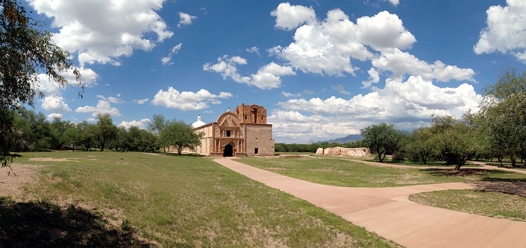
23. Tumacácori National Historical Park
Another one of the amazing Arizona National Parks is Tumacacori.
Tumacácori National Historical Park preserves the ruins of three Spanish colonial missions: Tumacácori, Guevavi, and Calabazas, which were established in the late 1700s and early 1800s.
The park’s main feature is the Tumacácori mission church, which was built in the early 1800s and is considered one of the best-preserved examples of Spanish colonial architecture in the American Southwest.
It also includes other historic structures such as the mission residence and the walled courtyard, as well as a visitor center that provides information about the history and culture of the missions.
The park is now managed by the National Park Service and is open to the public for tours and educational programs.
Tumacacori National Historical Park is a UNESCO World Heritage Site as part of the “Franciscan Missions in the Sierra Gorda of Querétaro.”
22. Fort Bowie National Historic Site
The west could be a dangerous place in the 19th century. The U.S. established a series of outposts, otherwise known as forts, to bring to provide settlers with a measure of safety in an otherwise dangerous land.
The Arizona National Parks tell the incredible story of the Westward Migration. The Fort Bowie National Historic Site is a case in point.
A short history lesson is in order and as a retired history teacher I’m only too glad to oblige. Have no fear, however, as I won’t be assigning any homework.
Fort Bowie commemorates the bitter conflict between Chiricahua Apaches and the U.S. military – a lasting monument to the bravery and endurance of U.S. soldiers in paving the way for settlement and the taming of the western frontier.
It provides insight into a “clash of cultures,” a young nation in pursuit of “manifest destiny,” and the hunter/gatherer society fighting to preserve its existence.
The Battle Of Apache Pass
The Battle of Apache Pass pitted Apache warriors against the Union volunteers of a California Column which had been dispatched from California to capture Confederate Arizona and to reinforce New Mexico’s Union army.
Fort Bowie was established in 1862 as a result of the Battle of Apache Pass.
While at the fort, visitors can tour the ruins of Fort Bowie and view the exhibits inside the visitor center. There are picnic facilities located at the trailhead on Apache Pass Road and the visitor center.
Visitors can also participate in bird watching, hiking, and wildlife viewing while there.
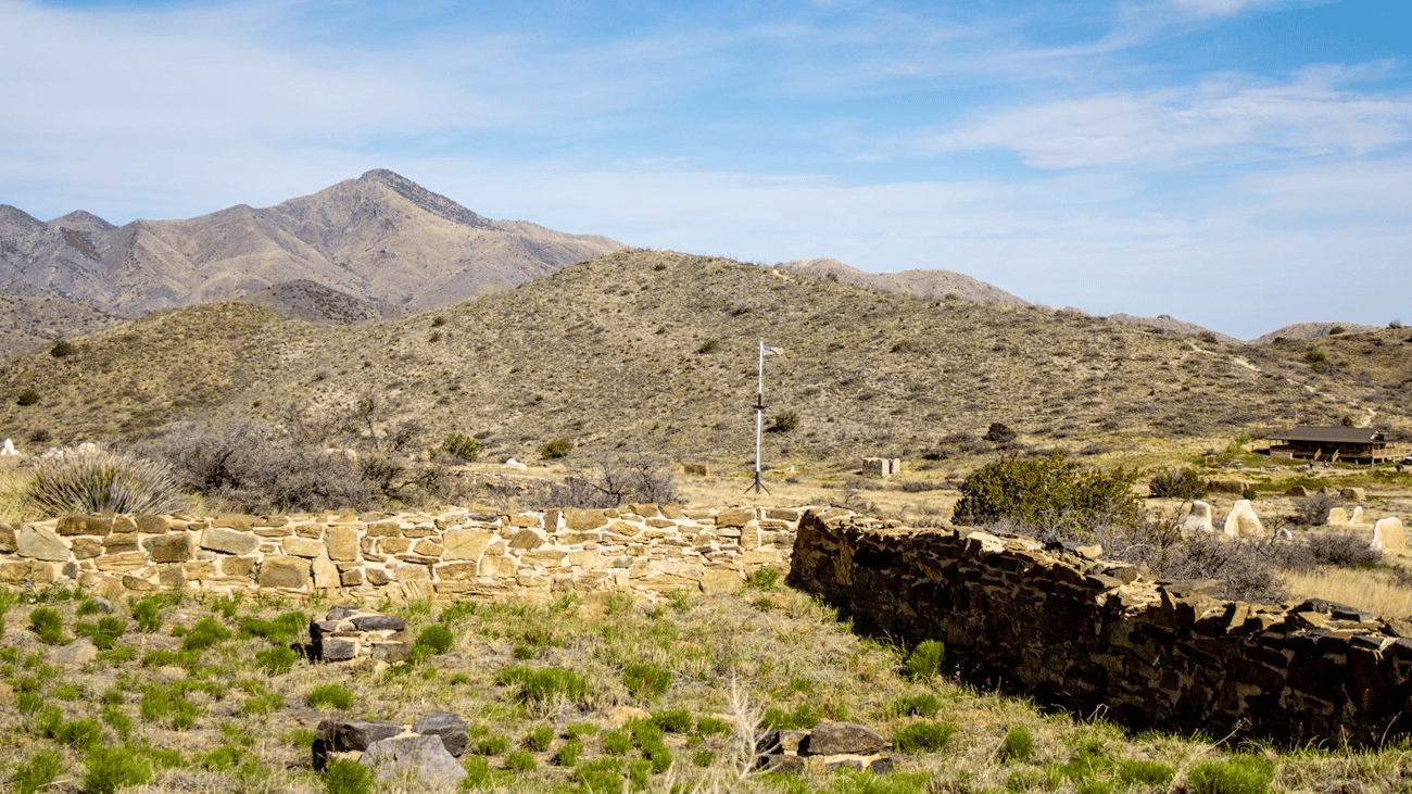
21. Pipe Spring National Monument
Steeped in Kaibab Paiute and the Mormon settler frontier history, Pipe Spring National Monument tells the story of western frontier life for those who inhabited the area.
It preserves the ruins of an historic fort and a spring that was considered a valuable resource by the local Native American tribes, early explorers, and settlers.
The site includes an original fort built by Mormon pioneers in the late 1800s to protect the spring and their settlements, and the Kaibab Band of Paiute Indians, who built a small village nearby to access the spring.
The monument also includes a visitor center that provides information about the history and culture of the area, and the ways in which water has shaped the lives of people in the region over time.
The monument also offers a short hiking trail, guided or self-guided tours of the historic structures, and a visitor center where you can learn more about the history of the place.
More Arizona National Parks & Monuments
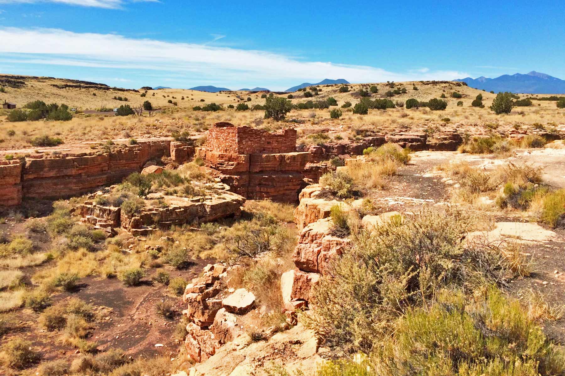
20. Wupatki National Monument
And last, but certainly not least, on our extraordinary list of Arizona National Parks, is the Wupatki National Monument.
Located between the Painted Desert and ponderosa highlands of northern Arizona, Wupatki is a landscape indicative of an ancient past.
What you’ll behold there are ancient pueblos dot red-rock outcroppings across miles of prairie. Imagine living in a harsh desert environment where food and water are not readily available.
And yet the amazing people who lived there built pueblos, raised families, farmed, traded, and even thrived. Sure you can read about it in books or see it on television, but it’s simply not the same as going there and experiencing it for yourself.
These places have incredible stories to tell us, but only if we’re willing to make the time to come and see them for ourselves.
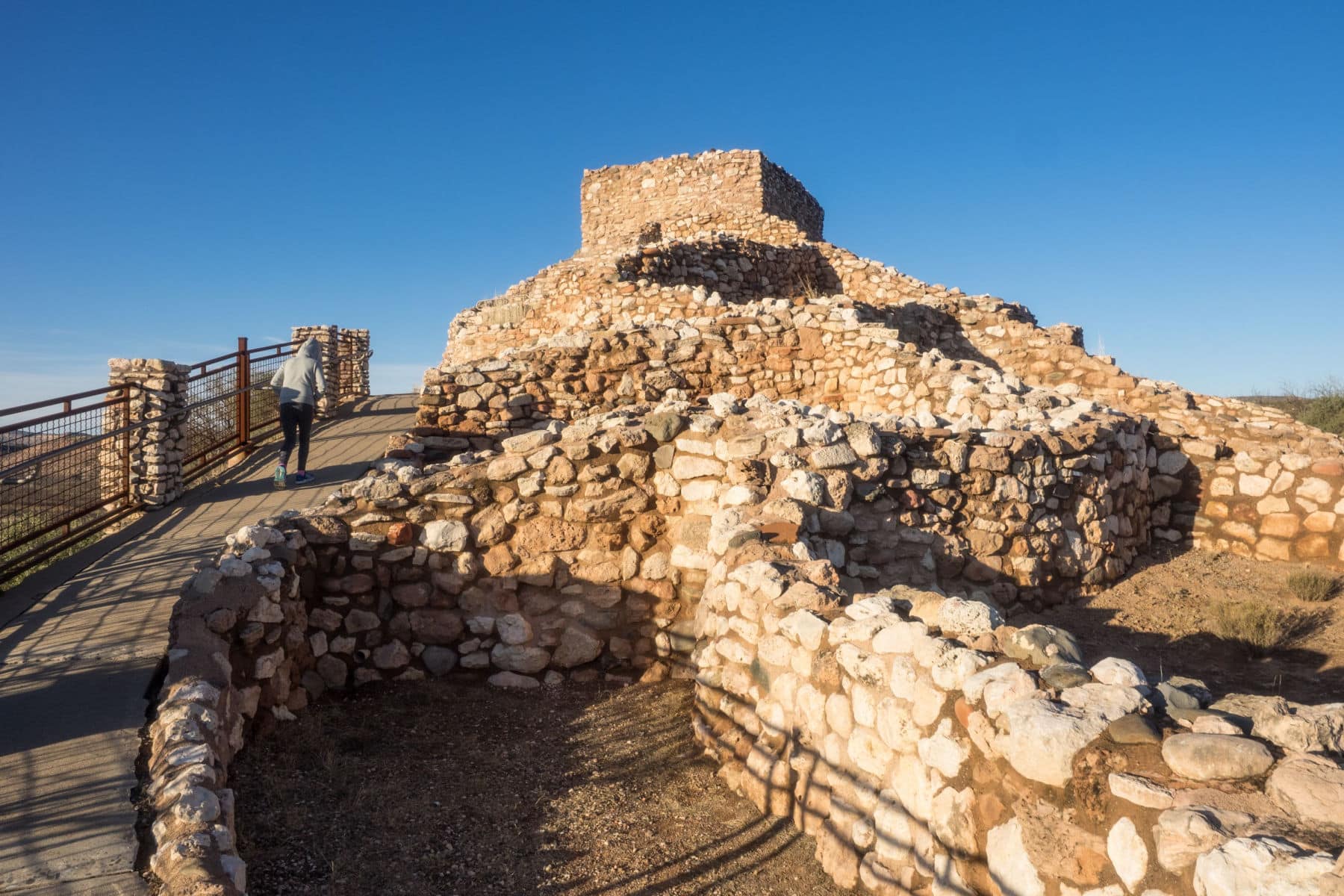
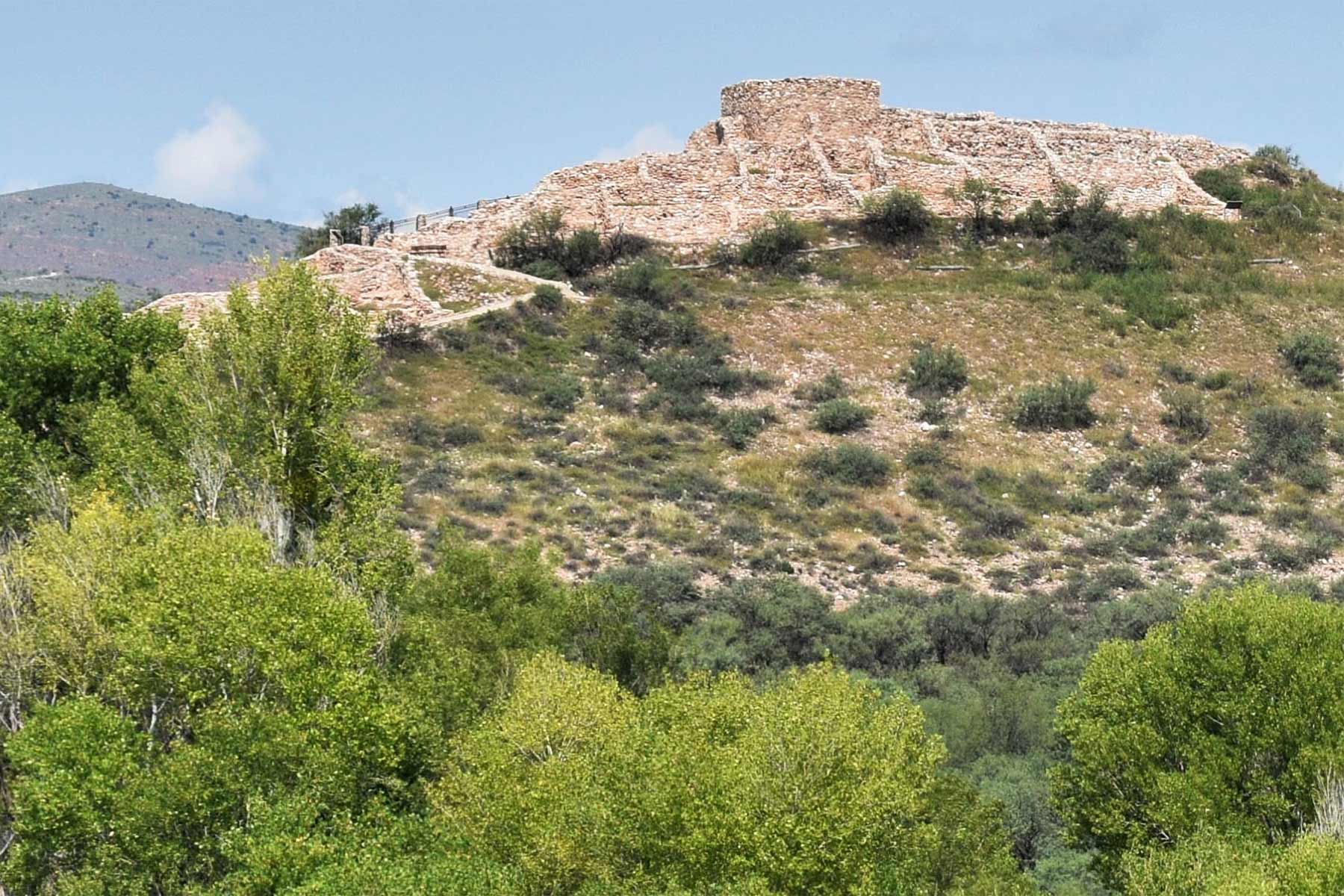
19. Tuzigoot National Monument
What is Tuzigoot? It’s a national monument which preserves a 2- to 3-story pueblo ruin on the summit of a limestone and sandstone ridge just east of Clarkdale, Arizona, 120 feet above the Verde River floodplain.
It preserves the ruins of an ancient puebloan village that was built on a limestone ridge overlooking the Verde Valley. The village, which dates back to the 12th century, is believed to have been home to the Sinagua people, who were skilled farmers and traders.
The site includes the ruins of more than 100 rooms, including living quarters, storage rooms, and ceremonial spaces. The monument also includes a visitor center that provides information about the history and culture of the Sinagua people, as well as the natural environment of the region.
You Need To See It For Yourself
Visitors can explore the ruins of the village, which include over 100 rooms, and gain insight into the daily lives of the people who lived there.
The visitor center and museum is also a great resource for learning more about the Sinagua people, their history, and the environment of the region. It’s an example of modern-day construction techniques that reflect traditional Sinagua building methods.
The museum has a rich collection of artifacts that were found at Tuzigoot and other nearby archaeological sites, including large ollas, woven baskets, cotton fabric, obsidian projectile points, and decorative pieces. These artifacts give visitors a deeper understanding of the lifestyle, culture and customs of the Sinagua people.
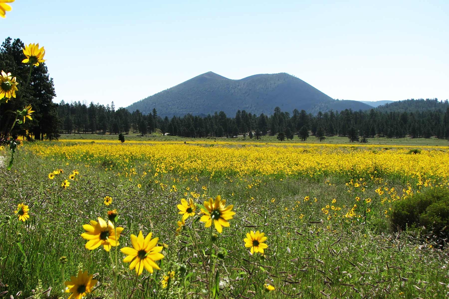
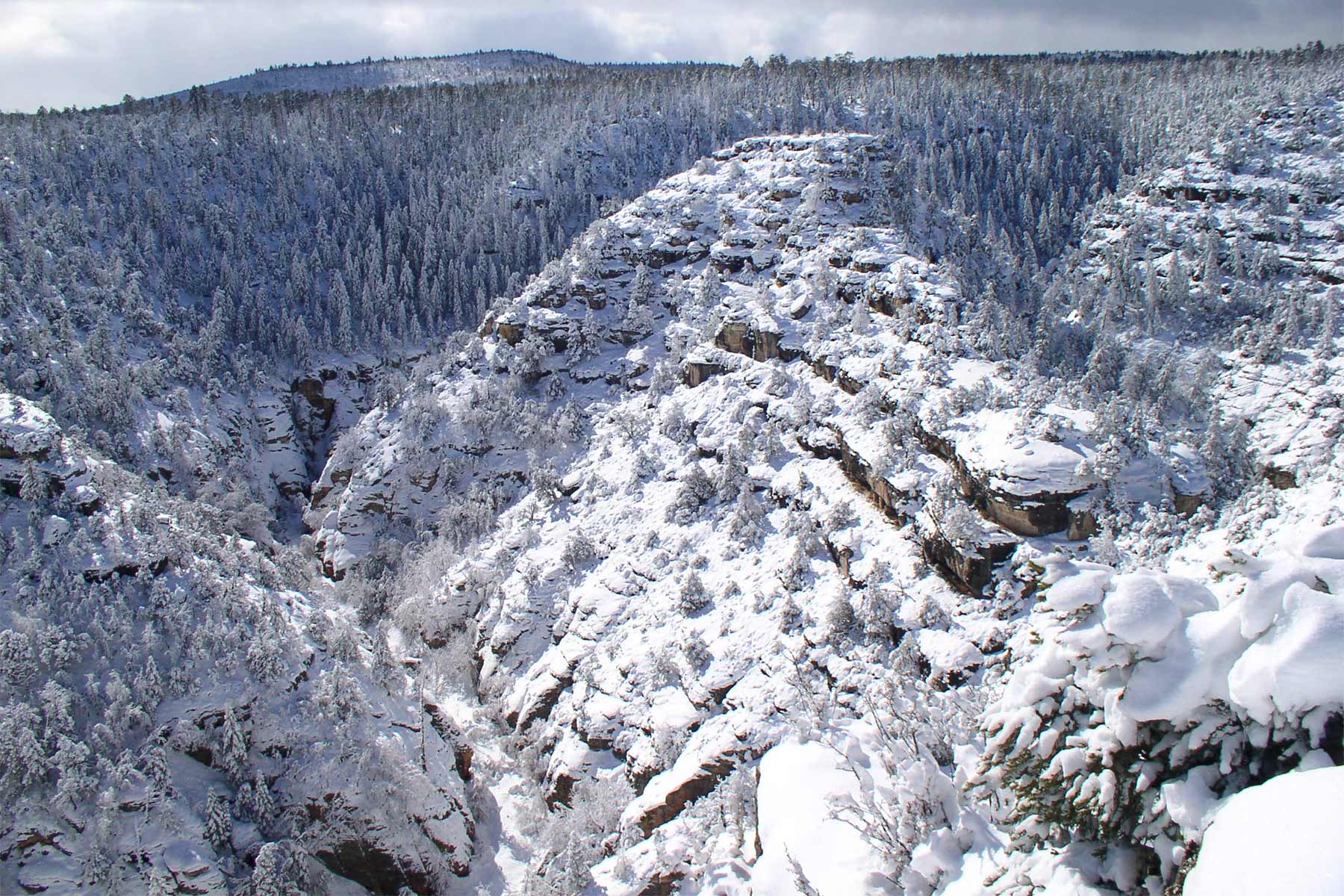
18. Sunset Crater Volcano National Monument
Imagine taking a trip to a volcano. It’s not active today, but it was almost a thousand years ago. You can do this in an Arizona National Park!
Visitors to this Sunset Carter Volcano National Monument can take a drive through the 34 mile scenic loop that winds from Highway 89 through Sunset Crater Volcano and Wupatki National Monuments.
This scenic loop will take you from the high Ponderosa Pine forests of Sunset Crater down nearly 2,000 feet in elevation. There you’ll see the red rocks and painted desert vistas of Wupatki.
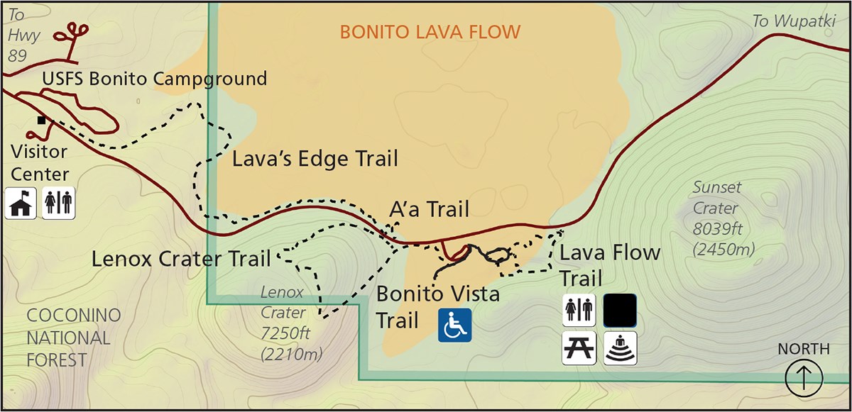
Hikes at Sunset Crater Volcano National Monument
We’ve included the top hikes with descriptions from the NPS:
- Lava’s Edge Trail-Here you’ll have the opportunity to walk under ponderosa pines, over loose cinders and rough basalt along the jagged edge of the Bonito Lava Flow. The hike is 3.4 miles round trip.
- A-s Trail-On this .2 mile trek, you’ll jagged blocks of rough, basaltic a’a lava, formed as the Bonito Lava Flow cooled over 900 years ago.
- Lenox Crater Trail-A 1.6 mile hike where you’ll walk in a ponderosa pine forest.
- Bonito Vista Trail-Imagine walking across a field of cinders on this paved trail for an expansive view of the Bonito Lava Flow and surrounding volcanoes. This trial is .3 miles.
- Lava Flow Trail-A 1 mile hike where you’ll explore numerous volcanic features while walking at the base of Sunset Crater Volcano.
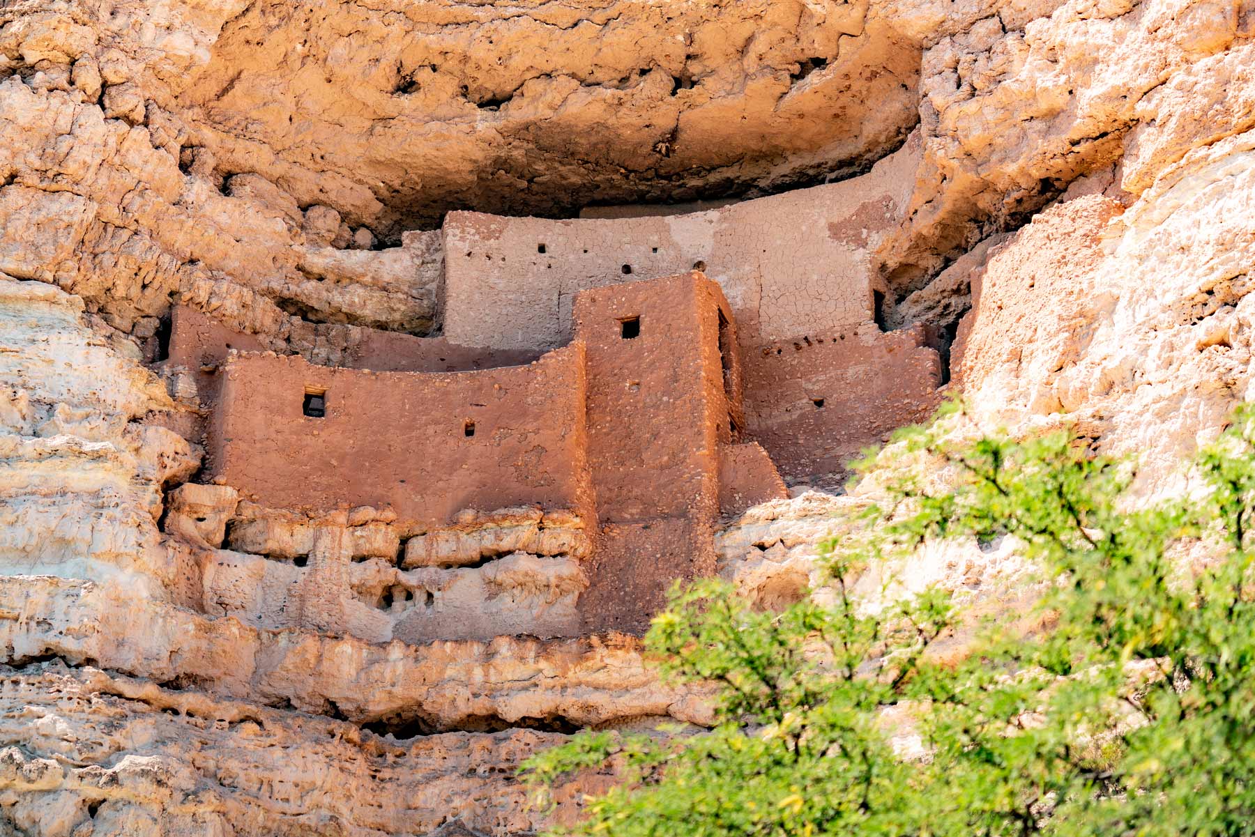
17. Montezuma Castle National Monument
I am fascinated by the cultures which predated the arrival of the Europeans. The Arizona National Parks offer us a glimpse into these intriguing cultures. One place in particular that I found most fascinating is Montezuma Castle National Monument.
Montezuma Castle was established in 1906 as the third National Monument dedicated to preserving Native American culture. These were the folks who came along long before Columbus and the Gang.
Nevertheless, they knew how to live in style. These Native Americans crafted these 20 room high-rise apartments, nestled into a towering limestone cliff. It’s a truly amazing story of ingenuity and survival in an unforgiving desert landscape. Not only did they survive, but they prospered too.
Visitors to the site can examine a collection of amazing artifacts including basketry, hunting, jewelry, pottery and tools. There’s even a Southwest Virtual Museum where you can check out these amazing collections online.
What to See at Montezuma Castle National Monumen
Montezuma Castle National Monument encompasses 826 acres and lies in the Verde Valley at the junction of the Colorado Plateau and Basin and Range physiographic provinces. Visitors are encouraged to check out the surroundings including the plant and animal life.
While you’re there, check out the Montezuma Well which has been home to many prehistoric groups of people since as early as 11,000 CE. Visitors can still see the irrigation canal, picnic areas, and historic Back ranch house at Montezuma Well.
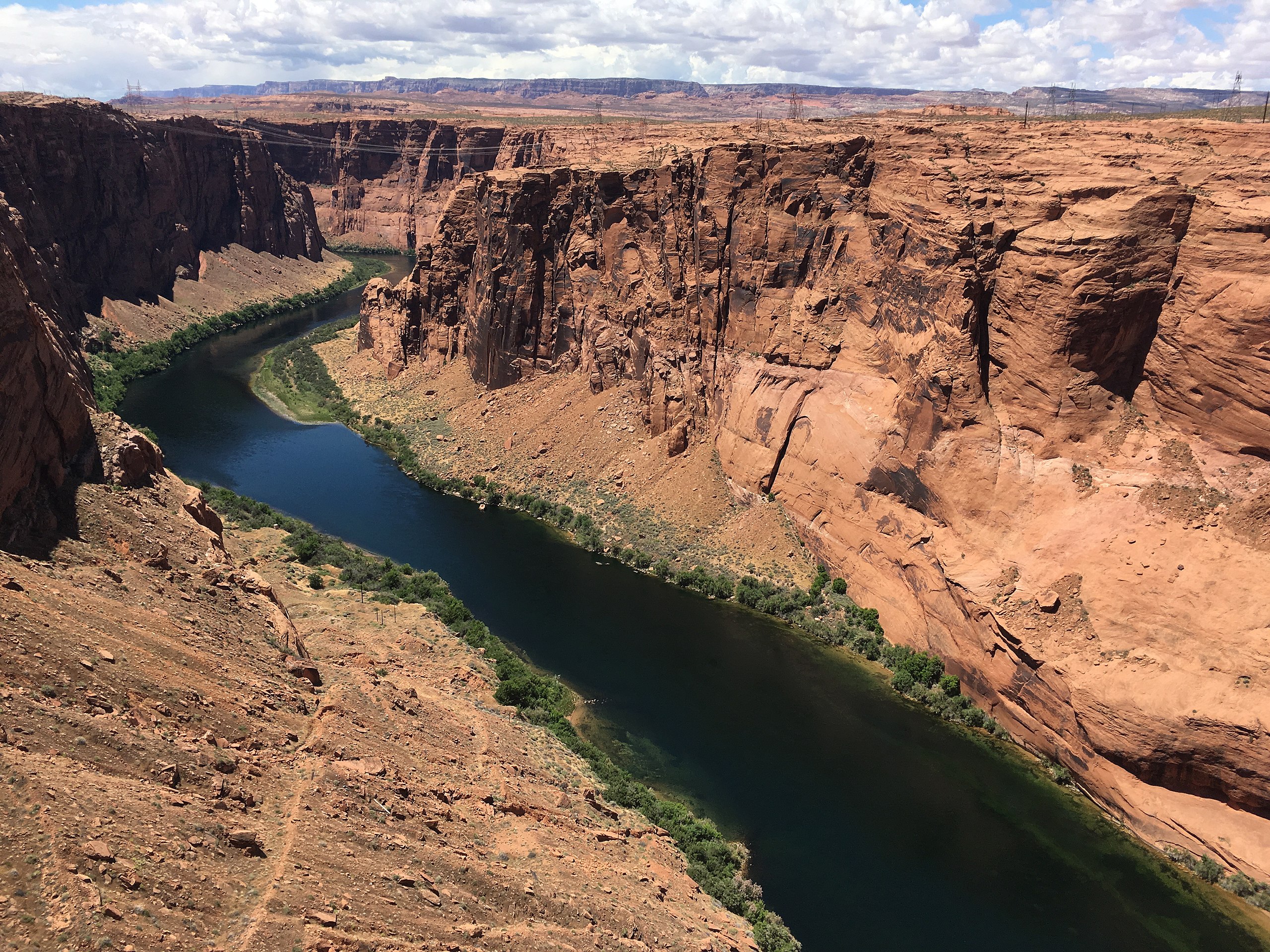
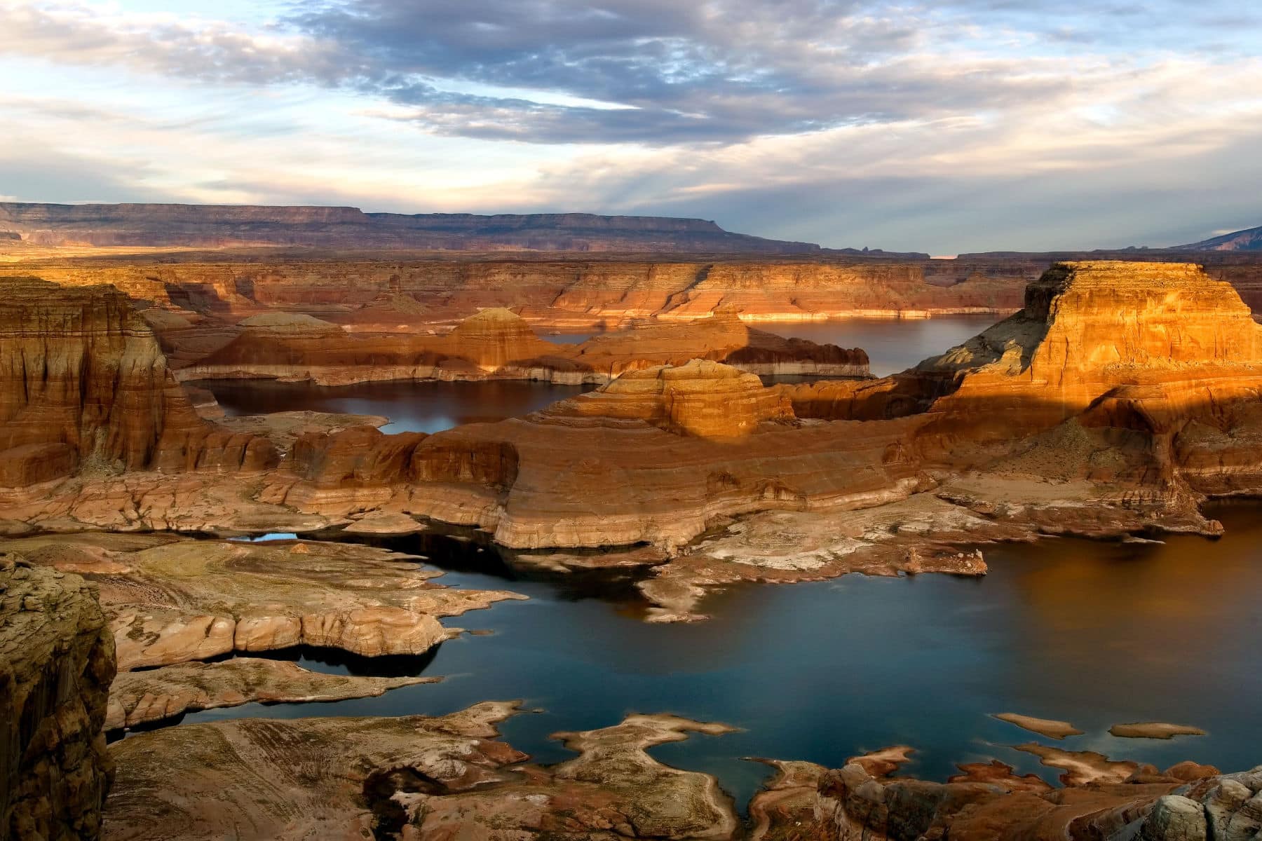
16. Glen Canyon National Recreation Area
Let’s take a break from learning about all of the wonderful history behind so many incredible places and just have some fun. And Glen Canyon National Recreation Area is the perfect place to do it.
Whether you prefer aquatic adventures or backcountry excitement, Glen Canyon’s got it going on! We’re talking over 1.25 million acres straddling two states.
Things To Do At Glen Canyon
The Glen Canyon National Recreation Area offers a wide range of activities for visitors to enjoy. Some of the things that you can do at the park include:
- Boating and water sports: The park is home to Lake Powell, which offers opportunities for boating, jet skiing, fishing, and swimming.
- Hiking and backpacking: The park has several hiking trails that offer scenic views of the canyons, mountains, and lake.
- Camping: There are several campgrounds in the park, including some that are accessible only by boat.
- Rock climbing and rappelling: The park has some of the best rock climbing and rappelling opportunities in the Southwest, with a variety of routes and levels of difficulty.
- Sightseeing and photography: The park offers many opportunities for sightseeing and photography, including scenic drives and overlooks that provide panoramic views of the lake and canyons.
- Ranger-led programs: The park offers a variety of ranger-led programs, such as guided hikes, boat tours, and campfire talks, that provide visitors with information about the park’s history, geology, and ecology.
- Archaeological sites: Glen Canyon is also known for its many ancient Native American sites, visitors can take guided tours to learn about the ancient people that lived in this area.
- Kayaking and Canoeing: Lake Powell offers many areas for visitors to explore by kayak or canoe.
- 4-wheel drive: Some roads in the park are accessible only by 4-wheel drive vehicles, and offer a unique experience of the park.
- Star Gazing: The park is a perfect spot for stargazing and night sky photography with minimal light pollution.
Overall, Glen Canyon National Recreation Area is a perfect place to enjoy nature, outdoor activities, and learn about the history of the area.
More Arizona National Parks & Monuments
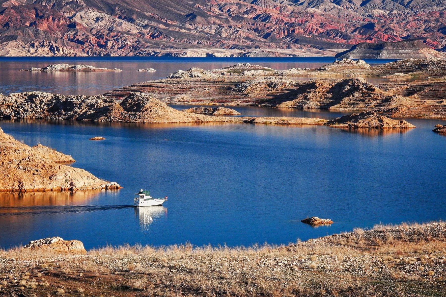
15. Lake Mead National Recreation Area
If you love aquatic activities and are wondering if one of these Arizona National Parks is for you then wonder no more. Lake Mead is definitely the place for you!
Visitors to Lake Mead National Recreation Area can enjoy a variety of water recreation activities including: biking, boating, canoeing, camping, fishing, hiking, horseback riding, hunting, kayaking, scenic driving and even scuba diving.
Bicyclists are welcome at Lake Mead on park roads and on routes designated for bicycle use. There are also approved backcountry roads which are designated routes and are marked with a yellow arrow sign with a number on it.
If you’re planning on boating then Hemenway Harbor, PWC Beach, Boulder Harbor, Callville Bay, Echo Bay, Temple Bar, South Cove, Willow Beach, Cottonwood Cove, Katherine Landing, North Arizona Telephone Cove, Cabinsite Cove and Princess Cove all offer safe places to launch your boat.
Recreational Activities At Lake Mead
Some of the things that you can do at the park include:
- Boating and water sports: Lake Mead and the Colorado River offer opportunities for boating, jet skiing, fishing, and swimming.
- Hiking and backpacking: The park has several hiking trails that offer scenic views of the canyons, mountains, and lake.
- Camping: There are several campgrounds in the park, including some that are accessible only by boat.
- Bicycling: There are several bike trails in the park that offer scenic views of the lake and surrounding area.
- Sightseeing and photography: The park offers many opportunities for sightseeing and photography, including scenic drives and overlooks that provide panoramic views of the lake and canyons.
- Ranger-led programs: The park offers a variety of ranger-led programs, such as guided hikes, boat tours, and campfire talks, that provide visitors with information about the park’s history, geology, and ecology.
- Beach activities: Lake Mead offers several sandy beaches that are perfect for sunbathing, swimming and picnicking.
- Kayaking and Canoeing: Lake Mead offers many areas for visitors to explore by kayak or canoe.
- Scuba diving: Lake Mead is a popular spot for scuba diving, with several shipwrecks and other underwater features to explore.
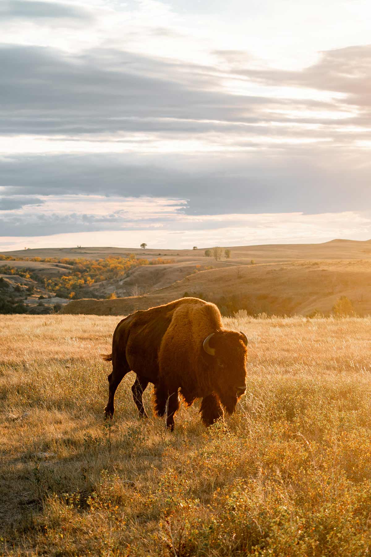
- Wildlife watching: The park is home to a wide variety of wildlife, including bighorn sheep, desert tortoises, and many species of birds.
Overall, Lake Mead National Recreation Area is a great place to enjoy nature, outdoor activities, and learn about the history of the area, and the park’s beautiful desert landscapes, and its wide variety of recreational opportunities make it a perfect destination for visitors of all ages and interests.
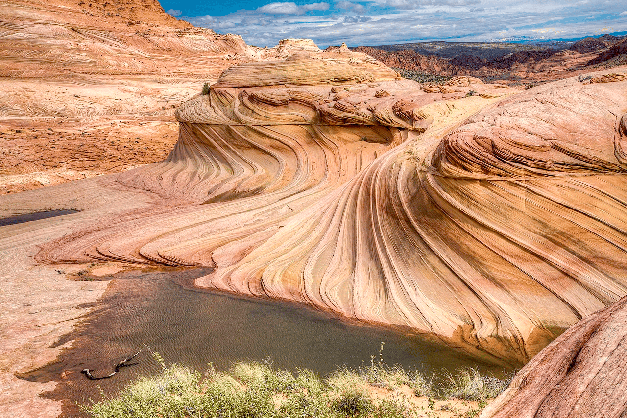
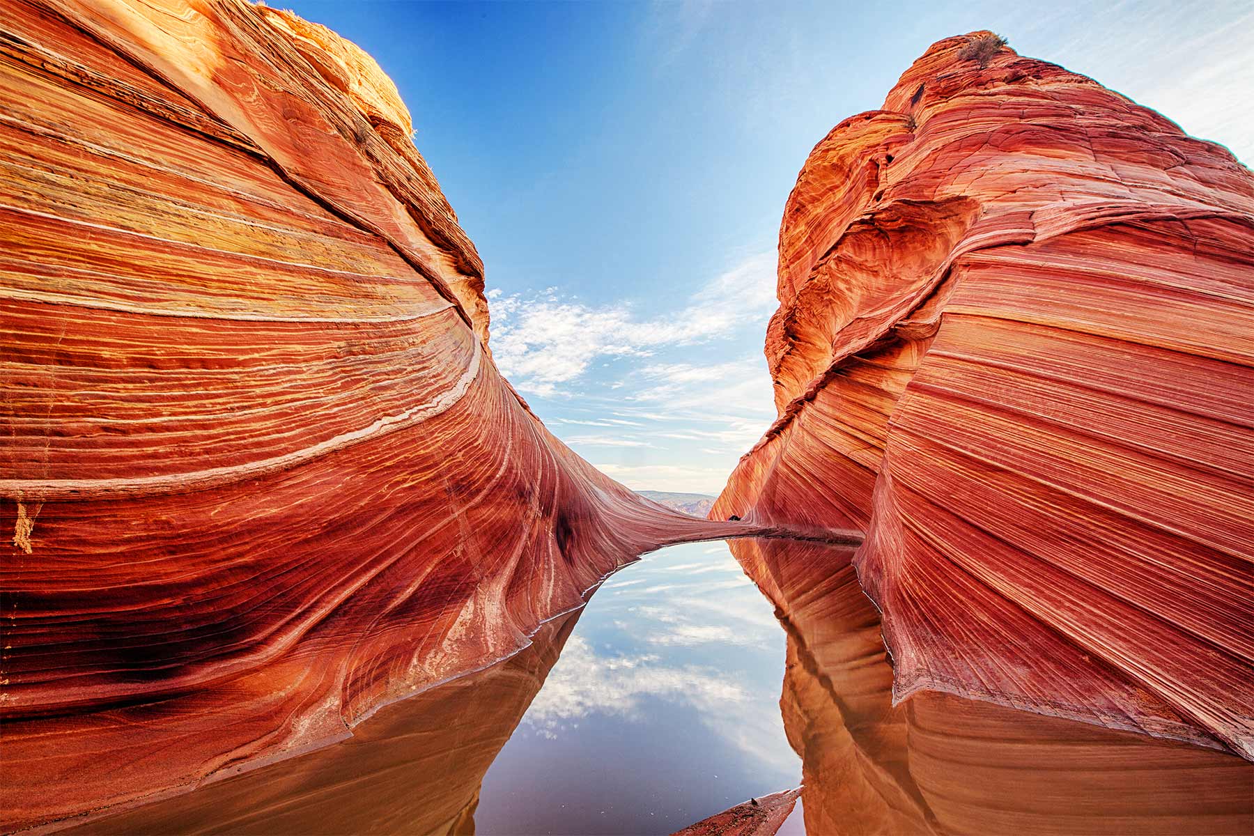
14. Vermilion Cliffs National Monument
Vermilion Cliffs National Monument covers nearly 300,000 acres and is known for its striking red and orange cliffs, deep canyons, and unique desert wildlife.
It was established as a national monument in 2000 by President Bill Clinton under the American Antiquities Act of 1906.
The area now known as Vermilion Cliffs National Monument has a rich and diverse history. The earliest known inhabitants of the area were the Anasazi, also known as the Ancestral Puebloans, who lived in the region from around 400 AD to 1300 AD. They built cliff dwellings and pit houses, which can still be seen today in the Paria Canyon-Vermilion Cliffs Wilderness area.
After the Anasazi, the Paiute and other tribes settled in the area. They used the area’s natural resources, such as plants, animals, and minerals, to sustain their way of life.
In the late 1800s, the area was explored by European Americans, including John Wesley Powell and his party, who were the first to document the area’s geology, biology, and archaeology.
Grazing & Mining Activities Threatened The Area
In the early 20th century, the area was used for grazing and mining activities. The mining activities had a significant impact on the area’s natural resources and habitats.
In the late 20th century, conservation groups and the Bureau of Land Management proposed the area to be protected as a national monument, to preserve its natural and cultural resources for future generations.
In 2000, President Bill Clinton established the Vermilion Cliffs National Monument, which encompasses nearly 300,000 acres of remote and rugged terrain, including the Vermilion Cliffs, the Paria Canyon-Vermilion Cliffs Wilderness, White Pocket, Coyote Buttes, and many other unique and beautiful landscapes.
Some Of The Most Beautiful & Unique Landscapes In The American Southwest
Some of the main features of the monument include:
- Vermilion Cliffs: These striking red and orange cliffs are the most prominent feature of the monument and are visible for miles around. They are made of Navajo Sandstone, and are composed of iron oxide which gives them their red color.
- Paria Canyon-Vermilion Cliffs Wilderness: This wilderness area encompasses nearly 100,000 acres of remote and rugged terrain, and is known for its deep canyons, slot canyons, and natural arches.
- White Pocket: A unique and beautiful area of undulating white and red layered rock formations.
- Coyote Buttes: This area is known for its unique rock formations, including The Wave, a beautiful and iconic rock formation that is popular with hikers and photographers.
- Hiking and backpacking: The monument offers several hiking trails, including the popular Wire Pass Trail and Buckskin Gulch, which are known for their scenic views and unique geology.
- Wildlife: The monument is home to a wide variety of wildlife, including bighorn sheep, mule deer, mountain lions, and many species of birds.
- Photography: The monument offers many opportunities for photography, with its beautiful red and orange cliffs, deep canyons, and unique rock formations.
- Camping: There is no designated campground within the monument, but dispersed camping is allowed in some areas with a permit.
Vermilion Cliffs National Monument is a remote and rugged area that offers visitors a chance to explore some of the most beautiful and unique landscapes in the American Southwest. It is a perfect destination for those who enjoy hiking, backpacking, photography, and wildlife watching.
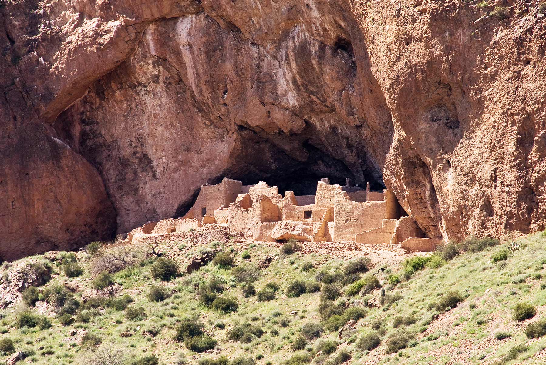
13. Tonto National Monument
If you’re someone who has never experienced a cliff dwelling then you’re in for a real treat because visitors to Tonto National Monument have the opportunity to marvel at two Salado-style cliff dwellings.
You can also see colorful pottery, woven cotton cloth, and other artifacts tell a story of people living and using resources from the northern Sonoran Desert from 1250 to 1450 CE.
Tonto was established in 1907. It’s mission is to protect several cliff dwelling sites and numerous smaller archeological sites scattered throughout the highlands and alluvial plains within the Tonto Basin, Arizona.
The Lower Cliff Dwelling is one of two large sites accessible to the public, and is the primary site visited in the Monument throughout the year.
Among the Arizona National Parks, if I’m looking to see fabulous cliff dwellings then this one is my favorite.
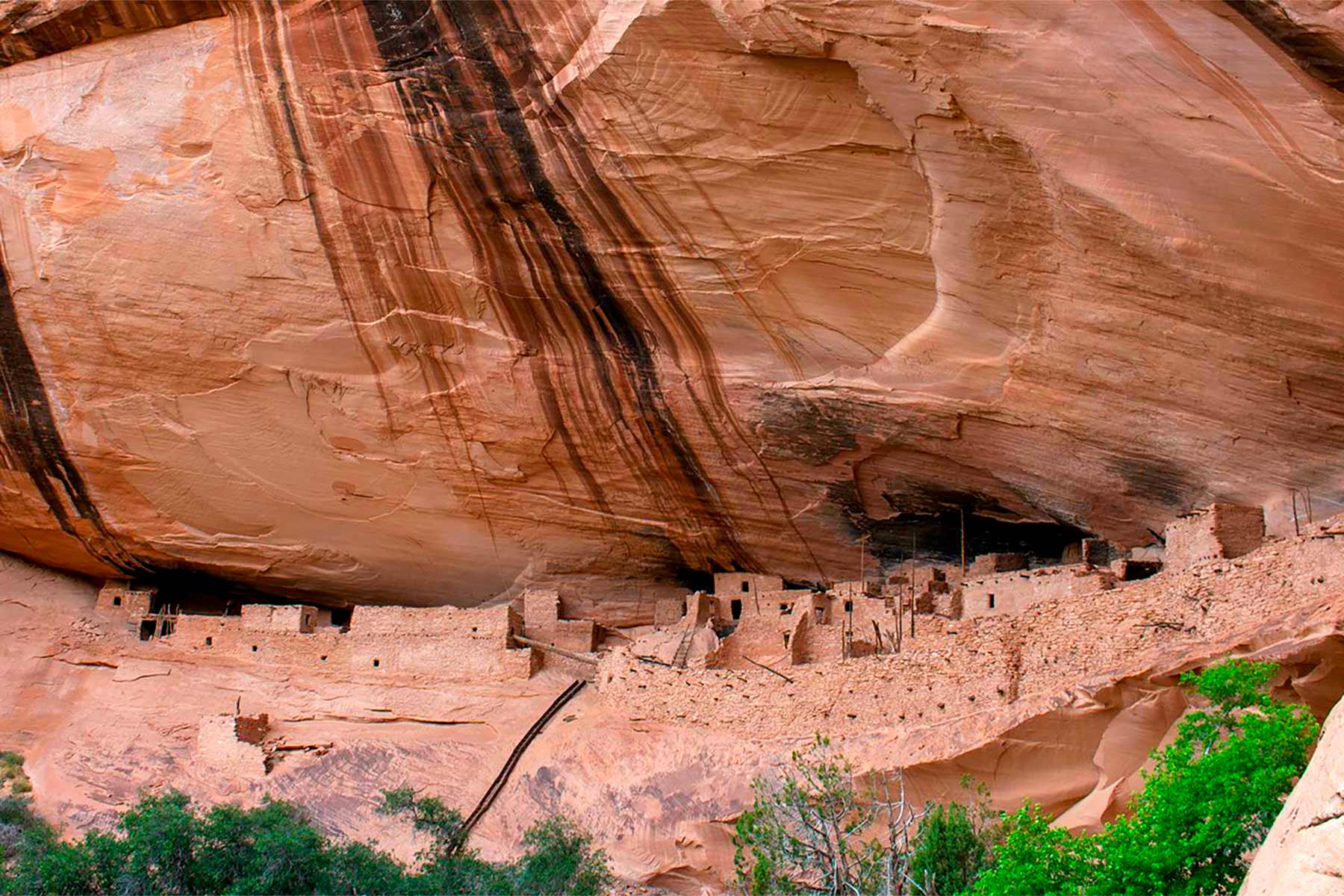
12. Navajo National Monument
Imagine exploring canyons that had been occupied for centuries prior to the birth of the United States.
The Hopi, San Juan Southern Paiute, Zuni, and Navajo are tribes that inhabited the canyons of the Navajo National Monument. Before they were Arizona National Parks, they built homes into the natural sandstone alcoves.
The monument was created in 1909 to protect the remains of three large pueblos dating to the 13th century. Archaeological evidence uncovered there documents the use of this region over the past several thousand years.
Today the park offers a visitor center, self-guided trails, free seasonal guided cliff dwelling tours, free camping, and more.
Best Trails at Navajo National Monument
Imagine walking the same ground trod by Native Americans centuries ago. There are three self-guided trails:
- The Sandal Trail which is a 1.3 mile round-trip paved trail to the Betatakin Cliff Dwelling overlook.
- The Aspen Trail which is a 0.8 mile steep round-trip nature trail that leads to an overlook of a relict forest on the canyon floor.
- The Canyon View Trail which is a 0.8 mile round-trip canyon rim trail that leads to the park’s historic ranger station and provides views of the canyon.
There are also ranger-guided cliff-dwelling tours available at Betatakin and Keet Seel.
CHECK OUT: List Of 128 BEST US National Monuments Ranked
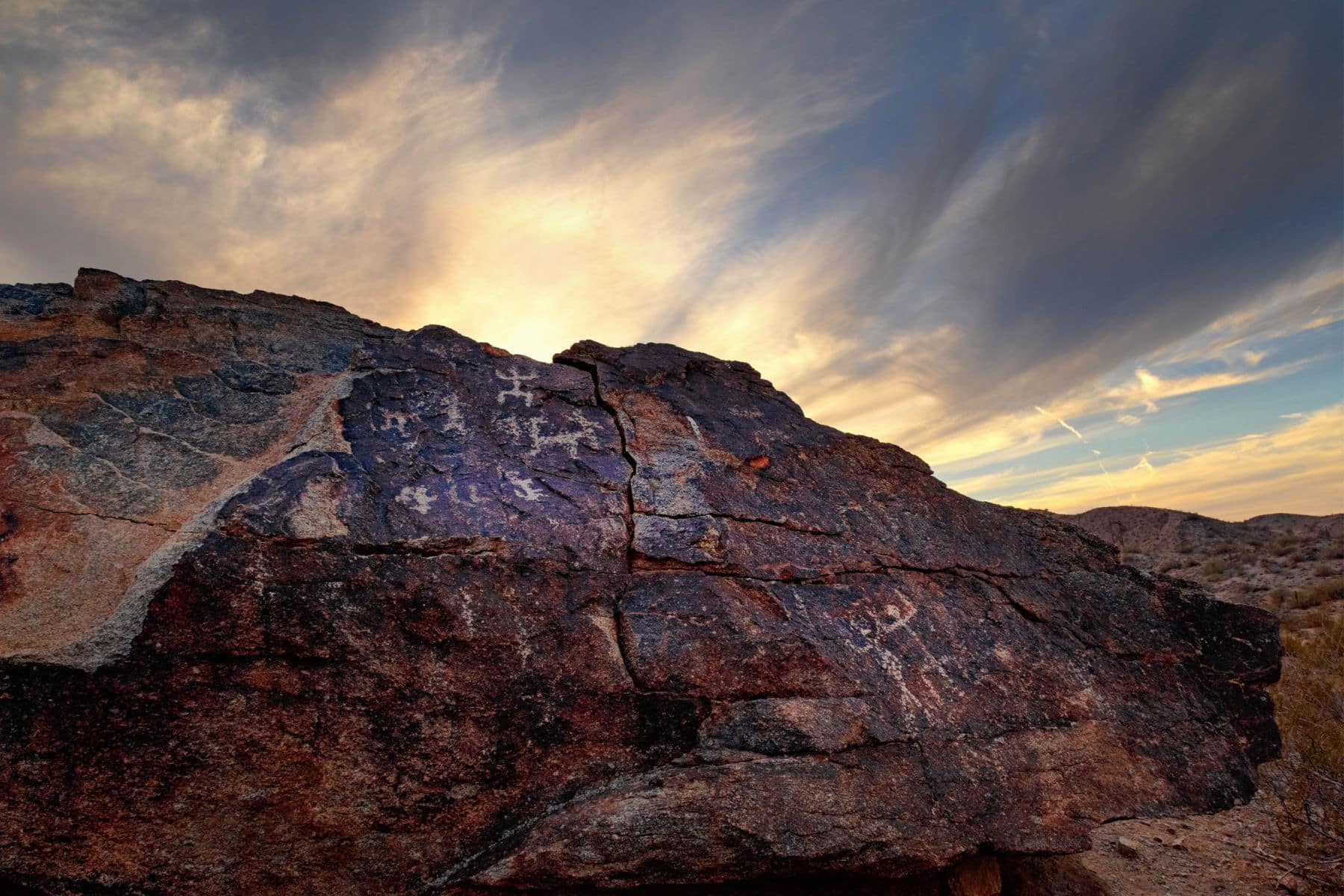
11. Agua Fria National Monument
Located just an hour north of Phoenix, Arizona lies one of the most beautiful national monuments in the southwest, Agua Fria National Monument.
Agua Fria National Monument contains vast collections of pictographs and petroglyphs, a tremendous diversity of wildlife, and deep desert canyons.
One thing to keep in mind for folks interested in visiting is that four wheel drive is king in this national monument. If you don’t have a four wheel drive vehicle then most of the monument is completely inaccessible.

Things To Do
Here are a few things you can do when visiting Agua Fria National Monument:
- Hiking: The monument offers several hiking trails, including the popular Agua Fria Trail, which winds through a scenic desert landscape and passes by several ancient Hohokam Indian ruins.
- Backpacking: The monument is home to several backpacking trails, including the Agua Fria River Trail, which follows the scenic Agua Fria River and passes by several ancient Hohokam Indian ruins.
- Archaeology: The monument is home to several ancient Hohokam Indian ruins, including the Agua Fria Pueblo, which dates back to around 1450 AD. Visitors can hike to the ruins and learn about the Hohokam people and their way of life.
- Wildlife watching: The monument is home to a wide variety of wildlife, including bighorn sheep, mule deer, mountain lions, and many species of birds.
- Photography: The monument offers many opportunities for photography, with its unique geology, ancient ruins, and diverse wildlife.
- Camping: The monument has no designated campground, but dispersed camping is allowed in some areas with a permit.
- History: The monument has rich cultural history that can be explored through visiting the ancient Hohokam Indian ruins, learning about the Hohokam people and their way of life.
More Arizona National Parks & Monuments
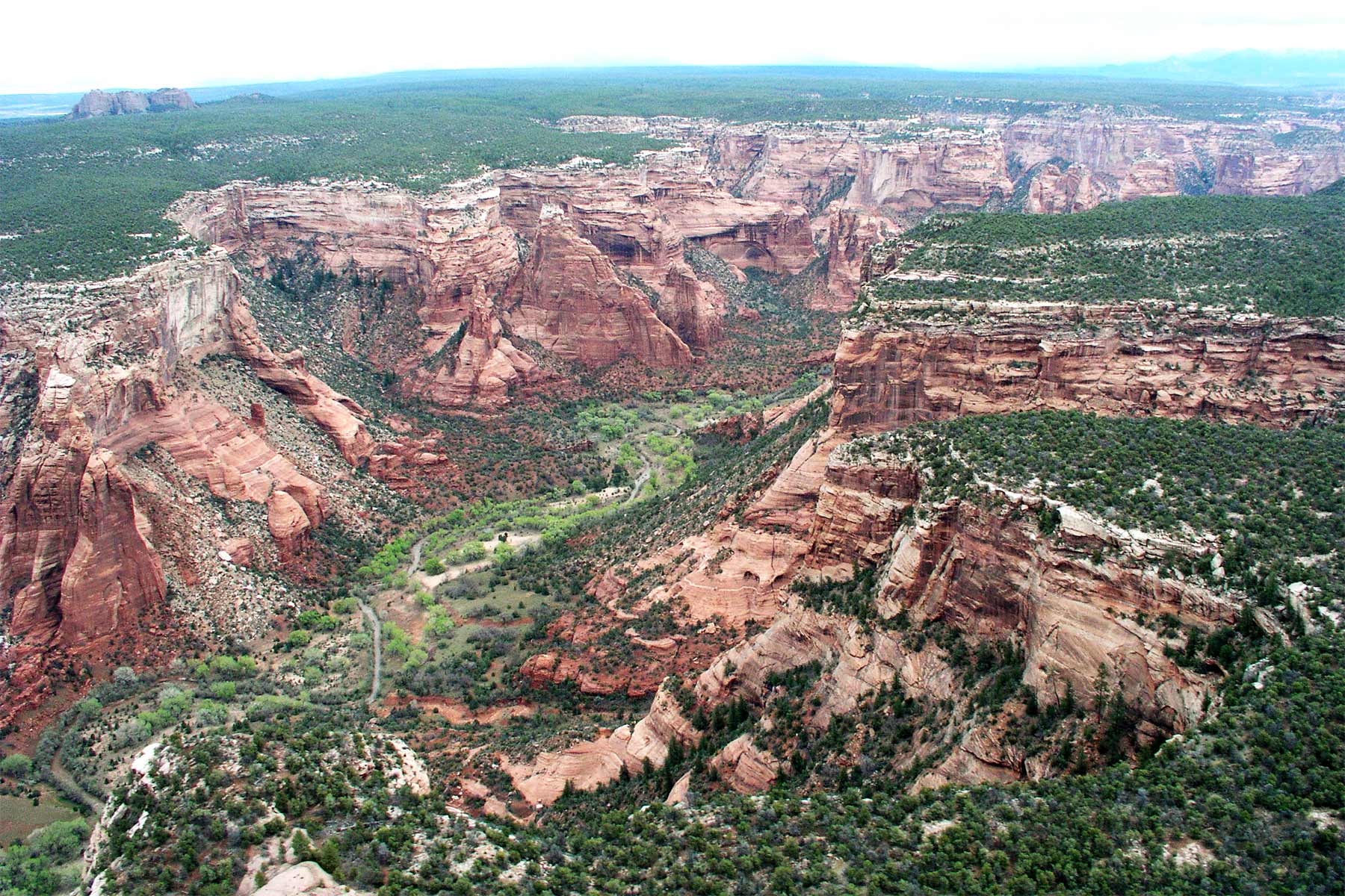
10. Canyon de Chelly National Monument
Canyon de Chelly National Monument covers 83,840 acres and is named after the Canyon de Chelly (pronounced “de shay”) which is a deep and winding canyon that was cut by the Chinle Wash. The canyon is home to several ancient Puebloan cliff dwellings ruins and is considered one of the most important archaeological sites in the Southwest.
The canyon has been continuously inhabited for over 5,000 years, first by the Ancient Puebloan people, also known as the Anasazi, and later by the Navajo people. The ancient Puebloan people built cliff dwellings homes in the canyon and farmed the canyon floor. The Navajo people, who still live in the canyon today, arrived in the area around the late 1700s.
The monument offers several visitor services, including guided and self-guided tours of the canyon floor, guided hiking and backpacking trips, and cultural demonstrations. Visitors can also explore the canyon on their own, with a permit, by foot or on horseback.
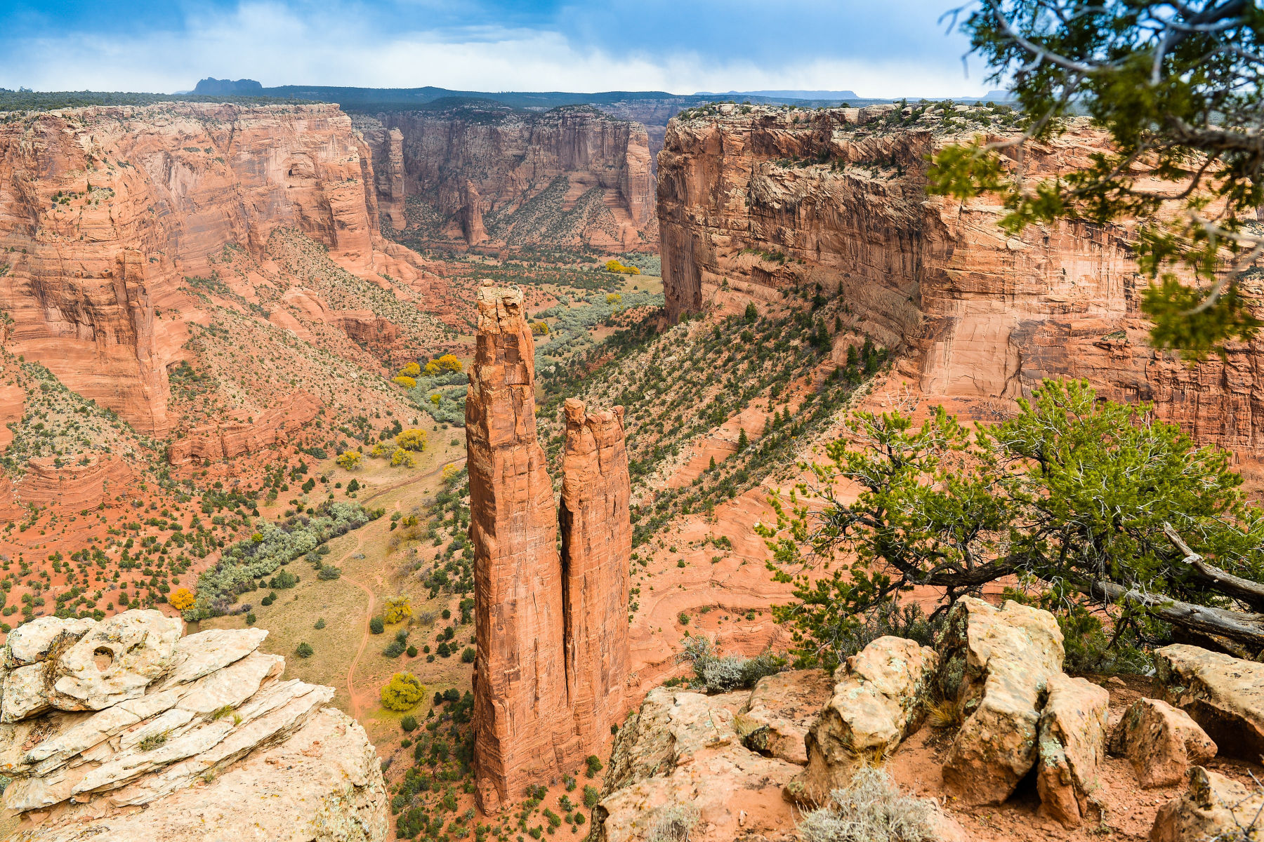
White House Ruin
One of the most popular sights at the monument is the White House Ruin, which is a well-preserved cliff dwelling located on the canyon floor. Visitors can take a self-guided tour of the ruin and learn about the ancient Puebloan people and their way of life.
The monument also offers several scenic drives, including the North Rim Drive, which offers panoramic views of the canyon and the South Rim Drive which offers views of the White House Ruin and other ancient Puebloan cliff dwellings ruins.
Canyon de Chelly National Monument is a great destination for those interested in history, archaeology, and the natural beauty of the Southwest. The monument offers a chance to explore ancient Puebloan cliff dwelling ruins, learn about the Navajo people and their way of life, and experience the beauty of the canyon landscape.
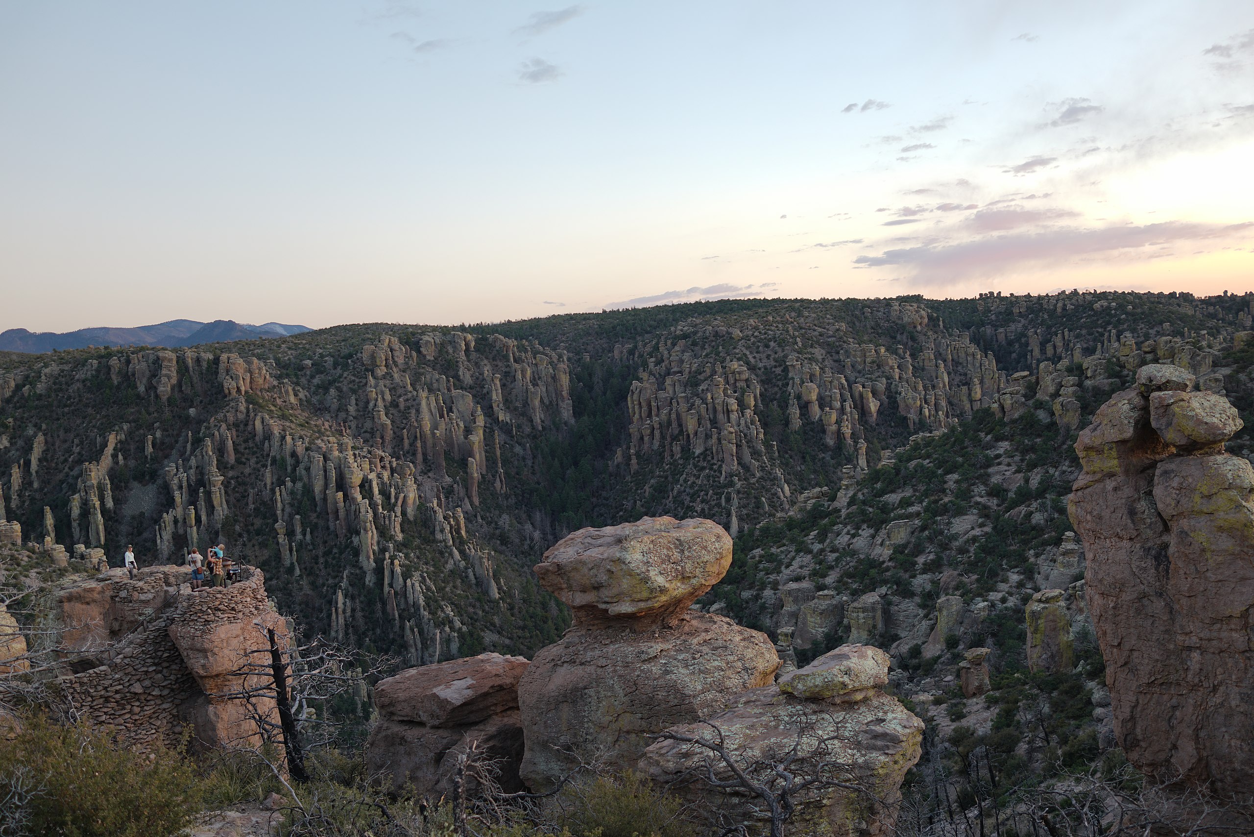
9. Chiricahua National Monument
Among the other intriguing Arizona National Parks is the Chiricahua National Monument which is best described as a “wonderland of rocks.”
This is a place where visitors can marvel at geologic wonders while birding, camping, hiking, or watching the wildlife which call this magical place their home.
Mother Nature can make a masterpiece to rival that of the greatest artists and Chiricahua is a case in point. Eruptions from the Turkey Creek Volcano spewed ash over 1,200 square miles forming layers of gray rock called rhyolite.
Believe it or not, the amazing pinnacles, which are known as “standing up rocks,” were formed 27 million years ago. The park comprises 12,025 acres and 84 percent of this is designated as wilderness. It has trails for everyone irrespective of their skill level.
An eight-mile scenic drive climbs from the grasslands to the summit at Massai Point.
Things To Do At Chiricahua National Monument
Bonita Canyon Campground is open year-round. The sites are available by online reservations through www.recreation.gov by searching Chiricahua National Monument. (Source: NPS)
While you’re visiting I recommend you take the Bonita Canyon Scenic Drive. It has an overlook with a 360-degree view of Rhyolite Canyon, adjacent valleys, and surrounding mountain peaks. It’s gorgeous! Don’t forget to bring your camera.
There’s picnicking at the Bonita Creek and Faraway picnic areas. They have tables, grills, trashcans, and restrooms. Massai Point, Echo Canyon, and Sugarloaf areas have tables and restrooms as well. Everything you’ll need to enjoy a feast with family or friends.
CHECK OUT: Arizona Bucket List Adventure Guide & Journal: Explore The Natural Wonders & Log Your Experience!
8. Walnut Canyon National Monument
You can take a trail like no other at Walnut Canyon National Monument. The one mile round-trip Island Trail provides access to 25 cliff dwellings. If you’re looking to see stunning canyon walls when visiting the Arizona National Parks then this is the place to visit.
And while you’re exploring you’ll see curved canyon walls and remarkable rocks. Among the amazing geological formations of the canyon itself are the former homes of ancient inhabitants.
As you walk along the trails you can imagine life within Walnut Canyon, while visiting actual pueblos and walking in the steps of those who came before. It’s just like you’re in a dream only you’re not.
7. Ironwood Forest National Monument, Arizona
Magnificent herds of bighorn sheep, thousands of giant saguaro cacti, and home to some of the highest concentrations of Ironwood trees in the world, Ironwood Forest National Monument falls into our “underrated” monuments category.
Ironwood National Monument is located in Arizona’s sonoran desert and also preserves a collection of over 200 Hohokam and Paleoindian sites.
Recreational opportunities abound at Ironwood National Monument including primitive camping, hiking, mountain biking, horseback riding, hunting, birdwatching, and more.
In the spring, visitors will be treated to dazzling wildflower displays.
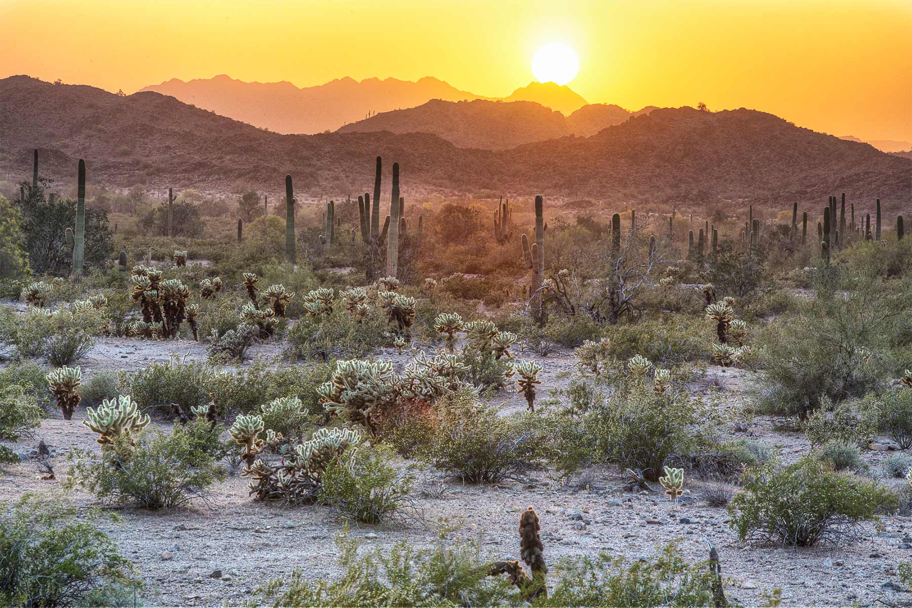
6. Sonoran Desert National Monument
Sonoran Desert National Monument consists of nearly half a million acres of beautiful, rugged mountain ranges and vast desert cactus plains.
The monument protects some of the most biologically diverse pieces of desert in the world as well as numerous important archaeological and historic sites.
The scenery at Sonoran Desert is really beautiful, among the finest desert scenery in America.
For those interested in visiting Sonoran Desert National Monument be sure to pack plenty of provisions as there is no drinking water available in the monument itself.
Despite being just an hour from Phoenix, cell service is extremely limited so plan for emergency situations.
More Arizona National Parks & Monuments
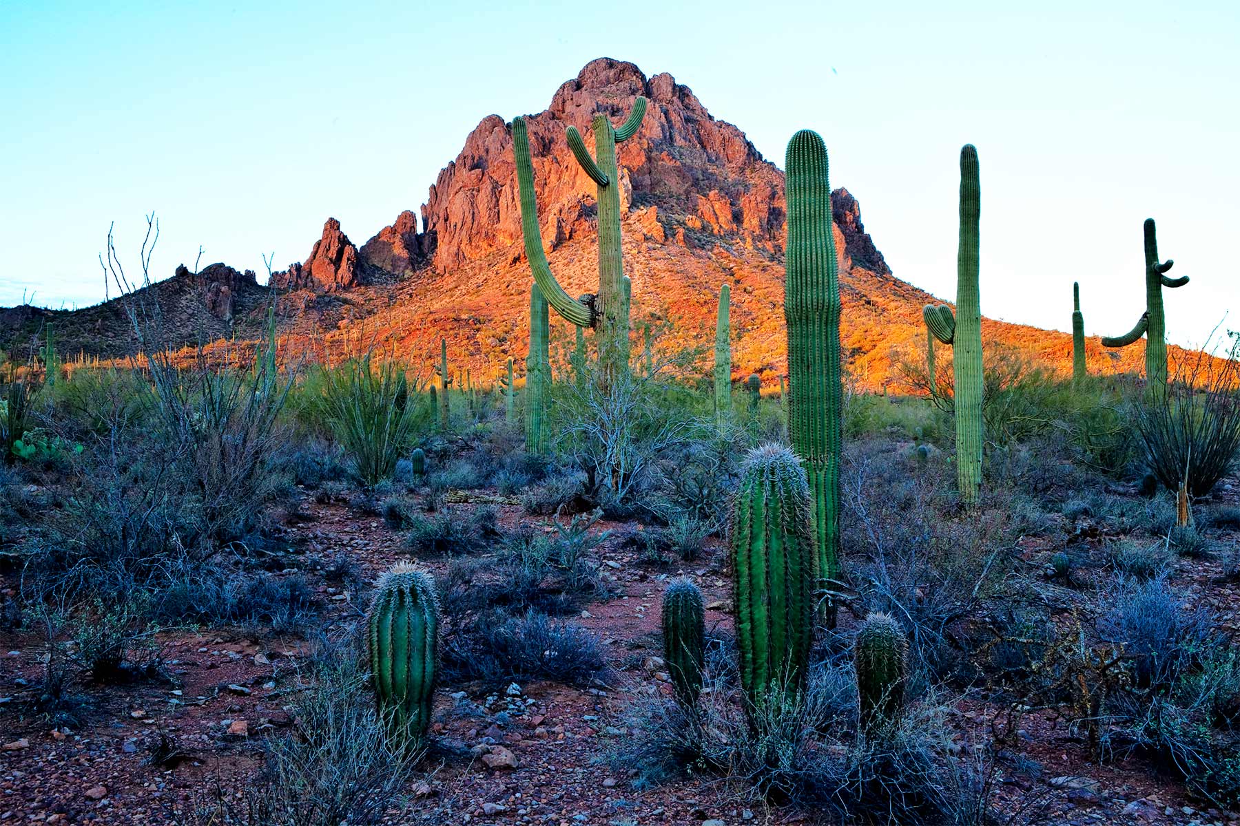
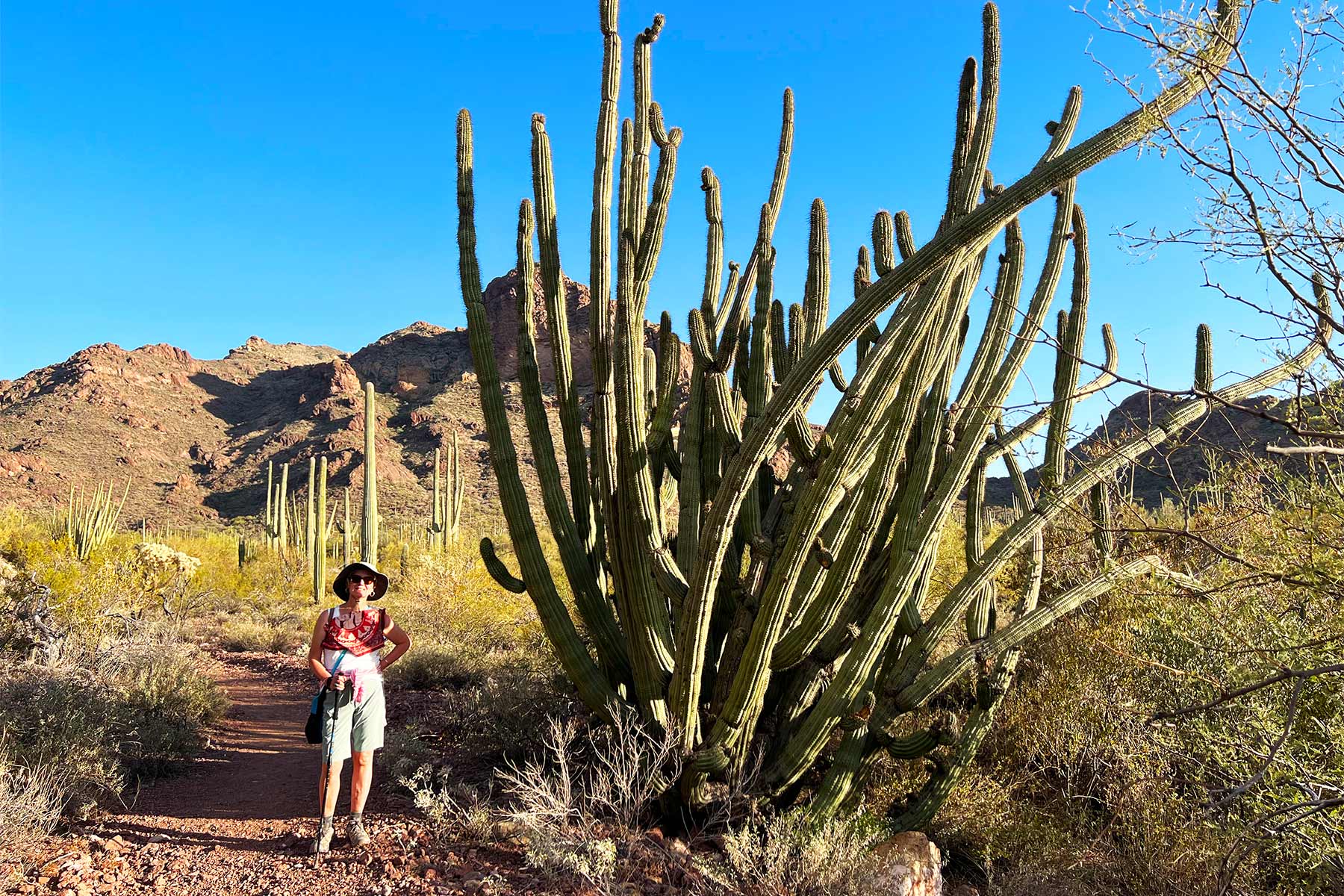
5. The Organ Pipe Cactus National Monument
When you visit the Organ Pipe Cactus National Monument you will discover that it’s not only a great Arizona National Park, but also an International Biosphere Reserve. Go there and behold a thriving community of plants and animals.
At Organ Pipe, visitors will have a variety of camping experiences to choose from including developed, primitive, and backcountry. There are some wonderful trails to hike which include:
- Visitor Center Nature Trail (.01 miles)
- Campground Perimeter Trail (1 mile)
- Desert View Trail (1.2 miles)
- Palo Verde Trail (2.6 miles)
There are mountain trails available to hike as well at Ajo and Puerto Blanco.
Enjoy The Scenery At Organ Pipe Cactus
There are some wonderful scenic drives in this Arizona national park which include:
- Ajo Mountain Drive-It’s a 21 mile, mostly gravel road usually passable by normal passenger car and it’s also a popular biking route too.
- Puerto Blanco Drive-It provides access to the Pinkley Peak Picnic Area, Red Tanks trail head, Dripping Springs, and Quitobaquito Springs.
- Bates Well Road-It extends for 23 miles from Hwy 85 to the boundary with Cabeza Prieata Wildlife Refuge.
- Pozo Nuevo Road-It’s a 14 mile road which offers views of the Cipriano Hills, the Growler Valley, and the historic Pozo Nuevo line-camp.
CHECK OUT: ALL 63 NATIONAL PARKS RANKED BY EXPERTS
4. Grand Canyon-Parashant National Monument
Grand Canyon-Parashant National Monument is a remote and rugged wilderness area located in northwest Arizona.
It is adjacent to the southern boundary of the Grand Canyon and spans over 1 million acres of diverse landscapes, including canyons, plateaus, and mountains.
The monument is home to a wide variety of plant and animal life, as well as important cultural and historical sites.
There are no developed facilities or services within the monument, and access is primarily by dirt road. It offers opportunities for activities such as backpacking, camping, and wildlife viewing, but visitors should be well-prepared and familiar with wilderness travel.
3. Petrified Forest National Park
Our Favorite Resources: Guidebook | Where to Stay
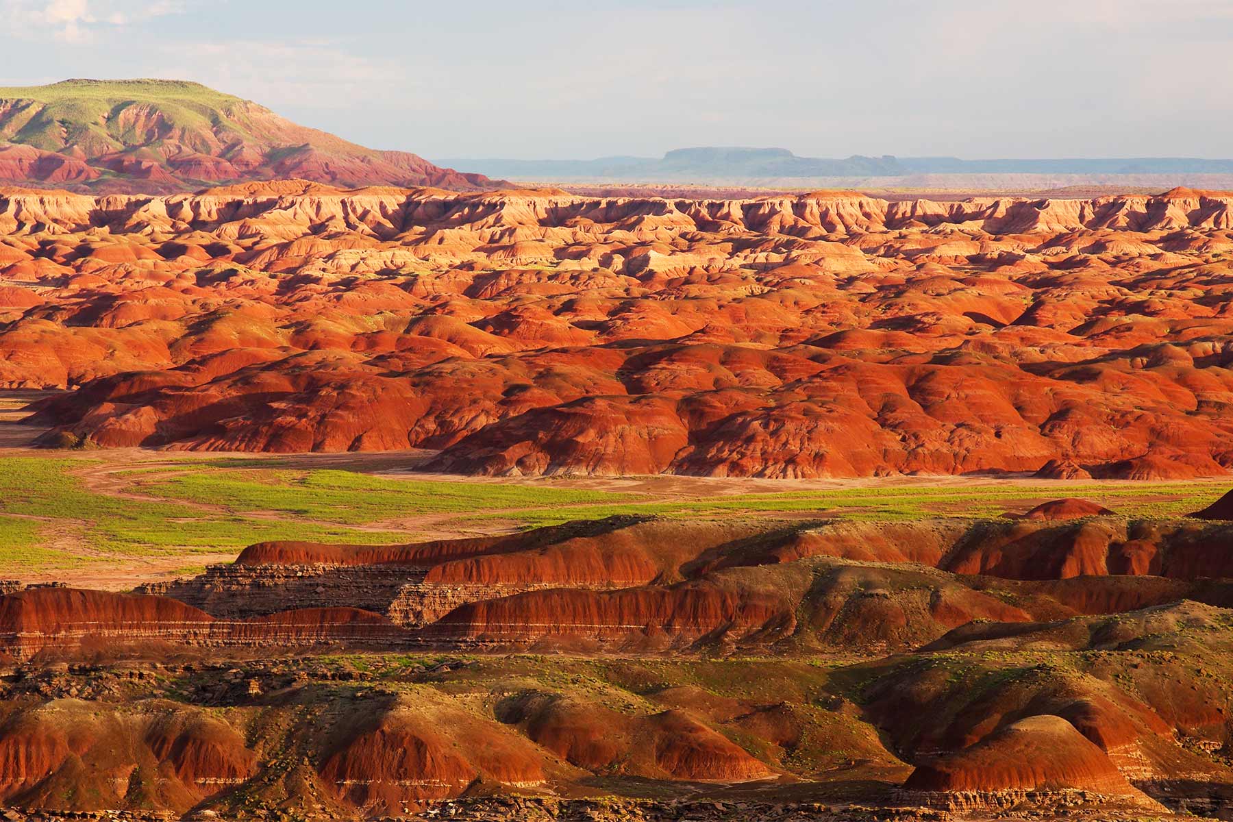
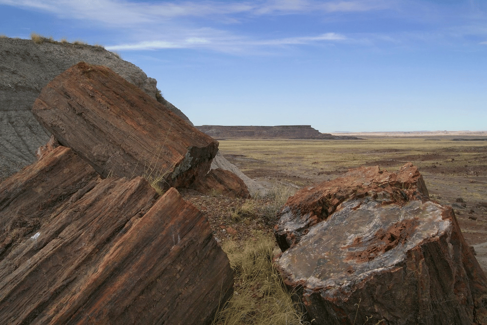
Among the incredible Arizona National Parks you will discover a place that is like something from another world.
Petrified Forest National Park, located in northeastern Arizona, is home to the Rainbow Forest. It’s chock full of colorful petrified wood.
If you’re new to the park then the visitor center is always a great place to start out. There’s an 18 minute orientation video to familiarize you with the park. There’s also a bookstore, exhibits, gift shop, restaurant and public amenities.
While You’re There Check Out The Rainbow Forest Museum
It’s also home to the Rainbow Forest Museum, which features paleontology exhibits and many trail access points.
In the center of the park you’ll find the petroglyphs of Newspaper Rock and the ruined village of Puerco Pueblo.
If you travel to the north of the park, you can visit the Painted Desert Inn, a 1930s adobe building, is a museum with Hopi murals.
Things To Do In Petrified National Forest
There are some wonderful hiking trails in this Arizona national park that highlight topics like archeology, natural environments, and the famous petrified logs. If you’re interested in backcountry hiking you can pick up a free guide at one of the park’s visitor centers.
The Petrified National Forest Park also has a designated Wilderness Area which consists of two units: one in the north allowing hikers to roam the red and orange part of the Painted Desert; and one in the south showcasing highly eroded landscapes, badlands, and petrified wood.
Bicycling in the park—including ebikes—is permitted on paved park roads and parking areas open to the public. Horseback riding is also available provided you BYOH (Bring Your Own Horse).
If you’re planning to stay overnight then be advised that there is no RV, car, or front country camping in the park. There is no boondocking, dispersed or “primitive” camping, or just pulling off into a parking area.
There is only backpacking/hiking into the designated Petrified Forest National Wilderness Area to spend the night in the park, at least a mile from your vehicle.
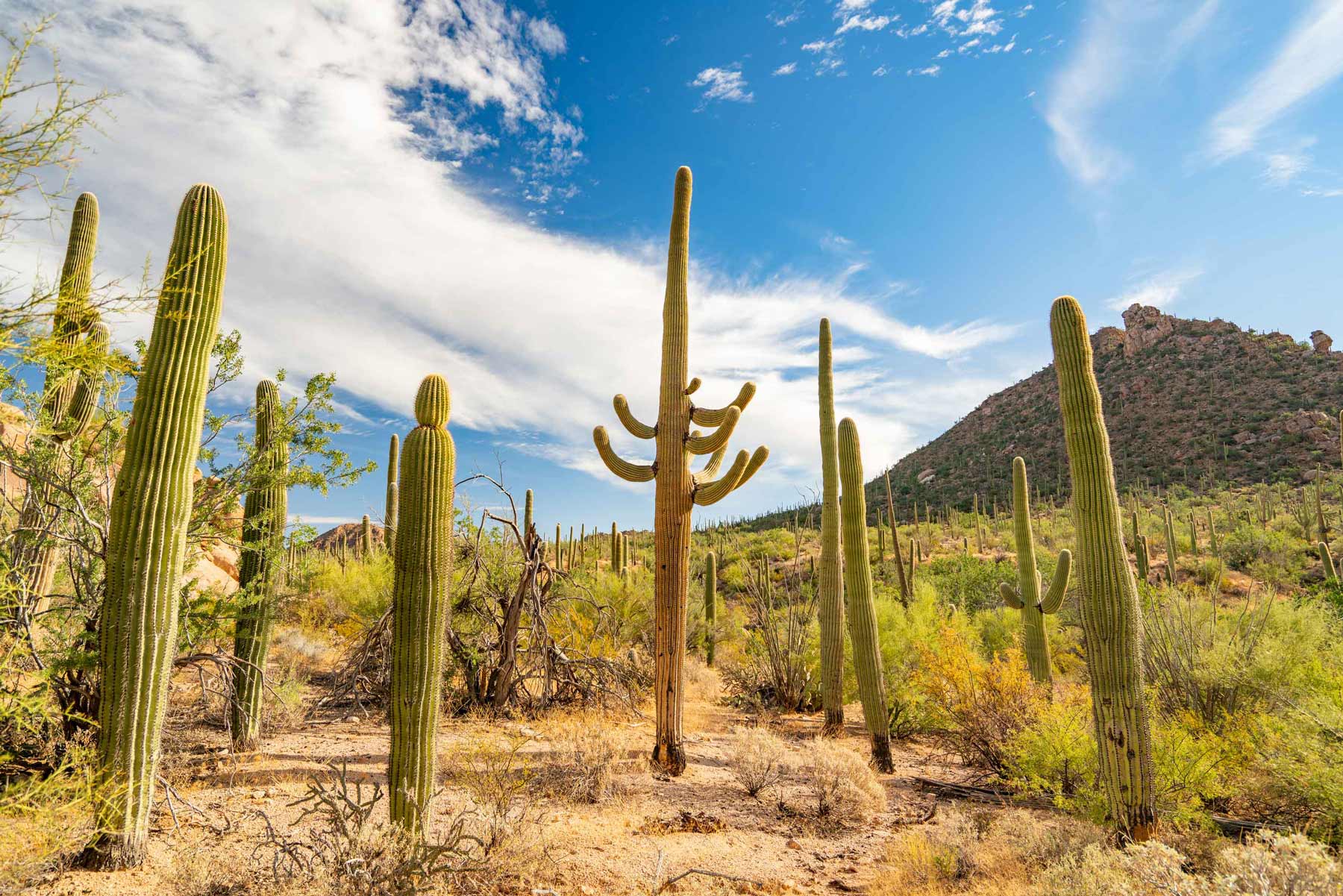
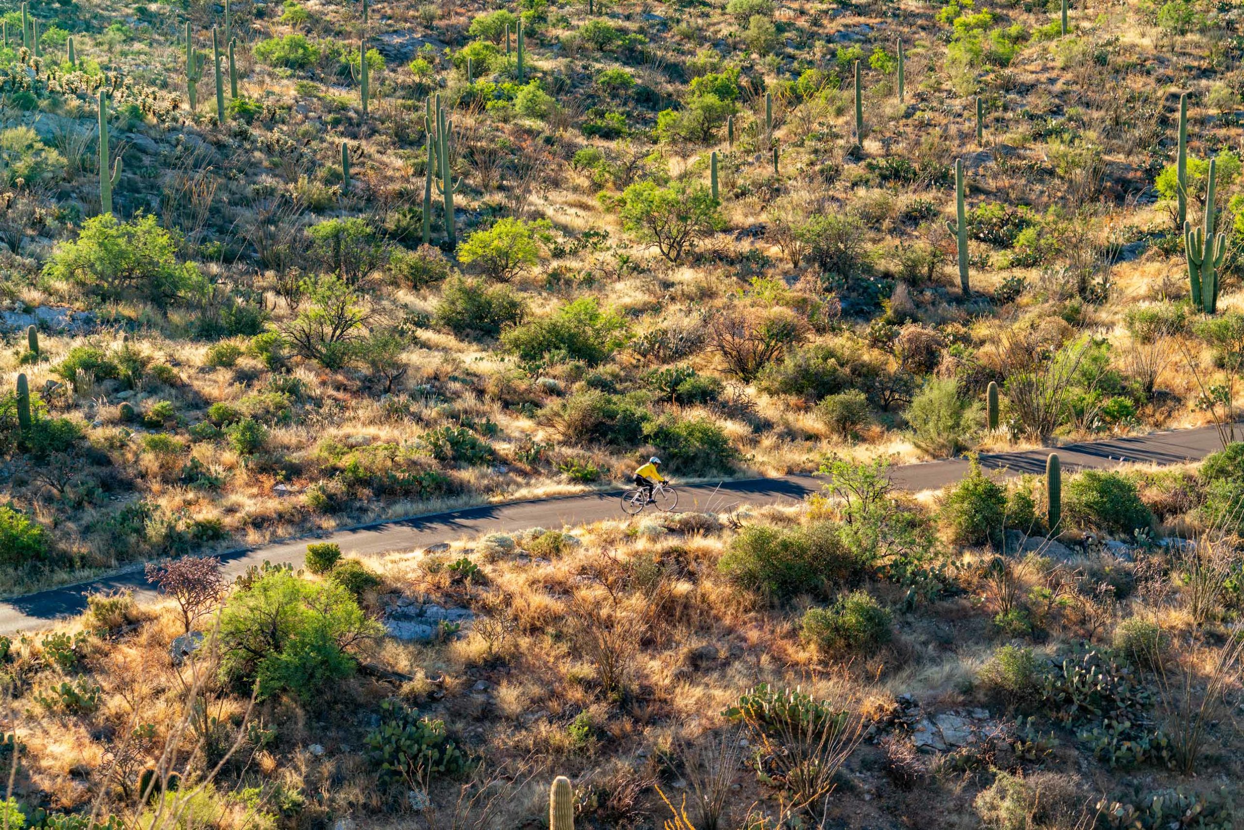
2. Saguaro National Park
Our Favorite Saguaro Resources: Guide / Hikes / Things to Do / Map / Guidebook / Where to Stay / Video
Among the Arizona National Parks are 3 capital letter national parks. Saguaro National Park is one of them. It’s unique in that it is bisected by the city of Tucson.
The two districts are – East & West. It takes 30-45 minutes to travel between the two districts. The park is home to the Saguaro Cactus. It’s a large, tree-sized cactus with a relatively long lifespan–up to 250 years.
The primary outdoor activities are biking, camping, hiking and horseback riding. It’s well worth a visit to this park as the desert beauty makes for an otherworldly experience.
What Is The Difference Between A National Park & A National Park Site? Check Out: What Is A National Park Really?
Things To Do At Saguaro National Park East District
The Cactus Forest Scenic Loop Drive is a paved, combination one-way and two-way road that features several trailheads, scenic vistas, and pullouts in a total of 8 miles.
To reach the hiking trails from the visitor center, you must drive into the park on the Loop Drive. The first trailhead is accessed in about 2 miles and begins at the Mica View Picnic Area. There are several trailheads with parking off the Loop Drive.
For a more complete list, check out our article on the best things to do in Saguaro National Park.
Things To Do At Saguaro National Park West District
The Scenic Bajada Loop Drive is a great way to explore the district’s foothills. There are scenic pullouts, picnic areas, and hiking trailheads in a 6 mile loop.
Bicycling is permitted along the Bajada Loop Drive and all paved roads. Bicycling is not permitted on any trails, except the 0.5 mile Belmont Multi-use trail and the 2.5 mile Golden Gate Multi-use trail. (Source: NPS)
Check Out Our Saguaro Film
SAGUARO is the culmination of weeks spent filming in one of the most unique and vibrant deserts in the world, the Sonoran Desert.
Encompassing over 90,000 acres, Saguaro National Park preserves vast forests of the iconic saguaro cactus, rare wildlife, and majestic landscapes.
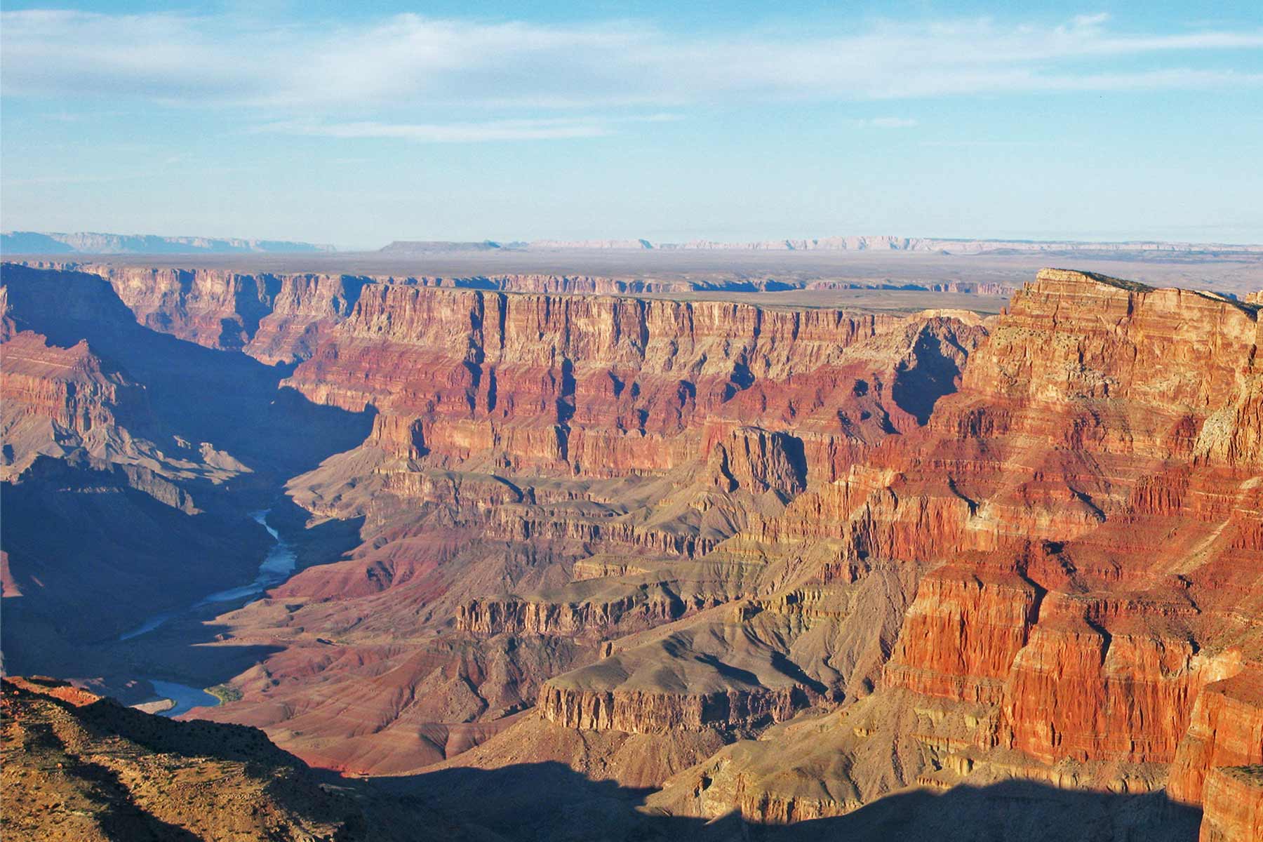
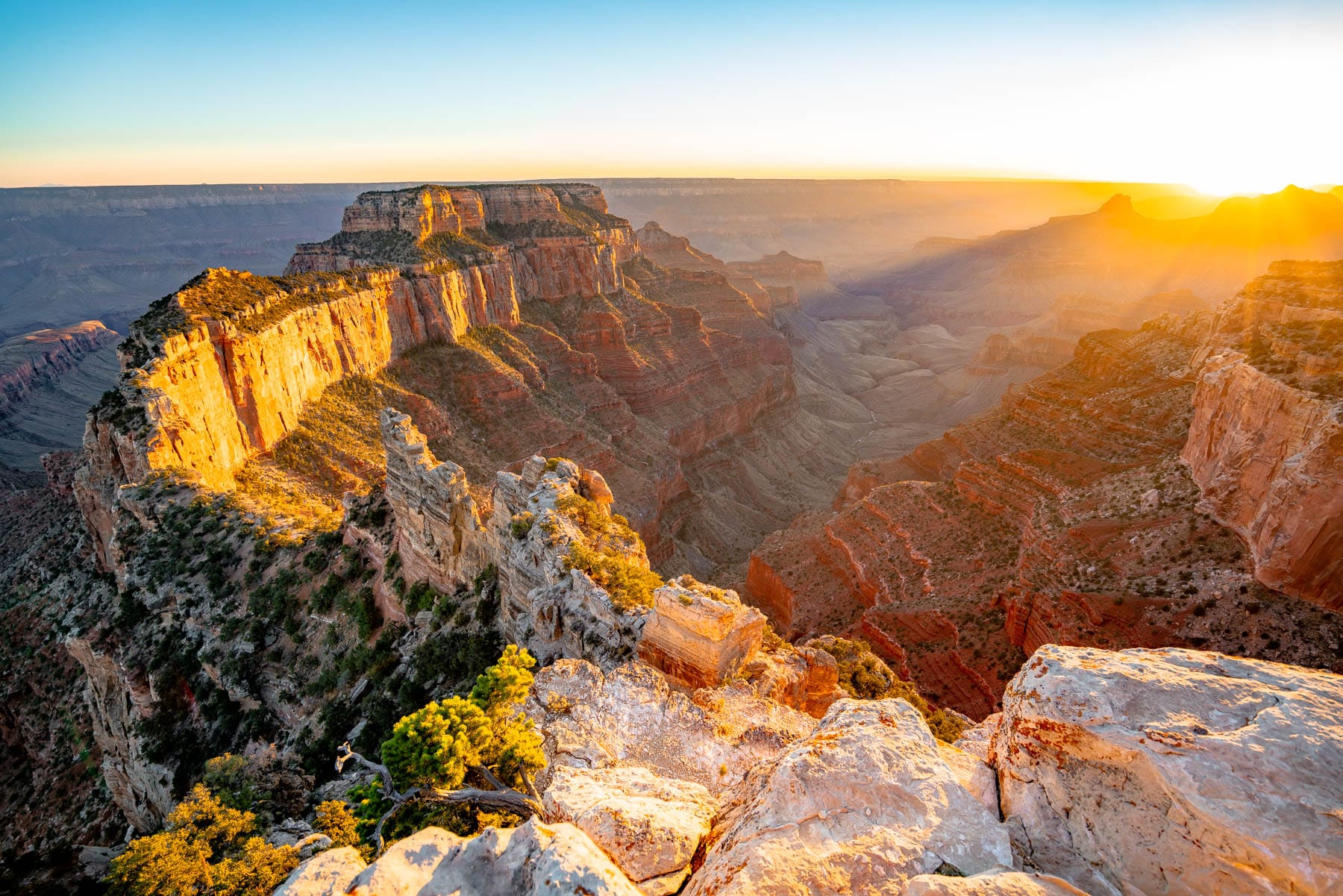
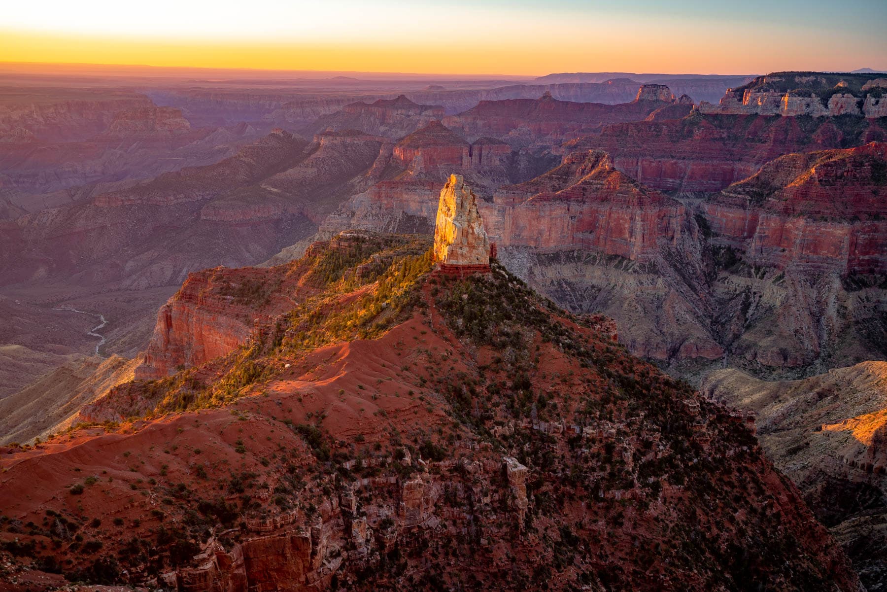
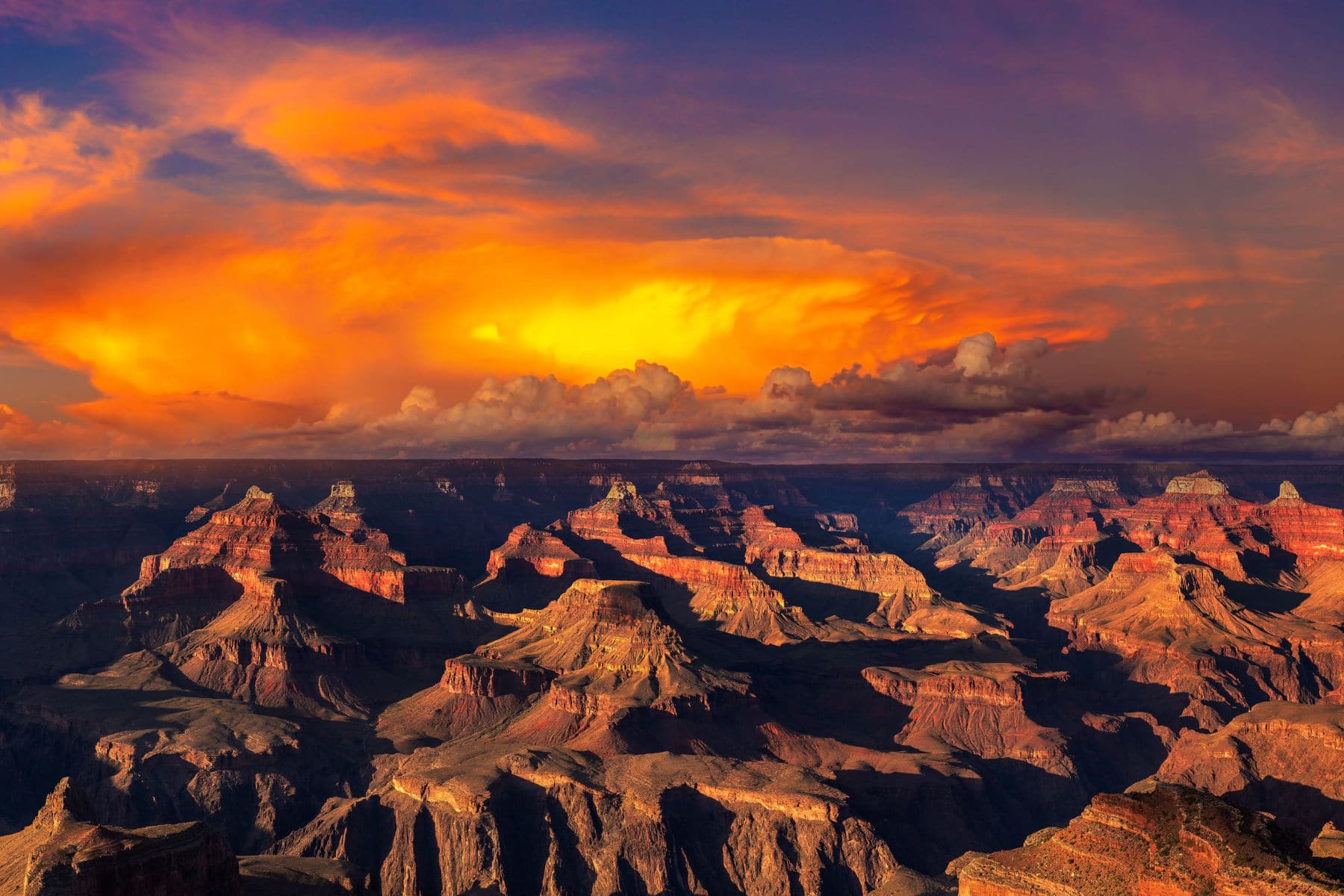
1. Grand Canyon National Park
Our Favorite Resources: Map / Guidebook / Things to Do / Best Views / Closest Cities / South Rim / Where to Stay
One of the Arizona National Parks, Grand Canyon National Park to be specific, has a special significance for the co-founders of More Than Just Parks.
We founded More Than Just Parks after a spur of the moment road trip with friends to the Grand Canyon during which we truly discovered the National Parks for the first time.
As for the place which forever changed our lives, it’s a mile-deep gorge in northern Arizona. Scientists estimate the canyon may have formed 5 to 6 million years ago when the Colorado River began to cut a channel through layers of rock.
Humans have in and out of the canyon there since the last Ice Age. The first Europeans to reach the Grand Canyon were Spanish explorers in the 1540s.
President Benjamin Harrison first protected the Grand Canyon in 1893 as a forest reserve, and it became an official United States National Park in 1919.
The Powell Expedition & The Grand Canyon
I don’t know why Hollywood hasn’t made a film about this expedition. It’s Lewis & Clark Meets Indiana Jones!
In 1869, John Wesley Powell, a one-armed Civil War veteran and self-trained naturalist, embarks on a daring descent of the mighty Colorado River. Powell boldly goes where no one has gone before! Into the Great Unknown!
Take A Deeper Dive With A Story That’s Worthy Of Indiana Jones: The Exploration of the Colorado River and Its Canyons by John Wesley Powell.
“We are now ready to start on our way down the Great Unknown . . . We are three quarters of a mile in the depths of the earth . . . We have an unknown distance yet to run; an unknown river yet to explore. What falls there are, we know not; what rocks beset the channel, we know not; what wall rise over the river, we know not. Ah, well! We may conjecture many things. The men talk as cheerfully as ever; jests are bandied about freely this morning; but to me the cheer is somber and the jests are ghastly.”
-John Wesley Powell, August 13, 1869
It Was The Final American Frontier To Be Conquered
By 1869, Lewis and Clark had already mapped much of the American West. The transcontinental railroad was completed that same year. Now Americans could truly go from sea to shining sea.
The Rockies and the Sierra Nevada and Yosemite and Death Valley had all been explored. Everything had been explored. Everything, that is, except for one spot. In the American Southwest, an immense area–an area as large as any state, as large as any country in Europe–remained largely unexplored.
Mapmakers even wrote the word “unexplored” next to this area which was still largely surrounded in mystery.
If you would like to learn more amazing facts about the Grand Canyon then check out: 16+ FASCINATING Grand Canyon Facts
Things To Do At The Grand Canyon National Park
Some popular activities include:
- Hiking: There are a variety of hiking trails available, ranging from easy rim walks to strenuous backcountry treks.
- Scenic Drives: Visitors can drive along Desert View Drive, Hermit Road, or the historic Route 66 for beautiful views of the canyon.
- Mule Rides: You can take a mule ride down to the canyon floor and explore the inner canyon.
- Rafting and Kayaking: The Colorado River that runs through the bottom of the canyon can be rafted or kayaked.
- Ranger Programs: The park offers a variety of ranger-led programs, such as guided walks, talks, and night sky viewing.
- Camping: The park offers both front-country and backcountry camping opportunities.
- Visiting the historic sites: Visitors can also visit the historic district in the park and explore the Grand Canyon Village, which includes the El Tovar Hotel, Bright Angel Lodge, and other historic buildings.
- Photography: The park offers many opportunities for photography and visitors can capture the beautiful landscape of the canyon.
- Wildlife Viewing: The park is home to a diverse array of wildlife, including desert bighorn sheep, mule deer, and coyotes.
- Star Gazing: The park offers stargazing program, during clear night sky visitors can enjoy stargazing with the help of ranger or park volunteer.
South Rim Vs. North Rim
The South Rim is more accessible from several large cities which makes it a perfect day trip. It’s also more user friendly and offers restaurants, cafeterias, stores and lodges. It’s a great choice for families with children.
The North Rim stays pleasantly cool, even during the summer. Since it’s covered in trees, the North Rim has a natural shade while the South Rim heats up drastically during the summer months.
There are plenty of hiking opportunities, but to get the most out of the North Rim, you’ll need to hike on lengthier and less accessible trails. Ultimately, the choice is yours. Be sure to do your homework. You don’t want to end up like Seneca Howland, O.G. Howland, and William H. Dunn.
To Learn More About Arizona’s National Parks
- The Exploration of the Colorado River and Its Canyons by John Wesley Powell.
- Arizona Myths and Legends: The True Stories behind History’s Mysteries (Legends of the West) by Sam Lowe.
- Roadside History of Arizona (Roadside History Series) by Marshall Trimble.
- Arizona Ghost Towns: 50 of the State’s Best Places to Get a Glimpse of the Old West by Noah Austin.
- A Natural History of the Sonoran Desert by the Arizona Sonora Desert Museum
Arizona National Parks FAQ
The Grand Canyon is Arizona’s most beautiful national park. Famed around the world for its size, scale, and splendor, the Grand Canyon boasts some of the most spectacular scenery on Earth. Protected and preserved as a national park, it sprawls over a huge swathe of northwestern Arizona, attracting millions of visitors every year.
Arizona is famous for many things, including beautiful scenery and rich history. It’s also known for its sun-drenched desert landscapes and cacti. Visitors to Arizona can experience all of these, as well as the state’s more recent attractions like shopping centers, theme parks, and golf courses.
The following is a list of must-see historic sites in Arizona:
Grand Canyon
Casa Grande Ruins National Monument
Coronado National Memorial
Fort Bowie National Historic Site
Navajo National Monument
Old Spanish National Historic Trail
Tonto National Monument
Tumacácori National Historical Park
Hubbell Trading Post National Historic Site Monument
Wupatki National Monument
Tombstone Historical District
Pioneer Living History Museum
San Xavier del Bac
Scottsdale’s Museum of the West
Lowell Observatory
Why Trust Us About Arizona National Parks?
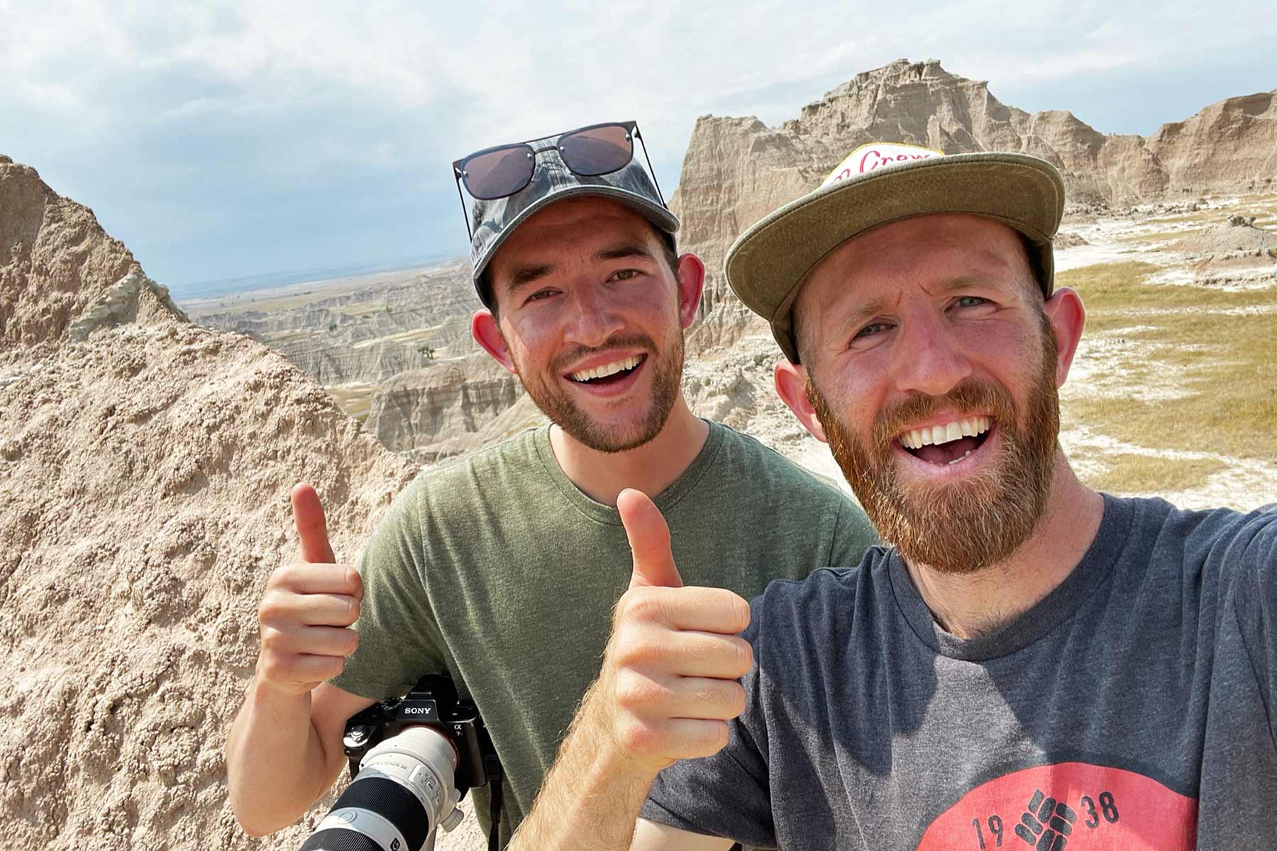
We’re Jim Pattiz and Will Pattiz, collectively known as the Pattiz Brothers (and sometimes the Parks Brothers) and we absolutely LOVE the national parks.
You should probably know that we don’t just make this stuff up out of thin air. We’ve spent our entire adult lives exploring and filming America’s national parks and public lands.
We’ve worked with the National Park Service, the Department of Interior, USDA, and the U.S. Forest Service for years creating films on important places and issues. Our work has been featured in leading publications all over the world and even some people outside of our immediate family call us experts on the national parks.
Meet The Parks Brothers
Map Of Arizona National Park Sites
List Of Arizona National Park Sites
- Grand Canyon National Park
- Saguaro National Park
- Petrified Forest National Park
- Grand Canyon-Parashant National Monument
- Organ Pipe Cactus National Monument
- Sonoran Desert National Monument
- Ironwood Forest National Monument
- Walnut Canyon National Monument
- Chiricahua National Monument
- Canyon de Chelly National Monument
- Agua Fria National Monument
- Navajo National Monument
- Tonto National Monument
- Vermillion Cliffs National Monument
- Lake Mead National Recreation Area
- Glen Canyon National Recreation Area
- Montezuma Castle National Monument
- Sunset Crater Volcano National Monument
- Tuzigoot National Monument
- Wupatki National Monument
- Pipe Spring National Monument
- Fort Bowie National Historic Site
- Tumacácori National Historical Park
- Coronado National Memorial
- Juan Bautista de Anza National Historic Trail
- Hubbell Trading Post National Historic Site
- Old Spanish National Historic Trail
- Casa Grande Ruins National Monument
- Hohokam Pima National Monument
We Hope You’ll Follow Our Journey
Our goal here at More Than Just Parks is to share the beauty of America’s national parks and public lands through stunning short films in an effort to get Americans and the world to see the true value in land conservation.
We hope you’ll follow our journey through the parks and help us to keep them the incredible places that they are. If you’re interested in joining the adventure then please sign up below!
Helpful Related Articles
Things to Do North Rim Grand Canyon: 15 Epic Things to Do at the North Rim of the Grand Canyon
Grand Canyon Viewpoints: 20 Best Views of the Grand Canyon (National Park)
Grand Canyon South Rim Things to Do: 15 Amazing Things to Do at the Grand Canyon South Rim
Things to Do at the Grand Canyon: 20 Best Things to Do at Grand Canyon National Park
Closest Cities to the Grand Canyon: 10 Closest Cities Near the Grand Canyon
Grand Canyon Facts: 15 Fascinating Grand Canyon National Park Facts
Grand Canyon in Winter: Visiting the Grand Canyon in December (Winter Guide)
Desert View Watchtower: Explore the Historic Desert View Watchtower
Arizona National Parks: 24 Epic Arizona National Parks to Visit (Photos + Guide)
Things to Do Saguaro NP: 15 Best Things to Do Saguaro National Park
Things to Do Zion NP: 18 Epic Things to Do at Zion National Park
Best Hikes Saguaro NP: 10 Best Saguaro National Park Hikes
National Parks Near Tucson: 10 Best National Parks Near Tucson
National Parks Near Phoenix: 10 Best National Parks Near Phoenix
Living in Phoenix: Pros & Cons of Living in Phoenix

What’s the difference between a National Park and National Monument?
Hey Steve,
Great question. We actually wrote a nice little article on What Exactly is a National Park that runs through all the designations. Boils down to level of protection, who manages, and how it’s managed. National Parks are managed exclusively by National Park Service for preservation purposes. National Monuments can be managed by the National Park Service, US Forest Service, Bureau of Land Management, and even US Fish & Wildlife. Monuments carry a lower level of protection and are generally a bit more do it yourself than parks – less maintained areas.
For more details feel free to check out the linked article above!
Best,
Will